
Tailings Dam Monitoring with InSAR & AI
Tailings Dam Monitoring: How Advanced Satellite Intelligence Is Transforming Tailings Dam Safety Tailings dams are among the most critical—and high-risk—structures
Satellite imagery has become one of the most powerful tools for understanding our world, capturing every detail of Earth from hundreds of kilometers above. In 2026, the value of high-resolution satellite imagery has never been greater. Organizations across industries now rely on these images to monitor infrastructure, manage natural resources, plan cities, and respond to environmental changes, all from space.
Buying satellite images was once a complex and expensive process reserved for government agencies and large corporations. Today, thanks to improved satellite technology, cloud platforms, and transparent marketplaces, it has become far more accessible. Businesses, researchers, and even startups can now purchase satellite imagery quickly and affordably for projects of any scale.
This complete guide from XRTech Group will help you understand how to buy satellite imagery that meets your specific needs. You’ll learn what satellite imagery is, why high-resolution data matters, and how to select the best satellite imagery provider for your goals so you can make informed, cost-effective, and confident decisions. Contact us to buy satellite imagery at best price!
Satellite imagery refers to photographs and data collected by satellites orbiting the Earth. These images can capture everything from farmland and forests to cities, coastlines, and construction sites. The level of detail depends on the resolution, how much ground each pixel of the image represents.
High-resolution imagery (sub-meter to 1 meter) shows fine details such as buildings, vehicles, and terrain features—ideal for mapping, engineering, and defense applications.
Medium-resolution imagery (1–10 meters) covers larger areas for regional monitoring, agriculture, and environmental studies.
Low-resolution imagery (10–30 meters and beyond) is often used for weather forecasting or large-scale climate analysis.
Satellite images serve a wide range of uses across industries:
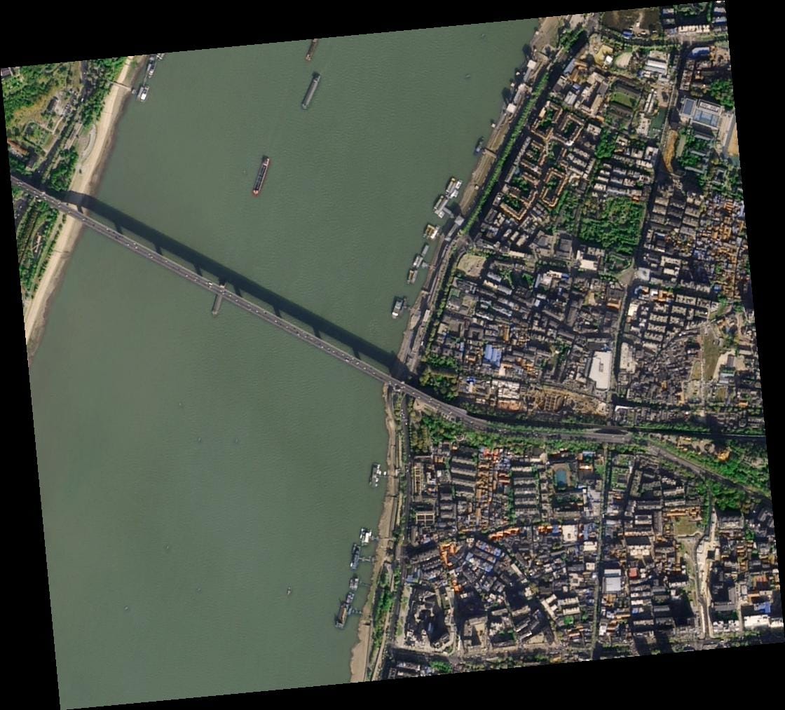
Urban Planning and Infrastructure Monitoring: Governments and city planners use imagery to track construction progress, road development, and land-use changes.
Agriculture and Forestry: Farmers and agronomists monitor crop health, soil conditions, and irrigation patterns to increase yield and reduce waste.
Environmental Management: Conservation groups track deforestation, coastal erosion, and wildfire impact using continuous satellite monitoring.
Defense and Security: High-resolution satellite imagery helps defense agencies detect changes, assess threats, and plan operations with precision.
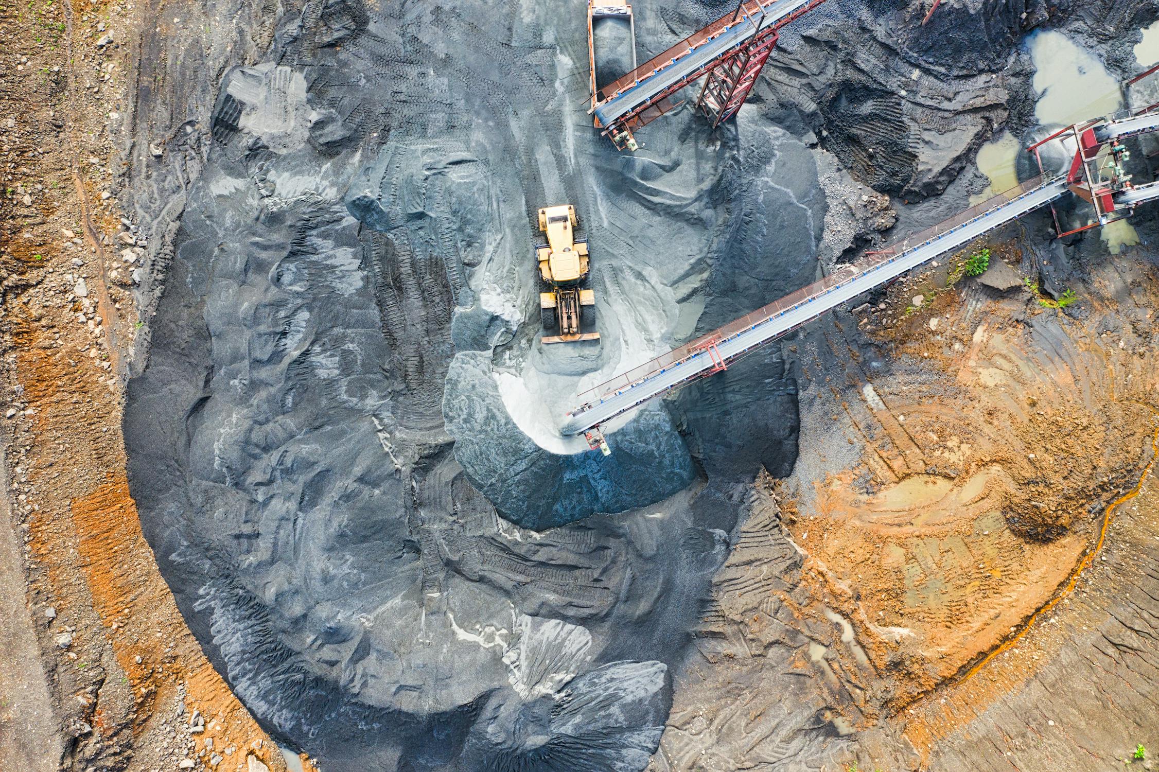
Energy and Mining: Companies use imagery for site exploration, pipeline monitoring, and environmental compliance.
Governments and Public Agencies: For planning, disaster management, and environmental monitoring.
Enterprises and Engineering Firms: For asset management, project feasibility studies, and risk assessments.
GIS and Remote Sensing Professionals: For mapping, analysis, and research-based modeling.
Academics and Researchers: For scientific studies involving land use, environmental changes, or climate monitoring.
Accurate Insights: Access precise, data-rich visuals to support smart decision-making.
Cost-Effective Monitoring: Replace expensive field surveys with reliable space-based data.
Global Coverage: Monitor any region on Earth, including remote or restricted areas.
Time Efficiency: Receive up-to-date imagery faster than ever with digital delivery platforms.
In short, satellite imagery provides the clarity and reach that ground-based observation simply cannot match.
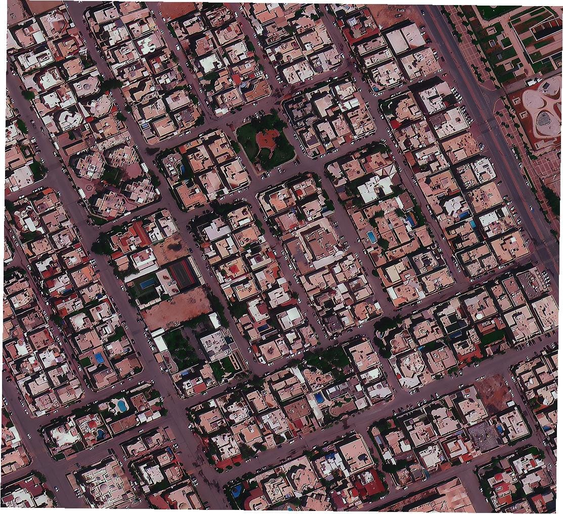
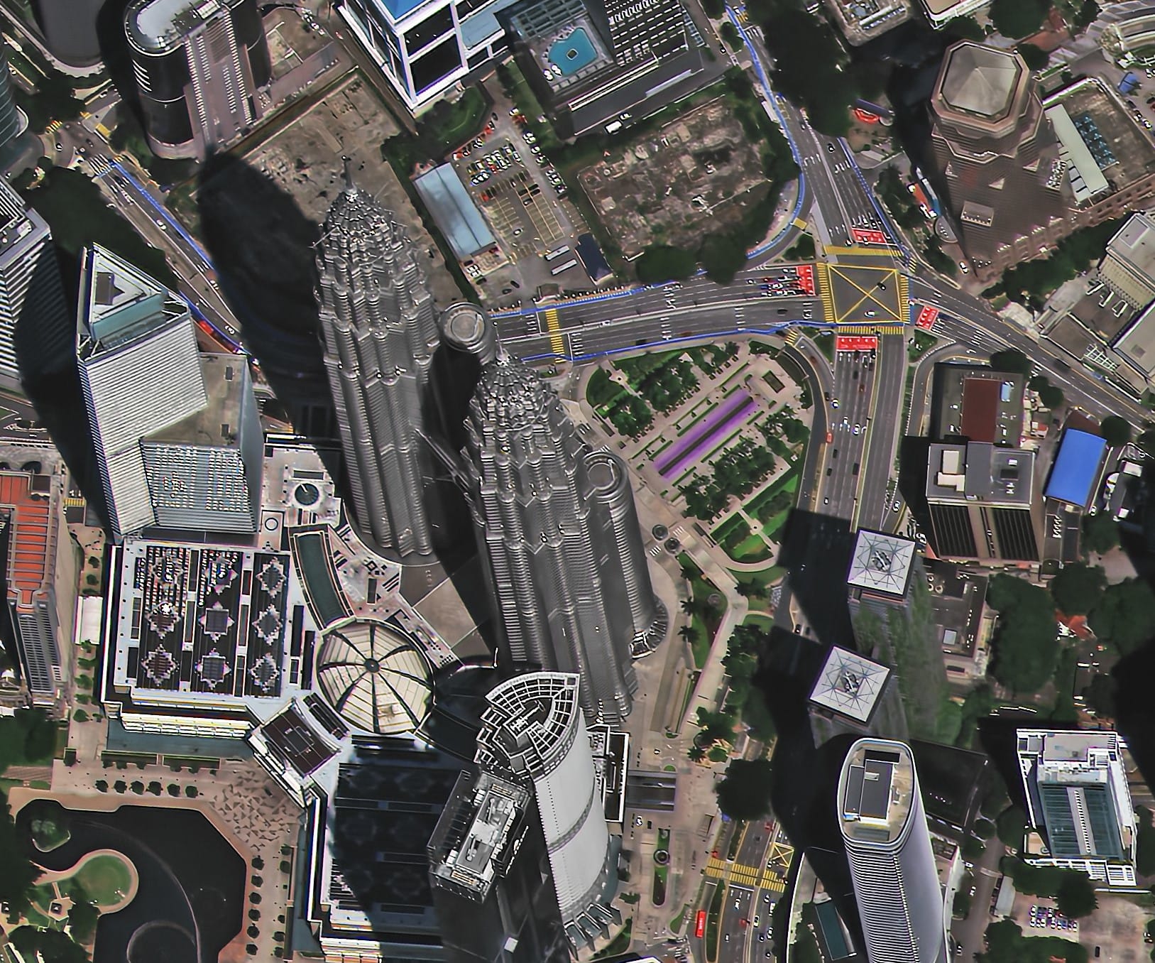
When we talk about high-resolution satellite imagery, we’re referring to images that can identify details as small as 30 centimeters or even finer. That means being able to distinguish between cars, small buildings, or even sections of road infrastructure directly from orbit. This level of detail is invaluable for industries that depend on precision, such as defense, engineering, urban planning, and agriculture.
Unmatched Detail: Enables detailed analysis of buildings, roads, and natural features for planning, design, and assessment.
High Accuracy: Sub-meter accuracy ensures that measurements, overlays, and spatial analyses are precise enough for professional and regulatory use.
Change Detection: Allows organizations to track subtle changes over time—such as construction progress, land degradation, or deforestation.
Operational Efficiency: Provides reliable intelligence for decision-making without costly on-site inspections.
Versatile Applications: Supports everything from asset management to environmental sustainability projects.
The main difference between high-resolution and lower-resolution imagery lies in clarity, cost, and application.
High-resolution satellite images (below 1 meter) are ideal for projects that demand detailed observation—such as city infrastructure planning or precision agriculture. However, they come at a higher price due to advanced sensors and limited acquisition time.
Medium or low-resolution images (1–30 meters) offer broader coverage at lower costs and are perfect for monitoring regional patterns, agricultural trends, or environmental shifts over large areas.
In essence, the best satellite imagery depends on your objective. For critical infrastructure or detailed inspection, investing in high-resolution data is worthwhile. For long-term environmental or regional analysis, lower-resolution imagery provides a better balance of coverage and cost.
Buying the right satellite imagery isn’t just about getting the clearest picture it’s about choosing the right balance between detail, coverage, and budget to achieve your project goals.
Before you buy satellite imagery, it is essential to clearly define your project’s technical and operational goals. This step helps ensure that you choose the right data type, resolution, coverage, and format to meet your needs without overspending. Whether your goal is monitoring, mapping, analytics, or compliance, understanding your requirements will save both time and budget.
Start by identifying what you want to achieve:
Monitoring: For regular observation of areas like construction zones, agricultural fields, or environmental sites.
Mapping: For generating accurate base maps, urban layouts, or infrastructure plans.
Analytics: For extracting insights such as vegetation health, land-use classification, or flood impact.
Compliance: For environmental audits, regulatory submissions, and operational verification.
The clarity of your goal will guide your decisions on resolution, revisit frequency, and imagery format.
Resolution defines how much detail is visible in the image. For example, a 30 cm pixel can capture small features such as road markings or small vehicles, while a 10 m pixel is sufficient for agricultural or regional mapping.
You should also define your Area of Interest (AOI) using precise spatial data. You can mark your area using KML, KMZ, SHP, or GeoJSON files. Most providers allow users to upload these files or manually draw polygons on a map. You can also define coordinates in latitude and longitude or specify the coverage area in square kilometers (sq km).
A well-defined AOI reduces unnecessary data costs since pricing usually depends on area size. For example, imaging a 50 sq km industrial site costs far less than acquiring 1,000 sq km of a province.
Determine when and how often you need imagery:
Archived Imagery: Ideal for historical analysis or when time is not critical.
New Tasking: Choose this when you need up-to-date or future acquisitions.
Near Real-Time: For defense, logistics, or natural disaster applications where frequent updates are required.
Frequent Monitoring: Some satellites offer daily revisits (like PlanetScope), while others provide every few days or weeks (like WorldView or SPOT).
Revisit frequency is key for projects that need continuous change detection such as construction tracking or vegetation monitoring.
Depending on your use case, you can purchase:
Raw Imagery: Unprocessed data suitable for experts who prefer custom processing.
Analysis-Ready Data: Pre-processed imagery corrected for geometry, radiometry, and atmospheric conditions, ready for direct use in GIS software.
Common file formats include GeoTIFF for analysis, JPEG or PNG for quick visualization, and SHP or KML for spatial vector data overlays. Most GIS systems also accept DEM (Digital Elevation Models) for terrain analysis.
Your budget depends on factors like resolution, coverage, and frequency. For instance, high-resolution imagery (30–50 cm) may cost between $15–$30 per sq km, while medium-resolution data (1–5 m) ranges from $5–$10 per sq km.
Licensing determines how you can use the imagery—some licenses allow internal use only, while others permit publication or sharing with clients. Make sure to select the right license for your organization’s goals.
Defining your project requirements precisely will make the purchase of satellite imagery smoother and ensure you receive data that is fit for purpose, within your timeline and budget.
The quality and usefulness of your satellite images depend on choosing the right sensor type. Each satellite captures data in a unique way—optical sensors capture reflected light, radar sensors use microwave signals, and hyperspectral sensors record hundreds of spectral bands. Selecting the right type ensures that the data you buy aligns with your analysis needs.
Optical satellites capture reflected sunlight in visible and infrared bands, producing images similar to photographs. This type of imagery is ideal for:
Urban planning, mapping, and visual analysis.
Agricultural assessment using vegetation indices like NDVI.
Environmental and infrastructure monitoring.
Strengths:
High-quality, natural-looking imagery.
Excellent for visual interpretation and map production.
Supports multispectral and hyperspectral bands for detailed analysis.
Limitations:
Cloud cover and low-light conditions can block visibility.
Dependent on daylight, making it unsuitable for night operations.
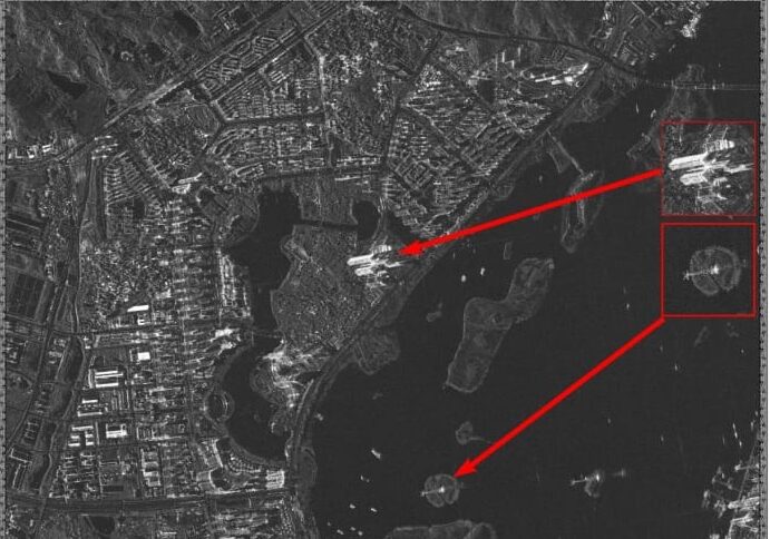
Synthetic Aperture Radar (SAR) satellites transmit microwave signals that can penetrate clouds, fog, and darkness. This allows them to capture images regardless of weather or lighting. SAR imagery is crucial for:
Flood mapping, maritime surveillance, and border security.
Tracking land deformation and subsidence with millimeter accuracy.
Emergency response and disaster monitoring in cloudy or dark conditions.
Strengths:
Reliable data collection in any condition, day or night.
Detects subtle surface movements and elevation changes.
Limitations:
Requires technical expertise for interpretation.
Visual output is less intuitive than optical imagery.
Multispectral imagery captures a handful of spectral bands (like red, green, blue, and near-infrared), while hyperspectral imagery records hundreds of narrow bands across the electromagnetic spectrum.
These sensors are ideal for:
Identifying minerals, soil types, and vegetation health.
Environmental research and precision agriculture.
Detecting pollution, contamination, and material composition.
Strengths:
Enables advanced analytics through spectral signature analysis.
Provides deeper insights beyond visible light.
Limitations:
Larger data size and higher processing demands.
Generally higher cost than standard optical data.
| Application | Recommended Sensor Type(s) | Rationale |
|---|---|---|
| Urban Planning and Detailed Mapping | Very High Resolution Optical | Provides sub-meter detail to identify structures, roads, and vehicles. |
| Vegetation Health and Agriculture | Multispectral or Hyperspectral Optical | Measures plant vigor using NDVI and other indices. |
| Maritime Surveillance and Disaster Response | SAR | Delivers reliable monitoring of ships, floods, and storms in any weather. |
| Ground Deformation and Subsidence Monitoring | SAR (InSAR Technique) | Detects surface movement at millimeter precision. |
| Environmental or Regional Monitoring | Medium-Resolution Optical (Landsat or Sentinel) | Offers large-scale coverage at lower cost with regular revisit times. |
Choosing the correct sensor type ensures your satellite imagery purchase delivers accurate, actionable data that fits your project’s goals and environmental conditions.
Once you have defined your technical requirements, the next step is to choose how and where to buy satellite imagery. You can purchase data directly from satellite operators, through trusted resellers, or from online marketplaces that bring multiple providers together.
Buying directly from satellite owners such as Maxar, Airbus, or Planet gives you full access to their archives and tasking services. This approach is suitable for large enterprises and government agencies managing high-volume projects. However, it often involves formal contracts, higher costs, and longer delivery times.
Resellers and aggregators, such as XRTech Group, offer access to multiple satellite constellations through a single point of contact. This is often the most efficient way to find the best satellite imagery for your project. You can browse different providers, compare data coverage, and choose based on cost, revisit rate, and delivery time—all in one platform.
Modern platforms allow you to browse, preview, and purchase satellite images directly through web-based interfaces. These platforms simplify procurement with:
Search tools to filter by date, cloud cover, resolution, and AOI.
Instant previews and quality checks before purchase.
Secure payment options and instant download of data files.
When choosing your imagery source, evaluate:
Provider Reputation and Accuracy: Look for companies with proven expertise and global coverage.
Data Catalog Depth: Ensure they provide both historical and real-time imagery options.
Processing Capabilities: Prefer providers offering analysis-ready data (orthorectified, pansharpened, and color-balanced).
Delivery Time: Fast turnaround is critical for projects needing recent or time-sensitive imagery.
Support and Licensing Flexibility: Reliable customer support and transparent license terms prevent complications later.
XRTech Group combines access to over 130 global satellites with advanced AI analytics and flexible data formats like GeoTIFF, SHP, and KML. The company provides fast, accurate, and cost-effective satellite imagery solutions tailored for sectors such as urban planning, defense, oil and gas, and environmental monitoring.
By using XRTech’s integrated platform, you can buy satellite imagery that matches your project’s scale and technical requirements, without the complexity of negotiating with multiple providers.
When you plan to buy satellite imagery, it’s essential to understand the key pricing factors, licensing conditions, and possible hidden costs. Many buyers overlook these details and end up paying more than expected. Knowing exactly what drives the cost helps you plan better and select the right high-resolution satellite imagery within your budget.
Several variables influence how much you pay for satellite images, including:
Spatial Resolution
The finer the resolution, the higher the price. For instance, super high-resolution imagery (30 cm) can cost up to twice as much as standard high-resolution imagery (50–80 cm) because of its higher precision and limited availability.
Coverage Area Size
Pricing is usually calculated per square kilometer. Smaller areas (e.g., below 25 sq km) tend to have higher per-kilometer costs, while large orders covering hundreds of square kilometers benefit from volume discounts.
Tasking New Imagery vs. Archive Data
Archived imagery (captured over 90 days ago) is always more affordable because it already exists in the provider’s database. New tasking imagery, on the other hand, requires a satellite to capture fresh data for your specific Area of Interest (AOI), which increases costs. Tasking is best when you need recent images, minimal cloud cover, or specific sun angles.
Processing Level
Processing adds value but also increases cost. Stereo imagery typically costs twice as much as mono imagery, while tri-stereo may triple the price. However, these higher processing levels produce elevation models and detailed 3D terrain data that are crucial for engineering or infrastructure projects.
Licensing Rights
Licensing affects cost and flexibility. Some imagery is licensed for internal use only, while others allow external sharing or commercial publication. The more open the license, the higher the price.
XRTech Group provides flexible and transparent licensing options designed to suit real-world project needs. Their project-wide licenses allow multiple users within an organization to access and use the imagery without additional fees or user restrictions.
Licensing options include:
Internal Use: For private, organizational analysis and reporting.
Commercial Use: For external publications, client delivery, or public sharing.
Exclusive Licensing: Reserved rights to specific imagery, often used for confidential defense or infrastructure projects.
XRTech’s licensing system eliminates complex usage limitations, ensuring your team can collaborate freely and use the imagery as needed.
Many first-time buyers underestimate additional expenses that can appear after the purchase. These include:
Processing Fees
Certain providers charge extra for advanced processing such as pansharpening, radiometric correction, or cloud masking. For instance, requesting imagery with less than 10 percent cloud cover or a low Off-Nadir Angle (ONA) may add a premium of $8–9 per sq km.
Delivery Options
Imagery is typically delivered via secure cloud download, but large datasets can also be shipped via a physical hard drive (HDD), which incurs extra logistics fees.
Integration Costs
While imagery is delivered in standard formats like GeoTIFF, SHP, or DWG, advanced integration with proprietary GIS or CAD platforms may require paid plug-ins or value-added models such as Digital Elevation Models (DEM, DSM, DTM).
| Resolution Range | Data Type | Price per sq km (USD) | Minimum Order Size |
|---|---|---|---|
| Super High Resolution (30 cm) | Archive (>90 days) | $20 per sq km | 25 sq km |
| Super High Resolution (30 cm) | New Tasking | $30 per sq km | 100 sq km |
| Very High Resolution (31–50 cm) | Archive (>90 days) | $13 per sq km | 25 sq km |
| Very High Resolution (31–50 cm) | New Tasking | $20 per sq km | 100 sq km |
Pricing may vary depending on provider, coverage, processing level, and delivery speed, but these figures represent the average market range for 2026.
Selecting the best satellite imagery provider involves more than just comparing prices. You need to evaluate the data quality, metadata, and processing standards to ensure that the imagery supports your goals.
Metadata:
Verify the capture date to determine if it’s archived or newly tasked.
Check cloud cover percentage and sun elevation angle, since high cloud cover reduces visibility.
Confirm Off-Nadir Angle (ONA); lower angles (below 10°) produce better geometric accuracy but may cost more.
Geometric Accuracy:
Ensure imagery meets industry standards such as CE90 and RMSE specifications for horizontal accuracy. For elevation models, look for ±3 m vertical RMSE or better.
Format Compatibility:
Choose imagery delivered in standard, widely compatible formats such as GeoTIFF, SHP, or DWG to integrate easily with GIS platforms like ArcGIS, QGIS, or AutoCAD.
Orthorectification:
Orthorectification corrects geometric distortions caused by satellite viewing angles and terrain elevation, producing spatially accurate imagery aligned to the Earth’s surface.
Pansharpening:
Combines panchromatic and multispectral bands for sharper, more detailed visuals—especially useful for urban mapping and defense applications.
Color Balance:
Adjusts and enhances image tones for visual clarity, ensuring uniform lighting and color across mosaics.
Mosaicing:
Stitches multiple overlapping images into a single seamless map, essential for large projects or national mapping applications.
Preview Before Purchase:
Reputable providers like XRTech Group allow clients to review sample imagery of their AOI before committing to a purchase. This preview ensures clarity, accuracy, and suitability.
Check Provider Credentials:
XRTech operates globally with partnerships such as China Siwei Surveying and Mapping Technology Co., Ltd., giving clients access to 130+ satellites. Being a non-U.S. provider also eliminates export control delays, leading to faster delivery.
Independent Benchmarks:
Client case studies show that XRTech delivers high-resolution satellite imagery up to twice as fast as many Western vendors, with new imagery often arriving in four days compared to competitors’ three weeks.
The value of purchasing satellite imagery lies in how effectively it integrates into your workflows and supports decision-making.
Imagery is delivered in universally recognized formats such as GeoTIFF, IMG, SHP, and DWG, compatible with major GIS and CAD platforms. Coordinate systems like WGS84, UTM, or custom projections are supported for seamless integration.
Ingest the Imagery: Receive data securely via cloud or HDD, typically as analysis-ready GeoTIFFs.
Overlay with Other Data: Integrate satellite layers with shapefiles (SHP), vector maps, or infrastructure plans.
Perform Spatial Analysis: Conduct distance, area, or temporal comparisons using GIS tools for mapping or monitoring.
Derive Insights: Extract key findings, trends, and predictive insights to guide business or operational decisions.
Advanced Analytics:
XRTech leverages AI-driven modeling for predictive analysis, such as crop health monitoring, infrastructure risk assessment, and natural resource tracking.
Change Detection:
Using multi-temporal imagery, XRTech detects changes in land cover, urban expansion, and deforestation, providing precise data for planning and reporting.
Feature Extraction:
AI-based interpretation automatically identifies and classifies buildings, roads, vegetation, and terrain types. This helps create updated base maps and 3D models for smart city projects.
XRTech also delivers DEM, DSM, and DTM models with vertical accuracy of ±3 m, as well as InSAR data for millimeter-level deformation analysis—vital for infrastructure safety and construction monitoring.
The process of acquiring satellite images has become streamlined, efficient, and fast. Here’s what a typical project workflow looks like:
Define Requirements: Identify your AOI, required resolution, and data type (optical, SAR, or hyperspectral).
Search and Catalogue: Browse extensive archives dating back to 1999 or schedule new tasking.
Request a Quote: Submit your specifications for a customized proposal, often processed within 24 hours.
Purchase: Confirm your selection and finalize the licensing terms.
Delivery: Receive data via secure cloud link or physical HDD, in formats like GeoTIFF or SHP.
Analysis: Load imagery into GIS software and start extracting insights.
New Tasking Imagery: Delivered in under 7 days, sometimes as fast as 4 days.
Archive Imagery: Available immediately after purchase.
DEM or 3D Models: Delivered within 21 days depending on processing complexity.
Cloud Cover: Optical imagery depends on clear skies, so consider SAR imagery for all-weather monitoring.
Revisit Delays: Most satellites revisit areas every 5 to 12 days, but XRTech’s 130+ satellite network offers near-daily coverage for many regions.
Technical Factors: Off-Nadir Angle adjustments or specific band requests can influence cost and schedule.
In simple terms, buying satellite imagery is like commissioning a global fleet of eyes in the sky. The sharper the vision, the wider the coverage, and the faster the revisit, the greater the value to your mission. With XRTech Group, you gain a partner that combines this power with efficiency, delivering the imagery and insights you need—accurately, quickly, and cost-effectively.
Even though buying satellite imagery is easier in 2026 than ever before, many professionals still make errors that affect both cost and project success. Understanding these common mistakes helps you make smarter, more efficient purchase decisions.
One of the most frequent mistakes is purchasing the highest possible resolution without evaluating whether it is truly necessary. While super high-resolution 30 cm imagery offers exceptional detail, it can cost nearly double compared to high-resolution 50–80 cm imagery.
To avoid unnecessary spending, match the resolution to your specific goals:
For regional mapping or infrastructure planning, a 2 m or 8 m resolution is typically sufficient.
For urban analysis or construction projects, a 0.3 m to 0.5 m resolution allows clear identification of buildings, vehicles, and smaller features.
For thermal inspections, such as solar panel monitoring, use a 640 × 512 pixel thermal camera drone for high precision detection of hot spots or structural defects.
Choosing the right resolution ensures that you balance detail, cost, and coverage effectively.
Failing to specify technical details—like processing level or data format—can result in imagery that’s incompatible with your systems or unusable for analysis.
To prevent this, always confirm the following:
Format Compatibility: Ensure data is provided in standard formats such as GeoTIFF, SHP, DWG, and coordinate systems like UTM that align with your GIS or CAD environment.
Processing Requirements: Request that high-resolution satellite imagery is delivered in an ortho-ready format or fully orthorectified, ensuring geometric accuracy.
Radiometric Features: For thermal data or drone integrations, specify that the camera or dataset should include radiometric functionality for precise temperature measurements instead of basic contrast visuals.
When processing and formatting details are clearly defined, your data becomes immediately usable and saves hours of reprocessing later.
Another costly oversight is relying on the wrong sensor type or not accounting for revisit frequency, especially for time-sensitive or weather-dependent projects.
To avoid this issue, consider the following:
Understand Optical Limitations: Optical imagery requires daylight and clear skies. During cloudy or rainy seasons, data acquisition may be delayed.
Use SAR for All-Weather Monitoring: Synthetic Aperture Radar (SAR) works day and night and can see through clouds, making it essential for flood monitoring, maritime tracking, and pipeline inspection.
Verify Revisit Capacity: For continuous monitoring projects, ensure that the chosen constellation offers frequent revisits. Satellites like Superview Neo-1 can revisit the same area daily, which is ideal for dynamic monitoring.
Account for Drone Constraints: Weather, humidity, and wind can impact thermal camera drone accuracy. For example, solar inspections should be conducted on clear, sunny days to avoid distorted readings.
Selecting the correct sensor and scheduling observations wisely prevents costly re-acquisitions or data gaps.
Start with a Pilot Project:
Before committing to a large order, request a free sample image or consultation. This lets you verify data quality and provider responsiveness without any risk.
Specify Licensing Early:
Clarify your intended use upfront. XRTech Group’s project-wide licensing allows internal sharing and publication without added fees, ensuring smoother collaboration between departments or external partners.
Verify Provider’s Support and Delivery Speed:
Work with providers known for fast turnaround and transparent communication. XRTech Group, for example, consistently delivers Earth Observation imagery in under 7 days, with some emergency deliveries within 24 hours. Digital Elevation Models (DEMs) are processed and delivered in under 21 days.
As a non-U.S. provider, XRTech avoids export licensing delays and guarantees faster international service. For added peace of mind, the company also offers a 30-day money-back guarantee on qualifying projects.
Acquiring satellite imagery is like setting a perfect camera shot—zoom in too much, and it becomes expensive; choose the wrong sensor, and you may miss the moment; forget to set the format, and the picture won’t fit the frame. The key is clarity: define what you need before you press the capture button.
The way organizations buy satellite images is rapidly changing. Between 2026 and 2030, the satellite industry is expected to experience major transformations in speed, accessibility, and automation.
Shorter Revisit Times: With more small-satellite constellations in orbit, global coverage will become near real-time. This will allow continuous updates for critical sectors like defense, agriculture, and energy.
Faster Delivery: Cloud-based distribution and AI-enabled tasking will reduce delivery times from weeks to hours.
Analysis-Ready Imagery: Providers will increasingly offer data that is pre-processed and ready for direct use in GIS systems, eliminating the need for manual corrections.
Expanded Spectral Capabilities: Hyperspectral and thermal imaging satellites will allow deeper analysis of environmental and industrial changes.
Modern procurement will rely less on complex contracts and more on instant-access platforms. Buyers will browse available imagery, preview it online, and purchase data instantly using transparent, pay-per-use models.
XRTech Group is at the forefront of this evolution. The company integrates high-resolution satellite imagery with AI-driven analytics, drone networks, IoT sensors, and 5G data links to create a unified geospatial ecosystem.
This fusion enables real-time environmental and infrastructure monitoring while offering localized support in Asia, the Middle East, and Africa—regions where fast access and flexibility are crucial.
XRTech Group simplifies the process of purchasing satellite images by offering direct access to multiple sensor types, global coverage, and fast delivery—all tailored to your project’s goals.
Optical Imagery: For mapping, planning, and infrastructure projects.
SAR Imagery: For all-weather and night monitoring.
Hyperspectral Imagery: For environmental and mineral analysis.
XRTech’s team provides personalized consulting to help you define technical specifications, select the most suitable satellite, and get precise quotes.
They also handle licensing, coordinate secure data delivery, and provide post-purchase support for integration into your GIS or CAD systems.
By combining best-in-class satellite imagery with transparent pricing, flexible licensing, and analytics integration, XRTech ensures clients receive data that matches both technical and operational requirements. Whether you need a one-time purchase or ongoing monitoring, XRTech delivers speed, accuracy, and reliability in one streamlined experience.
Buying high-resolution satellite imagery in 2026 is both easier and more powerful than ever before, but it still requires careful planning. Defining your objectives, selecting the right sensor type, comparing providers, setting a clear budget, and avoiding common mistakes are crucial steps to achieving reliable results.
With today’s market offering instant access, global coverage, and flexible licensing, satellite imagery purchasing has become an essential tool for decision-making across industries—from agriculture to defense.
XRTech Group stands as a trusted partner in this evolving landscape, guiding organizations through every stage of the procurement process. Their unmatched access to global satellites, advanced analytics, and regional support makes them a preferred choice for those seeking accuracy, speed, and value.
If you’re ready to explore customized imagery solutions, contact XRTech Group to discuss your project and receive tailored recommendations that align with your goals. The future of buying satellite imagery is here and XRTech helps you see it clearly.
Tailings Dam Monitoring: How Advanced Satellite Intelligence Is Transforming Tailings Dam Safety Tailings dams are among the most critical—and high-risk—structures

From Visible Light to Spectral Intelligence in Modern Satellite Remote Sensing Satellite imaging has moved beyond photography. For decades, Earth