How Do Almonds Grow? Complete Farming Guide from Planting to Harvest
Growing almonds is a structured agricultural process that moves from orchard planning to nut harvest and post-season care. Farmers must
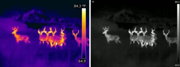
Thermal imaging technology, combined with the maneuverability of a drone, offers countless benefits for businesses and organizations. This combination has become a game-changer in many industries.
The growing list of uses for thermal imaging drones is largely due to advancements in drone technology and the integration of innovative features like thermal cameras. These drones provide unique capabilities, such as detecting heat signatures, that go beyond the capabilities of standard video cameras.
Industries are increasingly relying on drone thermal imagery for various tasks. For instance, these drones are used in fire detection to locate hotspots, in search and rescue missions to find individuals in challenging environments, and in utility grid inspections to detect potential issues. The versatility of thermal camera drones has made them indispensable tools in solving complex problems across sectors.
By leveraging these drones, businesses can save time, enhance safety, and improve efficiency in operations. Whether it’s a rescue operation or infrastructure maintenance, the applications of thermal imaging drones continue to grow, offering solutions that were once unimaginable.
When selecting a Thermal Imaging Drone, it’s not just about the camera. The commercial drone chassis plays a crucial role in ensuring your drone’s performance. Factors like speed, maneuverability, range, battery life, and durability all determine how well your Drone Thermal Imagery missions will be executed.
Below are some top commercial thermal drones that excel in thermal applications, making them suitable for various industries like search-and-rescue, inspections, and surveillance. Buy best thermal drones at XRTech Group.
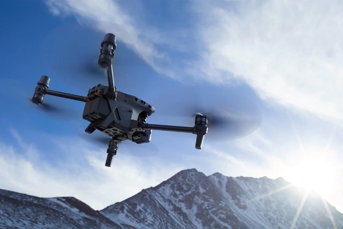
The DJI Matrice 30 Series (M30T Variant) is a high-performance Thermal Imaging Drone, equipped with a 640×512 thermal camera and a 12 MP wide camera. Its capability to capture precise Drone Thermal Imagery ensures success in search-and-rescue missions and industrial inspections. The drone offers stable performance, delivering 4K resolution and 16x zoom for clear, actionable visuals.
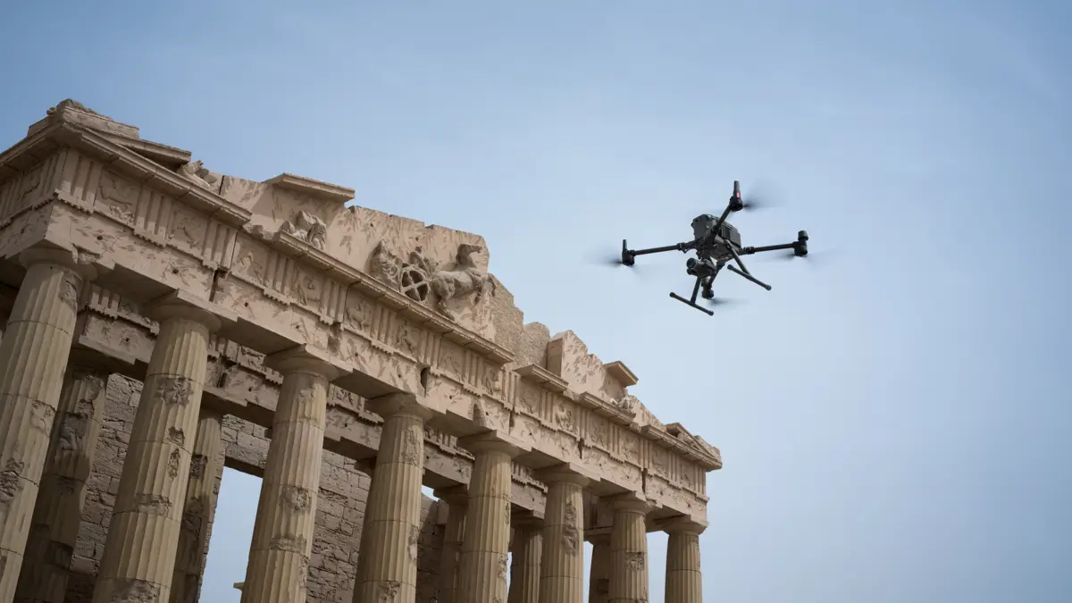
For detailed thermal inspections, the DJI Matrice 350 RTK offers unmatched precision. This Thermal Camera Drone is designed for industrial tasks, featuring the Zenmuse H20T thermal camera. It’s an ideal choice for professionals requiring reliable Drone Thermal Imagery and long flight times.
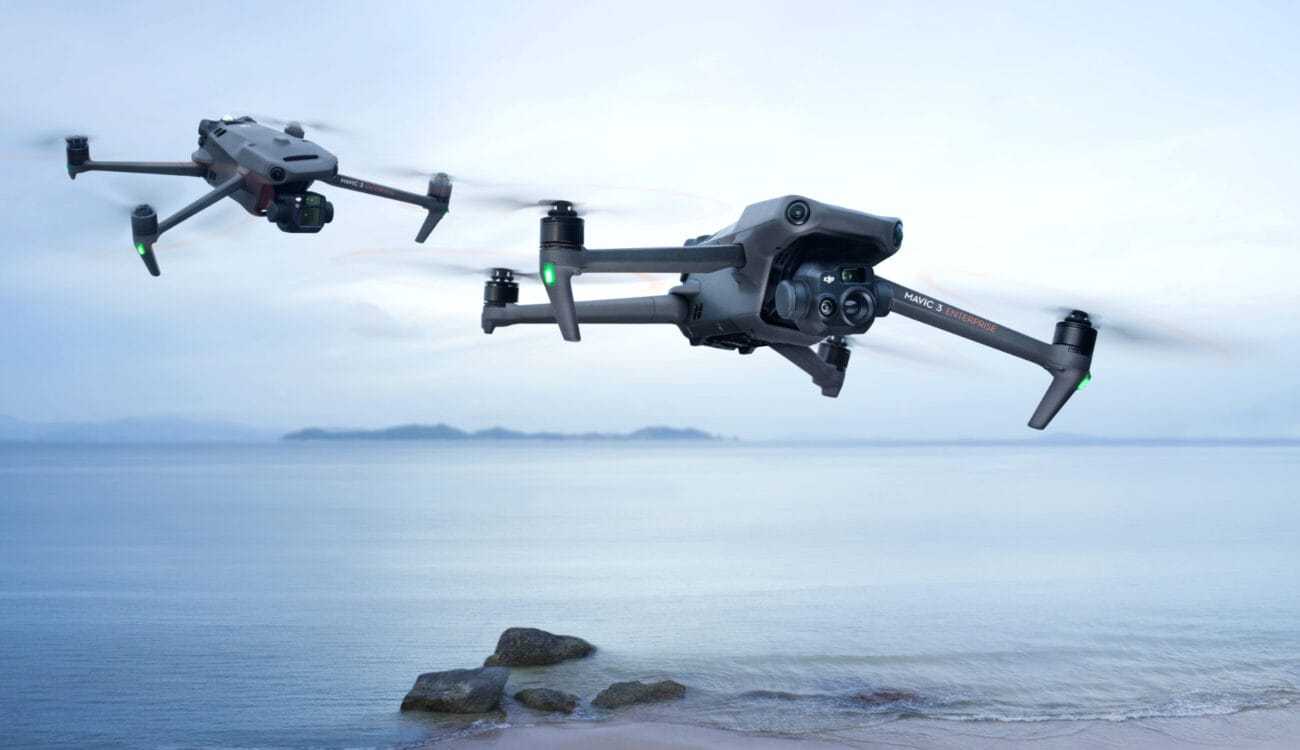
The DJI Mavic 3 Thermal Enterprise combines versatility with advanced Thermal Imaging Drone capabilities. Its integrated thermal and RGB cameras make it a go-to for enterprise inspections and emergency operations. This Drone Thermal Imagery solution provides real-time heat detection, ensuring critical tasks are handled with efficiency.
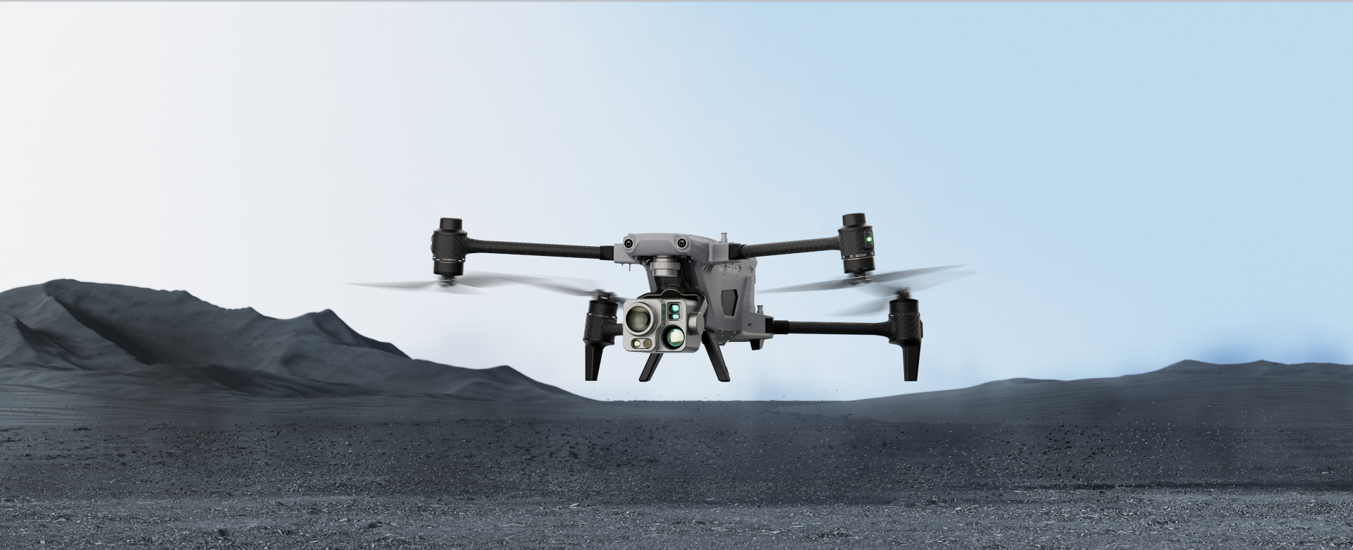
Autel ALPHA stands out for its ability to capture detailed Drone Thermal Imagery with its 640×512 thermal camera and 56x zoom. This Thermal Camera Drone is perfect for public safety missions and surveillance, providing reliable performance in demanding environments.
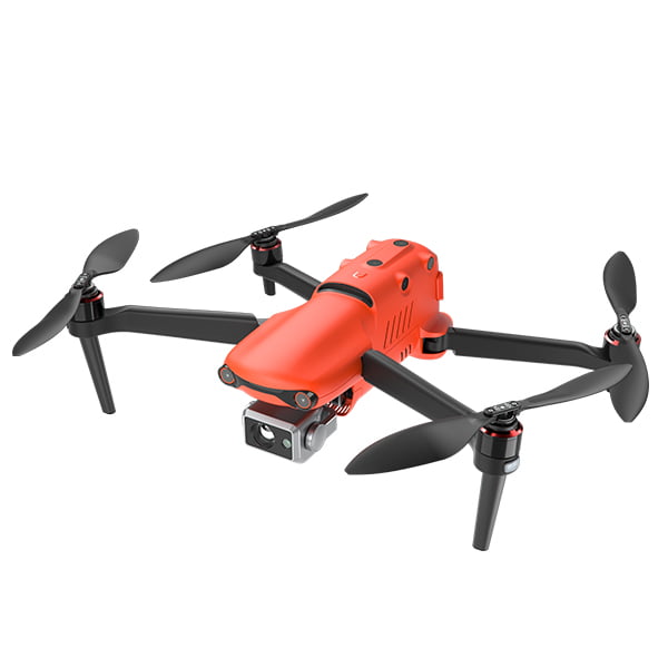
Equipped with dual cameras, the AUTEL EVO II Dual 640T V3 is a powerful Thermal Imaging Drone. Its 640×512 thermal resolution and 8K RGB imaging make it a top choice for industries requiring high-quality Drone Thermal Imagery. This drone is built for precise data collection and efficient operations.
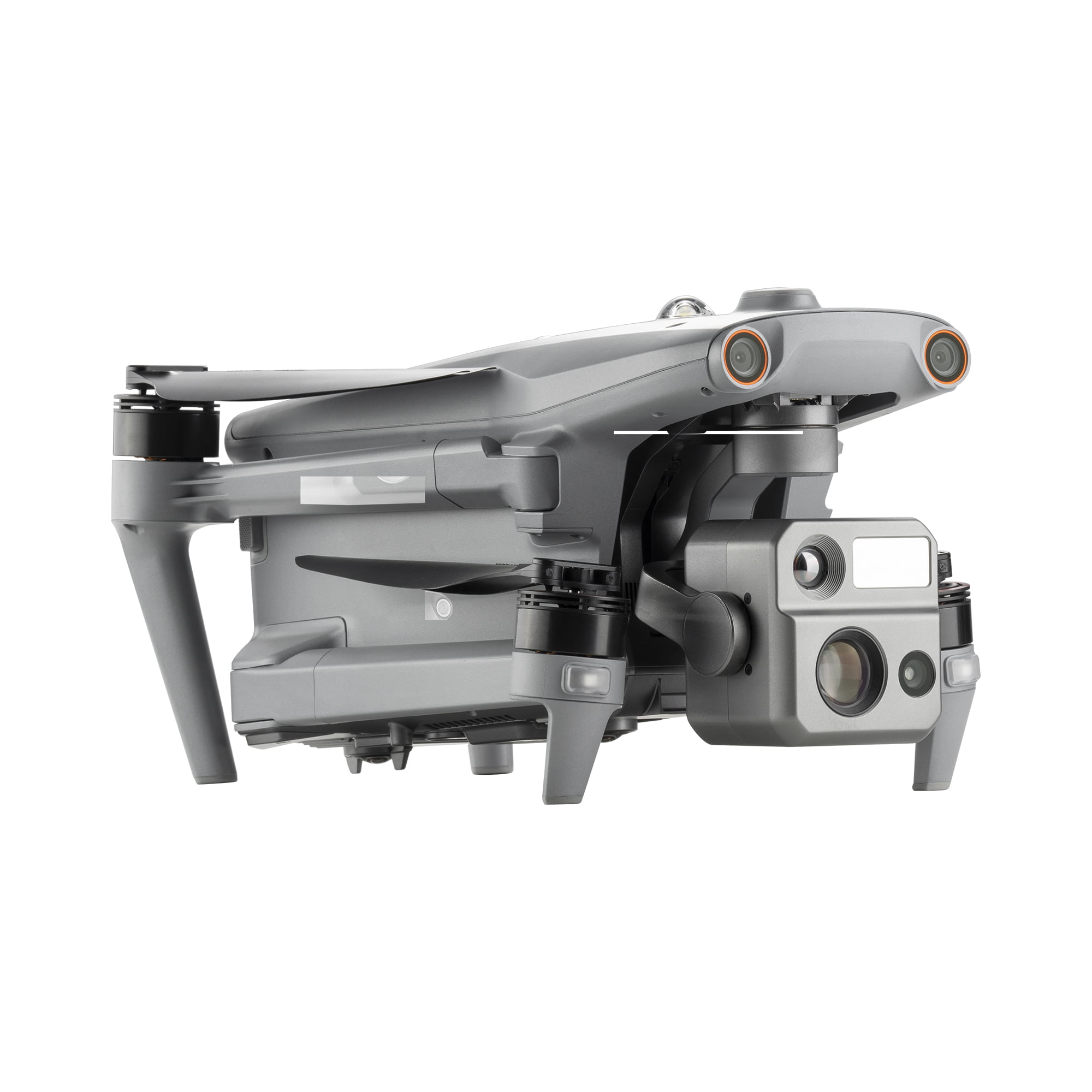
The AUTEL EVO MAX 4N is designed for low-light conditions, combining night vision and a thermal camera. It excels in capturing accurate Drone Thermal Imagery during night operations like surveillance or search-and-rescue. Its detailed thermal resolution makes it an essential tool for challenging environments.
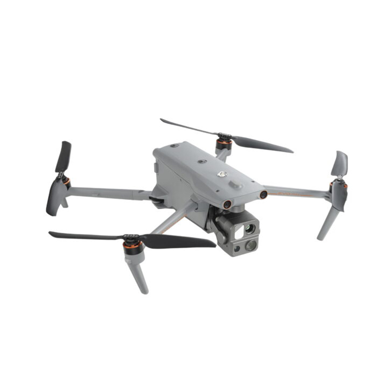
The AUTEL EVO MAX 4T combines a high-resolution thermal camera with a wide-angle RGB camera. This versatile Thermal Camera Drone is ideal for industrial applications and search-and-rescue missions, offering unmatched performance for Drone Thermal Imagery needs.
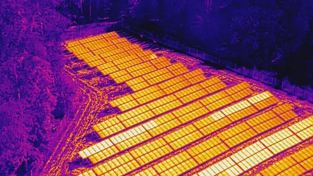
Thermal Camera Drones have become vital tools in various fields, providing unique solutions to problems that were once difficult to address. With their ability to detect heat signatures, these drones are making a significant impact in areas like search and rescue, agriculture, and wildlife protection. Here are seven inspiring real-life examples from 2024 that showcase the effectiveness of Drone Thermal Imagery.
In North Wales, a Thermal Imaging Drone was used by police to locate a missing elderly person. The drone’s heat-sensing camera quickly spotted the individual, saving valuable time and potentially saving a life. This successful operation highlighted how Drone Thermal Imagery can be crucial in urgent situations.
Firefighters in the West Midlands effectively utilized a Thermal Camera Drone during a large warehouse fire. The drone helped identify hot spots and guided the firefighting team, making their work safer and more efficient. This example demonstrates how thermal drones enhance safety and response times in emergency situations.
In Turkey, farmers adopted Drone Thermal Imagery to monitor their cornfields. The drones provided valuable insights into crop health, allowing farmers to optimize watering and care for their crops. As a result, they experienced a remarkable 20% increase in corn production, showcasing the benefits of using Thermal Imaging Drones in agriculture.
Vineyard owners in Switzerland employed Thermal Camera Drones to detect pests and diseases early on. By identifying potential issues quickly, they were able to take immediate action to protect their grapes, ultimately improving wine quality. This proactive approach illustrates how thermal drones can safeguard agricultural investments.
In Zimbabwe, Thermal Imaging Drones played a crucial role in protecting crops from quelea birds, which can cause significant damage to fields. The drones helped manage the bird population effectively, ensuring that crops remained safe and supporting the country’s food supply. This application highlights the environmental benefits of using thermal drones.
Brazilian coffee farmers utilized Drone Thermal Imagery to monitor their fields more effectively. The drones assisted them in managing water usage and identifying plant health issues early on. This proactive monitoring led to better coffee harvests and showcased the advantages of integrating technology into traditional farming practices.
In another instance from Brazil, rice farmers employed Thermal Imaging Drones to assess their fields accurately. The drones enabled them to use water and fertilizers more efficiently, resulting in healthier crops and increased yields. This example further emphasizes how thermal drones can revolutionize agricultural practices.
Thermal Camera Drones are advanced tools that allow us to see heat, or infrared radiation, instead of just light. They are equipped with specialized Thermal Imaging Drones that capture the heat emitted by objects and translate it into visual imagery. These drones are widely used in various sectors, including public safety, search and rescue, construction, and firefighting. With their ability to see in the dark and through smoke or fog, Thermal Camera Drones offer a unique advantage in challenging environments, making them invaluable for operations that require precise heat detection.
Whether it’s searching for missing persons, inspecting buildings for heat leaks, or helping firefighters assess a fire’s intensity, Thermal Imaging Drones provide clear, actionable data in situations where traditional cameras may fail. These drones can spot heat signatures of objects, animals, and even people, making them essential for safety and security.
Heat is simply a form of energy that causes atoms and molecules to move. The faster these particles move, the hotter the object becomes. This phenomenon is known as infrared radiation (IR). While humans can feel heat, we cannot see it with our naked eyes because infrared radiation is invisible to the human eye.
This is where Drone Thermal Imagery comes into play. Thermal Imaging Drones are designed to detect infrared radiation and convert it into visible images. These images highlight areas with higher temperatures, which appear as brighter or different colors on the thermal camera display. This ability allows us to “see” heat and gain insights into situations that are hidden to the naked eye, such as spotting fire hotspots, detecting people in low visibility, or identifying mechanical failures in equipment.
The Thermal Camera Drones can capture this infrared radiation from a distance, making them perfect for scanning large areas from the sky. This ability to “see” heat in the environment opens up new possibilities for applications in various industries.
Thermal Imaging Drones are equipped with specialized thermal cameras that detect infrared radiation, which is emitted by all objects based on their temperature. These cameras use advanced lenses that focus infrared radiation onto sensors, turning this invisible heat into a visible thermal image. This technology is powered by Thermal Camera Drones, which make it easier for operators to see the thermal signatures of objects.
One of the most critical components of a Thermal Imaging Drone is the microbolometer. This is a special sensor that detects infrared radiation and converts it into electrical signals. The microbolometer then sends these signals to the camera’s processor, which generates the thermal image. The thermal images produced by these cameras show temperature variations across the object’s surface, providing valuable data that can be used to assess heat sources.
When these cameras are mounted on Thermal Camera Drones, the drone’s gimbal stabilizes the camera, ensuring smooth and clear images even while the drone is flying. The gimbal allows the Thermal Imaging Drones to rotate 360 degrees, enabling operators to capture thermal images from every angle. This flexibility makes Thermal Camera Drones incredibly effective in various situations, whether it’s for fire surveillance, wildlife monitoring, or industrial inspections.
Thermal Camera Drones have revolutionized industries by offering a safe, efficient, and cost-effective way to detect heat and temperature differences. From Drone Thermal Imagery used in emergency response to industrial applications like equipment monitoring, these drones provide valuable insights that were previously difficult or impossible to gather.
In emergency situations, Thermal Imaging Drones help first responders assess the situation quickly, locate victims, and strategize effectively. In industries like construction, agriculture, and utilities, these drones save time and resources by identifying issues early, preventing costly repairs, and improving safety protocols.
Once Thermal Imaging Drones capture the thermal data through their infrared sensors, the information is displayed on a screen for operators to analyze. Operators can then process and review this drone thermal imagery with different options, including several color palettes.
With the right thermal camera drone, users can change the color palette to represent the heat levels of the scene in different ways. Some common palettes include:
These are just a few basic options. Advanced thermal camera drones, such as the Zenmuse H20T, offer a variety of additional color palettes (12 in total) for different thermal analysis needs.
The type of Thermal Camera Drone used impacts how the thermal imagery is stored. Basic drones capture thermal data as simple image files, while more advanced models also store thermographic data, temperature readings, and GPS coordinates. This additional data is extremely useful for detailed analysis, making it easy for operators to assess the scene and identify specific temperature variations.
With advanced drones, you can use tools like the DJI Thermal Analysis Tool to inspect and further process the thermal data collected, helping operators make precise decisions in critical situations.
Using a Thermal Camera Drone to take precise temperature readings can be tricky due to several factors in the environment. The weather, like heat, humidity, or even rain, can affect the accuracy of the drone thermal imagery. Clouds or snow may also get in the way of clear readings, making it hard for the thermal imaging drone to capture reliable data. Another factor is reflective surfaces, such as glass, which can absorb and reflect heat from the sun or nearby objects, causing the thermal camera to show incorrect results.
The material and condition of the object being measured are also important. For example, a freshly painted surface or a corroded area can cause the thermal camera drone to read the temperature differently. The angle at which the thermal imaging drone is viewing an object, along with the time of day, can also affect the readings. The sun’s position can make two objects of the same material appear very different in drone thermal imagery.
To get the best results from your thermal imaging drone, here are some key factors to consider:
By understanding these factors, you can achieve more accurate and reliable readings with your thermal camera drone.
When looking at thermal imaging drones, high resolution and more color display options are two major advantages. The latest Thermal Imaging Drones come with advanced features that make capturing images easier and more accurate. These improvements provide clearer pictures, helping users to spot details with precision. In today’s fast-moving technology world, drone thermal imagery is becoming more advanced, offering new capabilities to improve the way Thermal Camera Drones work.
Powerful new capabilities for Thermal Imaging Drones include dual camera payload options. Modern drones equipped with Thermal Camera Drones may be able to capture two different types of images at once. Hybrid thermal payloads allow the Thermal Imaging Drone to combine both a regular imaging system and an infrared camera, offering users a more detailed perspective in one flight. Another advanced feature is user-customized isothermal settings. With this setting, users can customize temperature ranges that the camera will automatically highlight, making it easier to spot areas with extreme heat or cold, such as in search-and-rescue operations.
The software used to interpret drone thermal imagery is improving as well. Today’s Thermal Imaging Drones come with next-generation thermal imaging software. This software allows features such as temperature tracking, real-time heat updates, and the ability to combine visible light and infrared images. A great example is the DJI Thermal Analysis Tool, which helps users see both the thermal and visible light data on the same screen.
As technology continues to improve, the possibilities for Thermal Imaging Drones will continue to expand, making them even more versatile for tasks that require high-tech solutions.
Choosing the right thermal imaging payload for your Thermal Camera Drone depends on the kind of work you plan to do. Different Thermal Imaging Drones come with various features, so it’s essential to choose the one that fits your specific needs. Here are some important factors to think about when selecting the perfect thermal camera system:
With all these features in mind, you can find the right Thermal Camera Drone that fits your needs and budget.
Some of the Thermal Imaging Drones available today offer impressive capabilities that make them highly useful in various industries. These Drone Thermal Imagery cameras are equipped with advanced sensors that provide incredible image clarity and accuracy. Let’s take a look at some of the top choices currently on the market:
Zenmuse H20T: This Thermal Imaging Drone is equipped with a 20MP zoom camera, a 12MP wide camera, and a 1200m laser rangefinder. The Zenmuse H20T takes it a step further by adding a 640×512px radiometric thermal camera. This Thermal Camera Drone generates R-JPEG files, which contain embedded temperature data, making it perfect for thorough analysis. With a recording rate of 30fps, this Thermal Imaging Drone is highly sensitive and can capture detailed thermal images. You can adjust its settings to suit your needs, whether you need a wider temperature range or increased sensitivity. The Drone Thermal Imagery features various color palettes, customizable isotherms, and temperature alarms, offering great versatility for different situations.
DEEPTHINK S3: The Deepthink S3 is a revolutionary AI-powered Thermal Imaging Drone designed specifically for low-light situations. This Thermal Camera Drone is perfect for ultra-low-light scenarios, even those with a lux level as low as 0.0001. Compatible with the DJI M300 & M350 RTK, the S3 features a hybrid payload that includes thermal, a laser rangefinder, and a zoom camera. Its advanced AI-ISP algorithm delivers top-notch true-color images even in the most challenging environments, such as urban firefighting, rescue missions, and oil and gas operations. The Thermal Imaging Drone also offers real-time transmission of images, ensuring users have a clear and accurate view of the situation. With a built-in thermal imaging camera and a high-definition 640*512 resolution, the S3 provides crystal-clear pictures in any conditions.
One of the standout features of the Thermal Camera Drone is its ability to measure temperature quickly. You can click on any point in the image to immediately view its surface temperature. This ensures that critical areas, like equipment or people, are closely monitored to avoid any errors. The S3 even supports split-screen functionality, displaying both thermal imagery and night vision zoom camera views, helping users quickly identify problems in challenging environments like nighttime or city traffic. The AI-powered ISP algorithm ensures that you get rich, true-color images, even in near-darkness.
These two Thermal Imaging Drones represent the cutting edge of technology, offering exceptional versatility and performance. Whether you’re conducting rescue missions, surveying dangerous environments, or providing security, the Thermal Imaging Drone technology is there to help.
If your organization is involved in any of the following activities, a Thermal Camera Drone could be just the technology you need:
1. Firefighting: A Thermal Imaging Drone is an essential tool for firefighting. Drone Thermal Imagery allows firefighters to see heat sources from the air, helping them get ahead of dangerous fire risks. Whether it’s tracking fire progress in wildfires or identifying weak points in buildings during structure fires, these drones offer a valuable advantage in staying safe and effective.
2. Search and Rescue: Thermal Imaging Drones aren’t just for fires; they are also vital during search and rescue missions. After natural disasters like floods, earthquakes, or hurricanes, these drones can help locate missing persons, even at night. Drone Thermal Imagery can detect body heat through debris, giving rescue teams the ability to save lives faster, even in the most challenging conditions.
3. Aerial Utility and Mine Inspections: Inspecting critical infrastructure like power lines, solar panels, or large factories can be dangerous and time-consuming. With a Thermal Camera Drone, inspections can be done safely from the air. Thermal Imaging Drones can spot potential failures in electrical systems, allowing for early intervention. Whether inspecting solar panels or large mining sites, Drone Thermal Imagery provides a level of precision and efficiency that was not possible before.
4. Advanced Agriculture: Drones are making agriculture smarter. With Thermal Imaging Drones, farmers can monitor crops and livestock from the air. Drone Thermal Imagery allows farmers to assess heat stress on crops or track animals, even in low light. This technology is making farming more efficient and helping farmers make better decisions about resource use, improving productivity.
The use of Thermal Camera Drones has recently expanded beyond public safety and now plays an important role in industries like utilities and agriculture. As technology continues to improve and become more affordable, new ways to use Thermal Imaging Drones are being discovered every day.
If your business requires aerial inspections in hard-to-reach areas, or you need to monitor assets or people during the night or bad weather, a Thermal Camera Drone might be the perfect fit for your needs. With advancements in Thermal Imaging Drone technology, the possibilities are endless, and businesses of all kinds can benefit from this innovation.
Visit:
Top Drone for Search and Rescue
Buy Best Thermal Camera Drone in the World
Autel EVO Lite Enterprise VS DJI Mavic 3 Thermal
DJI Thermal Drone and Night Vision Drone Comparison
Top 16 Best DJI Alternative Drones – Top DJI Drone Competitor
In conclusion, drone thermal imagery and thermal camera drones have revolutionized the way we approach inspections, safety operations, and data collection. These innovative tools provide unparalleled efficiency, precision, and accessibility, making them invaluable across industries like search and rescue, agriculture, construction, and energy. As technology advances, thermal drones will continue to open new possibilities, ensuring more reliable, cost-effective, and environmentally friendly solutions. Whether you’re enhancing safety protocols or optimizing operations, investing in thermal drone technology is a step toward a smarter and more efficient future.

Growing almonds is a structured agricultural process that moves from orchard planning to nut harvest and post-season care. Farmers must
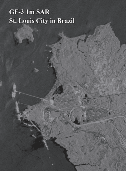
Rapid Detection and Response to Marine Oil Spills XRTech Group enables governments, coast guards, and energy operators to rapidly detect