2m · Daily Coverage
Look Broader
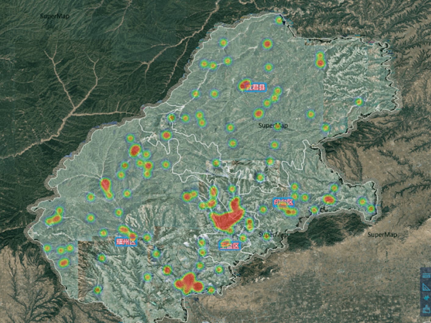
Monitor cities, borders, farms and infrastructure corridors at regional scale with frequent revisit coverage.
Most providers quote up to 2 weeks for delivery. XRTech Group responds in 48 hours for archive imagery, with high resolution optical, SAR and hyperspectral data ready for faster decisions.
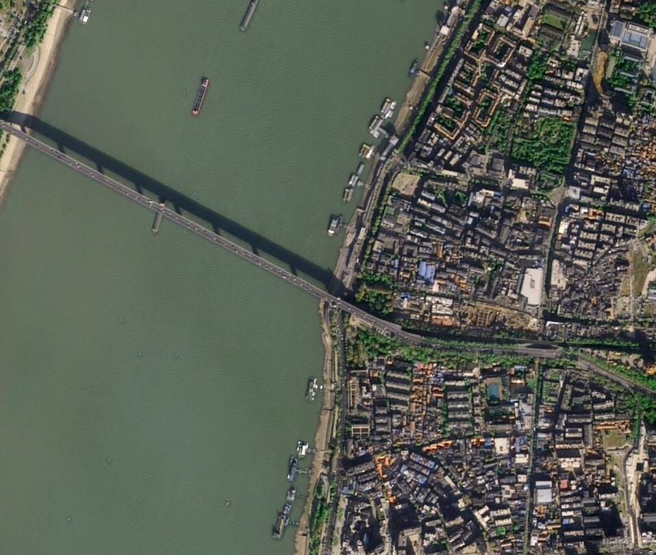
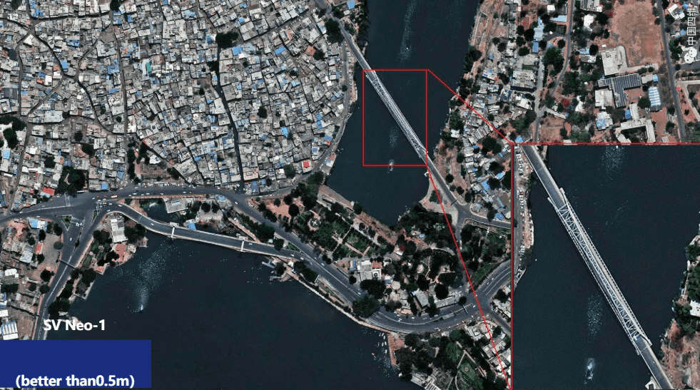
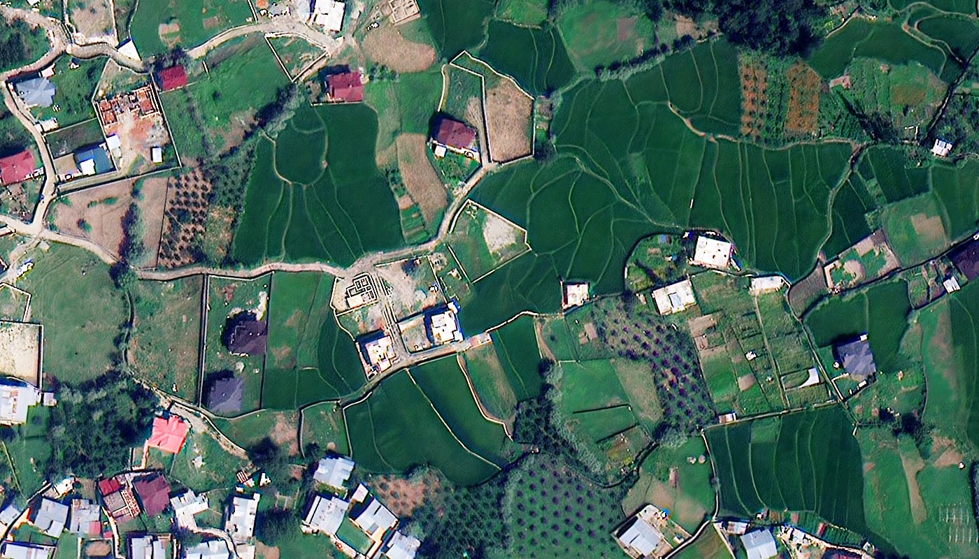
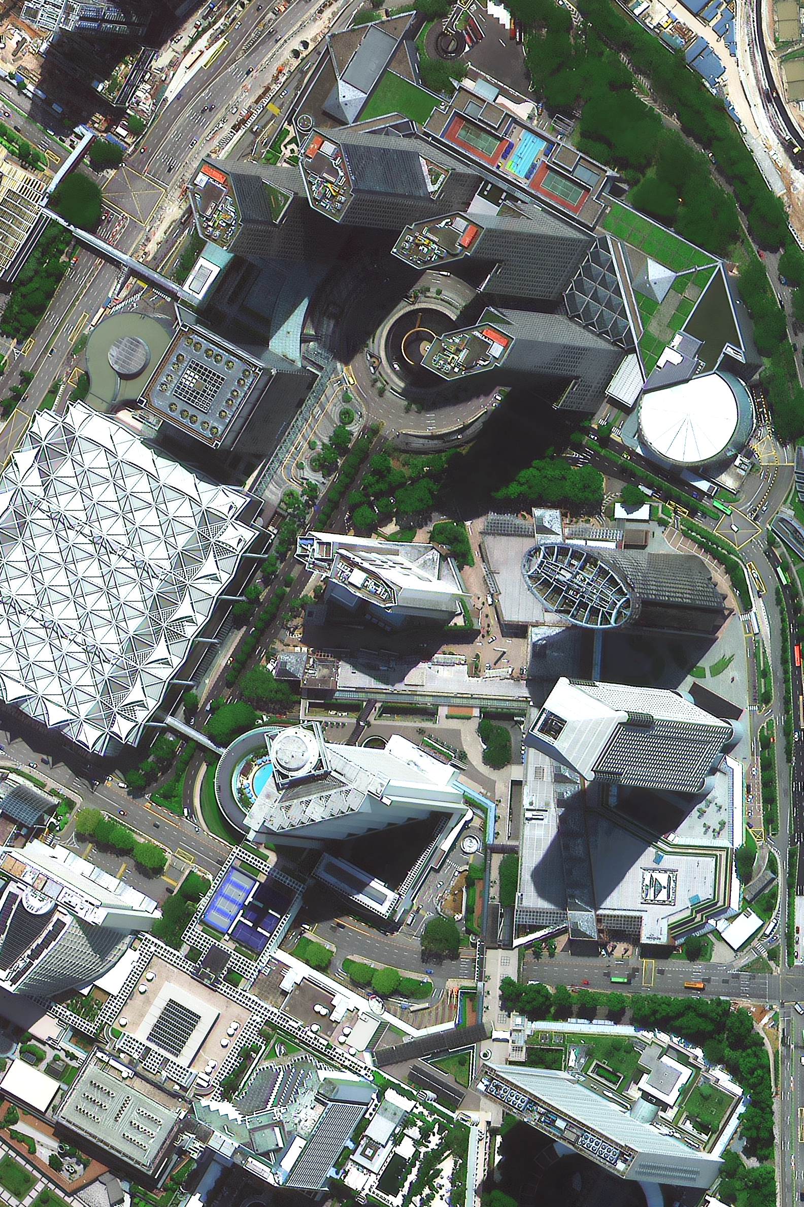 SuperView Neo · 30cm · Urban Infrastructure

Geospatial intelligence from orbit to your GIS in 48 hours. Archive or new tasking, delivered globally.
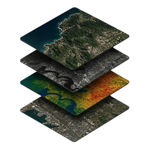
XRTech Group combines current satellite imagery, deep archive, SAR radar and hyperspectral intelligence so you can monitor more ground, inspect finer detail, compare what changed and respond with confidence.
Monitor cities, borders, farms and infrastructure corridors at regional scale with frequent revisit coverage.
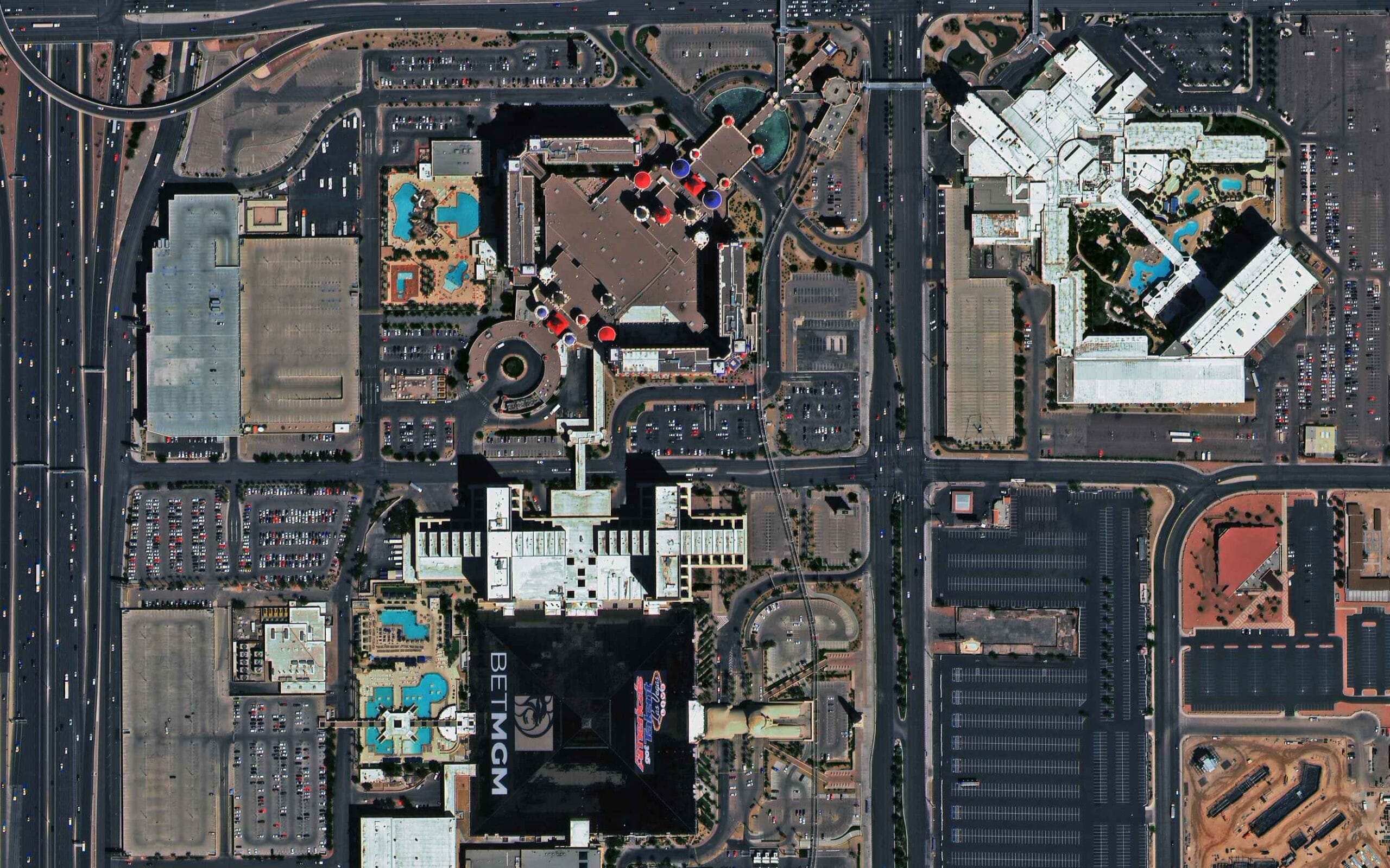
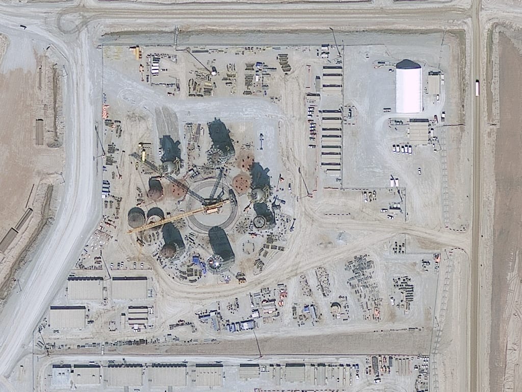
Inspect vehicles, site progress, equipment, road markings and structural activity at true native resolution.
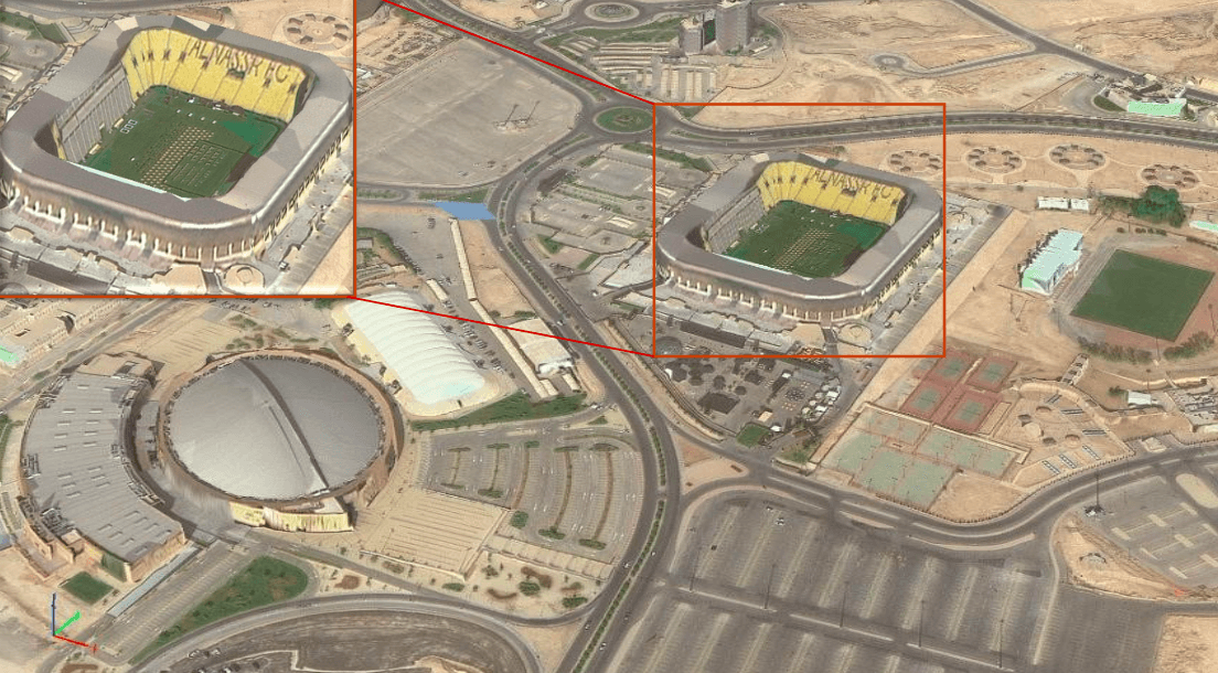
Establish baselines, verify past activity and compare before and after conditions across deep archive coverage.
See through cloud, operate at night and detect spectral patterns invisible to standard optical imagery.
One provider. Four ways to understand your area. Order archive, new tasking or analytics-ready data products from a single geospatial workflow.
Browse All Satellite ImageryFrom raw archive imagery to fully processed geospatial intelligence. XRTech Group delivers every data product your project needs, from the same trusted source.
Buy 30cm very high resolution satellite imagery and 50cm imagery from the SuperView Neo and SuperView-1 constellations. True native resolution, no resampling. Archive from $14/km².
Learn More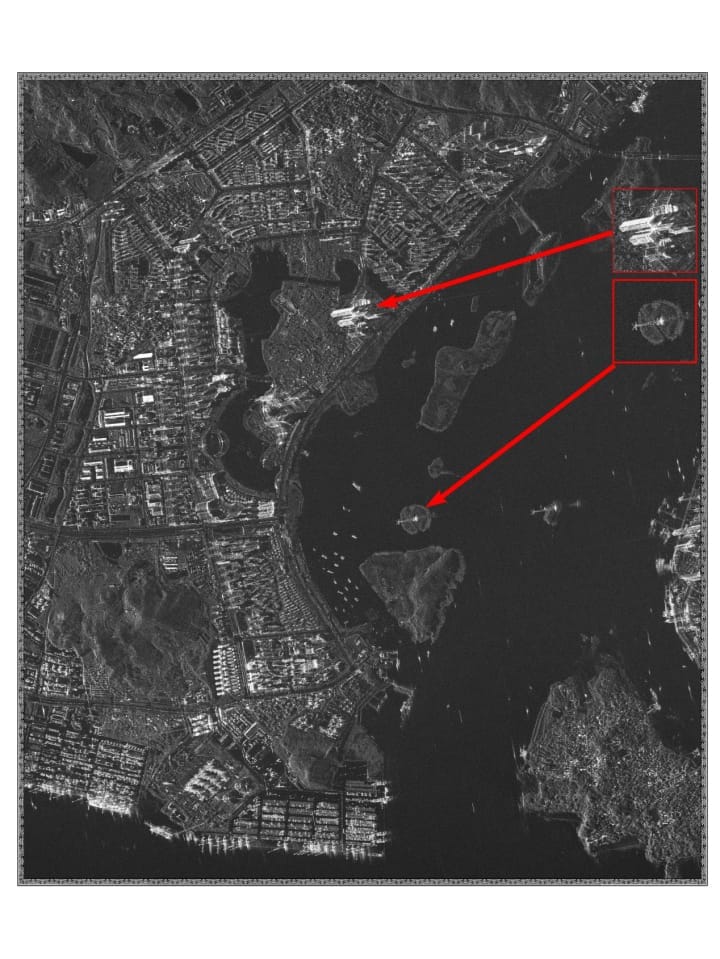
All-weather, day-and-night X-band and L-band SAR satellite imagery through cloud, rain and darkness. Essential for flood mapping, telecommunications infrastructure monitoring and environmental surveillance.
Learn More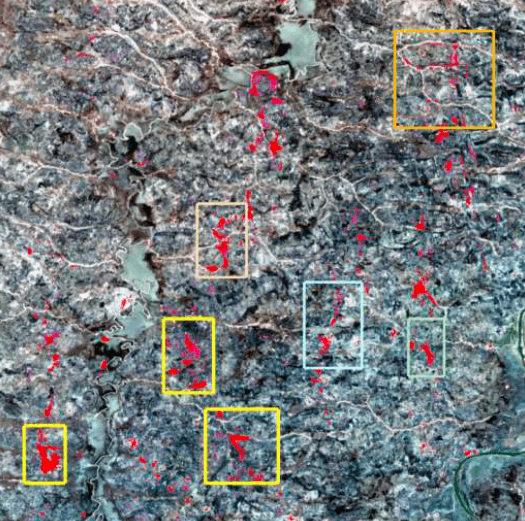
300+ band hyperspectral satellite imagery for mineral exploration, vegetation stress analysis, pollution detection and agricultural optimisation from the GF-5B constellation.
Learn More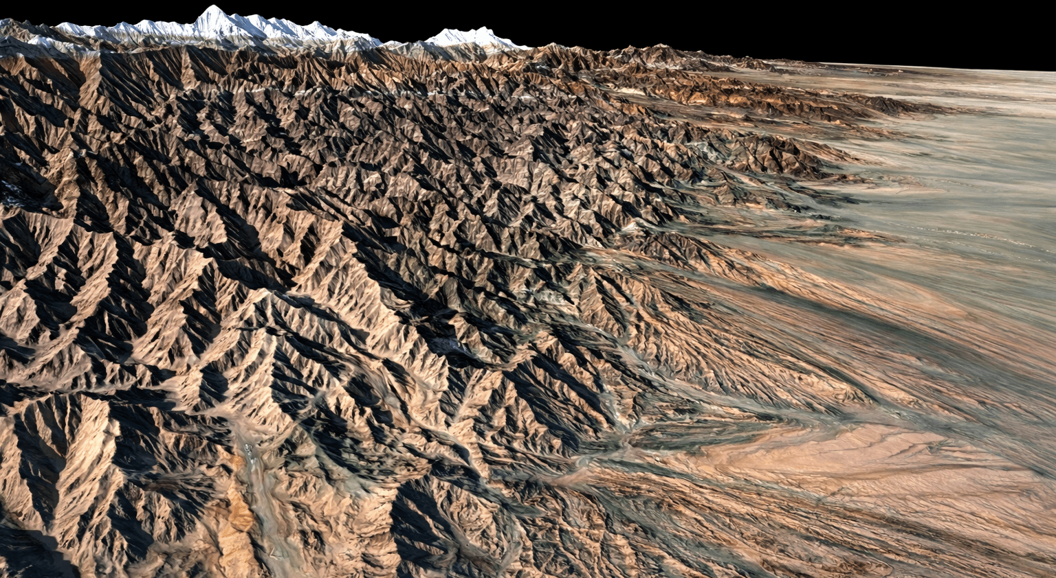
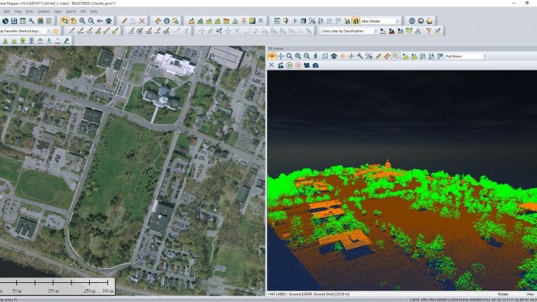
High-accuracy DEM, DSM and DTM derived from SuperView stereo tasking. Vertical accuracy ±3m RMSE. Used for terrain modelling, flood planning and 3D city models.
Learn More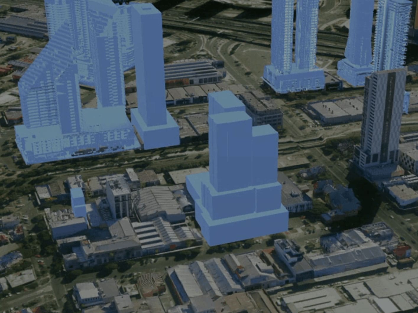
Building footprint extraction, urban 3D models and digital twin services from stereo satellite tasking. Sub-metre accuracy for city planning, infrastructure design and smart city applications.
Learn More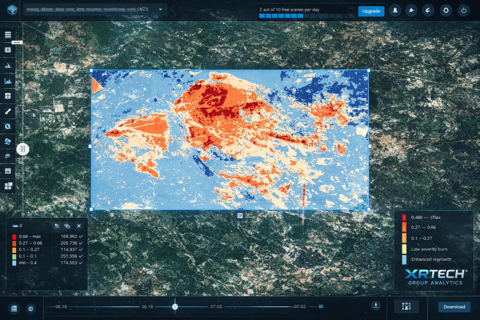
Processed, analysis-ready geospatial products including orthorectified imagery, change detection, object classification and AI-driven analytics, delivered in GeoTIFF, KML and standard GIS formats.
Learn MoreEvery image we deliver goes through a full processing pipeline. Ortho correction, alignment, pan-sharpening, colour balancing and mosaicing — all done before delivery, so your data loads directly into your GIS without additional steps.
Existing captures delivered within 48 hours of order. Archive data from $14/km².
New satellite capture on your chosen date, delivered in under 7 days.
Critical missions delivered within 24 hours of the satellite pass.
1.5-hour response time with 1-hour delivery for the most urgent operational requests.
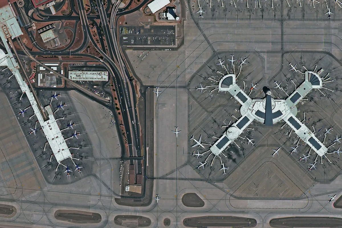
 30CM
30CM
True native 30cm · Roads, buildings and vehicles identifiable
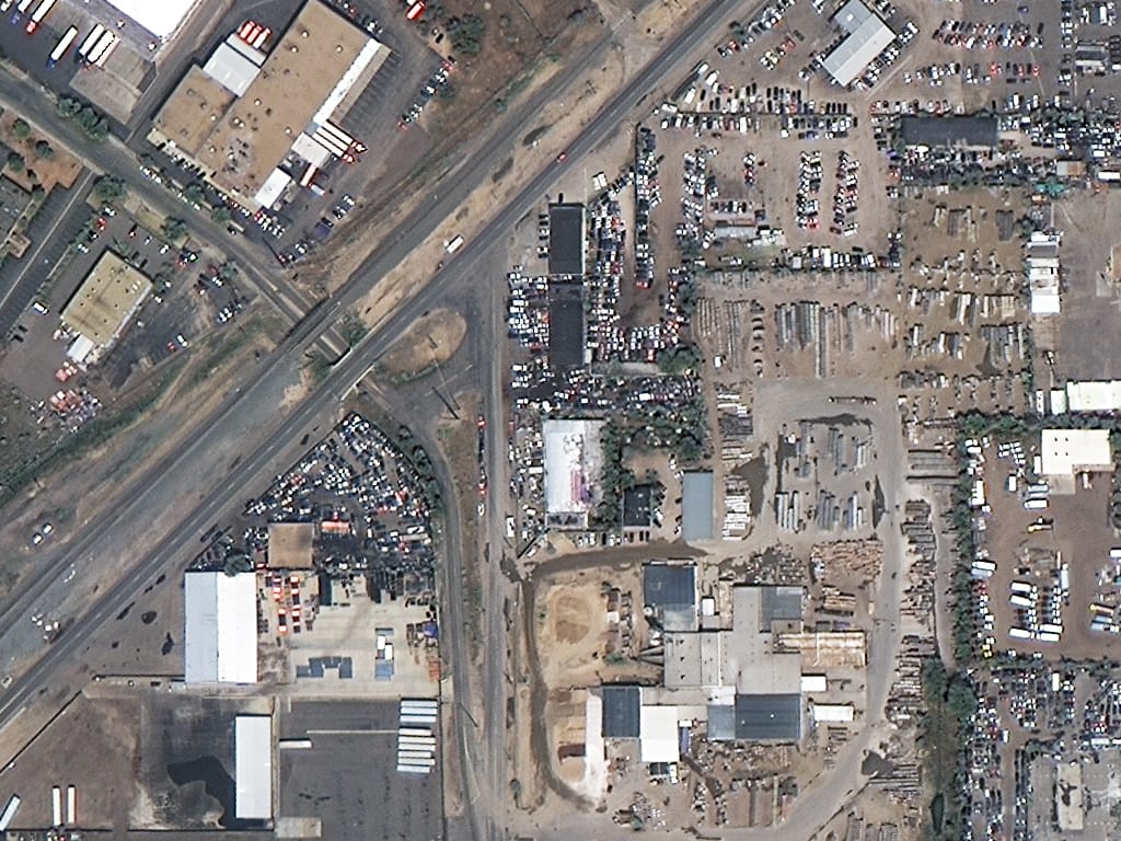 50CM
50CM
Equipment, foundations and site progress without a site visit
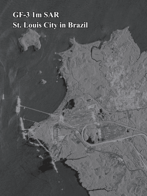
 SAR
SAR
X-band SAR through cloud and darkness · Network corridor monitoring
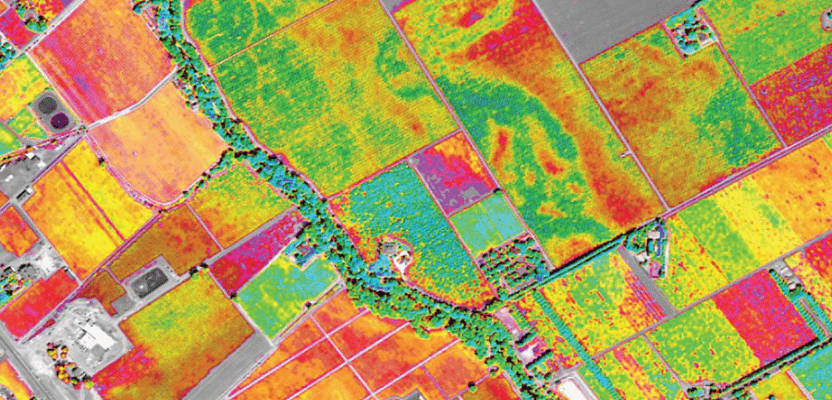 MULTISPECTRAL
4-band NDVI · Crop health, field boundaries and irrigation
 DISASTER
Before and after · Flood extent, damage and access routes
HYPERSPECTRAL
300+ spectral bands · Mineral signatures and geology mapping
XRTech Group provides access to 130+ optical, SAR and hyperspectral satellites from one trusted source, delivered worldwide at speeds 2× faster than other commercial providers.
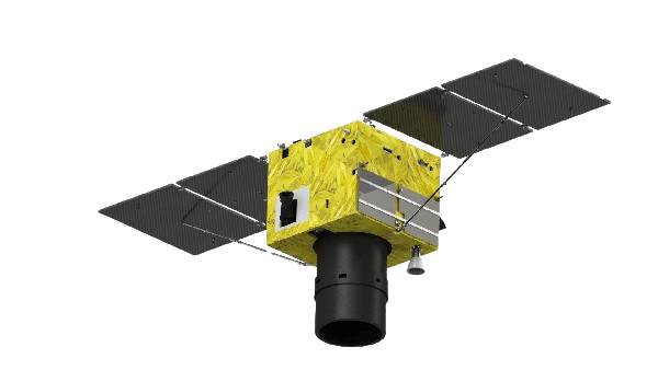
The finest native resolution commercial optical satellite available in 2025. Launched February 27, 2025. Ultra-high-resolution panchromatic and 1m multispectral. GSD: 25cm PAN · 1m MS · CE90: 3.5m. Ideal for Ideal for precision mapping, infrastructure monitoring and AI training datasets.
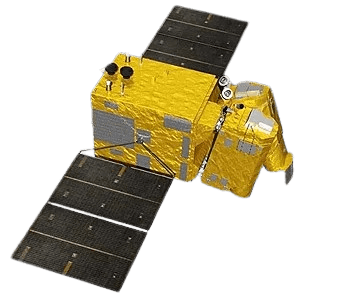
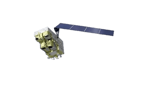
Original VHR optical constellation launched April 2022. True native 30cm ground sample distance, no resampling. Used for construction monitoring, and large-scale infrastructure analysis. The backbone of XRTech's premium imagery offering.
Wide-swath 8-band multispectral satellite with 130km footprint — the widest in the SuperView fleet. Launched 2024 and 2025. Coastal blue, yellow and red-edge bands added for enhanced vegetation, water and agricultural spectral analysis. Ideal for large-area regional projects.

China's first commercial high-resolution constellation of four agile satellites launched 2016 and 2018. Delivers reliable daily revisit at 50cm with up to 2 million km² per day capacity. The cost-effective workhorse for professional mapping and monitoring at scale. Archive from $14/km².
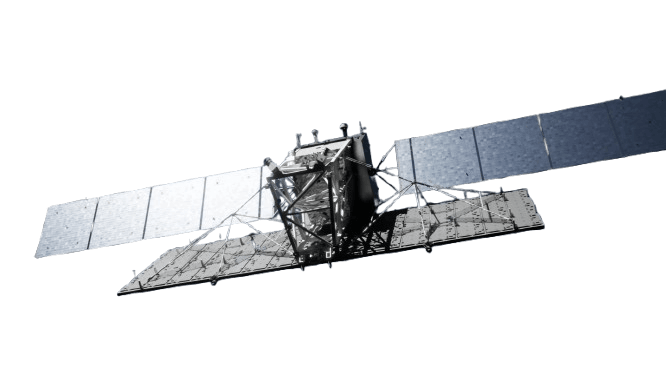
Gaofen-7 is a civilian stereoscopic mapping satellite with 0.65m resolution and laser altimeter capability. Used for precision digital elevation model generation, topographic mapping and urban planning at scales demanding the highest geometric accuracy.
Gaofen-2 provides 0.8m panchromatic and 3.2m multispectral imagery for land use mapping, urban planning and agricultural monitoring. Effective wide-area coverage with a 45km swath. Available through XRTech Group for environmental monitoring and land administration projects.

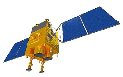
X-band SAR radar satellite providing all-weather, day-and-night imaging at 0.5m resolution. Sees through cloud, rain, smoke and darkness. Used for disaster response, flood mapping, telecommunications infrastructure monitoring and change detection when optical data is unavailable.
Gaofen-3 is a C-band Synthetic Aperture Radar satellite designed for all-weather Earth observation. It supports oil spill detection, flood monitoring, coastal environmental surveillance and telecommunications infrastructure assessment. C-band penetrates light vegetation and dry soil for improved land surface characterisation.
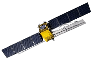
L-band SAR satellite capable of penetrating forest canopies and dry soil. Used for geological mapping, subsurface feature detection, forest biomass estimation and sub-surface infrastructure monitoring. L-band is uniquely effective for mineral exploration and deep vegetation analysis.
Gaofen-5B carries a hyperspectral imager with over 300 spectral bands at 30m resolution. Captures visible, near-infrared and shortwave infrared signatures for mineral identification, vegetation health and pollution monitoring. Used for mineral exploration, carbon monitoring and environmental compliance.
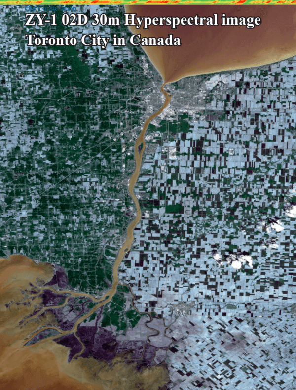
ZiYuan-1 02D provides 30m hyperspectral imagery for mineral exploration, land use mapping and carbon stock monitoring. The 76-band VNIR sensor supports crop species classification, soil composition analysis and geological feature mapping across large areas.
SuperView-2 is specialised for advanced vegetation analysis and water quality monitoring with extended spectral coverage including Red Edge, Yellow and NIR2 bands beyond the standard four. Supports precision agricultural monitoring, coastal water quality and ecosystem health assessment.
The right resolution depends on what you need to see. Choose too coarse and you miss critical detail. Choose finer than your application requires and you pay more than you need to.
Best for: Precision mapping, AI training datasets, engineering surveys, infrastructure inspection
Best for: Construction, pipeline, infrastructure, mapping
Best for: Urban planning, agriculture, land management, disaster response
Best for: Disaster response, flood mapping, oil spill detection, infrastructure monitoring, night operations
From precision agriculture and environmental compliance to urban planning and infrastructure monitoring — XRTech Group delivers the right satellite data product for every application, worldwide.
 Precision Agriculture
Combine 50cm multispectral imagery with red-edge spectral bands for NDVI, irrigation mapping and early-season crop stress detection. Monitor large agricultural areas daily without drone deployment.
 Disaster Management
When disaster strikes, satellite imagery for disaster management provides critical situational awareness within hours. Emergency tasking delivers 30cm imagery within 24 hours of the satellite pass, fast enough to support active response operations.
 Construction Monitoring
Monitor foundation works, equipment positions, material volumes and structural progress with 30cm to 50cm construction monitoring imagery. Document progress weekly or monthly without physical site visits, across any number of sites simultaneously.
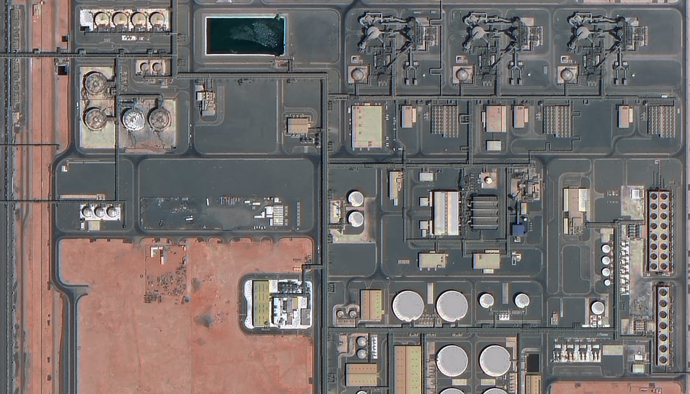 Oil and Gas
Detect pipeline encroachments, verify remote asset conditions and monitor corridor activity with satellite imagery for oil and gas. GF-3 C-band SAR detects oil spills on water surfaces day or night, providing early warning before environmental damage escalates.
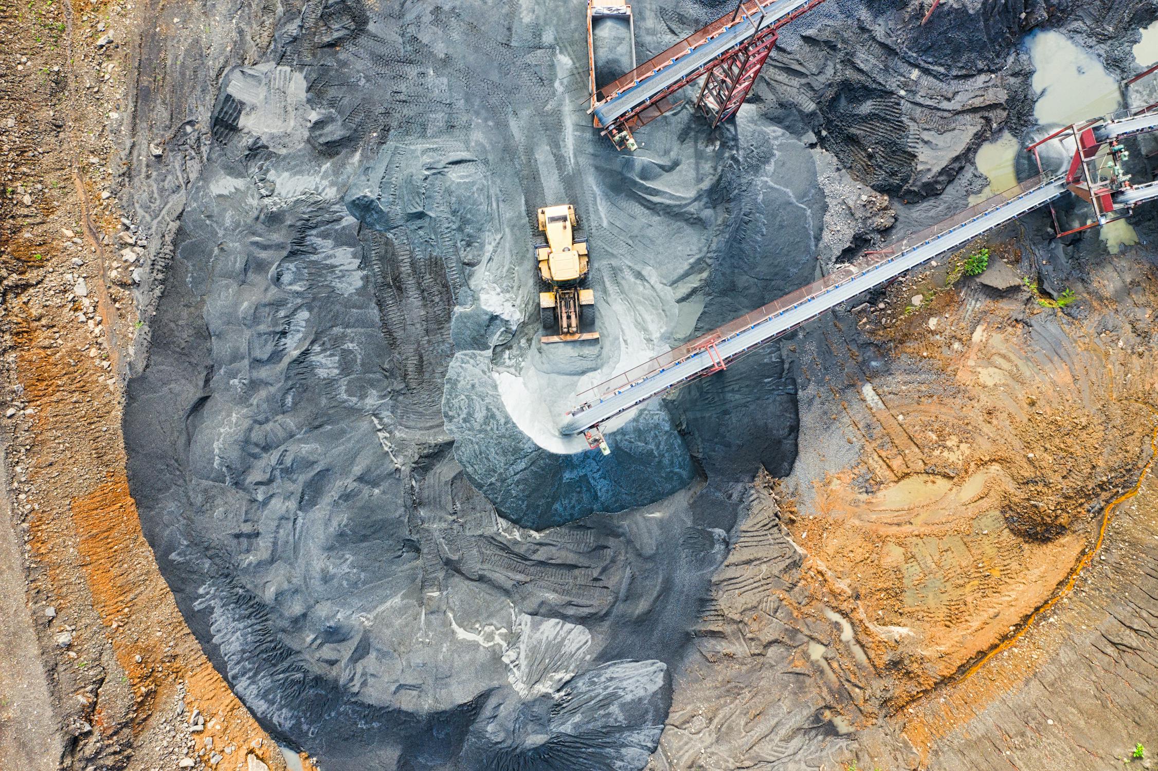 Mining and Minerals
GF-5B 300+ band hyperspectral imagery identifies mineral signatures, clay alteration zones and iron oxide anomalies that indicate potential ore deposits. Combine with 30cm optical and L-band SAR for a complete exploration monitoring workflow.
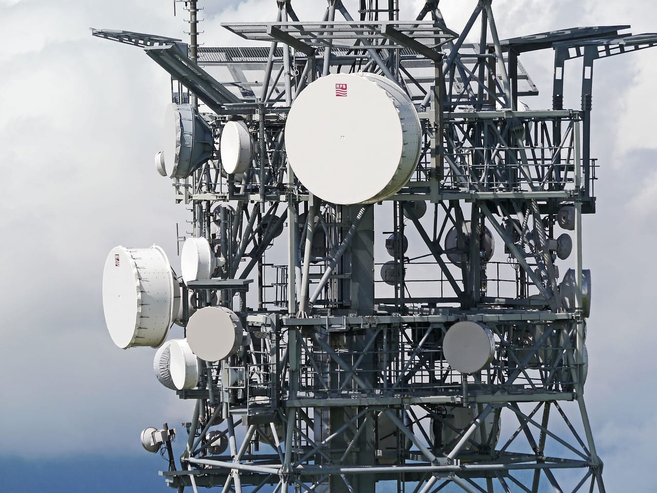 Telecommunications
Tower site selection, network coverage planning, and terrain analysis for signal propagation modeling using high-resolution satellite imagery.
 Environmental Monitoring
Detect deforestation, verify carbon project boundaries and monitor coastal erosion with consistent environmental monitoring satellite imagery. ZY-1 02D hyperspectral data supports carbon stock estimation and biodiversity assessment at 30m resolution.
 Urban Management
Sub-metre building footprint extraction and 3D city models from GF-7 stereo imagery. Updated satellite maps at scales up to 1:5,000 support housing policy, transportation planning, urban sprawl monitoring and smart city digital twin development.
 Insurance
Before-and-after satellite imagery provides verifiable, timestamped evidence for property assessment, catastrophe modelling and claims validation. Access archive imagery going back to 1999 for historical property condition assessment and rapid post-event damage surveys.
Compare satellite images from different dates to detect exactly what changed on the ground. Construction progress, deforestation, mining activity or unauthorised encroachment — delivered as a difference map with area calculation.
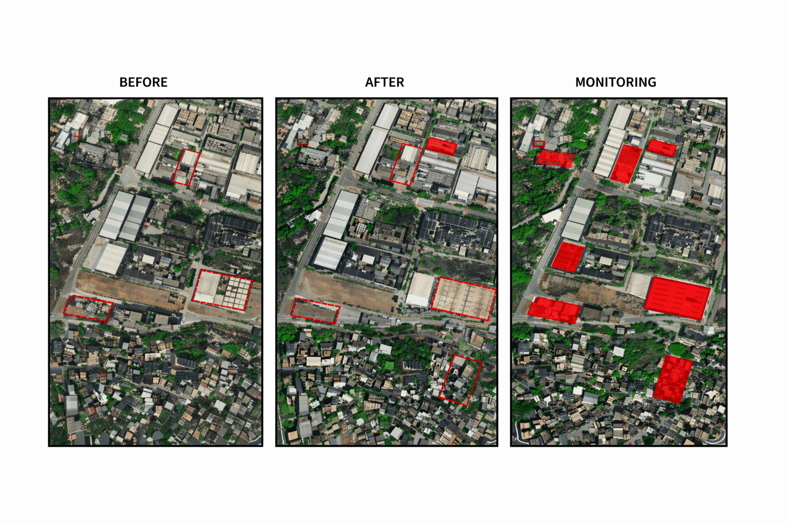
Before and after · Every change revealed in one map
Compare any two dates. Before and after analysis.
Track change trends across 3+ dates. See the rate of change.
Automatic change alerts. No manual interpretation needed.
No hidden fees. No subscription. Know your costs before you order. Every formal quote includes sample imagery for your area on request.
Previously captured imagery 90 days or older. Fastest delivery. Ideal for change detection and historical baselines.
True native 30cm archive from SuperView Neo-1 constellation. The finest commercially available archive optical data.
Fresh satellite capture on your chosen date at 30cm. Cloud cover guarantee available. Results in under 7 days.
Mission-critical delivery within 24 hours of the satellite pass. Disaster response, intelligence and time-critical operations.
Optical, SAR, hyperspectral and multispectral sensors from a single authorised provider. No need to manage multiple vendor relationships.
XRTech Group delivers to buyers worldwide on standard commercial terms. No licence applications, no review delays — just fast, direct access to your data.
Archive in 48 hours. Standard tasking in 7 days. Emergency in 24 hours. Urgent requests responded to within 1.5 hours through the cloud platform.
Fixed per km² pricing with no hidden fees. Know your total cost before placing an order. Sample imagery included with every quote.
Ortho correction, alignment, pan-sharpening, colour balancing and mosaicing included. Level 2A orthorectified and loads directly into ArcGIS or QGIS.
Our team helps you choose the right resolution, sensor type and processing level for your specific project requirements. WhatsApp at +971 58 885 3151.
Draw your area of interest or upload a KML or KMZ file. Tell us whether you need archive or new tasking, and your required resolution.
We search the archive for existing captures or schedule a new satellite tasking on your chosen date with your specified parameters.
Receive transparent fixed pricing with a free sample imagery tile for your area. See exactly what the data looks like before committing.
Fully processed GeoTIFF delivered to your preferred cloud storage or direct download. Loads directly into your GIS workflow.
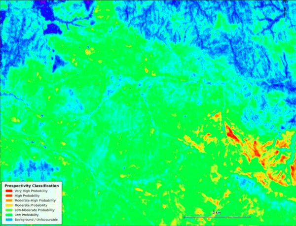
XRTech Group Case Study Satellite Gold Map Identifies 140 ha of Priority Land in Africa A mining company needed to screen a large licensed exploration
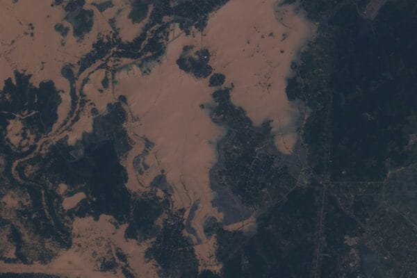
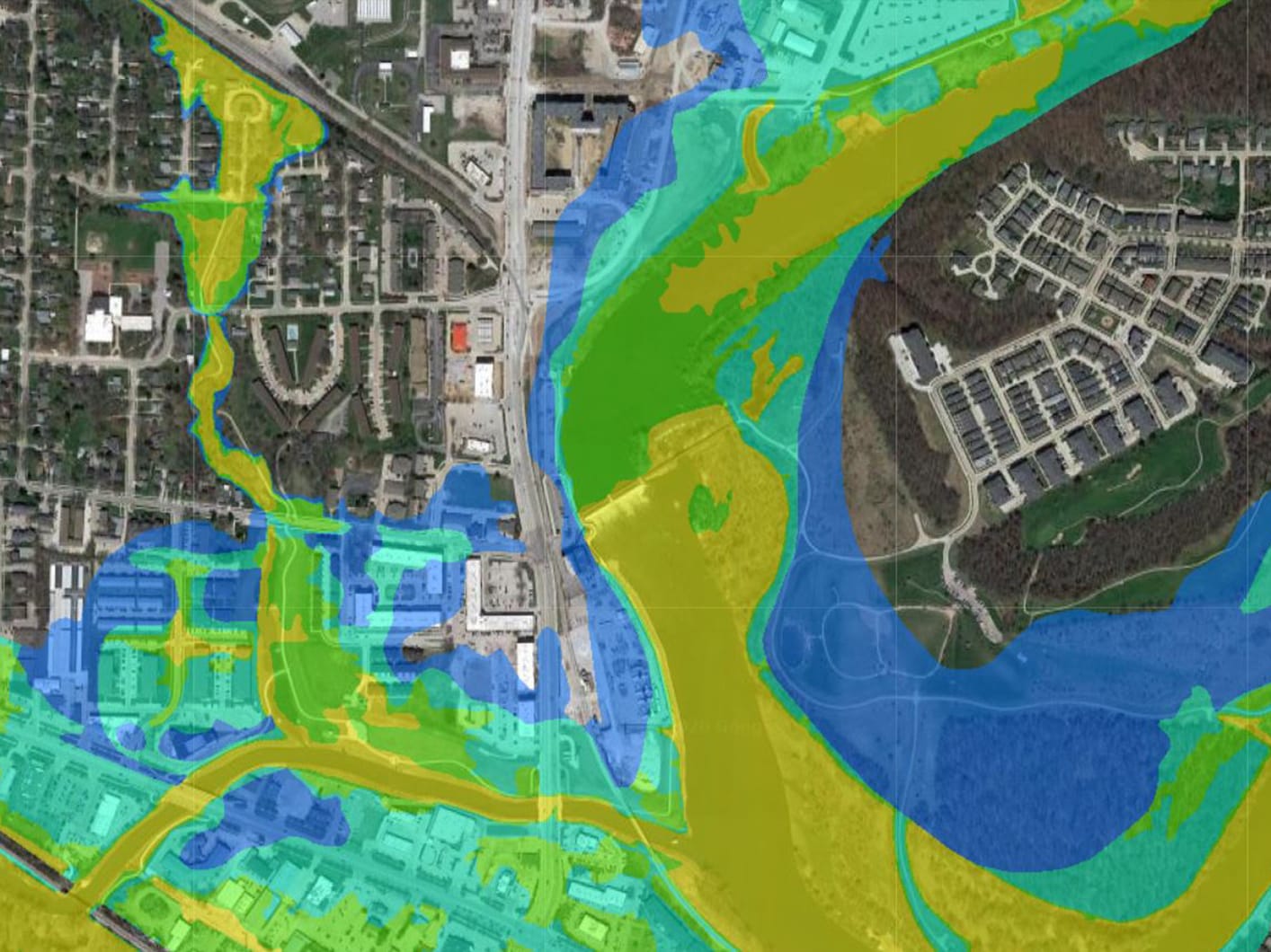
XRTech Group Case Study Satellite Imagery for Flooding in Sri Lanka Delivered in 72 Hours During Cyclone Ditwah 9 Sri Lanka flood zones. 4,100 km
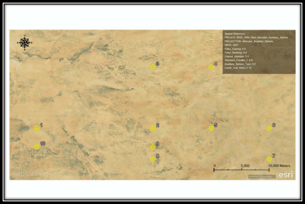
XRTech Group Case Study AI-Powered High Resolution Satellite Imagery for Gold Exploration in Africa How XRTech Group’s deep learning models analyzed remote sensing data to