Revolutionize Your Land Survey Companies in Dubai
Precision Geospatial Solutions with Satellite Imagery. Empowering every land survey companies in Dubai to enhance accuracy, reduce costs, and accelerate project timelines.
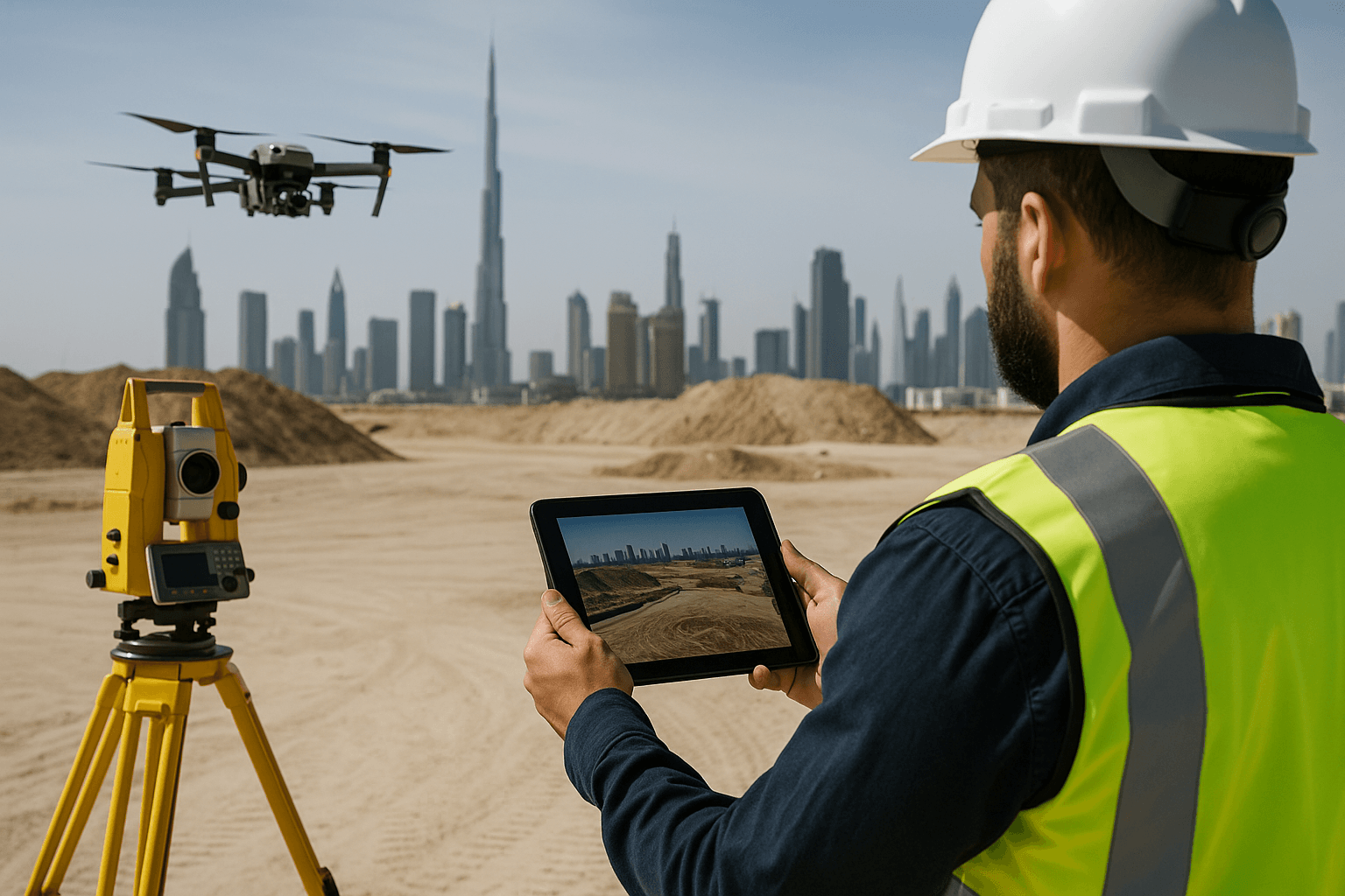
The Future of Land Surveying in Dubai is Here
The dynamic landscape of Dubai demands innovative solutions for accurate land surveying and infrastructure development. For every land survey company in Dubai and Middle East survey engineering firm, precision, efficiency, and safety are paramount. Traditional surveying methods, while foundational, can be time-consuming, costly, and carry inherent risks in complex urban and remote environments.
XRTech Group stands as a pioneer in delivering cutting-edge geospatial solutions, leveraging the unparalleled power of advanced satellite imagery and state-of-the-art drone technology. We empower survey companies in Dubai to overcome complex challenges by integrating the macro-perspective of our vast satellite constellation with the micro-detail of advanced drones. This synergy provides comprehensive, actionable insights, ensuring your projects—from initial planning to final inspection—are built on reliable, high-fidelity data.
Unmatched Benefits for Land Survey Companies in Dubai
Integrating XRTech Group's satellite and drone technology offers a multitude of advantages that directly address the core challenges faced by survey companies in Dubai.
Superior Accuracy & Precision
Achieve sub-meter satellite imagery resolution, with options as sharp as 0.3m per pixel. Our outputs consistently meet demanding CE90 and RMSE specifications. For ground deformation, our SAR data can detect movements as small as 1-2mm.
Enhanced Speed & Efficiency
Receive satellite imagery in under 7 days and detailed Digital Elevation Models (DEMs) in under 21 days. Our autonomous drone solutions offer real-time data collection and instant analysis.
Significant Cost Reduction
Drone inspections are approximately 40% cheaper than manual methods. By reducing the need for extensive on-site teams and avoiding project shutdowns, both satellite and drone solutions contribute to substantial cost savings.
Improved Safety
Drones can access hazardous or hard-to-reach areas like tall structures, industrial sites, or disaster zones, significantly reducing risks for human workers.
All-Weather & Day/Night Capabilities
Synthetic Aperture Radar (SAR) satellites penetrate clouds and smoke, operating in complete darkness to ensure continuous monitoring. Thermal imaging drones extend visibility into the night.
Real-Time Insights & Monitoring
Access live thermal imaging from drones and rapid satellite tasking for near real-time updates, enabling immediate decision-making during critical operations.
Comprehensive Applications for Land Survey Companies in Dubai
Our integrated solutions cater to every facet of operations, transforming how every land survey company in Dubai executes projects.
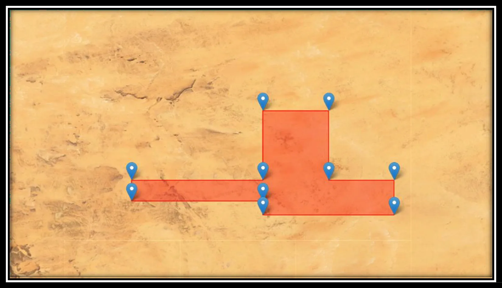
1. Land Surveying
Our high-resolution satellite imagery and precise DEM/DSM data are fundamental for traditional land surveying tasks, establishing precise control points across large or remote areas.
- Site Suitability & Reconnaissance: Utilize high-resolution satellite imagery (e.g., Superview Neo-1 at 0.3m/px, GF-7 at 0.65m/px) to rapidly assess large project areas, identify optimal locations for new facilities like airports or industrial zones, and understand general ground conditions before fieldwork begins.
- Boundary Verification: Precisely verify property lines using detailed optical imagery and historical archives dating back to 1999 for change analysis and dispute resolution.
- Terrain Analysis & Slope Detection: Generate accurate Digital Elevation Models (DEMs), Digital Surface Models (DSMs), and Digital Terrain Models (DTMs) to analyze terrain characteristics, slope, and aspect for optimal site selection and infrastructure design.
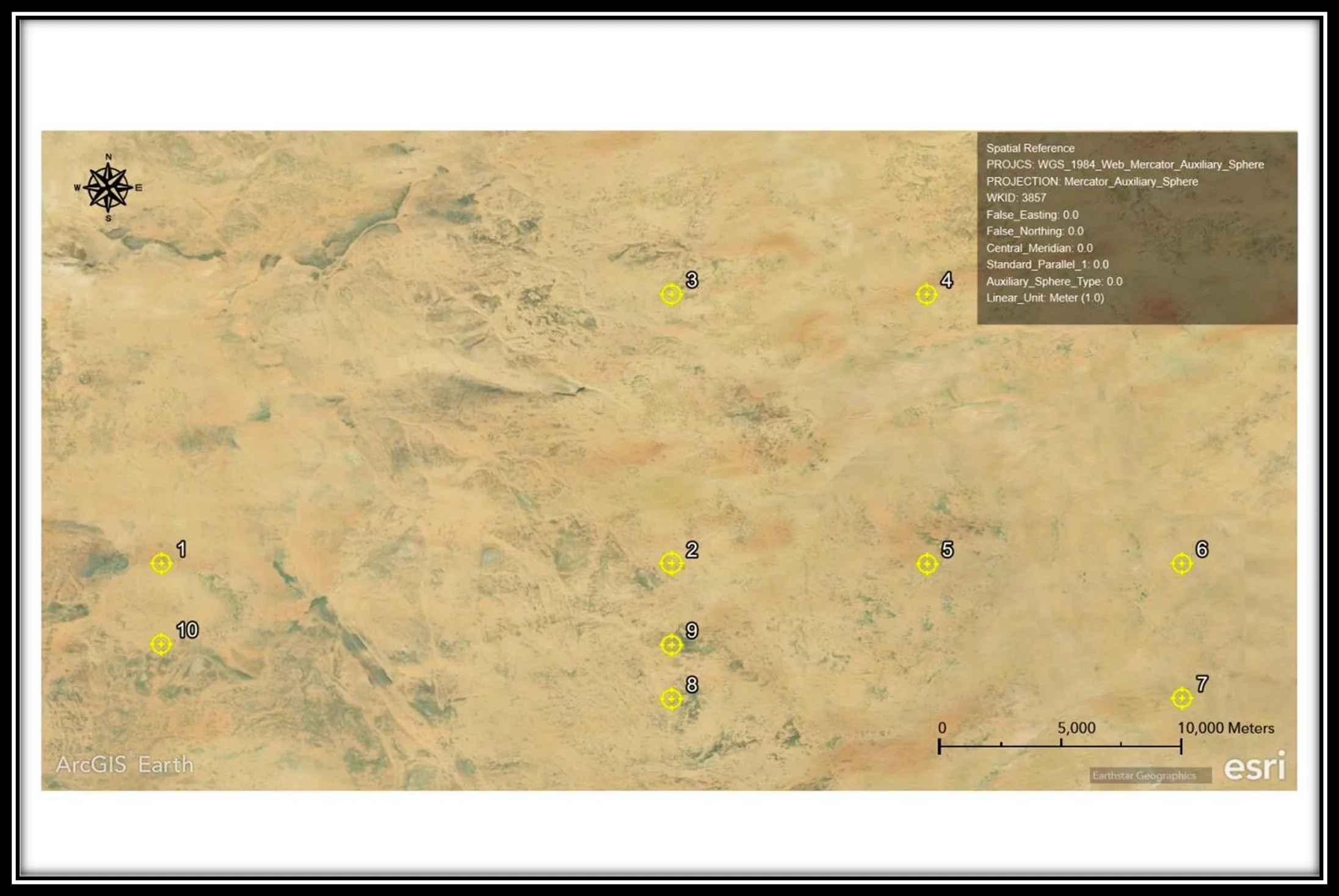
2. Aerial Data Collection & Mapping
We deliver comprehensive mapping solutions, from creating base maps for urban planning to sophisticated 3D geographical scenes. Satellites provide wide-area context, while drones fill in intricate details.
- High-Resolution Mapping: Create pixel-perfect Digital Orthophoto Maps (DOMs) with 50 cm resolution and 8m CE90 precision, invaluable for mapping details like buildings and roads.
- 3D City Models & Digital Twins: Build high-resolution 3D city models and digital twins of urban environments. These provide real-time insights into urban infrastructure, supporting urban planning, construction, and disaster management. AI-powered building contour extraction allows for precise scenario modeling.
- Change Detection Analytics: Automatically track construction progress, monitor urban expansion, and identify unauthorized changes with advanced satellite analytics and frequent revisits.
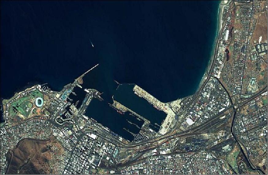
3. Hydrographic/Bathymetric Survey
For coastal and marine projects, satellite imagery provides essential data for mapping, environmental monitoring, navigation, and coastal engineering.
- Coastal Mapping: Orthophoto Maps are essential for mapping port infrastructure, coastal developments, and shallow water features, crucial for marine planning.
- Water Basin Modeling: Our satellite imagery provides detailed models for complex water systems, improving hydrological analysis and water resource management, critical for river basins leading to the sea.
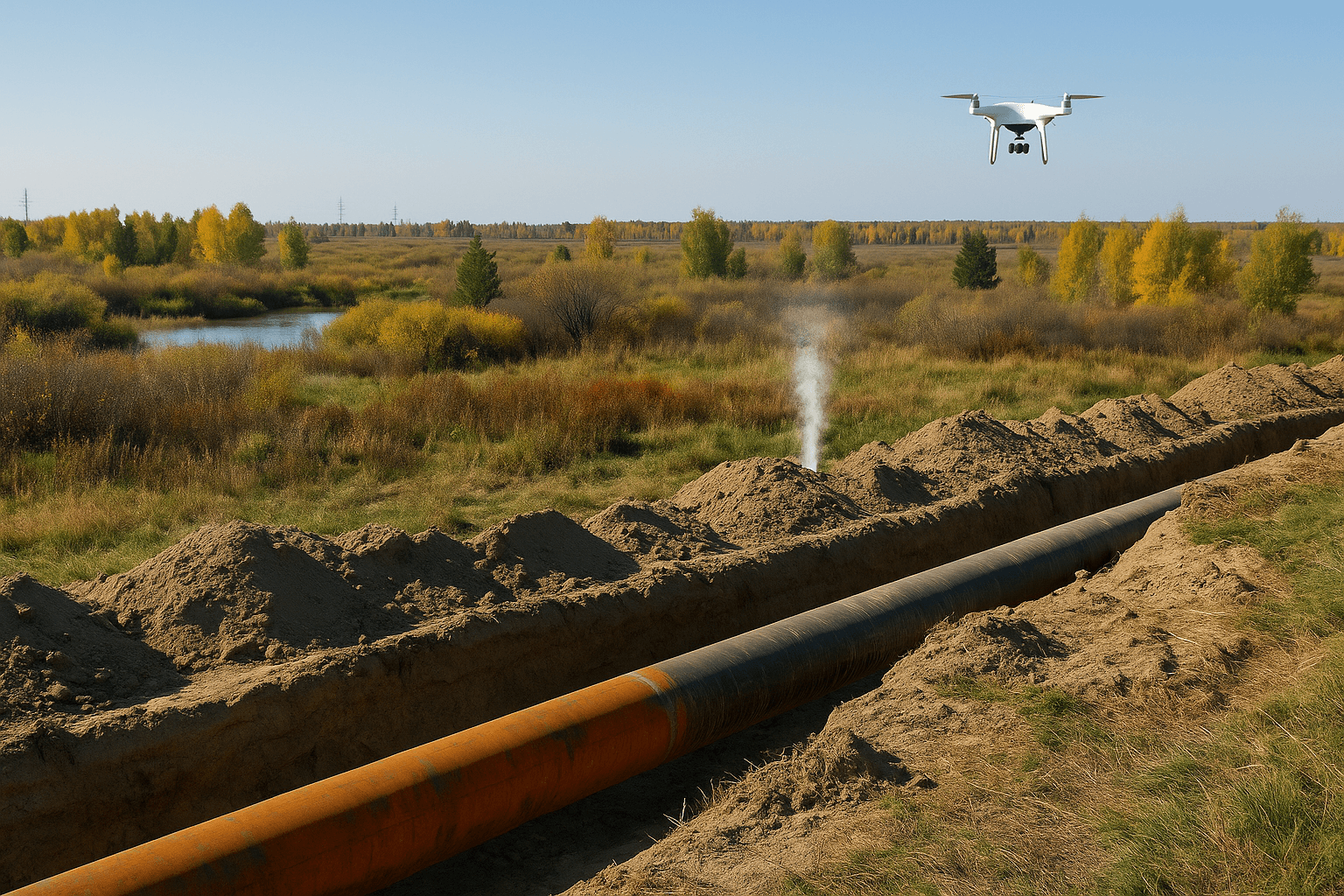
4. Underground Utility Survey (Indirect Contribution)
While direct underground utility locating is typically done with ground-penetrating radar, our solutions contribute significantly to related infrastructure integrity. L-band (LT-1 SAR) and C-band (GF-3 SAR) radar satellites, along with thermal drones, can monitor pipeline integrity, detect potential leaks through heat signatures, and track ground deformation above pipelines (using InSAR technology). This is crucial for maintaining the safety and efficiency of buried oil and gas infrastructure and can indirectly highlight areas of concern for other underground utilities.
Our Advanced Satellite & Drone Features
We leverage an expansive suite of technologies to deliver superior geospatial data for every Middle East survey engineering firm.
XRTech Group Satellite Features
Our constellation of over 130 satellites (optical, SAR, stereo, hyperspectral) provides unmatched coverage and data diversity:
- Very High Resolution (VHR) Optical: Offering resolutions as sharp as 0.3m/px (Superview Neo-1), 0.4m/px (Superview-2), and 0.5m/px (Superview-1) for unparalleled detail.
- High-Resolution (HR) Optical: Including GF-7 (0.65m/px) and GF-2 (0.8m/px).
- Wide-Swath Optical: GF-6 (2m/px, 90km swath; 16m/px, 800km swath) and GF-4 (50m/px, 400km swath with 20-second revisits for continuous monitoring).
- Radar (SAR): GF-3 SAR (1m/px, C-band) and LT-1 SAR (3m/px, L-band). These provide all-weather, day-and-night imaging, capable of detecting millimeter-scale surface deformation using InSAR technology.
- Hyperspectral: GF-5B and ZY-1 02D (30m/px) offer hundreds of narrow spectral bands (400-2500 nm) for in-depth material composition analysis, crucial for mining exploration and environmental studies.
- Diverse Spectral Bands: Including Panchromatic, RGB, Near-Infrared (NIR), Mid-Wave Infrared, Red Edge, Purple, and Yellow, enabling comprehensive land use analysis.
- Rapid Revisit Times: From daily for VHR optical to less than 1 day for our SAR constellation.
- Value-Added Products: We transform raw data into essential tools like Digital Orthophoto Maps (DOM), Digital Surface Models (DSM), Digital Elevation Models (DEM), and 3D city models. Our DEMs offer 2-10 meter spacing with ±3m vertical RMSE for engineering-grade accuracy.
XRTech Group Drone Features
Our advanced drone fleet is designed for close-up detail and specialized tasks:
- State-of-the-Art Thermal Imaging: We offer models like the DJI Matrice 350 RTK (with Zenmuse H20T camera for 640x512 thermal resolution, 55 min flight time, IP45 rating), DJI Matrice 30 Series, Autel EVO Max 4T (640x512 thermal, 42 min flight time, 9km range, multi-directional obstacle avoidance, IP43 weather rating), and Autel EVO II Dual 640T.
- UAV AI Night Vision: Our DEEPTHINK S2 PLUS, S2PRO, S3, and S8 models provide superior imaging capabilities in low-light conditions for public security, forestry, and inspections.
- Autonomous Drone-in-a-Box: Featuring DJI Dock 2, Autel EVO Nest, and Autel Dragonfish Nest. These systems enable autonomous takeoff, landing, charging, and data transfer without manual input for continuous operations.
- 5G Connected Innovation: XRTech Group was the first to introduce 5G modules for DJI drone systems and offers 5G automated battery swapping stations, enhancing real-time responsiveness and scalability.
- Robust Safety & Performance: Includes advanced parachute systems, 360-degree obstacle avoidance, GPS, extended flight times (up to 55 minutes), transmission distances up to 15 km, and weather resistance (IP43 to IP55).
Empowering Key Sectors Across the Middle East
Our geospatial solutions extend beyond traditional surveying to empower other critical industries in Dubai and beyond.
Construction & Urban Management
Provide critical support at every stage: evaluate terrain and detect geohazards with DEM/DSM data; monitor construction progress with frequent imagery updates; and use InSAR to detect deformation in critical infrastructure like bridges and dams. For urban planners, we enable real-time monitoring of urban expansion and land use optimization.
Mining, Oil & Gas
Enable precision mineral exploration with hyperspectral imagery, create 3D geological maps, and monitor infrastructure safety with InSAR. For oil & gas, we offer pipeline integrity monitoring, leak detection with thermal drones, crude oil inventory tracking, and 3D views of exploration areas.
Disaster Management & Environmental
Deliver rapid flood risk mapping, damage assessment, and real-time response support for various disasters. For environmental compliance, we monitor water quality, pollution, land degradation, and support climate analysis with multispectral data.
Insurance, Military & Intelligence
For insurance companies, our data aids in risk assessment and claims verification. We also provide high-resolution imagery for reconnaissance, border surveillance, and asset detection for military and intelligence applications.
Why Choose XRTech Group: Your Premier Geospatial Partner in Dubai
When survey companies in Dubai demand the best, XRTech Group delivers. Our commitment to innovation, reliability, and client success sets us apart.
Unmatched Integration
We offer a truly comprehensive solution by seamlessly blending wide-area satellite intelligence with detailed, localized drone data. This synergy provides the full picture, fast.
Industry-Leading Accuracy
Our high-resolution satellite imagery (down to 0.3m) and precise DEMs (±3m RMSE) guarantee the accuracy needed for any Middle East survey engineering project.
Rapid Delivery & No Export Delays
Unlike competitors, our non-U.S. provider status means no export license delays, enabling faster data access – often 2x faster than other vendors.
AI-Powered Analytics
We integrate advanced AI modeling and platform development, transforming raw data into actionable insights for smarter planning and decision-making.
Customized & Flexible Solutions
From archive imagery dating back to 1999 to new satellite tasking and custom drone missions, we tailor our services to meet your unique needs.
Trusted Expertise
Our solutions are trusted by governments, NGOs, and enterprises across the Middle East, with years of expertise in 5G drone technology and satellite data.
Leverage the Power of Precision with XRTech Group Today!
For any land survey company in Dubai or Middle East survey engineering firm, partnering with XRTech Group means unlocking a new era of geospatial intelligence. Our combined expertise in satellite imagery and drone technology, powered by advanced AI and delivered with unmatched speed and accuracy, will elevate your operations. From DEM, DSM, and DTM creation to comprehensive asset monitoring, we provide the tools for smarter decisions, reduced risks, and successful project outcomes.
The Plaza, Radisson Blu Hotel, Dubai Deira Creek, Dubai UAE
Call Us: +971 58 885 3151