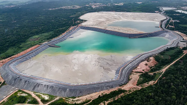
Tailings Dam Monitoring with InSAR & AI
Tailings Dam Monitoring: How Advanced Satellite Intelligence Is Transforming Tailings Dam Safety Tailings dams are among the most critical—and high-risk—structures
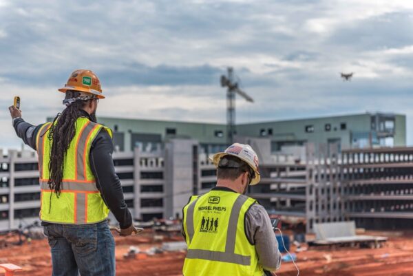
Drone for construction is becoming an essential part of how buildings are planned and built today. Companies that don’t use these high-tech flying machines risk falling behind in the competitive construction industry.
Understanding how drone for constructions can enhance workflows at every stage of a project is crucial for anyone involved in building.
Knowing how different types of drone for construction can help you choose the best ones for your construction tasks.
These amazing aerial tools are not only making construction work more efficient and accurate; they are changing how construction projects are managed altogether.
Drones for construction are now setting new standards for operational excellence, which means they help teams work smarter and achieve better results.
Whether it’s measuring materials accurately, monitoring progress on the job site, overseeing installations, or conducting thorough material checks, drones have become vital tools in the construction world.
As we move through 2025, it’s evident that UAVs for construction have evolved significantly. More and more construction companies are using specialized UAV drones for construction, leading to creative solutions for common problems on construction sites.
With the arrival of warmer weather, many construction teams are excited to use the latest drones for construction. Industries everywhere have been improving their productivity by adopting new technologies that make work easier and more cost-effective.
However, construction has often stuck to traditional methods and hasn’t kept up with technological advancements. According to a McKinsey report, construction accounts for 13% of the world’s economy, but its productivity has only grown by 1% each year over the past two decades.
The report identified several areas where construction productivity could increase by 50% to 60%, and integrating more technology, like drones for construction, is a key strategy.
These flying machines are not just gadgets; they are transformative tools. Each drone is designed to handle various complex tasks on construction sites. The days of seeing drones simply as flying cameras are over.
Now, construction drones play a crucial role in engineering teams by providing detailed, multi-angle views of job sites, revealing important details that might be missed from the ground.
In this guide, we will explore how drone for construction are reshaping the industry and which ones stand out as the best for different applications.
| Feature | Details |
|---|---|
| Efficiency | Speeds up tasks significantly |
| Accuracy | Provides precise measurements |
| Cost-effective | Reduces the need for manual work |
| Safety | Enhances site safety |
| Versatile | Suitable for various applications |
With these advantages, it’s clear that using UAVs for construction is no longer just an option; it’s becoming a necessity for companies that want to stay ahead in this fast-paced environment.
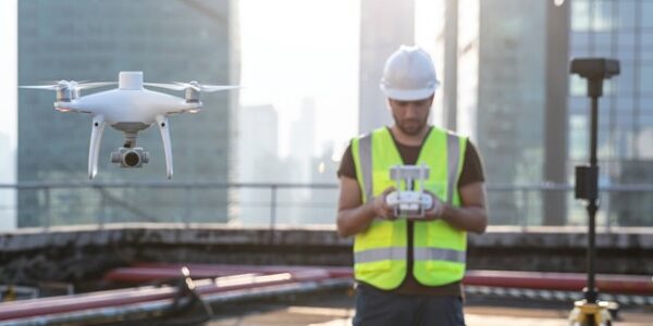
Drone & UAV for construction are revolutionizing the construction industry by capturing 3D views of worksites with centimeter-level accuracy. This means no more climbing poles, being suspended by ropes, or surveying stockpiles on foot around active machinery. Gone are the days of site shutdowns and the unfortunate consequences of construction-related incidents tied to traditional surveys or inspections.
Did you know that 6% to 9% of construction project costs are associated with injuries? These incidents lead to higher insurance rates and decreased profit margins. A serious accident can jeopardize a construction company’s future. Prior to the advent of drone for construction, topographical, planning, and inspection data often relied on fragmented information that took days to gather, analyze, and distribute. As construction sites evolve quickly, this data frequently became outdated, creating potential risks.
Now, precise, photorealistic details across an active site can be collected within hours by just one or two drone pilots. This immediate availability of fast, comprehensive views and analytics allows site managers, contractors, and stakeholders to access critical information on demand, vastly improving efficiency.
Frequent drone for construction surveys generate outputs that are easily accessible, enabling project managers to verify details without requiring manual checks that consume valuable time. Mistakes are common on construction sites, given the multitude of daily decisions. However, with regularly updated drone data, project managers can effectively monitor all site areas, ensuring that construction aligns with the original plans.
Catching errors early not only reduces rectification costs but also minimizes delays, ultimately saving hours and avoiding expensive setbacks. Additionally, equipment theft poses a significant challenge on busy construction sites. According to the latest annual equipment theft report by Verisk, stolen equipment costs the construction industry $1 billion per year. Drone for construction provide up-to-date views with centimeter-level resolution, enhancing the monitoring of security perimeters and equipment locations.
Key stakeholders often aren’t on-site, sometimes not even in the same city. With cloud-based drone data, stakeholders can instantly access site information, reducing travel expenses and time. Up-to-date drone for construction site data allows for swift checks and validations, providing a clear view of both as-planned and as-built conditions. When stakeholders can make decisions remotely, project timelines improve significantly.
Drone for construction excel at providing precise measurements for stockpiles and earth moved over specific periods. Utilizing high-resolution payloads and photogrammetry software, drone for construction generate millions of data points that offer detailed volume and progress analytics. Regularly updated visuals prevent lengthy discussions during the reconciliation phase, enabling owners, contractors, and subcontractors to rely on drone data for accurate site comparisons.
Incidents involving collapsing structures make headlines, leading to costly repairs that could have been avoided with routine maintenance checks. Drone for construction facilitate thorough inspections at a fraction of the traditional costs, allowing governments and asset owners to conduct necessary preventative maintenance without significant investment barriers.
With a drone for construction & UAV, surveyors can gather high-quality data from a distance—simply plan a flight, collect the data, and process it for planning, inspections, and maintenance purposes. This process not only enhances operational safety but also allows for quicker identification of security breaches on-site.
Manually surveying a construction site is a labor-intensive process that requires skilled workers and significant financial resources. Traditional methods can survey approximately five acres per hour, whereas drone for construction surveying can cover 120 acres per hour—a remarkable 60-fold improvement in efficiency. For a company with ten 150-acre sites needing five surveys annually, traditional methods would take 1,200 hours per year, whereas drone for construction surveying would only require 50 hours.
Furthermore, the financial implications are significant. Assuming traditional surveyors earn $100/hour and drone surveyors $120/hour, the annual costs would be $120,000 for traditional surveying, compared to just $6,000 for drone construction surveys. This translates to a potential savings of $114,000 annually for companies conducting frequent surveys.
Safety is a critical concern in construction. Traditional surveying often requires workers to access hazardous areas, exposing them to risks. Drone for construction surveying allows data collection to be done from a safe distance, mitigating risk. With falls accounting for 34% of fatalities on construction sites, adopting drone technology can significantly improve worker safety.
In the U.S., fatal construction injuries are estimated to cost $5 billion annually. Updating surveying processes to include drones is a smart investment for construction companies committed to enhancing safety and efficiency.
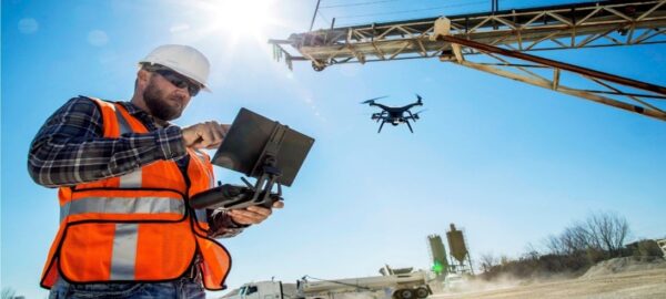
The application of drones for construction is revolutionizing the way companies approach site surveying. Traditionally, surveying was a time-consuming task, often delaying the start of projects. However, drone surveying allows for rapid and accurate site analysis, making it possible to gather real-time data regularly. This speed ensures that multiple teams can monitor project progress without waiting for lengthy base and rover surveying results. The construction industry’s dynamic nature demands that survey requirements change constantly, and drones for constructions can adapt to these needs efficiently.
Incorporating advanced surveying software, such as Propeller, with drone technology significantly enhances planning and design capabilities. Drones for constructions can capture 3D site imagery, allowing teams to compare designs with actual progress. This capability not only aids in monitoring but also enables virtual walkthroughs of project plans. With these insights, construction companies can identify potential hazards and address contractor disputes before they escalate. The combination of drone surveying and sophisticated software expands the scope of traditional site mapping to include detailed planning and design modeling.
Drone for construction are also instrumental in managing construction inventory and tracking specific assets. Using drone technology, companies can perform inventory assessments that provide detailed insights while saving time and reducing risks associated with hard-to-reach areas. For large projects like earthworks or mining, drones quickly calculate stockpile inventories, ensuring adequate building materials are on hand. Knowing the exact amount of resources available is crucial for long-term planning, especially since stockpiles represent a significant financial investment for many companies.
Detailed project documentation is essential for collaboration among multiple stakeholders in a construction project. By utilizing drone for construction, all team members can access easily understood 3D models and visualization tools. This accessibility ensures that subcontractors have a clear understanding of their roles and how their work fits into the broader project. With mobile and remote access to data, teams in the field and back office can make informed decisions, enhancing communication and collaboration.
Drone play a critical role in resolving disputes during construction projects. Before starting any project, conducting a topographic survey helps stakeholders understand site conditions, such as drainage points and elevation changes. Using drone data to create Digital Terrain Models (DTMs) and Digital Surface Models (DSMs) offers insights that assist in making informed decisions regarding site preparation. Moreover, drone imagery can provide essential visual documentation that helps clarify responsibilities among subcontractors, minimizing conflicts and misunderstandings.
The application of drones for construction becomes even more apparent during the earthworks phase. Drones can generate point clouds that capture geospatial and color information, enabling accurate volume measurements and cut/fill analyses. For contractors moving earth, precise measurements are vital for billing, making drone data an invaluable asset. Regular drone for construction surveys can document progress over time, helping site managers validate completed work quickly and efficiently, ultimately saving time and ensuring project deadlines are met.
Regular drone for construction surveys provide ongoing visual data, which is crucial for operational planning. Stakeholders can access real-time updates without needing to visit the site physically or hire expensive aerial photography services. This immediate access to information assists in identifying hazards and ensures that everyone involved stays informed about project progress, budget constraints, and timelines. Visual reports generated from drone surveys can also be shared with clients, keeping them engaged and aware of developments.
Drone for construction are increasingly becoming essential tools for quality assurance and maintenance in construction. The ability to capture detailed images of large structures or hard-to-reach areas allows companies to identify potential issues early on. By using drone for construction for visual inspections, construction teams can ensure that projects are meeting quality standards before moving forward. This proactive approach helps avoid costly mistakes that may require rework or demolition, ultimately saving both time and resources.
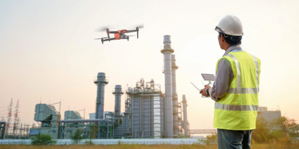
Choosing the best drone for construction site can seem overwhelming, but it doesn’t have to be. It’s important to find a drone that fits your needs without complicating things or spending too much money. Drones in construction can vary widely, so understanding factors like survey area size, camera needs, and budget will help you make a good decision.
Fixed-wing/VTOL drones are excellent for large worksites. They fly faster and can stay in the air longer on one battery charge, making them great for big projects, like long road corridors. Using a VTOL drone for construction to cover a large area is much more efficient than sending out multiple quadcopters. Think of it like taking a plane instead of flying a helicopter for a long distance; it’s all about efficiency!
However, fixed-wing drone for construction cannot hover, so they need more space for takeoff and landing. They might not be the best choice for smaller sites or city environments. VTOL drone for construction have extra propellers that allow them to take off and land vertically, making them versatile for different settings while still delivering the benefits of fixed-wing drones in the air.
Multirotor drone for construction are another option. They don’t need a runway and can easily take off and land anywhere. This feature is especially helpful when flying over uneven or hilly land. If your construction site is less than 200 hectares (about 500 acres), a quadcopter is usually a solid choice. For larger areas, consider a fixed-wing or VTOL drone.
When surveying earthworks, your drone for construction should have a camera with at least a 20MP sensor. It’s essential to understand terms like ground sample distance (GSD) and image resolution. The GSD tells you how accurate your survey will be. For instance, if your GSD is 5 cm, your survey’s accuracy is also 5 cm. All types of drones can provide high-quality images, but customization can vary.
For example, the Mavic 3 Enterprise comes with a fixed camera. If you need better resolution, you can’t upgrade the sensor. Many fixed-wing and VTOL drones offer various camera options, so you can choose the right one for your survey needs.
When selecting a drone for construction, consider your budget. Fixed-wing/VTOL UAVs are usually more expensive, costing up to three times more than quadcopters due to their longer battery life and speed. However, think about the total cost of ownership. Quadcopter drones for construction often have a shorter lifespan because of their more complex parts. You might need to replace them every few years. In contrast, fixed-wing/VTOL drones are built to last longer, even if the upfront cost is higher.
If your construction site is under 500 acres, a quadcopter is a great starting point. You’ll get good image quality and flight times. If you’re working in larger spaces or need speed, consider a fixed-wing or VTOL UAV for construction monitoring.
The quality of the camera on your drone for construction is crucial for capturing detailed images for mapping, inspections, and monitoring. High-resolution cameras help identify problems, track progress, and ensure projects meet specifications. Clear images lead to better analysis and decisions.
Long flight times are vital for drones for construction because construction sites can cover large areas. The longer a drone can fly, the more efficient it is, allowing for complete surveys or inspections without needing to recharge often.
Construction sites can be harsh, with dust, debris, and unpredictable weather. Therefore, it’s crucial for drones for construction to be durable and weather-resistant. They should operate reliably in various conditions, including high winds and extreme temperatures.
GPS and mapping capabilities are essential for construction drones. They allow drones to navigate precisely and gather accurate data. Drones with GPS can reach specific spots on their own, which is key for reliable data collection. Advanced mapping features help create detailed 3D models of the site, crucial for planning and monitoring.
Being able to carry extra equipment, like sensors or different cameras, is important for UAVs for construction. A higher payload capacity allows drones to perform various tasks, such as thermal imaging or LiDAR mapping, making them flexible for many applications on construction sites.
Finally, how easily the data from drones can be processed and used with construction management software is essential. Drones generate a lot of data, and the ability to quickly turn this data into usable information is vital. Integrating drone data with construction project management systems helps in making real-time decisions, tracking progress, and analyzing the project comprehensively.
Check out: Best Photogrammetry Drone
Check out: Best Drone for Powerline Inspection Drone
Check Out: Best Drone for Filmmaking, cinematography & Media
When using drones for construction, setting up Ground Control Points (GCPs) is crucial for collecting accurate and reliable data. GCPs are marked spots on the ground with known coordinates, which help align the aerial images taken by the drone for construction. This process is essential for creating precise maps and models of construction sites.
To effectively utilize GCPs with your construction drones, follow these steps:
Plan Your GCPs: Before the drone flight, decide on the locations of your GCPs. Aim to cover the entire area of interest and ensure that GCPs are evenly distributed.
Mark the GCPs: Use physical markers, such as flags or painted spots, to denote the locations. Ensure these markers are visible in the drone’s images.
Capture the Data: Fly the drone over the site and capture images. Make sure the drone captures the GCPs in multiple overlapping images for better accuracy.
Process the Data: Use photogrammetry software to process the images and incorporate the GCPs for precise georeferencing.
When determining where to place GCPs, consider these factors:
Checkpoints are additional points used to validate the accuracy of your data after processing. Unlike GCPs, which are used for aligning data, checkpoints help you assess the reliability of the results by comparing them to known coordinates. Including checkpoints ensures higher data integrity and can identify any potential errors in the processing stage.
Creating GCPs involves a few simple steps:
The number of GCPs required depends on the size and complexity of the area. As a general rule:
More GCPs typically lead to higher accuracy, especially in complex terrains.
While GCPs are highly recommended for accurate mapping, they may not always be necessary. In certain cases, such as small projects with low precision requirements, using drones without GCPs can be acceptable. However, for any professional applications where precision is key, using GCPs is advisable.
Manual GCPs: These are traditional markers placed by hand. They require manual measurement and verification, which can be time-consuming but provides high accuracy.
Smart Ground Control Points: These utilize advanced technology like GPS and automated systems to enhance accuracy and efficiency. They can automatically collect data and sync with drone systems, making them a modern choice for many construction projects.
Check out: Best DJI and Autel Drone Camera Price
Check out: Drone with 4k Camera
Check out: Best Drones with Thermal Camera

When it comes to construction site monitoring and inspection, the right drone can make all the difference. Here’s a detailed look at some of the best drones suited for various construction needs.

Overview: The EVO Max 4T is a cutting-edge drone designed for advanced construction tasks. It excels in complex environments with its real-time 3D flight path capabilities and obstacle avoidance.
Overview: The EVO Max 4N is versatile and equipped to handle inspections, search and rescue operations, and land surveying. Its payload includes a night-time camera, a 4K low-light camera, and a thermal camera.
Overview: The EVO II Pro V3 is known for its robust camera capabilities, including 6K video and 20MP photos. It’s a great choice for high-quality imaging and versatile filming needs.
Overview: The EVO II Enterprise V3 is designed for industrial applications with a focus on advanced imaging and precise control.
Overview: The EVO II RTK V3 provides exceptional accuracy with RTK technology, making it suitable for precise surveying and mapping applications.
Overview: The Dragonfish Series features a tilt-rotor design that enhances both performance and efficiency, making it ideal for long-duration missions.
Overview: The EVO Lite Series is known for its compact size and advanced RTK technology, suitable for a wide range of applications including construction.
Overview: The EVO Nano Series is compact and user-friendly, making it ideal for quick, high-quality shots and videos on construction sites.
Overview: The DJI Mavic 3 Enterprise offers compactness and versatility with options like a thermal camera, making it suitable for inspections and surveillance.
• Flight Time: 45 minutes
• Camera: 4/3 CMOS wide camera, 640 x 512 px thermal
• Features: Omnidirectional obstacle avoidance, high-volume speaker, simultaneous split-screen zoom
• Key Benefits: Ideal for a range of commercial applications, providing high-quality imaging and extended flight time.
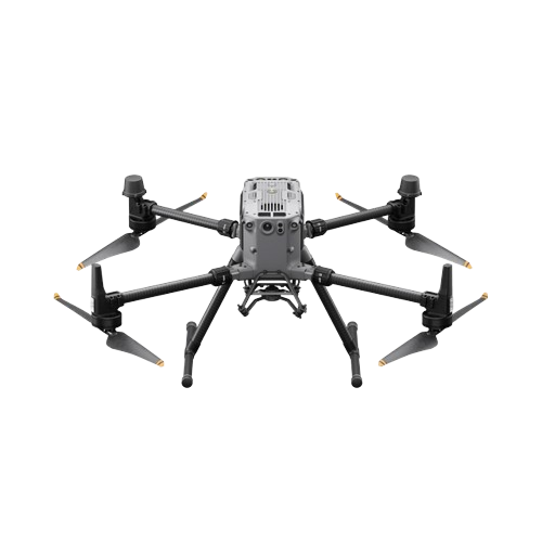
The DJI M350 RTK is a state-of-the-art drone designed for demanding applications in construction and beyond. This drone combines advanced technology with rugged durability, making it an ideal choice for various aerial missions. With its robust features and capabilities, the M350 RTK enhances operational efficiency and precision in construction projects.
Check out Top DJI Competitor Drones
Finding the right drone shop is essential. At XRTech, we offer a wide range of drones designed for construction monitoring. Our knowledgeable staff can help you choose the best drone for your needs, ensuring you get the most value for your investment.
Construction industry is changing, and drones are at the forefront of this transformation. By staying ahead of the curve and adopting drone technology, you can improve the way you manage and monitor your projects, ensuring success now and in the future.
Drones are commonly used for tasks like site surveying, progress monitoring, safety inspections, mapping, and creating aerial visuals. They help construction companies save time and increase accuracy.
Drones allow remote inspections of hazardous areas, reducing the need for workers to enter unsafe environments. They can also track and monitor construction site conditions in real time, improving overall safety protocols.
The best drones for construction include those with high-resolution cameras, GPS capabilities, and additional sensors like LiDAR for mapping. Models like the DJI Matrice 350 RTK and Autel EVO II are highly recommended.
Drones equipped with RTK (Real-Time Kinematic) GPS systems can achieve centimeter-level accuracy. Using Ground Control Points (GCPs) further enhances accuracy for aerial mapping and 3D models.
GCPs are physical markers placed on the ground, which drones reference for precise aerial mapping. They help ensure accurate measurements and reduce errors in the data collected.
Drones supplement but don’t entirely replace traditional methods. While they offer faster data collection and greater accessibility, some tasks may still require on-ground equipment for maximum precision.
Drone operators need to follow local and federal regulations, including obtaining appropriate licenses (e.g., FAA Part 107 in the U.S.). Compliance with safety and privacy laws is also crucial for construction sites.
The cost of construction drones ranges from around $2,000 to over $20,000 depending on features like camera quality, RTK capabilities, and payload options. Drones like the DJI M350 RTK fall in the higher price range due to their advanced features.
Drones provide real-time updates on project progress, allowing stakeholders to track timelines, detect delays, and optimize resources. Aerial images and 3D models give better visibility compared to ground-level inspections.
Yes, drones can be equipped with specialized sensors to assess environmental factors such as soil conditions, erosion risk, and water runoff, helping construction teams manage the site’s environmental impact.

Tailings Dam Monitoring: How Advanced Satellite Intelligence Is Transforming Tailings Dam Safety Tailings dams are among the most critical—and high-risk—structures
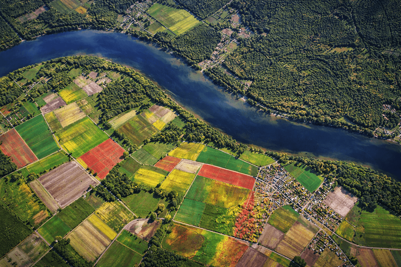
From Visible Light to Spectral Intelligence in Modern Satellite Remote Sensing Satellite imaging has moved beyond photography. For decades, Earth