| XRT UAV AI Night Vision Solutions | |||||
| Model | S2 PLUS | S2PRO | S3 | S8 | |
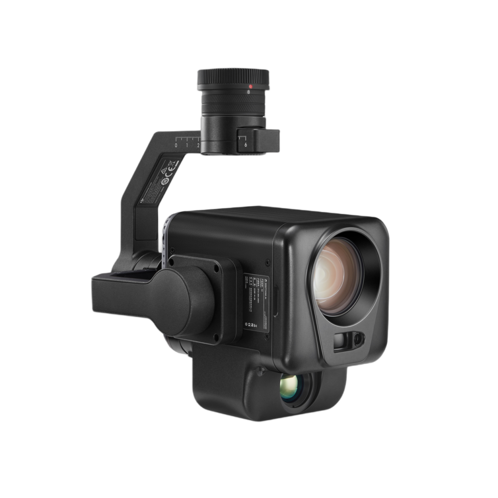
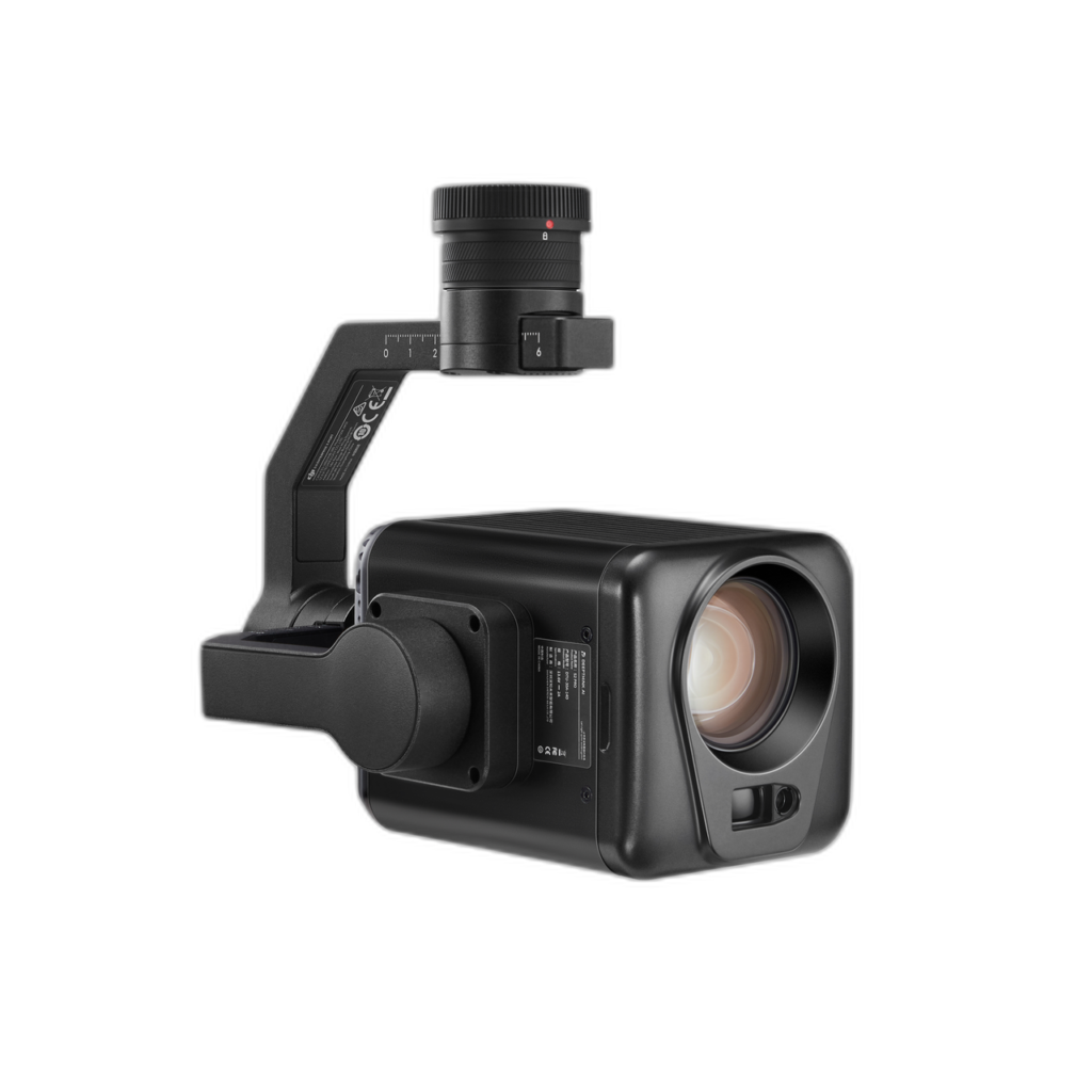
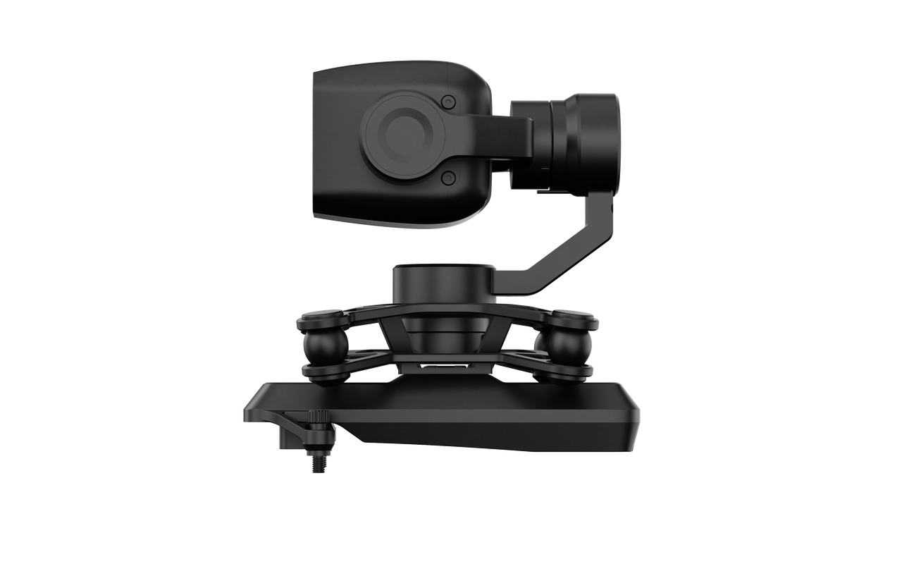
| Product Image | 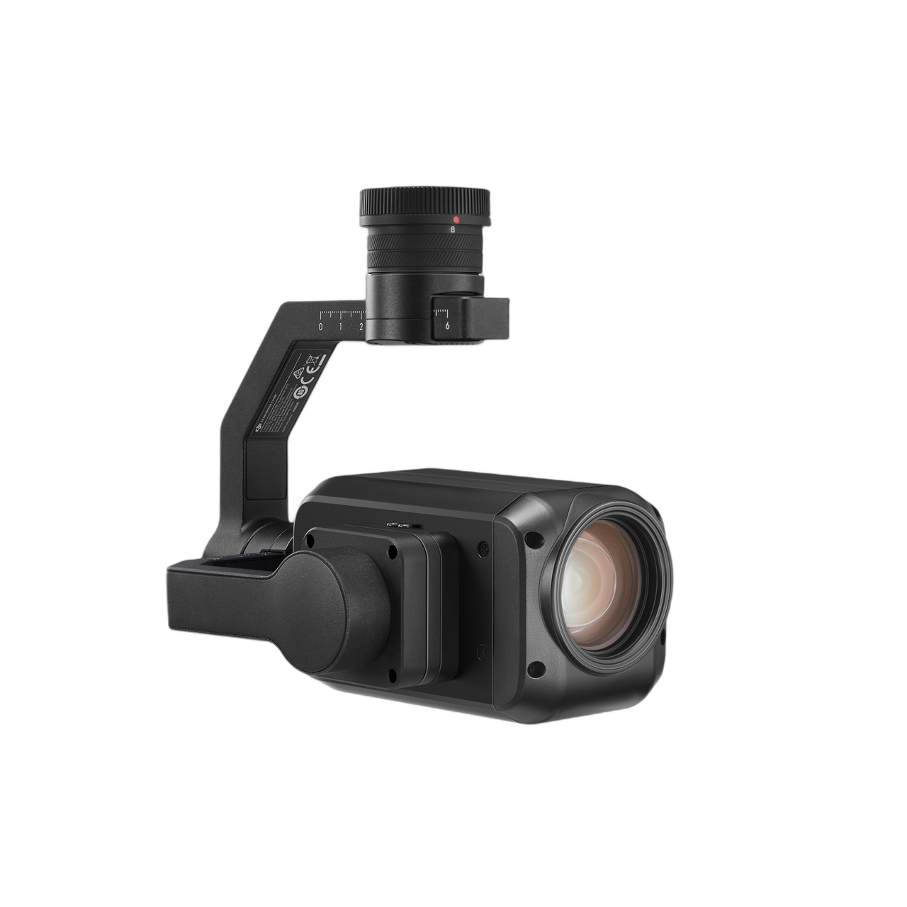 |
 |
 |
 |
|
|
Camera
|
Image Sensor | 1/1.8″Ultra Low Lux CMOS | 1/1.8″Ultra Low Lux CMOS | 1/1.8″Ultra Low Lux CMOS | 1/1.8″Ultra Low Lux CMOS |
| Min Illumination | Full Color:0.005Lux,No Fill Night | Full Color:0.0001Lux,No Fill Night | Full Color:0.0001Lux,No Fill Night | Full Color:0.0001Lux,No Fill Night | |
| Video Resolution | 4MP/Full Color 2688*1520P |
4MP/Full Color 2688*1520P |
4MP/Full Color 2688*1520P |
4MP/Full Color 2688*1520P |
|
| Video Frame Rate | 5fps~30fps | 5fps~30fps | 5fps~30fps | 5fps~30fps | |
| Video Codec | H.264 | H.264 | H.264 | H.264 | |
| White Balance | Auto | Auto | Auto | Auto | |
| Gain Control | Auto | Auto | Auto | Auto | |
| No Fill Light | Supported | Supported | Supported | Supported | |
| OTA Firmware Upgrading | Supported | Supported | Supported | Supported | |
| WDR | 120dB | 120dB | 120dB | 120dB | |
| SNR | >35dB | >48dB | >48dB | >48dB | |
| AI Denoising | Supported | Supported | Supported | Supported | |
| AI HDR | Supported | Supported | Supported | Supported | |
| AI Defogging | Supported | Supported | Supported | Supported | |
| Exposure Mode | Auto | Auto | Auto | Auto | |
|
Lens
|
Focal Length | Actual Focal Length: 6.3~125mm(Equivalent focal length: 30-600mm) 20x optical zoom 80x hybrid zoom |
Actual Focal Length: 7.1~171mm(Equivalent focal length: 34-820mm) 30x optical zoom 160x hybrid zoom |
Actual Focal Length: 7.1~171mm(Equivalent focal length: 34-820mm) 30x optical zoom 160x hybrid zoom |
Actual Focal Length: 15.40±5%mm(Equivalent focal length: 74.07mm) |
| Aperture | F1.6-F4 | F1.6-F5.1 | F1.6-F5.1 | F1.6 | |
| FOV(D×H×V) | Horizontal:59.6° WIDE;3.5° TELE Vertical:35.7° WIDE;2.0° TELE Diagonal:66.6° WIDE;4.0° TELE |
Horizontal:59.2° WIDE;2.5° TELE Vertical:34.6° WIDE;1.4° TELE Diagonal:66.7° WIDE;2.9° TELE |
Horizontal:59.2° WIDE;2.5° TELE Vertical:34.6° WIDE;1.4° TELE Diagonal:66.7° WIDE;2.9° TELE |
33.4°(D)*29°(H)*16.4°(V) | |
| Day-Night Mode | Electric IR-CUT infrared filter switching | Electric IR-CUT infrared filter switching | Electric IR-CUT infrared filter switching | / | |
|
Laser Range Finder
|
Distance | / | 5-1500m | 5-1500m | / |
| Wave Length | / | 905nm | 905nm | / | |
| Accuracy | / | ±1m | ±1m | / | |
|
Infrared Thermal Camera
|
Thermal Imager | / | / | Uncooled VOx Microbolometer | / |
| Lens | / | / | DFOV:45.76° Focal Length:19mm Aperture:f/1.0 |
/ | |
| Digital Zoom Equivalent | / | / | 8x | / | |
| Video Resolution | / | / | 640×512 | / | |
| Pixel Pitch | / | / | 12μm | / | |
| Temperature Measurement Range | / | / | -20℃~150℃(-4℉~302℉) 0℃~550℃(32℉~1022℉) |
/ | |
|
Stabilization System
|
Angular Vibration Range | ±0.008° | ±0.008° | ±0.008° | ±0.005° |
| Mechanical Range | Tilt:-120°~+30° Pan:±320° |
Tilt:-120°~+30° Pan:±320° |
Tilt:-120°~+30° Pan:±320° |
Tilt:-30°~+90° | |
| Mounting | DGC2.0 | DGC2.0 | DGC2.0 | E-PORT | |
| Power Supply | 13.6V/2A | 13.6V/2A | 13.6V/2A | 13.6V/3.26A | |
| Interface | MicroSD Card | Max 1T | Max 1T | Max 1T | Max 1T |
|
General
|
Power Consumption | 6W | 7W | 8W | ≥3W |
| Ingress Protection Rating | IP44 | IP55 | IP55 | / | |
| Working Temperature | -20℃~60℃(-4℉~140℉) | -20℃~60℃(-4℉~140℉) | -20℃~60℃(-4℉~140℉) | -20℃~60℃(-4℉~140℉) | |
| Working Humidity | ≤95% | ≤95% | ≤95% | ≤95% | |
| Dimension | L 175mm*W 126.5mm*H 152mm L 121mm*W 80mm*H 81mm(without gimble) |
L 179mm*W 126.5mm*H 158mm L 121mm*W 80mm*H 81mm(without gimble) |
L 179mm*W 126.5mm*H 190mm L 121mm*W 80mm*H 111mm(without gimble) |
L94.2mm*W71.1mm*H90mm | |
| Net Weight | Approx. 790±5g | Approx. 885±5g | Approx. 1025±5g | Approx. 200g | |
| Packaging Dimension | L 335mm*W 280mm*H 165mm | L 335mm*W 280mm*H 165mm | L 335mm*W 280mm*H 165mm | L270mm*W235mm*H150mm | |
| Gross Weight | Approx. 2160g | Approx. 2970g | Approx. 3190g | Approx. 1470g | |
| In the Box | Storage Case*1 Lens Cap*1 User Manual*1 Certificate*1 MicroSD Card*1 Lens Cleaning Cloth*1 Desiccant*2 |
Storage Case*1 Lens Cap*1 User Manual*1 Certificate*1 MicroSD Card*1 Lens Cleaning Cloth*1 Desiccant*2 |
Storage Case*1 Lens Cap*1 User Manual*1 Certificate*1 MicroSD Card*1 Lens Cleaning Cloth*1 Desiccant*2 |
Storage Case*1 User Manual*1 Certificate*1 MicroSD Card*1 Lens Cleaning Cloth*1 Desiccant*2 |
|
| After-sales Policy | 12 months warranty | 12 months warranty | 12 months warranty | 12 months warranty | |