Satellite Imagery for Emergency and Disaster Management
Detect Early, Act Faster, Recover Stronger with XRTech Group
Accelerate Emergency Response with Satellite Imagery for Disaster Management
XRTech Group empowers government agencies, first responders, and disaster recovery teams with high-resolution satellite imagery and remote sensing solutions for effective emergency and disaster management. Get real-time situational awareness with before, during, and after-disaster imagery—anywhere on Earth.
Our geospatial Satellite Imagery supports rapid assessment and monitoring of wildfires, floods, earthquakes, landslides, hurricanes, and other natural disasters. From small regions to global coverage, we help you reduce risk, improve planning, and accelerate recovery.
Using multispectral satellite imagery data, we provide accurate damage assessments and predictive models to support targeted mitigation and strategic response. XRTech Group delivers the tools you need to protect communities, save lives, and build resilience.
Advantages of XRTech's High-Resolution Satellite Imagery in Disaster Response
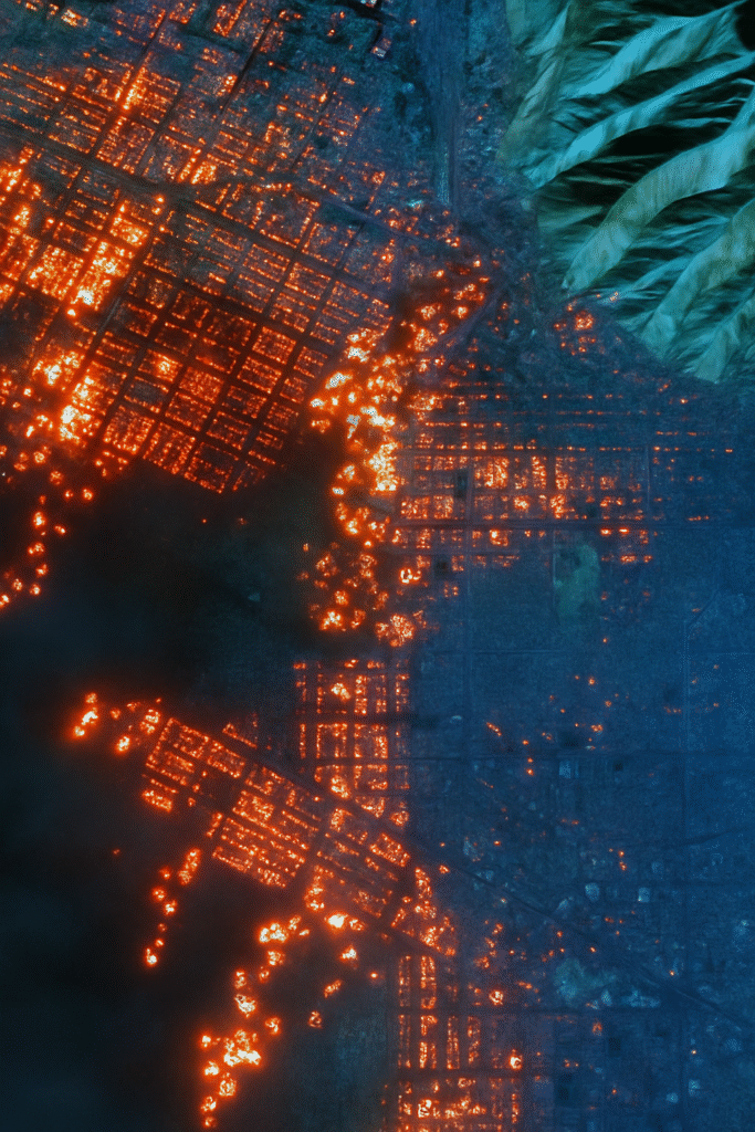
Continuous Monitoring
XRTech Group’s high-resolution satellite imagery allows continuous tracking of disasters for faster, data-driven emergency response.
Rapid Damage Assessment
Quickly assess damaged infrastructure and terrain with high-res satellite data to prioritize relief and allocate resources efficiently.
All-Weather Capability
Our SAR imaging technology captures critical data through clouds, smoke, and night, supporting disaster management in all weather conditions.
Safety for Responders
Remote sensing and satellite imagery reduces risk by limiting on-ground exposure, helping response teams operate safely in hazardous disaster zones.
Applications of XRTech's Satellite Imagery for Emergency and Disaster Management
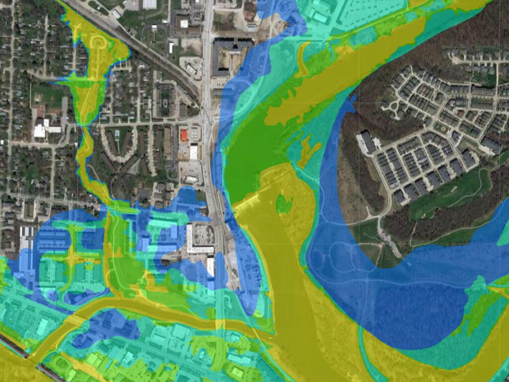
Flood Monitoring and Response
Real-time flood risk mapping using AI and satellite imagery & data to predict flood zones, monitor water levels, and assist in disaster response. These disaster management satellite imagery solutions have been applied in various flood scenarios, including the Venezuela Flood Response, where China Siwei provided actionable insights within hours.
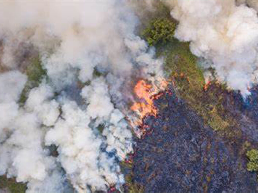
Forest Wild-Fire Detection and Monitoring
AI-based early warning satellite imagery systems for forest fires, including real-time fire detection, tracking, and damage assessment, using multi-source satellite imagery & data. Continuous monitoring allows minute-by-minute updates, reducing response times and limiting damage.
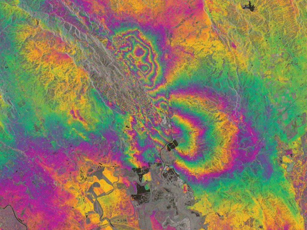
Earthquake and Infrastructure Monitoring
Satellite imagery & remote sensing data deformation monitoring of critical infrastructure like dams and bridges, identifying potential risks before they lead to disasters. This capability was effectively demonstrated in the monitoring of the Aswan Dam in Egypt.
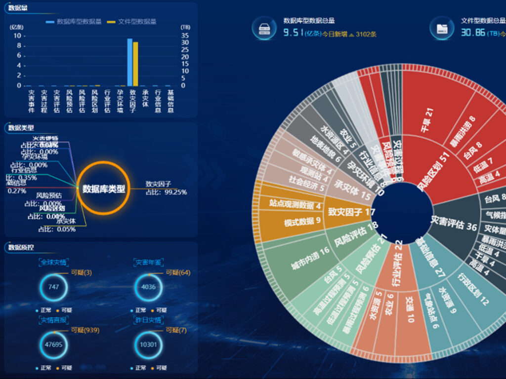
Integrated Disaster Platforms
AI disaster & emergency platforms integrate satellite imagery, aerial, and ground data, providing a comprehensive view of disaster scenarios for better decision-making.
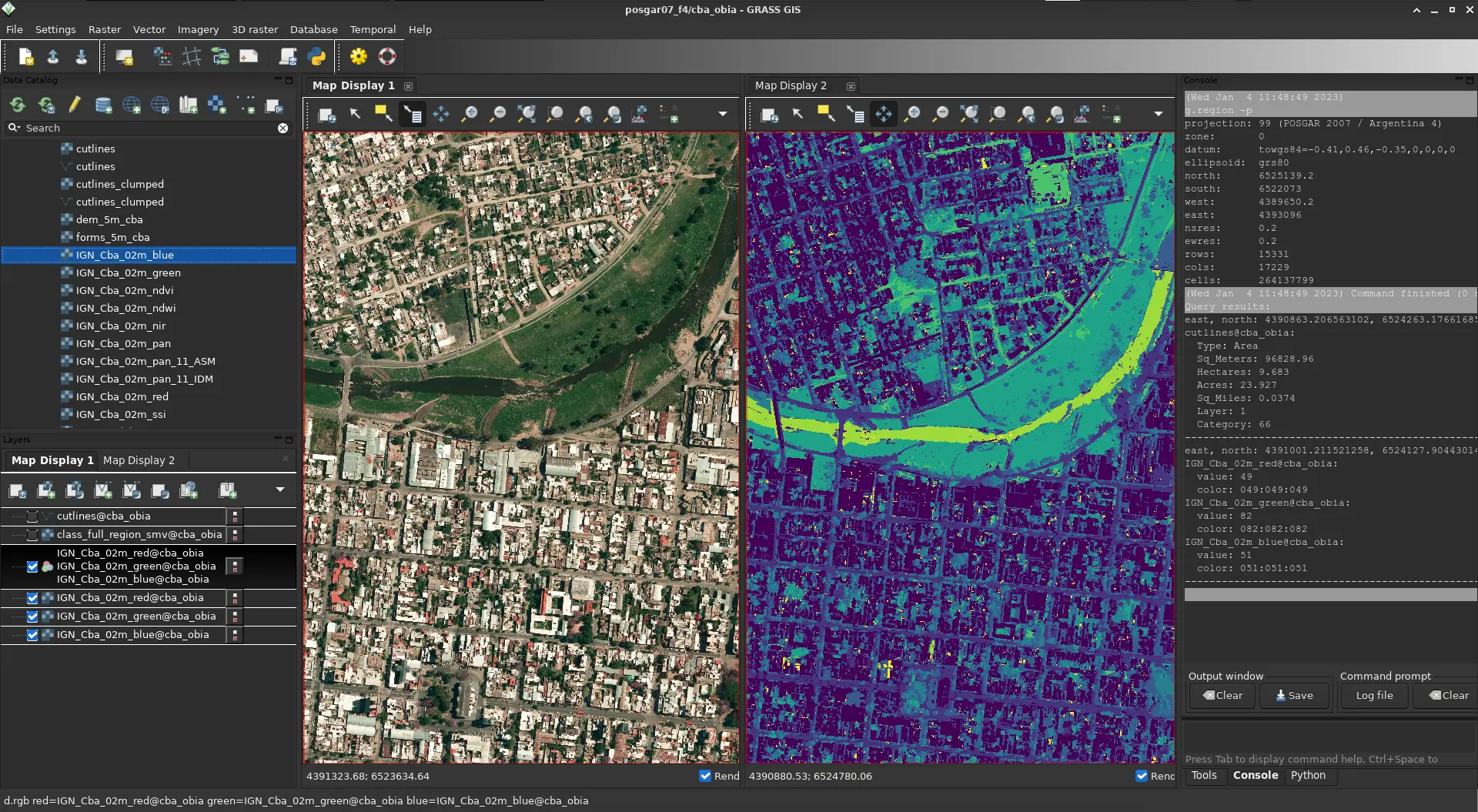
What You Get
Real-Time Insight. Actionable Results. With High-Resolution Satellite Imagery for Emergency and Disaster management
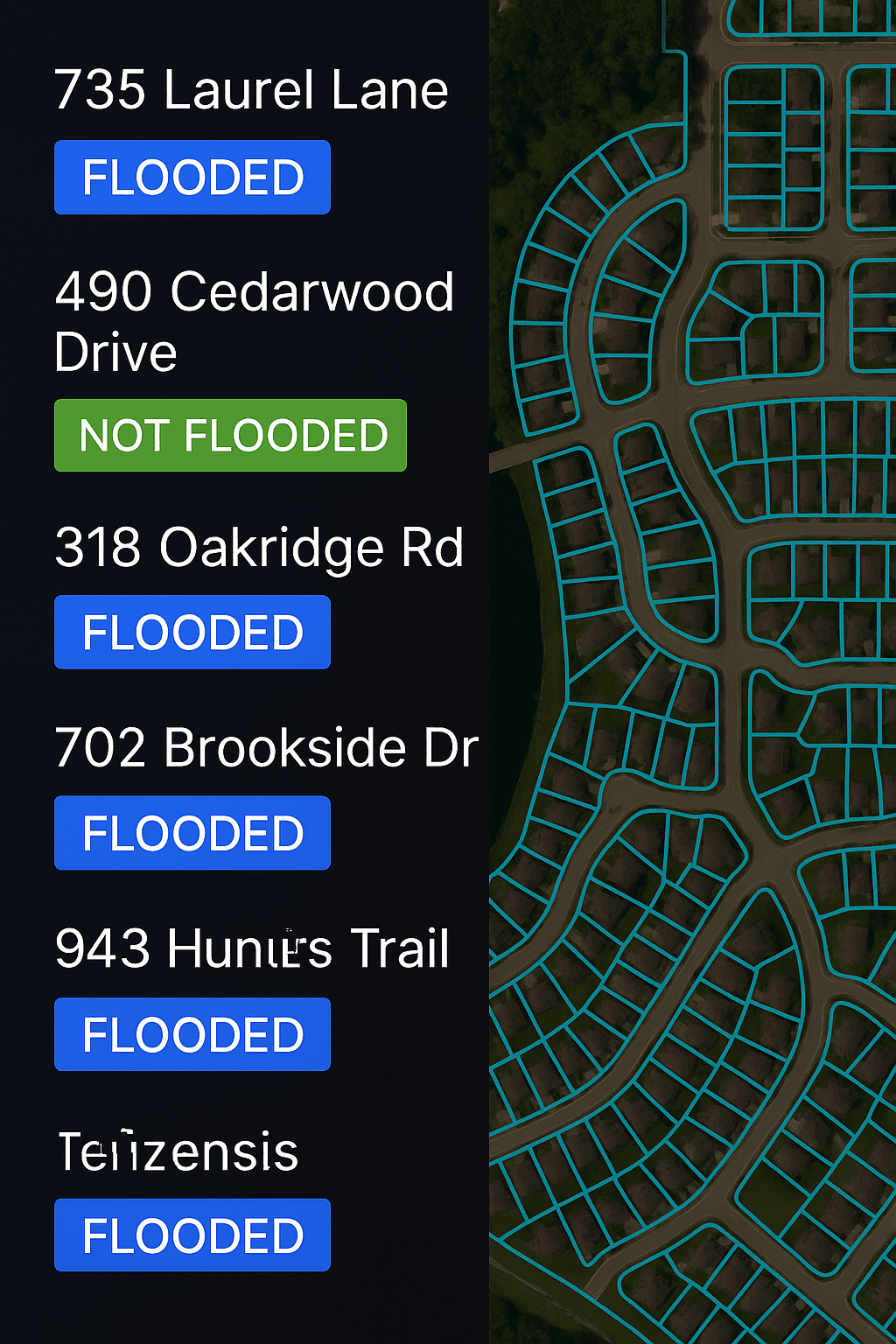
Get a firsthand look at the power of our Earth Observation and high resolution satellite imagery for disaster management and emergency response data delivery in critical situations. In the example below — Derna, Libya, just 24 hours after devastating floods — we delivered more than just satellite images. We enabled action.
Precisely identified flood extents to support relief operations.
Helped emergency responder and disaster management authorities plan safe zones and allocate emergency resources effectively.
Our high resolution satellite imagery & EO data for emergency situation and disaster management was delivered within 24 hours — while others were still preparing quotes.
Get On-Demand Situational Awareness with XRTech Group
XRTech Group empowers government, commercial, and non-profit sectors with flexible satellite monitoring solutions for rapid disaster response.
Select from region-based continuous monitoring or global event-triggered monitoring
Access analysis-ready satellite imagery within 24 hours of capture
Leverage AI-powered platforms that merge satellite, aerial, and ground data for a complete view of emergencies
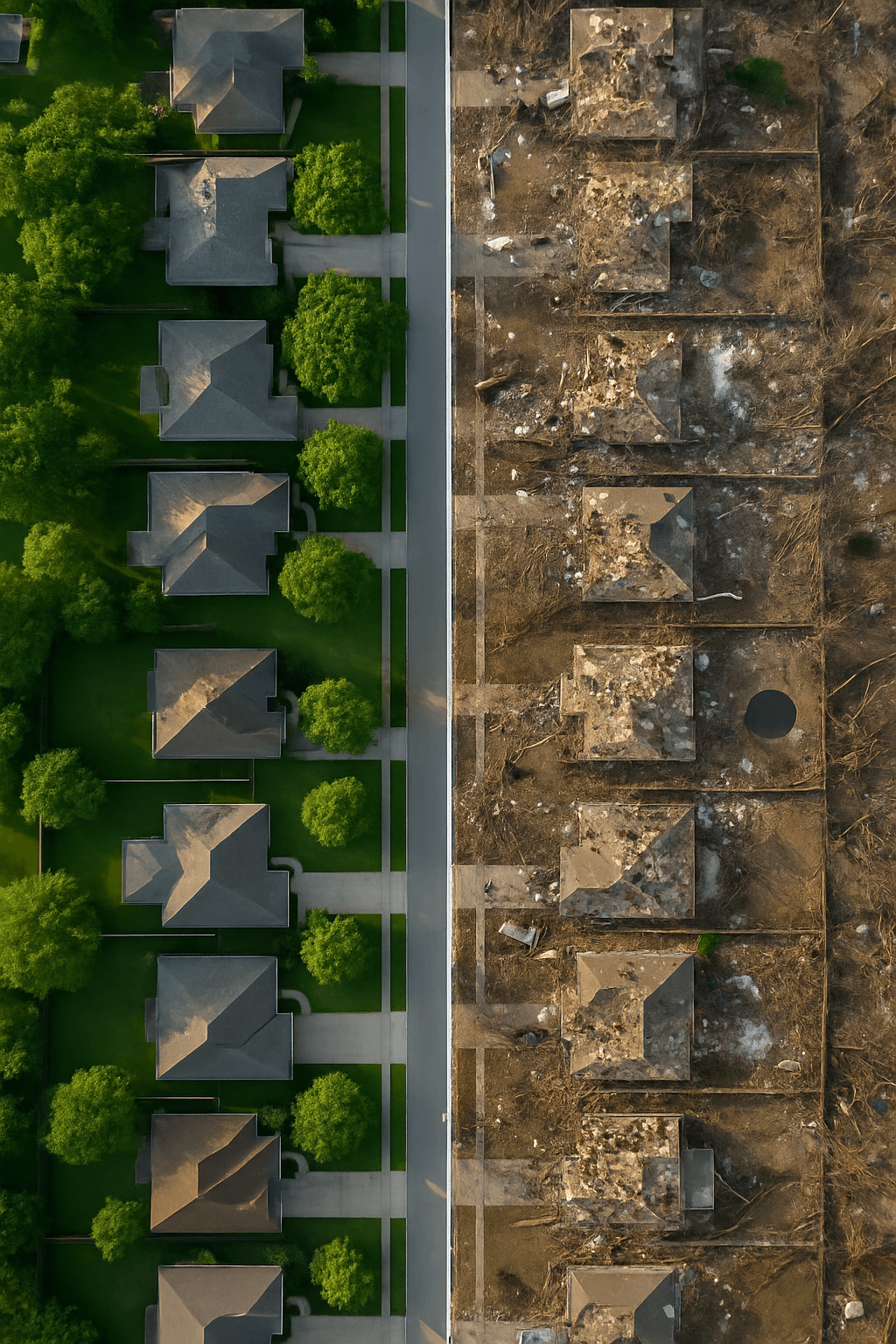
Drive Recovery and Strengthen Resilience with XRTech Group
Our extensive imagery archive and daily high-resolution satellite collections support every stage of disaster risk, response, and recovery.
Identify and address disaster exposures before they occur
Improve modeling with access to archive satellite imagery dating back to 1990
Enable continuous monitoring to guide rebuilding and resilience planning
Why Teams Switch to XRTech
Buy Satellite Imagery that Offers Precision, Speed, and Freedom – All in One Platform
Teams around the world are choosing XRTech for Earth Observation data and high resolution satellite imagery because we go beyond imagery — we deliver mission-ready solutions built for real-world demands.
Access to 130+ Satellites
A powerful satellite constellation including optical, SAR, stereo, and hyperspectral satellite sources ensures coverage across any terrain or condition.
Fast Turnaround Times
Get EO satellite imagery in under 7 days and DEMs in under 21 days, even for large or remote areas.
High Accuracy Satellite Imagery Outputs
Enjoy sub-meter satellite imagery resolution with CE90 and RMSE specs that meet even the most demanding project standards.
Compatible Imagery Data Formats
Satellite imagery data delivered in formats you already use — GeoTIFF, SHP, DWG, and UTM — for seamless integration with your GIS or CAD workflows.
No Export License Delays
As a non-U.S. high resolution satellite imagery provider, we avoid export control bottlenecks, getting your data to you faster and with fewer restrictions.
Flexible Licensing
Our high resolution satellite imagery is designed to match your operational realities, whether you're mapping a floodplain or planning national infrastructure.
Specs Snapshot
Satellite Imagery Engineered for Precision. Delivered for Productivity.
Sub-meter resolution high-resolution satellite imagery with support for 8-bit, 11-bit, and 16-bit depth — ortho-ready and optimized for analysis.
DEM images available at 2–10 meter spacing with ±3m vertical RMSE, suitable for engineering, hydrology, and land development.
Satellite imagery delivered in industry-standard formats: GeoTIFF, IMG, SHP, DWG, ready for GIS, CAD, or modeling workflows.
Receive your satellite imagery data via secure cloud delivery or physical HDD, depending on your project needs.
Flexible support for WGS84, UTM, or custom coordinate systems.
Simple, project-wide licensing that’s publication-friendly and built for collaborative teams.
Empowering Disaster Management Teams with XRTech Solutions

24/7
Continuous Coverage - Monitoring disasters anytime, anywhere.
130+
Satellite Fleet - A diverse constellation with optical and radar capabilities.
Response in Minutes
Rapid Data Delivery - Timely satellite imagery for critical decisions.
100%+
Coverage Area - Global satellite reach supporting emergency responders worldwide.
Testimonial
Our Satellite Imagery's Client Feedback & Reviews
Our clients don’t just get high-resolution satellite images and data — they get speed, clarity, and support that exceeds expectations. Here’s what they’re saying:


Pricing Plans
Our Flexible High-Resolution Satellite Imagery Pricing Built to Match your Project Scale.
Choose a plan that fits your needs — from rapid response satellite imagery to full-scale DEM + analysis packages. No hidden fees, no license confusion.
51-80cm | Applicable up to 4 bands
- Archive Image (>90 days):
- New Tasking Image:
31-50cm | Applicable up to 4/8 Bands*
- Archive Image (>90 days):
- New Tasking Image:
30cm | Applicable up to 4 Bands
- Archive Image (>90 days):
- New Tasking Image:
30-Day Money-Back Guarantee
Zero risk. Full confidence. We stand by the quality of our satellite imagery, satellite data and service. If you’re not satisfied with your deliverables within 30 days, we’ll refund your project — no questions asked.
Buy Satellite Imagery From The High-Resolution Satellite Constellation
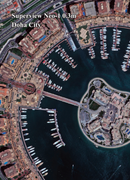
Superview Neo-1 High-Resolution Satellite Imagery
Feature | Details |
Resolution | 0.3m/px |
Spectrum Bands | Panchromatic, Red, Green, Blue, NIR |
Revisit | Daily for middle and high latitudes area |
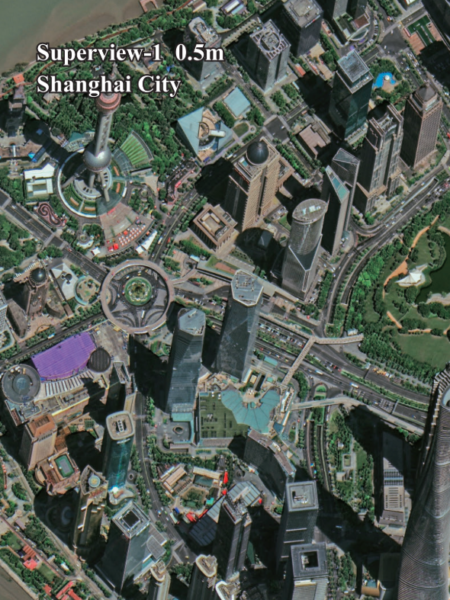
Superview - 1 High-Resolution Satellite Imagery
Feature | Details |
Resolution | 0.5m/px |
Spectrum Bands | Panchromatic, Red, Green, Blue, NIR |
Revisit | Daily |
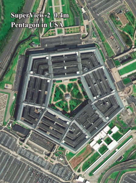
Superview - 2 High-Resolution Satellite Imagery
Feature | Details |
Resolution | 0.4m/px |
Spectrum Bands | Panchromatic, Purple, Yellow, Red Edge, Red, Green, Blue, NIR1, NIR2 |
Revisit | 3 Days |
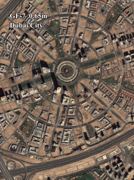
GF-7 High-Resolution Satellite Imagery
Feature | Details |
Resolution | 0.65m/px |
Spectrum Bands | Panchromatic, Red, Green, Blue, NIR |
Revisit | 5 Days |
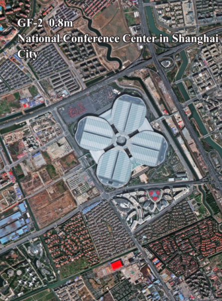
GF-2 High-Resolution Satellite Imagery
Feature | Details |
Resolution | 0.8m/px |
Spectrum Bands | Panchromatic, Red, Green, Blue, NIR |
Revisit | 5 Days |
GF-6 High-Resolution Satellite Imagery
Feature | Details |
Resolution | 2m/px |
Spectrum Bands | Panchromatic, Red, Green, Blue, NIR |
Revisit | 4 Days |

GF-1 High-Resolution Satellite Imagery
Feature | Details |
Resolution | 8m/px |
Spectrum Bands | Panchromatic, Red, Green, Blue, NIR |
Revisit | 4 Days |

ZY-3 High-Resolution Satellite Imagery
Feature | Details |
Resolution | 2m/px |
Spectrum Bands | Panchromatic, Red, Green, Blue, NIR |
Revisit | 5 days( only I satellite ) / 1-2 days ( 3 satellites ) |

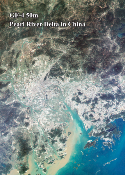
GF-4 High-Resolution Satellite Imagery
Feature | Details |
Resolution | 50m/px |
Spectrum Bands | Visible Light, Near-Infrared, Mid-Wave Infrared |
Revisit | 20sec |
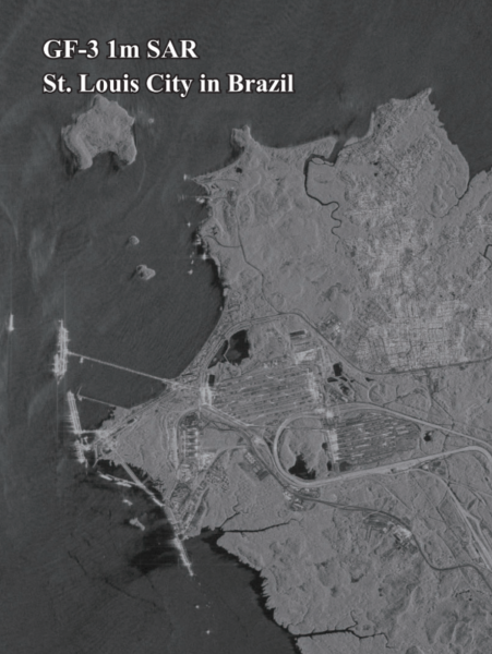
GF-3 SAR High-Resolution Satellite Imagery
Feature | Details |
Resolution | 1m/px |
Spectrum Bands | C-band SAR |
Revisit | 10 Days |
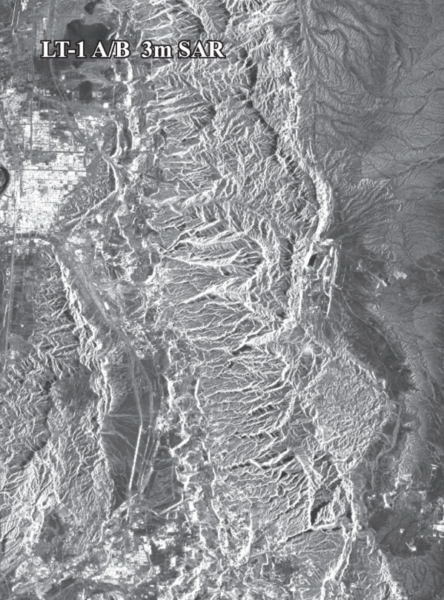
LT-1 SAR High-Resolution Satellite Imagery
Feature | Details |
Resolution | 3m/px |
Spectrum Bands | L-band SAR |
Revisit | 8 days( For I satellite) / 4 days(For 2 satellites) |
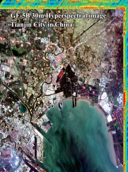
GF-5B High-Resolution Satellite Imagery
Feature | Details |
Resolution | 30m/px |
Spectral Range | 400-2500 nanometers (nm) |
Revisit | 12 days |
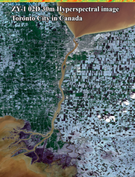
ZY-1 02D High-Resolution Satellite Imagery
Feature | Details |
Resolution | 30m/px |
Revisit | 3 days(WPM camera) / 26 days(MUX camera) |
Instrument | Spectral Bands (nm) |
MUXCam | Blue, Green, Red, Near-Infrared |
PanMUX | Panchromatic, Green, Near-Infrared |
IRS | B1, B2, B3, B4 |
WFI | Blue, Green, Red, Near-Infrared |
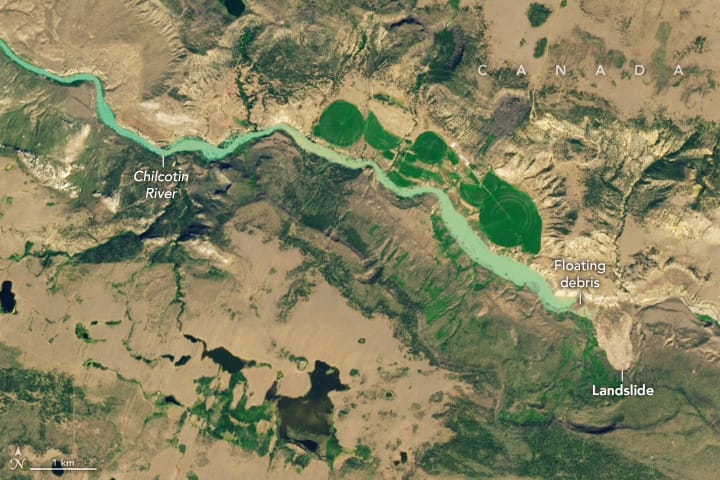
Disaster Management Case Study:
China Siwei provides real-time, AI-powered satellite disaster monitoring and response solutions using a constellation of high-resolution satellites. Our satellite systems offer comprehensive coverage, enabling quick assessment and effective management of natural and man-made disasters
Case Study:
- Aswan Dam Monitoring in Egypt: Quarterly satellite-based deformation monitoring ensures the structural stability of one of the world’s largest dams.
- Venezuelan Landslide Response: Rapid satellite imaging enabled timely disaster assessment and response during major landslides in 2022.
Choose XRTech Group to Buy Satellite Imagery?
XRTech Group stands at the forefront of innovative disaster monitoring, granting first responders and organizations unmatched intelligence for managing crises efficiently and safely.
When you decide to purchase high-resolution satellite images, you need accuracy, speed, and reliability. XRTech Group partners with leading satellite imagery provider with 130+ Satellites in the space to ensure you get the most detailed and up-to-date data available. With resolutions as sharp as 30 cm per pixel, you can monitor key areas, analyze changes, and make critical decisions with confidence.
Our platform offers:
- High-Resolution Data: We offer up to 30cm resolution for detailed satellite imagery.
- Flexible Collection Options: Choose from archive data, standard requests, priority collection, or emergency imaging.
- Custom Order Sizes: Whether you need 25 km² or 100 km², we have flexible minimum order sizes.
- Competitive Pricing: Affordable rates with transparent pricing for different needs.
- Real-time satellite awareness for up-to-the-minute data.
- A comprehensive satellite imagery archive for historical analysis.
- The ability to task satellites and acquire new images on demand.
- An easy-to-use online system for quick and secure purchases.
