Advanced SAR Satellite Imagery & Data Services
Unlocking All-Weather, Day-and-Night Earth Monitoring for Critical Insights with XRTech Group.
Understanding SAR Imagery: Beyond Visual Limits
All-Weather, All-Time Monitoring
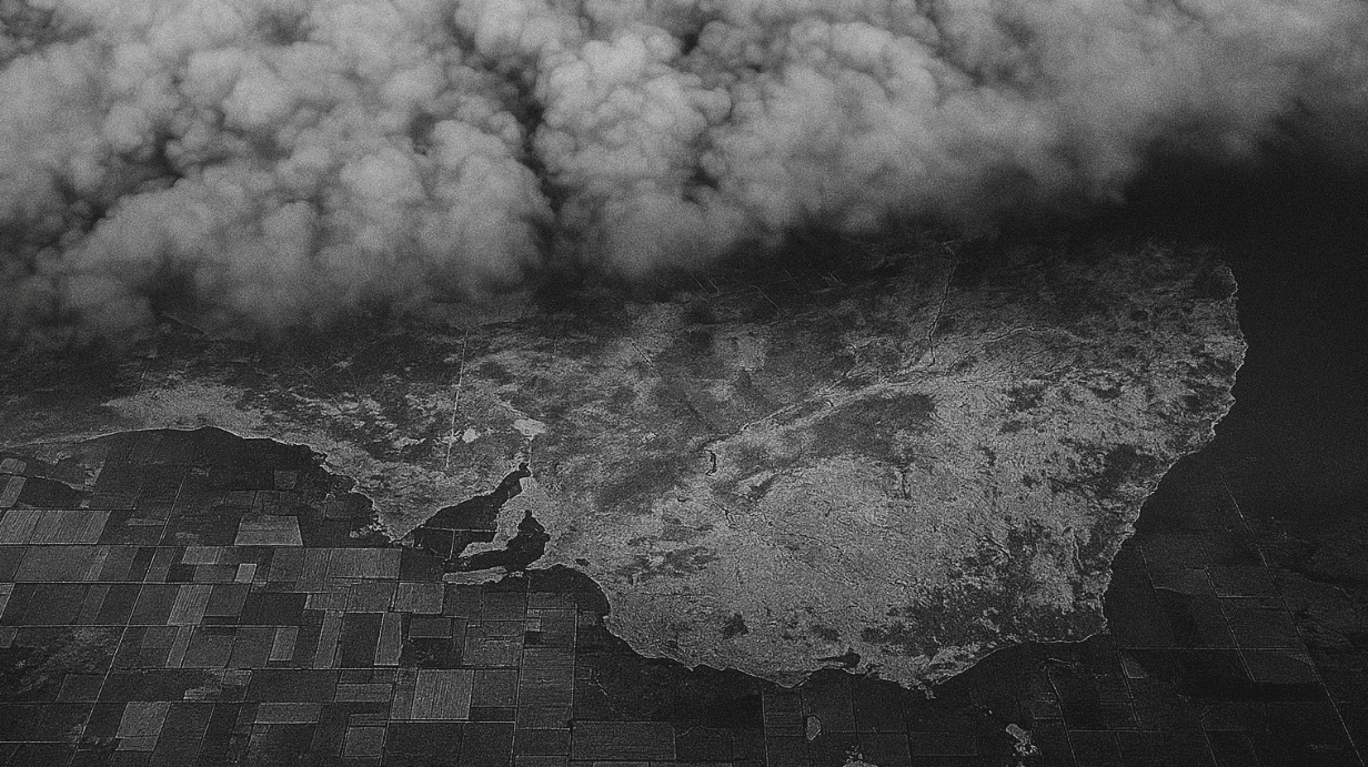
Unlike traditional optical imagery that relies on visible light, SAR (Synthetic Aperture Radar) technology harnesses radar signals to image the Earth. This fundamental difference grants SAR a unique and critical advantage: it can penetrate clouds, smoke, and even work effectively in complete darkness. This makes SAR data an incredibly reliable monitoring tool, ensuring the detection of subtle changes and the delivery of precise, actionable intelligence even in the most challenging environmental conditions.
This capability is paramount for continuous oversight, especially in regions prone to persistent cloud cover or during rapid response scenarios where immediate visibility is required, day or night. It represents a significant leap in persistent Remote sensing capabilities.
Day-and-Night Precision
The ability of SAR satellites to operate independently of sunlight revolutionizes monitoring capabilities. This means critical intelligence can be gathered 24/7, without interruptions caused by the diurnal cycle. For applications requiring constant surveillance or rapid post-event assessment, SAR imagery ensures that data is available precisely when it is needed, providing an uninterrupted flow of information to inform time-sensitive decisions.
This persistent monitoring capability is a cornerstone for strategic operations, emergency response, and dynamic environmental observation, where continuous and precise SAR data is indispensable for achieving comprehensive situational awareness.

XRTech Group’s Advanced SAR Capabilities
XRTech Group leverages the extensive satellite constellation of China Siwei, which includes over 130+ civilian and commercial satellites, with advanced SAR capabilities forming a pivotal component of our offerings. This robust infrastructure ensures comprehensive and cutting-edge SAR data for diverse applications.
SAR Satellite Resolution
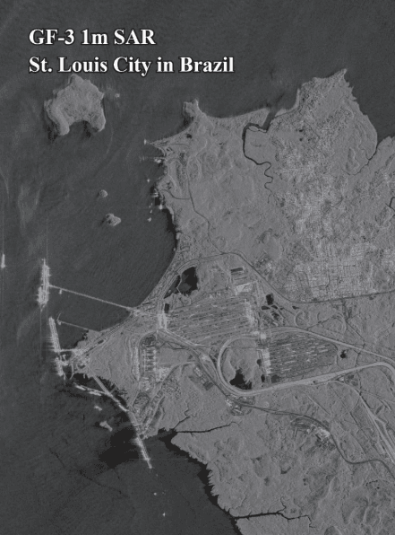
- GF-3 SAR: Delivers high-resolution 1 meter per pixel (1m/px) imagery, ideal for detailed observation.
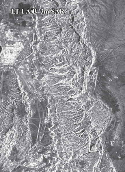
- LT-1 SAR: Provides excellent 3 meters per pixel (3m/px) resolution imagery, suitable for broader area monitoring with significant detail.
- The China Siwei constellation notably includes four dedicated SAR satellites, facilitating advanced imaging capabilities, exemplified by missions like Superview Neo-2.
Imaging Modes
Our radar satellites are equipped with multiple, flexible imaging modes to precisely capture data tailored to specific project requirements:
- Spotlight Mode: Captures extremely high-resolution imagery over highly localized areas, perfect for detailed asset inspection and precise target analysis.
- Stripmap Mode: Offers extensive wide-area coverage, enabling efficient monitoring of vast geographical regions for general surveillance and mapping.
Polarization Types
XRTech Group supports multiple polarization types to precisely tailor SAR imagery to unique industry requirements, enhancing data utility for specific analyses:
- Single Polarization: (e.g., HH, VV) for general applications.
- Dual Polarization: (e.g., HH/HV, VV/VH) provides more information about surface properties.
- Full Polarization: (HH, HV, VV, VH) offers the most comprehensive data for detailed material characterization and advanced scientific studies.
Frequency Bands
We utilize a range of imaging frequency bands to ensure high precision and versatility across diverse applications and environmental conditions:
- L-band: Excellent penetration through vegetation and soil, ideal for forestry, biomass, and geological studies.
- C-band: Highly versatile, widely used for ice, ocean, and land applications.
- X-band: Provides very high-resolution data, sensitive to small changes, often used for urban monitoring and precise mapping.
Multi-Sensor Integration
To deliver unparalleled depth of insight, XRTech Group integrates SAR data seamlessly with information from optical sensors. This synergistic approach enables:
- Dual or three-dimensional stereoscopic imaging, significantly enhancing the creation of highly accurate “true 3D models.”
- Combining the all-weather capability of SAR with the visual richness of optical data for comprehensive environmental understanding and analysis.
Advanced Analytics & InSAR
Beyond raw imagery, XRTech Group specializes in advanced analytical techniques, including InSAR (Interferometric Synthetic Aperture Radar). This powerful method uses multiple SAR images to detect and measure subtle changes in the Earth’s surface with millimeter precision.
- Deformation Monitoring: Detects ground subsidence or uplift.
- Millimeter Accuracy: Capable of detecting movements as minute as 1-2mm.
- Critical Insights: Valuable for urban planning, infrastructure development, and environmental management.
Our Advanced Satellite Constellations
XRTech Group leverages cutting-edge SAR satellites from China Siwei’s extensive constellation, ensuring diverse capabilities for all your monitoring needs. Below are details on key SAR-enabled and optical satellites in our network:
GF-3 Constellation: High-Resolution C-band SAR
The **GF-3 constellation** is equipped with multi-polarized C-band SAR sensors, providing high-resolution imagery crucial for maritime domain monitoring, disaster assessment, and oil spill tracking. With a design lifetime of 8 years and a rapidly improving revisit capacity, it ensures timely and reliable data for critical applications.
Technical Specifications:
| Characteristic | Value |
|---|---|
| Orbit Altitude | 755 km |
| Sensor Bands | C-band |
| Spatial Resolution | 1 m ~ 500 m |
| Swath Width | 10 km ~ 650 km |
| Revisit Capacity | Less than 1 day (with full constellation) |
| Imaging Modes | Spotlight, Stripmap (Ultra Fine, Fine, Standard, Quad-Pol), ScanSAR (Global, Wide, Narrow), Wave, Extended Incident Angle |
| Polarization | Single, Dual, Full |
LT-1 Constellation: L-band for Deformation Interferometry
The **LT-1 constellation** represents the world’s first L-band SAR constellation specifically designed for surface deformation interferometry. Comprising LT-1A and LT-1B, these satellites acquire 3m resolution SAR images with multi-polarization capabilities. They are vital for global 1:50000 DEM mapping, especially in cloudy regions, and for achieving millimeter-level surface deformation accuracy through interferometry.
Technical Specifications:
| Characteristic | Value |
|---|---|
| Launch Time | Jan 2022 (LT-1A), Feb 2022 (LT-1B) |
| Orbit Altitude | 607 km |
| Sensor Bands | L-band |
| Spatial Resolution | 3m ~ 30m |
| Swath Width | 30 km ~ 400 km |
| Revisit Capacity | 8 days (1 satellite) / 4 days (2 satellites) |
| Imaging Modes | Strip mode (3m, 12m), Scan mode (30m) |
| Polarization | Single, Dual, Full |
ZY-3 Constellation: Optical & DEM Mapping
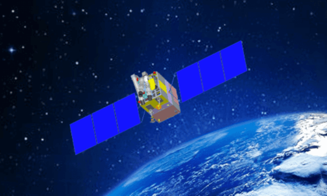
The **ZY-3 constellation** (ZY-3 01/02/03) are China’s pioneering stereomapping satellites, carrying high-resolution panchromatic and infrared multispectral cameras. They capture images from multiple perspectives simultaneously, forming a crucial database for 1:50000 DEM mapping. This constellation also provides essential data for resource mapping, environmental surveying, disaster monitoring, city planning, and national security, boasting a revisit capacity of 1-2 days.
Technical Specifications:
| Characteristic | Value |
|---|---|
| Orbit Altitude | 509 km |
| Sensor Bands | Panchromatic (450-900nm), 4 Multispectral (Blue, Green, Red) |
| Spatial Resolution (PAN) | Nadir: 2.1m; Forward/backward: 2.5m-3.5m |
| Spatial Resolution (MS) | 5.8m (01/02), 6m (03) |
| Swath Width | Nadir: 51km; Forward/backward: 52km; MS cam: 51km |
| Onboard Storage | 3.75 TB |
| Revisit Capacity | 1-2 days (3 satellites) |
CBERS-04/04A: Versatile Multispectral Imaging
The **CBERS-04 and CBERS-04A satellites** carry multiple cameras, offering diverse spatial resolutions (from 2m panchromatic to 73m wide-field infrared). These versatile payloads play a significant role in land and water resource surveys, forestry, crop yield estimation, urban planning, environmental protection and disaster monitoring, providing valuable multispectral data with robust revisit capacities.
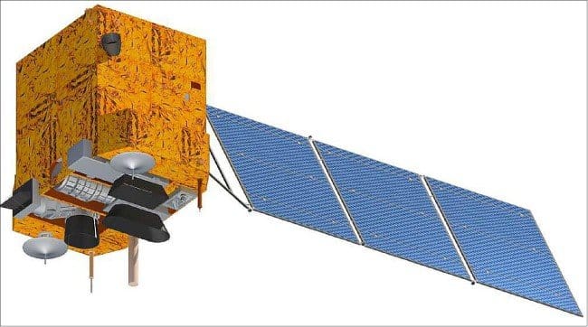
Technical Specifications:
| Characteristic | Value |
|---|---|
| Satellite ID | CBERS-04 / CBERS-04A |
| Launch Time | December 2014 / December 2019 |
| Orbit Type | Sun-synchronization |
| Orbit Altitude | 778km / 628km |
| Revisit Capacity | 3 days (WPM camera) / 5 days |
| Spatial Resolution (WPM) | Pan 5m, MS 10m / Pan 2m, MS 8m |
| Swath Width | 60km / 95km |
Streamlined SAR Data Processing & Delivery
XRTech Group is committed to rapid, efficient, and secure delivery of SAR data. Our advanced cloud-based systems and streamlined workflows ensure you receive actionable intelligence quickly and reliably.
Rapid Response & Delivery
Leveraging our cloud-based system, Siwei Earth, we boast an impressive 1.5-hour response time from data request to system tasking. Furthermore, processed SAR data is delivered in as little as 1 hour, setting a new benchmark for speed in the industry.
Massive Processing Volume
Our powerful platform is engineered to handle substantial workloads, capable of processing over 50 TB of data daily. This immense capacity ensures that large-scale projects and continuous monitoring needs are met with efficiency and precision.
Global Coverage Acquisition
With our robust ground station network and sophisticated command systems, satellite command uploads can be executed globally within 3 hours. This guarantees that new SAR imagery can be acquired for virtually any location worldwide with unprecedented agility.
Flexible Delivery Formats
All satellite imagery data, including SAR, is delivered in widely recognized industry-standard formats such as GeoTIFF, SHP, and DWG. We support flexible projections like WGS84 or UTM, ensuring seamless integration with your existing GIS or CAD workflows. Data can be securely received via cloud delivery or physical HDD, based on your preference.
No Export License Delays
As a non-U.S. provider, XRTech Group is uniquely positioned to avoid common export control bottlenecks. This significantly streamlines the data delivery process, ensuring faster access to critical SAR data with fewer bureaucratic restrictions, enabling truly agile operations.
Transformative Applications of SAR Imagery
SAR imagery from XRTech Group is instrumental across a multitude of sectors, leveraging its all-weather, day-and-night monitoring capabilities to provide actionable insights for critical decision-making. Explore how SAR data can empower your operations:
Military & Border Security
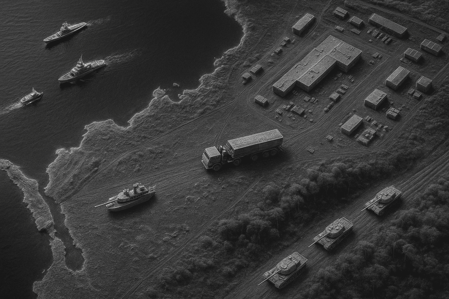
SAR satellites provide detailed imagery for reconnaissance, target detection, and battlefield management, crucial for national defense. They enable AI-driven image analysis for real-time monitoring of sensitive areas, detecting military assets, and analyzing enemy movements. Multi-source satellite monitoring, including SAR, significantly enhances border surveillance and helps identify unauthorized activities.
SAR satellites also specifically aid in improving ship safety and security and monitoring naval assets and maritime routes, ensuring comprehensive domain awareness.
Strategic Infrastructure Monitoring
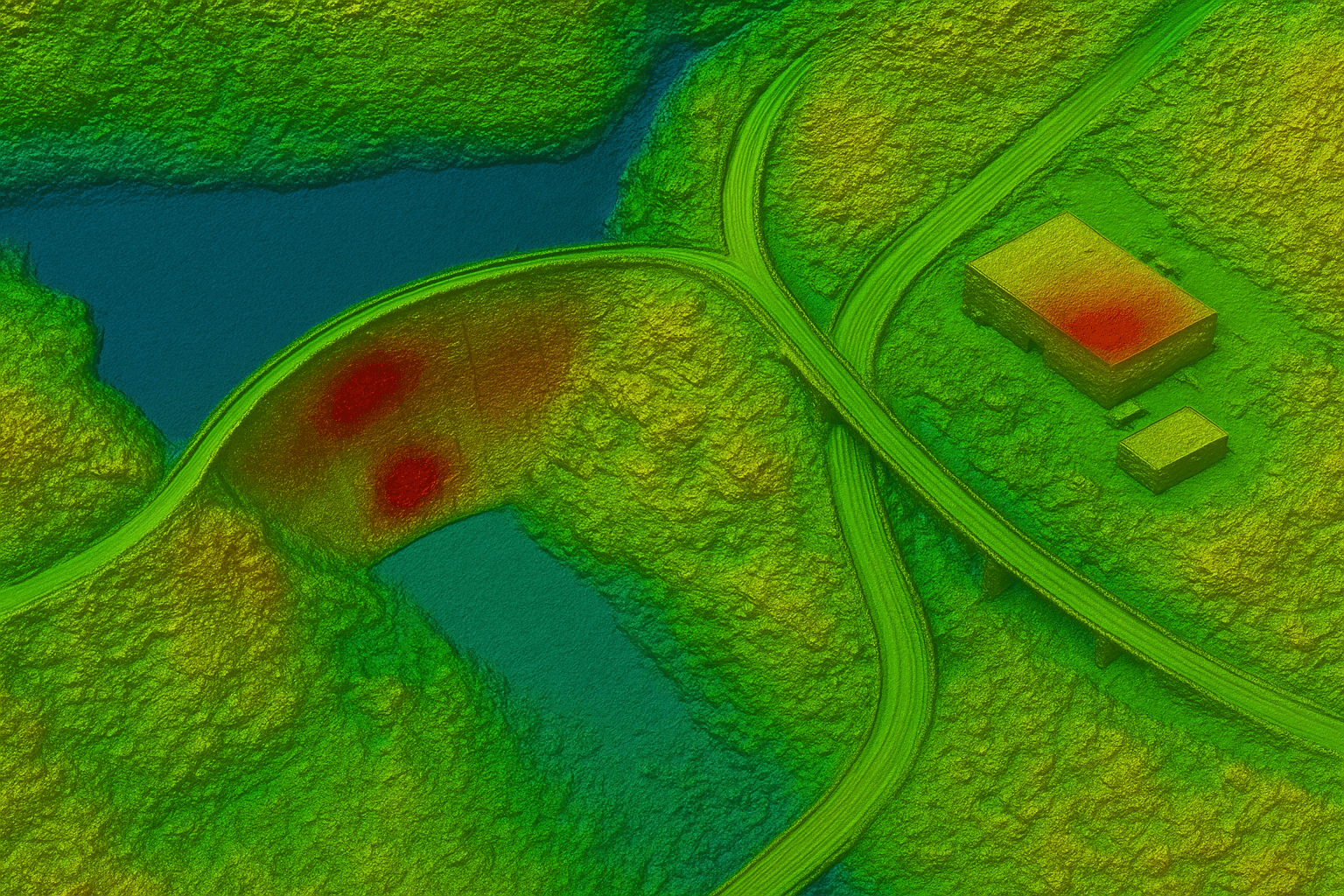
XRTech Group utilizes advanced InSAR technology for precise deformation and subsidence monitoring of critical infrastructure. This includes vital assets like dams, bridges, roads, railways, and military facilities. By detecting even millimeter-level ground movements, potential risks and structural instabilities can be identified and addressed proactively, preventing costly damage and ensuring public safety.
This proactive approach helps in managing the entire lifecycle of infrastructure, from planning to maintenance.
Disaster Management & Recovery
SAR data is indispensable for real-time disaster monitoring and response. Its ability to see through clouds and smoke makes it vital during events like floods, landslides, and wildfires, where optical visibility is severely limited. It complements optical data, providing immediate situational awareness for emergency services, damage assessment, and guiding recovery efforts.
From July to August 2020, our GF-3 SAR satellite effectively monitored a flood area in China, overcoming cloudy weather to provide unique all-weather support for dynamic flood area monitoring. Similarly, during continuous rainstorms in central Venezuela (Sept 2022), China Siwei swiftly responded to the International Charter on Space and Major Disasters (CHARTER), deploying multiple satellites to monitor the disaster area. This provided crucial pre & post-disaster data for assessment and reconstruction support.
Marine & Oil Spill Monitoring
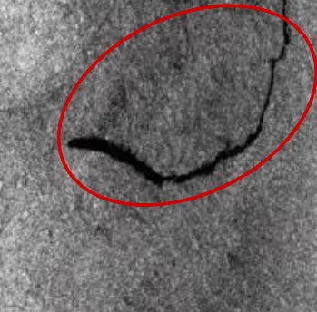
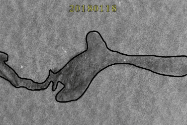
Marine oil spill monitoring is a critical aspect of disaster emergency management and environmental protection. Utilizing satellite-borne SAR remote sensing images, combined with ocean wind field, ocean currents, and electronic nautical chart data, allows for the automatic identification of oil spill areas.
This system facilitates prediction and analysis of oil spill evolution trends, helps build maritime oil spill monitoring systems, formulates optimal oil stopping paths and points, and evaluates the effectiveness of implemented measures. This powerful support for oil spill emergency response and safety supervision has been successfully applied in sea areas such as the East China Sea, South China Sea, and Bohai Sea.
Transportation Facility Deformation Monitoring
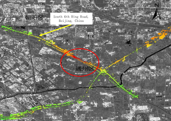
Monitoring deformation in transportation facilities is a fundamental task for municipal traffic management. By constructing a radar remote sensing monitoring system, pooling SAR data resources, integrating InSAR data processing methods, and combining with field verification terminals, periodic deformation monitoring of pavements, railroads, and airport facilities is achieved. This enables on-site investigation of hidden danger zones, providing crucial guidance for the safe operation of transportation infrastructure.
This solution boasts full monitoring coverage, high accuracy, and low cost, having been successfully implemented in transportation departments in Hunan, Beijing, and other provinces and cities in China.
Urban Infrastructure Remote Sensing Monitoring
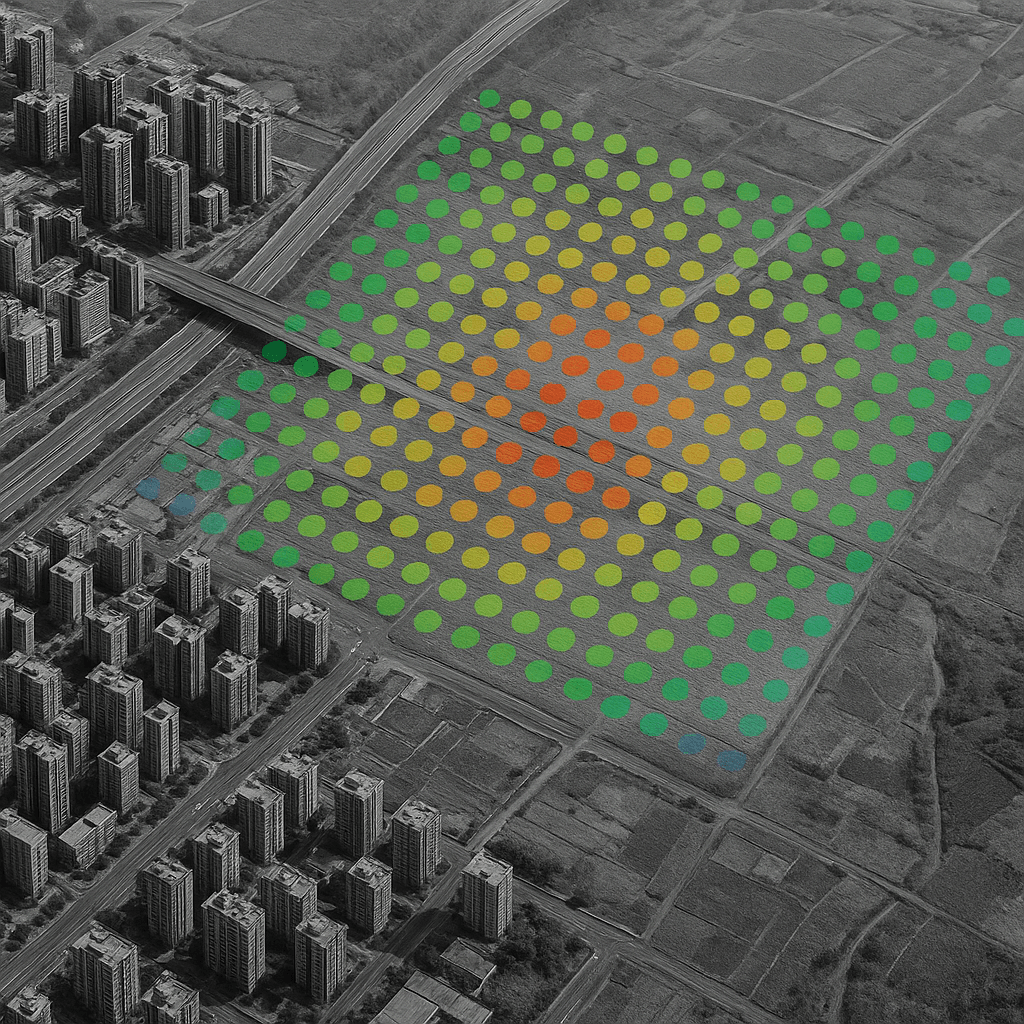
Remote sensing monitoring of urban infrastructure is a vital measure to ensure the safety and longevity of urban facilities. By constructing a robust remote sensing monitoring platform for urban infrastructure, and relying on multi-temporal SAR images combined with radar coherence information, quantitative indicators such as surface subsidence amount and rate can be calculated. This enables continuous monitoring of building and infrastructure deformation, assisting in site selection for urban infrastructures and ensuring safety throughout their lifecycle.
This solution is now widely applied in the housing and construction sectors in Beijing, Hunan, and Guangdong, China, contributing significantly to smart city development and urban resilience.
Mining & Natural Resources
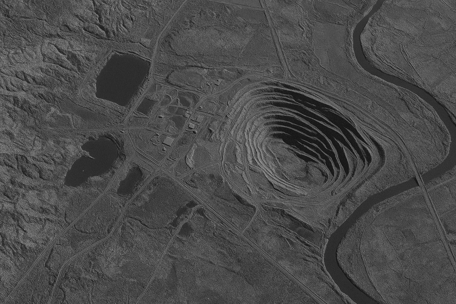
SAR data assists extensively in exploration, resource management, and environmental impact monitoring around mining sites. Its ability to penetrate ground cover is invaluable for identifying geological features and tracking surface changes caused by extraction activities. It can also aid in monitoring pipeline integrity and detecting potential leaks across vast and often remote terrains, ensuring operational safety and environmental compliance.
Environmental Monitoring
SAR imagery serves as a powerful tool for tracking changes in land use, deforestation, and other environmental aspects, particularly when optical visibility is limited due to cloud cover or smoke. It provides consistent data for assessing vegetation health, wetland changes, and glacial movements, supporting long-term ecological studies and conservation efforts.
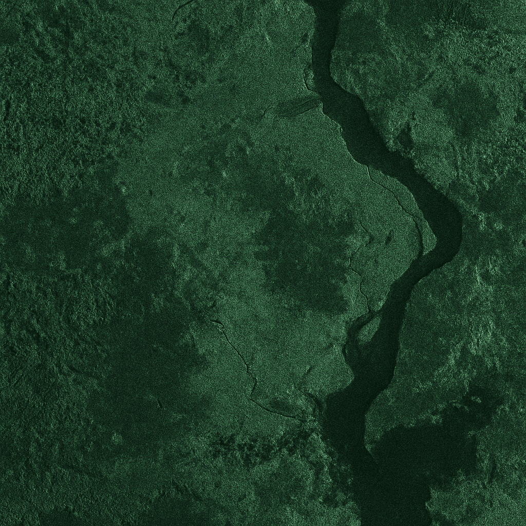
By leveraging advanced SAR technology and comprehensive data processing, XRTech Group delivers precise and reliable geospatial solutions that empower a wide range of industries for critical decision-making.
Why Choose XRTech Group for Your SAR Data Needs?
Choosing the right satellite data provider for your SAR imagery is paramount. XRTech Group stands as a leader, offering distinct advantages:
Truly Persistent Monitoring
Our constellation of 24/7 all-weather SAR satellites provides a continuous, uninterrupted view of our changing world. Gain critical insights in key areas of interest to drive informed decision-making, even in adverse conditions where optical imagery is ineffective.
Enhanced Insights & Analytics
Cut through the noise and gain clear signals with XRTech Group’s suite of SAR data capabilities. Our diverse range of offerings, including multi-polarization and frequency bands, provides varying resolutions and coverage to empower your decision-making and drive impactful results with unparalleled precision and clarity.
Unrivaled Timeliness
Receive critical SAR data in just a few hours from acquisition. Our rapid response and delivery systems ensure that you have the most current information for time-sensitive applications, making us faster than many competitors due to our integrated cloud processing and efficient tasking.
Global Coverage & Accessibility
Benefit from unlimited access to SAR imagery anywhere on the globe. Our extensive satellite constellation ensures that no location is out of reach, providing comprehensive monitoring solutions regardless of geographical constraints.
Non-U.S. Provider Advantage
As a non-U.S. provider, XRTech Group is uniquely positioned to avoid common export control bottlenecks. This significantly streamlines the data delivery process, ensuring faster access to critical SAR data with fewer bureaucratic restrictions, enabling truly agile operations.
Dedicated Support & Custom Solutions
Our team of experts provides tailored support and custom recommendations for your specific project needs. We offer free sample images and consultations, ensuring you receive the most suitable and impactful SAR data and geospatial solutions for your unique challenges.
Partner with XRTech Group to harness the true potential of SAR Satellite Imagery & Data, transforming complex challenges into actionable intelligence for superior operational efficiency and strategic advantage.
Get Started with XRTech Group’s SAR Services Today!
Ready to explore the power of all-weather, day-and-night SAR data for your critical operations? XRTech Group is your expert partner in advanced geospatial solutions. Contact us to discuss your specific requirements or request a demonstration.
