Buy High-Resolution Latest Satellite Imagery in Australia Starting at $1
Buy high-resolution satellite imagery in Australia today and unlock unmatched insights from the skies. At XRTech Group, we specialize in providing the most advanced, high-resolution satellite imagery in Australia to meet your diverse needs. Whether you want to purchase high-resolution satellite images for real-time monitoring, historical data analysis, or on-demand imaging, we offers the best prices globally & seamless access to cutting-edge geospatial solutions. Our services are designed to empower commercial businesses, governments, and organizations with reliable and actionable data, making decision-making smarter and faster.
XRTech Group offers high-resolution satellite imagery starting at just $1, providing access to real-time satellite awareness, satellite imagery archives, and new satellite imagery requests. Our platform ensures you get the best-quality satellite images with unmatched clarity and precision. With on-demand access to high-resolution satellite images, XRTech Group provides a seamless purchase process to acquire precise geospatial data. Whether you need real-time monitoring or access to historical satellite imagery archives, we have you covered.

High-Resolution Satellite Imagery Available in Australia
Archived Imagery:
XRTech Group provides access to a substantial archive of high-resolution satellite imagery and download options in Australia, with data going back to 1999.
● This archived imagery is suitable for various applications including:
- Single-use purposes, such as obtaining high-quality images for media.
- Visual identification, such as locating specific objects.
- Creating base maps for applications like urban planning.
- Analyzing historical changes, such as tracking infrastructure development.
● This is beneficial when:
- Images for a required time period are not available in the archive.
- Better AOI (Area of Interest) coverage is required.
- Archival imagery resolution is insufficient for the application.
- Regular monitoring and scheduled revisits of the area are required.
- Specific image types such as panchromatic or multispectral, are needed.
- The satellites capture data in a range of spectral bands, including panchromatic, red, green, blue, and near-infrared (NIR), with some also offering purple, yellow, red edge, NIR1, and NIR2 bands
- Optical imagery options include panchromatic, multispectral, infrared, and hyperspectral.
- SAR imagery provides all-weather, day-and-night monitoring capabilities.
- XRTech Group also provides value-added products, such as Digital Orthophoto Maps (DOM), Digital Surface Models (DSM/DEM), and 3D city models, enhancing the utility of the imagery.
Request High-Resolution New Images:
Our Most Competitive High Resolution Satellite Imagery Pricing in Australia
Discover the list of our pricing for high-resolution satellite imagery to meet your specific requirements in Australia. At XRTech Group, we provide high-resolution satellite imagery to support industries like agriculture, urban planning, disaster management, and environmental monitoring. Our satellite imagery is available in multiple resolutions, pricing categories, and collection priorities to meet diverse customer needs.
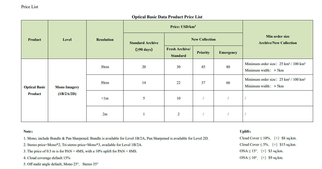
Pricing for Optical Basic Data
The pricing of Optical Basic Data depends on the resolution, archival status, and priority of collection. Below is a breakdown of the pricing structure based on USD/km²:
| Product | Level | Resolution | Standard Archive (≥90 days) | New Collection (Fresh Archive/Standard) | Priority | Emergency | Minimum Order Size |
|---|---|---|---|---|---|---|---|
| Optical Basic Product | Mono Imagery (1B/2A/2D) | 30cm | $20 | $30 | $45 | $80 | 25 km² / 100 km² (Min width: >5 km) |
| 50cm | $14 | $22 | $37 | $66 | 25 km² / 100 km² (Min width: >5 km) | ||
| <1m | $5 | $10 | - | - | - | ||
| 2m | $1 | $2 | - | - | - |
Understanding Our Satellite Imagery Pricing Categories
- Standard Archive (≥90 days) – This is the most affordable Satellite Imagery option, where customers purchase previously collected satellite imagery that is at least 90 days old.
- Fresh Archive / Standard Collection – A new satellite image is collected upon request but with standard scheduling. This cost slightly more than archived imagery.
- Priority Collection – Customers can request prioritized satellite image collection, ensuring faster access compared to standard requests.
- Emergency Collection – The fastest service, where satellite images are collected as soon as possible. This option comes at the highest cost due to the urgency of the task.
Additional Satellite Pricing Considerations
Stereo and Tri-Stereo Pricing
- Stereo Imagery: The price is 2× the Mono imagery cost
- Tri-Stereo Imagery: The price is 3× the Mono imagery cost
- Available for Level 1B/2A
Price Adjustments for Specific Features
- PAN + 4MS (0.5m Resolution): An additional 10% uplift for PAN + 8MS
- Cloud Coverage Adjustments:
- Cloud Cover ≤ 10%: +$8 per sq. km
- Cloud Cover ≤ 5%: +$15 per sq. km
- Off-Nadir Angle (ONA) Adjustments:
- ONA ≤ 15°: +$3 per sq. km
- ONA ≤ 10°: +$9 per sq. km
Key Features:
Flexible Resolutions: Choose from 30cm to 2m resolution to suit your needs.
Customizable Deliverables: Available in bundle, panchromatic sharpened, or stereo imagery.
Global Coverage: Access an extensive archive or opt for on-demand new collection imagery.
Precision Data: Make informed decisions with highly detailed satellite data.
At XRTech Group, we understand that every project is unique. That’s why we offer customizable pricing and satellite imaging solutions to meet your specific requirements.
Order Your Satellite Imagery Today
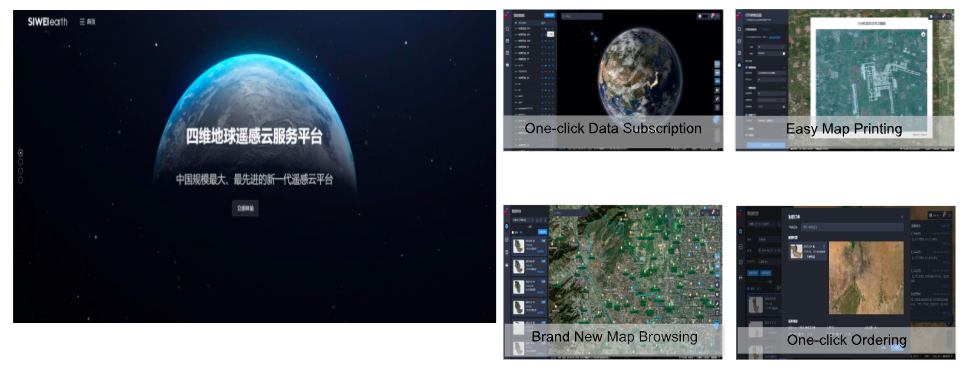
XRTech Group's Use of Remote Sensing Data with a Cloud Service Model
XRTech Group uses remote sensing data with a new online cloud service model called Siwei Earth, which transforms how remote sensing data is accessed and utilized. This model streamlines the process of ordering, processing, and applying data, making it faster and more efficient for users. Here’s how XRTech leverages remote sensing data with this cloud service model:
Why Choose XRTech Group to Buy Satellite Imagery in Australia?
When you decide to purchase high-resolution satellite images in Australia, you need accuracy, speed, and reliability. XRTech Group partners with leading satellite imagery provider with 60+ Satellites in the space to ensure you get the most detailed and up-to-date data available. With resolutions as sharp as 30 cm per pixel, you can monitor key areas, analyze changes, and make critical decisions with confidence.
Our platform offers:
- High-Resolution Data: We offer up to 30cm resolution for detailed satellite imagery.
- Flexible Collection Options: Choose from archive data, standard requests, priority collection, or emergency imaging.
- Custom Order Sizes: Whether you need 25 km² or 100 km², we have flexible minimum order sizes.
- Competitive Pricing: Affordable rates with transparent pricing for different needs.
- Real-time satellite awareness for up-to-the-minute data.
- A comprehensive satellite imagery archive for historical analysis.
- The ability to task satellites and acquire new images on demand.
- An easy-to-use online system for quick and secure purchases.
Images
Sensors
Providers
Our Constellation of High-Resolution Satellite Imagery
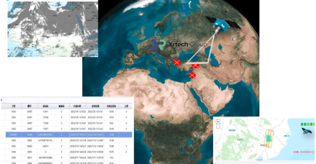
At XRTech Group, we offer access to a vast constellation of high-resolution satellite imagery powered by over 60 satellites, providing unmatched Earth observation data.
This extensive network, featuring advanced satellites with varied capabilities, ensures you get the most comprehensive and accurate imagery, tailored to meet the needs of different industries.
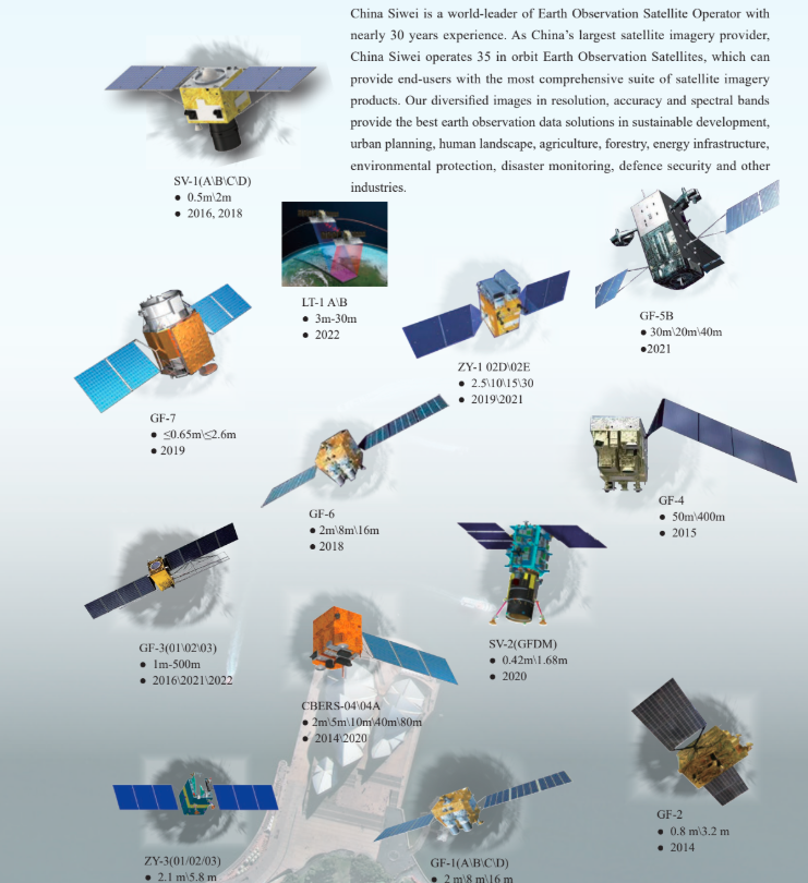
Through our partnership with China Siwei, one of China’s largest satellite imagery providers with nearly 30 years of experience, we bring you the best in geospatial insights, offering solutions for sustainable development, urban planning, agriculture, energy, and much more.
Our satellites capture a wide range of data with varying resolutions and spectral bands, allowing us to deliver the most precise, timely, and reliable satellite images.
Whether you need high-resolution imagery for urban infrastructure, forestry management, or environmental protection, our constellation provides the best Earth observation data solutions.
Buy Satellite Imagery From The High-Resolution Satellite
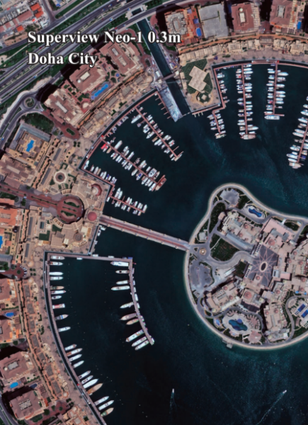
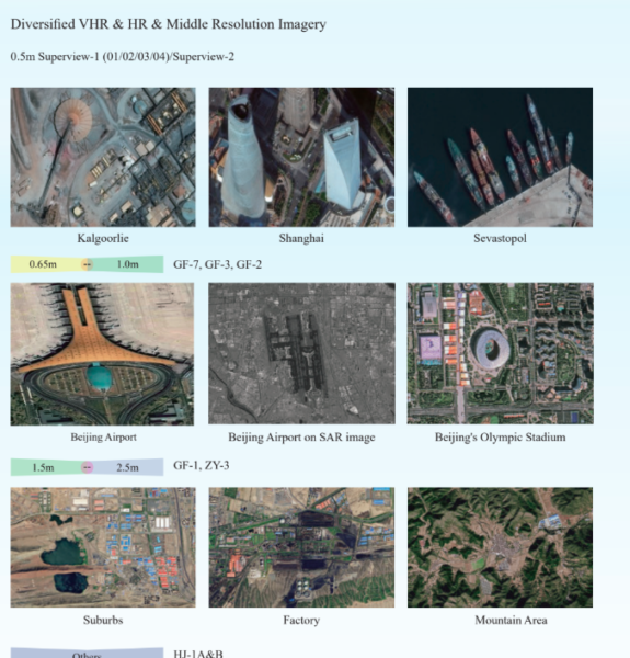
Superview Neo-1 High-Resolution Satellite Imagery
Feature | Details |
Resolution | 0.3m/px |
Spectrum Bands | Panchromatic, Red, Green, Blue, NIR |
Revisit | Daily for middle and high latitudes area |
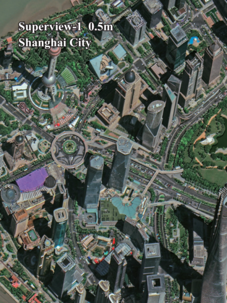
Superview - 1 High-Resolution Satellite Imagery
Feature | Details |
Resolution | 0.5m/px |
Spectrum Bands | Panchromatic, Red, Green, Blue, NIR |
Revisit | Daily |
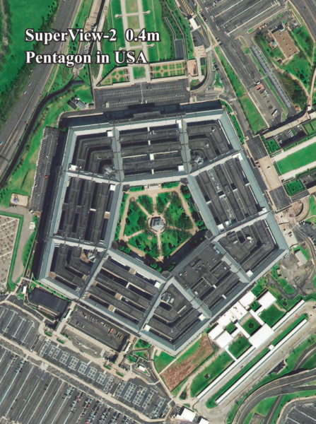
Superview - 2 High-Resolution Satellite Imagery
Feature | Details |
Resolution | 0.4m/px |
Spectrum Bands | Panchromatic, Purple, Yellow, Red Edge, Red, Green, Blue, NIR1, NIR2 |
Revisit | 3 Days |
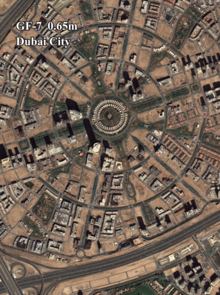
GF-7 High-Resolution Satellite Imagery
Feature | Details |
Resolution | 0.65m/px |
Spectrum Bands | Panchromatic, Red, Green, Blue, NIR |
Revisit | 5 Days |
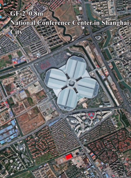
GF-2 High-Resolution Satellite Imagery
Feature | Details |
Resolution | 0.8m/px |
Spectrum Bands | Panchromatic, Red, Green, Blue, NIR |
Revisit | 5 Days |
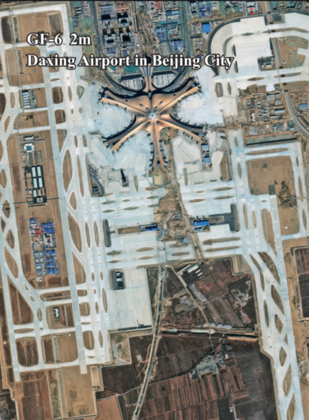
GF-6 High-Resolution Satellite Imagery
Feature | Details |
Resolution | 2m/px |
Spectrum Bands | Panchromatic, Red, Green, Blue, NIR |
Revisit | 4 Days |
GF-1 High-Resolution Satellite Imagery
Feature | Details |
Resolution | 8m/px |
Spectrum Bands | Panchromatic, Red, Green, Blue, NIR |
Revisit | 4 Days |

ZY-3 High-Resolution Satellite Imagery
Feature | Details |
Resolution | 2m/px |
Spectrum Bands | Panchromatic, Red, Green, Blue, NIR |
Revisit | 5 days( only I satellite ) / 1-2 days ( 3 satellites ) |
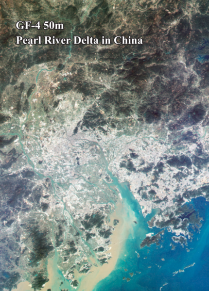
GF-4 High-Resolution Satellite Imagery
Feature | Details |
Resolution | 50m/px |
Spectrum Bands | Visible Light, Near-Infrared, Mid-Wave Infrared |
Revisit | 20sec |
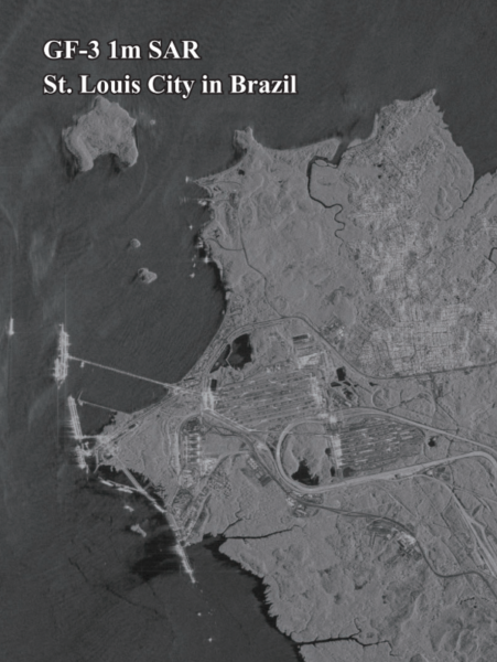
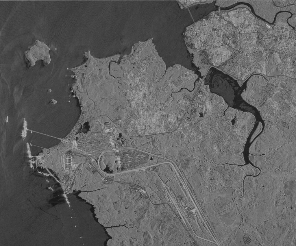
GF-3 SAR High-Resolution Satellite Imagery
Feature | Details |
Resolution | 1m/px |
Spectrum Bands | C-band SAR |
Revisit | 10 Days |
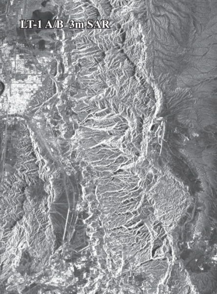
LT-1 SAR High-Resolution Satellite Imagery
Feature | Details |
Resolution | 3m/px |
Spectrum Bands | L-band SAR |
Revisit | 8 days( For I satellite) / 4 days(For 2 satellites) |
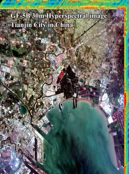
GF-5B High-Resolution Satellite Imagery
Feature | Details |
Resolution | 30m/px |
Spectral Range | 400-2500 nanometers (nm) |
Revisit | 12 days |
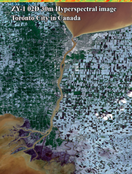
ZY-1 02D High-Resolution Satellite Imagery
Feature | Details |
Resolution | 30m/px |
Revisit | 3 days(WPM camera) / 26 days(MUX camera) |
Instrument | Spectral Bands (nm) |
MUXCam | Blue, Green, Red, Near-Infrared |
PanMUX | Panchromatic, Green, Near-Infrared |
IRS | B1, B2, B3, B4 |
WFI | Blue, Green, Red, Near-Infrared |
Primary Products and Services in Australia
At XRTech Group Satellite Imagery Provider offers a wide range of earth observation satellite imagery, offering a comprehensive suite of options to meet various resolution needs, It includes 29 VHR (Very High Resolution), HR (High Resolution), and Middle Resolution Optical Satellites, along with four SAR satellites for advanced imaging.
Synthetic Aperture Radar (SAR) Imagery in Australia
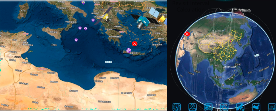
SAR imagery in Australia is a game-changer in geospatial technology, allowing you to detect changes even in challenging conditions such as heavy cloud cover or complete darkness. Unlike optical imagery, SAR can penetrate clouds and work effectively at night, making it a highly reliable monitoring tool for civil, commercial, and defense organizations worldwide. At XRTech Group, our advanced geospatial solutions leverage SAR technology to deliver precise and actionable data.
Our radar satellites are equipped with multiple imaging modes, such as spotlight mode for capturing high-resolution localized areas and stripmap mode for wide-area coverage. With support for multiple polarization types, including single, dual, and full polarization, we can tailor SAR imagery to meet the specific requirements of industries like urban planning, environmental monitoring, and defense. Additionally, we utilize imaging frequency bands, such as L, C, and X bands, to ensure high precision across various applications.
Value-Added Services and Products by XRTech Group
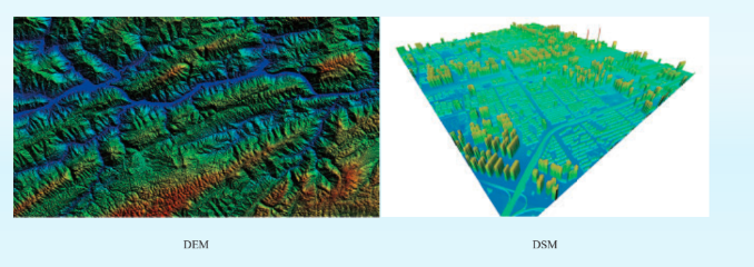
DEM and DSM
Digital Elevation Models (DEM) and Digital Surface Models (DSM) are essential tools for precise urban planning and resource management. Aerial maps corrected for distortion provide a reliable foundation for decision-makers to understand land features with unmatched accuracy. These models enable efficient planning of infrastructure projects, ensuring seamless integration with natural landscapes. From identifying ideal construction zones to minimizing environmental impact, DEMs and DSMs deliver actionable insights.
With 3D representations of terrain and buildings, DSMs take infrastructure development to the next level. They allow planners to visualize existing landscapes and structures in great detail, aiding in resource allocation and disaster preparedness. By combining accuracy with advanced technology, XRTech Group ensures clients have the tools they need for informed and impactful decisions.
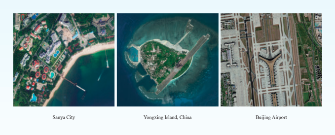
Digital Orthographic Maps (DOM)
Digital orthographic maps (DOM) offer georeferenced images corrected for terrain effects, ensuring pixel-perfect clarity. These orthoimages are a cornerstone for mapping the world, with consistent accuracy that meets stringent standards. With a resolution of 50 cm and an 8m CE90 precision, DOMs allow for extracting details like buildings, roads, and other objects essential for urban planning or infrastructure projects.
Moreover, DOMs are invaluable for long-term monitoring. Their accuracy makes them ideal for tracking changes in landscapes, evaluating urban growth, or monitoring environmental shifts. Whether creating base maps for GIS applications or using them to assess ongoing projects, XRTech Group’s DOM solutions provide the clarity and precision needed for success.
How High-Resolution Satellite Imagery Can Help Your Business in Australia
Why Choose XRTech Group to Buy High-Resolution Satellite Imagery
Unmatched Satellite Coverage
Access imagery from over 60+ satellites, providing diverse resolutions, spectral bands, and revisit capabilities to suit every need.
Industry-Leading Accuracy
Buy satellite images with resolutions as sharp as 0.3m per pixel, ensuring precise data for urban planning, agriculture, and more.
Customized Solutions
Tailor your satellite imagery purchases with on-demand tasking and access to extensive archives for historical analysis.
Advanced Technology
Benefit from SAR and multispectral imaging options for reliable data in challenging weather and lighting conditions.
Wide Industry Applications
Purchase imagery suited for various sectors, including infrastructure development, environmental monitoring, defense, and energy.
Expertise and Experience
Leverage nearly three decades of expertise from partnerships with top satellite imagery providers like China Siwei.
User-Friendly Platform
Easily browse, buy, and download high-resolution satellite imagery online through an intuitive platform.
Affordable Pricing Options
XRTech Group offers competitive pricing, making it cost-effective to purchase satellite imagery for projects of all sizes.
Real-Time Insights
Monitor and track changes on the ground with rapid updates and frequent imagery for timely and informed decisions.
Global Reach
With access to satellites providing coverage across the globe, obtain imagery of any location, no matter how remote.
What Our Happy Clients Says About Our Satellite Imeagery Solutions
XRTech Group: Buy Satellite Imagery at Best Price in Australia
XRTech Group offers a wide range of options to buy satellite imagery and purchase satellite imagery, tailored to meet diverse project needs at competitive prices. Partnering with China Siwei, XRTech provides access to high-resolution commercial satellite imagery, making it an excellent choice for industries seeking cost-effective and precise geospatial data.
Key Features and Pricing Factors:
Resolution Options: XRTech delivers imagery with resolutions as sharp as 0.3 meters per pixel. Higher resolution commercial satellite imagery offers unmatched detail at competitive prices.
Type of Imagery:
- Optical Imagery: Includes panchromatic, multispectral, infrared, and hyperspectral imagery, ideal for detailed visual analysis.
- SAR Imagery: Provides all-weather, day-and-night capabilities, perfect for challenging environments.
Coverage Area: Pricing varies based on the size and location of the area of interest, with flexible options for small and large-scale projects.
Data Usage: XRTech offers options for single-use imagery or ongoing project support, providing tailored pricing to fit your requirements.
Why Choose XRTech?
With its partnership with China Siwei, XRTech ensures access to one of the most advanced satellite constellations, offering diverse spectral bands and high-resolution imaging. Clients can rely on XRTech for flexible, affordable, and efficient solutions to purchase satellite imagery for industries like urban planning, agriculture, defense, and disaster management.
When you need reliable, high-quality commercial satellite imagery, buy satellite imagery at the best price with XRTech Group and experience data solutions designed to optimize your projects.
Get Started with XRTech Group's Satellite Imagery Solutions in Australia
Unlock the power of high-resolution satellite imagery for your projects. Whether you’re in agriculture, urban planning, defense, or environmental monitoring, our advanced geospatial solutions provide the accuracy and insights you need.
Contact us today to explore how XRTech Group can transform your data into actionable intelligence, or request a demo to see our satellite imagery products in action!