Digital Surface Models (DSM): High-Fidelity 3D Surface Intelligence by XRTech Group
XRTech Group delivers industry-leading Digital Surface Models (DSM), transforming aerial and satellite data into accurate, high-fidelity 3D representations of the Earth’s surface. As a crucial Value-Added Product, our DSMs capture every feature—from buildings and infrastructure to trees and topography—providing the comprehensive surface intelligence essential for modern urban planning, infrastructure monitoring, and environmental analysis. By leveraging our vast constellation of satellites and advanced AI processing, we ensure your projects benefit from a dynamic and precise digital mirror of the real world.
Defining the Digital Surface Model (DSM)
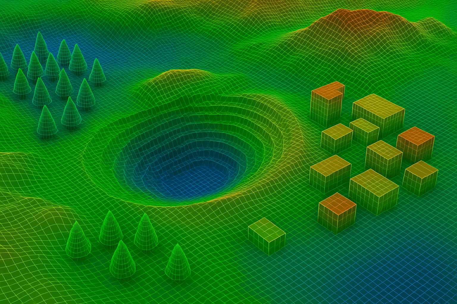
The Digital Surface Model (DSM) is a highly detailed 3D representation that models the elevation of every feature present on the Earth's surface.
What the DSM Represents
The DSM captures the elevation of all surface features, including:
1. Terrain
The natural ground elevation.
2. Vegetation
The height of all trees, forests, and other foliage.
3. Buildings and Structures
All man-made infrastructure, towers, and roofs.
This comprehensive depiction makes the DSM crucial for urban planning, forestry, and line-of-sight analysis. DSMs, with their 3D representations of terrain and buildings, enable planners to visualize existing landscapes and structures in detail, aiding in resource allocation and disaster preparedness in urban and coastal areas.
DSM Creation Engine: Satellite Data Acquisition and Processing
The high accuracy of XRTech Group's DSM services is achieved through precise satellite data acquisition and sophisticated, automated processing pipelines.
A. High-Accuracy Satellite Inputs (Stereo and Multi-Sensor)
The foundation of our 3D products is data collected using high-resolution satellite sensors specifically optimized for depth measurement.
1. Stereo Imagery
DSMs are built primarily using data from optical stereo image pair acquisition. Satellites like the GF-7 (0.65m/px resolution) are high-resolution stereo mapping satellites specifically designed to generate 1:10000 stereo mapping data.
2. Multi-Sensor Integration
We integrate data from optical, stereo, and SAR sensors. This multi-sensor system allows for dual or three-dimensional stereoscopic imaging, enhancing the robustness and accuracy of the 3D output.
3. Input Resolution
The underlying input imagery ranges from sub-meter resolution, with options as sharp as 0.3m/px (Superview Neo-1) and 0.4m/px (Superview-2), ensuring fine detail is captured.
B. Processing, Automation, and Refinement
The captured data undergoes specialized processing to generate the final DTM product.
1. 3D Modeling Tools
DSMs are created using advanced software tools and solutions that perform high-precision, automated processing.
2. AI Building Contour Extraction
AI is integrated to leverage the precise surface details of the DSM. The AI Building Contour Extraction tool automatically derives building footprints from the DSM for precise urban planning and scenario modeling.
3. Mosaicking and Fusion
Advanced software tools are used for mosaicking (stitching multiple satellite images together) and data fusion to create large, high-resolution maps, ensuring continuous DSM coverage over vast urban areas.
4. Orthophoto Input
The corrected, pixel-perfect Digital Orthophoto Maps (DOMs) are used to texture the DSM, creating realistic 3D Geographical Scenes & City Models.
III. Engineering-Grade Specifications and Delivery
XRTech Group's DSM services are engineered for precision and delivered for productivity, ensuring data is readily available and compatible with professional workflows.
| Specification | Details |
|---|---|
| Vertical Accuracy (RMSE) | ±3m vertical RMSE (Root Mean Square Error). |
| Resolution (Spacing) | 2–10 meter spacing for the elevation points. |
| Delivery Time | Custom DSM data (as part of DEM/DSM deliverables) is delivered in under 21 days. |
| Compatible Formats | Delivered in industry-standard formats: GeoTIFF, IMG, SHP, and DWG. |
| Projections | Flexible support for WGS84, UTM, or custom coordinate systems. |
| Licensing | Simple, project-wide licensing that is publication-friendly and built for collaborative teams. |
Core Applications and Benefits of DSM
The inclusion of above-ground features makes the DSM invaluable for applications where the built environment or natural canopy height is critical to the analysis.
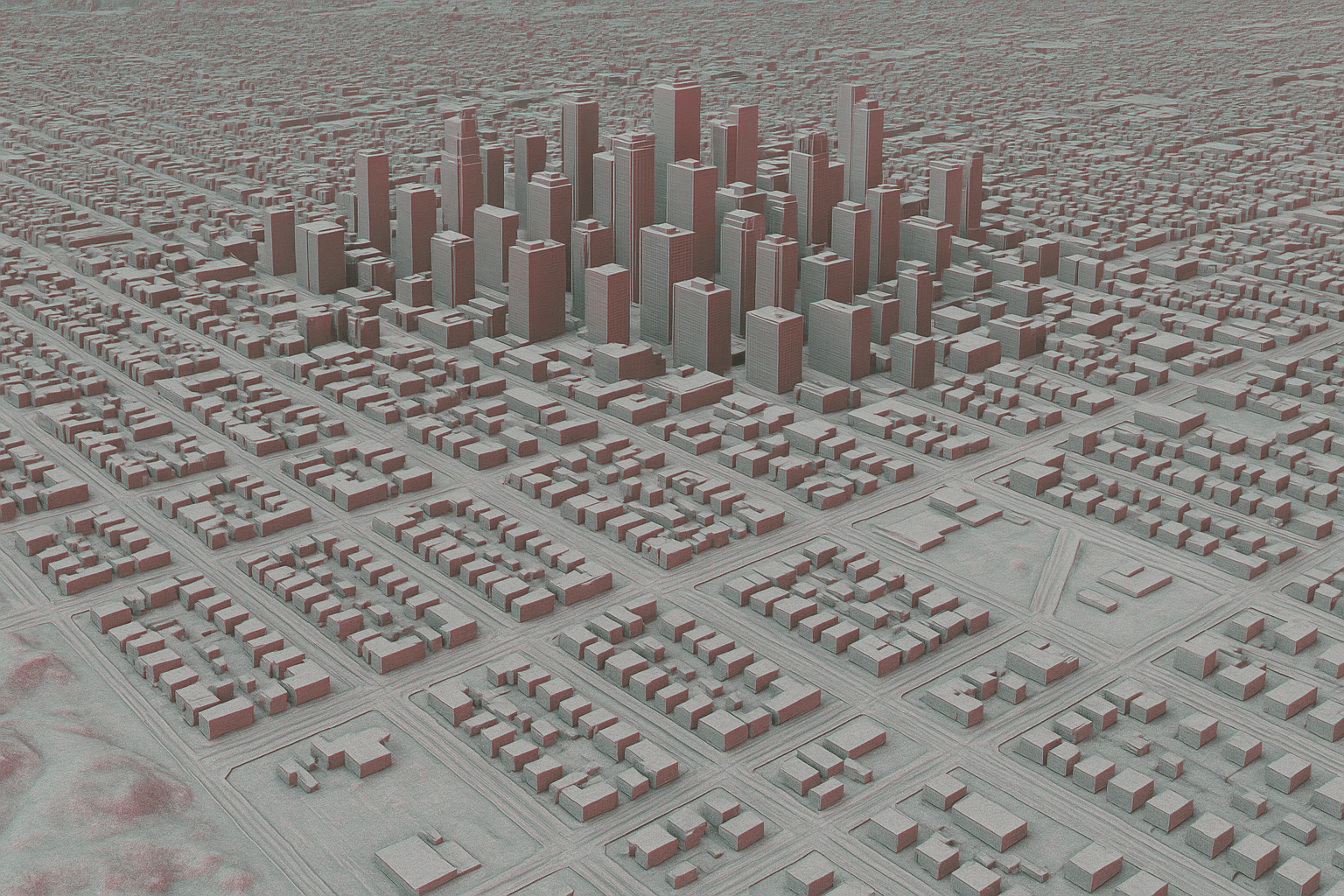
A. Urban Planning and 3D Modeling (Digital Twins)
The DSM is the foundational elevation data for visualizing and managing the urban environment.
- 3D City Models: DSMs are crucial for urban planning and are the primary input for creating 3D Geographical Scenes & City Models (Digital Twins). These models provide real-time insights into urban infrastructure.
- Smart City Planning: DSMs support smart city development by providing 3D representations of terrain and buildings, enabling planners to visualize existing landscapes and structures in great detail.
- Asset Inspection: DSMs provide the elevation context needed to remotely inspect and prioritize maintenance for utilities, roads, and critical assets.
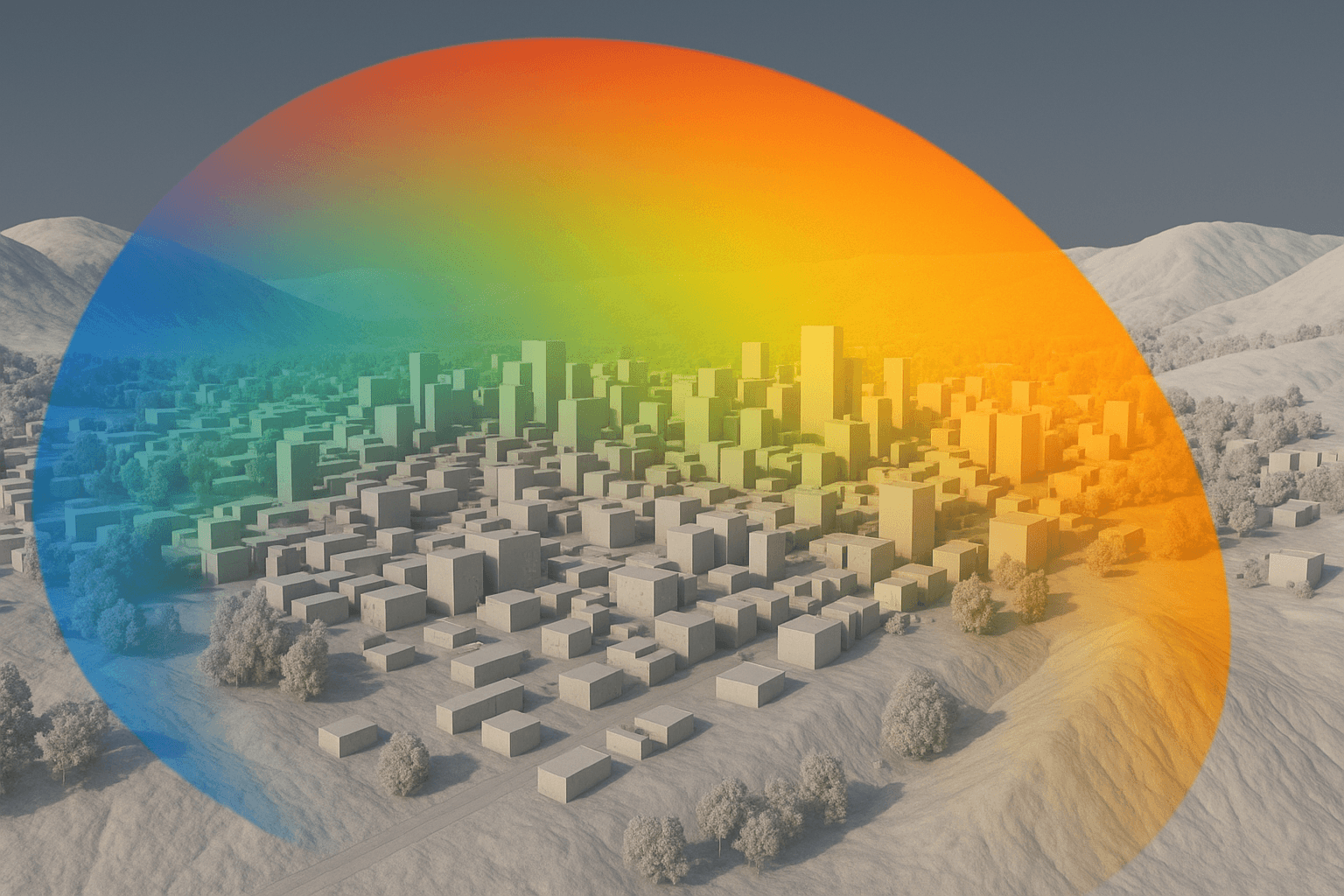
B. RF and Communications Planning
- Line-of-Sight Analysis: The DSM is directly used for line-of-sight analysis.
- Signal Propagation Modeling: DSMs accurately map obstructions like buildings and tall vegetation, allowing experts to model signal propagation and optimize transmitter placement for RF & Wireless Communications.
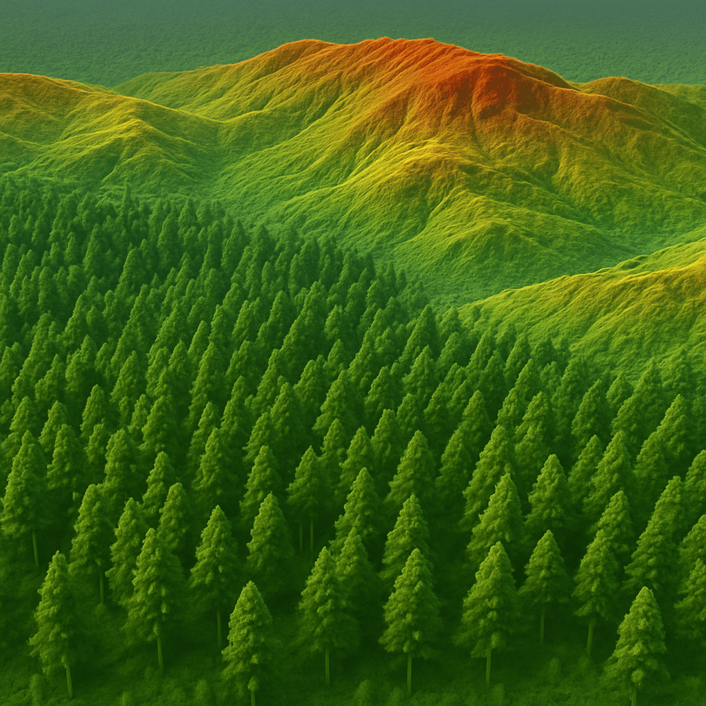
C. Forestry, Environment, and Vegetation Management
- Forestry Management: Since DSM captures vegetation height, it is crucial for forestry management. By comparing DSM with bare-earth models (DTM/DEM), tree canopy height can be calculated, aiding in monitoring reforestation success and assessing forest health.
- Environmental Impact Assessment: Used to model the potential impact of development projects on the landscape and ecosystems.
D. Disaster and Emergency Response
- Evacuation Modeling: DSMs are essential for creating realistic virtual environments and evacuation zone modeling during critical events like floods.
- Simulation: Used to create realistic virtual environments for simulation & military training.

Why Choose XRTech Group for DSM Services
XRTech Group stands as a premier provider by integrating high accuracy, speed, and competitive operational advantages, delivered through our global partnership with China Siwei.
1. Uncompromising Accuracy and Engineering-Grade Data
Guaranteed Vertical Accuracy
Our DSMs are reliable, boasting ±3m vertical RMSE, which is suitable for critical planning and engineering projects.
High-Resolution Input
Models are derived from sub-meter resolution imagery, providing the precision needed to accurately define surface features.
Expert Integration
Our DTM/DEM/DSM data is trusted by governments, planners, and responders across the globe.
2. Industry-Leading Speed and Global Reach
We overcome logistical challenges to ensure timely project execution:
Rapid Delivery
Receive custom DSM data in under 21 days. Raw imagery is often delivered in under 7 days.
No Export License Delays
As a non-U.S. provider, XRTech Group avoids export control bottlenecks, getting your data to you faster. We have been reported to deliver imagery 2x faster than Maxar or Airbus vendors.
Complete Global Coverage
Access to 130+ satellites, including specialized SAR and stereo sensors, ensures we can generate high-quality DSMs for any location on Earth.
3. Advanced Technology and Workflow Integration
Our solutions are designed to be immediately usable within your professional ecosystem.
Seamless Integration
Data is delivered in GeoTIFF, SHP, and DWG, guaranteeing seamless integration with your existing GIS or CAD workflows.
AI Integration
Our solutions utilize AI modeling for automated analysis, including AI Building Contour Extraction, maximizing precision in 3D modeling.
Flexible Licensing
We offer simple, project-wide licensing that is publication-friendly and designed for collaborative teams.
Risk-Free Assurance
XRTech Group ensures complete accuracy and reliability in DSM data, giving you confidence to make critical decisions without risk.
Frequently Asked Questions
Find answers to common questions about our Digital Surface Model (DSM) services.
Q1: What exactly is a Digital Surface Model (DSM) and what surface features does it include?
The Digital Surface Model (DSM) is a Value-Added Product that provides 3D representations of terrain and buildings. It captures the elevation of all surface features, which makes it a crucial tool for infrastructure development and resource planning.
Q2: What is the guaranteed vertical accuracy and spacing provided for XRTech Group's DSM data?
XRTech Group's DSM data is available at 2–10 meter spacing and boasts a vertical accuracy of ±3m vertical RMSE (Root Mean Square Error). This level of precision is suitable for engineering and land development projects.
Q3: How does XRTech Group create DSMs, utilizing satellite resources?
DSMs are created as Value-Added Products by leveraging advanced multi-sensor systems, including optical and SAR sensors, to deliver dual or three-dimensional stereoscopic imaging. This process transforms raw satellite data into precise 3D terrain intelligence.
Q4: What are the primary applications of DSMs in urban planning and infrastructure development?
DSMs are essential for urban planning and are a key input for creating 3D Geographical Scenes & City Models. These models allow planners to visualize existing landscapes and structures in great detail, aiding resource allocation.
Q5: How does DSM data support communications and network planning?
DSMs are used for RF & Wireless Communications because they accurately map obstructions like buildings and vegetation. This detailed surface map is critical for modeling signal propagation and optimizing transmitter placement.
Q6: In what formats are DSM data products delivered, and how are they delivered?
DSM images are delivered in industry-standard formats such as GeoTIFF, IMG, SHP, and DWG, ensuring seamless integration into existing GIS or CAD workflows. Delivery is provided via secure cloud delivery or physical HDD.
Q7: How quickly can XRTech Group deliver custom DSM data?
Custom DSM data (which is grouped with DEM/DTM products) can be delivered in under 21 days. This rapid delivery is achieved through efficient processing and access to a vast satellite network.
Q8: How does AI enhance the usability of DSMs for urban analysis?
The high-fidelity surface details captured in the DSM are leveraged by AI tools, such as AI Building Contour Extraction, which automatically derives building footprints for precise urban planning and modeling.
Q9: Why should a client choose XRTech Group for high-accuracy DSM data?
Clients choose XRTech Group for uncompromising accuracy (±3m RMSE), industry-leading speed (delivery in under 21 days), and complete global coverage ensured by access to over 130+ satellites.
Q10: Does XRTech Group offer flexible licensing for DSM products?
Yes, the licensing for DSM data is flexible. XRTech Group offers simple, project-wide licensing that is publication-friendly and designed for collaborative teams.
Elevate Your Projects with High-Fidelity DSM Data
Contact XRTech Group today to explore custom Digital Surface Model (DSM) services tailored to your project needs!