Digital Twins and 3D City Models by XRTech Group
Precision Geospatial Modeling for Smart Cities. Transforming static data into dynamic, actionable intelligence for modern urban management and infrastructure stability.
I. Defining the Digital Twin: The Future of Urban Management
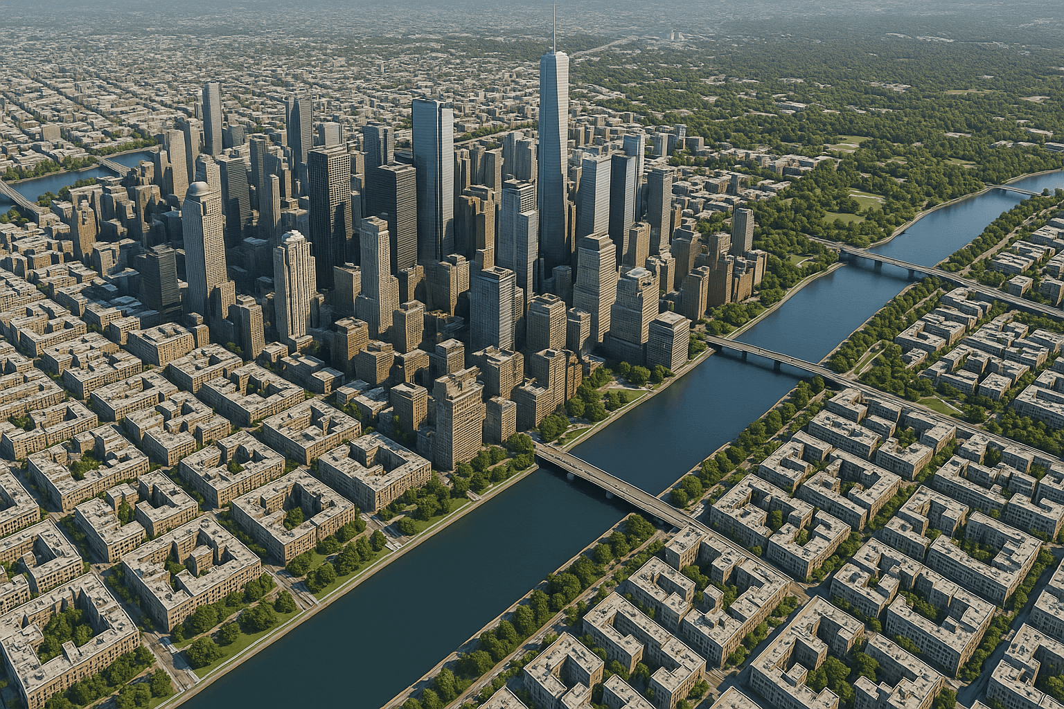
A 3D City Model, often referred to as a Digital Twin, provides a comprehensive, three-dimensional representation of an urban environment and its infrastructure. These models deliver crucial support across the entire lifecycle of a city or project—from initial planning to disaster resilience and ongoing operations.
A. The Building White Model Foundation
The construction of sophisticated city models often begins with the Building White Model. This fundamental, simplified 3D "box" model serves as the crucial base data for large-scale urban display, urban planning, and disaster assessment.
- Characteristics: Features the standard building contour, accurate height measurement, real coordinate position, and 3D shape.
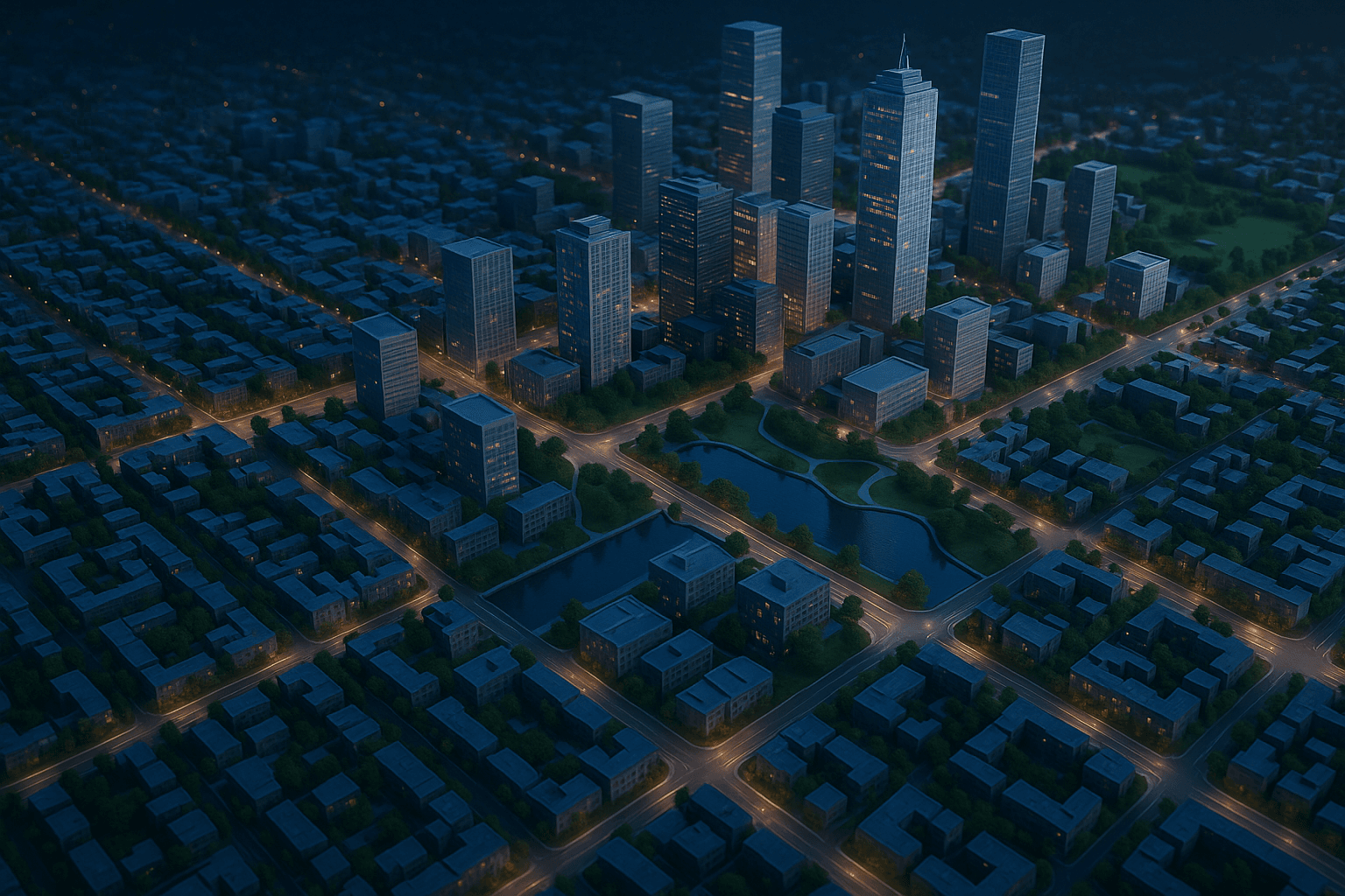
B. Digital Twin Capabilities
The full Digital Twin capability supports the entire life-cycle across planning, construction, operation, and investment.
- Observability & Visibility: Maps real-world information to a holographic 3D scene in an online digital space.
- Simulation: Creates a virtual model highly similar to the actual environment, allowing for accurate simulation and analysis anytime, anywhere.
II. Technical Foundation and Creation Process
The accuracy and detail of our 3D City Models are rooted in our access to diverse satellite resources and state-of-the-art AI processing pipelines.
A. Input Data and Sensor Integration
Models are derived from high-resolution optical and stereo satellite imagery. The system supports diverse data integration, including point cloud data (.xyz), BIM, 3D models (.ifc, .fbx, .3ds), and vector data (.shp, .kml) for a comprehensive view.
B. Foundational 3D Products
The model's integrity relies on precise elevation products like DEMs and DSMs, with Digital Orthophoto Maps (DOMs) providing pixel-perfect textures.
C. AI and Processing Automation
We use AI for automated construction of white models and intelligent building contour extraction. Our platform employs data fusion to integrate 3D models, geospatial data, and IoT data into a four-dimensional spatio-temporal knowledge graph for holistic scene rendering.
III. Core Specifications and Analytical Power
Our models are engineered to provide high precision and advanced analytical capabilities essential for engineers and planners.
A. Key Accuracy Metrics
Vertical Accuracy
Models rely on DEM/DSM data with a vertical accuracy of ±3m vertical RMSE.
High Resolution
Spatial spacing for elevation models is 2–10 meters, derived from VHR satellite imagery (0.3m–0.65m).
Engineering Precision
Built on high-accuracy outputs that meet demanding CE90 and RMSE specifications.
B. Advanced 3D Data Analysis
The 3D environment supports complex calculations, analysis, and visualization in response to specific business needs:
IV. Unmatched Applications: Powering Smart Cities
Our 3D City Models are primarily utilized within the Urban Management Module and the Smart Park Solution to drive efficiency and resilience.
A. Urban Planning and Development
We support the implementation of digital twin models to advance Smart City Development globally. Our models aid in smart zoning, real-time monitoring of urban expansion, identifying unauthorized constructions, and bolstering disaster resilience through effective planning and evacuation zone modeling.
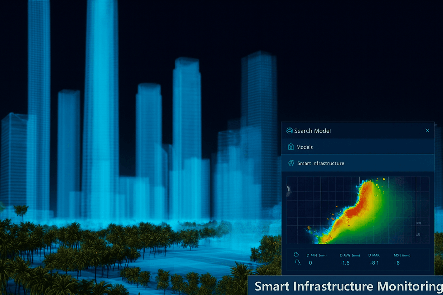
B. Smart Infrastructure Monitoring
The 3D context is crucial for Smart Infrastructure Monitoring. Using InSAR technology within the digital twin, we can detect subsidence or deformation in critical assets like bridges, roads, and buildings with millimeter-level accuracy, enabling predictive maintenance and remote asset inspection.
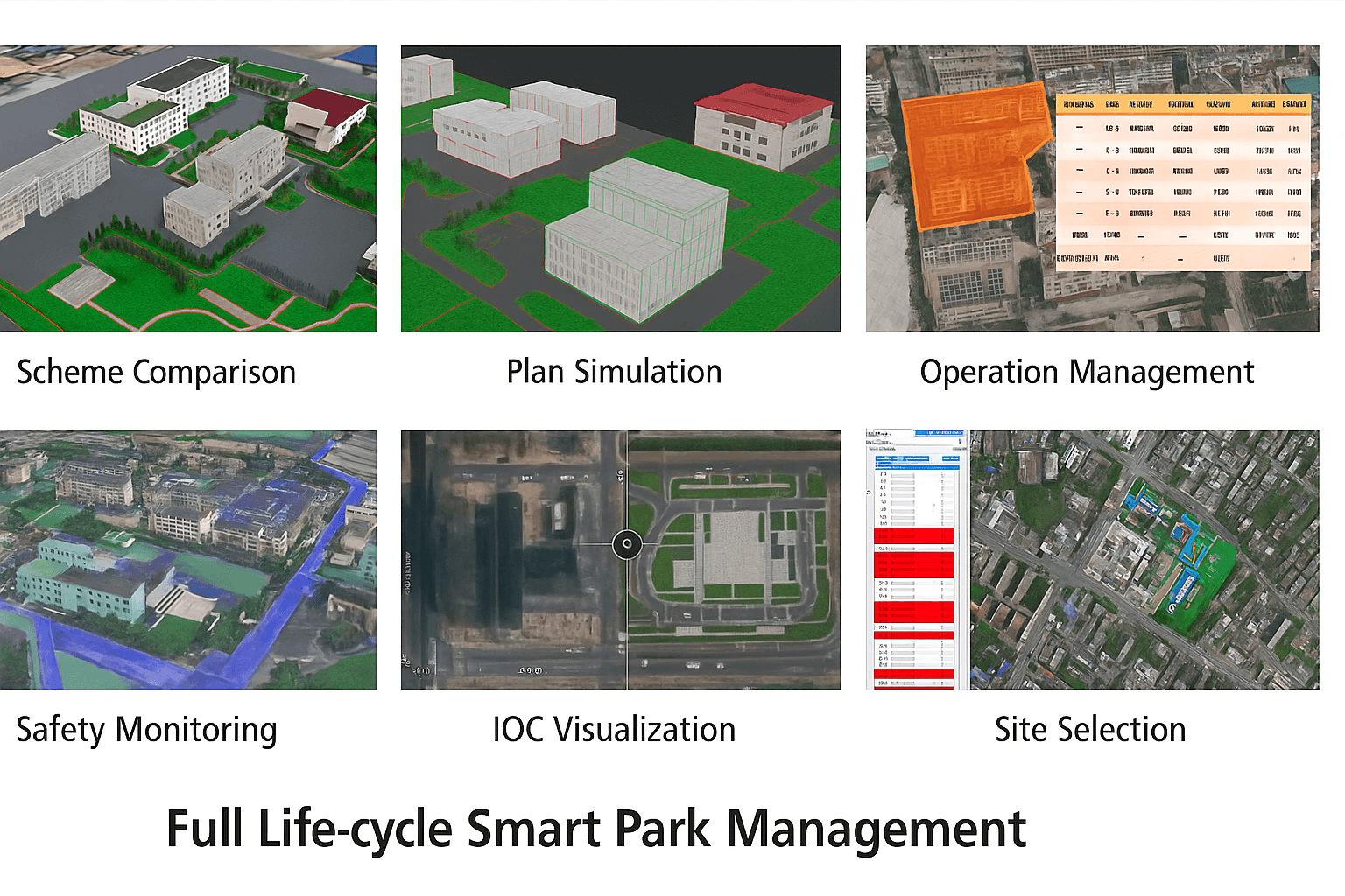
C. Full Life-cycle Smart Park Management
For developments like Smart Parks, the digital twin provides refined management through the entire process: planning (scheme comparison), construction supervision (plan simulation), operation management (safety, assets, environment via an IOC), and investment attraction (site selection visualization).
V. Why Choose XRTech Group for 3D City Models
We are a leader in high-accuracy 3D solutions due to unparalleled satellite access, processing power, and competitive advantages.
| Competitive Advantage | Details |
|---|---|
| Unmatched Accuracy | Our models are derived from sub-meter resolution imagery (down to 0.3m/px) and corrected using engineering-grade DEMs with ±3m vertical RMSE. |
| Industry-Leading Speed | We deliver custom DEM data (the 3D foundation) in under 21 days, accelerating project timelines. Raw imagery is often delivered in under 7 days. |
| Global Access & Capacity | We guarantee complete global coverage with access to a constellation of 130+ satellites. Our cloud platform can process 50 TB of data daily with 60 PB storage. |
| No Export Delays | As a non-U.S. provider, we avoid export control bottlenecks, meaning you get your data 2x faster than Maxar or Airbus vendors. |
| AI Integration | Models are enhanced by AI-powered analytics and automated tools like AI Building Contour Extraction for maximum precision and automation. |
| Seamless Integration | Data is delivered in industry-standard formats (GeoTIFF, SHP, DWG, UTM) for seamless compatibility with your existing GIS and CAD workflows. |
| Trusted Partnership | We are the global distributor for China Siwei Surveying and Mapping Technology Co., Ltd, leveraging decades of experience and robust ground infrastructure. |
VI. Contact XRTech Group
Ready to start your project with high-accuracy 3D terrain data? Contact XRTech Group today to explore custom 3D City Models and Digital Twins tailored to your specific needs!