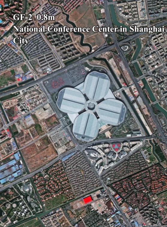
GF-2 Satellite Imagery
Launched on August 19, 2014, the GF-2 satellite provides powerful sub-meter high-resolution imagery. It is engineered for a wide range of applications, including geographical mapping, land surveying, and near-realtime environmental monitoring. With its 0.8m panchromatic resolution and a wide 45km swath, GF-2 is a cornerstone of modern remote sensing.

Resolution
0.8m Pan
Revisits
5 Days
Swath Width
45 km
Accuracy
<50m (No GCP)
Bands
5
Mission Life
5-8 Years
Technical Specifications
| Launch Date | August 19, 2014 |
| Panchromatic Resolution | 0.80m (at nadir) |
| Multispectral Resolution | 3.24m (at nadir) |
| Swath Width | 45 km |
| Positioning Accuracy | <50m (without GCP) |
| Altitude | 631 km |
| Orbit Type | Sun-Synchronous |
| Revisit Capacity | 5 days |
| Dynamic Range | 10-bit |
| Spectral Bands | Pan: 450-900 nm Blue: 450-520 nm Green: 520-590 nm Red: 630-690 nm NIR: 770-890 nm |
Features and Benefits
- Sub-Meter Resolution: The 0.8m panchromatic imagery provides excellent detail for feature identification and accurate mapping.
- Wide Swath Coverage: A 45km swath width allows for efficient collection over large areas, making it ideal for regional projects.
- Reliable Revisit Cycle: A 5-day revisit capability enables consistent monitoring of ongoing projects and environmental changes.
- Proven Technology: As a long-serving satellite, GF-2 provides a deep and reliable archive of historical imagery for change analysis over time.
Applications
Why Choose XRTech Group for GF-2 Imagery?
We provide more than just satellite data; we deliver comprehensive solutions tailored to your project's specific needs, ensuring you get actionable insights quickly and efficiently.
Expert Consultation
Our geospatial experts provide a free consultation to understand your needs and recommend the best acquisition parameters to ensure optimal results for your project.
Rapid Delivery
Leveraging our direct partnership and access to a vast 130+ satellite constellation, we offer fast turnaround times, delivering imagery in days, not weeks.
Seamless Integration
We deliver data in industry-standard formats (like GeoTIFF) compatible with your GIS, CAD, or modeling software, with a team ready to support your workflow.
GF-2 Sample Imagery