GF-3 SAR Satellite Imagery
The GF-3 constellation is a cornerstone of modern remote sensing, providing high-resolution C-band Synthetic Aperture Radar (SAR) imagery. Its ability to see through clouds, smoke, and darkness makes it an indispensable tool for reliable, all-weather, day-and-night Earth observation, from maritime surveillance to critical infrastructure monitoring.

Resolution
1m - 500m
Revisits
< 1 Day
Swath Width
10 - 650 km
Sensor
C-Band SAR
Imaging Modes
12
Mission Life
8 Years
Technical Specifications
| Launch Dates | GF-3 01 (Aug 2016), GF-3 02 (Nov 2021) |
| Altitude | 755 km |
| Orbit Type | Sun-Synchronous |
| Mission Lifetime | 8 years |
| Sensor Band | C-Band SAR |
| Revisit (Constellation) | Less than 1 day |
| Imaging Modes |
|
Features and Benefits
- All-Weather Reliability: GF-3 SAR penetrates clouds, fog, and smoke, providing crucial data in conditions where optical sensors fail.
- Versatile Imaging Modes: With 12 modes and multiple polarizations, GF-3 can be tailored for any application, from high-resolution site monitoring to wide-area maritime surveillance.
- Millimeter-Scale Change Detection: Ideal for Interferometric SAR (InSAR) applications, allowing for the detection of minute surface movements to monitor infrastructure health and geological hazards.
- High Resolution & Wide Coverage: Offers the flexibility to zoom in with 1m resolution for detailed analysis or zoom out with a 650km swath for regional oversight.
Applications
Why Choose XRTech Group for GF-3 SAR Imagery?
We provide more than just satellite data; we deliver comprehensive solutions tailored to your project's specific needs, ensuring you get actionable insights quickly and efficiently.
Expert Consultation
Our geospatial experts provide a free consultation to understand your needs and recommend the best acquisition parameters to ensure optimal results for your project.
Rapid Delivery
Leveraging our direct partnership and access to a vast 130+ satellite constellation, we offer fast turnaround times, delivering imagery in days, not weeks.
Seamless Integration
We deliver data in industry-standard formats (like GeoTIFF) compatible with your GIS, CAD, or modeling software, with a team ready to support your workflow.
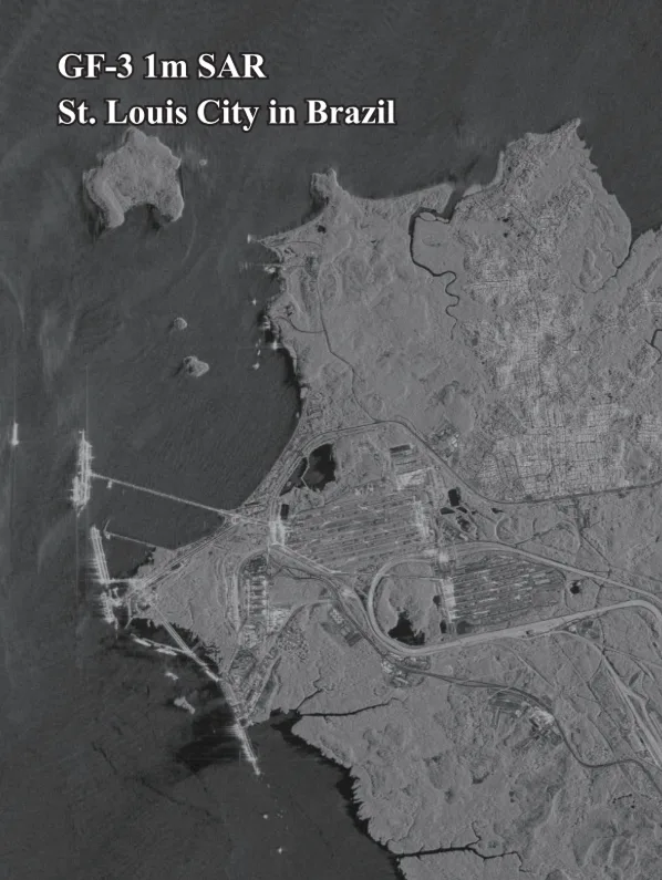
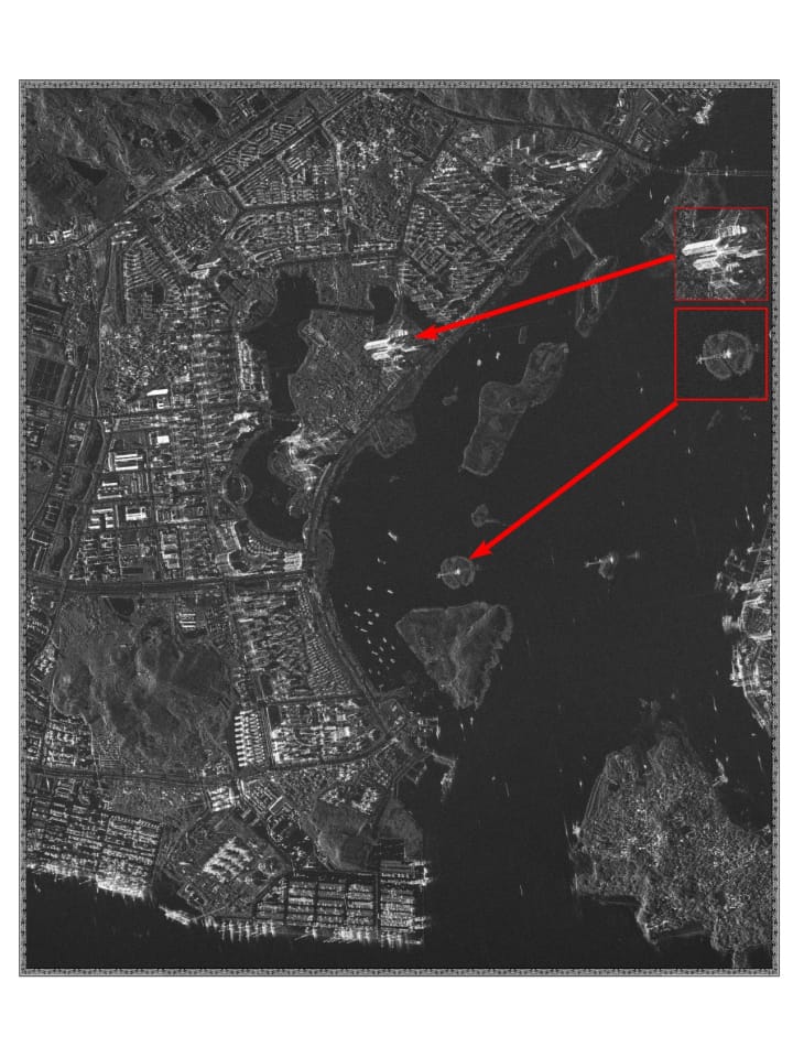
GF-3 SAR Sample Imagery