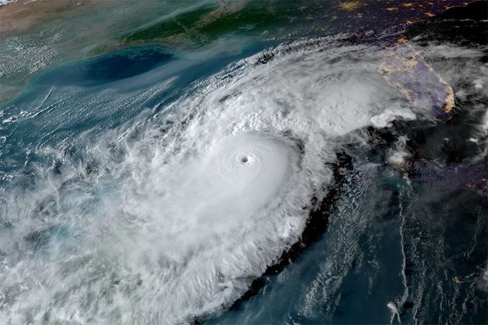
Satellite Hurricane Imaging
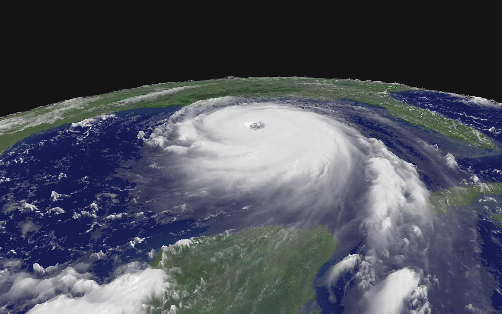
Satellite imagery for hurricane planning gives governments, state agencies, and emergency responders a powerful way to prepare before a storm hits.
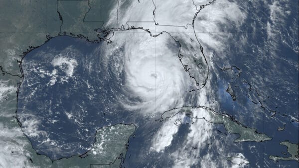
These satellite images of hurricane show which areas might be at risk and help identify what kind of land could get flooded based on the hurricane’s strength.
When they know this, local planners can focus on the areas that need the most protection and support.
Using this kind of hurricane imaging, emergency teams can see where past disasters happened.
They can also look at which areas might be in danger again, and how much damage was caused in previous hurricane.
This kind of information is important because it helps people make better choices to stay safe and reduce damage.
Before a hurricane, satellite maps show patterns and possible impact zones, so communities can prepare early.
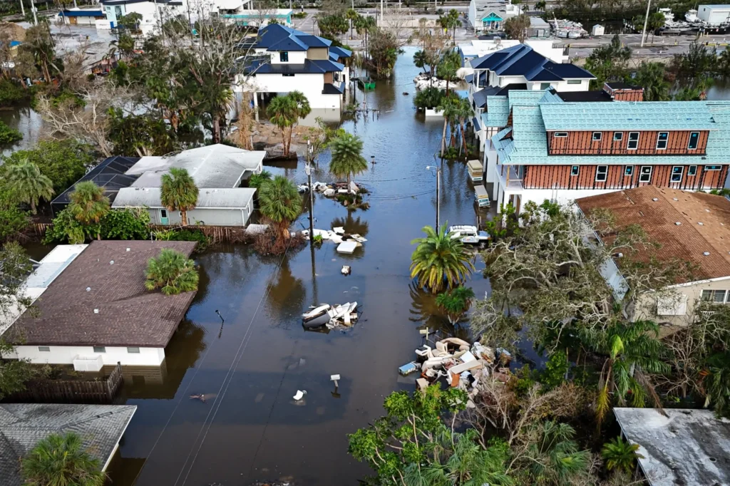
After the storm has passed, the same maps help show what changed—like flooded areas, damaged roads, or lost trees.
It also helps track how quickly the area is recovering, which is important for long-term rebuilding plans.
Get Real-Time Hurricane Imagery with XRTech Group
Stay ahead of the storm. Contact XRTech Group today to access high-resolution satellite imagery for hurricane tracking and damage assessment that supports faster, smarter decisions. Request a Demo Now!
How Satellite Imaging of Hurricane Works
Hurricane imaging works by using satellites and radar tools to watch the storm closely. This helps experts learn more about the storm’s size, speed, and where it’s going next.
Knowing these details makes it easier to warn people early and plan smart actions to protect homes, roads, and lives.
Satellite Imagery for Hurricane monitoring is not just for weather scientists. It’s a useful tool for local officials, emergency crews, and even schools and businesses to stay informed and make better decisions when a storm is near.
5 Different Types of Satellite Hurricane Imagery
There are several kinds of satellite imagery for hurricane tracking that help experts and emergency teams stay prepared and alert. Each type shows a different part of the storm, so when they are used together, they give a full picture of what’s happening in the sky and on the ground.
1. Visible Satellite Imagery
This kind of imagery works like a regular camera in space. It captures the sunlight reflecting off the clouds and the Earth. It’s very helpful during the day because it shows the size and shape of the hurricane in clear detail. You can actually see the swirling cloud patterns and even the eye of the storm if it’s strong enough.
2. Infrared (IR) Satellite Imagery
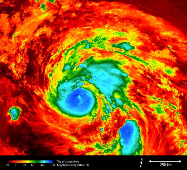
Infrared imagery is used to measure temperature, which helps spot how cold the tops of the storm clouds are. Colder clouds usually mean taller and stronger thunderstorms. This type works both day and night, so it’s very useful when tracking storms at any hour. It helps forecasters see how intense a hurricane might be getting.
3. Water Vapor Imagery
This type of hurricane imaging shows how much moisture is in the air. It’s important because hurricanes grow stronger in moist environments. Water vapor imagery helps meteorologists understand where the storm might be moving next and whether the conditions are right for it to get stronger.
4. Radar from Space
Some satellites carry special radar systems that can see through clouds and rain. These images show wind speeds, rainfall, and even surface flooding in some cases. This type is great for checking how much damage has been done during or after a storm.
5. Microwave Satellite Imagery
Microwave imagery looks deep into the hurricane’s core. It helps scientists see the rainbands and the inner structure of the storm, even through thick clouds. This helps them know if a hurricane is getting stronger or starting to fall apart.
Each type of satellite hurricane imagery adds a new layer of understanding. When used together, they help emergency planners and weather experts make better, faster decisions that can save lives and protect communities.
Uses of Hurricane Satellite Imagery
Satellite imagery for hurricanes plays a powerful role in protecting lives and guiding communities before, during, and after a storm. By capturing what’s happening from space, these images support many important actions that help reduce risk and speed up recovery.
Damage and Recovery Assessments
High-resolution hurricane imaging allows emergency teams and governments to clearly see damage across affected areas. When the images are detailed enough, they can even show the condition of individual buildings, roads, and bridges. For example, if a hurricane causes roof damage or bridge failure, that can be spotted from space. In cases of widespread flooding, even moderate-resolution imagery can help map the water’s reach and support faster response planning. These insights help teams know where to focus their repair work and where people might need the most help.
Early Warning and Evacuation
As a hurricane forms and begins to move, satellite images help track its path and strength. This real-time view gives weather experts the chance to alert local and state authorities early. With that information, evacuation plans can be activated in time to get people to safety. These early warnings save lives by giving communities enough time to prepare or leave before the storm hits.
Research and Forecasting
Scientists use satellite imagery for hurricane research to better understand how storms form and grow. By watching past hurricanes and comparing them to new ones, forecasting models improve. This helps meteorologists predict not only where the storm will go but how strong it might become. Better forecasts mean better decisions for everyone involved—from local leaders to everyday families.
Emergency Response
Once a hurricane passes through, the real work begins. Satellite images show the areas hit hardest, allowing emergency teams to respond faster and more accurately. These maps help guide search-and-rescue operations, place relief centers, and support the delivery of food, water, and medical aid. The clear view from above helps responders stay organized and focused on the areas that need help the most.
Supporting Insurance Claims
After a hurricane, many families and businesses depend on quick insurance responses. Hurricane imaging helps insurance companies see the damage clearly and confirm what happened. With high-resolution satellite photos, they can verify claims faster without always needing in-person inspections. This speeds up the process so people can get the help they need without long delays.
Urban Planning and Reconstruction
Rebuilding after a storm isn’t just about fixing what’s broken. It’s also a chance to make things stronger and safer for the future. Data from satellite imagery for hurricane damage helps city planners see which areas were hit hardest and why. With this information, communities can rebuild in smarter ways—like stronger roads, better drainage systems, or safer housing locations.
Environmental Impact Assessment
Hurricanes don’t only affect people—they also reshape nature. Satellite images help scientists and environmental teams track things like beach erosion, flooding in forests, or damage to wetlands. This helps them protect wildlife, clean up pollution, and restore damaged ecosystems. Keeping an eye on the environment ensures healthier communities in the long run.
Infrastructure Monitoring
Big structures like bridges, dams, and highways must be safe after a storm. Satellite imagery for hurricane recovery includes technology like InSAR, which helps detect small shifts or damage in these structures. This means safety teams can check if anything has moved or cracked, even if it’s not visible from the ground. Spotting these problems early helps prevent bigger disasters later.
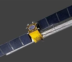
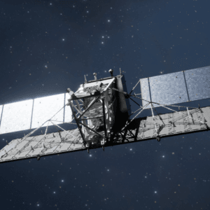
XRTech Group’s Satellite Constellation for Hurricane Imaging and Damage Assessment

When it comes to satellite imagery for hurricane monitoring and damage assessment, XRTech Group delivers unmatched precision and reliability. Our satellite constellation plays a vital role in helping governments, emergency agencies, and disaster response teams respond quickly and effectively when hurricanes strike.
XRTech Group provides access to over 120 satellites with advanced imaging capabilities. These satellites are equipped to capture high-resolution hurricane imagery, with detail levels as fine as 0.3 meters per pixel. This level of clarity is essential for assessing destruction to buildings, roads, and infrastructure after a storm.
Our satellite network ensures accurate, timely, and frequent coverage of hurricane-prone areas. Below are the standout satellites from our constellation that are specifically beneficial for hurricane imaging and mitigation efforts:
1. SuperView Neo-1
This satellite provides exceptionally high resolution at 0.3m per pixel and can revisit the same area daily in middle and high latitudes. It captures images in Panchromatic, Red, Green, Blue, and NIR spectral bands. Because of its fast revisit rate and detail, it’s ideal for rapid damage detection, ongoing monitoring, and recovery planning after a hurricane.
2. SuperView-1
With a resolution of 0.5m per pixel and daily revisit capability, SuperView-1 captures high-quality imagery in Panchromatic, Red, Green, Blue, and NIR bands. This consistent coverage is especially helpful for tracking ongoing changes in hurricane-impacted regions and supporting fast response actions.
3. SuperView-2
SuperView-2 delivers 0.4m per pixel resolution and revisits every three days. What sets it apart is its wide multi-spectral coverage, including Panchromatic, Purple, Yellow, Red Edge, Red, Green, Blue, NIR1, and NIR2 bands. This range makes it valuable for environmental impact assessments, helping analysts understand the effects of hurricanes on both natural and urban areas.
4. GF-3 SAR
This is a Synthetic Aperture Radar (SAR) satellite with 1m per pixel resolution and a 10-day revisit. Operating in C-band SAR, GF-3 SAR can penetrate cloud cover and capture images in darkness, making it extremely reliable for storm tracking and post-storm analysis, especially when optical satellites face weather-related limitations.
5. LT-1 SAR
Also equipped with SAR technology, LT-1 SAR offers 3m per pixel resolution with an 8-day revisit (or 4-day with 2 satellites). Operating in the L-band SAR, it provides all-weather, day-and-night coverage that is crucial during hurricane season. It helps emergency teams get accurate information when visibility is low and time is critical.
At XRTech Group, our platform doesn’t just stop at satellite access. We also offer:
Real-time satellite tasking, allowing users to request fresh imagery based on live situations
A comprehensive satellite imagery archive, giving users access to historical data for trend analysis
Real-time awareness, so decision-makers always have updated visuals during emergency events
These features ensure that the data collected is timely, useful, and impactful for hurricane imaging, risk analysis, and recovery efforts. The high-resolution satellite maps we provide deliver essential geospatial insights that enable emergency response teams to assess damage quickly, prioritize recovery, and guide rebuilding with confidence.
🌪️ Strengthen Your Hurricane Response Strategy
Whether you’re a government agency, emergency planner, or insurer, XRTech’s satellite solutions help you see the full picture. Get accurate, timely hurricane imaging data when it matters most.
📞 Schedule a Free Consultation Here
FAQS for Satellite Hurricane Imaging
1. What is hurricane imaging?
Hurricane imaging is the process of capturing satellite or radar images to monitor, track, and assess hurricanes. It helps experts understand storm patterns, damage areas, and plan emergency responses.
2. How is satellite imagery used for hurricanes?
Satellite imagery for hurricane tracking shows where the storm is going, how strong it is, and what areas are at risk. These images help governments, weather agencies, and emergency teams prepare and respond quickly.
3. Why is high-resolution satellite imagery important during hurricanes?
High-resolution satellite imagery helps spot damaged buildings, flooded roads, and affected communities in great detail. It provides a clear view from above that supports faster and smarter decision-making after a storm.
4. Can satellites see hurricanes at night or through clouds?
Yes, Synthetic Aperture Radar (SAR) satellites can capture hurricane images at night and through thick clouds. These radar-based satellites are perfect for hurricane imaging in tough weather conditions.
5. How do emergency teams use hurricane satellite imagery?
Emergency response teams use hurricane imaging to identify the most affected areas, check road conditions, and plan rescue or relief missions. It helps them act faster and save more lives.
6. Which satellite types are best for hurricane monitoring?
Optical satellites like Superview and radar satellites like GF-3 SAR or LT-1 SAR are often used. They offer high-resolution and frequent revisit rates, making them ideal for tracking hurricane development and damage.
7. Can hurricane imaging help in planning evacuations?
Yes. By showing the storm’s path and risk zones, satellite imagery helps governments plan safe evacuations, inform people early, and reduce panic before a hurricane hits.
8. How often can satellites capture images during a hurricane?
Some satellites revisit the same location daily or even multiple times a day. This helps track fast-changing hurricane conditions in near real-time.
9. How do insurance companies use hurricane satellite imagery?
Insurance providers use satellite images to quickly verify claims, check damage levels, and settle payouts faster after a storm, which helps people recover sooner.
10. Is hurricane imaging useful after the storm passes?
Absolutely. After the hurricane, imaging helps monitor recovery progress, identify long-term damage, and assess how well response efforts are working.
11. Can satellite hurricane imagery be used for research?
Yes. Researchers use past and present satellite data to study how hurricanes form, grow, and move. This improves forecasting models and long-term weather predictions.
12. Where can I get access to satellite imagery for hurricane monitoring?
You can access high-resolution hurricane imaging through XRTech Group’s satellite platform. It offers real-time monitoring, archived data, and on-demand satellite tasking tailored for government, emergency, and private use.

