Unlock Real Estate Potential: Precision High-Resolution Satellite Imagery
Empowering developers, investors, and planners with transformative insights into property, property lines, and neighborhood dynamics to accelerate project lifecycles.
Introduction: The Modern Edge in Real Estate Analytics
The competitive real estate market demands more than just traditional site visits. From assessing new development opportunities to managing existing portfolios, understanding every detail of a property and its surrounding neighborhood is crucial. XRTech Group offers a revolutionary approach, leveraging a vast constellation of satellites to provide comprehensive, actionable intelligence. Our solutions ensure your real estate investments are founded on the most reliable, high-fidelity data available.
Real Estate Challenges & XRTech's Solutions
Addressing the unique challenges in real estate data acquisition and analysis with targeted geospatial technology.
Pain Point: Outdated or Inaccurate Property Information
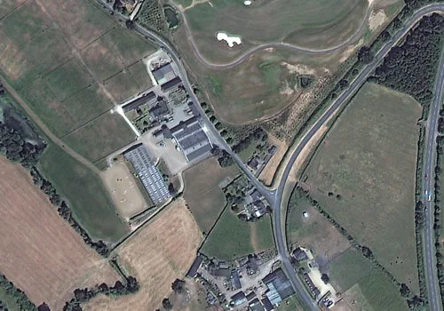
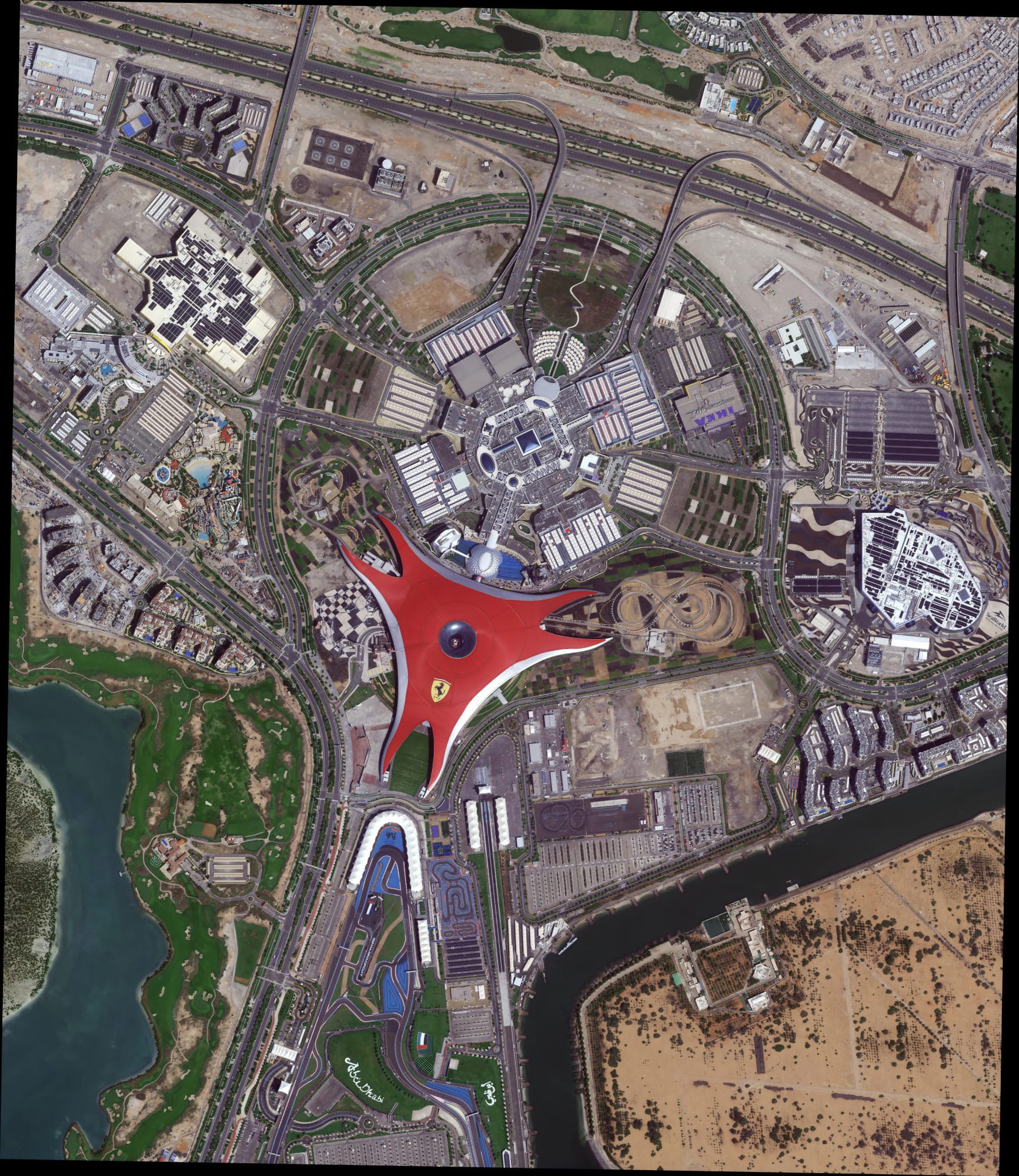
XRTech Solution: We provide current, high-resolution satellite imagery down to 0.3m/px (Superview Neo-1), ensuring the freshest data for property lines. Our archives dating back to 1999 enable historical analysis.
Pain Point: Difficulty Assessing Remote or Large Properties
XRTech Solution: Our global coverage from over 130 satellites ensures no location is out of reach. We generate high-quality DEM, DSM, and DTM data for any location on Earth.
Pain Point: Unauthorized Construction or Encroachment
XRTech Solution: Real-time monitoring of urban expansion and AI-powered building contour extraction helps identify unauthorized constructions early with regular satellite revisits.
Pain Point: Slow Due Diligence & Project Delays
XRTech Solution: Fast turnarounds for imagery (under 7 days) and DEMs (under 21 days). Our non-U.S. provider status eliminates export license delays for faster data access.
Pain Point: Workflow Incompatibility
XRTech Solution: We deliver data in ready-to-use formats like GeoTIFF, SHP, DWG, and UTM, ensuring seamless integration into existing GIS/CAD workflows.
Unmatched Benefits for the Real Estate Sector
By integrating our advanced satellite imagery, real estate professionals gain a significant competitive advantage.
Superior Accuracy & Detail
Achieve sub-meter resolution (0.3m/px) for clear views of vehicles, materials, and fine details on property lines.
Enhanced Speed & Efficiency
Rapidly acquire imagery in under 7 days. Satellites like GF-4 can revisit an area every 20 seconds for continuous monitoring.
Cost-Effectiveness
Reduce the need for extensive on-site teams and manual surveys, with competitive pricing to fit any project budget.
Comprehensive Coverage
Our satellite constellation offers global coverage for wide-area assessments, ensuring data availability for any location.
All-Weather Capabilities
SAR satellites penetrate clouds, smoke, and darkness, ensuring continuous monitoring regardless of weather conditions.
Fraud Reduction
Precise and unbiased data helps identify discrepancies and reduce fraud in property inspections and claims verification.
Applications of High-Resolution Satellite Imagery in Real Estate
Our advanced geospatial solutions offer a wide array of applications for the real estate industry.
1. Property Acquisition & Development
- Site Selection & Feasibility: Rapidly assess potential development sites using satellite imagery to analyze land suitability, terrain, and identify optimal project locations.
- Environmental Impact Assessment: Monitor land use, water bodies, and pollution around potential sites using multispectral imagery for environmental compliance.
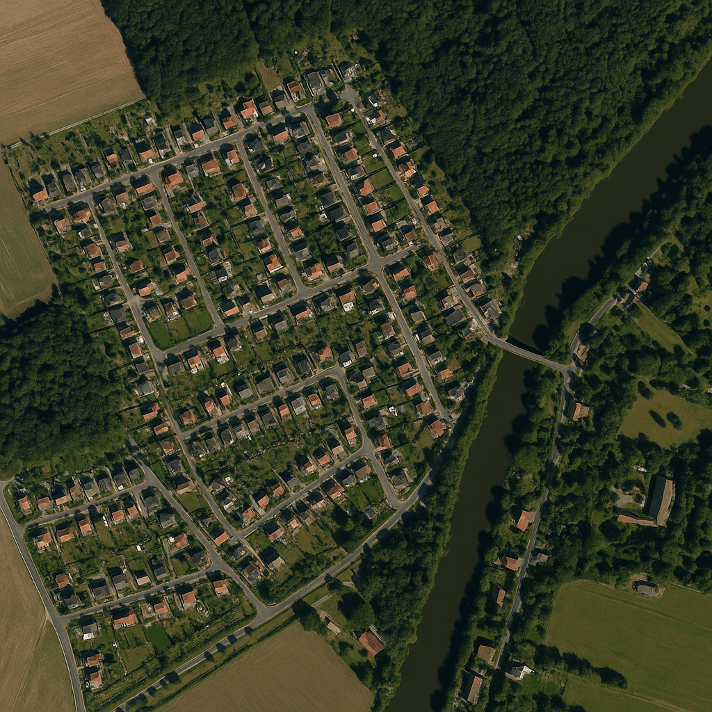
- Market Analysis & Neighborhood Profiling: Gain insights into neighborhood characteristics, amenities, population density, and growth patterns.
2. Property Management & Inspection
- Remote Property Inspection: Streamline inspections of fields, forests, or residential areas. Verify property boundaries, identify illegal constructions, and assess current land use.
- Historical Analysis: Access imagery archives dating to 1999 to track infrastructure development and long-term property alterations.
- Insurance Claims & Risk Assessment: Utilize satellite imagery for insurance companies for risk assessment, claims verification, and post-disaster impact analysis.
3. Real Estate Valuation & Sales
- Accurate Property Valuations: High-resolution imagery provides objective insights for more accurate property valuations.
- Marketing & Visualization: Create stunning aerial views, 3D city models, and digital twins to enhance marketing materials and provide immersive virtual tours.
- Dispute Resolution: Objective imagery serves as critical evidence in property line disputes.
4. Urban Planning & Infrastructure Monitoring
- Smart City Zoning: Utilize imagery and AI for precise urban planning, zoning, and growth projections within a neighborhood.
- Neighborhood Environmental Monitoring: Track urban air and water quality to support sustainability goals with multispectral data.
- Infrastructure Inspection: Remotely inspect and prioritize maintenance for utilities and roads. InSAR technology detects millimeter-level deformation in bridges and buildings.
Our Satellite Features for Real Estate
We deliver high-impact, scalable solutions by leveraging cutting-edge satellite imagery for real estate.
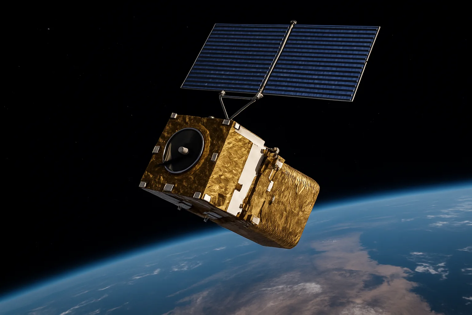
XRTech Group Satellite Constellation
VHR Optical Satellites
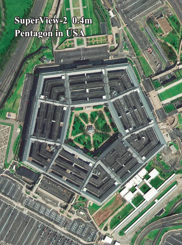
- Superview Neo-1: 0.3m/px
- Superview-2: 0.4m/px
- Superview-1: 0.5m/px
HR Optical Satellites
- GF-7: 0.65m/px
- GF-2: 0.8m/px
Wide-Swath Optical
- GF-6: 2m/px
- ZY-3: 2m/px
- GF-4: 50m/px (20s revisit)
Radar (SAR) Satellites
- GF-3 SAR: 1m/px (C-band)
- LT-1 SAR: 3m/px (L-band)
Hyperspectral Satellites
- GF-5B: 30m/px
- ZY-1 02D: 30m/px
Specialized Satellites
- CBERS-04 / 04A
Value-Added Products for Real Estate
Imagery Types & Spectral Bands
Panchromatic, Multispectral (RGB, NIR, Red Edge), Infrared, Hyperspectral, and Radar (SAR) imagery to support diverse analyses from checking property lines to assessing environmental health.
Advanced Data Products
We transform raw imagery into powerful tools: Digital Orthophoto Maps (DOM), Digital Surface Models (DSM), Digital Elevation Models (DEM), Digital Terrain Models (DTM), and 3D City Models for comprehensive planning and analysis.
Purpose & Impact: Transforming Real Estate Decisions
Our purpose is to empower real estate professionals with clarity and confidence. By providing accurate, timely, and comprehensive geospatial data, we help you:
Optimize Property Investments
Make informed decisions on acquisitions, development, and portfolio management.
Streamline Operations
Reduce manual effort in inspections and surveys, saving time and costs.
Mitigate Risks
Identify potential issues like unauthorized constructions or environmental hazards early.
Enhance Transparency
Provide objective data for stakeholders, fostering trust and accountability.
Why Choose XRTech Group: Your Trusted Real Estate Geospatial Partner
Choosing XRTech Group means partnering with a leader in geospatial solutions, dedicated to empowering your real estate ventures.
Unmatched Satellite Access
We leverage access to over 130 satellites, providing comprehensive coverage for any type of land or weather condition.
Industry-Leading Accuracy
Our high-resolution imagery (down to 0.3m) and precise DEMs (±3m RMSE) guarantee the accuracy needed for crucial decisions.
Rapid Delivery & No Delays
As a non-U.S. provider, we ensure faster data access by avoiding export control bottlenecks—often 2x faster than other vendors.
AI-Powered Analytics
We transform raw data into actionable insights for smarter planning, property assessment, and risk management.
Competitive & Transparent Pricing
Archive images from USD 20/km² and new tasking from USD 30/km² for 30cm-level resolution. We also offer a 30-Day Money-Back Guarantee.
Trusted Expertise
Our solutions are trusted by governments, NGOs, and enterprises across the Middle East, Africa, and globally.
Contact XRTech Group Today for Your High-Resolution Real Estate Imagery!
Unlock the full potential of your real estate projects. From precise property line mapping and detailed neighborhood analysis to 3D city modeling and infrastructure monitoring, we provide the accuracy and insights you need to succeed.
The Plaza, Radisson Blu Hotel, Dubai Deira Creek, Dubai UAE
Call Us: +971 58 885 3151