
Tailings Dam Monitoring with InSAR & AI
Tailings Dam Monitoring: How Advanced Satellite Intelligence Is Transforming Tailings Dam Safety Tailings dams are among the most critical—and high-risk—structures
Understanding Where Do Satellites Orbit and How Do Satellites Move Around Earth
Satellites are an essential part of our daily lives. From navigation to weather forecasting, communication to scientific research, satellites enable countless services we rely on. But how do satellites orbit the Earth? Where do satellites orbit exactly, and how do satellites move through space without falling back to Earth or drifting away? This blog will explain satellite orbits clearly, with new insights for 2026 and beyond.
An orbit is simply the path a satellite follows as it moves around a planet like Earth. It’s like a cosmic racetrack, with satellites constantly moving so gravity pulls them inward while their speed tries to fling them outward. This balance keeps them circling rather than crashing or floating off into space. Understanding how does a satellite orbit the Earth means knowing about gravity, speed, and altitude working together.
Where do satellites orbit? They circle Earth at different altitudes and speeds depending on their mission. Some orbit close, others far away, and the way they move orbits shapes what they can see and how they serve us.
Before discussing how do satellites orbit the Earth, it’s important to understand where Earth’s atmosphere ends and space begins. Space isn’t as far as most imagine. The boundary is generally accepted to be the Kármán Line, about 100 kilometers (62 miles) above sea level. This is where the atmosphere thins out, and the air becomes too thin for airplanes to fly effectively.
Although commercial airplanes fly at around 11 kilometers, weather balloons reach about 50 kilometers, satellites start orbiting above 160 kilometers, well beyond where the air is dense. So, satellites orbit beyond most of the atmosphere, allowing them to move with little air resistance.
The question of how do satellites move is answered by understanding the delicate balance between Earth’s gravity pulling the satellite down and the satellite’s forward speed pushing it away. Imagine throwing a ball straight ahead; gravity will pull it down, and it will fall to the ground. But if you throw the ball fast enough sideways, it will keep missing the ground because Earth curves away beneath it. This is essentially what a satellite does.
Satellites are launched with precise speeds to achieve a stable orbit. If the speed is too slow, they fall back to Earth. If it’s too fast, they escape Earth’s gravity and drift into space. This speed and gravity balance makes satellites revolve continuously in their orbits.
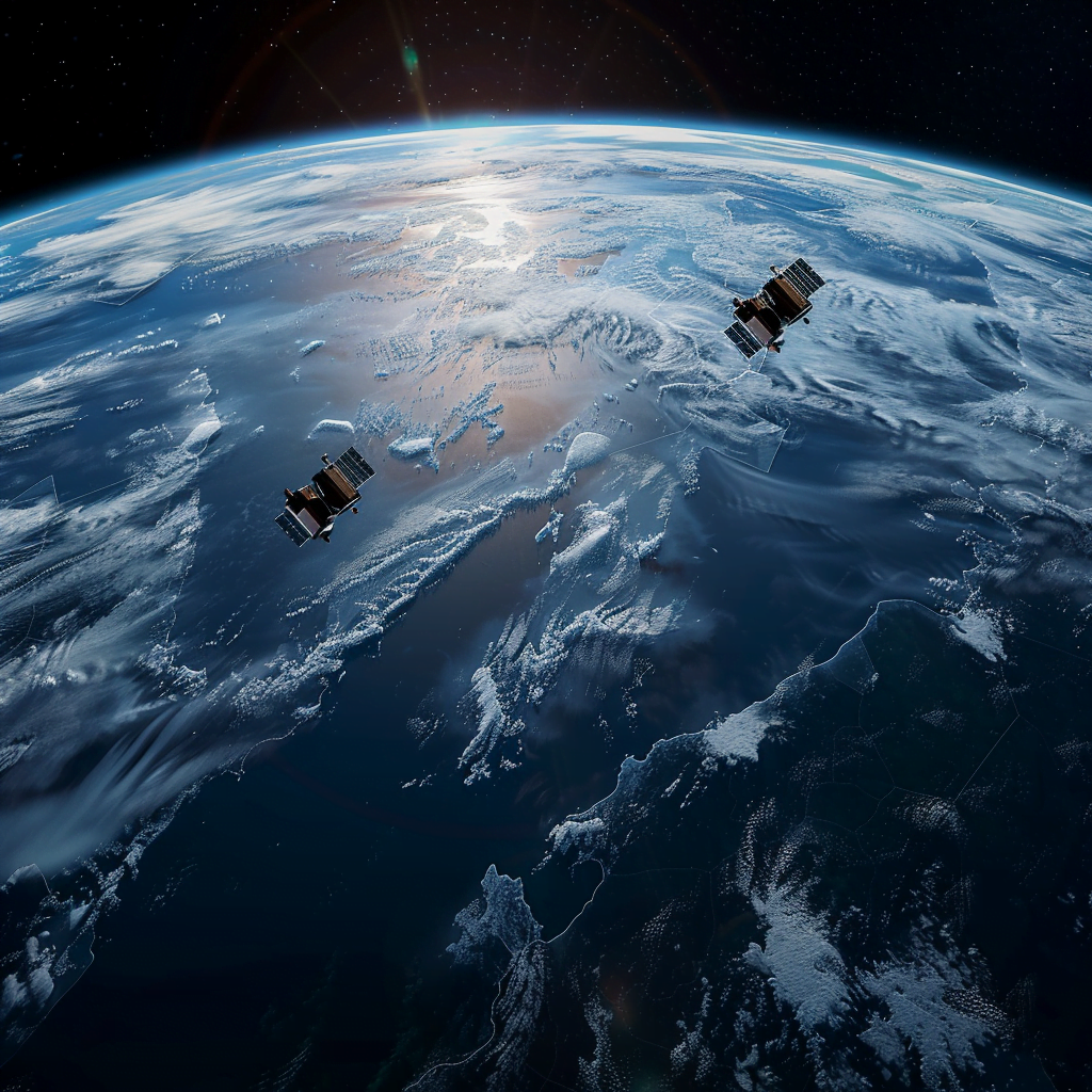
Satellites don’t all orbit in the same place or the same way. How do satellites orbit the Earth depends heavily on their altitude and mission. These different orbits give satellites unique advantages.
Satellites in Low Earth Orbit circle the Earth between approximately 160 kilometers (100 miles) and 2,000 kilometers (1,240 miles) above the surface. This region is crowded with satellites because of its closeness to Earth, which offers high-resolution images and quick communication.
Most Earth observation satellites and the International Space Station (ISS) orbit in LEO. These satellites move extremely fast—about 28,000 kilometers per hour (17,500 mph)—completing one orbit roughly every 90 minutes. Because of this speed, a satellite in LEO passes over the same point on Earth only briefly.
LEO satellites don’t need constant power to maintain speed due to the thin atmosphere and near vacuum conditions. However, satellites in LEO experience more drag than higher orbits and therefore have shorter lifespans before they need replacement.
Because of the speed and low altitude, where do satellites orbit in LEO means they provide low latency signals, ideal for internet services, satellite phones, and rapid data collection.
MEO satellites orbit between 2,000 and 36,000 kilometers above Earth. This range includes the altitudes used by navigation satellite systems like GPS, GLONASS, and Galileo. At this height, satellites travel slower than LEO but still cover large areas of the Earth’s surface.
Satellites in MEO typically orbit every 6 to 12 hours. Their location balances coverage area and signal delay, making them excellent for positioning and timing services we depend on for navigation.
One of the most remarkable orbits is the geostationary orbit, located about 36,000 kilometers (22,236 miles) above Earth’s equator. Satellites in GEO revolve around Earth at the same speed Earth spins. This unique motion means these satellites appear fixed over a single point on Earth.
Because they don’t move relative to the ground, satellites in GEO provide continuous coverage over large areas, ideal for TV broadcasting, weather monitoring, and communications. This convenience means ground antennas don’t have to track the satellite—they can stay pointed in one direction.
The trade-off is signal delay, as signals must travel a longer distance to and from GEO satellites. Still, geostationary satellites are crucial for global communications and real-time monitoring of weather systems.
Some satellites follow highly elliptical orbits that resemble stretched circles. These orbits bring satellites close to Earth at one end (perigee) and far away at the other (apogee). The Molniya orbit is a well-known example, favored for communication satellites covering high-latitude regions like the poles.
Because GEO satellites cannot see the poles well, HEO satellites fill that gap by spending more time over these regions, providing extended coverage in areas where communications are usually difficult.
Satellites that orbit in a sun-synchronous orbit travel in a path that passes over the same part of Earth at the same local solar time. Typically, these satellites orbit between 600 and 800 kilometers altitude.
This consistent sunlight angle makes SSO satellites ideal for Earth observation and environmental monitoring. It allows scientists to compare images over time without shadows or changing lighting confusing the data. This capability supports disaster monitoring, climate studies, and land-use tracking.
Understanding how do satellites orbit the Earth without drifting away or crashing involves exploring the science of orbital mechanics. This field explains the delicate balance of forces and motions that keep satellites moving smoothly around our planet.
When satellites are launched, powerful rockets propel them to specific altitudes and speeds tailored for their mission. This is crucial because where do satellites orbit determines the satellite’s speed and the strength of Earth’s gravity acting upon it. For example, satellites in Low Earth Orbit (LEO), orbiting between about 160 km to 2,000 km above Earth, must travel incredibly fast—up to 28,000 kilometers per hour—to stay in orbit. This speed counteracts the pull of Earth’s gravity, preventing them from falling back to the surface.
Once in space, the rocket separates, and satellites rely on their own onboard systems to maintain their path. These satellites have small thrusters that make tiny adjustments to keep their orbit stable and precise. This is especially important for communication, navigation, and weather satellites, which need to stay in exact positions. These thrusters help satellites correct their course, compensate for gravitational pulls from the Moon and Sun, and avoid collisions with space debris.
The question how do satellites move in orbit also relates to the concept of inertia—the tendency of a satellite to continue moving forward in a straight line. Earth’s gravity continuously pulls the satellite toward the planet, but because of its high forward speed, the satellite keeps “falling around” the Earth instead of directly toward it. This continuous free-fall around Earth creates a stable orbit.
However, how do satellites orbit the Earth without falling is complicated by factors like atmospheric drag. Even in the thin atmosphere of LEO, some air molecules exist, and over time, they slow satellites down. This slow decay means satellites in lower orbits gradually lose speed and altitude. To combat this, satellites perform “station-keeping” maneuvers—small, regular boosts using thrusters to regain lost speed and altitude. These adjustments ensure satellites remain in their intended orbits, extending their operational life.
In higher orbits, such as geosynchronous orbit at about 36,000 km altitude, atmospheric drag is negligible, so satellites can maintain their paths with fewer corrections. These satellites move at the same rate Earth rotates, which means they appear fixed above one spot, enabling consistent communication signals.
In summary, the science of orbital mechanics answers how do satellites orbit the Earth by balancing gravity’s pull and the satellite’s forward motion. Rocket launches provide the initial speed and altitude, while onboard thrusters and careful engineering ensure satellites stay on their paths for years, making modern technology like GPS, weather forecasting, and global communications possible.
As demand for satellite services grows, more satellites are launched, especially into LEO. This expansion creates crowded orbits and increases risks of collisions. When satellites or debris collide, they create even more fragments, worsening the space debris problem.
New satellite constellations, like SpaceX’s Starlink, are adding thousands of small satellites to LEO to provide global internet access. Managing where satellites orbit and how do satellites move safely is a big concern for the space industry. Organizations worldwide are working on guidelines and technologies to track debris and reduce collision risks.
Understanding where do satellites orbit helps explain why some satellites are better suited for certain tasks. For example:
Weather satellites in GEO provide constant views of large weather systems.
Imaging satellites in LEO capture high-detail pictures for mapping and monitoring changes on Earth.
Navigation satellites in MEO offer precise global positioning services.
Communications satellites in HEO ensure service to polar regions.
Knowing how does a satellite orbit the Earth allows engineers to design satellites that meet specific mission needs, optimize fuel use, and extend satellite lifetimes.
Looking ahead, satellite orbits will continue evolving. Advances in propulsion, materials, and miniaturization allow smaller satellites to perform better at lower altitudes. Laser communications promise faster data transfer between satellites and Earth.
AI and machine learning onboard satellites will improve orbit management and collision avoidance. New orbits, such as cislunar (between Earth and Moon) orbits, are gaining interest for future exploration missions.
The growing importance of satellite services for everything from climate monitoring to global internet access means a deeper understanding of orbits and satellite movement will be more valuable than ever.
At XRTech, we make it easy for you to get the power of satellite imagery right where you need it. Whether you’re working in farming, construction, city planning, or disaster response, our satellite solutions help you see the big picture — from above.
High-Resolution Satellite Images
We provide clear, detailed satellite images that show land, water, buildings, and more. You can use them to check changes over time or monitor large areas without needing to visit the location.
Real-Time and Historical Data
Need to know what’s happening now or what happened last year? XRTech gives you access to both real-time satellite data and past satellite images, so you can compare and make better decisions.
Custom Image Analysis
We don’t just give you the image — we help you understand it. Our experts can help you analyze satellite data to find patterns, detect problems, or plan ahead.
Industry Solutions
XRTech supports industries like:
Agriculture – to monitor crops and soil health
Environmental Monitoring – to track deforestation, pollution, or natural changes
Urban Planning – to map cities, roads, or construction sites
Disaster Management – to respond faster to floods, fires, or storms
You don’t need to be a space expert. At XRTech, we provide user-friendly tools and helpful support, so anyone can use satellite imagery with ease.
Contact XRTech today and get free satellite imagery for your project location. Whether it’s a farm, a construction site, or a city block — we’ll help you see it from above with clear, high-quality data.
👉 Contact Us Now to get started — it’s fast, easy, and free!
Satellites orbit Earth thanks to a balance between gravity pulling them inward and their speed pushing them outward. The place satellites orbit depends on their altitude and mission, ranging from low Earth orbit close to the surface to geostationary orbit far above.
Knowing how do satellites orbit the Earth reveals the invisible ballet above us that supports our connected world. With growing satellite numbers, understanding their paths and movement helps keep space safe and services reliable.
At XRTech Group, we keep an eye on these advances, helping clients understand satellite technology and how where do satellites orbit impacts innovations in communications, observation, and beyond.
Tailings Dam Monitoring: How Advanced Satellite Intelligence Is Transforming Tailings Dam Safety Tailings dams are among the most critical—and high-risk—structures

From Visible Light to Spectral Intelligence in Modern Satellite Remote Sensing Satellite imaging has moved beyond photography. For decades, Earth