Join The Satellite Imaging Revolution
Satellite Imagery for Precision Agriculture Mapping
Get up-to-date farm satellite images of your fields 365 days a year with clear agriculture imaging and reliable satellite insights.
Monitor crops in real time with daily farm satellite images. Agriculture satellite imagery helps track crop health, detect changes, and predict yield using multi-temporal data and smart agriculture imaging tools.

XRTech Group provides trusted farm satellite solutions to help farmers manage crops and monitor fields with confidence. The focus is on using accurate agriculture imaging and real-time data from agriculture satellite imagery to support better decisions in every part of the field.
Cloud-Free Monitoring
Clouds are no longer a major concern with daily updated farm satellite images you can rely on
Disease Detection
Catch early signs of crop issues and prevent serious loss using daily agriculture satellite imagery
Accurate Reporting
Create detailed reports and boost risk prediction with daily agriculture imaging data
What Our Satellite Imagery for Precision Agriculture Offers
XRTech Group’s precision agriculture satellite imagery provides daily farm satellite images for reliable crop monitoring and management, even in areas with frequent cloud cover.
Satellite Crop Monitoring & Yield Estimation
Multi-source agriculture satellite imagery enables real-time monitoring of crop growth, health, and maturity. Spectral analysis from farm satellite data helps estimate biomass, track soil moisture, and assess crop yield with up to 85% accuracy at the county level.
AI-powered agriculture imaging: Detect and analyze non-grain land changes, and classify crop types using agriculture satellite imagery with accuracy exceeding 90%.
Satellite Soil, Irrigation & Fertility Monitoring
Remote sensing using agriculture satellite imagery helps monitor soil moisture and fertility, giving accurate data on soil health to support smart irrigation and fertilization strategies.
Satellite Pest and Disease Management
AI-driven models using agriculture satellite imagery detect and classify agricultural risks, enabling timely interventions and reducing crop loss. Accuracy can exceed 90% in specific farm satellite scenarios.
Satellite Meteorological and Disaster Early Warning
Integrated farm satellite data with real-time weather monitoring and early warning systems helps reduce the impact of natural disasters on agriculture using advanced agriculture imaging.
Agriculture Satellite Imaging Strategy
Smart Precision Agriculture Planning with Satellite Imagery
At XRTech Group, our precision agriculture satellite imagery gives farmers and agronomists access to years of high-resolution ready-to-use farm satellite imagery from 130+ Satellites. This helps plan the growing season better by showing crop health, changes in the land, and long-term field trends. With these insights, you can make smart decisions that improve productivity and reduce risks in farming.
Measure and Compare Field Productivity
Use agriculture imaging to understand how each part of your field performs. This helps you plan better, use the right amount of seeds and fertilizers, and manage your fields with confidence.
Define Smart Farming Zones
Use our farm satellite data history to find different zones in your fields. Each zone can be treated based on its unique needs to get better results.
Build Accurate Seeding Plans
Create detailed prescription maps for variable rate seeding. These maps help you plant the right amount in the right place, saving money and increasing yield.


Our agriculture satellite imagery
Monitor Crops and Land with Advanced Satellite Imagery
Check Land Use and Farmland Quality
With high-resolution farm satellite images, you can see different land types and measure how good your farmland is for growing healthy crops.
Monitor Crop Growth and Soil Health in Real-Time
Track how crops are growing and keep an eye on soil moisture and fertility with 85–90% accuracy using our smart agriculture satellite imagery models.
Spot Changes and Keep Farmland Safe
Our AI and satellite agriculture imaging can quickly find changes like new forests, ponds, or greenhouses. This helps you protect your valuable farmland before major problems happen.
Detect Pests, Diseases, and Crop Readiness Early
Our farm satellite tools can spot signs of pests, crop diseases, and even crop maturity early. This helps you harvest at the best time and protect your hard work.
Pricing Plans
Flexible pricing built to match your project scale.
Choose a plan that fits your needs — from rapid response imagery to full-scale DEM + analysis packages. No hidden fees, no license confusion.
51-80cm | Applicable up to 4 bands
- Archive Image (>90 days):
- New Tasking Image:
31-50cm | Applicable up to 4/8 Bands*
- Archive Image (>90 days):
- New Tasking Image:
30cm | Applicable up to 4 Bands
- Archive Image (>90 days):
- New Tasking Image:
30-Day Money-Back Guarantee
Zero risk. Full confidence. We stand by the quality of our data and service. If you’re not satisfied with your deliverables within 30 days, we’ll refund your project — no questions asked.
NDVI Enhanced
Leverage NDVI satellite imaging to monitor crop health, detect stress early, and optimize farm productivity with precision insights.
Project Assistance
Get expert support for agriculture and land monitoring projects, with customized satellite data and reporting tailored to your needs.
Action Research
Use real-time satellite analytics to drive field experiments, crop trials, and smart farming innovations based on accurate observations.
Long-term Planning
Plan for the future with long-term crop monitoring, soil quality tracking, and climate insights powered by multi-season satellite imagery.
Our solutions
Smarter Mapping, Stronger Decisions
XRTech Group delivers powerful data solutions for agriculture, energy, urban planning, and beyond.
Precision Agriculture Imaging Solution
Empowering Smarter Agriculture with Satellite Imagery with Precision
At XRTech Group, we deliver high-resolution satellite imagery, advanced sensors, and trusted providers to transform the future of farming.
What You Get
Real-Time Insight. Actionable Results.
Get a firsthand look at the power of our Earth Observation (EO) data delivery in critical situations. In the example below — Derna, Libya, just 24 hours after devastating floods — we delivered more than just images. We enabled action.
Precisely identified flood extents to support relief operations.
Helped authorities plan safe zones and allocate emergency resources effectively.
Our EO data was delivered within 24 hours — while others were still preparing quotes.
Why Teams Switch to XRTech
Precision, Speed, and Freedom – All in One Platform
Teams around the world are choosing XRTech for Earth Observation data because we go beyond imagery — we deliver mission-ready solutions built for real-world demands.
Access to 130+ Satellites
A powerful constellation including optical, SAR, stereo, and hyperspectral sources ensures coverage across any terrain or condition.
Fast Turnaround Times
Get EO imagery in under 7 days and DEMs in under 21 days, even for large or remote areas.
High Accuracy Outputs
Enjoy sub-meter resolution with CE90 and RMSE specs that meet even the most demanding project standards.
Compatible Data Formats
Delivered in formats you already use — GeoTIFF, SHP, DWG, and UTM — for seamless integration with your GIS or CAD workflows.
No Export License Delays
As a non-U.S. provider, we avoid export control bottlenecks, getting your data to you faster and with fewer restrictions.
Flexible Licensing
Designed to match your operational realities, whether you're mapping a floodplain or planning national infrastructure.
Built for Projects Like Yours
Proven Across Sectors. Trusted Around the World.
XRTech’s Earth Observation capabilities are trusted by governments, NGOs, and enterprises to support real, high-impact work across continents and industries. Our solutions are not theoretical — they’re already making a difference.
Flood & Disaster Mapping
Rapid-response EO imagery enabled critical response efforts in Libya and Southeast Asia, supporting evacuation, assessment, and recovery.
National Infrastructure DEMs
Delivered high-accuracy Digital Elevation Models across Africa to guide large-scale infrastructure and transportation planning.
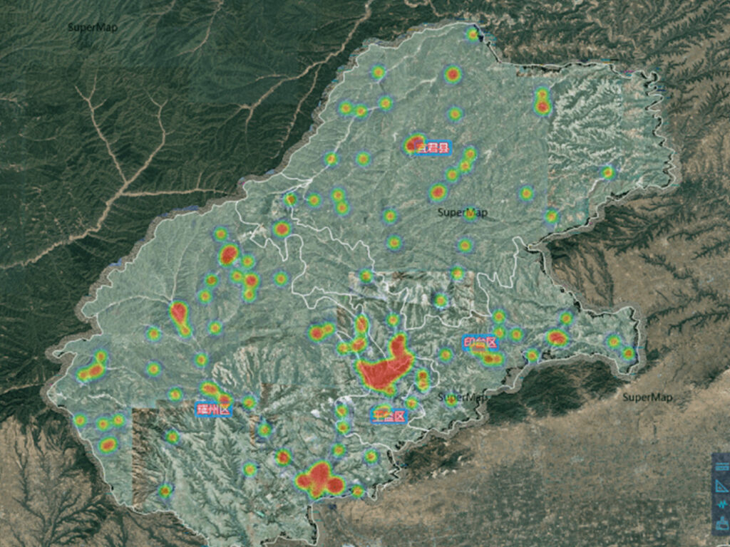
Smart City Zoning
Enabled forward-thinking urban planning in China and Vietnam with high-resolution data tailored for zoning, mobility, and growth projections.
Agricultural Monitoring & Subsidy Validation
Supported crop health tracking and subsidy distribution accuracy in India and Nigeria, combining EO data with local insights.
Border Surveillance
Leveraged SAR and optical fusion to provide persistent, all-weather monitoring of sensitive border regions.
Water Basin Modeling
Delivered detailed modeling for complex water systems like the Yellow River Basin, enhancing hydrological analysis and water resource management.
Specs Snapshot
Engineered for Precision. Delivered for Productivity.
Sub-meter resolution with support for 8-bit, 11-bit, and 16-bit depth — ortho-ready and optimized for analysis.
Available at 2–10 meter spacing with ±3m vertical RMSE, suitable for engineering, hydrology, and land development.
Delivered in industry-standard formats: GeoTIFF, IMG, SHP, DWG, ready for GIS, CAD, or modeling workflows.
Receive your data via secure cloud delivery or physical HDD, depending on your project needs.
Flexible support for WGS84, UTM, or custom coordinate systems.
Simple, project-wide licensing that’s publication-friendly and built for collaborative teams.
Transforming Agriculture with Satellite Imagery and AI: XRTech Group’s Case Study
XRTech Group, we are using the latest farm satellite technology, agriculture imaging solutions, and AI-driven models to change the way farmers manage crops. By combining multi-temporal agriculture satellite imagery with artificial intelligence, we deliver real-time insights across the entire farming cycle — from planting to harvesting — making agriculture smarter, more efficient, and more sustainable.
Case Study: Monitoring Crop Health Across China’s Wheat Belt
XRTech Group deployed multi-temporal satellite remote sensing and AI technology to monitor crop health across China’s massive wheat-growing areas. Using advanced agriculture satellite imagery, we helped local authorities and farmers to:
Track Crop Growth: Multi-temporal farm satellite images captured changes in crop development at every key stage, from germination to maturity.
Detect Stress Early: Our agriculture imaging revealed early signs of drought stress, disease outbreaks, and nutrient deficiencies, allowing for timely interventions.
Predict Yields Accurately: Using AI models trained on satellite imagery and ground truth data, we forecasted wheat yields with high accuracy, helping with harvest planning.
Optimize Resources: Farmers were able to target irrigation, fertilizers, and treatments only where needed, reducing costs and improving sustainability.
✅ Outcome: Thanks to XRTech Group’s farm satellite monitoring and AI analysis, the wheat-growing regions saw better yield predictions, improved crop health, and reduced input costs — leading to a more profitable and sustainable farming system.
Case Study: Soil Moisture Monitoring in Henan Province
In Henan Province, XRTech Group applied agriculture satellite imagery combined with remote sensing models to monitor soil moisture across key farming areas. Our system delivered:
Real-Time Soil Moisture Data: High-resolution satellite data allowed us to map soil moisture levels at field scale daily.
Smarter Irrigation Management: Farmers received timely alerts to irrigate only when and where needed, avoiding overwatering or water stress.
Higher Crop Yields: By optimizing water use, farmers achieved healthier crops and significant yield improvements.
✅ Outcome: This project showed how farm satellite technology and agriculture imaging can directly boost productivity and promote sustainable water management in farming.
XRTech Group is committed to helping farmers unlock the full potential of their fields through powerful farm satellite, agriculture imaging, and agriculture satellite imagery solutions. Our mission is to make precision agriculture simple, scalable, and accessible for farmers around the world.
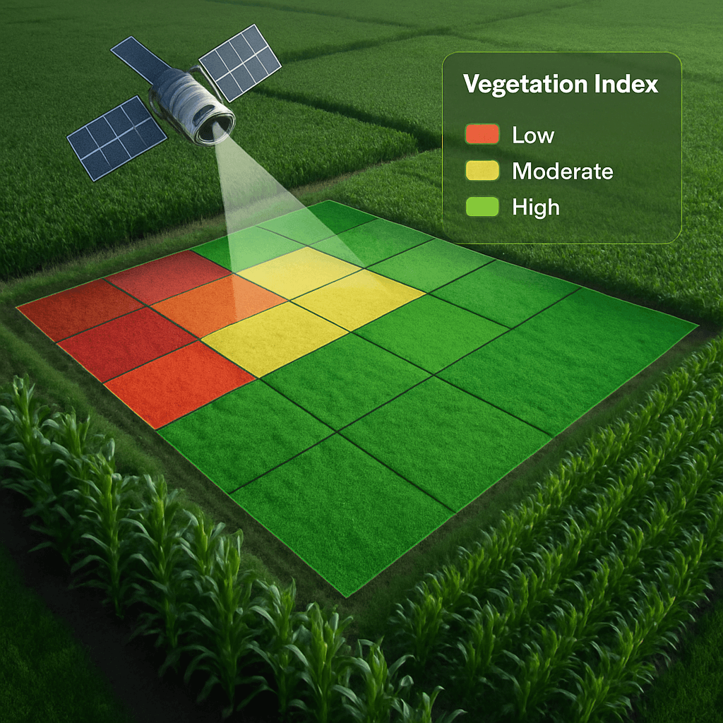
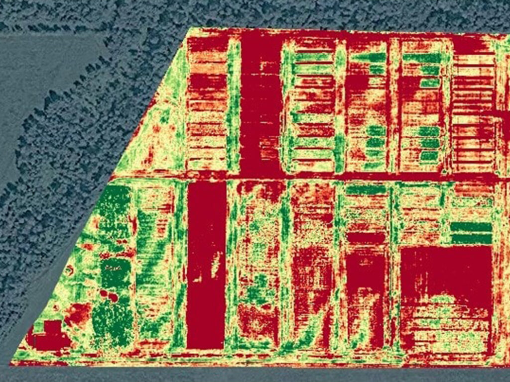
Vegetation Indices from Agriculture Satellite Imagery
When we talk about farm satellite technology and agriculture imaging, it is important to understand vegetation indices. Vegetation indices are simple formulas that help monitor the health of crops without needing to physically visit the fields.
Vegetation indices are a key part of Smart Farming. With agriculture satellite imagery from XRTech Group, farmers can reduce field interventions and build a cost-effective crop scouting plan. These indices can show plant vigor, water stress, and chlorophyll levels — all critical for planning farm activities more precisely.
XRTech Group provides agriculture satellite imagery with special spectral bands perfect for creating many different types of vegetation indices. These tools are essential for checking plant health, density, and condition, making precision farming smarter and easier.

Types of Vegetation Indices
Normalized Difference Vegetation Index (NDVI)
NDVI uses the Red and Near-Infrared (NIR) bands to measure vegetation health.
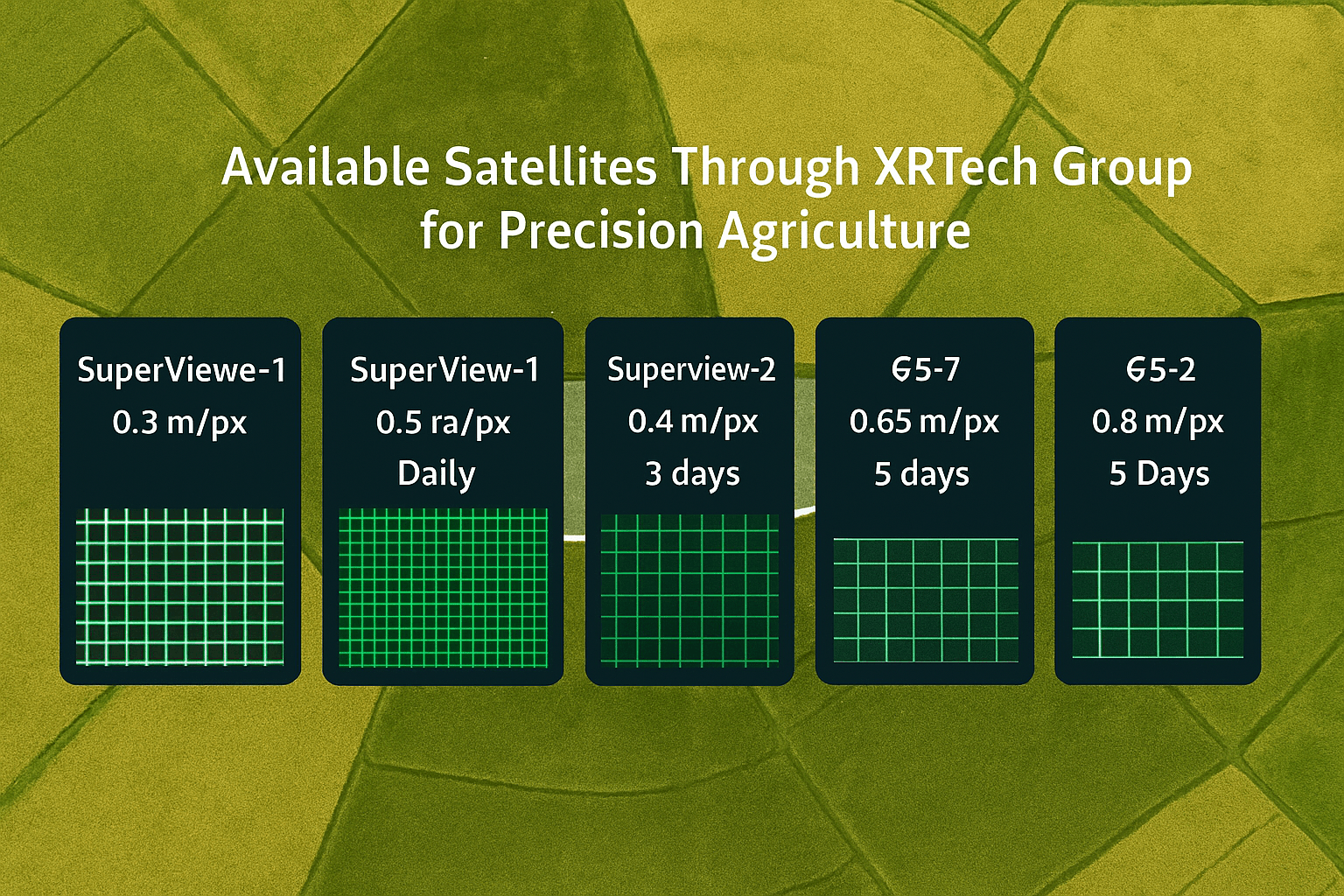
XRTech Group’s satellites like Superview Neo-1, Superview-1, GF-7, GF-2, GF-6, GF-1, and ZY-3 include these bands.
NDVI = (NIR – Red) / (NIR + Red).
Healthy plants reflect more NIR and less Red light, resulting in a high NDVI value.
XRTech Group uses NDVI to monitor crop growth and predict yields with up to 85% accuracy at the county level.
Normalized Difference Red Edge Index (NDRE)
NDRE uses the Red Edge band, available in the Superview-2 satellite.
Red Edge is more sensitive to chlorophyll and leaf structure, providing detailed crop health data.
NDRE is especially useful for spotting early signs of stress and nutrient deficiencies.
Additional Vegetation Indices
CCCI – Canopy Chlorophyll Content Index
CIRedEdge – Red-Edge Chlorophyll Index
CWSI – Crop Water Stress Index
GNDVI – Green Normalized Difference Vegetation Index
LAI – Leaf Area Index
MRESAVI – Modified RESAVI
NDVI – Normalized Difference Vegetative Index
NNI – Nitrogen Nutrition Index
OMNBR – Optimal Multiple Narrow-Band Reflectance Index
OSAVI – Optimized Soil-Adjusted Vegetation Index
REDVI – Red-Edge Difference Vegetation Index
REIP – Red-Edge Inflection Point
RERDVI – Red-Edge Renormalized Difference Vegetation Index
RERVI – Red-Edge Ratio Vegetation Index
RESAVI – Red-Edge Soil-Adjusted Vegetation Index
RVI – Ratio Vegetation Index
SAVI – Soil-Adjusted Vegetation Index
Testimonial
Client Feedback & Reviews
Our clients don’t just get data — they get speed, clarity, and support that exceeds expectations. Here’s what they’re saying:


30-Day Money-Back Guarantee
Zero risk. Full confidence. We stand by the quality of our data and service. If you’re not satisfied with your deliverables within 30 days, we’ll refund your project — no questions asked.
Challenges in the Agricultural Sector
Today’s agriculture industry faces many big challenges. Old farming methods and limited access to real-time data are making it hard for farmers to meet modern needs. Without smart technology like farm satellite services and agriculture imaging, farmers struggle with efficiency, sustainability, and protecting their land. This lack of innovation makes farms more vulnerable to risks like climate change, poor yields, and food insecurity.
At XRTech Group, we believe agriculture satellite imagery is the key to solving many of these problems. Let’s look at the major challenges in more detail:
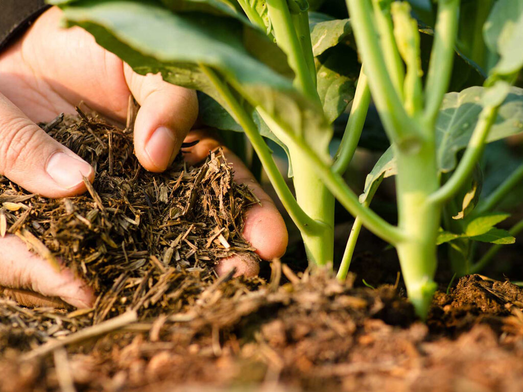
Poor Resource Management and Soil Damage
Many farms don’t have enough accurate information about their crops or soil. Without crop health data from agriculture satellite imagery, farmers often overuse water, land, and fertilizers. This wastes resources and damages the soil over time, reducing crop quality and farm profits. Farm satellite technology can help monitor soil conditions and improve the way resources are used.
Climate Change and Environmental Harm
Without access to modern tools like farm satellite systems, it’s hard for farmers to adopt sustainable practices. Extreme weather events like droughts, floods, and storms can destroy crops and ruin the land. Agriculture imaging from satellites gives farmers early warnings and helps them plan better, protecting their farms and the environment.
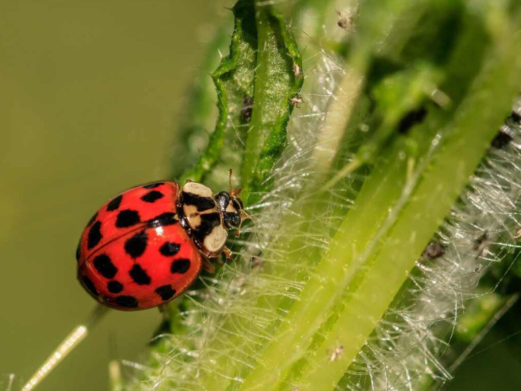
Disease and Pest Attacks
When pests or diseases hit, fast action is important. But many farmers don’t have enough real-time data to spot problems early. This delay leads to big crop losses and threatens food supplies. XRTech Group’s agriculture satellite imagery can help farmers detect early signs of disease or pest attacks, so they can act quickly and save their crops.
Lack of Monitoring and Transparency
Without proper monitoring, some farming practices go unnoticed or misreported. This can lead to problems like poor quality crops, unfair practices, and less trust in the agricultural market. Using farm satellite solutions, XRTech Group provides clear, detailed images that help track every stage of crop growth, ensuring transparency and building trust between farmers, suppliers, and buyers.
Experience
Ready to Transform Your Farming with XRTech Group Satellite Imagery?
Unlock the power of farm satellite technology and advanced agriculture imaging today! With XRTech Group’s cutting-edge agriculture satellite imagery solutions, you can monitor crops, manage soil health, and boost yields like never before.