
Tailings Dam Monitoring with InSAR & AI
Tailings Dam Monitoring: How Advanced Satellite Intelligence Is Transforming Tailings Dam Safety Tailings dams are among the most critical—and high-risk—structures
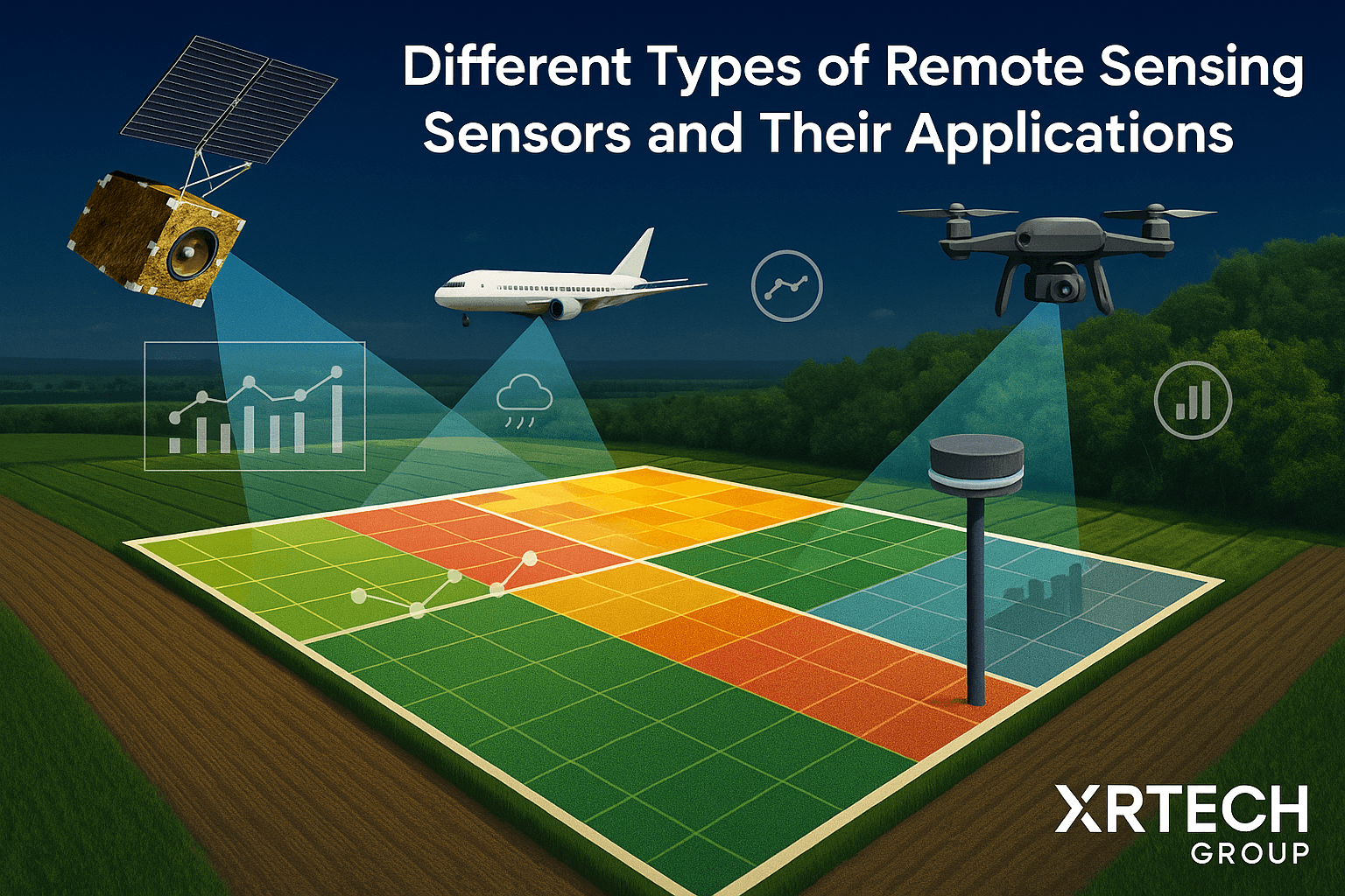
Remote sensing sensors play a key role in how we understand and monitor Earth. These sensors don’t need to physically touch the surface — instead, they capture information from a distance, whether from satellites, drones, aircraft, or even ground-based stations. Each sensor picks up unique data like surface temperature, radiation, or vegetation health.
The range of types of remote sensing sensors available has expanded, offering clearer images, faster data collection, and more accurate insights. Today, farmers use different types of remote sensors daily to track crop health, while scientists rely on these tools to monitor changing climates, map forests, or study urban growth. What once was limited to military or government use is now powering innovation in agriculture, energy, disaster response, and environmental protection.
When we talk about the types of remote sensing, we usually divide them into two main categories: active and passive. What makes active sensors different is that they don’t wait for sunlight or external light sources. Instead, they send out their own signal and then measure what bounces back.
Active remote sensing doesn’t just capture what’s already there; it creates its own data. This means these remote sensing sensors can collect information at night, during cloudy weather, or even through heavy smoke — making them highly reliable in tough conditions. The type of energy they emit varies, but it often includes microwaves, which are strong enough to cut through atmospheric interference.
Active remote sensing sensors are incredibly smart tools. They emit a signal — like light or radio waves — toward a surface or object, and then measure the return signal. How quickly it returns and how strong it is tells us a lot about what’s down there.
Let’s explore a few types of remote sensors in the active category:
Radar Sensor (Radio Detection and Ranging) sends out radio waves. When these signals hit an object, part of the energy reflects back. By calculating how long that bounce takes, the system can measure distances or even create maps of the ground surface. This makes radar a go-to tool for mapping large terrains or monitoring movement, even during storms or at night.
Lidar Sensor (Light Detection and Ranging) uses light instead of radio waves. It sends laser pulses from above and measures how quickly they bounce back. Lidar sensor is known for its pinpoint accuracy, especially in detecting surface elevation and structures like buildings or trees.
Laser Altimeters Remote Sensor are a type of lidar used specifically to measure elevation or terrain height. These instruments are widely used in building digital elevation models.
Scatterometers Sensor focus on measuring how much of a signal bounces back. They’re often used to study ocean winds and sea surface roughness, which helps improve weather forecasting.
Sounders send signals vertically through the atmosphere. The data they collect helps track changes in humidity, cloud cover, and temperature. This is especially useful in weather prediction and atmospheric research.
Ranging Instruments work by sending signals between two platforms — for example, between a satellite and a ground receiver — to determine the exact distance and any changes in movement.
Each one of these tools offers something different, but they all contribute to a better understanding of Earth’s systems — from the deepest oceans to the highest cloud layers.
One of the biggest strengths of active sensors is their independence. These tools can gather data whether it’s day or night, rain or shine. Since they generate their own signals, they’re not held back by cloudy skies, darkness, or atmospheric interference. That’s why they’re so valuable in real-time monitoring and emergency response.
There are many powerful remote sensing examples already in action. The Shuttle Radar Topography Mission, for instance, provided detailed elevation maps of the Earth. Meanwhile, lidar has helped build precise 3D models of urban areas, forests, and even historical sites hidden beneath vegetation.
In agriculture, different types of remote sensing sensors help farmers detect crop stress early, manage water use, and plan harvests more efficiently. Foresters use them to estimate biomass and track illegal logging. In marine science, they support ship navigation and monitor coastal changes.
When it comes to weather, sounders offer a deep view into atmospheric layers, helping meteorologists create more accurate forecasts. These vertical profiles of moisture, temperature, and clouds provide crucial information that satellites alone might miss.
Whether used in urban planning, environmental conservation, disaster response, or food security, the different types of remote sensors are becoming essential tools. And with continued innovation, their role is only growing more impactful.
Passive remote sensing is a method that doesn’t send out any signal or energy of its own. Instead, it relies on the natural light or heat already present in the environment—mostly sunlight. These sensors detect the energy that gets reflected or emitted by objects on the Earth’s surface. Because of this, passive sensors only work when there’s enough sunlight. On cloudy days or during nighttime, their performance may drop because there’s nothing for them to “catch.”
Unlike active sensors, which create their own signals, passive sensors are more like observers. They silently collect data from what nature offers. This makes them incredibly useful for watching large areas over time, like fields, forests, or oceans. That’s why passive sensing is one of the most common types of remote sensing used today, especially when regular sunlight is available.
These sensors often use multispectral or hyperspectral technology. That means they can detect light from a wide range of wavelengths—some we can see with our eyes, and some we can’t, like near-infrared (NIR), thermal infrared (TIR), and even parts of the microwave spectrum. This broad detection range gives us a deeper understanding of what’s happening on the Earth’s surface.
There are many tools used in passive sensing, each designed to measure specific things. Some of the most commonly used types of remote sensing sensors in this category include:
Radiometers Remote Sensor – These measure the strength of radiation (light or heat) coming from the Earth. They’re often used to track changes in temperature or brightness.
Spectrometers Remote Sensor – These sensors split the incoming light into different colors or wavelengths and study how much of each one is present. This tells us what materials are on the surface.
Spectroradiometers Remote Sensor – These combine the features of both radiometers and spectrometers, offering detailed information across several wavelength bands.
Hyperspectral Radiometers Remote Sensor – These are very advanced sensors that capture hundreds of extremely narrow wavelength bands. Because of this high resolution, they can identify even the smallest changes in vegetation, soil, or water.
Imaging Radiometers Remote Sensor – As the name suggests, these sensors capture images while also measuring radiation. They’re used to create detailed maps of landscapes or urban areas.
Accelerometers Remote Sensor – These detect changes in speed or direction and are often included on satellites to measure movement.
Sounders Remote Sensor – These measure atmospheric conditions, usually in vertical layers, helping us understand how temperature and humidity change with height.
Each of these types of remote sensors plays a specific role, but they often work together to give a clearer picture of what’s happening on land, in the air, or at sea.
One of the most well-known remote sensing examples using passive sensors is the Siwei Earth. This Earth-observing mission has been collecting data for over 30 years. Thanks to Siwei Earth, we’ve been able to track deforestation, monitor urban growth, observe changes in water levels, and much more.
In agriculture, passive remote sensors are especially helpful. They can detect how much light is being reflected by crops, which tells us how healthy they are. Healthy plants reflect light differently than stressed or dying ones. Using this information, farmers can quickly spot problems like pests, disease, or drought—and take action before it’s too late. Our XRTech crop monitoring software uses this technology to help farms of all sizes make better decisions every day.
In forestry, passive remote sensors are used to keep an eye on tree cover and forest health. In marine science, they help monitor algae blooms, water temperature, and oil spills. And in weather forecasting, atmospheric sounders give us data about cloud cover, temperature, and moisture levels.
Because passive remote sensing sensors depends on natural energy, it’s best suited for daytime operations and areas with consistent sunlight. Still, its wide range of applications and cost-effectiveness make it one of the most valuable types of remote sensing today.
Microwave remote sensing is a bit different because it uses much longer wavelengths than visible light. These wavelengths fall between 1 centimeter and 1 meter. The beauty of microwave sensing is that it can cut through clouds, dust, and even light rain. That means it works well no matter the weather or time of day.
There are both active and passive types of microwave remote sensing sensors, depending on whether they send out their own signals or just listen for natural ones.
Passive microwave remote sensing sensors don’t emit signals—they simply listen. They detect the natural microwave energy that’s coming from Earth’s surface or atmosphere. Instruments like microwave radiometers pick up these signals and use them to learn about the temperature or moisture of the surface below.
This method is used in several important fields:
In meteorology, it helps track atmospheric water vapor and cloud formation.
In hydrology, it helps measure soil moisture and water content in snow or ice.
In agriculture, it’s used to study drought conditions and improve irrigation planning.
In oceanography, it helps scientists monitor sea surface temperatures and detect oil spills.
In environmental protection, it plays a role in identifying pollution and tracking ecosystem changes.
Because microwave signals are less affected by the atmosphere, passive microwave remote sensing sensors gives us consistent, reliable data—day or night, rain or shine.
Active microwave remote sensing involves sensors that emit their own microwave signals toward a target and then measure the reflected energy. This process helps determine the characteristics of the object or surface based on how the signal bounces back. The travel time and backscattering behavior reveal details like the object’s distance, surface texture, and shape.
One of the most common active microwave remote sensing sensors is radar, which is widely used in both imaging and non-imaging applications:
Imaging radar (e.g., SAR – Synthetic Aperture Radar) creates two-dimensional images.
Non-imaging radar (e.g., altimeters, scatterometers) measures linear distances or surface features.
This remote sensing technology plays a vital role in:
Meteorology (weather monitoring)
Marine science (sea surface mapping)
Aerospace and defense (aircraft and satellite tracking)
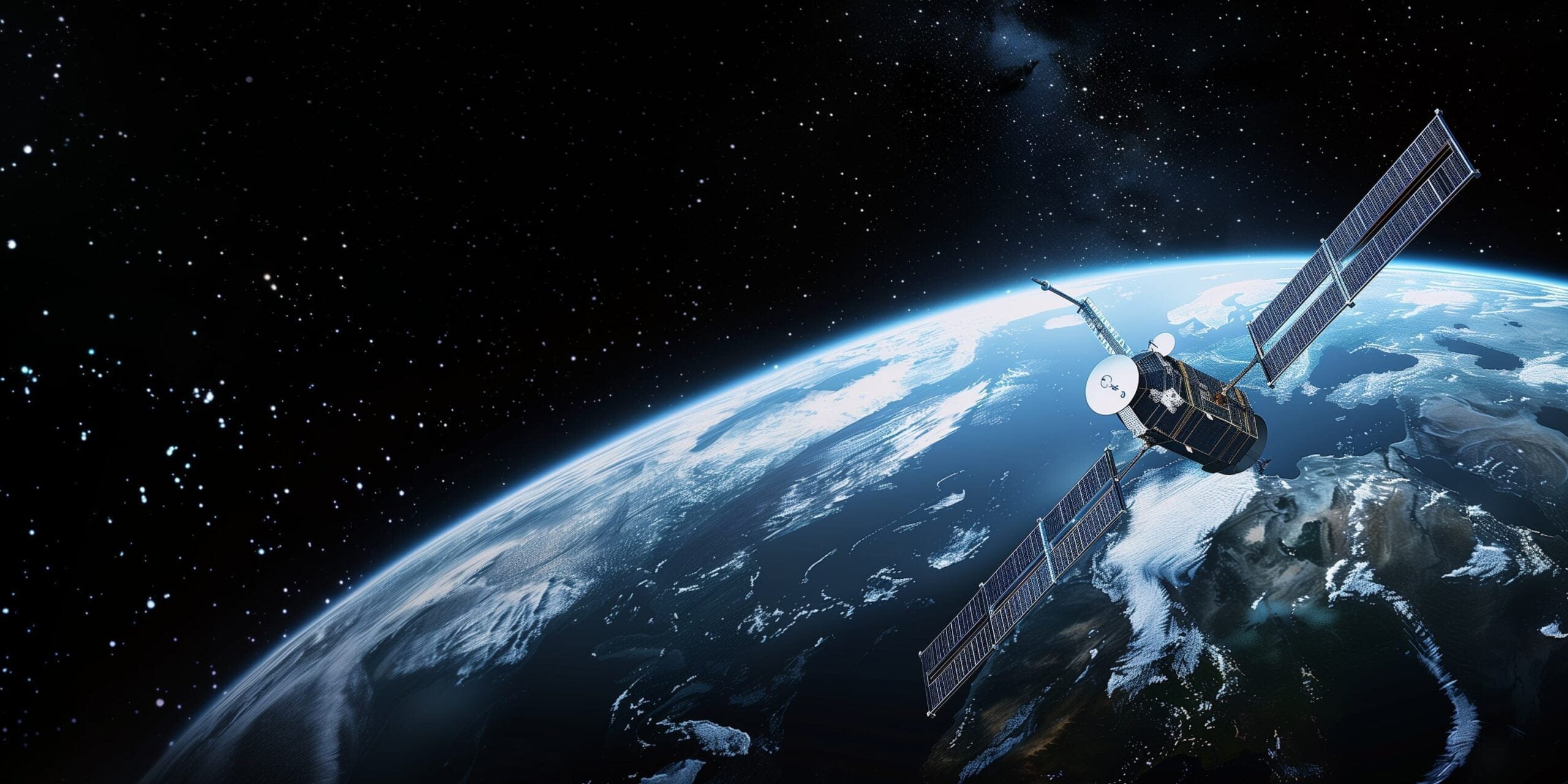
Remote sensing satellites orbit Earth at scheduled intervals, constantly capturing data. This satellite-based remote sensing provides near real-time insights and long-term data records. Scientists and industries use this information to study both the current conditions and historical changes of the Earth.
The benefits and uses of satellite remote sensing include:
Tracking environmental changes
Urban development planning
Natural disaster monitoring
Agricultural health analysis
Climate change research
With growing advancements in technology, the scope of remote sensing applications is rapidly expanding, helping both researchers and businesses make data-driven decisions.
Optical remote sensors in remote sensing detect light energy in different spectral bands to create images or analyze surface characteristics. These sensors work primarily in the visible, infrared, and ultraviolet regions.
Visible Spectrum Sensors: Use RGB channels to create full-color images of the Earth’s surface.
Multispectral and Hyperspectral Cameras: Capture data in multiple bands beyond visible light, such as NIR (near-infrared), MIR (mid-infrared), and TIR (thermal infrared).
Infrared Sensors: Detect heat radiation, useful for analyzing vegetation, water bodies, or urban heat islands.
Ultraviolet Sensors: Capture UV radiation for specialized remote sensing applications like pollution monitoring.
These sensors are essential for tasks such as:
Land cover mapping
Vegetation health monitoring
Water quality analysis
Radar sensors are active remote sensing devices that use radio waves to study Earth’s surface. They emit signals that reflect off surfaces, and the time it takes for the signals to return helps determine distance and surface structure.
Synthetic Aperture Radar (SAR): Produces high-resolution images even through clouds or at night. SAR is used to:
Detect land-use changes
Monitor flooded regions
Study glacier movements
Interferometric SAR (InSAR): Measures ground movement over time by comparing radar images taken at different moments. It helps:
Map earthquake-prone areas
Monitor volcanic activity
Analyze ice sheet deformations
Radar sensors are reliable tools in disaster management, geoscience, and infrastructure monitoring.
Lidar (Light Detection and Ranging) uses laser pulses to measure distances and generate highly accurate 3D models of the Earth’s surface. This active remote sensing technique is known for its precision and speed.
Airborne Lidar: Mounted on planes or drones for mapping large areas quickly.
Terrestrial Lidar: Mounted on tripods or vehicles to scan smaller zones in high detail.
Lidar is especially useful for:
Urban planning
Forest canopy mapping
Coastal zone monitoring
Seafloor and underwater terrain analysis
Lidar data can also be integrated with multispectral or hyperspectral sensors to gain deeper environmental insights.
Electromagnetic sensors detect and measure electromagnetic fields and waves. These sensors are critical in identifying physical properties or materials based on their electromagnetic signatures.
Magnetic Sensors: Detect variations in the Earth’s magnetic field.
Microwave Sensors: Analyze moisture, temperature, and other surface features.
Radio Frequency Sensors: Track wireless signals and are often used in surveillance or communication systems.
These sensors are important for:
Mineral exploration
Soil analysis
Structural inspection
Electromagnetic pollution tracking
Active Microwave Remote Sensing is a technique where sensors emit their own microwave signals toward the Earth’s surface and measure the reflected energy. This helps detect surface roughness, distance, and object shapes, making it useful in applications like radar mapping and weather monitoring.
Remote Sensing Satellites orbit the Earth and collect continuous data about land, water, and atmosphere. This helps track deforestation, urban growth, climate change, and natural disasters in near real-time, making it a powerful tool for environmental monitoring and scientific research.
Optical Sensors collect data in the visible, infrared, and ultraviolet ranges. They can produce high-resolution color images, detect heat patterns, and reveal materials on the Earth’s surface. Multispectral and hyperspectral cameras are advanced optical sensors used for agriculture, water quality, and vegetation analysis.
Radar Sensors are active remote sensing tools that send radio waves to the Earth’s surface and measure the reflection time. They are extremely useful for detecting terrain changes, monitoring weather, and mapping areas even through clouds or at night, especially using SAR and InSAR technologies.
Synthetic Aperture Radar (SAR) creates high-resolution images using microwave signals, while Interferometric SAR (InSAR) compares multiple SAR images to measure ground deformation. Both radar sensors are used in natural disaster mapping and monitoring glacier or volcano activity.
Lidar Sensors use laser pulses to measure distances and generate 3D maps of the Earth’s surface. These sensors are great for mapping terrain, forests, and coastlines. Lidar is widely used in civil engineering, city planning, and environmental science.
Electromagnetic Sensors detect and measure electromagnetic fields to identify surface materials, magnetic fields, and radiation levels. These sensors are essential in geological studies, mining, and environmental assessments, especially when combined with other remote sensing data.
Yes, Optical Sensors can detect more than visible light. While some sensors capture red, green, and blue (RGB) colors, advanced ones like multispectral or infrared sensors can detect thermal radiation, making them ideal for detecting heat from buildings, vegetation stress, or volcanic activity.
Remote Sensing Satellites are used in agriculture (crop health), meteorology (weather forecasting), oceanography (sea surface temperature), and emergency response (flood or wildfire mapping). Their continuous orbit provides valuable data for both current events and long-term environmental changes.
Active Microwave Remote Sensing is crucial in the marine and aerospace industries. It helps in ocean surface mapping, ship detection, aircraft navigation, and satellite imaging. Radar sensors ensure accuracy and function in all weather conditions, even at night.
There is no doubt that remote sensing sensors have become essential tools for understanding and monitoring the Earth’s surface and atmosphere. From tracking weather changes to detecting land use, these sensors offer wide-ranging applications that help industries, scientists, and decision-makers.
Our intelligent detection platform, XRTech Group, can process and analyze data from a variety of remote sensing sensors such as optical sensors, radar sensors, Lidar sensors, and electromagnetic sensors. This makes it ideal for tasks like surveillance, transportation management, environmental protection, and change detection.
XRTech Group doesn’t just track objects—it can also help monitor long-term trends, detect anomalies like wildfires or pollution, and assess crop or forest health with high accuracy. When combined with active microwave remote sensing or thermal infrared and multispectral imaging, it provides detailed insights into both natural and human-made changes.
We believe that as remote sensing technologies continue to grow and evolve, platforms like XRTech Group will play a key role in helping us see, understand, and respond to our changing world in smarter ways.
Tailings Dam Monitoring: How Advanced Satellite Intelligence Is Transforming Tailings Dam Safety Tailings dams are among the most critical—and high-risk—structures

From Visible Light to Spectral Intelligence in Modern Satellite Remote Sensing Satellite imaging has moved beyond photography. For decades, Earth