What is Satellite Imagery Pricing? Your Easy Guide for 2026
Have you ever wondered how businesses get pictures of Earth from space? These pictures, called satellite images, are very helpful for many different jobs. People often ask, "What is the price of satellite imagery?" This guide will help you understand how much it costs to get these amazing pictures in 2026. It will be explained in simple words so everyone can understand. The aim is to help you easily buy satellite images for your needs.
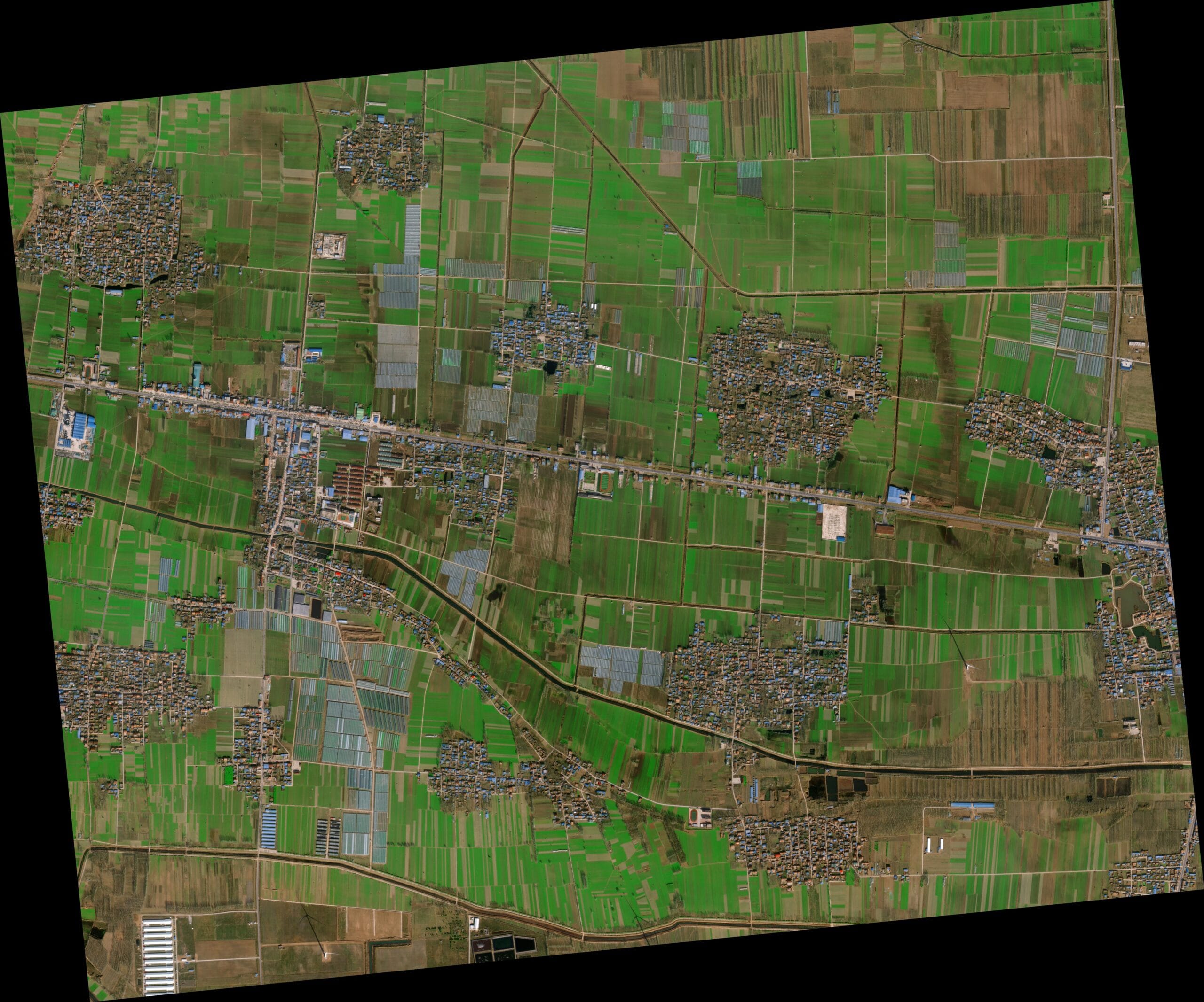
Satellite images are used by many different groups. For example, farmers use them to check their crops to see if they are healthy. City planners use them to see how cities are growing and where new buildings might be placed. Also, people who help after floods or earthquakes use them to see what happened to damaged areas quickly. These images are also used to watch our environment, like tracking changes in forests or ice. The satellite imagery price can change based on a few things, which will be discussed in detail here. This information is updated for 2026 to give you the freshest insights into pricing of satellite images.
Finding the right satellite image for your project means understanding how its cost is decided. It is not just one number; instead, several factors are considered. This guide will walk you through these factors so that you can make good choices when you are ready to buy satellite images. Knowing about these factors helps you plan your budget better and understand the value you are getting.
Visit: Buy High-Resolution Satellite Imagery
Understanding What Affects the Satellite Imagery Price
When you want to buy satellite images, several things make the cost go up or down. These are like ingredients in a recipe; each one adds to the final satellite imagery pricing. Knowing these factors is very important because it helps you understand why one image might cost more or less than another. This part of the guide explains the main things that affect the price of satellite imagery.
1. How Clear the Picture Is (Resolution)
One big thing that changes the price of satellite imagery is how clear the picture is. This is called "resolution." Resolution tells you the smallest thing that can be seen in the picture. A smaller number for resolution means a clearer picture. For example, a 30-centimeter resolution means that objects as small as 30 centimeters (about the size of a school ruler) can be clearly seen in the image.
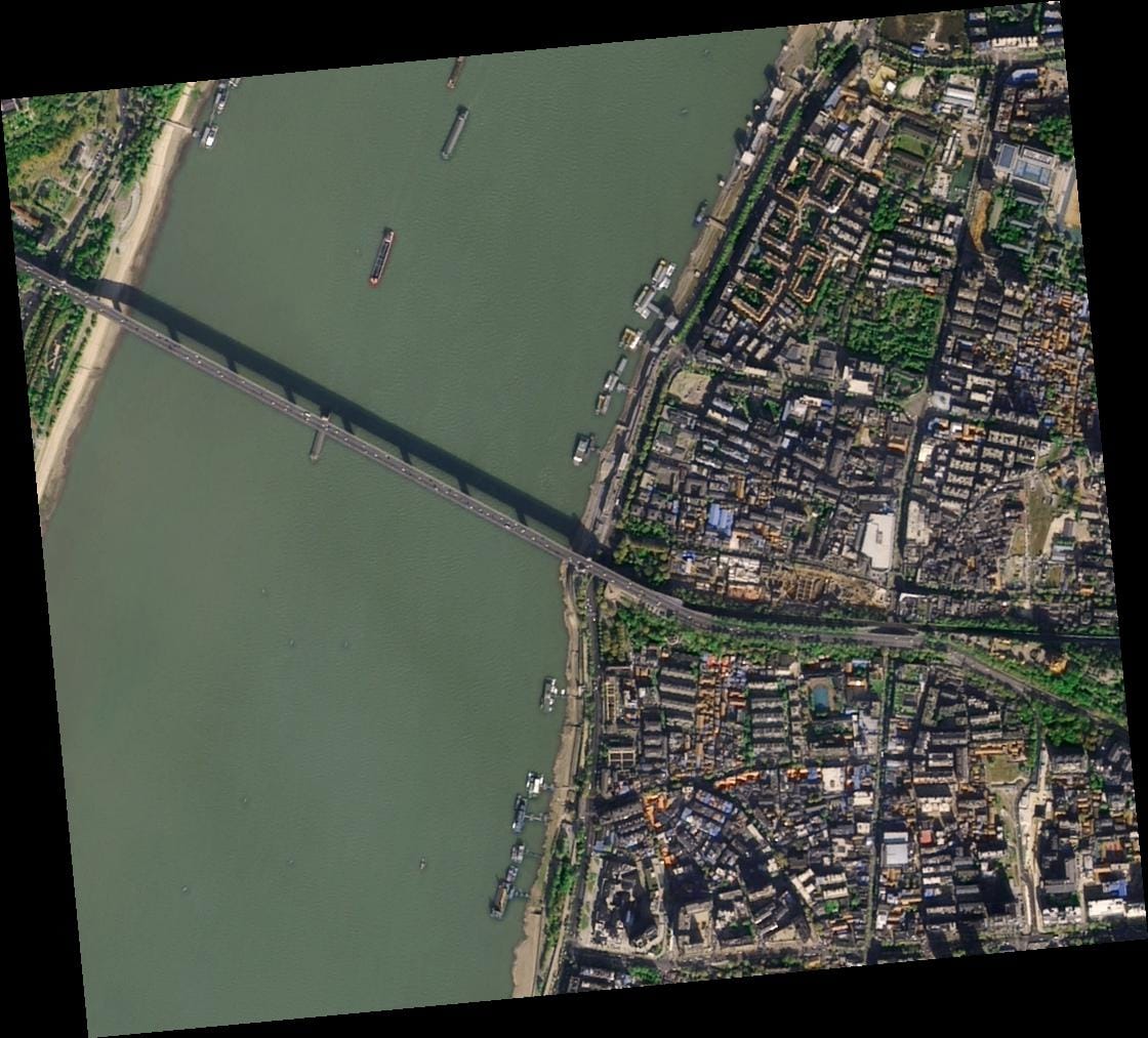
- Super Clear (30cm to 50cm): These pictures are very detailed. You can see small things on the ground, like cars, specific trees, or even people and their shadows. Because they show so much detail, the pricing of satellite images at this level is usually higher. For instance, 30cm pictures are super clear, showing details as small as 30 centimeters. This kind of resolution is often needed for very exact work, such as mapping building details or checking small changes on the ground.
- Very Clear (51cm to 80cm or less than 1 meter): These images are still very good, but they show things a bit less clearly than the super clear ones. They are still very useful for many jobs where a good level of detail is needed but not the absolute finest. For example, 50cm images let you see things as small as 50 centimeters. Images under 1 meter (like 80cm) also give a good view, letting you make out larger vehicles or the general layout of an area. These are often chosen when a balance between detail and satellite imagery price is desired.
- Good Enough (2m and above): These pictures are less clear, but they are great for looking at bigger areas where fine details are not the main goal. They are usually less expensive. For example, 2-meter images show details as small as 2 meters. This might be used for studying large forests, big farms, or general land-use changes over wide areas. The price of satellite imagery for these resolutions is considerably lower, making them suitable for broad studies or initial surveys.
The clearer the picture, the more special sensors are needed on the satellite, more data is collected, and more work is done to get it ready for you to use. This is why resolution has a big effect on the final satellite imagery pricing. When you decide to buy satellite images, thinking about the level of detail you truly need can help you save money.
2. Is the Picture Old or New? (Archival Status)
Another important factor affecting the price of satellite imagery is if the picture has been taken before or if it needs to be taken just for you. This is like deciding between buying a book that is already printed versus commissioning a new painting.
- Archive Image (Older than 90 Days): These are pictures that have already been taken by satellites and are kept in a large library, like old books in a library. This vast collection of images is always growing. Because they are already there, ready to be sent to you, they are the most affordable way to buy satellite images. This is often called "standard archive" at XRTech Group. These images are perfect for looking at past changes or for areas where current, real-time data is not needed. The satellite imagery price for archive images is the lowest entry point.
- New Tasking Image (Freshly Collected): Sometimes, you need a brand new picture of a certain place, taken right now or very soon. A satellite is given a special instruction to fly over that spot and take a new picture just for your request. This process costs more because it's a custom job, like ordering a custom cake instead of buying one that's already made from the bakery shelf. At XRTech Group, this is known as "new collection" or "fresh archive." The cost difference reflects the extra effort and planning involved in directing a satellite to capture a specific area at a specific time. When freshness of data is key, this is the option chosen, and its impact on the pricing of satellite images is significant.
The choice between archive and new tasking greatly affects the satellite imagery price. If historical data is acceptable, archive images offer a cost-effective solution. However, for up-to-the-minute analysis or monitoring, new tasking is necessary, and the higher price of satellite imagery is considered a worthwhile investment.
Visit: Satellite Imagery Pricing & Archive/Tasking Costs
3. How Fast You Need It (Collection Priority)
Just like with shipping a package, how quickly you need your new satellite image can change the satellite imagery price. Faster service generally means a higher cost because it involves adjusting satellite schedules and resources immediately.
- Standard Collection: This is when a new image is taken when it's most convenient for the satellite, based on its regular orbit and schedule. It is a good choice if you are not in a hurry and have some flexibility on when the image is collected, perhaps over a couple of weeks. The price of satellite imagery for this option is more affordable than faster services.
- Priority Collection: If you need the image faster than standard collection, you can ask for a priority collection. This means the satellite's schedule is adjusted to get your picture sooner than usual, often within a few days or a week, depending on the area. This adds to the pricing of satellite images because it involves specific planning and resource allocation. This option is chosen when timely data is important but not critically urgent.
- Emergency Collection: This is the fastest way to get a new image. It means the satellite will take your picture as soon as it possibly can, often within hours to a day, given favorable conditions. This service is typically used in very urgent situations, like after a big storm, a natural disaster, or a breaking news event where immediate information is needed. Because it's so urgent and requires immediate reallocation of satellite resources, it has the highest satellite imagery price. This option is reserved for critical situations where the speed of data delivery outweighs cost considerations.
The urgency of your request directly influences the price of satellite imagery. It is important to weigh the necessity of immediate data against the additional cost.
4. What Kind of Light the Picture Uses (Bands and Sensors)
Satellites can "see" different kinds of light that our eyes cannot. This is called "spectral bands." Different bands are used for different purposes, and collecting data in many bands or specialized bands can affect the price of satellite imagery.
- Panchromatic: This is like a very detailed black-and-white photo. It combines all visible light into one band, which helps in seeing very fine details and edges. These are great for mapping and visual identification.
- Red, Green, Blue (RGB): These are like the colors we see. Data from these bands is combined to make regular, true-color pictures of the Earth, similar to what a digital camera takes. These are widely used for general viewing and mapping.
- Near-Infrared (NIR): This band helps scientists look at how healthy plants are, as healthy plants reflect a lot of near-infrared light. It is very useful for agriculture and environmental monitoring.
- Special Bands (e.g., Purple, Yellow, Red Edge): Some satellites, like Superview-2, have even more special bands. These can give extra information that is useful for very specific scientific studies, such as monitoring water quality or specific plant health details. The more specialized the bands, the more unique the data, which can influence the pricing of satellite images.
- SAR (Synthetic Aperture Radar) Imagery: This is a very special type of image that can see through clouds and at night! It uses radar waves instead of light waves. This means it can collect data when optical satellites cannot, such as during heavy rain or in areas that are always cloudy. XRTech Group offers C-band SAR (from GF-3 SAR) and L-band SAR (from LT-1 SAR). Because it can see through clouds and darkness, its technology is more complex, and its satellite imagery price might be different from optical imagery. SAR imagery is crucial for disaster response, maritime surveillance, and geological mapping.
- Mid-Wave Infrared and Visible Light: These are other types of light used by satellites like GF-4. Mid-wave infrared can be used for things like detecting heat signatures or understanding land surface temperatures.
- Other Specific Bands (e.g., B1, B2, B3, B4 for ZY-1 02D's IRS): Different satellites are equipped with different sets of sensors to capture light in various parts of the electromagnetic spectrum. These specific bands are chosen for particular scientific or commercial applications, each offering unique insights. The availability and processing of these specialized bands contribute to the overall satellite imagery pricing.
More complex images using many bands or special radar bands might cost more because of the advanced technology and processing required. This adds to the total pricing of satellite images. When you are looking to buy satellite images, it is important to consider which spectral bands are most useful for your specific project.
5. Extra Things That Change the Price of Satellite Imagery
Sometimes, extra features or conditions during image collection can also affect the final cost when you want to buy satellite images. These are usually small adjustments but can add up.
- Stereo and Tri-Stereo Imagery: Imagine taking two or three pictures of the same spot from slightly different angles. This helps create 3D views of the landscape, which is very useful for building models or precise mapping. Stereo imagery costs 2 times more than a regular, single (mono) image because it involves collecting and processing two images. Tri-Stereo imagery costs 3 times more. These options are available for Level 1B/2A products. This type of imagery is highly valued for its ability to provide depth information, which is reflected in its satellite imagery pricing.
- More Color Bands (PAN + 4MS / 8MS): If you want more detailed color information by combining a panchromatic (black and white) image with multiple spectral bands (like PAN + 4MS or 8MS for 0.5m resolution), there might be a small extra charge. For example, an additional 10% uplift might be applied for PAN + 8MS products. This uplift covers the extra data volume and processing needed to create these enriched images.
- Cloud Coverage Adjustments: Clouds can block the view from space. If a picture is taken and there are clouds covering more than a certain percentage of the area you need (e.g., Cloud Cover ≤ 10% or ≤ 5%), there might be an extra charge per square kilometer. This is because getting a clear view with fewer clouds can be harder and might require multiple attempts by the satellite. For example, a cloud cover of 10% or less might add $8 per sq. km, while 5% or less might add $15 per sq. km. This helps ensure you get the clearest possible image, even if it adds to the pricing of satellite images.
- Off-Nadir Angle (ONA) Adjustments: This refers to how much the satellite has to look to the side (off-nadir) to take a picture, rather than looking straight down (nadir). If it looks more directly down (smaller ONA), the picture is usually better because there's less distortion. However, capturing images with a very low off-nadir angle can be more challenging for the satellite's schedule. So, getting an image with an ONA of 15° or less might add $3 per sq. km, and 10° or less might add $9 per sq. km to the price of satellite imagery. This adjustment ensures the best possible geometric accuracy of the image.
These additional considerations ensure that the specific requirements for image quality and geometry are met, and the related costs are factored into the overall satellite imagery pricing.
XRTech Group's Satellite Imagery Pricing: A Clear Look for 2026
At XRTech Group, we aim to make the pricing of satellite images easy to understand and fair. We offer different options so you can find the best fit for your needs, whether you are looking for very detailed images or broader coverage. Our satellite imagery pricing is designed to be competitive and provide great value. Here's a simple breakdown of our main prices for high-resolution images, updated for 2026.
Buy High Resolution Satellite Imagery (51-80cm | Up to 4 Bands)
This category is perfect for projects that need good detail without the absolute highest resolution. It is a very popular choice for many uses, like general mapping or environmental monitoring.
| Type of Image | Price (USD/km²) | Minimum Area |
|---|---|---|
| Archive Image (>90 days) | $5 | 25 km² |
| New Tasking Image | $8 | 100 km² |
Buy Very High Resolution Satellite Imagery (31-50cm | Up to 4/8 Bands*)
When you need more detail than the "High Resolution" images, but not the absolute sharpest, this category is an excellent choice. It provides very clear pictures suitable for more precise applications.
| Type of Image | Price (USD/km²) | Minimum Area |
|---|---|---|
| Archive Image (>90 days) | $13 | 25 km² |
| New Tasking Image | $20 | 100 km² |
*Band availability may vary depending on the satellite source. This means some special color information might not be available from all satellites, which is important to know when you plan to buy satellite images.
Buy Super High Resolution Satellite Imagery (30cm | Up to 4 Bands)
This is our top-tier option for image clarity. When every detail counts, 30cm resolution images are chosen. They are perfect for highly specific tasks like detailed urban planning or precise asset monitoring.
| Type of Image | Price (USD/km²) | Minimum Area |
|---|---|---|
| Archive Image (>90 days) | $20 | 25 km² |
| New Tasking Image | $30 | 100 km² |
This is XRTech Group's most competitive high-resolution satellite imagery pricing in the market for this level of detail. We believe this offers excellent value for those who need the best.
Detailed Pricing for Satellite Images: Optical Basic Data
The price of satellite imagery for basic optical data depends on how clear the picture is (resolution), if it's old or new (archival status), and how fast you need it (priority of collection). Here is a detailed look at our structure, which helps to clarify the overall satellite imagery pricing.
| Product Level | Resolution | Standard Archive (≥90 days) | New Collection (Fresh Archive/Standard) | Priority | Emergency | Minimum Order Size |
|---|---|---|---|---|---|---|
| Mono Imagery (1B/2A/2D) | 30cm | $20/km² | $30/km² | $45/km² | $80/km² | 25 km² / 100 km² (Min width: >5 km) |
| Mono Imagery (1B/2A/2D) | 50cm | $14/km² | $22/km² | $37/km² | $66/km² | 25 km² / 100 km² (Min width: >5 km) |
| Mono Imagery (1B/2A/2D) | <1m | $5/km² | $10/km² | --- | --- | 25 km² / 100 km² (Min width: >5 km) |
| Mono Imagery (1B/2A/2D) | 2m | $1/km² | $2/km² | --- | --- | 25 km² / 100 km² (Min width: >5 km) |
More About Our Satellite Imagery Pricing Categories (Extended Explanation)
To further clarify the factors that influence the price of satellite imagery, here are more details on each collection category offered by XRTech Group:
- Standard Archive (≥90 days): This is the most affordable way to buy satellite images because the images are already collected and stored. They are readily available and can be delivered quickly. This option is ideal for historical analysis, baseline mapping, or any project where the data does not need to be from the very recent past. The wide availability of archive imagery helps keep the satellite imagery price low for these essential uses. Many users find this category offers excellent value for general mapping and long-term trend analysis.
- Fresh Archive / Standard Collection: When a specific, new image is needed, but without extreme urgency, this category is chosen. A new satellite image is collected upon request, but it is put into the satellite's regular, planned schedule. This means it might take a few days or weeks for the image to be captured and delivered, depending on the satellite's orbit and weather conditions. It costs slightly more than archived imagery because resources are specifically tasked for your request. This balance of freshness and controlled cost makes it a popular choice for updated maps or monitoring projects where a recent view is helpful but not critical within hours.
- Priority Collection: For situations where data is needed faster than standard collection allows, customers can request prioritized satellite image collection. This ensures faster access compared to standard requests, as the satellite's schedule is adjusted to capture your area of interest more quickly. This speed and specific scheduling add to the pricing of satellite images. This service is often used for time-sensitive projects, such as construction progress monitoring or early stages of environmental event tracking, where receiving data within a few days is important.
- Emergency Collection: This is the fastest service available for new image collection. Satellite images are collected as soon as possible, often within hours of the request, assuming weather conditions are clear. This option comes at the highest cost due to the immediate and urgent re-tasking of satellite resources. Emergency collection is used for critical situations, such as disaster response, emergency management, or rapid assessment of sudden environmental changes. The high satellite imagery price for this service reflects the dedicated and immediate attention given to the task.
Additional Satellite Pricing Considerations
Beyond the core factors, certain specific features or conditions can adjust the price of satellite imagery. These considerations are often related to the complexity of data collection and processing.
| Feature | Adjustment |
|---|---|
| Stereo Imagery | 2× the Mono imagery cost |
| Tri-Stereo Imagery | 3× the Mono imagery cost |
| PAN + 4MS (0.5m Resolution) | An additional 10% uplift (for PAN + 8MS) |
| Cloud Cover ≤ 10% | +$8 per sq. km |
| Cloud Cover ≤ 5% | +$15 per sq. km |
| Off-Nadir Angle (ONA) ≤ 15° | +$3 per sq. km |
| Off-Nadir Angle (ONA) ≤ 10° | +$9 per sq. km |
Why Teams Switch to XRTech Group (Positive Points)
Teams around the world are choosing XRTech Group for Earth Observation data and high-resolution satellite imagery pricing because we go beyond just providing images. We deliver mission-ready solutions that are built for real-world needs and challenges. Our focus is on offering precision, speed, and freedom, all within one easy-to-use platform. This section explains why many are choosing to buy satellite images from us.
- Access to 130+ Satellites: We have access to a very powerful group of satellites. This includes those that collect optical images, SAR (radar) images, stereo images for 3D views, and hyperspectral images for very detailed material analysis. This large network ensures that we can provide coverage across almost any terrain or weather condition. This extensive access enhances the value of our satellite imagery pricing.
- Fast Turnaround Times: Getting Earth Observation satellite imagery is often done in under 7 days. Even for large or remote areas, Digital Elevation Models (DEMs), which show ground height, can be delivered in under 21 days. This speed is very important for projects with tight deadlines or urgent needs, allowing quick action based on fresh data.
- High Accuracy Satellite Imagery Outputs: We provide sub-meter satellite imagery resolution with very high accuracy. Our images meet strict standards (CE90 and RMSE specs), which means the data is very precise. This high accuracy is needed for even the most demanding project standards, ensuring that decisions are made based on reliable information.
- Compatible Imagery Data Formats: Our satellite imagery data is delivered in formats that are commonly used by professionals. These include GeoTIFF, SHP, DWG, and UTM. This makes it very easy to use our data with your existing Geographic Information Systems (GIS) or Computer-Aided Design (CAD) software, ensuring a smooth workflow without extra steps.
- No Export License Delays: As a non-U.S. high-resolution satellite imagery price provider, we are not affected by certain export control rules that some other providers might face. This means that your data can be delivered to you faster and with fewer restrictions, avoiding unnecessary delays. This streamlines the process to buy satellite images globally.
- Flexible Licensing: Our high-resolution satellite imagery pricing and licensing are designed to match your real-world project needs. Whether you are mapping a floodplain after heavy rains or planning national infrastructure projects that last for years, our licensing is straightforward and adaptable. This provides peace of mind and simplifies data usage.
Built for Projects Like Yours: Proven Across Sectors
XRTech Group’s High Resolution Satellite Imagery and Earth Observation capabilities are trusted by governments, non-profit organizations (NGOs), and businesses around the world. We support real, high-impact work across many continents and industries. Our solutions are not just ideas; they are already making a difference in the field. When you buy satellite images from XRTech Group, you are getting data that has been proven in action.
- Border Surveillance: We have used a mix of SAR (radar) and optical satellite imagery to provide constant, all-weather monitoring for sensitive border regions. This helps in keeping areas secure, no matter the time of day or how cloudy it is.
- Water Basin Modeling: XRTech Group satellite imagery has provided very detailed models for complex water systems, like the Yellow River Basin. This helps experts understand how water moves and improves the way water resources are managed, which is crucial for farming and drinking water.
- Flood & Disaster Mapping: During emergencies, quick help is needed. Our rapid-response Earth Observation high-resolution imagery has enabled critical response efforts in places like Libya and Southeast Asia after disasters. This supports faster decisions for evacuation, damage assessment, and recovery efforts. The speed at which this data can be delivered is a key factor in its satellite imagery price.
- National Infrastructure DEMs: We have provided highly accurate Digital Elevation Models (DEMs) across Africa. These models show the height of the land and are used to guide large-scale projects like building roads, railways, and other important structures, helping engineers plan safely and efficiently.
- Smart City Zoning: In cities like those in China and Vietnam, our high-resolution satellite imagery data has helped in forward-thinking urban planning. This data is specially designed for zoning (deciding what kind of buildings go where), planning for traffic and public transport, and making plans for how cities will grow in the future.
- Agricultural Monitoring & Subsidy Validation: In countries like India and Nigeria, we have helped track the health of crops and check the accuracy of money given to farmers (subsidies). This is done by combining Earth Observation data and high-resolution satellite imagery with local information, helping farmers and governments make better choices.
These examples show that XRTech Group's satellite imagery is not just about pictures; it is about providing solutions that help solve big problems and support important projects globally. When you consider the value added, the pricing of satellite images from XRTech Group reflects their impactful applications.
Specs Snapshot: Satellite Imagery Engineered for Precision. Delivered for Productivity.
Understanding the technical details of the satellite imagery you are about to buy satellite images is important. XRTech Group’s imagery is built for precision and designed to help you work efficiently. Here’s a quick look at some key specifications that relate to the quality and usability of our data, which indirectly affects the overall price of satellite imagery by adding significant value.
- High-Resolution Satellite Imagery: Our high-resolution satellite imagery offers sub-meter resolution. This means very fine details can be seen. The images support different levels of brightness detail, like 8-bit, 11-bit, and 16-bit depth, which helps in seeing subtle changes in the environment. All images are "ortho-ready," meaning they have been corrected to be true-to-scale maps, and are optimized for easy analysis in various software.
- Digital Elevation Model Data (DEM / DSM / DTM): We provide DEM images that show the height of the land. These are available at 2–10 meter spacing with a vertical accuracy of ±3m RMSE. This means they are very accurate for measuring heights. These models are suitable for many important jobs, such as engineering projects (like building roads), studying water flow (hydrology), and planning land development.
- File Formats: Our satellite imagery is delivered in widely used industry-standard formats. These include GeoTIFF (great for maps), IMG, SHP (for geographic data), and DWG (for design software). This makes our data ready to be used with your Geographic Information Systems (GIS) or Computer-Aided Design (CAD) workflows right away, saving you time and effort.
- Delivery Options: You can choose how you receive your satellite imagery data. It can be sent via a secure cloud delivery system, which is fast and convenient, or if you prefer, it can be delivered on a physical Hard Disk Drive (HDD). The choice depends on your project needs and how you prefer to handle large data files.
- Projections: Our data supports flexible coordinate systems, which are like different ways of drawing maps. We support common ones like WGS84 and UTM, and also custom coordinate systems if your project requires something specific. This ensures that our imagery fits seamlessly into your mapping projects.
- Licensing: Our licensing is simple and designed to cover your entire project. It is "publication-friendly," meaning you can use the data in reports or publications without problems. It is also built for collaborative teams, allowing multiple people to work with the data. This clear and flexible licensing adds to the transparency of our satellite imagery pricing.
A detailed spec sheet (PDF) can be requested for more in-depth technical information.
Why Buy Satellite Images from XRTech Group? (Positive Points)
XRTech Group is known for providing great value when it comes to satellite imagery pricing and overall service. We understand that every project is unique, which is why flexible options and high quality are offered. Here are some of the reasons why XRTech Group is a trusted choice for your satellite imagery needs, highlighting our strengths and commitment to performance.
- Flexible Resolutions for Every Need: You can pick exactly how clear you need the picture to be, from very detailed 30cm for fine mapping to broader 2m resolution for wider area surveys. This flexibility directly helps manage the price of satellite imagery based on your exact requirements, ensuring you only pay for the level of detail that is truly necessary for your project. This customization is highly valued by diverse clients.
- Customizable Deliverables: Your data can be delivered in many different ways. Images are available in a standard bundle, as panchromatic sharpened images (which are very clear black and white photos), or as stereo imagery for 3D views. This means the output is tailored to fit perfectly into your existing workflows and applications, adding significant value beyond just the raw image.
- Extensive Global Coverage: We have a huge collection of older pictures (archive imagery) from all over the world. Also, we can get new pictures taken just for you on demand. This means that no matter where your area of interest is located, the necessary data can be accessed. This global reach ensures that projects across different continents can be supported effectively.
- Precision Data for Informed Decisions: Our satellite images are highly detailed and very precise. This level of accuracy means that the information you get from the images is reliable, allowing you to make well-informed decisions for your projects. High precision is crucial for applications like land planning, infrastructure development, and disaster management.
- Competitive Satellite Imagery Pricing: We work hard to offer very good prices for high-resolution images, especially for our Super High Resolution (30cm) options. This competitive approach makes it easier for more people and businesses to access valuable satellite data without breaking their budget. Our transparent pricing of satellite images is designed to offer excellent value.
- Advanced Bands and Imagery Types: A wide range of spectral bands and imagery types are offered, including Optical (panchromatic, multispectral, infrared, hyperspectral) and SAR imagery. SAR imagery is particularly useful because it can "see" through clouds and at night, making it possible to get data even in challenging conditions. The availability of diverse sensors allows for a broader range of applications and insights.
- Value-Added 3D Products: Beyond just images, we can also create special 3D maps and models from satellite data, such as Digital Orthophoto Maps (DOM), Digital Surface Models (DSM/DEM), and 3D city models. These products offer deeper insights and are very helpful for complex engineering, urban planning, and environmental studies. The provision of these enhanced products adds significant utility to the raw imagery.
- 30-Day Money-Back Guarantee: We are so sure about the quality of our satellite imagery and service that we offer a 30-day money-back guarantee. If you are not satisfied with your deliverables within 30 days, your project will be refunded, no questions asked. This promise shows our full confidence in the value provided and eliminates risk for the customer, making the decision to buy satellite images with us even easier.
These strengths show XRTech Group's dedication to providing high-quality, flexible, and affordable satellite imagery solutions to meet diverse customer needs.
Things to Think About When You Buy Satellite Images (Important Considerations)
While getting satellite images is very helpful and offers many benefits, there are a few things to keep in mind that might affect your decision or the final satellite imagery price. These are important considerations to help you plan your project well and avoid surprises. These points are not weaknesses but rather aspects that require careful planning and understanding of the pricing of satellite images.
- Higher Cost for Speed (Emergency Collection): If you need an image very, very quickly (like with "Emergency Collection"), it will cost much more per square kilometer. This is because special efforts are needed to change satellite schedules immediately and ensure rapid data delivery. While invaluable in emergencies, this higher price of satellite imagery should be carefully considered if time is not extremely critical. Planning ahead can significantly reduce your costs.
- Minimum Order Sizes: There are often smallest areas you must order when you buy satellite images. For archive images, this is usually 25 km², and for new tasking, it is 100 km². If your area of interest is smaller than these minimums, you will still pay for the minimum size. This means that for very small areas, the cost per actual square kilometer used might be higher than the listed rate. This is a common practice in the industry and is factored into the general satellite imagery pricing.
- Cloud Cover and Its Impact: Clouds can be a challenge when trying to get clear satellite images. Even with advanced technology and frequent satellite passes, persistent cloud cover can delay image acquisition or reduce the usable area of an image. If a low cloud cover percentage (like ≤ 10% or ≤ 5%) is specifically requested, extra charges are often added because it can be harder and require more satellite attempts to achieve such clear conditions. This is a common factor in pricing of satellite images across the industry and highlights the natural limitations that can affect data delivery.
- Band Availability May Vary: While many different spectral bands are offered, some special bands might not be available for all satellite sources or for all regions. It is always a good idea to check the availability of specific bands needed for your project before you finalize your order to buy satellite images. This ensures that the data you receive will meet your exact analytical requirements.
- Data Volume and Storage: High-resolution satellite imagery, especially multispectral or SAR data, can result in very large file sizes. You should consider how this data will be stored, processed, and transmitted, as managing large datasets might require specific technical resources or infrastructure on your end. While not directly part of the initial satellite imagery price, these operational aspects are important for project success.
- Technical Expertise for Analysis: While XRTech Group provides high-quality imagery, getting the most value from complex satellite data often requires some technical knowledge or specialized software for analysis. Users might need to invest in training or hire experts to fully utilize the detailed information contained within the images, especially for advanced applications like 3D modeling or spectral analysis.
By being aware of these considerations, customers can better plan their projects, manage their budgets, and ensure a smooth process when obtaining satellite imagery. These points are openly discussed to provide a complete and honest picture of the pricing of satellite images and related project aspects.
How to Buy Satellite Images: Other Ways to Pay
The world of buying satellite data has become much easier and more open to everyone. Not long ago, attempting to source data was hugely challenging for anyone other than large government clients or big corporations. Now, multiple marketplaces have empowered users to buy satellite images, whether they need old archived data or want to task satellites to capture new imagery—and to do so quickly and conveniently. There are options to suit all budgets, including free open-source data for lower resolutions and high-resolution data available commercially. It is important to understand the typical models available for the price of satellite imagery.
When analyzing typical pricing models offered, it becomes apparent that regardless of the packaging, the price of satellite imagery per 1km² remains the common denominator and baseline for most commercial high-resolution data.
The Main Data Pricing Models Available:
- Pay-as-you-go Model: This is like paying for what you use, similar to a taxi ride or a utility bill. You only pay for the specific area of imagery you need. This is a very popular and flexible way to manage the price of satellite imagery, especially for one-time projects or when your needs vary. It provides control over spending by directly linking cost to usage.
- Subscription Model: This is like paying a monthly or yearly fee for a service, similar to a TV streaming service or a gym membership. You get access to a certain amount of data, or a specific area, over a set time for a fixed price. This model is often chosen by users who have ongoing needs for satellite data in a particular region, as it can offer cost savings compared to buying individual images repeatedly. It provides predictability in satellite imagery pricing.
- Basemap: These are pre-made maps that cover large areas, often updated regularly. Instead of individual images, you might pay a flat fee or a subscription for access to these ready-to-use basemaps. These are very useful for general background mapping in web applications or geographic information systems (GIS), where consistency and broad coverage are more important than real-time individual image captures.
- Government and Enterprise Project Contracts: For very big projects, especially those involving large areas, long-term monitoring, or specialized governmental needs, custom contracts are made. These are usually for large companies, research institutions, or government groups and involve significant volumes of data and often specialized services. The satellite imagery price in these contracts is negotiated based on the project's unique scale and complexity.
These different models ensure that whether you are a small business, a large corporation, or a government agency, there is a way to buy satellite images that fits your operational and financial requirements.
What Can Be Seen? (Resolution Details & Imagery Types from XRTech Group)
XRTech Group offers many different kinds of images and resolutions to help you get exactly what you need for your projects. Understanding the specifics of what our satellites can provide helps you make informed decisions when looking at the overall pricing of satellite images.
Resolutions Available from XRTech Group
Our satellite imagery ranges from super-fine sub-meter details to broader views at 50 meters, ensuring that various levels of detail can be captured to suit specific needs. The resolution directly impacts the level of detail that can be observed and, consequently, the price of satellite imagery.
- 0.3m/px: This is a super clear resolution, capable of distinguishing very small objects. It is often captured by satellites like Superview Neo-1, and is ideal for highly precise mapping and detailed asset inspection. This is among the highest resolution commercially available, reflected in its satellite imagery price.
- 0.4m/px: Also very clear, this resolution is often available from Superview-2 satellites. It provides excellent detail for urban analysis, infrastructure planning, and environmental monitoring where fine features need to be identified.
- 0.5m/px: Clear images are captured at this resolution by satellites such as Superview-1. It is a widely used resolution for many professional applications, offering a good balance between detail and file size.
- 0.65m/px: Good clarity is provided by GF-7 satellites at this resolution, which is useful for general mapping and observing medium-sized objects or features across landscapes.
- 0.8m/px: Clear images at this resolution are offered by GF-2 satellites. These images are suitable for a broad range of applications where individual buildings or larger infrastructure elements need to be identified.
- 1m/px: This resolution is commonly used for SAR imagery, for example, from GF-3 SAR. While not as fine as optical sub-meter imagery, 1m SAR offers exceptional capabilities for all-weather, day-and-night imaging, and its unique data content is highly valued.
- 2m/px: This resolution is captured by satellites like GF-6 and ZY-3. It is often used for regional mapping, agricultural assessment over large farms, or initial surveys of land use. The price of satellite imagery at this resolution is significantly lower, making it very accessible.
- 3m/px: For SAR imagery, 3m resolution is available from satellites like LT-1 SAR. This provides a broader view with SAR capabilities, useful for large-scale monitoring projects where cloud penetration is critical.
- 30m/px: This resolution is provided by satellites such as GF-5B and ZY-1 02D. While less detailed, it is designed for very large-area studies, such as regional vegetation mapping, water resource monitoring, or climate change research. The satellite imagery price for this range is typically very low or even free for open-source data.
- 50m/px: From GF-4, this resolution is also used for very large-area studies, providing broad contextual information.
- General Access: XRTech Group also provides general access to satellite resources offering resolutions from sub-meter to 16-meter, ensuring a comprehensive range of options for every project.
XRTech Group emphasizes providing high-resolution satellite imagery with resolutions as sharp as 0.3m per pixel. We also highlight the ability to access satellite imagery archives, real-time satellite awareness, and on-demand tasking capabilities, all contributing to a flexible and competitive satellite imagery pricing structure.
Types of Imagery Offered by XRTech Group
Beyond just resolution, the type of imagery collected by satellites is also very important. XRTech Group offers a wide range of imagery types to suit different analytical needs, each with its own advantages and effects on the price of satellite imagery.
-
Optical Imagery: These are the most common types of satellite images, captured using visible light and sometimes invisible light. They include:
- Panchromatic data (black and white, high detail).
- Multispectral data (multiple color bands, useful for vegetation, water, etc.).
- Infrared data (used for heat signatures and vegetation health).
- Hyperspectral data (very many narrow bands, used for detailed material identification).
- SAR Imagery (Synthetic Aperture Radar): This is a powerful type of imagery that uses radar waves. Its key advantage is that it can see through clouds and operate day and night, regardless of weather conditions. This makes it invaluable for monitoring areas with frequent cloud cover or for rapid response in disaster situations. SAR imagery is available with various imaging modes (spotlight for fine details, stripmap for broader coverage) and polarization options (single, dual, full polarization), which affect the information captured and thus the satellite imagery price.
-
Value-Added 3D Products: From the raw satellite data, XRTech Group can also create special 3D products. These include:
- Digital Orthophoto Maps (DOM): Very accurate map-like images where distortions from terrain have been removed.
- Digital Surface Models (DSM/DEM): Maps that show the height of the Earth's surface, including buildings and trees (DSM), or just the bare ground (DEM).
- 3D City Models: Detailed three-dimensional models of urban areas, often used for city planning, telecommunications, and simulation.
The wide array of imagery types ensures that specific project requirements, from simple visual inspection to complex 3D modeling and all-weather monitoring, can be met.
Our Satellite Imagery's Client Feedback & Reviews (Testimonials)
Our clients don’t just get high-resolution satellite images and data from XRTech Group. They also experience speed, clarity, and support that goes beyond what they expect. Here’s what some of them are saying about their experience with our satellite imagery pricing and service. These testimonials show the real-world performance and trust placed in XRTech Group.
"We received high-resolution satellite imagery 2x faster than Maxar or Airbus vendors."
— Infrastructure Planner, Asia
Comment: When project timelines are very tight, speed makes a significant difference. This feedback highlights XRTech Group's ability to deliver quickly, which is a major advantage for critical infrastructure planning.
"Others said 3 weeks. XRTech delivered high-resolution satellite imagery in 4 days — as was needed."
— National Mapping Lead, Africa
Comment: This demonstrates XRTech Group's dependable delivery and ability to meet critical project milestones, even under demanding schedules. Such rapid turnaround time is often a key factor for teams needing to buy satellite images for urgent national projects.
"Clear licensing, human support, and fast turnaround — finally."
— NGO Partner, MENA
Comment: This testimonial speaks to the ease of doing business with XRTech Group. Transparent processes, responsive customer support, and quick delivery combine to provide a smoother experience for partners, reducing delays and simplifying execution.
These positive comments show that XRTech Group is dedicated to high performance across various aspects of its service, from providing high-resolution satellite imagery to ensuring fast and clear processes, all while keeping the customer experience as a top priority. The consistent praise for speed and clarity in satellite imagery pricing and delivery is a testament to our commitment.
Final Thoughts on Satellite Imagery Pricing in 2026
Understanding the price of satellite imagery can seem tricky at first, but it is made much clearer by looking at things like picture clarity (resolution), how old the picture is (archival status), how fast you need it (collection priority), what special features are wanted (bands and additional considerations), and the overall value provided. The great thing is that getting satellite data is now easier and more open to everyone than ever before. This comprehensive guide, updated for 2026, has been created to give you all the information needed to confidently navigate the world of pricing of satellite images.
The days when only governments could easily source this data are long gone. Multiple marketplaces and providers like XRTech Group have made it convenient to buy satellite images quickly, with options available for all budgets. From free open-source data (though at lower resolutions like Landsat or Sentinel) to commercially available high-resolution imagery, choices abound.
At XRTech Group, we are here to help you get the exact satellite images you need with fair and competitive satellite imagery pricing. We stand by our quality and the value we offer, which is why we provide a 30-day money-back guarantee. This means you can feel good and confident about your choice when you decide to buy satellite images from us. We are committed to providing helpful content that is optimized for your understanding and search needs.
Whether your project involves agriculture, urban planning, disaster management, environmental monitoring, or advanced 3D mapping, high-resolution satellite imagery can provide the critical insights needed for informed decisions. We encourage you to explore our offerings and reach out if you have any questions about the price of satellite imagery for your specific needs.
Ready to get your satellite images?
Request a Custom Quote Today!Zero risk. Full confidence. Your project is important to us.