ZY-1 02D Satellite Imagery
The ZY-1 02D satellite is a versatile Earth observation platform, uniquely equipped with both hyperspectral and high-resolution multispectral cameras. This powerful combination provides stable, long-term data for a wide range of applications, from detailed land resource investigation and disaster prevention to agriculture and urban planning.

Pan Resolution
2.5m
Hyperspectral Res.
30m
Revisits
3 / 26 Days
Swath Width
60 / 115 km
Bands (Hyper)
166
Mission Life
8 Years
Technical Specifications
| Launch Date | September 12, 2019 |
| Altitude | 778 km |
| Orbit Type | Sun-Synchronous Frozen Orbit |
| Mission Lifetime | 8 years |
| Hyperspectral Camera |
Resolution: 30m Swath: 60km Bands: 166 (76 VNIR + 90 SWIR) Spectral Resolution: 10nm (VNIR), 20nm (SWIR) |
| MUX Camera |
Pan Resolution: 2.5m MS Resolution: 10m Swath: 115km Bands: Pan + 8 Multispectral Bands |
| Revisit Capacity | 3 days (WPM Camera), 26 days (MUX Camera) |
Features and Benefits
- Dual-Sensor Advantage: Offers a unique combination of 30m hyperspectral data for material analysis and 2.5m high-resolution panchromatic data for detailed mapping.
- Rich Spectral Information: With 166 hyperspectral bands, ZY-1 02D can identify and differentiate materials and vegetation types with high confidence.
- Diverse Resolutions: The satellite provides a flexible range of resolutions (2.5m, 10m, 30m) to suit various scales of application, from site-specific analysis to regional mapping.
- Wide Applicability: Its comprehensive data supports a broad range of sectors, from environmental monitoring and disaster prevention to urban planning and agriculture.
Applications
Why Choose XRTech Group for ZY-1 02D Imagery?
We provide more than just satellite data; we deliver comprehensive solutions tailored to your project's specific needs, ensuring you get actionable insights quickly and efficiently.
Expert Consultation
Our geospatial experts provide a free consultation to understand your needs and recommend the best acquisition parameters to ensure optimal results for your project.
Rapid Delivery
Leveraging our direct partnership and access to a vast 130+ satellite constellation, we offer fast turnaround times, delivering imagery in days, not weeks.
Seamless Integration
We deliver data in industry-standard formats (like GeoTIFF) compatible with your GIS, CAD, or modeling software, with a team ready to support your workflow.
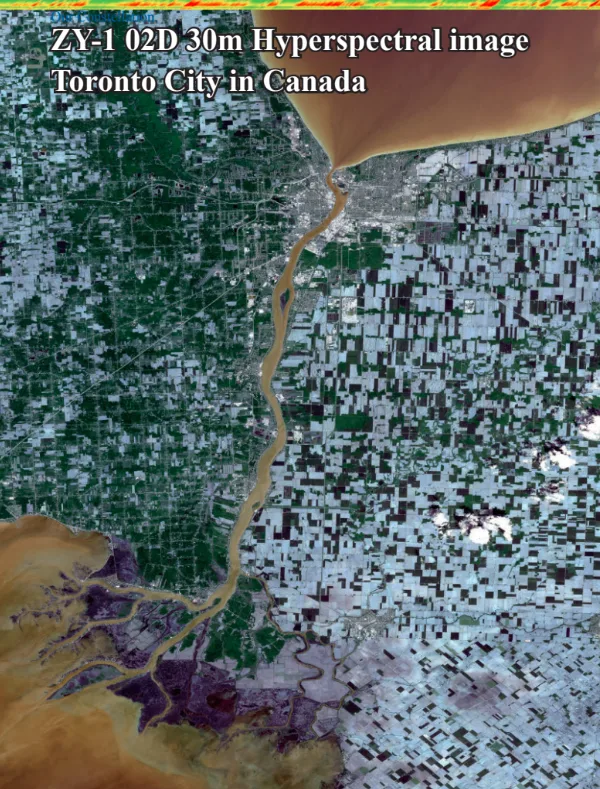
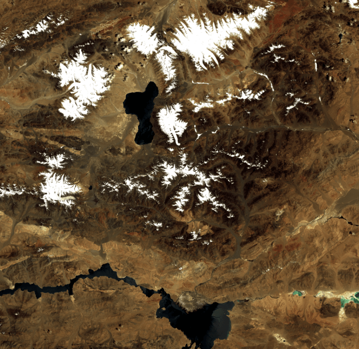
ZY-1 02D Sample Imagery