ZY-3 02 Satellite Imagery
As part of China's first civilian stereomapping constellation, the ZY-3 02 satellite is a cornerstone for creating high-precision 1:50,000 scale Digital Elevation Models (DEMs). It is specifically designed to acquire panchromatic stereoscopic pairs, providing invaluable data for detailed resource mapping, environmental surveying, and 3D modeling applications.

Resolution
2.1m Nadir
Revisits
1-2 Days
Swath Width
51 km
Primary Mission
Stereo Mapping
Bands
5
Stereo
Available
Technical Specifications
| Nadir Pan Resolution | 2.1m |
| Fwd/Bwd Pan Resolution | 2.7m |
| Multispectral Resolution | 5.8m |
| Swath Width | 51 km |
| Revisit Capacity (Single) | 5 days |
| Revisit Capacity (Constellation) | 1-2 days |
| Panchromatic Band | Pan: 0.50-0.80μm |
| Multispectral Bands |
Blue: 0.45-0.52μm Green: 0.52-0.59μm Red: 0.63-0.69μm NIR: 0.77-0.89μm |
Features and Benefits
- Advanced Stereo Mapping: As a core component of a civilian stereomapping constellation, ZY-3 02 provides essential data for generating accurate 3D terrain models and base maps.
- DEM Database Creation: Its primary capability supports the creation of high-quality 1:50,000 DEM databases, which are critical for detailed land analysis and large-scale planning.
- Comprehensive Coverage: The satellite's ability to collect stereoscopic pairs ensures seamless and consistent coverage across a significant portion of the Earth.
- Frequent Updates: The constellation's rapid revisit time of 1-2 days enables timely monitoring of dynamic changes for projects that require up-to-date information.
Applications
Why Choose XRTech Group for ZY-3 02 Imagery?
We provide more than just satellite data; we deliver comprehensive solutions tailored to your project's specific needs, ensuring you get actionable insights quickly and efficiently.
Expert Consultation
Our geospatial experts provide a free consultation to understand your needs and recommend the best acquisition parameters to ensure optimal results for your project.
Rapid Delivery
Leveraging our direct partnership and access to a vast 130+ satellite constellation, we offer fast turnaround times, delivering imagery in days, not weeks.
Seamless Integration
We deliver data in industry-standard formats (like GeoTIFF) compatible with your GIS, CAD, or modeling software, with a team ready to support your workflow.
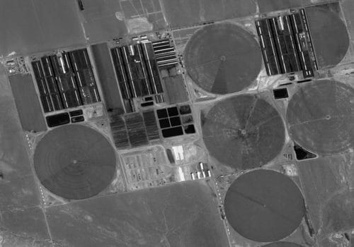
ZY-3 02 Sample Imagery