XRTech Group Case Study
AI-Powered High Resolution Satellite Imagery for Gold Exploration in Africa
How XRTech Group's deep learning models analyzed remote sensing data to identify high-potential gold deposits across hundreds of square kilometers in a challenging West African terrain, saving time and reducing exploration costs.
The Challenge: Pinpointing Gold in Vast, Promising Terrain
A leading exploration company needed to assess a large, remote concession in a resource-rich West African region, home to one of the continent's largest gold mines. The area lies within the Reguibat Shield, composed of Precambrian rocks ideal for hosting hydrothermal gold deposits. However, traditional ground surveys across such a vast area of several hundred square kilometers are prohibitively expensive and time-consuming.
The primary objectives were clear:
- Analyze multispectral and interferometric data from various satellites to map key geological indicators of mineralization.
- Utilize a deep learning model to compute the probability of gold presence across the entire study area, identifying specific rock alterations and mineral features.
- Deliver a ranked list of high-potential exploration targets to guide efficient ground-truthing efforts and optimize resource allocation.
A Data-Driven Exploration Strategy
Our methodology combined advanced satellite data processing with a custom-trained AI model to systematically identify promising exploration zones.
1. Remote Sensing Data Fusion
We integrated multispectral and interferometric data to build a comprehensive geological overview. This allowed us to map structural features like shear zones and faults, which are critical for mineral concentration, and create precise digital elevation models (DEM).
2. Mineral Feature Identification
The fused data was processed to detect specific minerals and rock alterations that serve as complementary indicators for hydrothermal gold deposits. This technique is also used in environmental monitoring to identify soil composition.
3. Deep Learning Analysis
These geological and mineralogical features were fed into our proprietary deep learning algorithm, which generated a detailed gold probability map for the entire region.
Key Results: Pinpointing High-Potential Zones with AI
The analysis successfully transformed raw high-resolution satellite imagery into actionable exploration intelligence, highlighting specific zones with a high probability of gold deposits.
1. Comprehensive Prospectivity Map
The primary deliverable was a detailed probability map, classifying the entire concession into distinct tiers of mineral potential (from <10% to over 20%). This allowed the client to visually prioritize vast areas instantly, focusing resources effectively.
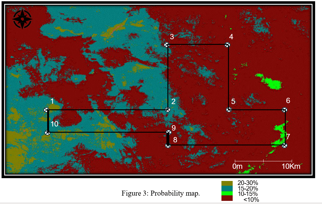
2. High-Confidence Target Identification
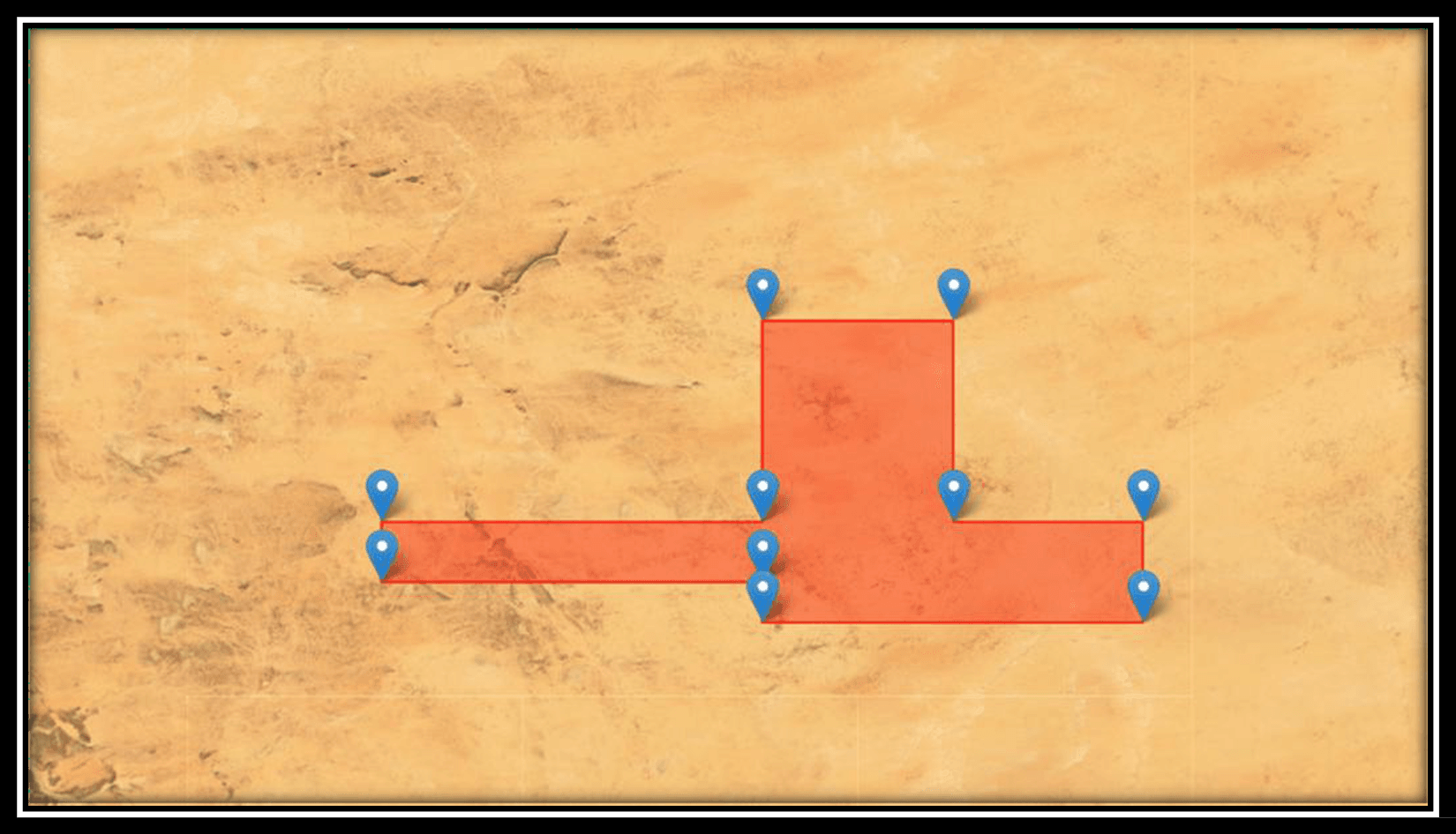
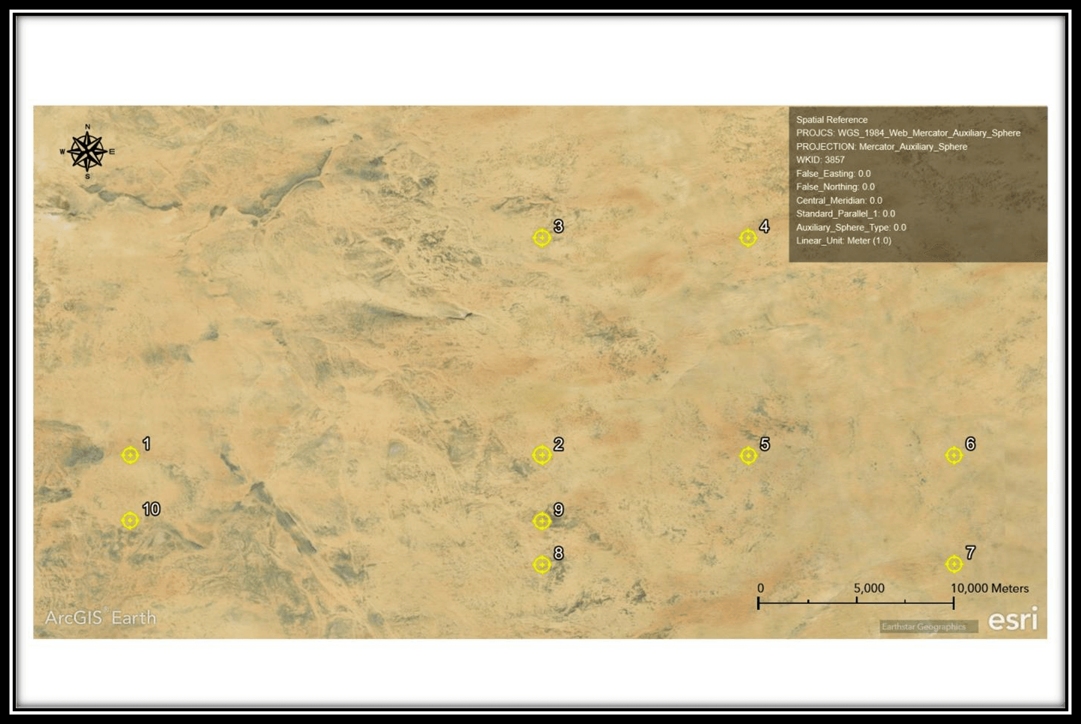
The deep learning model identified ten key locations for initial investigation, with several zones showing a gold probability of over 20%—a significant indicator in early-stage exploration. The top-ranked targets are summarized below:
| Target Point Ranking | Calculated Gold Probability |
|---|---|
| 1 (Target 10) | 21.69% |
| 2 (Target 1) | 20.16% |
| 3 (Target 9) | 15.97% |
| 4 (Target 2) | 14.86% |
| 5 (Target 3) | 13.23% |
Applications & Business Value
This AI-driven approach provides a significant competitive advantage in mineral exploration. The same technology can be applied to disaster management, urban planning, and projects for insurance companies.
Reduced Exploration Costs
Minimize expensive and time-consuming fieldwork by focusing only on AI-vetted, high-probability zones. This is also key when using satellite imagery for construction.
Accelerated Discovery Timeline
Dramatically shorten the path from initial assessment to discovery by eliminating low-potential areas early on.
Data-Driven Investment
Provide stakeholders with quantitative, data-backed evidence to de-risk investment decisions in exploration projects.
Scalable & Adaptable
This methodology can be rapidly deployed to other regions or adapted for exploring other commodities like copper, lithium, or rare earth elements.
A New Frontier in Mineral Exploration
This project proved that combining AI and deep learning with advanced remote sensing provides a revolutionary, cost-effective, and scalable method for modern mineral exploration. By delivering a clear, probabilistic guide, XRTech Group empowered the client to make faster, smarter decisions that maximized their chances of discovery while minimizing financial risk.
Disclaimer
This analysis is provided for informational and exploration guidance purposes only. While every effort has been made to ensure accuracy in processing satellite and spectral data using advanced techniques, the results presented herein do not constitute a guarantee of mineral presence or economic viability. Any interpretations, exploration activities, drilling, investments, or decisions made based on this report are solely at the discretion and risk of the client. XRTech assumes no liability or responsibility for any direct or indirect outcomes resulting from actions taken based on this report.
