
Tailings Dam Monitoring with InSAR & AI
Tailings Dam Monitoring: How Advanced Satellite Intelligence Is Transforming Tailings Dam Safety Tailings dams are among the most critical—and high-risk—structures
If you’re new to drones and wondering how far can a drone fly or what are the longest range drones, you might compare them to airplanes flying between countries. However, drones operate differently. Long range drones are advanced aerial machines designed to travel vast distances and stay in the air for extended periods. These long range drones are essential for various industries, including agriculture, mapping, security, and search-and-rescue missions.
With rapid advancements in drone technology, long-range drones now come with high-resolution cameras, GPS navigation, obstacle avoidance, and automated flight paths. Whether you need a drone for professional use or personal exploration, understanding the right features will help you choose the best model.
This guide covers 24 of the best long-range drones available. You’ll learn about different types, including fixed-wing drones, FPV drones, VTOL drones, and professional drones, along with their key specifications. Whether you’re surveying large fields, monitoring remote areas, or inspecting critical infrastructure, these drones are built to extend your reach and capabilities like never before.
But with so many options available, choosing the right long-range drone can be overwhelming. That’s why we’ve done the research and tested various models to bring you the best drones with the longest flight ranges. This guide will help you navigate your choices hassle-free, ensuring you get the most out of your investment.
A long-range drone is designed to cover vast distances while maintaining a stable connection and clear real-time video transmission. But the definition of “long-range” depends on who you ask.
Consumer drones typically have a flight range between a few kilometers to several dozen kilometers, while professional and industrial drones are capable of flying hundreds of kilometers.
The range of a drone depends on its type, purpose, and technology. Below is a breakdown of various drones and their typical flight distances:
The flight range of a long-range drone depends on two key factors:
For a drone to fly long distances, it must have:
Whether you need a drone for professional missions or personal exploration, long-range drones are built to push boundaries and enhance aerial capabilities like never before.
Long-range drones come in various types, each designed for specific tasks. The right drone depends on your needs—whether it’s detailed aerial photography, large-scale mapping, or precision inspections. Below is a breakdown of different long-range drone categories and their capabilities.
Multi-rotor drones, such as quadcopters, are widely used for aerial photography, surveillance, and detailed inspections. They offer:
These drones are best for photographers, security teams, and small-scale survey missions that require detailed, close-range footage.
Fixed-wing drones resemble airplanes and are built for long flights. These drones:
Flight ranges based on drone type:
If you need a long-range drone for large-scale mapping or surveying, a fixed-wing model is a great choice.
VTOL drones combine the strengths of multi-rotor and fixed-wing designs. These drones:
One example of VTOL drones is the JOUAV CW Series, known for long-range flights and flexible deployment.
Helicopter drones have a single rotor and are designed for tasks requiring stable hovering and high-precision control. These drones are often used for:
They offer great endurance and load capacity, making them a valuable tool for specialized applications.
Mini drones are small and lightweight, designed for missions that require agility and precision. They are useful in:
When selecting a long-range drone, consider:
With so many long-range drones available, choosing the right one can feel overwhelming. However, by understanding the strengths and limitations of each type, you can find the perfect drone for your needs.
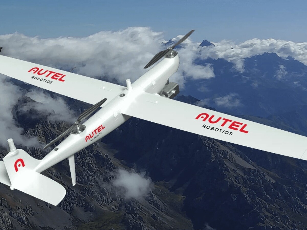
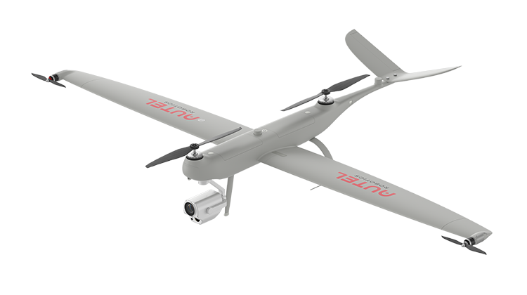
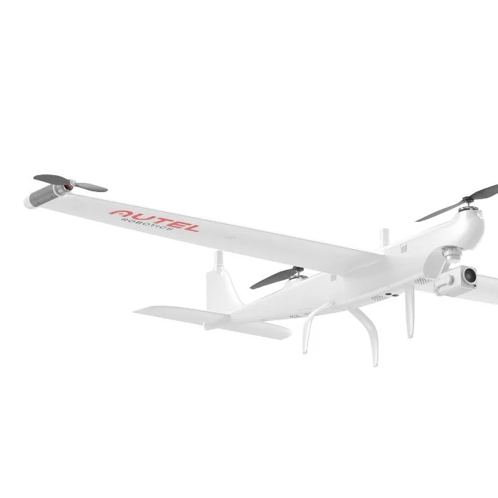
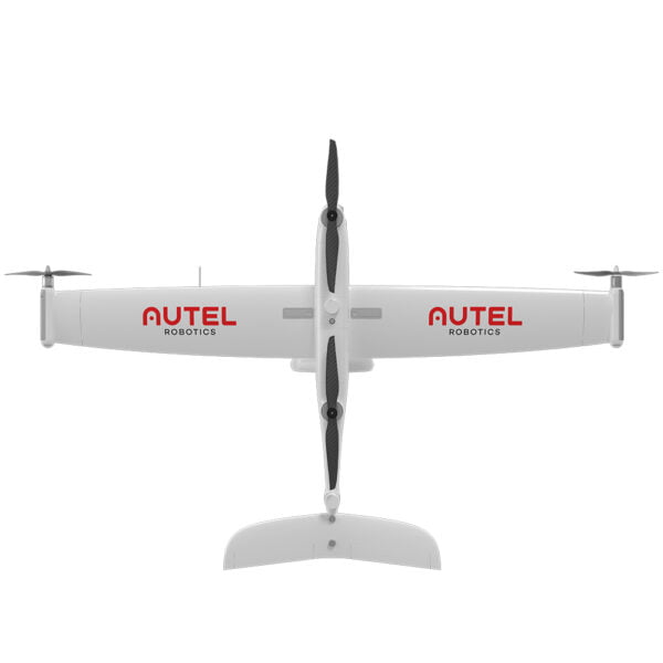
1. Autel Dragonfish Pro
| Feature Category | Details |
|---|---|
| Type | VTOL drone (Fixed-wing + Multirotor) |
| Range | Advertised 30 km (19 miles), real-world tests show a strong connection up to 16 km. |
| Flight Time | 158 minutes |
| Camera | L50T payload, 50x optical zoom & 240x hybrid zoom, captures details up to 2 km away, 4K video recording. |
| Build | Weather-resistant composite shell with carbon fiber frame for durability. |
| Transmission | Dual-frequency (2.4GHz & 5.8GHz) for a stable video feed even with obstacles. |
| Safety Features | AI-powered self-checks, automatic multi-rotor mode switch in emergencies, RTK modules for precise positioning, GPS loss and low battery protection, ADS-B for air traffic awareness. |
| Additional Features | Ready to fly in 3 minutes, centimeter-level accuracy with dual RTK modules, advanced payload options. |
The Autel Dragonfish Pro is designed for industries requiring long-range aerial operations and high-precision data collection. Common use cases include:
✅ Large-Scale Mapping & Surveying – Ideal for infrastructure planning, environmental studies, and topographical surveys.
✅ Surveillance & Law Enforcement – Used for border security, search & rescue, and monitoring operations.
✅ Industrial Inspections – Suitable for oil rigs, power lines, and offshore platforms.
✅ Mining & Construction – Helps with site planning, volume calculations, and progress tracking.
✅ Environmental Monitoring – Useful for wildlife tracking, deforestation analysis, and ecosystem studies.
✔ Exceptional Flight Time – 158 minutes of continuous operation.
✔ Strong Connection – Maintains a stable signal up to 16 km even with obstacles.
✔ Powerful Camera – 50x optical zoom, 240x hybrid zoom, and 4K video recording.
✔ Durable Build – Weather-resistant, carbon fiber-reinforced structure.
✔ Advanced Safety Features – AI self-checks, redundant systems, and RTK precision for safe operations.
✔ Stable Transmission – Dual-frequency signal prevents interference.
✔ Fast Deployment – Ready to fly in just 3 minutes.
✔ High Precision – Centimeter-level accuracy using dual RTK modules.
✖ Requires a Second Operator – Payload operation needs an additional controller.
✖ Expensive – The premium price may not be justified for all users.
Why Choose the Autel Dragonfish Pro?
If you’re looking for a long-range, high-performance drone with exceptional endurance, precision, and safety, the Autel Dragonfish Pro is one of the best options available.
✅ Long Endurance: 158 minutes of flight time allows for extended missions.
✅ Advanced Imaging: 50x zoom, 240x hybrid zoom, and 4K video for high-quality surveillance and inspection.
✅ Robust & Reliable: Weather-resistant carbon fiber build for harsh environments.
✅ Superior Safety: AI-powered self-checks, RTK accuracy, and dual-frequency transmission ensure safe and stable operations.
✅ Versatile VTOL Design: Vertical takeoff and landing means no runway required, making it ideal for quick deployment.
✅ Multi-Industry Applications: Whether it’s oil and gas, mining, construction, public safety, or environmental monitoring, this drone delivers powerful and reliable results.
While it has some limitations, such as target tracking issues and higher costs, the Autel Dragonfish Pro remains a top-tier drone for professionals who need long-range performance. If your work requires precise data collection, large-area coverage, and high-quality imaging, this drone is worth considering.
| Feature Category | Details |
|---|---|
| Type | VTOL drone (Fixed-wing + Multirotor) |
| Camera | 12 MP sensor, 4K video recording, 1/2.8” CMOS sensor |
| Flight Time | 126 minutes with payload |
| Transmission Distance | 30 km (18.6 miles) |
| Build | IP43-rated weather-resistant frame, built for industrial applications |
| Max Speed | 67 mph (30 m/s) in fixed-wing mode |
| Payload Capacity | Supports various payloads, including 4K zoom cameras and infrared sensors |
| Quick Assembly | Ready to fly in 5 minutes with modular design |
The Autel Dragonfish Standard is a cost-effective, high-performance drone designed for industrial use cases. It is widely used for:
✅ General Industrial Inspections – Suitable for factories, plants, and large facilities.
✅ Monitoring & Surveillance – Effective for wildlife tracking, border patrol, and security monitoring.
✅ Power Line Inspections – Helps detect faults, damage, and wear on power infrastructure.
✅ Infrastructure Mapping – Ideal for road construction, bridge monitoring, and urban planning.
✔ Long Flight Time – 120 minutes of continuous operation.
✔ Extended Range – 30 km transmission distance for long-distance missions.
✔ VTOL Capability – Easy takeoff and landing in varied environments.
✔ High-Quality Camera – 12 MP sensor with 4K video recording for clear imagery.
✔ Versatile Payload Support – Compatible with zoom cameras and infrared sensors.
✔ Weather-Resistant Design – IP43-rated frame for industrial and outdoor use.
✔ Quick Deployment – Ready to fly in just 5 minutes, saving setup time.
✔ Affordable Alternative – Offers great performance at a lower cost than the Pro model.
✖ Lacks Advanced Features of the Pro Version – Does not include:
If you need a cost-effective yet powerful long-range drone, the Autel Dragonfish Standard is an excellent option. It offers:
✅ Reliable Industrial Performance – Perfect for monitoring, inspections, and mapping.
✅ Long Flight Endurance – 120-minute flight time allows for extended missions.
✅ Balanced Cost & Performance – More affordable than the Pro model while still delivering high efficiency.
✅ VTOL Flexibility – Can take off and land anywhere without requiring a runway.
✅ High-Quality Imagery – 12 MP camera and 4K video recording provide detailed visuals.
✅ Ideal for Power Line Inspections & Infrastructure Mapping – Offers precision and stability in complex industrial environments.
The Autel Dragonfish Standard is a great investment for professionals looking for long-range capabilities without the high cost of premium drones. Its versatile design, extended flight time, and strong imaging features make it an ideal solution for industrial applications.
The Autel Dragonfish Lite is a compact, long-endurance VTOL drone designed for surveillance, law enforcement, and industrial applications. With a 80-minute flight time, a 30 km transmission range, and a high-quality 12 MP camera, it is a cost-effective solution for extended missions.
| Feature Category | Details |
|---|---|
| Type | VTOL (Vertical Takeoff and Landing) drone |
| Camera | 12 MP sensor, 4K video recording, 1/2.8” CMOS sensor |
| Flight Time | 80 minutes with payload |
| Transmission Distance | 30 km (18.6 miles) |
| Build | Designed for long-range surveillance, law enforcement, and infrastructure mapping |
| Max Speed | 67 mph (30 m/s) in fixed-wing mode |
| Payload Capacity | Supports zoom cameras, infrared sensors, and other modular payloads |
| Quick Assembly | Ready to fly in 5 minutes, with a modular design |
| Weather Resistance | IP43-rated frame, suitable for diverse environments |
The Autel Dragonfish Lite is an ideal drone for industries and organizations that require long-range aerial surveillance and data collection. It is commonly used for:
✅ Long-Range Surveillance – Ideal for border security, coastal monitoring, and wildlife tracking.
✅ Law Enforcement – Used for crowd monitoring, search-and-rescue operations, and tactical assessments.
✅ General Industrial Inspections – Helps with monitoring large facilities, factories, and plants.
✅ Infrastructure Mapping – Perfect for urban planning, road construction, and power line inspections.
✔ Designed for Long-Range Operations – Perfect for law enforcement and surveillance applications.
✔ Extended Flight Time – 80-minute endurance ensures longer missions without frequent recharging.
✔ 30 km Transmission Range – Covers a large operational area for data collection and inspections.
✔ VTOL Capability – Easy to deploy in any environment without requiring a runway.
✔ High-Quality Camera – 12 MP sensor and 4K video recording provide clear aerial imagery.
✔ 1/2.8” CMOS Sensor – Ensures sharp and detailed visuals for accurate data collection.
✔ Cost-Effective Solution – More affordable than high-end surveillance drones while offering long-range capabilities.
✔ Great for Infrastructure Mapping – Helps engineers and surveyors collect precise geographical data.
✖ Limited Advanced Features – Unlike Dragonfish Pro, it does not have:
The Autel Dragonfish Lite is a practical and cost-efficient choice for professionals needing long-range aerial surveillance, law enforcement support, and infrastructure mapping.
✅ Best for Long-Range Surveillance & Law Enforcement – Covers large areas efficiently.
✅ Extended Flight Time & Range – 80 minutes of endurance and 30 km transmission range.
✅ Easy Deployment – VTOL takeoff and landing make it ideal for any location.
✅ High-Quality Imaging – 12 MP sensor with 4K video recording ensures detailed visuals.
✅ Cost-Effective Solution – Affordable while still offering professional-grade performance.
If you need a powerful yet budget-friendly drone for long-range operations, the Autel Dragonfish Lite is a perfect fit.

The DJI Matrice 300 RTK is a powerful, long-range drone designed for professional aerial inspections, mapping, and surveying. With an impressive 55-minute flight time, a 15 km transmission range, and advanced AI capabilities, it is one of the most reliable drones for industrial use.
| Feature Category | Details |
|---|---|
| Type | Commercial multirotor drone, built for professional and industrial applications |
| Camera Payloads | Compatible with Zenmuse P1, L1, H20T camera systems |
| Sensor | Full-frame CMOS (P1), 1″ CMOS (H20T Wide Camera), Uncooled VOx Microbolometer (H20T Thermal) |
| Flight Time | 55 minutes with a single charge |
| Transmission Distance | 15 km (9.3 miles) with OcuSync Enterprise transmission |
| Max Speed | 51 mph (23 m/s) |
| Payload Capacity | Up to 2.7 kg |
| Obstacle Sensing | Omnidirectional Obstacle Sensing with six-directional vision sensors |
| Build | Robust design, inspired by modern aviation systems with weather-resistant features |
| Positioning System | GPS, GLONASS, BeiDou, RTK for ultra-precise navigation |
| Battery System | TB65 dual battery system, supports hot-swapping and operates in -20°C conditions |
The DJI Matrice 300 RTK is widely used for aerial mapping, inspections, and search & rescue operations. Its high payload capacity and AI capabilities make it ideal for:
✅ Aerial Mapping & Surveying – Collects high-resolution data with Lidar and photogrammetry technology.
✅ Industrial Inspections – Wind turbine inspections, pipeline monitoring, and power line inspections.
✅ Construction Project Monitoring – Helps in site planning, bridge inspections, and urban development.
✅ Search & Rescue Operations – Uses thermal cameras and AI tracking for disaster response and firefighting.
✅ Mining & Quarrying – Volume calculations, site planning, and land development.
✅ Offshore Inspections – Perfect for oil rigs, maritime surveillance, and solar panel inspections.
✅ Telecom Tower Inspections – Provides high-quality imaging for maintenance and troubleshooting.
✔ Reliable for Long-Range Missions – 15 km transmission range with OcuSync Enterprise technology.
✔ 55-Minute Flight Time – Longer endurance for industrial and mapping applications.
✔ Omnidirectional Obstacle Sensing – Six-directional vision sensors ensure real-time detection and avoidance.
✔ Multiple Payload Configurations – Supports Zenmuse P1, L1, H20T, and other camera systems.
✔ Advanced AI Features – Smart inspection automation and AI-powered analytics.
✔ High-Precision Positioning – RTK (Real-Time Kinematic) system for accurate geospatial data.
✔ Robust & Weather-Resistant – Built for extreme conditions with temperature tolerance down to -20°C.
✔ Hot-Swappable Battery System – TB65 dual battery setup for continuous operations without shutdown.
✖ Premium Pricing – Higher cost compared to other industrial drones.
✖ Slightly Heavier Than Competitors – Requires proper transportation and setup.
✖ Extended Charging Time – Longer battery recharge duration than smaller drones.
✖ Shorter Flight Time Compared to Some Fixed-Wing Drones – 55 minutes may be less than VTOL alternatives.
The DJI Matrice 300 RTK is one of the best long-range drones for professional and industrial use. Whether you need it for mapping, surveying, or inspections, this drone offers unmatched reliability, high-resolution imaging, and AI-powered automation.
✅ Best for Industrial Inspections & Mapping – Perfect for power line inspections, pipeline monitoring, and mining operations.
✅ Long Flight Time & Range – 55-minute flight endurance with 15 km transmission range.
✅ Smart AI Features – Automates inspection tasks, search & rescue, and surveying projects.
✅ High-Resolution Imaging – Zenmuse camera compatibility for detailed aerial visuals.
✅ Safe & Reliable – Omnidirectional sensing for real-time obstacle avoidance.
If you’re looking for a high-performance, long-range drone, the DJI Matrice 300 RTK is a top choice for professionals in surveying, construction, and security.
The DJI Matrice 350 RTK is a next-generation industrial drone, designed for mapping, surveying, and inspections. It improves upon the DJI Matrice 300 RTK, offering enhanced durability, longer endurance, and an upgraded transmission system. With a flight time of up to 55 minutes and a 20 km transmission range, it is one of the best long-range drones for industrial applications.
| Feature Category | Details |
|---|---|
| Type | Commercial multirotor drone, built for industrial and professional applications |
| Camera Payloads | Compatible with Zenmuse P1, L1, H20T, and third-party payloads |
| Sensor | Full-frame CMOS (P1), 1″ CMOS (H20T Wide Camera), Uncooled VOx Microbolometer (H20T Thermal) |
| Flight Time | Up to 55 minutes |
| Transmission Distance | 20 km (12.4 miles) with O3 Enterprise transmission |
| Max Speed | 51 mph (23 m/s) |
| Payload Capacity | Up to 2.7 kg |
| Obstacle Sensing | Omnidirectional Obstacle Sensing with six-way vision sensors |
| Build | Reinforced airframe, IP55 rating for dust and water resistance |
| Positioning System | GPS, GLONASS, BeiDou, RTK for ultra-precise navigation |
| Battery System | TB65 dual battery system, supports hot-swapping and operates in -20°C conditions |
The DJI Matrice 350 RTK is one of the most powerful long-range drones available. It is widely used in:
✅ Aerial Mapping & Surveying – Captures high-accuracy geospatial data with Lidar and photogrammetry.
✅ Industrial Inspections – Ideal for wind turbine inspections, pipeline monitoring, and power line inspections.
✅ Construction & Infrastructure Monitoring – Used for site planning, bridge inspections, and urban development.
✅ Search & Rescue Missions – Equipped with thermal imaging and AI tracking for disaster response.
✅ Mining & Quarrying Operations – Performs volume calculations, land assessments, and 3D mapping.
✅ Offshore & Oil Rig Inspections – Provides safe and reliable monitoring for maritime operations.
✅ Telecom Tower Inspections – Ensures high-quality imaging for maintenance and troubleshooting.
✅ Firefighting & Emergency Response – Uses thermal cameras for locating hotspots in wildfires and search operations.
✔ Industry-Leading Long-Range Capabilities – 20 km transmission range with O3 Enterprise technology.
✔ 55-Minute Flight Time – Extended endurance for industrial and mapping applications.
✔ Enhanced Obstacle Avoidance – Omnidirectional sensing with six-way vision sensors.
✔ Multiple Payload Support – Compatible with Zenmuse P1, L1, H20T, and custom third-party payloads.
✔ Strong Signal Stability – Features quad-antenna transmission system for low interference and high reliability.
✔ High-Precision RTK Positioning – Accurate geospatial data for mapping and surveying.
✔ Durable & Weather-Resistant – IP55-rated body for dust and water resistance, ideal for tough environments.
✔ Hot-Swappable Battery System – TB65 dual battery setup allows continuous operation without downtime.
✖ Premium Price – Higher cost due to advanced features and AI technology.
✖ Slightly Heavier Than Competitors – Needs proper transport and setup.
✖ Longer Charging Time – TB65 batteries take longer to recharge compared to smaller drone batteries.
✖ Requires Advanced Training – More complex controls due to AI features and multi-payload support.
The DJI Matrice 350 RTK is one of the best long-range drones for industrial, mapping, and inspection applications. It combines powerful AI, high-resolution imaging, and precise navigation, making it a top choice for professionals.
✅ Best for Industrial & Mapping Use – Ideal for construction, surveying, and inspections.
✅ Extended Flight Time & Range – 55-minute flight endurance and 20 km transmission range.
✅ Advanced AI & Smart Features – Automated inspection tasks, real-time analytics, and AI-powered flight modes.
✅ High-Quality Imaging – Zenmuse camera compatibility for detailed aerial visuals.
✅ Safe & Reliable – Omnidirectional obstacle sensing and real-time positioning.
If you need a high-performance, long-range drone with AI capabilities and advanced imaging, the DJI Matrice 350 RTK is the perfect solution.
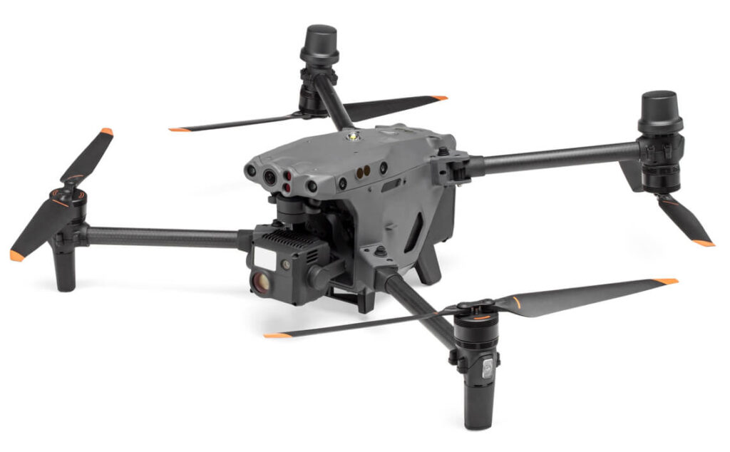
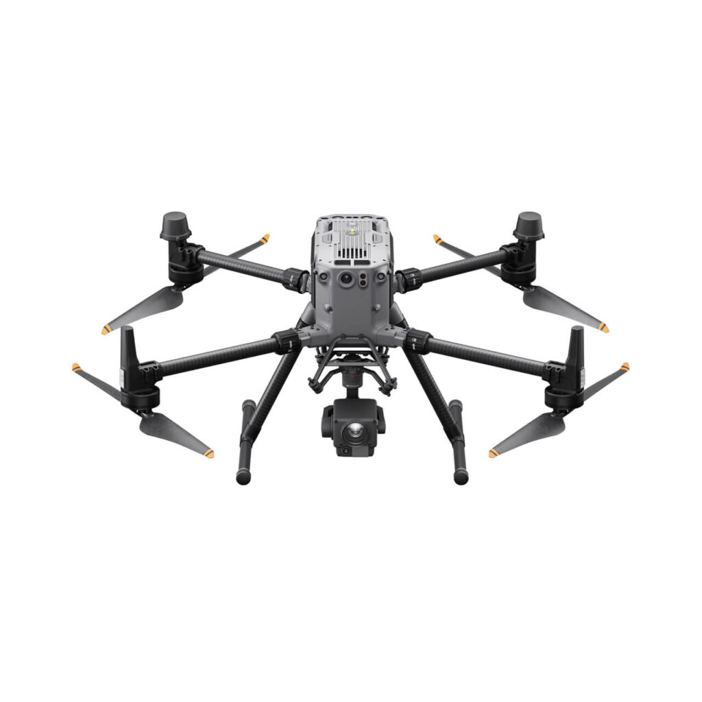
The DJI M30 and M30T are high-performance industrial drones designed for inspection, public safety, and emergency response. These drones combine portability, power, and advanced AI technology, making them ideal for long-range operations. The M30 features high-resolution optical and zoom cameras, while the M30T adds a thermal imaging sensor for night operations and search & rescue missions.
With a flight time of up to 41 minutes and a 15 km transmission range, the DJI M30 series is one of the best long-range drones for professionals.
| Feature Category | Details |
|---|---|
| Type | Portable industrial drone, built for inspections, public safety, and emergency response |
| Camera Payloads | M30: Zoom + Wide + Laser Rangefinder M30T: Zoom + Wide + Laser Rangefinder + Thermal Camera |
| Sensor | 48 MP zoom camera (1/2” CMOS), 12 MP wide-angle camera (1/2” CMOS), thermal sensor (M30T) |
| Flight Time | Up to 41 minutes |
| Transmission Distance | 15 km (9.3 miles) with OcuSync 3 Enterprise transmission |
| Max Speed | 51 mph (23 m/s) |
| Payload Capacity | Fixed payload with multi-sensor integration |
| Obstacle Sensing | Six-directional obstacle avoidance with advanced sensors |
| Build | Foldable design, IP55-rated for dust and water resistance |
| Positioning System | GPS, GLONASS, BeiDou, RTK for ultra-precise navigation |
| Battery System | TB30 hot-swappable batteries, supports operation in -20°C conditions |
The DJI M30 series is a powerful long-range drone designed for professional missions in tough environments. It is widely used in:
✅ Search & Rescue Missions – The M30T’s thermal camera helps locate missing persons in low visibility.
✅ Disaster Response – Deployed for flood, wildfire, and earthquake response.
✅ Industrial Inspections – Used for power line, wind turbine, and infrastructure inspections.
✅ Firefighting Support – Thermal imaging identifies hotspots and monitors fire spread.
✅ Law Enforcement & Surveillance – Enables real-time tracking and monitoring.
✅ Maritime & Offshore Operations – Water-resistant IP55 rating allows reliable use in coastal areas.
✅ Construction Site Monitoring – Captures detailed aerial images for project planning.
✔ Long-Range Performance – 15 km transmission range with OcuSync 3 Enterprise technology.
✔ High-Resolution Imaging – 48 MP zoom camera and 12 MP wide camera for detailed visuals.
✔ Thermal Imaging (M30T) – Ideal for night operations, firefighting, and search & rescue missions.
✔ Portable & Foldable Design – Easily transportable for rapid deployment.
✔ Enhanced Obstacle Avoidance – Six-directional vision sensors ensure safe flights.
✔ Rugged & Weatherproof – IP55-rated body for dust, rain, and extreme conditions.
✔ Hot-Swappable Batteries – TB30 batteries allow continuous operation without power loss.
✔ AI-Powered Automation – Smart flight features for automated inspections and tracking.
✖ Fixed Payload Design – Cannot swap cameras or add third-party payloads.
✖ Shorter Flight Time – 41 minutes is lower than larger industrial drones like the M350 RTK.
✖ Premium Price – High-tech features come at a cost.
✖ Requires Advanced Training – Multiple sensors and AI functions require experienced pilots.
The DJI M30 series is one of the best long-range drones for professionals needing powerful imaging, AI features, and rugged reliability.
✅ Best for Public Safety & Emergency Response – Firefighters, search & rescue teams, and law enforcement rely on the M30T’s thermal imaging.
✅ Long-Range & High-Speed Capabilities – 15 km transmission range and 51 mph top speed ensure fast, efficient missions.
✅ Advanced AI & Smart Features – Automated inspections, real-time object tracking, and AI-powered mapping.
✅ Weatherproof & Durable – IP55 rating makes it perfect for harsh environments.
✅ High-Resolution Data Collection – Ideal for infrastructure inspections and industrial surveys.
If you need a compact yet powerful long-range drone for industrial inspections, emergency response, or law enforcement, the DJI M30 / M30T is the ultimate choice.
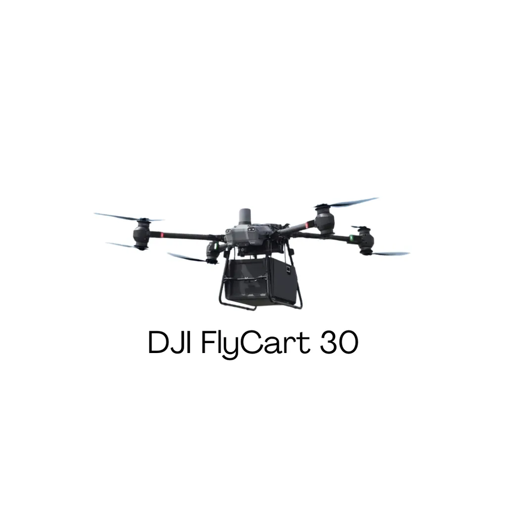
The DJI FlyCart 30 is a high-performance industrial drone designed for long-range cargo delivery in challenging environments. With a maximum payload of 30 kg, a transmission range of 28 km, and advanced AI-assisted flight capabilities, this drone is built for efficient and safe aerial transportation.
Designed with a dual-battery system and IP55 weather resistance, the DJI FlyCart 30 can operate in harsh conditions, including rain, snow, and strong winds. Its autonomous flight capabilities and smart obstacle avoidance make it a game-changer for logistics, emergency supply drops, and remote deliveries.
| Feature Category | Details |
|---|---|
| Type | Long-range cargo delivery drone |
| Payload Capacity | Up to 30 kg (66 lbs) |
| Flight Time | Up to 16 minutes with full payload, 18 minutes with 20 kg load |
| Transmission Distance | 28 km with OcuSync Enterprise |
| Max Speed | 20 m/s (72 km/h or 45 mph) |
| Weather Resistance | IP55-rated for dust and water resistance |
| Battery System | Dual TB65 batteries with hot-swapping capability |
| Flight Modes | Autonomous flight, waypoint navigation, real-time tracking |
| Obstacle Sensing | 360-degree obstacle detection for enhanced safety |
| Build | Heavy-duty carbon fiber frame for durability |
The DJI FlyCart 30 is designed to revolutionize aerial cargo transport, making it an essential tool in logistics, emergency response, and industrial operations.
✅ Remote Area Deliveries – Efficient transportation of medical supplies, food, and essentials to isolated locations.
✅ Emergency Supply Drops – Rapid deployment of relief materials in disaster-hit areas.
✅ Mountain & Offshore Logistics – Delivers goods to hard-to-reach places like mountains, islands, and oil rigs.
✅ Construction & Infrastructure – Transports tools, materials, and equipment across large work sites.
✅ Military & Defense – Aerial supply transport for troops in remote regions.
✅ Agricultural Operations – Carries fertilizers, pesticides, and supplies to large farms.
✔ Best for Long-Range Deliveries – 28 km transmission range with reliable OcuSync Enterprise technology.
✔ Heavy Payload Capacity – Carries up to 30 kg, making it ideal for logistics and industrial transport.
✔ Autonomous Flight & AI Navigation – Smart flight planning ensures efficiency and safety.
✔ Weather-Resistant Design – IP55-rated for use in rain, snow, and dust.
✔ 360° Obstacle Avoidance – Ensures safe flight in complex environments.
✔ Dual Battery System – TB65 batteries with hot-swappable function for continuous operations.
✔ Fast & Efficient – Reaches speeds of 72 km/h, reducing delivery times.
✖ Limited Flight Time – Only 16 minutes with max payload, but efficient for short-range cargo transport.
✖ Specialized Use Case – Not a multipurpose drone; designed mainly for cargo transport.
✖ Requires Skilled Operation – Needs trained pilots for autonomous and manual flight management.
✖ High Initial Cost – Premium features come at a higher investment.
The DJI FlyCart 30 is the best long-range drone for cargo transport, offering unmatched payload capacity, AI-driven navigation, and rugged durability.
✅ Perfect for logistics, supply chains, and emergency response teams.
✅ Ideal for businesses needing fast, aerial delivery solutions.
✅ Weather-resistant and built for extreme conditions.
✅ Advanced AI-powered automation for smart and efficient deliveries.
✅ Seamless integration into existing logistics and infrastructure networks.
If you need a powerful, long-range drone for safe and efficient aerial deliveries, the DJI FlyCart 30 is the ultimate choice.

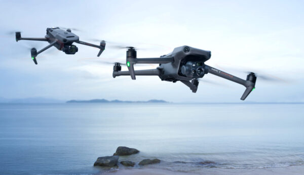
The DJI Mavic 3 is one of the best long-range drones for aerial photography and videography, featuring a transmission range of 15 km (9.3 miles) with OcuSync 3.0+ technology. This consumer drone is packed with a powerful Hasselblad camera, 5.1K video resolution, and omnidirectional obstacle sensing, making it a top choice for professionals and content creators.
With up to 46 minutes of flight time, the DJI Mavic 3 is perfect for long aerial shoots, ensuring crystal-clear image quality and smooth video recording. Whether you’re a filmmaker, real estate marketer, social media influencer, or vlogger, this drone delivers exceptional performance and reliability.
| Feature Category | Details |
|---|---|
| Type | Consumer drone designed for professional aerial photography & videography |
| Camera | 20 MP Hasselblad camera, 4/3″ CMOS sensor, 5.1K video resolution |
| Flight Time | Up to 46 minutes |
| Transmission Distance | 15 km (9.3 miles) with OcuSync 3.0+ |
| Obstacle Sensing | Omnidirectional obstacle detection for maximum safety |
| Max Speed | 21 m/s (75 km/h or 47 mph) |
| Battery | Intelligent flight battery for extended flight time |
| Build | Sleek, mid-sized design with a premium finish |
The DJI Mavic 3 is a top choice for professionals and hobbyists who require high-quality aerial imaging.
✅ Aerial Photography & Videography – Perfect for cinematic shots and breathtaking landscapes.
✅ Cinematic Video Production – Ideal for filmmakers and content creators.
✅ Real Estate Marketing – Capture stunning aerial footage of properties for listings.
✅ Social Media & Influencer Content – Create engaging aerial content for YouTube, Instagram, and TikTok.
✅ Event Coverage – Provides unique aerial perspectives for weddings, concerts, and sports events.
✅ Wildlife & Environmental Monitoring – Helps track and observe wildlife in their natural habitat.
✅ Aerial Surveys & Mapping – Useful for photogrammetry and 3D modeling.
✅ Vlogging & Travel Content – A must-have drone for travel bloggers and adventure enthusiasts.
✔ Best Long-Range Drone for Aerial Photography – 15 km transmission range for uninterrupted connectivity.
✔ Outstanding Image & Video Quality – Hasselblad camera with a 4/3” CMOS sensor delivers professional-grade images.
✔ Impressive Flight Time – Up to 46 minutes of continuous flight for longer aerial sessions.
✔ Omnidirectional Obstacle Sensing – Ensures safe and smooth navigation.
✔ Cinematic Video Capabilities – 5.1K video resolution with adjustable aperture for creative filming.
✔ Perfect for Professional & Social Media Use – Ideal for real estate, marketing, filmmaking, and content creation.
✔ Compact & Portable Design – Lightweight and foldable for easy transportation.
✖ Premium Price Tag – Higher cost compared to other consumer drones.
✖ Not Ideal for Beginners – Advanced features may require experience to use effectively.
✖ Gimbal Motors Could Be Stronger – Some users report minor stabilization issues.
✖ Limited Adjustments in Zoom Modes – Sharpness levels increase in 3x and 7x zoom settings.
✖ DJI RC Controller Response Time – Switching between cameras can be slightly slow.
The DJI Mavic 3 is the ultimate drone for professional aerial photography and videography, offering unmatched image quality, a long flight time, and a reliable transmission range.
✅ Perfect for professional photographers, filmmakers, and social media creators.
✅ Hasselblad camera with a 4/3” CMOS sensor delivers top-tier image quality.
✅ Best long-range drone for cinematic content, real estate marketing, and event coverage.
✅ Advanced obstacle avoidance for stress-free flying.
✅ Portable, foldable design makes it easy to carry anywhere.
If you’re looking for a premium long-range drone for high-quality aerial footage, the DJI Mavic 3 is the best choice.
The DJI Mavic 3 Thermal Enterprise is a high-performance long-range drone designed for professional applications such as search and rescue, firefighting, infrastructure inspection, and law enforcement. It features a dual-camera system with a 48 MP visual camera and a high-resolution thermal sensor, making it perfect for nighttime operations and detecting heat signatures.
With a maximum transmission range of 15 km (9.3 miles) using OcuSync 3.0+ technology, the DJI Mavic 3 Thermal ensures secure and stable communication even in challenging environments. It also offers up to 45 minutes of flight time, making it an excellent choice for long-duration operations.
| Feature Category | Details |
|---|---|
| Type | Enterprise drone for industrial applications |
| Camera | 48 MP visual camera + high-resolution thermal sensor |
| Thermal Resolution | 640 × 512 pixels |
| Flight Time | Up to 45 minutes |
| Transmission Distance | 15 km (9.3 miles) with OcuSync 3.0+ |
| Obstacle Sensing | Omnidirectional obstacle detection |
| Zoom Capability | 32x digital zoom (4x optical zoom) |
| Max Speed | 21 m/s (75 km/h or 47 mph) |
| Battery | Intelligent flight battery for extended missions |
| Build | Lightweight, foldable, and portable design |
The DJI Mavic 3 Thermal is one of the best long-range drones for industrial and emergency applications.
✅ Search & Rescue Missions – Locate missing persons in harsh conditions using thermal imaging.
✅ Firefighting & Disaster Response – Detect heat sources and monitor fire spread.
✅ Law Enforcement & Security – Conduct surveillance and nighttime operations efficiently.
✅ Infrastructure & Power Line Inspection – Identify faults in electrical grids and detect overheating components.
✅ Pipeline & Industrial Facility Monitoring – Ensure operational efficiency and detect leaks.
✅ Wildlife Conservation & Environmental Monitoring – Track animal movements and detect illegal activities.
✅ Construction Site Management – Monitor progress and detect structural issues.
✔ Best Long-Range Drone for Industrial Use – 15 km transmission range ensures stable connectivity.
✔ Dual-Camera System – 48 MP visual camera + thermal imaging for day and night operations.
✔ High-Resolution Thermal Sensor – 640 × 512 pixels for accurate heat detection.
✔ Impressive Flight Time – Up to 45 minutes for extended missions.
✔ Advanced Zoom Capabilities – 32x digital zoom (4x optical zoom) for detailed inspections.
✔ Omnidirectional Obstacle Avoidance – Ensures safe navigation in complex environments.
✔ Lightweight & Foldable Design – Portable and easy to deploy in emergency situations.
✖ Premium Price – High cost due to advanced thermal imaging and enterprise features.
✖ Not Designed for Beginners – Professional-level controls require training for optimal use.
✖ Limited Use for Casual Photography – More suited for industrial applications than creative filmmaking.
The DJI Mavic 3 Thermal Enterprise is the best long-range drone for industrial and emergency applications, offering thermal imaging, a high-resolution camera, and a 15 km transmission range.
✅ Perfect for search and rescue, firefighting, law enforcement, and industrial inspections.
✅ Thermal imaging ensures visibility in low-light and emergency scenarios.
✅ Long-range transmission and extended flight time make it ideal for critical missions.
✅ Foldable, portable design for rapid deployment in any situation.
✅ Reliable obstacle avoidance ensures safe and precise flying.
If you’re looking for a powerful, reliable, and high-tech long-range drone for professional use, the DJI Mavic 3 Thermal Enterprise is the ultimate choice.
The Autel Alpha is a high-performance long-range drone built for professional aerial operations, including long-range surveillance, industrial inspections, public safety, and emergency response. With a maximum transmission range of 15 km, this drone delivers exceptional long-range capabilities, making it one of the best drones for aerial monitoring and industrial applications.
Equipped with a 4K zoom camera featuring 35x optical zoom and 560x hybrid zoom, dual thermal imaging cameras, and AI-powered navigation, the Autel Alpha ensures high-quality imaging and real-time intelligence gathering. It also features a 50-minute flight time, omnidirectional obstacle avoidance, superior anti-interference, and A-Mesh networking technology, making it one of the most advanced drones for professionals.
| Feature Category | Details |
|---|---|
| Type | Professional industrial drone for surveillance, inspections, and public safety |
| Camera | 4K zoom camera (35x optical zoom, 560x hybrid zoom), 48 MP wide camera, dual thermal imaging |
| Laser Rangefinder | Detects up to 1.24 miles (2 km) |
| Flight Time | 40-50 minutes |
| Transmission Distance | 15 km for long-range drone operations |
| Obstacle Sensing | Omnidirectional obstacle avoidance with wire-level detection |
| Max Video Resolution | 4K UHD |
| Anti-Interference | Adaptive frequency-hopping, SLAM navigation for uninterrupted operation |
| Networking | A-Mesh technology for drone-to-drone communication |
| Battery | Hot-swappable batteries with dual redundancy |
| Weather Resistance | IP55-rated for challenging environments |
The Autel Alpha is designed for professional industries that require high-performance long-range drone capabilities.
✅ Long-Range Surveillance – Perfect for security, border control, and monitoring large areas.
✅ Industrial Inspections – Ideal for powerlines, substations, oil rigs, and refinery inspections.
✅ Public Safety & Emergency Response – Used by law enforcement, fire departments, and search & rescue teams.
✅ Security Operations – Helps detect threats in restricted or high-risk areas.
✅ Mapping & Spatial Planning – Supports construction, surveying, and urban development.
✅ Agriculture & Environmental Monitoring – Assists in land management and wildlife tracking.
✅ Anti-Smuggling & Border Security – Enhances monitoring of remote and unauthorized areas.
✔ Best Long-Range Drone for Professional Use – 15 km transmission distance for extensive coverage.
✔ Powerful Zoom & Thermal Imaging – 4K camera with 35x optical zoom and 560x hybrid zoom, plus dual thermal imaging.
✔ Exceptional Flight Time – Up to 50 minutes of uninterrupted operation.
✔ Laser Rangefinder – Accurately detects and calculates target distances up to 1.24 miles (2 km).
✔ Advanced Obstacle Avoidance – Omnidirectional sensors with wire-level detection.
✔ Superior Anti-Interference – Reliable performance near powerlines, towers, and critical structures.
✔ A-Mesh Networking – Multi-device drone-to-drone autonomous communication.
✔ Hot-Swappable Batteries – Allows continuous operation without downtime.
✔ Weather-Resistant Design – IP55 rating ensures durability in tough conditions.
✔ Autonomous Flight Capabilities – Supports global path planning and 3D scene reconstruction.
✔ Multi-Payload Support – Compatible with multiple attachments using an open PSDK platform.
✖ Premium Price – High cost compared to entry-level drones.
✖ Not for Beginners – Advanced features require professional knowledge.
✖ Larger & Heavier Build – Not as portable as consumer drones like the DJI Mavic series.
✖ Complex Setup – Requires proper calibration before flights.
The Autel Alpha is one of the best long-range drones for professional aerial operations, combining powerful imaging, extended flight time, and advanced navigation technologies.
✅ Perfect for industrial inspections, security surveillance, and emergency response.
✅ 4K zoom camera with 35x optical and 560x hybrid zoom for detailed imaging.
✅ Dual thermal cameras for short and long-range heat detection.
✅ 50-minute flight time allows for extended aerial operations.
✅ 15 km transmission range ensures long-distance coverage.
✅ Omnidirectional obstacle avoidance provides enhanced safety.
✅ A-Mesh networking enables multi-device communication, even without a public network.
✅ Hot-swappable batteries ensure non-stop operations.
✅ Autonomous flight features include AI target recognition and 3D scene reconstruction.
For professionals looking for a high-end long-range drone for surveillance, industrial inspections, and security, the Autel Alpha is an unbeatable choice.
The Autel EVO II is a high-performance long-range drone designed for professionals in filmmaking, photography, real estate, and social media content creation. With an industry-leading 8K video resolution and 48 MP still camera, this drone delivers unmatched image quality, making it an ideal choice for professional aerial photography.
With a maximum transmission distance of 9 km and up to 40 minutes of flight time, the Autel EVO II ensures extended flight sessions with stable connectivity. Its omnidirectional obstacle sensing provides added safety, making it a reliable drone for complex aerial operations.
| Feature Category | Details |
|---|---|
| Type | Long-range drone for high-resolution video & photography |
| Camera | 48 MP still camera, 8K video resolution |
| Sensor | 1/2″ CMOS sensor for exceptional image quality |
| Flight Time | Up to 40 minutes |
| Transmission Distance | 9 km long-range transmission |
| Obstacle Sensing | Omnidirectional obstacle detection for safe flying |
| Max Video Resolution | 8K at 25fps for ultra-high-definition video |
| Max Photo Resolution | 48 MP for detailed aerial shots |
| Build | Durable, foldable design for easy transportation |
The Autel EVO II long-range drone is used across various industries that require high-quality aerial imaging and extended flight performance.
✅ High-Resolution Aerial Photography & Videography – Capture breathtaking images & cinematic footage.
✅ Filmmaking & Professional Photography – Perfect for high-quality commercial video production.
✅ Social Media Content Creation – Create stunning aerial content for Instagram, YouTube, and TikTok.
✅ Real Estate Marketing – Shoot professional property listings with detailed aerial shots.
✅ Environmental Studies & Conservation – Useful for monitoring landscapes, wildlife, and ecosystems.
✅ Educational Programs – Ideal for teaching drone technology and aerial mapping.
✔ 8K Video Resolution & 48 MP Camera – Unmatched clarity and image sharpness.
✔ Long-Range Transmission (9 km) – Stable connection for long-distance flights.
✔ 40-Minute Flight Time – Extended sessions for aerial shoots.
✔ Omnidirectional Obstacle Sensing – Enhanced safety while navigating complex environments.
✔ 1/2″ CMOS Sensor – Delivers superior image quality and low-light performance.
✔ Perfect for Filmmakers & Content Creators – Ideal for professional photography, video production, and vlogging.
✔ Durable & Portable Design – Withstands crashes and comes with a premium carrying case.
✔ Automated Flight Paths – Allows for smooth, pre-programmed cinematic shots.
✔ Great for Education & Environmental Research – Used in teaching drone technology and conservation studies.
✖ Premium Price – Higher cost compared to other consumer drones.
✖ Slightly Heavy Build – Not as lightweight as other compact drones.
✖ Limited Low-Light Performance – Not as strong as larger sensor drones in low-light conditions.
✖ Software Updates Can Be Slow – Some users report delayed firmware updates.
The Autel EVO II is one of the best long-range drones for professional-grade aerial photography and videography. Its 8K video capability, 48 MP camera, and extended flight time make it a powerful tool for filmmakers, photographers, and content creators.
✅ Perfect for professional photographers, filmmakers, and social media influencers.
✅ Industry-leading 8K video resolution for cinematic footage.
✅ Long 40-minute flight time for uninterrupted aerial shots.
✅ Omnidirectional obstacle sensing ensures safe flying.
✅ A great choice for real estate, education, and environmental monitoring.
If you’re looking for a high-quality, long-range drone that delivers stunning aerial footage, the Autel EVO II is the perfect choice.
The Autel EVO II Dual 640T V3 is a high-performance long-range drone designed for industrial, public safety, and environmental applications. Equipped with a powerful 640×512 thermal camera and a 50 MP visual camera, this drone provides detailed imaging in both thermal and visible spectrums. With a 15 km transmission range and advanced AI tracking, it is one of the best drones for industrial inspections, search and rescue, and night surveillance.
This dual-camera long-range drone comes with SkyLink 2.0 transmission technology, 360° obstacle avoidance, and 38 minutes of flight time, making it a reliable choice for professionals who need precision imaging and maximum efficiency in critical operations.
| Feature Category | Details |
|---|---|
| Type | Dual-camera drone with thermal imaging and visual capabilities |
| Thermal Camera | 640×512 resolution, 13mm focal length lens, 16x digital zoom |
| Visual Camera | 50MP, 0.8″ RYYB CMOS sensor |
| Image Transmission | 15 km range, SkyLink 2.0, Tri-band communication (2.4GHz / 5.8GHz / 900MHz) |
| Obstacle Avoidance | 360° obstacle avoidance with 19 groups of sensors |
| Flight Time | 38 minutes |
| Smart Controller V3 | 7.9-inch 2000 nit high-brightness screen |
| Additional Features | Dynamic Track 2.1, ADS-B signal receiver, multiple temperature measurement modes, Picture-in-Picture display, IRPC Tool for thermal analysis |
| Max Video Resolution | 8K at 25fps (visual camera); 640×512 at 25fps (thermal camera) |
| Max Photo Resolution | 50 MP (visual camera); 640*512 (thermal camera) |
The Autel EVO II Dual 640T V3 long-range drone is designed for professional operations where thermal and visual imaging are crucial.
✅ Industrial Inspections – Monitor infrastructure, power lines, and pipelines with high-resolution imaging.
✅ Search & Rescue Missions – Locate missing persons and survivors using thermal detection.
✅ Thermal Inspections – Detect heat leaks, equipment malfunctions, and fire hazards.
✅ Low-Light Operations & Night Surveillance – Ideal for law enforcement and security patrols.
✅ Power Line Inspections – Safely inspect electrical grids and transmission lines.
✅ Wildlife Tracking & Environmental Monitoring – Observe and protect ecosystems with minimal disturbance.
✅ Public Safety & Security – Used by emergency responders for tactical surveillance.
✅ Emergency Response – Quick deployment for disaster management and damage assessment.
✔ Advanced Dual-Camera System – 640×512 thermal camera + 50MP visual camera for high-precision imaging.
✔ Long Transmission Range – SkyLink 2.0 ensures a stable connection up to 15 km.
✔ High-Resolution Imaging – 8K video and 50 MP photos provide exceptional clarity.
✔ Multiple Temperature Measurement Modes – Supports central, spot, and regional temperature readings.
✔ Picture-in-Picture Display – Combines thermal and visual imaging for better analysis.
✔ IRPC Tool for Thermal Analysis – Free software for image analysis and report generation.
✔ Low-Light Performance – 0.8″ RYYB CMOS sensor captures clear images in dark environments.
✔ AI-Enhanced Dynamic Tracking – Automatically follows moving subjects while avoiding obstacles.
✔ 360° Obstacle Avoidance – 19 groups of sensors ensure safe flights in complex environments.
✔ Tri-Band Communication – Automatic frequency hopping for better anti-interference protection.
✔ Smart Controller V3 – 7.9″ screen with 2000-nit brightness for outdoor visibility.
✔ Reliable Flight Performance – 38 minutes of flight time for extended operations.
✖ No RTK Support – Lacks RTK modules for high-precision mapping.
Why Choose the Autel EVO II Dual 640T V3?
The Autel EVO II Dual 640T V3 is the ultimate long-range drone for thermal and visual imaging, offering high-resolution cameras, smart AI features, and a powerful transmission system.
✅ Ideal for industrial inspections, search-and-rescue, and emergency response teams.
✅ Equipped with a 640×512 thermal camera for heat detection and monitoring.
✅ 50 MP ultra-sensitive RYYB sensor captures detailed images in low light.
✅ 15 km range with SkyLink 2.0 ensures reliable, interference-free operation.
✅ AI tracking, multiple temperature measurement modes, and Picture-in-Picture display for enhanced usability.
✅ 360° obstacle avoidance for safe navigation in complex environments.
✅ Smart Controller V3 with high-brightness display for better outdoor visibility.
✅ Supports 8K video recording for ultra-high-definition footage.
If you need a professional-grade long-range drone with both thermal and visual imaging, the Autel EVO II Dual 640T V3 is the best choice for your operations.
The Autel EVO II Enterprise V3 is a high-performance long-range drone built for enterprise-level operations, such as inspection, search and rescue, security, and mapping. With an impressive transmission range of 15 km (9.3 miles) and a maximum range of 25 km, this enterprise drone delivers high-resolution imaging, extended flight time, and advanced obstacle avoidance, making it an excellent choice for demanding aerial missions.
The Autel EVO II Enterprise V3 is equipped with a 48 MP camera, 8K video recording, thermal imaging options, and 3x lossless zoom, ensuring top-tier image quality for professional applications. With a robust airframe, enhanced heat dissipation, and extended flight stability, it is the perfect drone for professionals in industrial inspections, public safety, and emergency response.
| Feature Category | Details |
|---|---|
| Type | Enterprise-level multi-rotor drone with advanced imaging capabilities |
| Camera | 48 MP still camera, 8K video recording capability, thermal imaging option |
| Sensor | 1/2″ CMOS sensor (main camera); Uncooled VOx Microbolometer (thermal) |
| Image Transmission | 9.3 miles (15 km) transmission range, tri-band communication (2.4GHz / 5.8GHz / 900MHz) with automatic frequency hopping for interference-free operations |
| Flight Time | 42 minutes |
| Obstacle Avoidance | 360° obstacle avoidance with 19 groups of sensors, including 12 visual sensors, ultrasound, IMUs, and the main camera |
| Zoom | 3x lossless zoom and 16x digital zoom for detailed inspections |
| Additional Features | Modular accessories, compatibility with Pix4D, DroneDeploy, SkyeBrowse, ADS-B receiver, extended thermal vents, longer carbon fiber arms, Moonlight Algorithm 2.0 for low-light performance |
| Maximum Range | 25 km |
| Max Video Resolution | 8K at 25fps |
| Max Photo Resolution | 48 MP |
The Autel EVO II Enterprise V3 is designed for professional applications, making it a versatile tool for complex aerial missions.
✅ Infrastructure & Power Line Inspections – Conduct high-precision aerial inspections of buildings, bridges, and power lines.
✅ Search & Rescue Missions – Locate missing persons and assist emergency teams with aerial thermal imaging.
✅ Situation Overwatch – Monitor large-scale events and security operations.
✅ Mapping & 3D Modeling – Generate high-resolution 3D maps with third-party software integration.
✅ Accident Reconstruction – Capture aerial imagery for forensic analysis and reconstruction.
✅ Thermal Inspections – Detect heat signatures for industrial and environmental applications.
✅ Public Safety & Emergency Response – Support law enforcement and firefighting operations.
✅ Long-Range Surveillance – Monitor large areas for security and law enforcement purposes.
✅ Industrial Inspections – Evaluate pipelines, towers, and critical infrastructure.
✅ Environmental Monitoring – Assess deforestation, pollution, and wildlife conservation efforts.
✔ High-Resolution Imaging – Capture 48 MP photos and record 8K video with superior clarity.
✔ Extended Flight Time – 42 minutes of flight ensures maximum operational efficiency.
✔ Best Long-Range Drone for Professional Use – 15 km image transmission range with tri-band communication for stable connections.
✔ 360° Obstacle Avoidance – 19 sensor groups, including 12 visual sensors, enhance safety.
✔ Thermal Imaging Capabilities – Ideal for industrial and emergency applications.
✔ Modular Design & Accessories – Supports attachments such as loudspeakers, strobes, and spotlights.
✔ Advanced Low-Light Performance – Moonlight Algorithm 2.0 enhances night-time imaging.
✔ Strong Flight Stability – Longer carbon fiber arms and larger propellers improve aerodynamics.
✔ 3x Lossless Zoom & 16x Digital Zoom – Capture high-detail images from safe distances.
✔ Enterprise-Level Performance – Designed for complex tasks such as inspections, surveillance, and mapping.
✔ Compatible with Leading Software – Works seamlessly with Pix4D, DroneDeploy, and SkyeBrowse.
✔ Enhanced Heat Dissipation – Extended thermal vents prolong battery life and improve efficiency.
✔ ADS-B Receiver – Increases airspace safety by detecting nearby aircraft.
✖ Higher Cost – Premium pricing for enterprise-level features.
✖ Requires Professional Training – Not suitable for beginners due to advanced controls.
✖ Larger & Heavier Design – Less portable compared to consumer drones.
✖ 900MHz Band Limitation – Only available in FCC-compliant regions.
The Autel EVO II Enterprise V3 is the best long-range drone for professional aerial operations, offering unmatched image quality, flight stability, and modular versatility.
✅ Designed for professionals who need powerful aerial solutions for industrial, security, and rescue operations.
✅ Offers high-end imaging capabilities with 48 MP photos and 8K video recording.
✅ Delivers superior performance with a long transmission range of 15 km and a max range of 25 km.
✅ Supports enterprise applications such as inspections, mapping, and emergency response.
✅ Integrates seamlessly with third-party software for workflow optimization.
✅ Features robust safety measures, including 360° obstacle avoidance and ADS-B receiver.
✅ Provides extended flight time of 42 minutes for maximum efficiency.
✅ Ideal for thermal imaging, law enforcement, and environmental monitoring.
If you’re looking for a long-range enterprise drone with high-resolution imaging, extended flight time, and top-tier safety features, the Autel EVO II Enterprise V3 is the perfect choice.
The Autel EVO II Pro V3 is a high-performance long-range drone designed for professionals and drone enthusiasts who demand top-tier imaging, advanced flight features, and a robust build. Equipped with a 1-inch CMOS sensor, 6K video capability, and a 9.3-mile (15 km) transmission range, this drone is perfect for aerial cinematography, professional photography, and demanding missions that require high-quality imaging.
With its 360° obstacle avoidance, adjustable aperture (f/2.8-f/11), and Moonlight Algorithm 2.0 for low-light photography, the Autel EVO II Pro V3 is a reliable choice for capturing stunning visuals, even in challenging conditions.
| Feature Category | Details |
|---|---|
| Type | Consumer/Professional multi-rotor drone |
| Camera | 20 MP still camera, 6K video recording capability, 1-inch CMOS sensor |
| Sensor | 1-inch CMOS sensor |
| Image Transmission | 9.3 miles (15 km) maximum transmission range with HD video transmission, tri-band communication (2.4GHz / 5.8GHz / 900MHz) with automatic frequency hopping for maximum anti-interference. 900MHz frequency band is only applicable for FCC countries. |
| Flight Time | 37-39 minutes (without RTK) or 34 minutes (with RTK) |
| Obstacle Avoidance | 360° obstacle avoidance with 19 groups of sensors, including 12 visual sensors, the main camera, ultrasound, and IMUs. |
| Zoom | 1-16x digital zoom (maximum 3x lossless zoom) |
| Aperture | Adjustable f/2.8-f/11 |
| ISO Range | Video: ISO100 ~ ISO6400; Photo: ISO100 ~ ISO6400; Night scene mode: Maximum video ISO44000 |
| Video Resolution | Up to 6K at 30fps |
| Photo Resolution | 20MP |
| Additional Features | Moonlight Algorithm 2.0 for low-light photography, 4K HDR video, 12-Bit DNG photos, Hyper-Lapse Photography in 6K, Autel Smart Controller SE compatibility, and a durable design |
| Maximum Range | 25 km |
| Maximum Flight Distance | 25 km |
| Wind Resistance | 12 m/s (27 mph) |
| Maximum Flight Speed | 20 m/s (45 mph) in Ludicrous mode |
| Internal Storage | 8GB onboard storage |
The Autel EVO II Pro V3 is a versatile long-range drone with advanced imaging capabilities, making it suitable for various industries and creative applications:
✔ 1-inch CMOS sensor delivers superior image quality for professional photography and videography.
✔ 6K video recording with 20MP still images ensures crisp, detailed shots.
✔ Long-range transmission of 9.3 miles (15 km) allows stable operation over long distances.
✔ Tri-band communication (2.4GHz / 5.8GHz / 900MHz) provides enhanced anti-interference.
✔ Adjustable aperture (f/2.8-f/11) for greater control over exposure and depth of field.
✔ 360° obstacle avoidance enhances flight safety in complex environments.
✔ Extended flight time of up to 39 minutes, perfect for long aerial sessions.
✔ Moonlight Algorithm 2.0 improves low-light performance for night photography.
✔ 4K HDR video support enhances dynamic range for more vibrant colors.
✔ 12-bit DNG RAW photos provide flexibility in post-production editing.
✔ 6K Hyper-Lapse Photography for creative time-lapse videos.
✔ SkyLink 2.0 Video Transmission system ensures a stable connection with low latency.
✔ Multiple color profiles, including Log 10-bit HDR up to 4K, for cinematic workflows.
✔ High wind resistance (12m/s or 27 mph) ensures stable flight in tough conditions.
✔ Maximum flight speed of 20 m/s (45 mph) in Ludicrous Mode for fast maneuverability.
✔ 8GB onboard storage provides backup for critical footage.
✔ Autel Smart Controller SE compatibility with a 6.4-inch OLED screen for a premium control experience.
✔ Durable build and premium carrying case for professional use and transport.
✖ Shorter battery life compared to some high-end drones.
✖ Lacks some intelligent flight features available in competitors.
✖ Default video profile has excessive sharpening, requiring post-processing adjustments.
✖ Many functions require a smartphone app for full control.
✖ 10-bit Log video is not available in 6K resolution.
✖ No iPhone cable included, requiring additional accessories for iOS users.
✖ Obstacle avoidance may be less effective in low-light conditions.
✖ Occasional weak signal warnings in real-world long-range testing.
✖ May lose connection and land if flown too far with low battery.
The Autel EVO II Pro V3 is one of the best long-range drones for professionals looking for top-tier imaging and advanced performance. Here’s why it stands out:
✔ Ideal for professional aerial photography and videography with 6K resolution and a 1-inch CMOS sensor.
✔ Best-in-class low-light performance with Moonlight Algorithm 2.0 for nighttime shoots.
✔ Adjustable aperture (f/2.8-f/11) allows creative control over depth of field.
✔ 9.3-mile (15 km) long-range transmission ensures uninterrupted flights.
✔ 360° obstacle avoidance enhances flight safety, reducing crash risks.
✔ Hyper-Lapse Photography and 12-bit DNG RAW support give cinematic flexibility.
✔ High wind resistance and fast flight speed (45 mph) make it suitable for extreme environments.
✔ Durable build quality and included premium case ensure safe transport and reliability.
✔ Tri-band communication with automatic frequency hopping reduces signal interference.
✔ Compatible with Autel Smart Controller SE, which has a high-brightness OLED screen.
The Autel EVO II RTK V3 is a high-performance long-range drone designed for professional mapping, surveying, and industrial applications. With its advanced RTK (Real-Time Kinematic) technology, high-resolution camera, and 9.3-mile transmission range, this drone delivers centimeter-level accuracy without requiring Ground Control Points (GCPs). Its robust obstacle avoidance, powerful Autel Smart Controller V3, and Autel Mapper software compatibility make it one of the best choices for surveying, inspections, and photogrammetry.
| Feature | Specification |
|---|---|
| Positioning System | Real-time centimeter-level RTK positioning, supports PPK, horizontal accuracy: 1 cm + 1 ppm, vertical accuracy: 1.5 cm + 1 ppm |
| Base Station Support | Connects to RTK base station and NTRIP RTK networks, supports all NTRIP-compatible base stations |
| GCP Requirement | No GCPs required for centimeter-grade accuracy |
| Camera (EVO II Pro RTK V3) | 1-inch CMOS sensor, 20 MP, 6K video @ 30fps, adjustable aperture (f/2.8–f/11), 1-16x digital zoom (3x lossless) |
| Mapping Software | Autel Mapper, supports roll & global shutter cameras, real-time 2D stitching, 2D and 3D reconstruction, meets 1:500 precision requirement without GCPs |
| Multi-NTRIP Profile Saving | Records previous flight positions for repeatable data acquisition missions |
| Obstacle Avoidance | 360° obstacle avoidance system with 19 sensors (12 visual, ultrasonic, IMUs) |
| Video Transmission | SkyLink 2.0, 9+ mile (15 km) range, tri-band communication (2.4GHz/5.8GHz/900MHz), automatic frequency hopping |
| Max Flight Time | 38 minutes |
| Max Transmission Range | 9.3 miles (15 km) (FCC: 9 miles, CE: 5 miles) |
| Max Wind Resistance | 27 mph (12 m/s) |
| Max Flight Speed | 45 mph (20 m/s) |
| Smart Controller | Autel Smart Controller V3, 7.9-inch, 2000-nit bright screen, SkyLink 2.0 |
| Mission Planner | Rectangular & Polygon mission planners for photogrammetry |
| Zoom | 1-16x digital zoom, 3x lossless zoom (EVO II Pro RTK V3) |
| Internal Storage | 8GB, supports SD cards up to 256GB |
| Setup to Takeoff Time | 45 seconds |
| Dimensions (Folded) | 230×130×143 mm |
| Dimensions (Unfolded) | 457×558×143 mm |
| Weight | 1237g (EVO II Pro RTK V3) |
| Takeoff Weight | 1270g (EVO II Pro RTK V3) |
| Operating Temperature | -10°C to 40°C (14°F to 104°F) |
| No Fly Zones | No restrictions – Can take off anywhere |
EVO II Pro RTK V3 Camera:
EVO II Dual 640T RTK V3 Camera (Thermal + Visual):
✔ Centimeter-Level Accuracy – RTK/PPK positioning for precise data.
✔ No GCPs Needed – Saves time and effort in surveying projects.
✔ 6K Camera with Adjustable Aperture – Superior image quality.
✔ Thermal Imaging Option – Dual 640T RTK V3 offers thermal capabilities.
✔ Long-Range Transmission (9.3 miles) – Ideal for large-scale missions.
✔ 360° Obstacle Avoidance – Advanced safety system.
✔ Autel Smart Controller V3 – 7.9-inch ultra-bright display.
✔ 38-Minute Flight Time – Efficient for extended missions.
✔ No No-Fly Zones – Unrestricted flying capabilities.
✔ Supports 3rd-Party RTK Base Stations – Flexible positioning options.
✖ High Price – More expensive than consumer drones.
✖ Limited to 38-Minute Flight Time – May require extra batteries for long missions.
✖ Larger Size When Unfolded – Not as portable as compact drones.
✖ Steep Learning Curve – Requires training for full utilization.
The Autel EVO II RTK V3 is one of the best long-range drones for professionals in surveying, mapping, and industrial applications. With its RTK module, high-resolution camera, and no-fly zone restrictions, it offers unmatched precision, reliability, and flexibility. Whether you need high-accuracy mapping, real estate modeling, or infrastructure inspections, this drone delivers exceptional performance with industry-leading technology.
The Autel EVO Lite is a long-range drone designed for both hobbyists and professionals. It is lightweight, portable, and packed with advanced features. Competing with drones like the DJI Air 2S and DJI Mavic 3, it is the first in its category to feature a 4-axis gimbal for vertical video capture. Equipped with a 50MP camera and 1/1.28″ CMOS sensor, the EVO Lite delivers 4K HDR video with a 1-16x digital zoom. The Autel SkyLink transmission system provides a 7.4-mile (12 km) range, ensuring reliable connectivity.
| Feature | Specification |
|---|---|
| Camera | 50 MP, 1/1.28″ CMOS sensor, RYYB filter, 4K HDR video, 1-16x digital zoom |
| Gimbal | 4-axis, enables vertical video |
| Obstacle Avoidance | Ultra-wide angle, 150° front FOV, forward/backward/downward detection |
| Video Transmission | Autel SkyLink, 7.4 miles (12 km) range, 2.7K/30FPS, 2.4/5.8/5.2GHz frequencies |
| Flight Time | 40 minutes |
| Max Flight Distance | 24 km |
| Battery | 6175 mAh, 11.13V |
| Weight | 835 g |
| Dimensions (Folded) | 210 × 123 × 95 mm |
| Dimensions (Unfolded) | 433 × 516 × 95 mm |
| Intelligent Features | Dynamic Track 2.1, SkyPortrait, automatic shooting modes, HDR, defog mode |
| Additional Features | SoundRecord, SuperDownload |
✅ High-Quality Camera: The 50MP sensor and RYYB filter ensure sharp and bright images, even in low light.
✅ 4K HDR Video: The drone records in 4K HDR and features a 1-16x digital zoom.
✅ 4-Axis Gimbal: The unique 4-axis design allows for vertical video capture, making social media content creation easier.
✅ Advanced Obstacle Avoidance: Ultra-wide angle cameras provide a 150° front field of view, along with forward, backward, and downward sensors.
✅ Long Flight Time: Offers 40 minutes of flight per charge.
✅ Extended Transmission Range: The Autel SkyLink system delivers a 7.4-mile (12 km) range.
✅ Portable and Lightweight: Weighing just 835g, with a compact folded size of 210 × 123 × 95 mm.
✅ Smart Features: Includes Dynamic Track 2.1, SkyPortrait, HDR, defog mode, and automatic shooting modes.
✅ Adjustable Aperture: The EVO Lite+ model offers an adjustable aperture (f/2.8 to f/11) for better exposure control.
✅ Fast Media Transfer: SuperDownload allows for fast 160Mbps downloads of photos and videos.
✅ Competitive Pricing: It provides high-end features at a lower price than the DJI Mavic 3.
❌ Price: More expensive than entry-level drones.
❌ Limited Third-Party App Support: Unlike DJI, it has fewer compatible third-party apps.
Why Choose the Autel EVO Lite?
🔹 Portability and Ease of Use: A lightweight design and foldable size make it travel-friendly.
🔹 Vertical Video Capability: The 4-axis gimbal allows for direct vertical shooting, ideal for social media.
🔹 High-Quality Imaging: The 50MP camera and RYYB sensor deliver stunning aerial photos and videos.
🔹 Long Flight Time: 40-minute battery life supports extended aerial photography sessions.
🔹 Advanced Obstacle Avoidance: Front, rear, and downward sensors provide extra safety.
🔹 Great for Content Creators: Ideal for social media influencers, real estate professionals, and event videographers.
🔹 Extended Transmission Range: With a 7.4-mile (12 km) range, it offers stable connectivity for long-distance flights.
The Autel EVO Lite Enterprise Series is a long-range drone designed for industrial applications, offering a lightweight and portable design with quick deployment and simple controls. It features AI target recognition for automatic identification and mapping and three-way binocular vision obstacle avoidance for safe flights.
The series includes two models:
Additionally, the Autel Enterprise App provides an optimized interface with a split-screen display, allowing users to simultaneously view different camera outputs.
| Feature | Specification |
|---|---|
| Flight Time | 40 minutes |
| Max Horizontal Speed | 18 m/s |
| Max Takeoff Altitude | 3000 meters |
| Weight | 866 g |
| Folded Dimensions | 210×123×95mm |
| Unfolded Dimensions | 433×516×95mm |
| Max Flight Distance | 24 km |
| Max Wind Speed Resistance | 10.7 m/s |
| Image Transmission | 12 km (FCC), 6 km (CE) |
| Operating Frequencies | 2.4G, 5.2G, 5.8G |
| Obstacle Avoidance | Forward, Backward, Downward |
| 6K Camera | 1-inch CMOS, 20MP, 1-16x digital zoom |
| 640T Visible Camera | 1/2 inch CMOS, 48 MP |
| 640T Thermal Camera | Uncooled VOx Microbolometer, 640×512 resolution, -20°C to 550°C range |
| Controllers | Autel Smart Controller SE V2, Autel Smart Remote Controller V3 (optional) |
The Autel EVO Lite Enterprise Series is designed for a variety of industrial and professional applications, including:
✔ Lightweight and Portable – Compact size (866g) allows easy transport and rapid deployment.
✔ Advanced AI Capabilities – The AI target recognition enables automatic object detection and mapping.
✔ Three-Way Obstacle Avoidance – Forward, backward, and downward sensors provide safe navigation.
✔ Dual Camera Options –
✖ Expensive – Due to its advanced features, it is a high-end drone.
✖ Not Beginner-Friendly – Designed for professional applications, it may not be suitable for casual drone users.
✖ Obstacle Avoidance Limitations – The three-way system does not provide omnidirectional obstacle avoidance.
Why Choose the Autel EVO Lite Enterprise Series?
🔹 Lightweight and Portable – Easy to carry and quick to deploy.
🔹 Advanced AI Target Recognition – Automatically identifies and maps objects.
🔹 Three-Way Obstacle Avoidance – Ensures safer flights.
🔹 Dual Camera Options –
The Autel EVO Lite+ is a versatile long-range drone designed for aerial photography and videography, featuring a 50MP camera and the ability to record 4K HDR video at 30fps. With a 1-inch CMOS sensor, this drone delivers exceptional low-light performance, making it a top choice for professionals and content creators.
With a flight time of 40 minutes and a transmission distance of 11.9 km (7.4 miles), the Autel EVO Lite+ is built for extended missions. Its three-way collision sensing system ensures safe and smooth flight operation, while its lightweight and portable design makes it easy to carry for various aerial imaging tasks.
| Feature Category | Details |
|---|---|
| Type | Long-range drone for aerial photography and videography |
| Camera | 50MP camera, 4K HDR video at 30fps |
| Sensor | 1-inch CMOS sensor for superior low-light performance |
| Flight Time | Up to 40 minutes |
| Transmission Distance | 11.9 km (7.4 miles) with SkyLink video transmission |
| Obstacle Sensing | Three-way collision sensing system, omnidirectional avoidance |
| Aperture | Adjustable aperture (ƒ/2.8-ƒ/11) for creative control |
| Build | Lightweight and portable, available in Arctic White, Deep Space Gray, and Autel Orange |
The Autel EVO Lite+ is perfect for aerial photography, videography, and mapping, offering advanced features for professionals and enthusiasts.
✅ Aerial Photography & Videography – Capture high-resolution photos and smooth 4K HDR video.
✅ Content Creation – Ideal for vloggers, influencers, and filmmakers needing cinematic footage.
✅ Real Estate Marketing – Provides stunning aerial views of properties.
✅ Wildlife Tracking – Observe and monitor wildlife safely from the air.
✅ Photogrammetry & 3D Mapping – Generate detailed maps and 3D models with high-accuracy imaging.
✅ Event Coverage – Perfect for filming weddings, concerts, and outdoor events.
✔ High-Quality Imaging – 50MP camera with 6K video capability for professional-grade content.
✔ Superior Low-Light Performance – 1-inch CMOS sensor ensures excellent results in dim conditions.
✔ Long Flight Time – 40-minute flight time allows for extended aerial shoots.
✔ Adjustable Aperture – ƒ/2.8-ƒ/11 aperture for better exposure and creative flexibility.
✔ Lightweight & Portable – Easy to transport for travel and professional use.
✔ User-Friendly Controls – Suitable for both beginners and experienced pilots.
✔ Advanced Obstacle Avoidance – Three-way collision sensing system enhances safety.
✔ Multiple Color Options – Available in Arctic White, Deep Space Gray, and Autel Orange.
✔ SkyLink Transmission System – Provides a 7.4-mile range with anti-interference technology for stable video transmission.
✖ Not as Compact as Some Competitors – Slightly larger than other foldable drones in its class.
✖ No Side Sensors – Lacks full 360-degree obstacle detection.
✖ Premium Price – Higher cost compared to entry-level drones.
The Autel EVO Lite+ is one of the best long-range drones for those who need a balance of high-quality imaging, portability, and ease of use. Its 50MP camera and 1-inch CMOS sensor provide outstanding image quality, especially in low-light conditions.
With a 40-minute flight time, it ensures extended shooting sessions, while its adjustable aperture (ƒ/2.8-ƒ/11) allows for creative control in different lighting environments. The SkyLink transmission system offers long-range connectivity, making it an excellent choice for aerial photography, real estate, event coverage, and content creation.
If you’re looking for a powerful, long-range drone with professional imaging capabilities, the Autel EVO Lite+ is a great investment.
The Autel EVO Max 4N is a rugged long-range drone designed for night operations, public safety, industrial inspections, and search & rescue missions. Equipped with a starlight night-vision camera with low-light sensitivity of 0.0001 LUX and an ISO range of 100-450,000, this drone can capture clear images even in complete darkness.
With a maximum transmission range of 12.4 miles (20 km), a 42-minute flight time, and 720° obstacle avoidance, the EVO Max 4N is built for reliable and high-performance missions in extreme environments. Its thermal camera (640×512 resolution), 50 MP wide camera, and laser rangefinder make it one of the most advanced commercial drones on the market.
The drone is IP43-rated, protecting it against water sprays and small objects, making it weather-resistant and highly durable for critical operations.
| Feature Category | Details |
|---|---|
| Type | Rugged commercial drone for professional applications |
| Camera | Starlight Night-Vision, 50MP Wide, Thermal (640×512 resolution) |
| Low-Light Sensitivity | 0.0001 LUX, ISO 100-450,000 |
| Transmission Range | 12.4 miles (20 km) |
| Max Flight Time | 42 minutes |
| Obstacle Avoidance | 720° obstacle detection for maximum safety |
| IP Rating | IP43 (Water-resistant, protects against objects greater than 1mm) |
| Special Features | A-Mesh 1.0 Networking, 3D Map Planning, Autonomous Navigation in GPS-Denied Areas, Laser Rangefinder, Autel Autonomy Engine, AI Recognition Technology, Anti-Jamming Technology |
The Autel EVO Max 4N is engineered for critical operations that require high-precision imaging and autonomous flight capabilities.
✅ Night Surveys & Low-Light Missions – Superior starlight night vision for capturing detailed images in total darkness.
✅ Emergency Responses – Helps law enforcement, firefighters, and emergency teams assess dangerous situations quickly.
✅ Public Safety & Law Enforcement – Ideal for police surveillance, crowd monitoring, and border security.
✅ Industrial Inspections – Detects structural weaknesses, thermal leaks, and hazards in factories, power plants, and oil refineries.
✅ Search & Rescue Operations – Find missing persons in remote or hazardous areas using thermal imaging.
✅ Wildlife & Environmental Monitoring – Track and observe wildlife at night without disturbing them.
✅ Disaster Response – Assists in post-disaster assessment by mapping affected areas.
✅ BVLOS Operations – Enables Beyond Visual Line of Sight (BVLOS) flights with A-Mesh networking.
✔ Best Long-Range Drone for Night Operations – Starlight night vision camera with 0.0001 LUX low-light sensitivity.
✔ Exceptional Transmission Range – 12.4 miles (20 km) for extended operations.
✔ Outstanding Flight Time – 42-minute flight duration allows longer missions.
✔ 720° Obstacle Avoidance – Advanced sensors detect and avoid obstacles in all directions.
✔ Thermal Imaging & Laser Rangefinder – Detects heat signatures and measures distances accurately.
✔ AI-Powered Navigation – Autonomous flight capabilities in GPS-denied environments.
✔ A-Mesh 1.0 Networking – Drone-to-drone communication for collaborative operations.
✔ Weather-Resistant Design – IP43 rating provides protection against water splashes and dust.
✔ Anti-Jamming Technology – Ensures uninterrupted communication and control.
✖ High Cost – Premium pricing makes it a significant investment for professionals.
✖ Requires Training for Advanced Features – AI and autonomous functions need proper training to maximize efficiency.
✖ Larger Size & Heavier Weight – Not as portable as smaller consumer drones.
The Autel EVO Max 4N is one of the most advanced long-range drones for professional applications, offering cutting-edge night vision, AI-powered autonomous navigation, and high-performance imaging technology.
✅ Perfect for night-time missions, law enforcement, search & rescue, and industrial inspections.
✅ Superior low-light performance with 0.0001 LUX sensitivity and ISO 100-450,000.
✅ A-Mesh 1.0 technology enables multi-drone collaboration and BVLOS operations.
✅ Thermal camera and AI-powered object recognition for advanced data collection.
✅ Weather-resistant build for reliable performance in harsh conditions.
If you’re looking for a high-performance drone for critical operations in extreme environments, the Autel EVO Max 4N is the best choice.
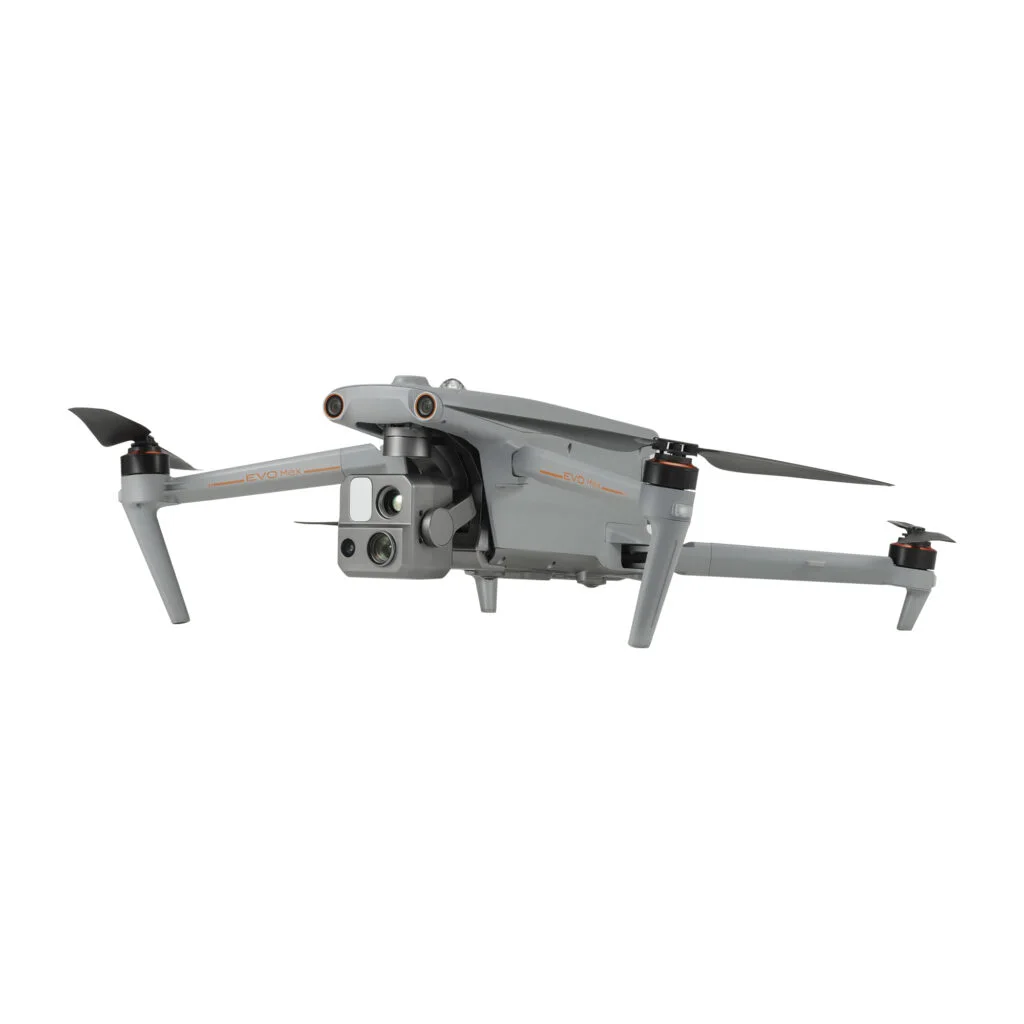
The Autel EVO Max 4T is a rugged, intelligent, long-range drone designed for public safety, industrial inspections, emergency response, and search and rescue missions. It is equipped with wide, zoom, and thermal cameras, plus a laser rangefinder, making it a versatile choice for professional applications.
With a 12.4-mile transmission range, a maximum flight time of 42 minutes, and 720° obstacle avoidance, the Autel EVO Max 4T delivers reliable performance even in complex environments. It also features GPS-denied navigation, an IP43 weather-resistant rating, and a hot-swappable battery system, ensuring uninterrupted operations in demanding conditions.
| Feature Category | Details |
|---|---|
| Type | Professional drone for industrial inspections, public safety, and search & rescue |
| Cameras | Wide (50MP), Zoom (8K 10x Optical, 160x Max Hybrid), Thermal (640×512), Laser Rangefinder |
| Flight Time | 42 minutes |
| Transmission Distance | 20 kms (12.4 miles) |
| Obstacle Sensing | 720° omnidirectional obstacle avoidance |
| Max Speed | 23 m/s (82 km/h or 51 mph) |
| Battery | Hot-swappable for extended missions |
| Weather Resistance | IP43-rated for dust and water resistance |
| Special Features | A-Mesh 1.0 Networking, 3D Map Planning, GPS-Denied Navigation, Anti-Jamming Technology, Autel Autonomy Engine |
The Autel EVO Max 4T is ideal for professional aerial operations that require precision, durability, and cutting-edge technology.
✅ Energy & Industrial Inspections – Monitor power lines, telecom towers, and oil rigs.
✅ Public Safety & Law Enforcement – Assist in crime scene investigations and security operations.
✅ Emergency Rescue & Search Operations – Locate missing persons and assess disaster areas.
✅ Mapping & Surveying – Generate high-resolution 3D models and geospatial data.
✅ Environmental Monitoring – Track wildlife, assess natural disasters, and monitor deforestation.
✅ Military & Defense Applications – Support surveillance and reconnaissance missions.
✅ Infrastructure & Construction – Inspect bridges, highways, and buildings for maintenance.
✅ Disaster Response – Aid in post-disaster damage assessments and rescue operations.
✔ Best Long-Range Drone for Industrial & Public Safety Use – 12.4-mile transmission range for uninterrupted operations.
✔ High-End Imaging Capabilities – 50MP wide camera, 8K 10x optical zoom, 160x hybrid zoom, and thermal camera.
✔ Superior Obstacle Avoidance – 720° omnidirectional sensing prevents crashes in complex environments.
✔ Extended Flight Time – 42-minute flight duration for longer missions.
✔ Hot-Swappable Battery System – Swap batteries mid-mission without shutting down the drone.
✔ GPS-Denied Navigation – Reliable operation in tunnels, urban canyons, and high-interference areas.
✔ Anti-Jamming & Anti-Interference Tech – Ensures stable flights even in electromagnetic-heavy zones.
✔ A-Mesh 1.0 Networking – Enables multi-drone collaboration and communication.
✖ High Cost – Premium features come at a higher price.
✖ Requires Training – Advanced functions may require specialized training.
✖ Larger & Heavier Build – Less portable compared to consumer drones.
The Autel EVO Max 4T is a high-performance, long-range drone built for demanding professional applications. Its 12.4-mile transmission range, advanced imaging system, and GPS-denied navigation capabilities make it an essential tool for industrial inspections, law enforcement, and emergency response teams.
✅ Perfect for energy inspections, search & rescue, public safety, and mapping.
✅ High-end imaging system with optical zoom, thermal vision, and laser rangefinder.
✅ Industry-leading obstacle avoidance and GPS-denied navigation.
✅ Hot-swappable battery system for uninterrupted missions.
✅ Designed for harsh environments with an IP43-rated weather-resistant build.
If you need a rugged, intelligent, and long-range drone for professional applications, the Autel EVO Max 4T is the best choice.
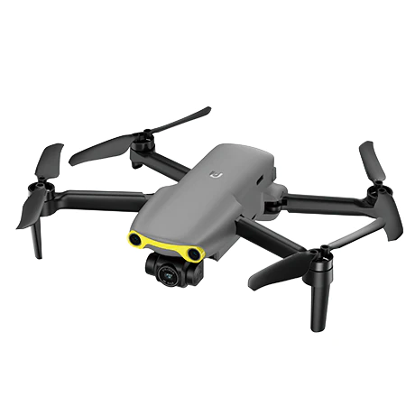
The Autel EVO Nano is an ultra-lightweight long-range drone designed for portability and ease of use. Weighing just 249g, it falls under the sub-250g category, meaning it does not require registration in many countries. Despite its small size, the EVO Nano features a powerful 48MP camera with a 1/2″ CMOS sensor, capable of shooting stunning 4K video.
Equipped with Autel SkyLink transmission technology, this drone offers a 6.2-mile (10 km) transmission range and 2.7K/30FPS real-time video streaming. The three-way obstacle avoidance system enhances flight safety, making it ideal for hobbyists, travelers, and content creators. With a foldable design and multiple color options, the Autel EVO Nano is the perfect balance of performance and portability with long range.
| Feature Category | Details |
|---|---|
| Weight | 249g (0.55 lbs) – No registration required in many regions |
| Camera | 48MP, 1/2″ CMOS sensor, 4K video resolution |
| Video Transmission | Autel SkyLink, 6.2-mile range, 2.7K/30FPS real-time video |
| Max Flight Time | 28 minutes |
| Obstacle Avoidance | Three-way binocular vision sensors (front, rear, and below) |
| Portability | Compact, foldable design – fits in the palm of a hand |
| Intelligent Flight Modes | Dynamic Track 2.1, pre-programmed cinematic shots |
| Wind Resistance | Up to 22 mph |
| Dimensions | **Folded: 142x94x55mm |
| Max Flight Distance | 16.8 km |
| Max Horizontal Speed | 15 m/s (Ludicrous Mode), 10 m/s (Standard), 5 m/s (Smooth) |
| GNSS | GPS, GLONASS, Galileo |
| Operating Temperature | 0°C ~ 40°C |
| Operating Frequency | 2.400-2.4835GHz, 5.725-5.850GHz, 5.150-5.250GHz |
The Autel EVO Nano is a top-tier long-range drone for those who need a high-performance, travel-friendly aerial photography solution.
✅ Portable Aerial Photography – Capture stunning aerial images anywhere.
✅ Content Creation & Social Media – Ideal for Instagram, YouTube, and TikTok creators.
✅ Travel & Adventure Filming – Easily fits in a backpack for on-the-go shooting.
✅ Casual Drone Flying – Perfect for beginners and hobbyists.
✅ Cinematic Video Production – Built-in intelligent flight modes for professional results.
✅ Real Estate & Marketing – Shoot high-quality aerial footage of properties.
✅ Sports & Action Shots – Great for tracking moving subjects with Dynamic Track 2.1.
✔ Ultra-Portable & Lightweight – Perfect for travel and everyday use.
✔ No Registration Needed in Many Countries – Under 250g weight category.
✔ High-Quality Camera – 48MP sensor for crisp photos & 4K video recording.
✔ Long-Range Video Transmission – 6.2-mile Autel SkyLink transmission ensures reliable connection.
✔ Three-Way Obstacle Avoidance – Enhanced safety with front, rear, and downward sensors.
✔ Multiple Color Options – Available in Arctic White, Deep Space Gray, Blazing Red, and Autel Orange.
✔ Intelligent Flight Features – Cinematic pre-programmed shot modes for professional results.
✔ Strong Wind Resistance – Handles wind speeds up to 22 mph for stable flights.
✔ Compact & Foldable Design – Easily fits in small bags for convenience.
✖ Limited Flight Time – 28 minutes is shorter compared to larger drones.
Why Choose the Autel EVO Nano?
The Autel EVO Nano is an excellent choice for users who need a compact long-range drone that balances performance, portability, and advanced imaging.
✅ Perfect for travelers, vloggers, and social media creators looking for an easy-to-carry drone with premium features.
✅ 48MP camera and 4K video ensure high-quality aerial photography and videography.
✅ Three-way obstacle avoidance provides extra flight safety.
✅ Autel SkyLink transmission system offers a reliable 6.2-mile range.
✅ Intelligent flight modes make it easy to capture cinematic shots effortlessly.
✅ Awarded a five-star rating as the first non-DJI camera drone in its category.
If you’re looking for a small yet powerful long-range drone, the Autel EVO Nano is the perfect choice for you.

The Autel EVO Nano+ is a lightweight and highly portable long-range drone, designed for casual users, content creators, and hobbyists. Weighing just 249g (0.55 lbs), this drone delivers exceptional image quality with its 50MP camera, 1/1.28″ CMOS sensor, and 4K HDR video capability.
Despite its small size, the EVO Nano+ boasts an impressive transmission range of 6.2 miles (10 km), thanks to Autel SkyLink technology. It also features three-way obstacle avoidance for safe flying, making it an excellent choice for beginners and professionals alike.
Available in Arctic White, Deep Space Gray, Blazing Red, and Autel Orange, the Autel EVO Nano+ is one of the best compact long-range drones for capturing high-quality aerial shots in a travel-friendly design.
| Feature Category | Details |
|---|---|
| Weight | 249g (0.55 lbs) – Ultra-light and travel-friendly |
| Camera | 50MP, 1/1.28″ CMOS sensor, 4K HDR video recording |
| Video Transmission | Autel SkyLink, 6.2-mile (10 km) range, 2.7K/30FPS video feed |
| Max Flight Time | 28 minutes per charge |
| Obstacle Avoidance | Three-way binocular vision sensors (front, rear, and below) |
| Portability | Foldable design, compact size – fits in the palm of a hand |
| Intelligent Flight Modes | Dynamic Track 2.1, pre-programmed cinematic shot modes |
| Wind Resistance | Up to 22 mph (35 km/h) – Handles moderate winds well |
| Dimensions | Folded: 142x94x55mm, Unfolded: 260x325x55mm |
| Max Flight Distance | 16.8 km (10.4 miles) |
| Max Horizontal Speed | 15 m/s (Ludicrous mode), 10 m/s (Standard mode), 5 m/s (Smooth mode) |
| GNSS | GPS, GLONASS, Galileo – Provides accurate positioning |
| Operating Temperature | 0°C ~ 40°C (32°F ~ 104°F) |
| Operating Frequency | 2.400-2.4835GHz, 5.725-5.850GHz, 5.150-5.250GHz |
The Autel EVO Nano+ is one of the best compact long-range drones for users who need a lightweight yet powerful flying camera.
✅ Casual Aerial Photography & Videography – Perfect for travelers, influencers, and hobbyists.
✅ Content Creation & Social Media – Capture stunning 4K HDR footage for YouTube, Instagram, and TikTok.
✅ Hobbyists & Drone Enthusiasts – Easy to fly and packed with intelligent flight modes.
✅ Event & Travel Filming – A great travel-friendly drone for capturing cinematic footage on the go.
✅ Real Estate Photography – Helps create dynamic aerial shots for property listings.
✔ Extremely Portable & Lightweight – Fits in a pocket and weighs only 249g.
✔ High-Quality Camera – 50MP sensor and 4K HDR video for professional-looking footage.
✔ Advanced Obstacle Avoidance – Three-way binocular vision sensors for added safety.
✔ Long Transmission Range – Up to 6.2 miles (10 km) with reliable Autel SkyLink technology.
✔ Multiple Intelligent Flight Modes – Includes Dynamic Track 2.1 and cinematic preset shots.
✔ Strong Wind Resistance – Handles winds up to 22 mph (35 km/h) effectively.
✔ Stylish & Customizable Design – Available in multiple colors (Arctic White, Deep Space Gray, Blazing Red, Autel Orange).
✖ Limited Battery Life – 28 minutes flight time is shorter than larger drones.
✖ Less Stable in Strong Winds – Due to its lightweight design, it may struggle in very windy conditions.
✖ Smartphone App Required for Some Functions – Some intelligent features require the Autel app.
The Autel EVO Nano+ is the perfect choice for anyone looking for a compact yet powerful long-range drone. Its lightweight, foldable design makes it incredibly easy to transport, while its 50MP camera and 4K HDR video capability deliver exceptional image quality.
✅ Ideal for content creators, hobbyists, and travelers who need a portable drone.
✅ Advanced three-way obstacle avoidance ensures safer flights.
✅ Intelligent flight modes help users capture cinematic shots effortlessly.
✅ Wind resistance up to 22 mph makes it reliable in different weather conditions.
✅ A stylish, customizable drone available in four vibrant colors.
If you’re looking for a high-quality, compact long-range drone that combines portability, performance, and intelligent features, the Autel EVO Nano+ is one of the best options available.
The Trinity F90+ is a fixed-wing long-range drone designed for large-area mapping, surveying, and environmental monitoring. With an impressive 100 km (62 miles) range and 90 minutes of flight time, it covers vast areas efficiently, making it ideal for professional surveying, precision agriculture, and infrastructure inspection.
Equipped with a 42MP HighRes RGB camera, dual RGB & NDVI payloads, and a PPK (Post Processed Kinematic) system, the Trinity F90+ ensures precise data collection with centimeter-level accuracy. Its vertically take-off and landing (VTOL) capability eliminates the need for belly landings, allowing it to operate in diverse terrains with ease.
The Trinity F90+ is built for professionals who require high-quality aerial imagery, efficient coverage, and advanced flight planning capabilities.
| Feature Category | Details |
|---|---|
| Type | Fixed-wing long-range drone for surveying and mapping |
| Range | 100 km (62 miles) |
| Flight Time | 90 minutes |
| Camera | 42MP HighRes RGB camera, Dual RGB & NDVI payloads |
| Telemetry | 2.4 GHz telemetry with a range of up to 7.5 km |
| Positioning | PPK with Quantum-System iBase ground reference station |
| Software | QBase 3D for flight planning, monitoring, and data management |
| Obstacle Avoidance | Downward-facing LiDAR for terrain tracking and automatic obstacle avoidance |
| Data Interface | Improved data interface for quick and easy downloads |
| Durability | IP54 certified for dust and water resistance |
| Takeoff/Landing | VTOL (Vertical Takeoff and Landing), no belly landings required |
The Trinity F90+ is designed for professional applications where long-range drone capabilities and precise data acquisition are required.
✅ Surveying & Mapping – Ideal for large-area mapping and geospatial data collection.
✅ Environmental Monitoring – Used for tracking climate changes, deforestation, and natural resource management.
✅ Precision Agriculture – Helps farmers monitor crops, detect plant health issues, and optimize yields.
✅ Infrastructure Inspection – Suitable for inspecting power lines, pipelines, roads, and bridges.
✅ Forestry & Land Management – Assists in forest inventory, land classification, and ecosystem analysis.
✅ Disaster Response & Management – Provides real-time aerial data for search and rescue operations.
✔ Long-Range Drone with Extended Flight Time – 100 km range & 90-minute endurance for large-area coverage.
✔ High-Resolution Imaging – 42MP HighRes RGB camera ensures sharp, detailed aerial images.
✔ PPK System for High Precision – Provides centimeter-level accuracy for mapping and surveying.
✔ VTOL (Vertical Takeoff and Landing) Capability – No need for belly landings, making it versatile for various terrains.
✔ Live Air Traffic Awareness (ADS-B) – Enhances flight safety by detecting other aircraft in the area.
✔ Advanced Terrain Tracking – Downward-facing LiDAR enables automatic obstacle avoidance.
✔ Efficient Data Management – QBase 3D software simplifies flight planning and data analysis.
✔ Durable & Weather Resistant – IP54 certification ensures resistance to dust and water.
✖ Complex Setup & Training Required – Not beginner-friendly; requires professional expertise.
✖ Issues with Post-Processing & Payload Recognition – Some users report software-related challenges.
✖ Prone to Fail-Safe in Windy Conditions – May not perform well in strong winds despite advertised wind ratings.
✖ Elapor Foam Lacks Stiffness – Build quality could be improved for better durability.
The Trinity F90+ is one of the best long-range drones for professional surveying and mapping, offering exceptional range, high-precision imaging, and VTOL capabilities.
✅ Ideal for professionals in land surveying, environmental monitoring, and precision agriculture.
✅ 100 km range and 90-minute flight time allow for efficient, large-area coverage.
✅ 42MP HighRes RGB camera and dual payloads provide detailed, accurate imagery.
✅ PPK system ensures centimeter-level positioning accuracy.
✅ Downward LiDAR improves terrain tracking and obstacle avoidance.
✅ Live air traffic awareness (ADS-B) enhances safety during operations.
✅ VTOL technology eliminates belly landings, making it usable in various terrains.
While the Trinity F90+ requires some expertise to operate, it is a powerful, high-end fixed-wing drone that delivers professional-grade results. If you need a reliable, long-range drone for large-scale surveying and data collection, the Trinity F90+ is an excellent choice.
The JOUAV CW-30E is a high-endurance, long-range fixed-wing VTOL (Vertical Take-Off and Landing) drone, designed for professional applications. With an exceptional range of 200 km (124 miles) and an impressive 480-minute (8-hour) flight time, this drone is perfect for large-area mapping, high-precision surveying, and surveillance missions.
Built with carbon fiber material, the CW-30E offers a lightweight yet robust airframe, ensuring durability in challenging conditions. With a payload capacity of 8 kg, it can carry a variety of advanced sensors and equipment. The drone features a strong 1.4GHz band for signal penetration and anti-interference, along with PPK (Post Processed Kinematic) and RTK (Real-Time Kinematic) positioning systems to eliminate GNSS errors.
This long-range drone is equipped with cutting-edge technology, making it a top choice for large-scale, professional missions requiring precision, efficiency, and reliability.
| Feature Category | Details |
|---|---|
| Type | Fixed-wing VTOL (Vertical Take-Off and Landing) drone |
| Range | 200 km (124 miles) |
| Flight Time | 480 minutes (8 hours) |
| Payload Capacity | 8 kg |
| Material | Carbon fiber for a strong and lightweight build |
| Frequency Band | 1.4GHz for strong signal penetration & anti-interference |
| Positioning | PPK & RTK to cancel GNSS errors for high-precision data |
| Flight Modes | Autonomous flight mode for efficient operations |
| Safety Features | Obstacle avoidance radar, ADS-B, auto-return feature |
| Takeoff/Landing | Vertical takeoff and landing (VTOL) for versatile deployment |
The JOUAV CW-30E is designed for professional industries requiring long flight endurance and precision data capture.
✅ Mapping & Surveying – High-precision mapping for large-scale infrastructure, land surveys, and topographic analysis.
✅ Surveillance & Security – Long-range aerial monitoring for border patrol, law enforcement, and critical infrastructure.
✅ Environmental Monitoring – Tracking deforestation, climate change effects, and wildlife observation.
✅ Industrial & Infrastructure Inspection – Inspection of power lines, pipelines, and large construction sites.
✅ Agriculture & Crop Analysis – Monitoring crop health, irrigation efficiency, and large farm operations.
✅ Disaster Response & Emergency Services – Search and rescue missions, wildfire monitoring, and flood assessment.
✔ Best Long-Range Drone for Large-Scale Missions – Covers up to 200 km (124 miles) per flight.
✔ Exceptionally Long Flight Time – Up to 8 hours of continuous operation.
✔ High Payload Capacity – Can carry up to 8 kg of sensors and equipment.
✔ VTOL Capability – Vertical takeoff and landing for deployment in various terrains.
✔ Carbon Fiber Build – Lightweight and durable for high-performance flights.
✔ Advanced Positioning System – PPK & RTK eliminate GNSS errors for precise mapping.
✔ Autonomous Flight Mode – Efficient and automated operations for professional use.
✔ Strong Signal & Anti-Interference – 1.4GHz band for uninterrupted connectivity.
✔ Robust Safety Features – Obstacle avoidance radar, ADS-B, and auto-return enhance safety.
✖ Large & Heavy Airframe – Not as compact as consumer drones, requiring proper storage & transport.
✖ High Cost – Premium pricing for professional applications.
✖ Lower Max Speed Compared to Some Drones – Prioritizes endurance over speed.
The JOUAV CW-30E is the perfect choice for professionals needing an ultra-long flight endurance and extensive range for mapping, surveillance, and industrial applications.
✅ Covers vast areas in a single flight with its 8-hour endurance and 200 km range.
✅ Ideal for infrastructure inspection, environmental monitoring, and large-scale data collection.
✅ Can carry multiple payloads, including LiDAR, thermal cameras, and multispectral sensors.
✅ Vertical takeoff and landing make it suitable for diverse terrains and environments.
✅ Advanced safety features ensure secure operations in challenging conditions.
For professionals and industries requiring a high-performance, long-range drone, the JOUAV CW-30E is an outstanding investment.
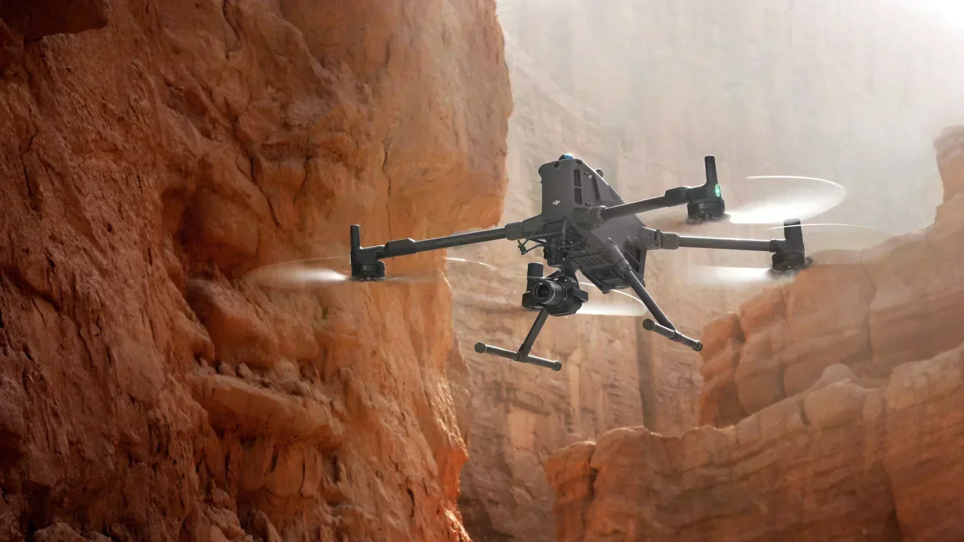
The DJI Matrice 400 (M400) is a next-generation enterprise multirotor drone designed for demanding professional missions. Built for industries that require long flight endurance, heavy payload capability, and advanced safety systems, the Matrice 400 is ideal for large-scale inspections, surveying, public safety, and emergency response operations.
With a maximum flight time of up to 59 minutes and a transmission range of up to 40 km (24.8 miles), the M400 delivers exceptional operational efficiency for extended missions. Its powerful propulsion system and enhanced battery management allow stable performance even while carrying multiple payloads.
The Matrice 400 features a rugged, weather-resistant design (IP55) and supports a wide range of DJI Zenmuse and third-party payloads, including photogrammetry cameras, LiDAR sensors, thermal cameras, speakers, and spotlights. Advanced positioning technologies, intelligent flight modes, and comprehensive obstacle avoidance systems make it a highly reliable platform for complex and high-risk environments.
| Feature Category | Details |
|---|---|
| Type | Enterprise commercial multirotor drone |
| Range | Up to 40 km (24.8 miles) transmission distance |
| Flight Time | Up to 59 minutes |
| Payload Capacity | Up to approximately 6 kg |
| Payload Compatibility | Zenmuse P1, L2, H30, H30T, S1 spotlight, V1 speaker, and third-party payloads |
| Obstacle Avoidance | Omnidirectional obstacle sensing with LiDAR, mmWave radar, and vision sensors |
| Positioning | RTK positioning for centimeter-level accuracy |
| Transmission System | Advanced O4 Enterprise video transmission |
| Weather Resistance | IP55-rated for dust and water resistance |
| Operating Temperature | -20°C to 50°C |
| Flight Modes | Intelligent and autonomous mission modes |
| Safety Features | Obstacle avoidance, ADS-B, redundancy systems, auto return-to-home |
The DJI Matrice 400 is engineered for professional industries that require precision, safety, and reliability in challenging environments.
✅ Mapping & Surveying – High-accuracy aerial mapping, photogrammetry, and LiDAR data collection.
✅ Infrastructure & Industrial Inspection – Power lines, substations, pipelines, bridges, towers, and construction sites.
✅ Public Safety & Emergency Response – Search and rescue, disaster assessment, firefighting, and law enforcement operations.
✅ Security & Surveillance – Perimeter monitoring, crowd observation, and critical infrastructure protection.
✅ Environmental Monitoring – Forest monitoring, wildlife tracking, and environmental impact analysis.
✅ Energy & Utilities – Inspection of wind turbines, solar farms, and transmission networks.
✔ Long Flight Endurance – Up to 59 minutes for extended missions.
✔ Long Transmission Range – Up to 40 km for large operational areas.
✔ High Payload Capacity – Supports multiple and heavy enterprise payloads.
✔ Advanced Obstacle Avoidance – LiDAR, radar, and vision sensors for safe navigation.
✔ RTK Accuracy – Centimeter-level positioning for precise data capture.
✔ Rugged & Weather-Resistant – IP55 rating for reliable operation in harsh conditions.
✔ Enterprise-Grade Safety Systems – ADS-B, redundancy, and intelligent failsafes.
✔ Versatile Payload Support – Compatible with mapping, thermal, LiDAR, and mission-specific accessories.
✖ High Cost – Premium pricing aimed at enterprise and government users.
✖ Larger & Heavier Than Consumer Drones – Requires professional transport and setup.
✖ Shorter Endurance Than Fixed-Wing Drones – Optimized for versatility rather than ultra-long range.
The DJI Matrice 400 is an ideal choice for professionals who need a powerful, flexible, and highly reliable drone platform for complex operations.
✅ Covers large operational areas with long flight time and extended transmission range.
✅ Ideal for inspections, public safety, and industrial missions requiring precision.
✅ Supports advanced payloads such as LiDAR, thermal, zoom, and photogrammetry cameras.
✅ Operates safely in challenging environments with advanced obstacle avoidance and redundancy systems.
✅ Built for enterprise users who demand efficiency, accuracy, and mission reliability.
For organizations and professionals seeking a top-tier enterprise multirotor drone, the DJI Matrice 400 is a highly capable and future-ready solution.
XRTech Group provides cutting-edge solutions for longest range drone operations by integrating advanced technologies such as 5G automated battery swapping stations and drone-in-a-box solutions. These technologies allow drones to fly for extended periods without manual intervention, making them highly efficient for applications like surveillance, infrastructure inspections, agriculture, environmental monitoring, and disaster response.
One of the main challenges in long-range drone operations is battery life. A drone’s flight time is limited by its battery capacity, which requires frequent landings for recharging or battery replacement. XRTech Group solves this issue with 5G-powered automated battery swapping stations, ensuring drones stay operational with minimal downtime.
By implementing 5G battery swapping stations, XRTech Group ensures that longest range drones can perform uninterrupted missions, covering large areas with high efficiency.
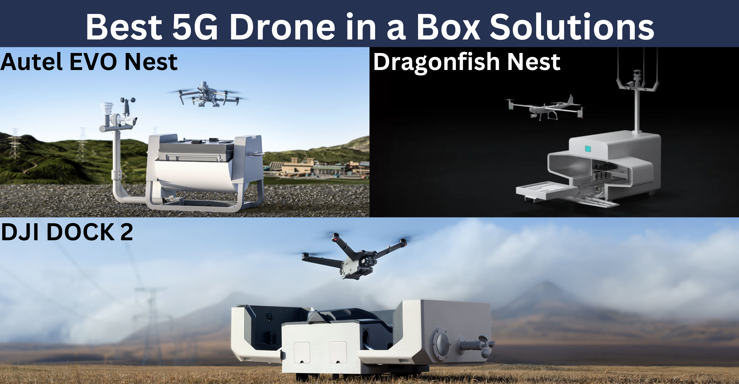
Drone-in-a-box technology enhances long-range drone capabilities by allowing fully autonomous operations. These solutions provide a secure docking station where drones can take off, land, recharge, and transfer data without human intervention. XRTech Group offers multiple drone-in-a-box solutions tailored for different operational needs.
XRTech Group offers customizable longest range drone solutions based on specific business needs. Whether for surveillance, inspections, or mapping, their technology-driven approach ensures maximum efficiency and precision.
XRTech Group offers a comprehensive range of solutions that extend drone flight times, automate operations, and enhance data collection, making it the ideal partner for longest range drone operations. Whether you need continuous security surveillance, infrastructure inspections, or agricultural monitoring, XRTech’s advanced technology ensures efficiency, reliability, and cost-effective drone operations.
Longest range drones are changing the way industries work. They can fly far, stay in the air longer, and cover large areas without stopping. These drones help businesses, governments, and researchers do their jobs faster, safer, and with less cost. Here are 10 important ways longest range drones are making a difference.
Keeping areas safe is a big challenge, especially in remote locations. Longest range drones help security teams monitor large areas without sending people on the ground. They can detect suspicious activity, track movements, and provide live video feeds to security teams. In border patrol, these drones help officers monitor illegal crossings and track people or vehicles in hard-to-reach places.
When people go missing in forests, mountains, or disaster zones, every second counts. Longest range drones can fly over vast areas quickly, searching for survivors using thermal cameras and night vision. They can also drop supplies like food, water, or medical kits to people who need help. This technology saves lives by helping rescue teams act faster and reach places that are dangerous for humans.
Energy companies need to check power lines, gas pipelines, and oil refineries to make sure everything is working safely. This work is risky for workers because they have to climb high towers or travel through harsh environments. Longest range drones make these inspections safer and more efficient. They can fly for hours, scanning miles of infrastructure using high-resolution cameras and thermal sensors. This helps companies detect problems early and avoid costly failures.
Farmers use longest range drones to monitor their crops and manage large farmlands. These drones can fly over fields and take detailed images to show which areas need water, fertilizer, or pest control. This technology helps farmers grow more food while using fewer resources, making farming more sustainable. It also reduces the need for workers to walk through fields, saving time and effort.
Natural disasters like floods, earthquakes, and wildfires can cause widespread destruction. Longest range drones help emergency teams assess the damage quickly and plan their response. They can fly over dangerous areas, provide live footage, and help authorities understand which places need urgent help. These drones also assist in delivering medical supplies and communication tools to affected regions.
Protecting animals in the wild is difficult because national parks and forests cover vast areas. Poachers often target endangered species, and rangers cannot monitor every part of these lands. Longest range drones help conservationists track animal movements, detect illegal hunting, and stop poachers before they harm wildlife. These drones also collect valuable data about animal populations and their habitats, helping scientists protect ecosystems.
Climate change is affecting the planet, and scientists need to study weather patterns, air pollution, and deforestation. Longest range drones collect data from remote locations, such as the Arctic, rainforests, and deep oceans. They help researchers measure temperature changes, track glacier melting, and monitor deforestation without disturbing nature. This information is crucial for finding solutions to environmental problems.
Large construction projects, such as highways, bridges, and skyscrapers, need regular inspections to ensure safety and progress. Longest range drones provide real-time aerial views of construction sites, allowing engineers to track developments, detect problems, and improve planning. These drones reduce the need for workers to climb scaffolding or use helicopters, making the inspection process safer and more cost-effective.
Defense forces use longest range drones for surveillance, reconnaissance, and logistics support. These drones can gather intelligence, track enemy movements, and provide aerial support during missions. They help soldiers stay informed without putting themselves in danger. Some military drones can also deliver supplies or act as communication relays in remote areas where traditional networks fail.
Companies are exploring longest range drones for package deliveries, especially in rural and hard-to-reach areas. Medical services use drones to deliver medicines and vaccines to remote clinics. In disaster zones, they transport emergency supplies when roads are blocked. This technology has the potential to revolutionize the way goods are transported, making deliveries faster and more efficient.
Longest range drones are transforming industries by making tasks safer, faster, and more effective. They provide a bird’s-eye view of the world and help humans do things that were once impossible. As technology advances, these drones will continue to play a bigger role in security, research, and daily life.
Maximizing the flight time and range of the longest range drone requires careful planning and the right strategies. The key areas to focus on include battery management, reducing weight, optimizing flight operations, and improving communication systems. Making small adjustments in these areas can significantly extend how far and how long a drone can fly.
A drone’s battery is one of the most important factors affecting its flight time. Managing battery health and choosing the right upgrades can make a big difference.
• Optimize Battery Usage – Always start with a fully charged battery and follow proper maintenance routines. Avoid overcharging or letting the battery drain completely, as both can shorten its lifespan.
• Maintain Proper Battery Temperature – Keeping the battery at the right temperature is critical. If the battery is too cold, below 15°C, it can lose efficiency and reduce flight time. Warming the battery before flight helps maintain power output.
• Upgrade to a High-Capacity Battery – A larger-capacity battery can increase flight time, but it must be compatible with the drone. Some drones have specific battery requirements, so always check before upgrading.
• Use Hot-Swappable Batteries – Drones like the Autel EVO Max 4N and 4T support hot-swappable batteries. This means you can change batteries while the drone is still active, reducing downtime and extending total operational time.
• Plan Multi-Battery Missions – Using software to pre-set flight plans for different locations can minimize setup time and allow efficient battery usage across multiple flights.
Reducing the weight of a drone and improving its aerodynamics can help extend its flight time and range.
• Minimize Unnecessary Weight – Every extra gram impacts battery life. Removing unneeded accessories and using lightweight components can improve efficiency.
• Choose an Aerodynamic Design – Drones with sleek, well-designed bodies experience less air resistance, allowing them to travel further while using less power.
The way a drone is flown and the conditions it flies in play a big role in its range and battery life.
• Select the Right Flight Mode – High-speed flights and sudden movements use more power. Choosing a stable, low-energy flight mode helps conserve battery life.
• Avoid Extreme Weather – Flying in strong winds, heavy rain, or extreme temperatures forces the drone to use more energy. Calm weather conditions help maximize efficiency.
• Plan Efficient Routes – Avoiding obstacles and planning direct flight paths reduces unnecessary movements, saving battery life. Flying at higher altitudes can also improve range by minimizing interference.
• Use Flight Mapping Software – Advanced mapping tools help optimize flight paths, ensuring the drone follows the most efficient route possible.
Longest range drones rely on strong communication and smart technology to push the limits of flight distance.
• Use Relay Systems – Combining drones with systems like the Autel Dragonfish Nest allows for remote takeoff and landing, extending total flight range. With multiple base stations, the operational range can be increased to over 75 miles.
• Deploy Visual Observers – In long-range operations, visual observers can be placed along the drone’s flight path. These observers help maintain direct contact with the drone, passing control as needed to keep the drone within visual range.
• Improve Signal Strength – Using range extenders and directional antennas can enhance the communication signal between the drone and the controller. Upgrading to a high-power transmitter can further extend range.
• Keep Firmware Updated – Regular updates ensure the drone’s software is running efficiently, improving signal strength, stability, and overall performance.
By applying these strategies, drone operators can extend flight times, push the limits of range, and complete longer, more complex missions with confidence.
Choosing the best longest range drone requires careful planning and understanding of your needs. Whether you want a drone for aerial photography, surveying, or security, the right choice will depend on factors like flight range, battery life, camera quality, and regulatory requirements. Here’s a detailed guide to help you make the right decision.
Before purchasing a longest range drone, identify how you plan to use it. Different drones serve different purposes, so knowing your exact requirements will help you choose the best option.
• Application Requirements – Are you buying the drone for personal use, such as travel photography, or for professional tasks like mapping, inspections, or search and rescue? Professional drones have more advanced features than consumer models.
• Flight Distance – How far does the drone need to fly? Hobbyists may need only a 5km range, while commercial applications might require 10km or more. Some advanced drones can fly up to 200km.
• Flight Time – How long should the drone stay in the air? Some drones can only fly for 20 minutes, while others can operate for several hours with extended battery solutions.
• Payload Capacity – If you need to carry cameras, sensors, or other equipment, ensure the drone supports the required weight.
Understanding the different types of drones can help you choose the best one for your needs.
• Fixed-Wing Drones – These drones are designed for long-distance flights, offering extended endurance and efficiency. They are ideal for mapping, surveying, and environmental monitoring.
• Multi-Rotor Drones (Quadcopters) – These drones are more flexible and easier to maneuver, making them perfect for tasks like aerial photography, inspections, and short-range surveying.
• VTOL (Vertical Takeoff and Landing) Drones – Combining the features of fixed-wing and multi-rotor drones, VTOL drones provide excellent range while being able to take off and land in tight spaces.
• Helicopter Drones – Equipped with a single rotor, these drones offer precise hovering capabilities, making them useful for detailed inspections.
• Mini Drones – Small and lightweight, these drones are designed for specific tasks in confined spaces, like industrial inspections.
To get the most out of a longest range drone, look for the following technical features:
• Transmission System – A strong, interference-free transmission system is essential for long-range control. Drones that support 2.4GHz and 5.8GHz frequencies with automatic switching provide a stable connection.
• Camera Quality – If aerial photography or videography is a priority, consider sensor size, resolution, lens quality, and stabilization.
Before flying a longest range drone, ensure you follow local regulations and safety rules.
• Line of Sight – Many countries require drones to be flown within the operator’s line of sight. Long-range drones may require special approvals.
• Restricted Areas – Avoid flying near airports, military zones, and other sensitive locations.
• Privacy Concerns – Never use drones to invade people’s privacy or record footage without permission.
• BVLOS (Beyond Visual Line of Sight) Operations – If you plan to operate beyond visual range, you may need an FAA waiver or approval from the relevant aviation authority.
Several brands manufacture high-quality longest range drones, each offering unique features.
• DJI – Leading drone manufacturer with models like Mavic 3, Air 3, and the Matrice series, known for long flight range, high-quality cameras, and advanced flight control systems.
• Autel – The EVO series, including EVO II Pro V3, EVO Max 4N, and Dragonfish Pro, offers powerful long-range capabilities, robust designs, and professional-grade cameras.
• Parrot – The Anafi series is ideal for inspections and specialized operations with features like high zoom capabilities.
• JOUAV – Produces high-endurance drones like the CW-30E, which can fly up to 200km and stay in the air for 8 hours.
The price of a longest range drone varies depending on features, flight capabilities, and brand.
• Entry-Level Models – Basic long-range drones for personal use range from $500 to $2,000.
• Professional Drones – More advanced models with better cameras and longer battery life cost between $2,000 and $10,000.
• High-End Drones – Industrial drones with specialized features like BVLOS capabilities and heavy payload support can cost $10,000 to $50,000 or more.
When investing in a longest range drone, consider brands that provide strong customer support, including:
• Maintenance and Repairs – A good warranty and access to repair services ensure your drone remains operational for a long time.
• Software Updates – Regular updates improve flight performance, stability, and safety features.
By carefully evaluating your needs, technical requirements, and budget, you can choose the best longest range drone that offers reliability, performance, and value for money.
The regulations surrounding the longest range drone flights are strict because of safety concerns, airspace management, and privacy issues. Governments around the world have created rules to prevent accidents, unauthorized surveillance, and interference with manned aircraft. While the longest range drone models are capable of flying hundreds of kilometers, legal limits usually restrict how far they can be flown.
The Federal Aviation Administration (FAA) enforces strict rules for drone operations:
BVLOS operations allow drones to travel far beyond what the human eye can see, making them useful for delivery services, large-scale mapping, and infrastructure inspections. However, they require advanced technology and special regulatory approval.
Because laws change over time, drone operators must stay updated on regulations in their country to ensure compliance. Ignoring these rules can lead to severe consequences, including fines, license suspensions, and drone confiscation. Always follow legal requirements to fly safely and responsibly.
The longest range drone models use advanced control systems to ensure stable communication over long distances. Unlike standard drones that rely on basic remote controls, long-range drones use sophisticated technologies that enhance reliability, security, and precision.
The way the longest range drone is controlled depends on its purpose, range requirements, and available technology. Whether using RF signals, satellite links, cellular networks, or GPS navigation, the goal is always reliable, safe, and precise control over long distances.
When a longest range drone goes out of range, several things can happen depending on the drone’s technology, control system, and built-in safety features. Losing connection can be risky, but most advanced drones come with fail-safe mechanisms to prevent crashes or permanent loss.
Drones rely on radio signals, Wi-Fi, 4G/5G networks, or satellite communication. If the connection is lost, the drone can no longer receive commands from the controller. This can happen due to:
Most long-range drones have a built-in Return-to-Home (RTH) function. If the drone loses signal, it will automatically:
However, RTH only works if:
Some drones are programmed to hover in place when they lose connection. This allows the operator to:
Hovering can be risky if:
If the battery gets too low, the drone may land automatically at its current location.
Some professional long-range drones have multiple communication systems:
If all failsafe measures fail, the drone can:
To avoid signal loss and drone loss, you should:
A longest range drone is designed to handle long-distance flights, but signal loss is always a possibility. Knowing how your drone reacts when it goes out of range and preparing for such scenarios can prevent accidents and ensure safe operation.
When it comes to long-range drones, flight distance, signal stability, and battery life play a crucial role. These drones are designed for professional applications like surveillance, mapping, industrial inspections, and military operations. Here are the top 5 longest range drones available today:
The JOUAV CW-30E is one of the longest range drones in the industry, with an incredible 200 km (124.3 miles) range. It is commonly used for border patrol, pipeline inspections, and large-scale mapping missions.
The Albatross UAV is a fixed-wing long-range drone with a 100 km (62.1 miles) range. It is widely used for scientific research, environmental monitoring, and commercial applications.
The T-DRONES VA23 and VA25 are advanced VTOL (Vertical Takeoff and Landing) drones with a 30 km (18.6 miles) range. These drones are ideal for search and rescue, industrial inspections, and infrastructure monitoring.
The Delair UX11 is a lightweight fixed-wing drone that offers a 53 km (32.9 miles) range and is highly efficient for aerial mapping, forestry, and mining applications.
The Autel Dragonfish Pro is an advanced VTOL drone with a 30 km (18.6 miles) range and an extended flight time of 158 minutes when carrying a payload. It is widely used for law enforcement, traffic monitoring, and wildlife protection.
The future of long-range drones is set to bring longer flight times, stronger connectivity, and more autonomous capabilities. As technology advances, these drones will play an even bigger role in commercial, industrial, and military operations, offering solutions that were once impossible.
Future drones will have more efficient batteries, hydrogen fuel cells, and solar power integration, allowing them to fly hundreds of kilometers without refueling. Some military and enterprise drones are already exceeding 200 km, and with further advancements, drones could soon reach 500 km or more on a single flight.
Improvements in satellite communication (SATCOM), 5G/6G networks, and AI-powered RF signals will enable stronger and more stable connections over vast distances. This means drones will be able to operate beyond visual line of sight (BVLOS) with minimal risk of losing control.
Autonomous drones will use AI and machine learning to make real-time decisions, improving route optimization, obstacle avoidance, and mission execution. This will allow for self-navigating drones capable of handling complex tasks without human intervention.
Industries like logistics, agriculture, infrastructure inspection, and environmental monitoring will see wider drone adoption. Delivery drones will transport goods over long distances, and agriculture drones will monitor vast farmlands with precision and efficiency.
Governments will continue investing in long-range UAVs for defense, surveillance, and border security. Stealth technology, advanced imaging, and swarm drone capabilities will make military drones more powerful and versatile.
With drones flying longer distances, air traffic management and safety regulations will need to evolve. AI-driven collision avoidance systems, geofencing, and real-time tracking will help ensure safer operations in shared airspace.
The future of long-range drones is promising, with faster, smarter, and more efficient models set to revolutionize multiple industries. As battery technology, communication systems, and AI continue to improve, drones will become a crucial part of daily operations, from deliveries to disaster response and beyond.
The JOUAV CW-30E has the longest range among commercial drones, capable of flying 200 km (124.3 miles) with a flight time of 480 minutes (8 hours). It is mainly used for military surveillance, mapping, and industrial operations.
Currently, no commercial drone offers a 500 km range. However, high-end military UAVs like the MQ-9 Reaper or Bayraktar TB2 can exceed this distance using satellite communication (SATCOM) and advanced flight systems.
Drones with a 100 km range, such as the Albatross UAV, typically cost between $20,000 to $100,000, depending on features like payload capacity, flight time, and communication systems. Industrial and military-grade drones with such range often require custom orders and special regulatory approvals.
Several consumer drones offer a 5-mile (8 km) range, including:
These drones use OcuSync, Skylink, or Lightbridge transmission systems for stable long-distance flights.
Yes, JOUAV CW-30E can fly 200 km using a combination of RF control, GPS waypoints, and SATCOM. However, such distances are mostly used in military, security, and industrial applications with special flight permissions.
Most consumer drones have a range of 15-20 km (9-12 miles) under ideal conditions. Models like DJI Mavic 3 Pro and Autel EVO Max 4T use advanced signal technology to ensure stable control over long distances.
The range of a drone depends on:
Yes, but BVLOS flights require special permissions in most countries. Long-range drones like the Delair UX11 and Albatross UAV use autonomous GPS navigation and real-time tracking to fly beyond the pilot’s sight.
Long-range drones use:
Most long-range drones have fail-safe features:
It depends on the drone type:
Yes, but rules vary by country. Most regions require:
Long-range drones are used in:
For military & industrial use: JOUAV CW-30E (200 km range).
For surveying & mapping: Delair UX11 (53 km range).
For law enforcement & security: Autel Dragonfish Pro (30 km range, 158-minute flight time).
Yes, you can extend a drone’s range by:
Long-range drones have transformed industries by enabling extended flight distances, advanced surveillance, and autonomous operations. From military reconnaissance to industrial mapping and search-and-rescue missions, these drones provide unmatched capabilities.
The JOUAV CW-30E leads the market with an impressive 200 km range and 8-hour flight time, making it the longest-range commercial drone. Other top models like the Albatross UAV, T-DRONES VA23/VA25, Delair UX11, and Autel Dragonfish Pro also offer exceptional range, ideal for mapping, inspections, and security applications.
Technological advancements in RF communication, 4G/5G connectivity, SATCOM, and GPS navigation allow drones to operate beyond visual line of sight (BVLOS) with greater precision and safety. However, challenges like regulatory restrictions, battery limitations, and signal interference still impact long-range drone operations.
As technology evolves, we can expect longer flight times, stronger signals, and more autonomous capabilities, making drones even more essential for industries like aerial inspections, agriculture, and surveillance. Whether for professional use or future innovations, long-range drones continue to reshape how we explore, monitor, and connect with the world.
Tailings Dam Monitoring: How Advanced Satellite Intelligence Is Transforming Tailings Dam Safety Tailings dams are among the most critical—and high-risk—structures

From Visible Light to Spectral Intelligence in Modern Satellite Remote Sensing Satellite imaging has moved beyond photography. For decades, Earth