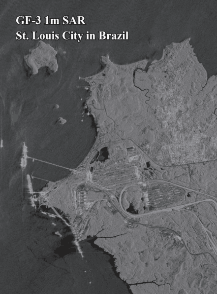
Understanding Synthetic Aperture Radar (SAR) Satellite Imagery
What is Synthetic Aperture Radar (SAR)? When people think of satellite images, they often picture colorful photos taken from space.
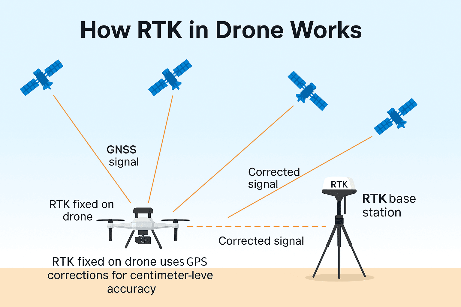
If you work in mapping, surveying, or construction, you’ve likely heard terms like RTK UAV, RTK Drone, or drone with RTK. These aren’t just fancy words—they’re powerful tools that make your work faster and more accurate.
A drone with RTK uses Real-Time Kinematic technology to correct its GPS location while flying. This gives you super-precise positioning—often within a few centimeters. That means no more guessing, less time spent on corrections, and fewer errors in your maps or measurements.
In the past, surveyors relied on GCPs (Ground Control Points), which took time to set up. But now, RTK UAVs can deliver high-accuracy results without all that extra work.
Many industries—from construction to agriculture—are turning to RTK drones because they save time, reduce costs, and improve safety. Whether you’re just starting or looking to upgrade your gear, understanding how these drones work will help you make smarter choices.
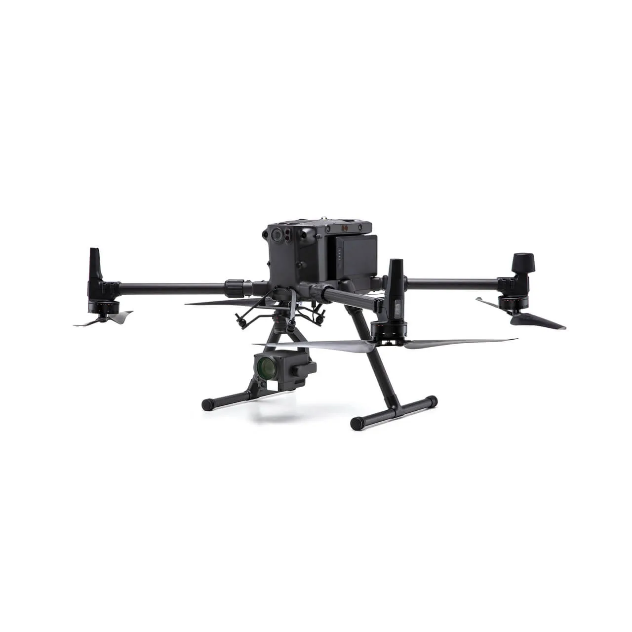
The DJI Matrice 300 RTK is built to meet the needs of commercial drone pilots and surveyors who require superior performance and reliable data. Inspired by modern aviation systems, it includes advanced flight safety features, intelligent functions, and a robust design suited for challenging environments.
Up to 55 Minutes of Flight Time – Ideal for long missions with fewer stops.
Centimeter-Level Accuracy – This RTK UAV uses dual-antenna RTK GPS and supports NTRIP corrections.
Smart Dual-Battery System – Hot-swappable and auto-heated batteries for cold-weather use.
Advanced AI Functions – Automates inspections with Smart Track and AI Spot-Check.
6-Directional Obstacle Avoidance – Detects objects up to 40m for safer flights.
Redundant Safety Systems – Dual IMUs, compasses, GNSS, and flight controllers ensure reliability.
Flexible Payload Options – Works with Zenmuse P1, L1, H20T for photogrammetry, LiDAR, and thermal imaging.
15 km HD Transmission – OcuSync Enterprise provides long-range 1080p video feed.
Secure Data Management – Onboard health system, encrypted links, and full flight logs.
Perfect for professionals who need a powerful and precise drone with RTK for mapping, inspections, or public safety.
The DJI Matrice 300 RTK is more than just a drone with GPS. It’s a fully integrated aerial platform that brings unmatched precision, reliability, and intelligence to professional workflows. Whether you’re working in mapping, infrastructure, emergency response, or industrial inspection, this drone gives you the tools to get the job done faster and more accurately.
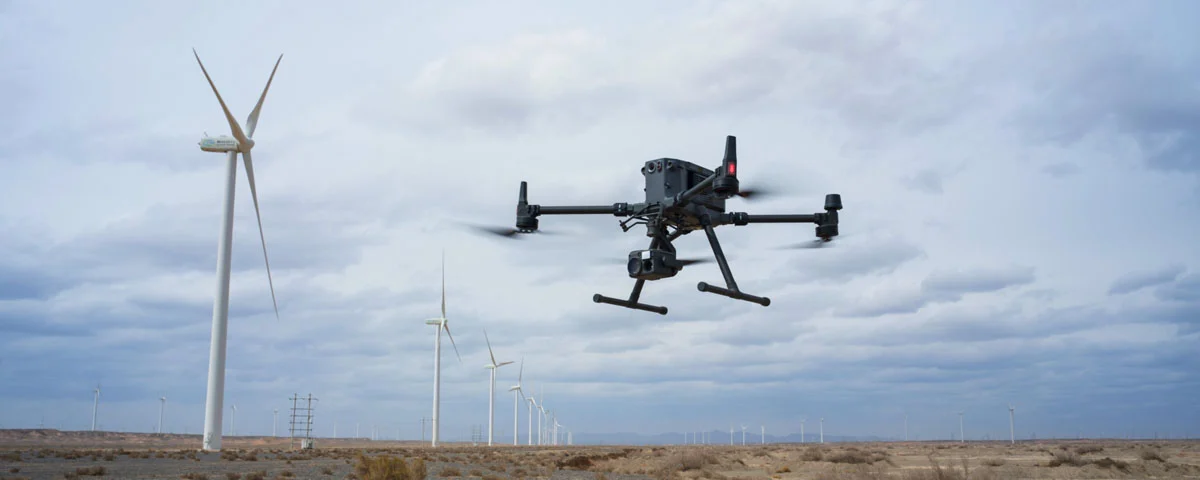
The DJI Matrice 350 RTK is the upgraded version of the Matrice 300 RTK, bringing improved performance, enhanced flight safety, and even more intelligent features. It’s built for demanding commercial drone operations and is widely regarded as one of the best RTK drones available today. This drone is especially valuable for surveying, mapping, inspections, and emergency response due to its robust build, long flight endurance, and precise RTK GPS capabilities.
55-Minute Flight Time – Dual TB65 batteries support hot-swapping and intelligent charging.
20 km HD Video Transmission – DJI O3 Enterprise provides real-time 1080p video from afar.
Centimeter-Level RTK Precision – This RTK UAV uses an advanced RTK module with NTRIP and D-RTK 2 support.
All-Weather Ready – IP55-rated for rain, dust, and tough environments.
Night Vision FPV Camera – Ideal for safe low-light operations.
Next-Level Safety Systems – Features obstacle sensing in six directions and dual-antenna redundancy.
Industry-Grade Payloads – Compatible with Zenmuse P1, L1, H20 Series for mapping, LiDAR, and thermal imaging.
Rugged DJI RC Plus Controller – 7″ ultra-bright screen with IP54 protection and hot-swappable battery.
Cloud & Mission Management – Works with DJI Pilot 2, DJI Terra, and FlightHub 2 for full data sync and control.
Smart Automation Features – Includes AI Spot-Check, Smart Oblique, and terrain follow for repeatable flights.
This drone with RTK is built for serious work—accurate, tough, and smart for real-world missions.
The DJI Matrice 350 RTK is more than just an upgrade—it’s a future-ready solution that enhances every aspect of enterprise drone operations. With its improved environmental protection, better connectivity, longer flight time, and exceptional RTK precision, it provides the power and reliability professionals demand in the field.
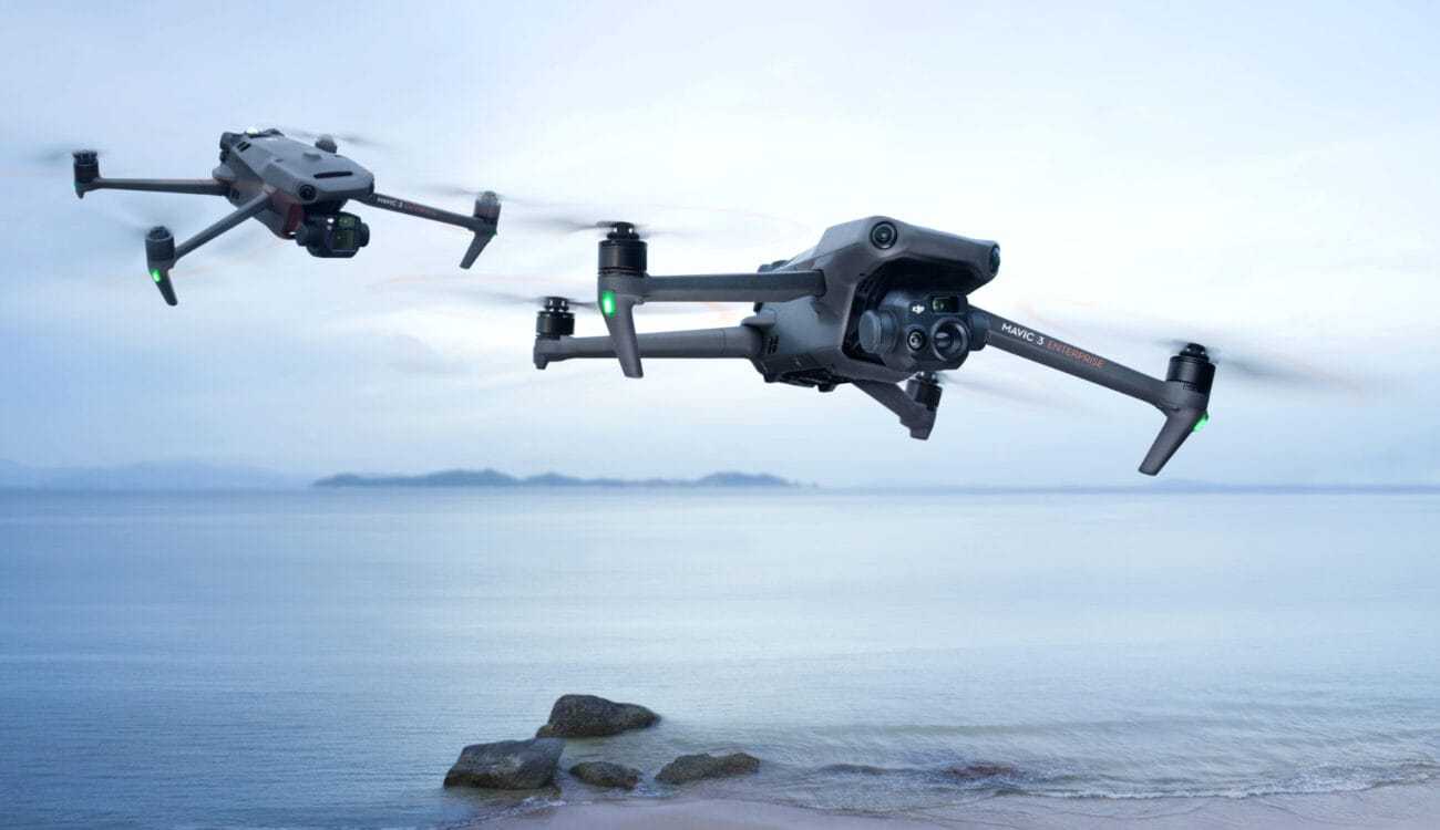
The DJI Mavic 3 Thermal (M3T) is a lightweight, foldable drone designed for professional missions that demand both RTK precision and thermal imaging. Part of the DJI Mavic 3 Enterprise series, this drone delivers outstanding performance in a small and highly portable body, making it a top choice for public safety, inspections, and search & rescue operations.
Dual Camera Setup – Includes 48MP wide-angle and 640×512 thermal imaging camera.
Optional RTK Module – Upgrade to a high-precision RTK UAV with centimeter-level GPS accuracy.
Lightweight & Foldable – Under 1 kg and portable; great for on-the-go field missions.
56× Hybrid Zoom – Capture distant objects safely and clearly.
Thermal Imaging Tools – Offers spot, area, and isotherm temperature readings.
Up to 45 Minutes Flight Time – Long missions without frequent battery changes.
Smart Mapping Modes – Features waypoint flights, terrain follow, and Smart Oblique Capture.
Full Obstacle Detection – Uses omnidirectional sensors and APAS 5.0 for safe navigation.
Real-Time Mapping – Works with DJI Terra for quick 2D area analysis.
Enterprise Controller – DJI RC Pro with bright 5.5″ display and DJI Pilot 2 app for mission planning.
Perfect for inspection teams and emergency responders who need a compact, reliable drone with RTK and thermal vision.
The DJI Mavic 3 Thermal is perfect for users who need compactness, speed, thermal imaging, and RTK-level accuracy all in one system. Its portability, advanced imaging features, and fast deployment make it a reliable solution for public safety professionals, inspection teams, and emergency response units who require actionable data and real-time decision-making in high-pressure environments.
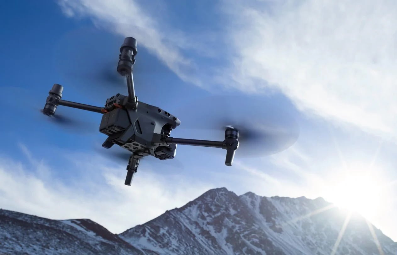
The DJI Matrice 30 Series is a rugged, compact, and highly capable enterprise drone built for demanding professional applications. With built-in RTK capability, the Matrice 30 Series offers centimeter-level precision, even in tough environments. It’s engineered to combine powerful flight performance, multi-sensor imaging, and weather resistance, making it ideal for public safety, inspection, and environmental monitoring.
This series includes two models: the Matrice 30 (M30) and Matrice 30T (M30T). The M30T adds a thermal camera for advanced temperature detection, while both models come with a laser rangefinder, zoom, and wide-angle cameras.
Multi-Sensor Camera Payload – Built-in:
48MP zoom camera
12MP wide camera
Laser rangefinder (up to 1,200m)
Optional 640×512 thermal camera (M30T model only)
Attachable RTK Module – This RTK Drone enables precise mapping, accurate georeferencing, and repeatable flight paths.
High-End Flight Performance – Up to 41 minutes of flight time, 7,000m service ceiling, 15 m/s wind resistance, and 82.8 km/h top speed.
IP55 Weather Rating – Dust- and water-resistant, ideal for tough field environments or industrial operations.
Quick Deployment Design – Foldable arms and instant setup make this drone with RTK ready to fly in under a minute.
Smart Safety Features – Dual-vision and ToF sensors on all six sides, ADS-B receiver for manned aircraft alerts, and hot-swappable dual battery system.
Seamless Software Integration – Works with DJI Pilot 2 app and DJI FlightHub 2 for real-time mapping, mission planning, and live collaboration.
Perfect for first responders, utility inspections, and survey professionals who need speed, accuracy, and versatility in an RTK UAV.
The DJI Matrice 30 Series is built for professionals who need power, flexibility, and reliability in one platform. Whether you’re inspecting critical infrastructure, responding to emergencies, or conducting high-accuracy mapping missions, the M30 or M30T offers unmatched durability, RTK accuracy, and multi-sensor capability—all in a portable design.
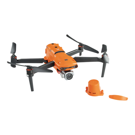
The Autel EVO II RTK V3 is a powerful yet compact drone designed for professional surveying, mapping, and inspection. With an integrated RTK module, this drone provides centimeter-level positioning accuracy without relying heavily on GCPs. It combines Autel’s renowned flight performance with a 1-inch 20MP CMOS sensor for crystal-clear images and precise georeferencing.
The EVO II RTK V3 is part of the Autel Robotics EVO II Series V3, known for its modular design, long flight times, and robust data security. Whether you’re working in construction, land surveying, or asset inspections, this drone is built to deliver reliable and accurate results.
Built-in RTK Module – Delivers sub-inch accuracy in real time and supports PPK for post-flight correction. Works with Autel’s base station or NTRIP.
20MP 1-Inch Camera – Shoots stunning 6K video and geotagged images with an adjustable aperture (f/2.8 to f/11).
Excellent Flight Performance – Up to 36-minute flight time, 15 km transmission, 360° obstacle avoidance, and handles winds up to 12 m/s.
Private and Secure Data – No forced cloud storage. Ideal for government and sensitive missions where data privacy matters.
Compact & Rugged Design – Lightweight, foldable, and tough. Easy to carry without sacrificing enterprise power.
Smart Flight Modes – Plan photogrammetry missions, configure RTK settings, and repeat automated flights with the Autel Explorer App.
Software Integration – Fully compatible with mapping tools like DroneDeploy and Pix4D for professional survey workflows.
A perfect drone with RTK for those who need precision, power, and portability in one smart RTK UAV.
The Autel EVO II RTK V3 stands out as one of the best RTK drones for professionals who need a lightweight, high-performing, and cost-effective platform. With superior data security, high-resolution imaging, and flexible RTK/PPK support, it’s a top choice for users in construction, surveying, agriculture, and inspection industries.

The Autel Robotics EVO II Pro RTK V3 is a high-end RTK drone designed for surveying, mapping, and inspection professionals who require superior image quality and precise positioning. This drone is equipped with a 1-inch CMOS 20MP sensor, integrated RTK module, and adjustable aperture, making it ideal for detailed aerial data collection in a wide range of industries.
Whether you’re flying missions in construction, land development, mining, or environmental surveying, the EVO II Pro RTK V3 delivers centimeter-level accuracy and unmatched clarity in a compact and portable airframe.
Integrated RTK System – Real-time centimeter-level accuracy via built-in RTK UAV and PPK support, plus NTRIP and Autel GNSS base compatibility.
6K Camera with 1″ CMOS Sensor – Capture ultra-clear images and video with 20MP stills, adjustable aperture (f/2.8–f/11), and strong low-light performance.
Stable Flight Performance – Up to 36 mins of airtime, resists winds up to 12 m/s, and delivers 15 km range with SkyLink 2.0.
360° Obstacle Avoidance – Uses 19 sensor groups to detect and avoid objects in every direction.
Compact & Field-Ready Design – Foldable, portable frame designed for quick deployment and rugged use.
100% Local Data Control – Operate fully offline with local data storage—no forced cloud uploads.
Advanced Mission Tools – Plan terrain-aware flights, repeat missions, and sync with apps like Pix4D, DroneDeploy, Dronelink, and more via Autel Explorer.
A powerful drone with RTK ideal for professional mapping, inspection, and surveying with top-tier imaging and field flexibility.
The Autel EVO II Pro RTK V3 is a perfect blend of advanced imaging, RTK precision, and portable convenience. It’s one of the best drones with RTK for professionals who need high-end visuals, data security, and accurate georeferencing without the bulk of larger enterprise drones.
It’s a go-to tool for surveyors, engineers, construction managers, and government agencies who demand quality and reliability in every flight.
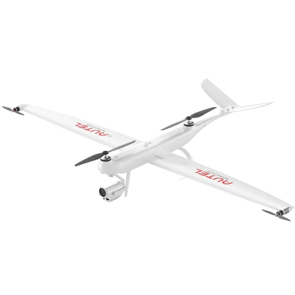
The Autel Dragonfish Pro is a high-performance RTK drone designed for large-area mapping, public safety, infrastructure inspection, and surveillance missions. As part of Autel’s Dragonfish VTOL (Vertical Takeoff and Landing) series, the Pro version combines long endurance, multi-sensor payloads, and centimeter-level RTK accuracy in one of the most advanced fixed-wing hybrid drones on the market.
This RTK drone is ideal for professionals who need extended flight time, fast deployment, and high-precision data across vast or difficult terrains.
Up to 158 Minutes of Flight Time – Long missions with extended coverage.
30 km Maximum Transmission Range – Covers vast distances for large-area surveys.
Covers 33 Square Kilometers in One Flight – Ideal for wide-area mapping and inspections.
VTOL (Vertical Takeoff and Landing) – No runway needed, perfect for uneven or remote terrains.
**Integrated RTK/PPK GNSS System – Supports real-time or post-processing for centimeter-level accuracy.
Modular Payload System – Swappable options: 4K zoom camera, thermal sensor, multispectral, and mapping sensors.
Advanced AI and Tracking Capabilities – Real-time object recognition and smart route planning.
Industrial Durability – IP43-rated, with wind resistance up to 17 m/s and a rugged carbon fiber body.
Autel Ground Station 2.0 – Military-grade tablet for mission planning, with one-tap flight controls and real-time feedback.
The Autel Dragonfish Pro is a robust RTK UAV designed for demanding missions that require precision and reliability. Ideal for large-scale mapping and inspections.
The Autel Dragonfish Pro is one of the most advanced long-endurance RTK drones available. With VTOL capability, flexible payload options, and unmatched flight time, it’s a powerful solution for professionals who operate across large or remote regions.
If your job demands precision, scalability, and performance, the Dragonfish Pro delivers on all fronts, making it one of the best drones with RTK in enterprise and government-level operations.
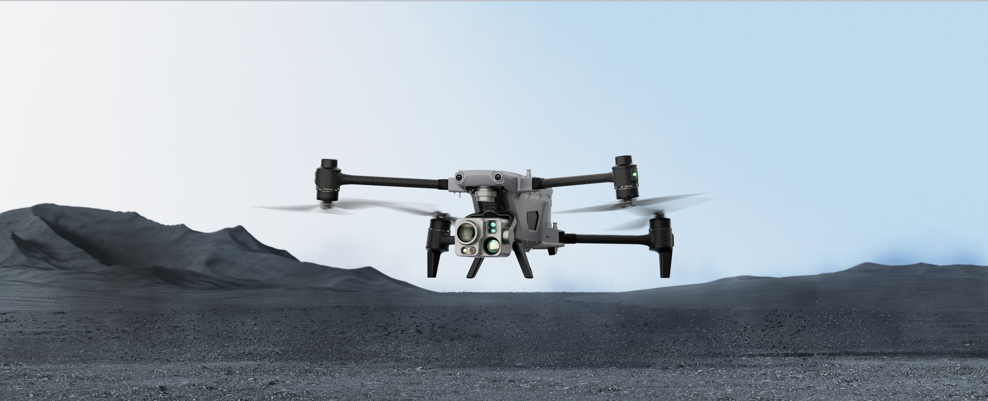
The Autel Alpha is a next-generation RTK drone built for demanding professional missions that require high-precision data, multi-sensor payloads, and long-endurance performance. Designed for public safety, infrastructure inspection, surveying, and night operations, the Autel Alpha stands out with its dual-camera system, military-grade AI processing, and advanced obstacle avoidance.
It’s a fully integrated platform that rivals the top-tier enterprise drones from DJI and is equipped for the most complex aerial tasks.
Dual RTK + AI Edge Processing – Built-in RTK/PPK GNSS module for centimeter-level accuracy, supporting NTRIP networks or Autel base stations.
AI-Powered Object Recognition – Integrated AI edge computing enables real-time object tracking and scene analysis.
Up to 45 Minutes of Flight Time – Enjoy longer missions with impressive endurance.
15 km Transmission Range – Ultra-low latency video feed with triple-band communication (2.4GHz, 5.8GHz, and 900MHz) for stable performance in complex environments.
Advanced Imaging System – Dual-camera payload includes a 20MP 1-inch CMOS RGB camera with 6x optical zoom and a 640×512 thermal sensor with 30Hz refresh rate.
Laser Rangefinder & Night-Vision – Equipped with laser rangefinding and night-vision for versatile operations.
6-Directional Obstacle Avoidance – 12 visual sensors provide smart collision prevention and terrain adaptation, ideal for tight spaces.
IP55 Weather Resistance – Operates in extreme temperatures from -20°C to 50°C, designed for rugged environments.
Autel SkyCommand Center – Real-time fleet management and mission planning, with cloud-based synchronization and remote video feed sharing.
Perfect for professionals who need a robust RTK UAV for reliable mapping, inspections, and complex operational needs.
The Autel Alpha brings together RTK-level precision, thermal and optical sensors, and AI-powered flight intelligence to meet the demands of modern enterprise and government operations. Whether it’s urban mapping, night surveillance, or complex inspection, this drone performs with top-tier results and reliability.
Looking for a rugged, intelligent RTK drone with the ability to see in the dark and work in any environment? The Autel Alpha is built for you.
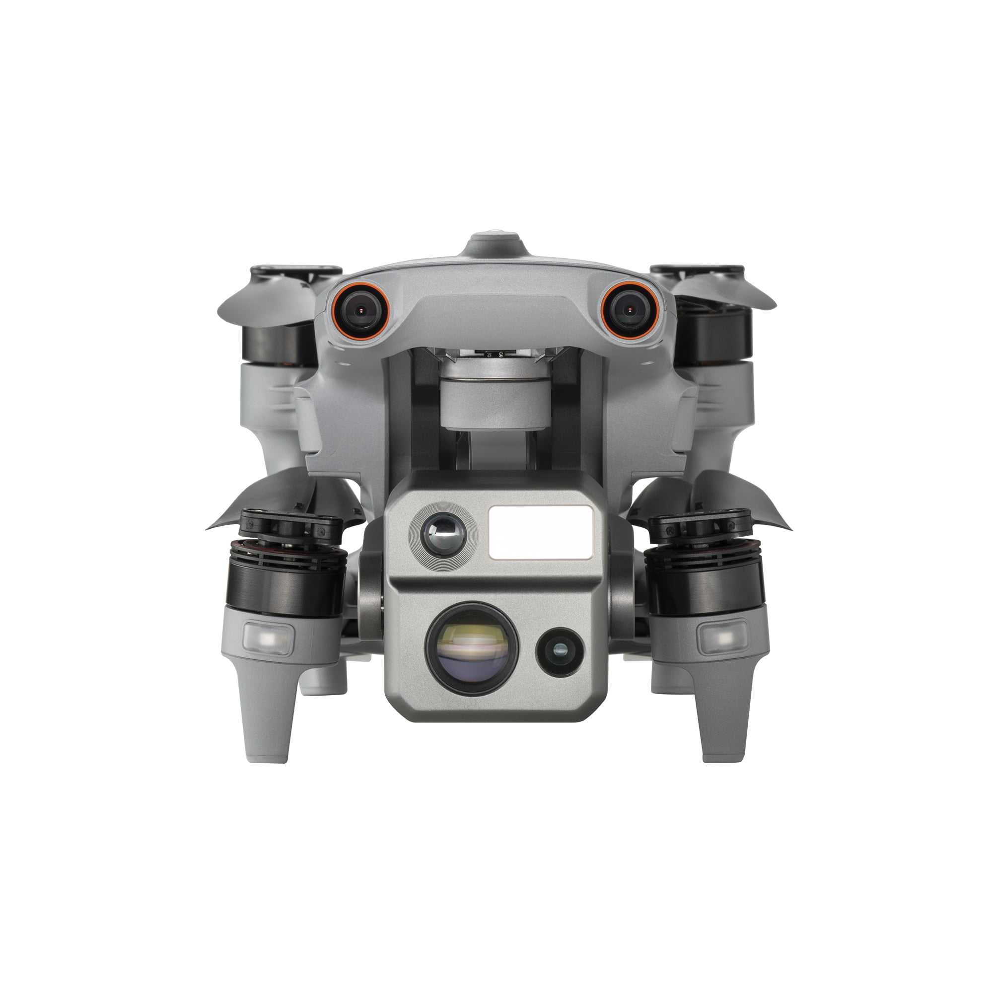
The Autel EVO Max 4N is a powerful RTK-enabled drone designed for advanced enterprise tasks, especially in low-light or complete darkness. Built for public safety, search and rescue, inspections, and tactical operations, it integrates AI-powered autonomy, multi-sensor payloads, and extreme low-light performance. With centimeter-level positioning accuracy powered by RTK technology, this drone ensures precision even in GPS-denied environments.
RTK and PPK Ready – Built-in RTK module ensures centimeter-level accuracy. Supports both RTK and PPK workflows for real-time and post-processed positioning.
Enhanced Night Vision – Equipped with a moonlight algorithm and starlight night vision camera (0.0001 Lux sensitivity), plus 640×512 thermal imaging with 16x digital zoom for clear vision in low light.
AI-Powered Obstacle Avoidance – Full 360° obstacle avoidance with binocular vision sensors and AI-driven features like target recognition and smart return to home.
Long Transmission Range – SkyLink 3.0 supports up to 20km video transmission with triple-band communication and automatic frequency hopping for stable connections.
Extended Flight Time – Offers up to 42 minutes of flight time, making it ideal for long-duration missions.
Rugged Build – IP43-rated for dust and water resistance, and operates in extreme temperatures from -20°C to 50°C.
Advanced Fleet Control – Seamlessly integrates with the Autel Enterprise App and SkyCommand Center for real-time video streaming, remote collaboration, and secure data logging.
The Autel EVO Max 4N is a powerful and reliable drone with RTK, perfect for precision mapping, inspections, and critical missions in various environments.
If you’re looking for a high-precision RTK drone that can see in the dark, avoid obstacles intelligently, and operate in the toughest environments, the Autel EVO Max 4N is unmatched. Whether it’s for night surveillance, emergency response, or industrial inspection, this drone delivers advanced performance when visibility is low but precision is critical.
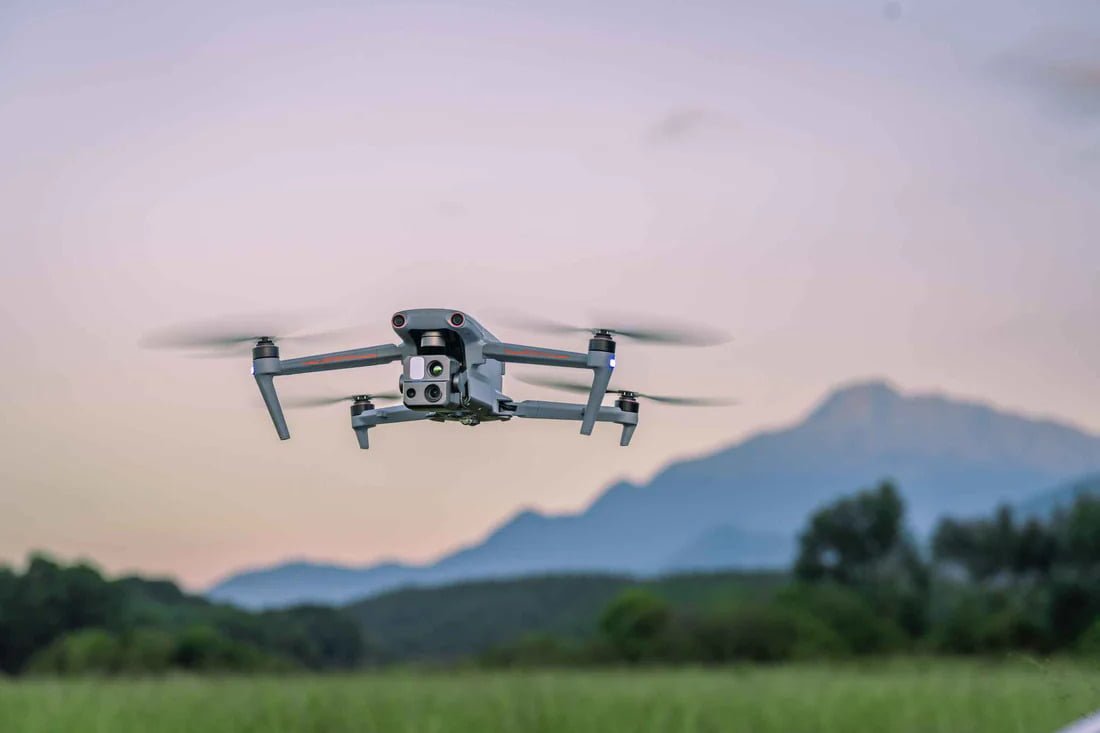
The Autel EVO Max 4T is a high-performance RTK-enabled drone engineered for demanding enterprise missions such as search and rescue, inspection, surveying, and mapping. It combines AI-powered autonomous flight, multi-sensor payloads, and centimeter-level GPS accuracy to meet the needs of professional teams in complex environments.
With Real-Time Kinematic (RTK) technology built in, the EVO Max 4T delivers precise geolocation data, even in GPS-compromised areas, making it a reliable choice for mission-critical operations.
RTK Precision & PPK Support – Integrated RTK module for centimeter-level accuracy, supports NTRIP and base station workflows, and flexible RTK UAV and PPK correction options.
High-Resolution Multi-Sensor Payload – 50MP wide-angle camera for visual mapping, 8K telephoto lens with 10x optical zoom and 160x digital zoom for long-distance observation.
Thermal Imaging – 640×512 thermal camera with 16x digital zoom for heat detection.
Laser Rangefinder – Accurate distance measurements with 1.2 km range for object tracking.
AI-Powered Features – Smart object recognition, autonomous tracking, 360° obstacle avoidance, and GPS-denied navigation for challenging environments.
Stable Long-Distance Transmission – SkyLink 3.0 ensures up to 20km video transmission with triple-band communication for reliable connectivity.
Rugged & Reliable Build – IP43-rated for dust/water resistance, operates in temperatures from -20°C to 50°C, and flight time of up to 42 minutes.
Enterprise Software Integration – Seamless compatibility with Autel Enterprise App and SkyCommand Center for real-time fleet coordination, mission planning, and secure data management.
The drone with RTK is ideal for professionals needing precision, long-range transmission, and advanced AI capabilities.
The Autel EVO Max 4T is built for professionals who need versatility, precision, and safety in one package. Whether you’re surveying large industrial sites or responding to critical incidents, this drone gives you the tools to capture detailed and accurate data from the sky — day or night, in easy or extreme conditions. With its powerful sensors and RTK-powered accuracy, it’s one of the best drones for enterprise missions across various industries.
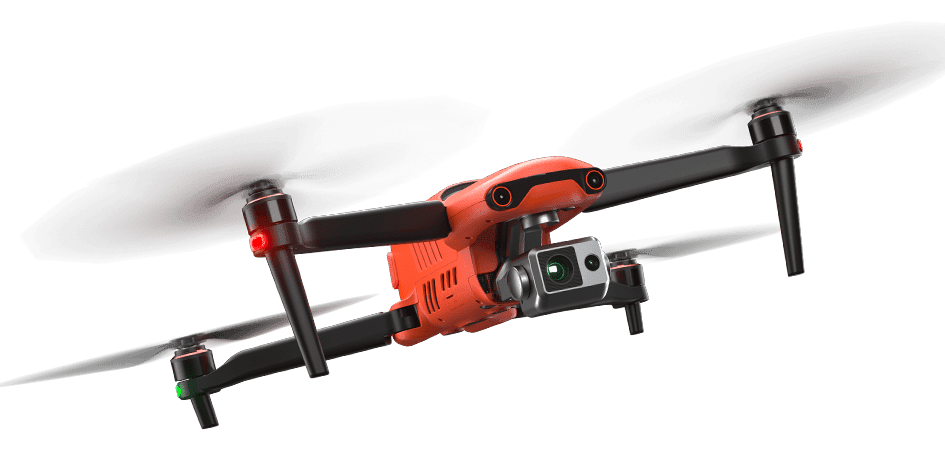
The Autel EVO II Dual 640T RTK V3 is a powerful RTK drone designed for public safety, industrial inspections, agriculture, and surveying. It combines thermal imaging, high-resolution RGB imagery, and RTK precision to deliver accurate geospatial data in both daylight and low-visibility conditions.
Equipped with dual sensors—a 640×512 thermal camera and a 50MP ultra-sensitive visual camera—this drone is ideal for missions that demand real-time situational awareness and centimeter-level GPS accuracy.
Dual-Sensor Payload – 640×512 thermal sensor with 16x zoom and 50MP visual camera with 4K HDR and 8K stills.
Picture-in-Picture Mode – View both thermal and visual imagery at the same time for enhanced analysis.
**Integrated RTK Module – Provides centimeter-level accuracy using RTK corrections and supports NTRIP, PPK, and Autel’s GNSS base stations.
Long-Range Transmission – SkyLink 2.0 offers up to 15 km transmission with secure, high-bandwidth encrypted video.
Up to 38 Minutes Flight Time – Wind resistance up to 12 m/s and top speeds of 72 km/h for dynamic missions.
Intelligent Obstacle Avoidance – 12 visual and 2 ultrasonic sensors with AI tracking for safer flights.
Rugged and Reliable Build – IP43-rated, operating from -10°C to 40°C, perfect for tough, industrial environments.
The Autel EVO II Dual 640T RTK V3 brings together thermal imaging, high-resolution mapping, and RTK-level GPS accuracy into one rugged, reliable platform. It’s built for professionals who need both situational awareness and mapping-grade precision—making it a top choice for inspectors, first responders, surveyors, and agronomists. Whether you’re working in challenging weather or GPS-compromised areas, this drone provides accurate, real-time data you can trust.
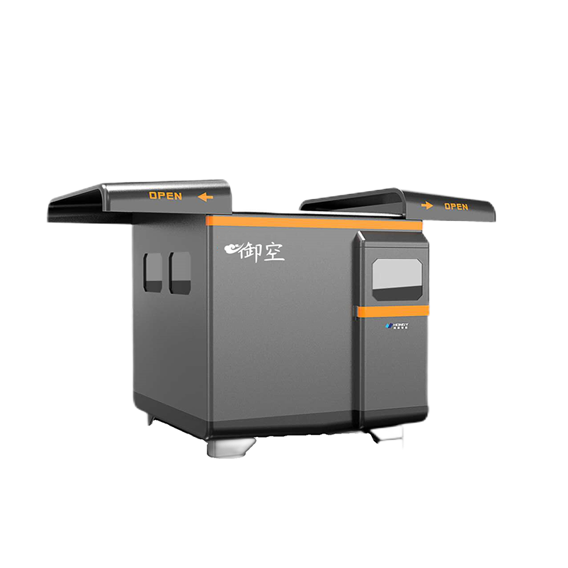
The XRTech Group Automated Battery Swapping Station is built to work with the DJI Matrice 350 RTK and DJI Matrice 300 RTK, two of the best RTK drones used for high-precision applications like surveying, mapping, and inspections. These drones feature Real-Time Kinematic (RTK) technology, which gives them centimeter-level accuracy—perfect for professional missions that require precise data.
The automated battery swapping station helps these drones work longer and more efficiently without needing manual battery changes. It makes it easier to run missions continuously with minimal downtime.
This system is designed to boost drone productivity and safety. It supports both DJI M350 RTK and DJI M300 RTK and includes:
Fast battery swapping in just 3 minutes, which reduces waiting time between flights
High landing accuracy of ±0.05m, even at night using fill lights
Multiple connection options like 4G/5G, LAN cable, and private networks for remote control and management
Weather-resistant design (IP54-rated) so it can operate outdoors in different weather conditions
Wide operating temperature range from -20°C to 50°C, making it suitable for various climates
Robotic arm with 0.02mm precision, ensuring safe and accurate battery handling
Temperature-controlled environment using 2 industrial-grade AC units
Real-time environment monitoring with cameras and sensors to detect humidity, rain, wind, and temperature
Supports A-B hopping, so drones can complete multi-location missions
Propeller retraction feature, which adds extra safety during landing and battery change
Holds 3 sets of spare batteries, allowing multiple flights without manual swaps
Optional UPS (Uninterruptible Power Supply) and auto-fire extinguisher for added safety
Both drones are built for long flights and high-accuracy missions, and they work perfectly with this automated station:
Integrated RTK systems provide centimeter-level precision, which is critical for industries like construction, utilities, and agriculture
Up to 55 minutes of flight time, allowing drones to cover more area between swaps
Triple payload support, so they can carry multiple cameras or sensors for more complex missions
DJI M350 RTK has enhanced signal stability, advanced positioning systems, and hot-swappable batteries
DJI M300 RTK supports specialized payloads like the Zenmuse P1 for aerial mapping and the Zenmuse L1 for LiDAR scanning
Both drones feature six-directional obstacle avoidance and AI-powered capabilities that help them fly safely and precisely on autonomous missions
The XRTech Automated Battery Swapping Station, paired with either the DJI Matrice 350 RTK or DJI Matrice 300 RTK, creates a strong and reliable solution for demanding drone operations. This setup eliminates manual battery handling, improves flight efficiency, and supports continuous, high-precision RTK drone missions.
If you are looking for the best RTK drones for industrial or commercial work and want to reduce downtime, this automated station combined with the DJI RTK drone lineup is the ideal choice.
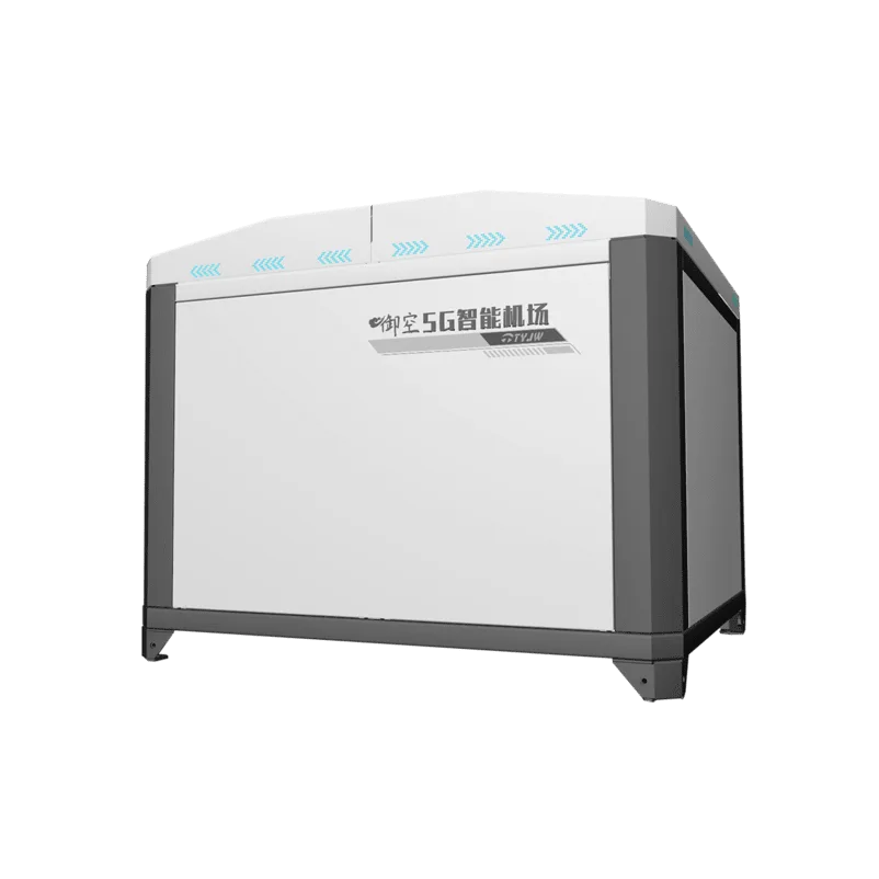
The XRT Automated Battery Swapping Station is built to support the DJI Matrice 30 Series, including the DJI Matrice 30 and DJI Matrice 30T. These drones are compact, powerful, and ideal for various industrial operations. Some models in the Matrice 30 Series come with RTK (Real-Time Kinematic) capability, which is essential for missions that demand high-precision positioning.
When paired with RTK-enabled drones, the XRT Automated Battery Swapping Station helps ensure longer, uninterrupted missions by automating the battery change process—making operations more efficient and reliable.
This system is designed to improve uptime, reduce manual handling, and support seamless automated workflows with RTK drones like the DJI M30 Series.
Supports DJI Matrice 30 and Matrice 30T
The station is made specifically for the DJI M30 Series, ensuring full compatibility and reliable operation.
3-Minute Battery Swapping Time
The quick swapping process reduces mission downtime and is perfect for RTK drone operations like mapping or inspections that need continuous flight time.
High Landing Accuracy of ±0.05m
Precision landing is critical for automatic docking. This feature ensures that drones land correctly for battery replacement, even in low-light conditions.
Multiple Remote Connection Options
The station supports 4G/5G, LAN, private network, and satellite connectivity, making it easy to manage remotely in both urban and remote locations.
IP54 Ingress Protection
It’s designed for outdoor use in varied environments, which is important for RTK drone missions that often take place in rugged or changing conditions.
Wide Operating Temperature Range (-20°C to 50°C)
This matches the working limits of professional drones and allows the system to function in hot or cold climates, supporting year-round operations.
If you’re using RTK-enabled DJI M30 or M30T drones, this automated station provides everything needed to maintain efficient and continuous flight operations. It’s especially useful in industries like surveying, infrastructure inspection, emergency response, and public safety, where accurate data and reduced downtime are key.
The XRT Automated Battery Swapping Station and the DJI Matrice 30 Series together form a complete solution for professionals who rely on RTK drones for high-precision, long-duration missions.
When investing in a drone with RTK (Real-Time Kinematic), it’s important to make sure you’re getting the right system for your needs. RTK drones offer centimeter-level positioning accuracy, but not all drones are created equal. Whether you’re buying for surveying, agriculture, construction, or inspections, here are the most important factors to consider before making your decision.
Start by identifying what you’ll use the RTK drone for. Different industries require different specs:
For surveying and mapping, you’ll want high-resolution cameras and strong RTK reliability.
For public safety or inspections, consider drones with thermal sensors and night vision.
In agriculture, multispectral capabilities and long flight times may be more important.
Knowing your use case helps narrow down the features you really need.
Your drone’s sensors determine the quality of data you’ll collect:
Look for high-resolution RGB cameras (20MP and above) for detailed mapping.
For thermal missions, ensure the drone includes a radiometric thermal sensor.
Some RTK drones support interchangeable payloads, so you can switch between different cameras for different jobs.
Better sensors mean more accurate and useful data, especially when paired with RTK.
RTK positioning should deliver centimeter-level GPS accuracy, but it’s important to check:
Does the drone support NTRIP or local base station setups?
Does it also support PPK (Post-Processed Kinematic) in case real-time correction isn’t possible?
Can it work with third-party correction networks?
Drones with flexible RTK/PPK options give you more reliability in challenging environments.
RTK data collection often requires longer flights to cover wide areas. Look for drones with:
30+ minutes of flight time on a single charge
Smart batteries with self-heating options (especially for cold weather)
Swappable battery systems for continuous operations
This ensures more productivity and fewer delays on site.
Reliable communication between the drone, controller, and base station is key to RTK performance. You’ll want:
Long-range transmission (10–15 km or more)
Strong anti-interference systems for urban or industrial areas
Dual-band (2.4GHz / 5.8GHz) transmission support
Signal dropouts during flight can result in inaccurate data—or worse, lost missions.
RTK drones are often flown close to structures, terrain, or in difficult environments. Prioritize drones with:
Omnidirectional obstacle avoidance
Terrain following sensors
Automated return-to-home (RTH) and emergency protocols
These features protect your investment and help maintain consistent flight paths for accurate data.
Check if the drone works with popular photogrammetry or GIS software like:
DJI Terra
Pix4D
DroneDeploy
Agisoft Metashape
Some drones come with built-in mission planning apps that make it easy to pre-plan RTK flights and export compatible data.
If you’re new to drones or RTK, choose one that’s:
Easy to fly with smart automation features
Comes with clear documentation or training support
Backed by a supportive user community or dealer network
Some vendors even offer certified RTK drone training to help teams get started quickly.
RTK drones are often used in tough outdoor conditions. Look for:
IP-rated drones (like IP43 or IP55) for dust and rain resistance
Operating temperature range that fits your climate
Rugged build materials and foldable arms for field use
A strong build ensures reliability and fewer repairs.
Finally, consider your full investment, not just the drone price:
Are RTK base stations or NTRIP subscriptions included?
Will you need extra batteries, cases, or payloads?
What about software licenses or support contracts?
Some drones may seem affordable up front but become expensive once accessories and software are added. Choose a setup that fits your budget and long-term workflow.
Choosing the right drone with RTK depends on your specific goals, environment, and technical requirements. The key is to focus on what matters most for your operations—whether it’s camera resolution, flight time, thermal capability, or software compatibility.
By considering these factors carefully, you’ll get a drone that not only delivers centimeter-level accuracy, but also helps you work faster, safer, and more efficiently in any field.
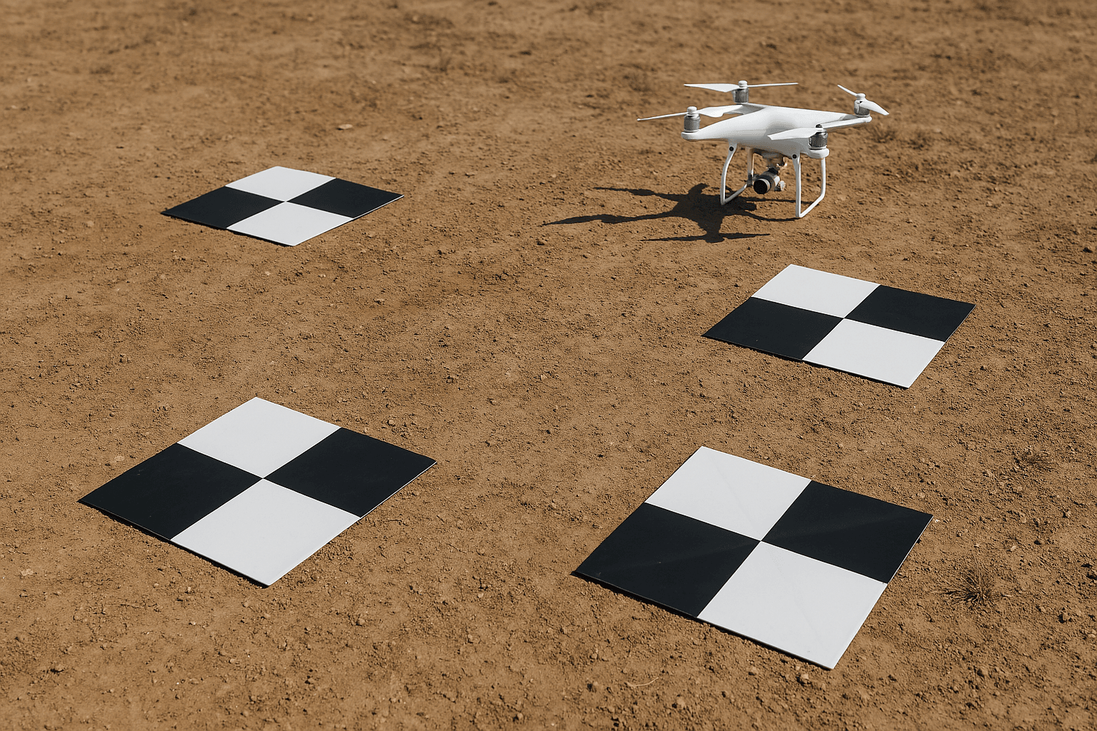
When using a drone for surveying or mapping, one of the most important things is making sure that the drone knows exactly where it is. This is where something called Ground Control Points, or GCPs, comes into the picture.
A GCP is a marked point on the ground that has a known, exact GPS location. Think of it like a flag on a map. Surveyors use these flags to help line up the drone images with real-world locations. Once those points are placed on the ground, the drone uses them to match its data and maps to those same locations. This makes everything more accurate.
Before drones became common, surveyors had to walk the site with GPS equipment, collecting thousands of points one by one. It could take hours or even days to finish a full survey. But when GCPs are used with drone data, it’s much faster. Surveys that used to take days can now be done in under half an hour.
Even though technology has improved, many surveyors still use GCPs with their RTK UAVs or drone mapping platforms. That’s because they help double-check the accuracy of the drone’s maps. Some teams also use these points as checkpoints, which means they help test how close the drone’s map matches the real-world positions.
GCPs can be simple things—like a painted “X” on the ground, or more advanced tools like smart GPS panels that collect location data on their own. Either way, they all serve the same purpose: to improve accuracy.
Even though GCPs help with accuracy, they aren’t always easy to set up. Getting them in place takes time, people, and equipment. You often need to carry gear around, drive across the site, get permission to access the area, and then carefully place the markers so they’re in the right spots.
Sometimes it’s not even possible to use GCPs. The land might be too remote, or the site could be dangerous. In these cases, laying out GCPs becomes not just hard—but unsafe.
As drone technology has improved, there’s now a better way to get accurate data—without the hassle of placing ground markers. This is where Drones with RTK or RTK UAVs really shine. These drones use something called GPS correction technology, which adjusts their location data in real time as they fly.
So instead of walking around the site setting up ground points, the drone corrects itself on the fly. That’s because RTK (Real-Time Kinematic) and PPK (Post-Processing Kinematic) are used to fix GPS signal errors that normally happen. This is sometimes called DGPS or Differential GPS.
With a drone that has RTK GPS, the accuracy is built into the flight. You don’t need to spend all that time getting ready before the mission. And when the flight is done, the data is already aligned with the real-world locations. That saves hours of work and reduces mistakes too.
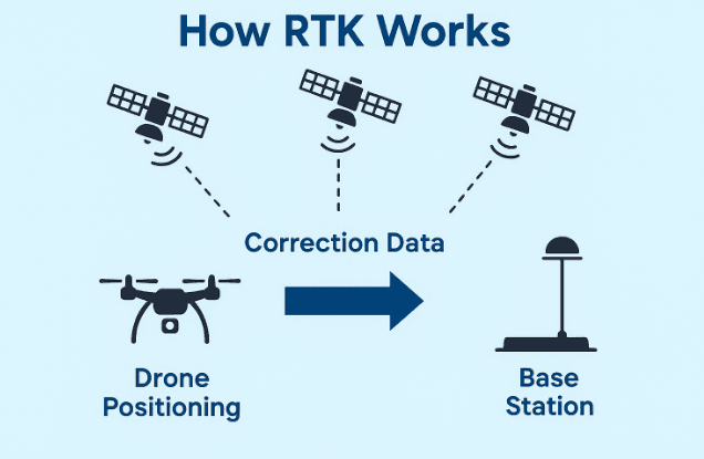
Let’s break down RTK, which stands for Real-Time Kinematic. That name might sound a little too technical, but the idea behind it is easy to understand once you know how it helps. If you’re using drones for work like surveying land, making maps, or capturing images of construction sites, having accurate data is a big deal. That’s where RTK drones come in.
RTK technology helps fix the small errors that come from regular GPS signals. Regular GPS can sometimes be off by a meter or more. But with RTK UAV systems, we can improve that and get location data that’s accurate within just a few centimeters—even while the drone is flying.
Here’s how it works: When a drone with RTK GPS takes off, it talks to satellites in the sky to figure out where it is. But it also connects to a base station on the ground—a station that already knows its exact location. This base station sends correction data to the drone while it’s flying, and the drone uses this info to sharpen its position in real-time.
To make this happen, there are two key connections working during the flight:
One link connects the drone’s remote controller to the base station.
The second link connects the remote controller to the RTK drone.
These two paths help the drone stay connected to both the ground and the sky. Because of this, the drone always knows exactly where it is, and every photo it takes is marked with super accurate location data.
When you’re using RTK drones, like the DJI M350 RTK or the Mavic 3 Enterprise RTK, you no longer need to place as many ground control points (GCPs). GCPs are those physical markers placed on the ground to help correct mapping data. While RTK helps reduce the number of GCPs, it’s still a good idea to use a few just to double-check your data when absolute accuracy is needed.
So what exactly do you need if you want to use RTK drones the right way?
You’ll need a base station placed somewhere on the ground, in a clear and open area.
You’ll also need a RTK-enabled drone (like the ones mentioned earlier).
A drone controller to fly the drone and stay connected to the station.
And last but not least, a strong and stable network signal, because the drone, controller, and base station all need to communicate clearly with each other.
When everything’s working well, RTK UAVs give you the power to collect detailed, reliable location data in real time. You can create better maps, complete your survey faster, and make fewer mistakes—all while flying with more confidence.
By using RTK drones in your workflow, you’re using the latest and smartest way to get accurate data from the sky. And in industries like construction, land development, agriculture, and mining, that kind of precision is not just helpful—it’s necessary.
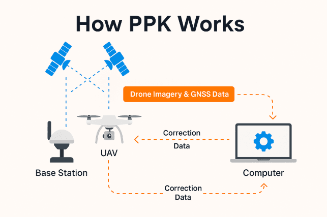
Let’s now look at something called PPK, which stands for Post-Processed Kinematic. This is another smart GPS correction system, just like RTK, but it works a little differently. If you’re already using drones with RTK, you might be wondering what sets PPK apart. Well, here’s the simple answer—RTK drones correct location data while they are flying, but PPK drones correct the location after the flight is finished.
Now, that might sound like a small change, but it can make a big difference depending on where and how you’re flying.
With PPK, your drone flies the mission and saves all the GPS data on its memory card. At the same time, the base station on the ground is also collecting location data. After the flight, you take both sets of data—one from the drone and one from the base station—and process them on your computer using special software. This software lines up the two data sets and makes corrections. The result is super-accurate location info for every image your drone captured.
So instead of relying on live signals during the flight like RTK UAVs do, PPK drones do their smart thinking after the mission. And that gives you a few real advantages.
One of the biggest benefits of PPK drones is that they don’t need a constant signal between the drone and the base station. That’s perfect if you’re flying in tricky places—like cities full of tall buildings, hilly areas, forests, or any place where your drone might lose connection during flight. Since the data correction happens later, your drone can focus on flying safely and collecting as much raw data as possible.
You can use popular RTK drones like the Phantom 4 RTK or the Mavic 3 Enterprise RTK for PPK missions too. These drones are flexible and powerful enough to do both types of GPS corrections, which means you don’t need two separate drones.
Here’s what you need to use PPK:
A drone capable of PPK (most RTK-enabled drones can also handle PPK).
A base station that records data during the flight.
Software on your computer that helps match and fix the data.
A few GCPs (Ground Control Points) to check your results and improve overall accuracy.
Checkpoints to validate the final map data.
Even though PPK does a great job, it’s still smart to use a few GCPs as a safety net. They help make sure your results are not just accurate—but also trustworthy.
Let’s go over how it actually works in simple terms:
The drone flies over the area and takes pictures.
Each image gets tagged with basic GPS coordinates—this part is just like regular GPS.
At the same time, a base station on the ground is recording its own accurate GPS info.
After the flight is over, both the drone and base station data are brought together in your software.
The software compares both data sets and fixes any GPS errors.
The final output gives you precise, corrected location data for each image.
And just like that—you have centimeter-level accurate maps or survey data.
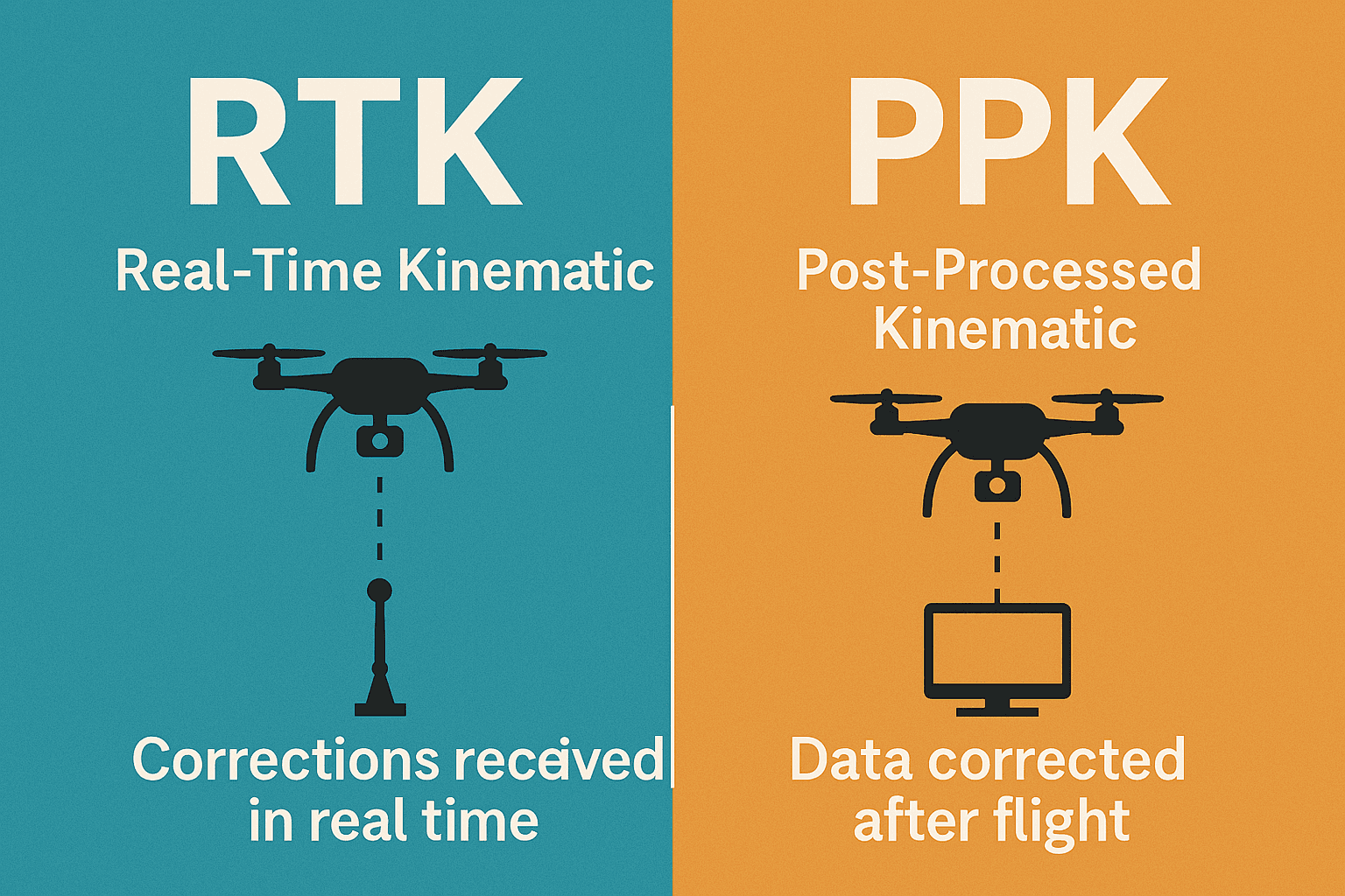
Both RTK and PPK drones give you highly accurate results. But each one has a different style. If you’re wondering which one is better, it really depends on your project.
RTK drones work best when you can maintain a strong signal between the drone, the controller, and the base station the whole time.
PPK drones give you more flexibility because they don’t depend on constant connection. You can fly longer distances, cover remote areas, or work in busy cities where signals might drop.
So, if you’re doing large-scale surveys, or if your site is full of obstacles, PPK might be the better fit. But if you need real-time corrections and faster results on the spot, then RTK UAV systems are a solid choice.
In either case, both technologies are built to help you get more done with fewer errors. And that’s exactly what makes today’s RTK and PPK drones such powerful tools for mapping, construction, mining, agriculture, and more.
Provide real-time GPS corrections during flight.
Offer fast and immediate results—no post-processing needed.
Great for on-site survey teams needing instant accuracy.
Useful in open areas like fields or flatlands.
High-quality data when the connection is stable.
Require a constant connection between the drone, base station, and controller.
Signal loss (even briefly) can cause data gaps or mapping errors.
Not ideal in dense areas—like forests, mountains, or cities—where signals can be blocked.
Works best with reliable hardware and strong networks.
Don’t need a live connection during flight—more freedom to fly anywhere.
Great for dense environments like forests, cities, and hills.
Easy setup—no need for live data connection before takeoff.
High accuracy through post-flight data correction.
Ideal for long-range and BVLOS (Beyond Visual Line of Sight) flights.
More dependable in challenging conditions.
Requires post-flight processing using a computer.
Slower results since data needs to be matched after the mission.
Needs a clear view of the sky and good onboard data recording.
When it comes to using drones for tasks like surveying, mapping, or building detailed 3D models, accuracy is everything. And that’s why it’s really important to understand the difference between three main methods: Standard Surveying, RTK, and PPK. All three are used to find and record precise locations—but they do it in different ways. If you’re not sure which method to choose, this section will help make things much clearer.
Let’s start with the basics and compare how these three work.
Standard drone surveying is the traditional way of collecting mapping data. This method uses the drone’s onboard GPS to figure out where it is in the sky. While it sounds simple, it’s not always very accurate. Why? Because the drone’s location can be affected by a lot of things, like how many satellites are overhead, the weather, or even the shape of the land.
To fix this, surveyors usually place several Ground Control Points (GCPs) across the area they’re working on. These are special markers placed on the ground with known exact locations. After the drone captures its images, the data is adjusted using these GCPs to improve accuracy.
Although this method works, it takes more time and effort. Setting up GCPs, measuring them, and processing all the data can turn into a full-day task—especially on large sites or tough terrain.
RTK, or Real-Time Kinematic, is a more advanced way to capture accurate data while the drone is flying. It works by connecting the drone to a base station on the ground or a network of base stations, like the Point One Polaris network, which constantly sends correction signals. These signals help the drone know exactly where it is at all times, down to the centimeter.
So, with RTK drones, you can skip placing lots of GCPs and still get highly accurate results. This is super helpful if you’re working under a tight schedule, in large areas, or where it’s hard to physically reach the ground. As long as the connection between your drone, base station, and controller is strong, you’ll get live corrections as the drone flies. And that means faster work, less guesswork, and great accuracy.
However, you still need good network coverage and open sky visibility for the best results. In places where the signal might drop—like in cities with tall buildings or deep valleys—RTK might not be the perfect fit.
Now let’s talk about PPK, which stands for Post-Processed Kinematic. This method works similarly to RTK in that it improves GPS data accuracy—but it does so after the flight is done. So instead of correcting positions live, the drone collects all the GPS data during its mission. Meanwhile, the base station is also recording accurate positioning on the ground. After the flight, you upload both sets of data to a computer, and the software does all the corrections there.
One big benefit of PPK drones is that you don’t have to worry about losing signal during the flight. If you’re flying in tough environments or over long distances, PPK gives you more freedom and fewer connection issues. It also helps if you’re working in areas where network access is poor or even unavailable.
But keep in mind—PPK takes more time. You’ll have to wait to process your data before you can see final results. That’s why PPK is a great choice for jobs where real-time results aren’t necessary, but accuracy still matters a lot.
To make it easier, here’s how these three compare in a real-world setting:
Standard Surveying needs more ground setup like GCPs. It’s accurate but takes longer and requires more manual work.
RTK UAVs give you real-time accuracy. They’re great for fast mapping, but they depend on a strong, stable connection during flight.
PPK drones give you flexibility. They’re reliable in hard-to-reach areas and don’t need a constant signal, but the data takes longer to process.
Each of these methods has its place depending on the job site, weather, and what level of accuracy you need. Some professionals even combine them—like using RTK during flight and validating results with a few GCPs or using PPK when working in remote or busy city areas.
No matter which option you go with, using drones with RTK GPS or PPK technology can dramatically improve the quality of your work. These newer systems are not only more efficient, but they also reduce the need for extra gear and large field teams. And in today’s fast-moving world, saving time and boosting accuracy makes all the difference.
When you’re flying a drone for surveying, mapping, or inspection, accuracy is one of the most important things to get right. That’s where RTK (Real-Time Kinematic) technology comes in. Unlike standard GPS, which usually gives you positioning within a few meters, RTK delivers centimeter-level accuracy—often between 1 to 3 centimeters.
That means with the right setup, your RTK UAV knows almost exactly where it is, in real time. It’s one of the reasons RTK drones are becoming essential for industries like construction, agriculture, and infrastructure planning.
RTK improves accuracy by correcting common GPS errors as they happen. GNSS (Global Navigation Satellite System) data can be affected by several things like:
Ionospheric disturbances
Satellite clock errors
Orbital drift
Signal reflections (multipath interference)
To fix this, RTK systems use a base station that sits on the ground at a known fixed location. The base station compares its actual position with the position reported by GPS satellites, figures out the errors, and then sends real-time corrections to your drone. The drone then adjusts its position as it flies, resulting in extremely precise data.
So basically, RTK gives your drone a live GPS tune-up, correcting it centimeter by centimeter as it moves.
The closer your drone is to the RTK base station, the better the accuracy. That’s why RTK networks like Point One Polaris are so powerful. With over 1,440 base stations across the world, they help deliver centimeter-accurate positioning with 99.99% reliability—even across large or remote areas.
If you’re using drones with RTK GPS and connected to a network like Polaris, you can get top-tier results without setting up your own base station or laying down dozens of GCPs.
In the past, most drone surveyors relied on GCPs (Ground Control Points). These are physical markers on the ground with known coordinates that help adjust GPS data after the flight. While effective, GCPs take time to set up, especially across large or hard-to-reach areas.
With RTK drones, you don’t need as many GCPs, or sometimes none at all. That means:
Less time preparing the site
Faster setup
Shorter post-processing times
It’s one of the biggest reasons professionals are switching to RTK UAVs for surveying and mapping.
Let’s break down why RTK drone systems are such a game-changer for serious drone operations.
Still spending hours setting up GCPs for every job? With an RTK drone, you can skip it. Thanks to modern RTK networks like Polaris, you get access to correction data from a global base station network. No more hauling out markers and measuring tape—just fly and go.
When your drone already captures high-accuracy data in-flight, you spend way less time fixing it afterward. This is especially helpful for photogrammetry, LiDAR, or 3D mapping. Some RTK drone users have reported up to 90% time savings on post-processing.
Less time in the office = more time flying and delivering results to clients.
Planning a flight path is much easier when you don’t need GCPs to correct your data later. RTK technology helps your drone fly accurately in the real world, matching the exact path you’ve programmed in your software—even when GNSS signals aren’t perfect.
This helps reduce mistakes, re-flights, and mapping errors.
In busy skies or tight environments, knowing exactly where your drone is at all times is key to avoiding crashes. With RTK correction, your drone knows its location to the centimeter—even around tall structures or during complex missions.
Pair this with path-planning tools, and RTK becomes your silent safety partner in the sky.
Even when things go wrong, RTK gives you the data to figure out what happened. With timestamped location logs, you can see exactly where and when something went off-track. For example, using Point One’s GraphQL API, you can quickly pull historical RTK data from your drone using a simple HTTPS request.
That level of real-time observability is a huge advantage for teams managing multiple drones or critical missions.
If you’re still relying on standard GPS or manual GCPs, it’s time to upgrade your workflow. RTK drones give you real-time, centimeter-level positioning, which means:
Fewer errors
Faster workflows
Less setup
Better data
More confident flying
Whether you’re flying a RTK drone for agriculture, construction, surveying, or infrastructure inspection, the benefits are clear. With networks like Point One Polaris and technology like GraphQL APIs, your drone can become a smart, connected, and super-accurate flying machine—ready to tackle any high-precision task you throw at it.
When you use an RTK UAV, you’re unlocking powerful tools that can save time, improve accuracy, and open doors to new opportunities. With all the precise data your RTK drone provides, you can now explore more advanced ways to collect, use, and analyze information from the sky.
Every day, people are discovering smart new ways to apply drone RTK GPS technology. From farming to construction, and even public safety—RTK drones are helping different industries work faster, safer, and more efficiently.
Let’s take a look at how this amazing technology is being used in the real world.
The precise positioning that comes with drones with RTK makes them essential tools across many industries. Not only do they make existing work easier, but they also allow for brand-new types of missions that weren’t possible before. Here are some of the top industries using RTK UAVs right now:
RTK drones in agriculture are changing the game for farmers. These drones can fly over large fields and collect detailed data on soil health, crop growth, and plant stress. Because the drone knows exactly where it is, the data it collects is super accurate.
This means farmers can:
Spot unhealthy areas faster
Apply fertilizers or pesticides only where needed
Save water and reduce waste
Improve crop yield
Precision farming becomes easier and more effective with RTK GPS drones.
Traditional land surveying is time-consuming. But with an RTK drone, you can create detailed maps quickly and without needing to walk every part of the site. These drones are ideal for:
Topographic surveys
GIS data collection
Environmental monitoring
And because they don’t rely as much on ground control points (GCPs), you save a lot of time setting up.
Using RTK UAVs to inspect dangerous or hard-to-reach areas keeps people safe and speeds up work. These drones are used to check:
Power lines
Dams and bridges
Cell towers
Building rooftops
In emergency situations, RTK drones help teams get real-time aerial views during search and rescue missions, natural disasters, and public safety operations.
In construction, everything needs to be in the right place—and on time. RTK drones help teams:
Plan job sites
Track equipment and materials
Compare the actual build with the original design (as-built vs as-planned)
This means fewer mistakes, faster problem-solving, and better communication between teams.
Mining sites are large and often dangerous. With RTK drones, you can:
Survey large areas faster
Monitor stockpiles of material
Measure volumes of extracted earth
Keep workers safe by reducing time spent in risky zones
The data is accurate, and the process is much cheaper and safer than manual surveys.
City planners and engineers use RTK UAVs to design smarter cities. These drones help create:
3D models of buildings and streets
Plans for new roads or parks
Viewshed analysis (what areas can be seen from a specific point)
Planners can quickly test new ideas and spot problems before they start digging or building.
In oil fields or gas pipelines, safety is critical. That’s why many companies are now using RTK drones to:
Inspect pipelines for leaks
Monitor drilling equipment
Map oil field layouts
Spot problems in hard-to-reach areas like offshore rigs
With drone RTK GPS, everything is monitored with incredible precision, helping teams fix issues before they become disasters.
Using your RTK UAV isn’t just about flying a drone—it’s about making smarter decisions based on accurate data. Whether you’re growing crops, building bridges, or planning new city streets, RTK drones give you the tools you need to work better and faster.
And as more industries start using these high-precision drones, the list of applications will only keep growing. No matter the job, if accuracy matters, an RTK drone is the right tool to use.
A: An RTK drone is a drone that uses Real-Time Kinematic (RTK) technology to improve GPS accuracy. It helps the drone know its exact position with centimeter-level precision, which is very useful for jobs like mapping, surveying, and inspections.
A: RTK technology makes drones fly with better accuracy and stability. It’s important for tasks that need very precise location data, like land surveying, construction planning, or farming. RTK helps reduce errors and saves time.
A: Some of the best RTK drones include:
DJI Matrice 350 RTK
DJI Mavic 3 Thermal
Autel EVO II RTK V3
Autel EVO MAX 4T
These drones are great for different jobs like inspections, mapping, and agriculture.
A: GPS gives you location data that is usually accurate within a few meters. RTK improves this by using correction data from a base station, so the location is accurate within a few centimeters. That makes a big difference for professional work.
A: Yes, RTK drones are great for precision agriculture. They help farmers check crop health, plan irrigation, and map fields with high accuracy. This helps grow more crops and use less water and fertilizer.
A: Most RTK drones come with their own software or apps for flight planning and data processing. Some also work with other mapping or surveying tools. Make sure the software supports RTK corrections.
A: Flight time depends on the drone model. For example, the DJI Matrice 350 RTK can fly up to 55 minutes, while smaller models like the Autel EVO II RTK can fly for around 40 minutes. RTK doesn’t shorten flight time but adds better positioning.
A: Yes, RTK drones usually connect to a base station or a network that sends correction data. This helps them fix small GPS errors and fly more accurately. Some drones can also use NTRIP services for corrections.
A: RTK drones cost more than basic drones because of their high-end technology. Prices vary by model. For example, DJI RTK drones or Autel RTK drones can range from a few thousand to tens of thousands of dirhams or dollars depending on features.
A: Absolutely. RTK drones are perfect for inspecting buildings, power lines, towers, and bridges. They provide accurate data and clear images, helping teams find problems without needing to climb or shut down equipment.
Enhance safety and efficiency in power line inspections with advanced drone technology.

What is Synthetic Aperture Radar (SAR)? When people think of satellite images, they often picture colorful photos taken from space.
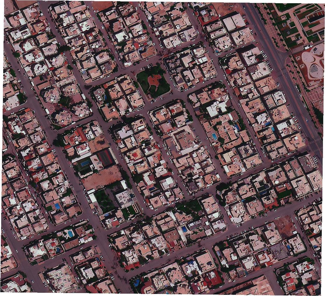
Understanding the differences between free satellite maps and powerful commercial satellite data for your needs in 2025. The world is constantly being watched from

The Plaza, Radisson Blu Hotel, Dubai Deira Creek, Dubai UAE

+971 58 885 3151

Specialized in satellite data, drone products, industrial products & supply chain management.
© Copyright 2025 by XrTech Group. All rights reserved.