
Tailings Dam Monitoring with InSAR & AI
Tailings Dam Monitoring: How Advanced Satellite Intelligence Is Transforming Tailings Dam Safety Tailings dams are among the most critical—and high-risk—structures
Finding satellite imagery Australia free can be very helpful! This guide shares the best satellite maps that cost nothing to use.
Looking at Earth from space is amazing. Pictures taken by satellites, called satellite imagery, help us see our world in new ways. Sometimes, these pictures are needed for big projects, and companies like XRTech Group provide very detailed and custom satellite images in Australia. But sometimes, people just need to look at an area, plan a trip, or do school work. For these times, free options for satellite maps are very useful.
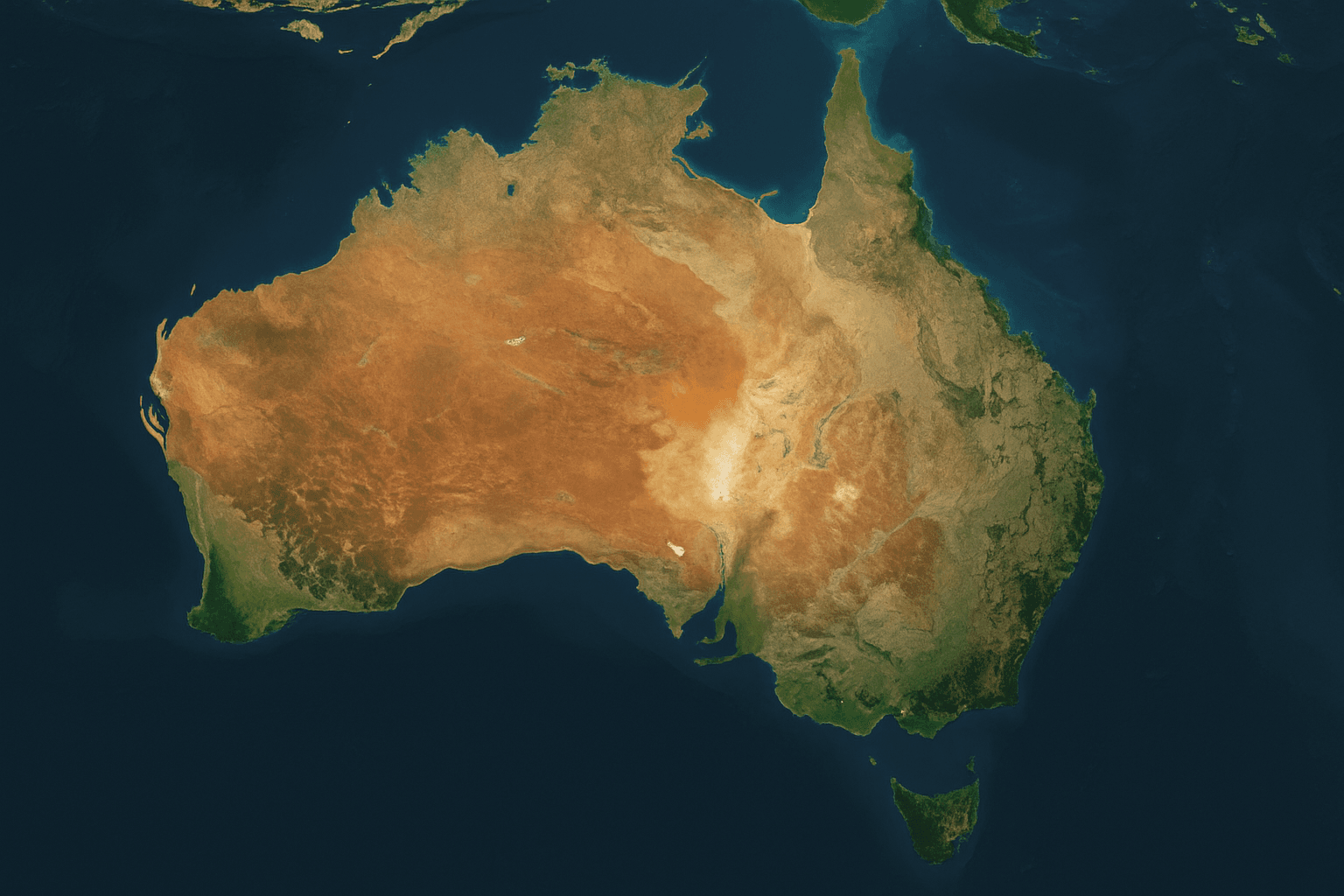
Australia is a very big country with many different landscapes. Knowing where to find good quality satellite imagery Australia free can save time and money.
Access to accurate satellite imagery Australia free has never been more important. Whether you’re in agriculture, urban planning, real estate, education, or environmental monitoring, having reliable access to the best free satellite maps can help save time, money, and effort.
This blog will explore the best free satellite maps Australia has to offer for everyone. These free satellite imagery sources in Australia are often provided by governments or groups that want to share information for public use.
XRTech Group partners with the top satellite imagery provider in Australia to deliver reliable, high-resolution Earth observation data for a wide range of industries. We specialize in delivering satellite imagery Australia and premium high-precision datasets used across agriculture, mining, infrastructure, environmental monitoring, urban planning, and more.
By working closely with both global and Australia-based satellite companies, XRTech ensures clients receive accurate data tailored to their location, resolution needs, and revisit frequency. Whether your project requires historical imagery, near real-time monitoring, or customized tasking, we offer flexible access to the best satellite maps available in the region.
Access to global satellite constellations including commercial and government-backed systems.
Support for custom tasking and historical image archives.
Delivery formats optimized for GIS, CAD, and enterprise systems.
Flexible pricing models based on resolution, area, and urgency.
Localized support tailored for Australia’s geography and climate zones.
From major cities like Sydney, Melbourne, Brisbane, and Perth to remote regions and coastlines, XRTech makes it easy to get reliable satellite imagery Australia at lowest price or custom commercial data as per project scope.
Here are some of the top places where you can find satellite imagery Australia free, offering various views and tools:
Google Earth and Google Maps are very popular ways to view satellite imagery. These platforms offer a vast collection of images covering almost the entire world, including detailed views of Australia. The images are put together to create a smooth, zoomable map. While not always the most recent for every spot, they are updated regularly and are very easy to use.
Google Earth/Maps is best for general exploration, personal use, simple planning, and school projects. It is often the first place people go to find best satellite maps.
The Sentinel Hub Playground provides access to data from the European Union’s Copernicus program, which includes the Sentinel satellites. These satellites offer fresh satellite imagery for Australia and the rest of the world. While it might look a bit more complex at first, it offers different types of images (like true color and false color) that are updated very often.
This is best for environmental monitoring, agriculture, and anyone needing more up-to-date views or different types of satellite data than what general maps offer. It’s a great source of satellite imagery Australia free for more advanced users.
NASA Worldview is a tool from the United States space agency. It lets users explore a wide range of global satellite images that are updated daily. While not just focused on Australia, it provides very recent views of the continent for environmental understanding. It is an excellent resource for watching large-scale natural events. Many different kinds of data are shown here, which makes it a strong source for best satellite maps for environmental study.
NASA Worldview is best for researchers, students, and anyone interested in environmental science, disaster monitoring, and climate patterns. It’s a powerful tool for seeing satellite imagery Australia free from an environmental perspective.
The U.S. Geological Survey (USGS) offers EarthExplorer, which is a very large online library of free satellite imagery and aerial photos. While many images are for the U.S., it includes a good amount of global data, including for Australia, from missions like Landsat. This platform is excellent for looking at how places have changed over many years. It is a good choice if you need older satellite imagery Australia free.
USGS EarthExplorer is best for historical studies, land use change analysis, and academic research. It is widely used by those who need to understand long-term changes shown in best satellite maps from the past.
OpenStreetMap (OSM) is a map of the world that is made by many volunteers. While it’s mainly a map, it uses different kinds of satellite imagery as a base layer. This means you can see community-added map details on top of satellite views. The imagery quality can vary depending on the area, but it’s often a good source of satellite imagery Australia free for general mapping tasks and combined with human-contributed data.
OpenStreetMap is best for local mapping projects, community planning, and when combining general mapping data with underlying satellite views. It provides a unique way to explore best satellite maps with local knowledge.
CSIRO is Australia’s national science agency. Their Data Access Portal provides a range of scientific datasets, which often include satellite imagery and derived products specific to Australia. This imagery is typically used for research and environmental management. While it might require a bit more understanding of scientific data, it is a valuable source for high-quality satellite imagery Australia free for specific uses.
This portal is best for environmental scientists, agricultural researchers, and students needing detailed, Australia-focused satellite data for specific studies. It provides valuable information for various Remote sensing applications within Australia.
Geoscience Australia (GA) is the national agency for geology and geography. Their MapConnect portal offers access to official geospatial data and maps for Australia. This often includes base satellite imagery and related geospatial products. It is a reliable source for government-provided satellite imagery Australia free, ensuring accuracy and authority.
GA MapConnect is best for government planning, academic research focused on Australian geography, and anyone needing official and reliable geospatial data for the continent. It helps in creating accurate best satellite maps for many uses.
While often focused on oceans globally, the Copernicus Marine Service provides ocean-related satellite data and derived products that are highly relevant to Australia’s vast coastline. This includes information on sea surface temperature, ocean color, and sea ice. While not direct land imagery, it offers crucial environmental insights from satellite imagery for Australia’s marine areas.
This service is best for marine biologists, oceanographers, coastal managers, and environmental scientists interested in Australia’s marine ecosystems. It offers valuable satellite services for understanding ocean changes.
OpenTopography provides access to high-resolution topographic data, which includes Lidar and other elevation datasets. While not strictly satellite imagery in the visual sense, these datasets are often derived from airborne or satellite platforms and are crucial for understanding the 3D shape of the land in Australia. This is a specialized kind of satellite data provider for detailed terrain information.
OpenTopography is best for geologists, engineers, hydrologists, and researchers needing very precise elevation data for detailed analysis, such as flood modeling or geological studies. It provides a unique view among best satellite maps for land elevation.
Digital Earth Australia (DEA) is a national program that turns Earth observation satellite data into information about Australia’s land and coastal environments. It provides free, ready-to-use information for better decision-making. DEA processes vast amounts of historical and new satellite imagery Australia free to create a continuous picture of the continent. It is one of the most comprehensive sources for Australia-specific Remote sensing data.
Digital Earth Australia is best for government agencies, environmental managers, farmers, and researchers needing comprehensive and processed satellite imagery and derived products specific to Australia. It’s a go-to for national-level best satellite maps.
Each Australian state provides its own platforms for accessing geospatial data, which often includes high-resolution satellite imagery and other mapping information. These state-level resources often offer more detailed and frequently updated images for their specific regions compared to national or global platforms. They are important sources for finding precise satellite imagery Australia free for local planning and projects.
These resources are best for local government planning, property developers, farmers, and individual citizens needing highly specific and up-to-date satellite imagery for their state or territory. They are excellent sources for region-specific best satellite maps.
The National Map is a free online tool that lets people find and look at Australian geospatial data from many different sources. It helps bring together data from various government and research bodies, including satellite imagery. While it doesn’t host all the data itself, it makes it easier to discover and access a wide range of national geographic information, making it a valuable tool for finding best satellite maps Australia has to offer.
National Map is best for researchers, policy makers, students, and the general public who need to explore and combine different types of Australian geospatial data, including available satellite imagery, for broader analysis and understanding.
The Australian Bureau of Meteorology (BoM) provides a Satellite Viewer that offers real-time weather satellite imagery for Australia and the surrounding regions. This is primarily focused on showing cloud cover and weather patterns, rather than detailed ground features. It is a critical tool for weather forecasting and understanding atmospheric conditions, making it an essential source for a specific type of satellite imagery Australia free.
The BoM Satellite Viewer is best for weather enthusiasts, pilots, marine operators, and anyone interested in current weather patterns and forecasting across Australia. It provides direct access to vital meteorological satellite data.
NSW Spatial Viewer is an official platform by the NSW Government that offers free GIS data layers and satellite imagery focused on New South Wales. It allows users to view, combine, and analyze various geospatial datasets related to land, infrastructure, planning zones, and environmental indicators. It is considered one of the best satellite maps available for regional professionals.
Key Features:
Region-Specific Data: Focused entirely on New South Wales.
Imagery Access: Includes aerial and satellite imagery overlays.
Zoning & Property Details: Supports land use analysis and boundary insights.
Searchable Layers: Explore assets like flood zones, road networks, and vegetation.
Best For:
NSW Spatial Viewer is best suited for surveyors, local councils, and academic institutions working on land planning, legal boundaries, or satellite imagery Australia free use cases in New South Wales.
TerriaMap Australia is a dynamic, open-source map viewer used to explore Australia’s geospatial data layers, including free satellite maps. Developed by the creators of NationalMap, TerriaMap integrates government datasets with satellite imagery, offering users a flexible and visual way to explore land usage, infrastructure, and climate overlays.
Key Features:
Layer Control: Turn datasets on/off for layered insights.
Live Data Integration: Updated from real-time government sources.
Mobile-Friendly Viewer: Works well on desktop and portable devices.
Open-Source Engine: Built on Cesium and open standards.
Best For:
TerriaMap is ideal for urban planners, emergency services, developers, and GIS students who need access to satellite imagery Australia free across various public datasets. It’s one of the best free satellite maps Australia tools for real-world and academic use.
AgroClimate Australia is a government-supported tool built for farmers and agronomists who need climate-sensitive decision-making support. By providing free satellite imagery, rainfall estimates, and seasonal outlooks, it plays a key role in precision agriculture across Australia.
Key Features:
Satellite Vegetation Indexes: NDVI and rainfall overlays.
Climate Projections: Forecasts for seasonal planting and harvesting.
Crop Risk Monitoring: Identify dry spells and potential yield threats.
Free and Public: No cost or registration required.
Best For:
AgroClimate Australia is perfect for drought planners, agribusiness teams, and growers who depend on best satellite maps and environmental data for risk management and crop rotation planning.
These free satellite imagery platforms can support dozens of industries. Here’s how they’re being used today across Australia:
| Industry | Application |
|---|---|
| Agriculture | Crop monitoring, irrigation planning, NDVI vegetation checks |
| Urban Planning | Land zoning, infrastructure tracking, construction updates |
| Disaster Management | Bushfire detection, flood damage, storm tracking |
| Mining & Resources | Terrain modeling, permit verification, ground monitoring |
| Real Estate | Site visualization, land access, elevation checks |
| Research & Academia | Environmental change tracking, biodiversity mapping |
| Tourism & Conservation | Coastal erosion, reef monitoring, trail management |
While the best free satellite maps in Australia offer a wealth of valuable insights, they have limitations. There are specific scenarios where upgrading to high-resolution commercial satellite imagery becomes necessary.
Lower resolution (often 10–30m)
Slower update frequency (some update every 5–16 days)
Limited historical archives or analytics
Restricted commercial usage rights
Lack of tailored support
| Use Case | Why Paid Imagery Is Better |
|---|---|
| Urban infrastructure & smart city planning | Super-high-resolution (30cm) imagery enables precise project modeling |
| Precision agriculture | Frequent revisit and vegetation index layers for crop health optimization |
| Disaster response | Real-time tasking, thermal bands, and cloud-penetrating SAR data for emergency decisions |
| Environmental monitoring | Multi-spectral or hyperspectral analysis to detect subtle land use or vegetation changes |
| Mining and resources | Slope detection, excavation tracking, and permit monitoring with 3D models |
| Defense & intelligence | Night-time imaging, change detection, object tracking, and secure delivery pipelines |
With platforms like XRTech Group, you get access to commercial satellite imagery at best price in Australia.
Access to leading global providers
Support for archive data and new tasking
SAR, thermal, hyperspectral, and stereo options
Flexible pricing plans (Archive, Priority, Emergency)
Government, NGO, enterprise, and research use cases supported
Agriculture & AgriTech
Energy & Utilities
Urban Development
Environmental Research
Defense & Intelligence
Oil, Gas & Mining
Disaster Response Agencies
Maritime & Logistics
Infrastructure & Civil Engineering
When free tools fall short, XRTech Group fills the gap with personalized guidance, fast delivery, and ongoing support.
Australia is facing new and complex challenges that require faster, smarter, and more accurate decision-making. From climate-driven disasters to rapid urban expansion, relying on ground-level data alone is no longer enough. That’s where satellite imagery and GIS data come in—not just as tools, but as essential foundations for national resilience, economic planning, and sustainability.
Australia continues to face unpredictable and devastating bushfire seasons. Satellite imagery offers real-time fire mapping, burn severity analysis, and post-fire recovery monitoring. Emergency services now depend on near-infrared and thermal satellite data to:
Identify hotspots before they spread
Monitor inaccessible terrain
Plan controlled burns or evacuations
GIS overlays help assess risk zones, population density, and infrastructure vulnerability—making response faster and smarter.
With the rising threat of coastal erosion, droughts, and floods, Australia’s environment is changing faster than we can measure from the ground. Using remote sensing, agencies track:
Rainfall and soil moisture patterns
Vegetation stress in farms and forests
Algal blooms, reef bleaching, and water levels
This data feeds into GIS platforms to inform water policies, land use planning, and conservation efforts. It’s how local councils, Indigenous rangers, and researchers collaborate to protect biodiversity and manage natural assets.
Cities like Melbourne, Brisbane, and Sydney are growing rapidly. Satellite imagery gives planners the ability to:
Monitor sprawl and illegal developments
Evaluate traffic and land use in real-time
Guide zoning and master planning decisions
Combined with GIS analytics, satellite data allows city councils to optimize transport, utilities, and green space planning—ensuring smarter, safer, and more liveable cities.
Australia’s economy relies heavily on land-intensive sectors, companies are under more pressure to operate efficiently and sustainably. Satellite data helps:
Detect mineral deposits and plan exploration
Monitor deforestation or illegal land clearing
Improve irrigation and fertilization in large farms
Track mine expansion or land degradation
When layered with GIS, businesses can visualize land ownership, compliance risks, and performance over time—turning insights into action.
Preserving and protecting Aboriginal and Torres Strait Islander lands is more important than ever. Satellite data supports:
Monitoring sacred sites for encroachment
Managing ranger programs remotely
Supporting land claims with visual historical change
GIS tools help map traditional knowledge with environmental changes, allowing Indigenous communities to co-lead conservation and land planning efforts.
Real-time, location-based intelligence isn’t just helpful—it’s non-negotiable. Whether it’s managing bushfire risk in Victoria, planning flood defenses in Queensland, or supporting sustainable mining in Western Australia, Australia’s future depends on accurate satellite data and geospatial tools.
XRTech Group supports businesses, government, and researchers with custom satellite imagery solutions, ensuring they have the high-resolution, up-to-date information they need to solve real Australian challenges.
Not all free satellite maps are created equal. When selecting the best platform, especially for Australian use, consider the following:
Update Frequency: How often are the images refreshed? Some providers update weekly, others monthly.
Image Resolution: Is the imagery sharp enough for your needs? High-resolution maps offer more detail.
Ease of Use: Platforms with clear interfaces, zoom tools, and overlays are better for beginners and professionals alike.
Historical Data: Need to track changes over time? Look for tools with archives going back years.
Download Options: Some maps allow you to download data for offline use or GIS analysis.
Local Coverage: Ensure the platform covers Australia comprehensively and prioritizes regional events like bushfires or droughts.
These features are vital if you’re using satellite imagery Australia free for agriculture, conservation, mining, logistics, or city planning.
Free satellite maps Australia tools like Sentinel Hub, NASA Worldview, Google Earth, and OpenAerialMap provide incredible value for students, professionals, and public users. They’re perfect for exploring Earth, planning small-scale projects, and learning about geospatial data.
But when the stakes are higher—like during bushfires, droughts, or commercial development—paid satellite imagery gives you the precision, speed, and reliability your work demands.
XRTech Group bridges this gap—offering advice, access, and high-quality imagery from the top providers in the world.
Tailings Dam Monitoring: How Advanced Satellite Intelligence Is Transforming Tailings Dam Safety Tailings dams are among the most critical—and high-risk—structures

From Visible Light to Spectral Intelligence in Modern Satellite Remote Sensing Satellite imaging has moved beyond photography. For decades, Earth