Understanding the Earth has always been important, but today it’s easier and more powerful thanks to remote sensing software. Whether you’re a scientist studying climate, a city planner mapping land use, a student working on a school project, or someone who simply loves learning about our planet, these tools make it possible to see and analyze the world in new ways.
Remote sensing means collecting information about Earth without touching it—usually using satellites or drones that capture images and data from above. But that data alone isn’t very helpful unless you can process it. That’s where remote sensing software comes in. This software turns raw images into clear, useful information. You can use it to spot changes in forests, track how cities grow, monitor floods, or even plan new roads.
One of the most popular remote sensing software is ENVI, which is great if you’re working with satellite images or need detailed analysis of land and water. It’s known for helping users understand what’s happening on the ground—even when it’s not visible to the eye. Then there’s ArcGIS Pro, which lets you look at maps and satellite images together, helping you make better decisions using layers of location data. If you prefer something open and free, QGIS is a strong choice. It’s packed with features and has a big community ready to help. And for cloud-based work, Google Earth Engine lets you analyze massive amounts of satellite data without needing a supercomputer.
So whether you’re just getting started or have years of experience, there’s a remote sensing software that fits your needs. These remote sensing software don’t just show you pictures—they help you understand what’s happening on Earth in real-time or over time. As you keep reading, you’ll discover more about each one and how to choose the best tool for your projects.
How XRTech Group Helps Businesses with Remote Sensing

XRTech Group gives businesses powerful tools through remote sensing software and satellite data. Here’s how they help:
High-Quality Satellite Imagery
XRTech offers crystal-clear high-resolution satellite images from over 60 satellites. These include high-resolution optical and radar (SAR) images that work day or night—even through clouds and dust.Different Image Types Available
You can choose from:Panchromatic (black & white)
Multispectral (for color analysis)
Infrared (helps monitor vegetation or heat)
Hyperspectral (detects materials or crop types)
SAR (sees through clouds and in darkness)
Popular Satellite Options
Access data from advanced satellites like:Superview Neo-1 (0.3m resolution)
Superview-1 (0.5m)
Superview-2 (0.4m)
GF and ZY series (with varying detail levels)
3D Mapping & Modeling Services
XRTech creates helpful 3D models using satellite data, such as:Digital Orthophoto Maps (DOM)
Digital Elevation Models (DEM & DSM)
3D City Models
These tools are great for urban planning, engineering, and land development.
Full Geospatial Solutions
They provide everything from data to analysis—customized for your industry. XRTech supports:Agriculture
Urban planning
Mining
Disaster management
Environment tracking
Military & defense
Smart AI-Powered Tools
XRTech builds AI platforms that help you:Detect crop issues early
Monitor disasters
Track city growth
Assist with national security
These tools help save time and reduce mistakes.
Real-Time & On-Demand Data
Need an image now? XRTech lets you request satellite images on demand. You can also explore a large archive to look at changes over time.Easy Integration with GIS Systems
XRTech makes sure all their remote sensing data works smoothly with your GIS tools, so you can make better decisions faster.Custom Projects & Expert Support
Whether you’re managing a big infrastructure project or protecting natural resources, XRTech builds tailored solutions to fit your exact needs.
🌍 Want Smarter Insights from Space?
XRTech Group helps businesses like yours track, plan, and protect what matters—with powerful remote sensing tools built for real-world results.
Best Remote Sensing Software
1. ENVI
– A Powerful Tool for Image Analysis and Geospatial Insights
ENVI, developed by NV5 Geospatial, is one of the top remote sensing software tools. It helps users turn satellite and aerial images into meaningful information. Whether you’re studying land use, monitoring agriculture, or planning cities, ENVI helps you make sense of complex geospatial data.
It supports many types of imagery—from satellites, drones, and airplanes—and offers tools for both beginners and advanced users. ENVI also allows users to choose extra modules for specific needs, like object detection, creating 3D land models, or correcting blurry images. These tools help in building accurate maps, tracking changes over time, and analyzing environments.
ENVI is even smarter, using AI and deep learning to process images quickly and clearly. It handles tricky data like SAR (Synthetic Aperture Radar) and supports atmospheric correction, making it great for projects in cloudy or dusty areas.
ENVI also makes repeated tasks easier through its Modeler tool, which automates steps to save time. Plus, it works well with data from big providers like XRTech Group, Maxar, Airbus, and Planet, so you can use it with many types of files.
How Much Does ENVI Cost?
The price of ENVI depends on what you need it for. If you only need the basic features, it’s more affordable. But if your project requires special tools—like the ones for deep learning, radar images, or 3D models—then it can get a bit expensive. ENVI offers flexible pricing, so you only pay for what you use. Organizations with big teams or unique needs often build custom plans with the help of a sales expert.
What’s Great About ENVI?
It gives you everything you need to analyze images, track changes, and see details that are not visible to the naked eye.
You can customize your ENVI setup by adding only the tools you actually need.
It works with a wide variety of data formats and connects well with other platforms, making teamwork and integration smooth.
What to Keep in Mind
ENVI is full of powerful features, which is great—but it can be a little tricky for beginners. New users may need some time to get comfortable with all the options and tools. Also, the more advanced features can raise the cost, especially if you’re working on a tight budget.
2. ArcGIS Pro
– A Remote Sensing Platform Built for Powerful Analysis
ArcGIS Pro, developed by Esri, is a leading remote sensing software used around the world. It’s more than just a mapping tool—it’s a full remote sensing platform that helps people work with geospatial data in smarter ways. Whether you’re building maps, tracking environmental changes, or managing infrastructure, ArcGIS Pro gives you everything you need to do it well.
At the heart of ArcGIS Pro’s remote sensing abilities is the Image Analysis extension. With it, users can explore and process large amounts of imagery—whether it’s from satellites, drones, or aerial photos. You can visualize terrain, run image classification, and even detect changes over time using deep learning tools. That means you can understand what’s happening on the ground faster and with more accuracy.
ArcGIS Pro is known for its ability to work with both 2D and 3D data, helping users create clear, detailed maps. It also supports real-time monitoring, digital twin creation, and big-data analysis—all from one flexible platform. Many industries like urban planning, forestry, transportation, and disaster response rely on it to make smart decisions with location-based data.
How Much Does ArcGIS Pro Cost?
ArcGIS Pro has different pricing based on user types. You can choose a plan based on what your role is and how you’ll use the software:
Creator: Good for those who build maps and apps or manage projects.
Professional: For users managing detailed systems like utility maps or land records.
Professional Plus: Designed for high-level users who need deep data analysis and automation.
Mobile Worker: Great for people in the field who collect and update real-time data.
Contributor: Allows light editing and collaboration on shared projects.
Viewer: Perfect for users who just need to view maps and dashboards without editing anything.
This setup makes it easy to find a plan that fits your work and your budget.
What’s Great About ArcGIS Pro?
It gives users access to a full suite of mapping, data editing, and analysis tools in one place.
You can bring in data from many sources and work with 3D models or real-time updates.
It’s one of the most reliable and widely supported remote sensing platforms available today.
What to Keep in Mind
ArcGIS Pro can feel overwhelming at first, especially if you’re not used to GIS Platforms. There are a lot of features to explore, and understanding what each one does might take a little time. Also, since there are many pricing options, it can be confusing to know which plan fits best. A bit of research or help from an expert can make the decision easier.
3. ERDAS IMAGINE
– A Versatile Remote Sensing Platform for Complex Geospatial Tasks
ERDAS IMAGINE, created by Hexagon Geospatial, is a top choice when it comes to advanced remote sensing software. It’s trusted by professionals who need to analyze satellite images, aerial photos, LiDAR data, and elevation models all in one place. This remote sensing platform is designed to handle large and complex geospatial projects with ease.
Users love how ERDAS IMAGINE brings everything together—image classification, 3D mapping, and radar image processing are just a few of the things it can do. Its easy-to-use ribbon-style interface makes it simple to find the right tools for your task, even when you’re dealing with huge amounts of data.
One of its most useful features is the Spatial Modeler, a visual tool that lets you build custom models without writing code. This helps users tailor their workflow and repeat it with new data, which saves time and effort. From land mapping to forest monitoring and infrastructure planning, this remote sensing software is a go-to for industries like agriculture, mining, and city development.
ERDAS IMAGINE is also known for simplifying tricky tasks like orthorectification (correcting image distortion), mosaicking (stitching images together), and extracting 3D terrain. That’s why it’s considered one of the most flexible tools in the field.
How Much Does ERDAS IMAGINE Cost?
Pricing for ERDAS IMAGINE isn’t listed on the official website. Instead, Hexagon offers custom quotes based on the tools and usage needs of each organization. This means your cost depends on how much you need from the platform and which features are required for your work. You’ll need to contact their sales team to get exact pricing for your setup.
What’s Great About ERDAS IMAGINE?
It’s packed with powerful features for handling almost any type of geospatial data.
The Spatial Modeler helps you build your own workflows visually, without needing to code.
It’s great for both small teams and large agencies that handle remote sensing projects at scale.
What to Keep in Mind
While it offers a lot of features, this remote sensing platform can be a bit complex for beginners. It may take some time to learn how everything works, especially if you’re new to geospatial software. Also, since pricing details aren’t public, getting started might take longer if you’re waiting on custom quotes.
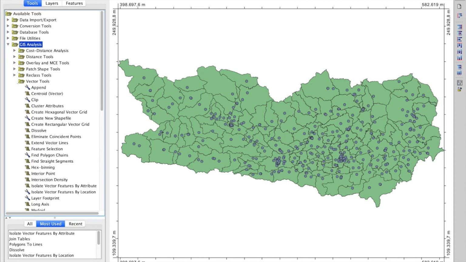
4. QGIS 3
– A Free and Flexible Remote Sensing Platform
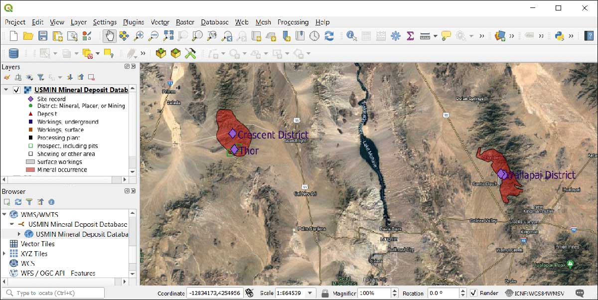
QGIS 3 stands out as one of the most popular remote sensing software options today. It’s completely free and open-source, which makes it perfect for students, researchers, or anyone just getting started with mapping and image analysis.
This powerful remote sensing platform comes packed with useful tools right out of the box. It supports raster analysis, terrain modeling, and image interpretation without needing extra setup. But what really makes QGIS special is its ability to connect with other tools. It works smoothly with toolboxes from SAGA GIS, GDAL, and GRASS GIS, which means you can do more without switching platforms.
For users who want to go even further, QGIS supports plugins that can expand its remote sensing features. One of the best examples is the Semi-Automatic Classification Plugin (SCP). This free plugin lets users download and classify satellite images with just a few clicks. It also helps with pre-processing, accuracy checks, and improving results after classification—making it a powerful add-on for more advanced image work.
QGIS 3 remains one of the top choices for those looking for a flexible and affordable remote sensing software that doesn’t cut corners on performance.
How Much Does QGIS Cost?
QGIS 3 is 100% free. You don’t have to worry about subscriptions or licenses. It’s supported by a strong global community that keeps it up to date and full of new features. If you’re on a budget or just want to try remote sensing without making a big investment, QGIS is a great place to start.
What’s Great About QGIS?
It’s free to use with no hidden costs or license fees.
It connects with other remote sensing platforms like SAGA GIS and GRASS GIS, which means more tools at your fingertips.
Plugins like SCP allow you to do advanced satellite image classification without needing paid software.
What to Keep in Mind
While QGIS is full of features, it can be a little overwhelming at first, especially with all the tools and plugins. It may take time to learn where everything is and how it works. Also, some features might need extra configuration or knowledge to run properly.
5. PCI Geomatica (Catalyst)
– Trusted Remote Sensing Platform with Deep Roots
PCI Geomatica, also known today under the Catalyst brand, is a well-known remote sensing software built for deep image analysis and geospatial work. Developed by the Canadian company PCI Geomatics, it’s been helping scientists, environmental analysts, and mapping experts since the early 1980s. Even today, it stands strong as a reliable remote sensing platform.
With PCI Geomatica, users can easily process aerial images, satellite data, and digital elevation models. It’s especially powerful when working with SAR and InSAR data, which helps in tracking ground movement and terrain changes. Even though the interface hasn’t had a major redesign, the software still delivers some of the best tools for photogrammetry, image mosaicking, and land cover classification.
One of its standout features is automated feature extraction, which helps you identify roads, buildings, water bodies, and more—right from digital images. It supports both supervised and unsupervised classification, as well as object-based image analysis (OBIA), making it easier to understand what’s in the image without needing deep technical knowledge.
How Much Does PCI Geomatica Cost?
The pricing for PCI Geomatica depends on the features you need and whether you want the traditional desktop version or the newer cloud-based Catalyst services. The platform offers different pricing levels, including educational, commercial, and enterprise options, and has flexible licensing plans that work for individual users or large teams.
What’s Great About PCI Geomatica?
It’s a trusted remote sensing platform with a strong track record in the geospatial industry.
Great for working with SAR and terrain data, which makes it ideal for infrastructure and environmental studies.
Automated tools help simplify feature extraction and classification, making it beginner-friendly once you get used to the layout.
What to Keep in Mind
PCI Geomatica is packed with features, but its interface can feel old compared to newer software. Some users may find it takes time to learn the layout and settings. Also, the most powerful tools—like advanced SAR processing—may only be available in higher-priced versions or through Catalyst cloud services.
6. Trimble eCognition
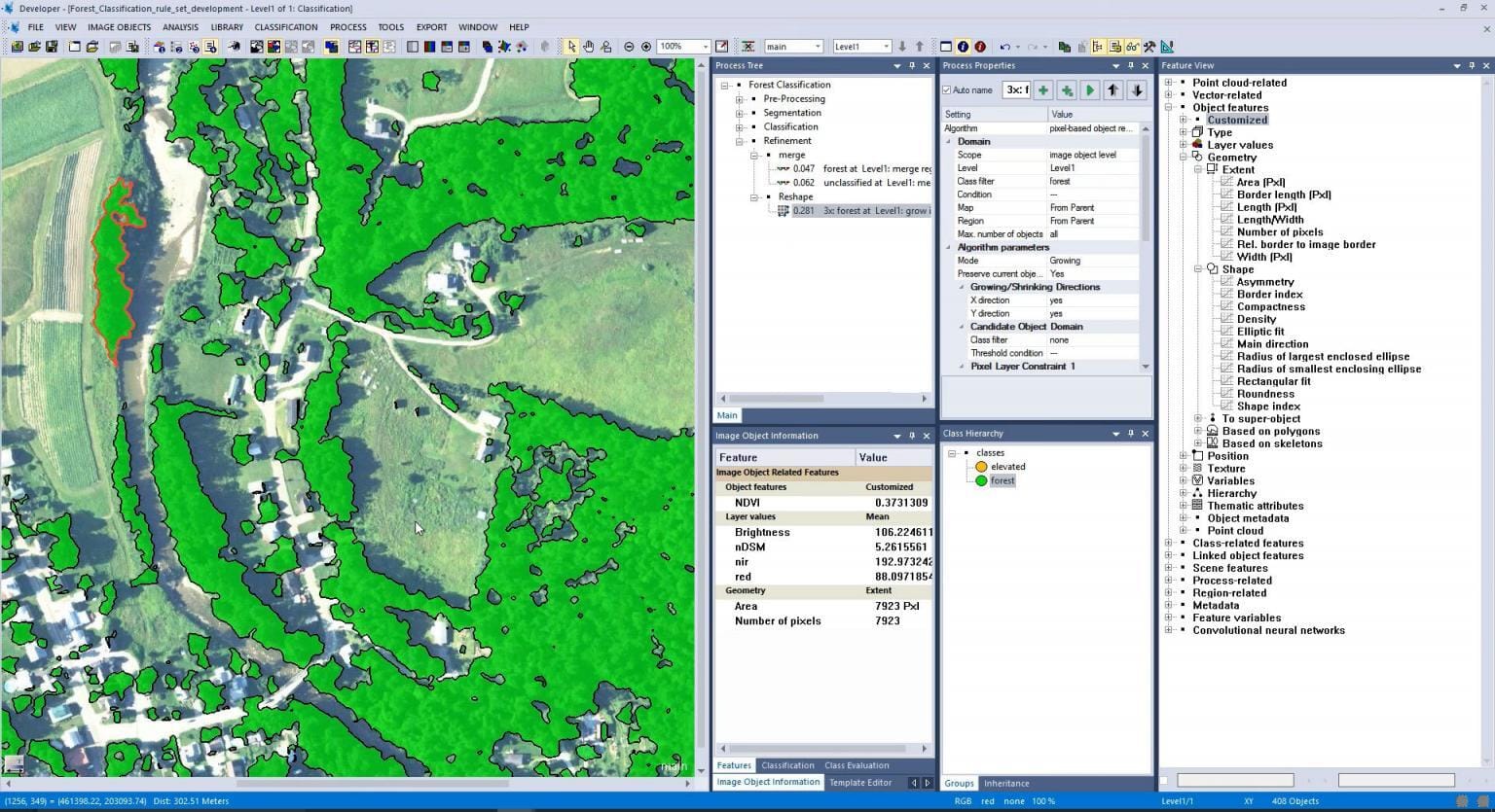
– A Smart Remote Sensing Platform for Object-Based Analysis
Trimble eCognition is a unique remote sensing software that focuses on object-based image analysis. Instead of analyzing single pixels, it groups pixels into smart objects using patterns, shapes, and colors—this helps turn images into real-world insights. This makes it perfect for creating detailed land cover maps or spotting changes over time in a specific area.
This remote sensing platform uses advanced segmentation tools that break images into parts, and each part gets its own set of data. With this, users can build rules that teach the software how to find things like buildings, trees, or water automatically. These rules can also be reused on other images, saving time and effort.
eCognition works well with many data types, including images from drones, satellites, planes, and LiDAR point clouds. While it’s powerful for tasks like change detection, feature extraction, and land classification, it doesn’t include tools like georeferencing, 3D visualization, or radar image processing—so it’s often used alongside other tools in a remote sensing workflow.
The software includes different parts based on what you need:
eCognition Developer is for creating custom tools and rules.
eCognition Architect helps non-technical users run guided analysis.
eCognition Server is for processing big datasets all at once.
How Much Does Trimble eCognition Cost?
The pricing for Trimble eCognition isn’t listed online. If you’re interested in this remote sensing platform, you’ll need to reach out to Trimble directly for a quote. They usually offer tailored pricing based on your specific needs and the tools you want.
What’s Great About eCognition?
It works with lots of geospatial data, including 3D and spectral imagery.
You can build custom rules to get exactly the results you need.
It’s great for land cover analysis, planning, and environmental work.
What to Keep in Mind
The trial version has some limits, so it’s hard to test everything before you buy. Also, since pricing isn’t shown upfront, it may take a little extra time to get started. And because it doesn’t include some basic tools, you may need to use it along with other remote sensing software.
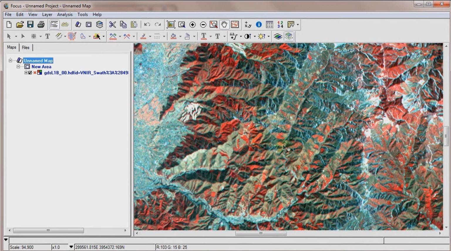
7. Google Earth Engine
– A Cloud-Based Remote Sensing Platform That Scales With You
Google Earth Engine is one of the most powerful remote sensing platforms in the world. What makes it stand out is that it’s cloud-based, which means you don’t need a high-end computer to handle large satellite datasets. Everything runs online, so you can process huge amounts of geospatial data directly from your browser.
This remote sensing software gives you access to decades of satellite images and environmental data. Whether you’re tracking forest loss, measuring crop health, or planning smart cities, Google Earth Engine gives you the tools to do it all from one place. With its built-in code editor and support for JavaScript and Python, it lets users build custom workflows to solve real-world problems.
Researchers, scientists, and even students use Google Earth Engine every day to explore changes happening on Earth’s surface. You can use their ready-to-go datasets or upload your own, and then run detailed analysis without worrying about storage or performance. It’s all handled by Google’s powerful cloud infrastructure.
How Much Does Google Earth Engine Cost?
Basic Plan – Starts at $500/month. This plan is great for small teams with up to two users. You get 100 hours of batch processing, 10 hours of live processing, and 100 GB of cloud storage.
Professional Plan – At $2000/month, this plan supports larger teams with up to five users. It comes with more processing power, more online hours, and 1 TB of storage, ideal for teams running regular remote sensing workflows.
Premium Plan – For high-demand or enterprise use, the Premium Plan offers custom pricing. You get advanced features like private cloud access and higher API request limits, but you’ll need to contact Google directly for a quote.
Google also keeps things open for learning—it’s free for academic and research projects, which makes it perfect for students and institutions.
What’s Great About Google Earth Engine?
It gives you access to one of the biggest remote sensing archives available today.
You don’t need a supercomputer—it’s all cloud-based, so your laptop is enough.
Perfect for real-time analysis, big data processing, and long-term environmental monitoring.
Completely free for academic and research users, helping students and nonprofits worldwide.
What to Keep in Mind
While Google Earth Engine is one of the top remote sensing platforms, it does have a learning curve. It’s mostly designed for users who can code or understand scripting. And for businesses or commercial use, the pricing can go up quickly depending on your data usage and team size. Also, if you’re considering the Premium Plan, it takes a custom approach—so you’ll need to speak with Google to get a final quote.
8. Whitebox GAT
– An Open-Source Remote Sensing Platform Built for Exploration
Whitebox GAT (Geospatial Analysis Toolbox) is a trusted open-source remote sensing software that’s been a favorite for many years. It’s built for people who want a reliable tool to explore, analyze, and process spatial data—without needing to spend a fortune.
What makes Whitebox GAT special is that it’s both a standalone remote sensing platform and a library you can use inside other programs. That means whether you’re running it solo or integrating it into a bigger system, it fits in easily.
This tool comes packed with hundreds of functions to handle different geospatial tasks. Even though it’s known for strong hydrological analysis, Whitebox GAT is also great for processing remote sensing data. It lets users work with both raster and vector data, use smart spatial interpolation methods, and perform deep terrain analysis.
Another thing that makes it stand out is its LiDAR support, which lets you work with 3D data, create elevation models, and get more detailed insights from the ground up. It’s simple enough for students or researchers to use, but powerful enough for advanced users in government or environmental work.
How Much Does Whitebox GAT Cost?
It’s completely free to download and use. As an open-source project, Whitebox GAT is ideal for users or organizations with smaller budgets who still want high-quality tools for remote sensing work. Plus, it has a growing community of users and developers who keep improving it year after year.
What’s Great About Whitebox GAT?
It’s a free, open-source remote sensing platform with no hidden costs.
Offers strong tools for terrain and LiDAR analysis.
Supports both raster and vector data, giving users a lot of flexibility.
What to Keep in Mind
Whitebox GAT doesn’t have the most polished user interface, and it might feel a bit different compared to commercial remote sensing software. Some users may find the design old-school, but it’s still packed with useful tools. If you’re okay with that, it’s a powerful option worth trying.
9. SAGA GIS
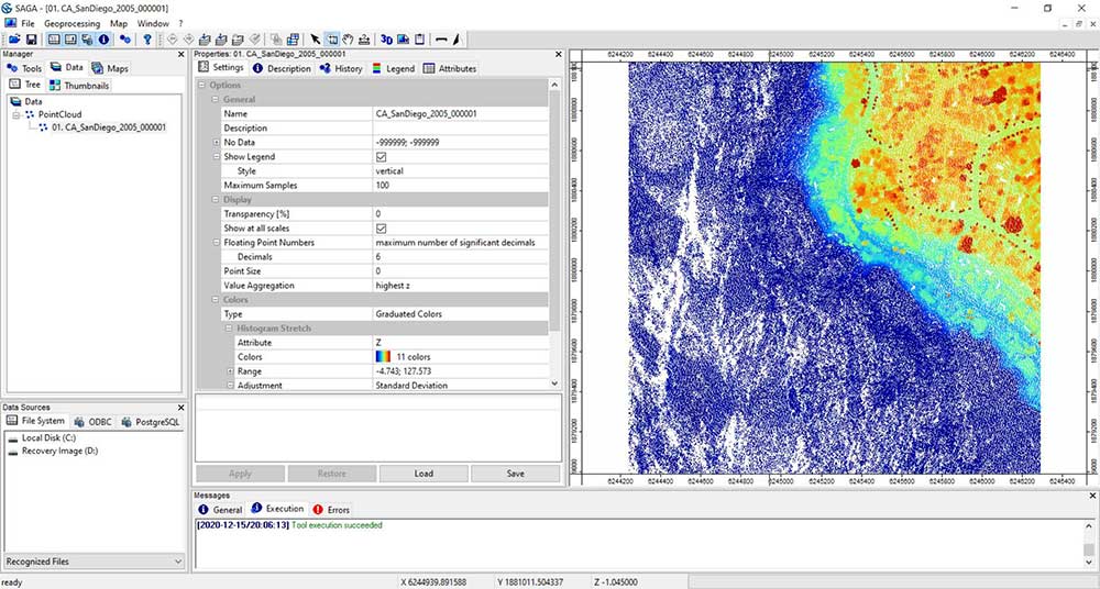
– A Classic Yet Capable Remote Sensing Software
SAGA GIS is one of those tools in the remote sensing software world that might not look the most modern, but it still brings a lot to the table. While it’s a bit old-school in design, many people still use it because it offers a strong set of features, especially for an open-source platform.
This remote sensing platform helps users work with satellite and aerial images in simple yet useful ways. You can cut, merge, and crop images, change how they’re displayed on a map, and even analyze vegetation health using various index tools. SAGA GIS also includes options for working with elevation data, such as finding slopes and detecting terrain features.
One cool thing about SAGA GIS is that it has many tools—some of which are unique and not easy to find in other software. While not all of them work perfectly, there are definitely some hidden gems that are helpful for certain projects. People who like to explore will find it interesting to test different tools and learn what works best.
If you’re already using QGIS 3, you can also connect SAGA GIS tools through the QGIS Processing Toolbox, which makes it easier to use both platforms together without switching programs.
How Much Does SAGA GIS Cost?
SAGA GIS is completely free. That’s one of its biggest advantages. You can download it, use it, and explore all its features without paying anything. This makes it perfect for students, researchers, or small teams who need a remote sensing platform without stretching their budget.
What’s Great About SAGA GIS?
It offers a surprising number of tools for processing satellite and elevation data.
You don’t need to pay for anything—it’s 100% open source.
You can combine it with QGIS 3 to make your workflow easier and more powerful.
What to Keep in Mind
SAGA GIS may not be the easiest or most modern tool to use. Its interface feels outdated, and not every feature works perfectly. If you’re new to remote sensing software, you might need a little patience while learning it. But once you get the hang of it, you’ll find that it still has valuable tools for many types of geospatial projects.
10. PolSARPro
– A Specialized Remote Sensing Platform for Radar Data
PolSARPro (Polarimetric SAR Data Processing and Education Toolbox) is a unique remote sensing software built especially for radar-based data. It helps you work with polarimetric synthetic aperture radar (PolSAR) images and turns them into valuable insights about Earth’s surface. This includes things like detecting soil moisture, surface texture, and hidden ground changes.
This remote sensing platform supports data from major satellite missions like ALOS-1, COSMO-SkyMed, RADARSAT-2, TerraSAR-X, and TanDEM-X. It is perfect for users who work with radar imagery or need deeper details than what regular optical images can provide—especially in cloudy, dark, or dusty conditions where optical sensors often fail.
Even though PolSARPro was designed as an educational toolbox, professionals use it for real-world applications because it offers in-depth analysis tools. With the ability to handle raw PolSAR data, it allows users to explore advanced radar processing methods in research, disaster monitoring, environmental studies, and land analysis.
How Much Does PolSARPro Cost?
Here’s the best part—PolSARPro is completely free. It’s open-source and available to everyone, which makes it an excellent choice for students, researchers, and professionals who need a reliable radar remote sensing software without the high cost.
What’s Great About PolSARPro?
It focuses on radar images, which are perfect for studying the Earth in all weather and lighting conditions.
It supports many well-known satellite systems, which means more flexibility and data variety.
It’s free, open-source, and a great learning tool for those new to PolSAR data or those working in radar-heavy research.
What to Keep in Mind
PolSARPro can be complex for beginners because it deals with highly technical radar data. It’s not meant for general image processing like some other platforms. However, if your work involves radar or you want to understand polarimetric SAR better, it’s one of the most valuable remote sensing platforms out there.
11. GRASS GIS
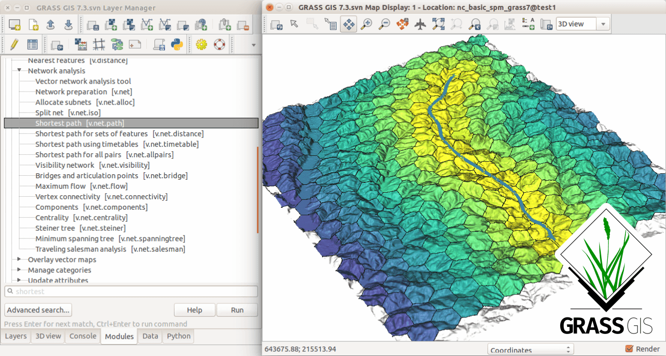
– A Trusted Open-Source Remote Sensing Platform
GRASS GIS is one of the oldest open-source tools in the world of geospatial analysis. Over the years, it has grown into a solid remote sensing platform that many professionals and researchers still trust today. Even though it may take a little time to get used to, GRASS GIS remains a powerful option for those working with complex geospatial data.
This remote sensing software offers a wide set of tools to process and analyze satellite images. It helps with important tasks like image classification, enhancement, and registration, making it useful for projects that involve tracking land use, vegetation, or urban development. GRASS GIS also gives users the ability to create stunning visuals with its built-in map-making and 3D modeling features.
One of the strongest parts of GRASS GIS is its LiDAR tools. It lets users handle point cloud data with functions like filtering, classification, and turning the data into detailed surface models. This is great for projects that involve elevation mapping or forest monitoring.
GRASS GIS can be used on its own or combined with other platforms like QGIS 3, which gives users even more flexibility. If you’re looking for a tool that is both free and full of features, GRASS GIS offers a valuable solution that fits many remote sensing needs.
How Much Does GRASS GIS Cost?
This is one of the best parts—GRASS GIS is completely free. As an open-source remote sensing platform, it’s available for anyone to download and use. It’s a great choice for students, researchers, or small teams that want powerful tools without the high cost of commercial software.
What’s Great About GRASS GIS?
Strong tools for remote sensing software tasks like image analysis and LiDAR data processing
Works well on its own or within QGIS, giving users more choices
Great support for 3D mapping and detailed terrain analysis
Free to use, which is perfect for teams with tight budgets
What to Keep in Mind
GRASS GIS may feel overwhelming at first, especially if you’re new to remote sensing. Its interface is a bit more technical, so it might take some extra learning to get comfortable. But once you understand how it works, you’ll find that it offers deep functionality that rivals many paid platforms.
12. ILWIS
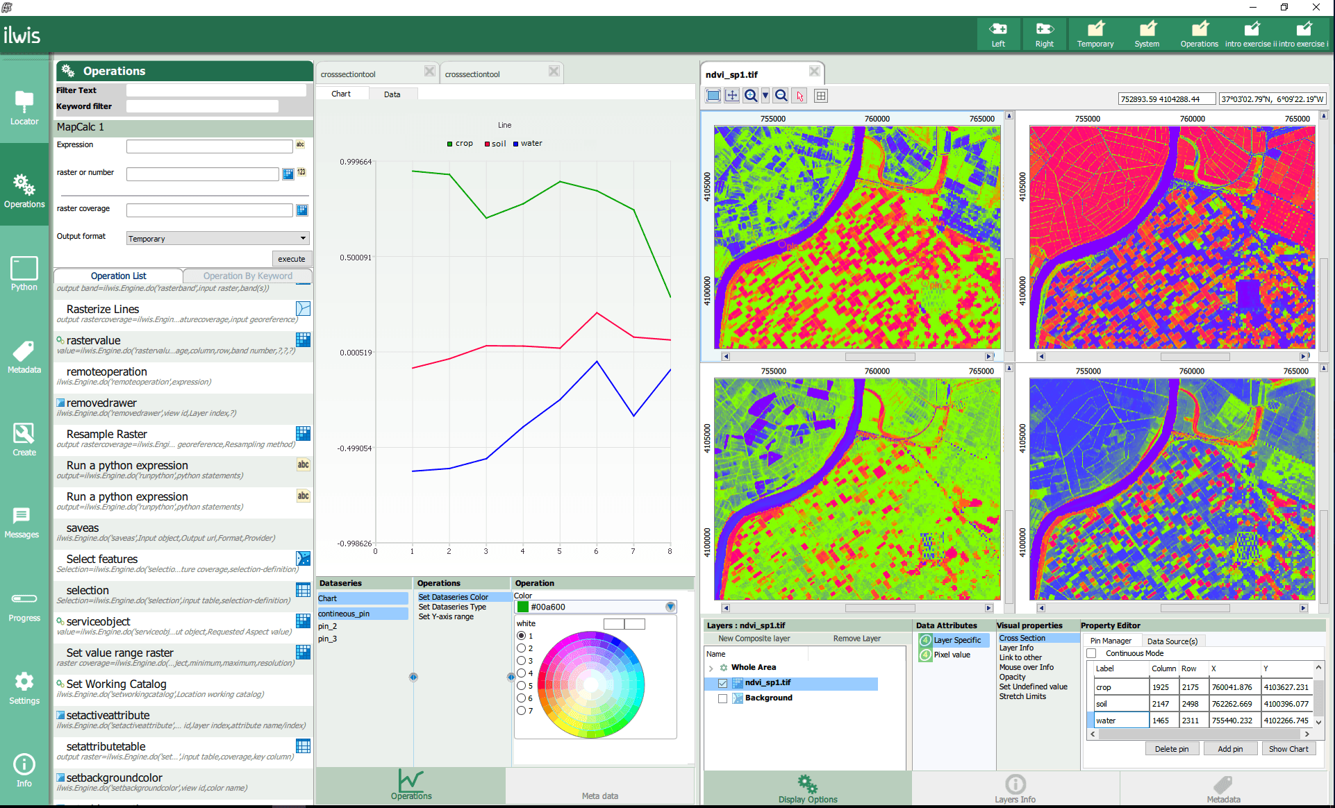
– Open-Source Remote Sensing Platform for Land and Water Analysis
ILWIS, which stands for Integrated Land and Water Information System, is a reliable open-source remote sensing software created by ITC in the Netherlands. It’s widely used for understanding land and water systems, especially in projects related to farming, forests, soil studies, and managing natural resources.
This remote sensing platform helps you store, view, and analyze maps and satellite images. It is a good choice for people who want to explore how land changes over time, how water flows in an area, or how land is used or affected by human activity.
ILWIS offers tools for creating maps, checking changes in land or vegetation, and understanding soil types. Even though it’s free, it gives you many features similar to those in paid software. The 3D view in ILWIS also helps you understand elevation and landscape changes in a more visual and clear way.
How Much Does ILWIS Cost?
One of the best things about ILWIS is that it’s free and open-source. This makes it a great option for students, researchers, or small teams who need a solid remote sensing platform without spending a lot of money. You can download and use it right away without any license fees.
What’s Great About ILWIS?
It supports both raster and vector data, which means it works well with different kinds of maps and satellite images.
The platform is very useful for land and water studies, especially in environmental and agricultural projects.
It’s easy to install and works well on standard computers without needing high-end hardware.
What to Keep in Mind
While ILWIS is powerful, it may look a little outdated compared to newer remote sensing software. The user interface is simple, but not as modern or polished. Also, since it’s not updated as often, it may not support the latest data formats or AI-based features found in some other remote sensing software. But for many users, it’s still a dependable and effective choice.
13. Orfeo Toolbox
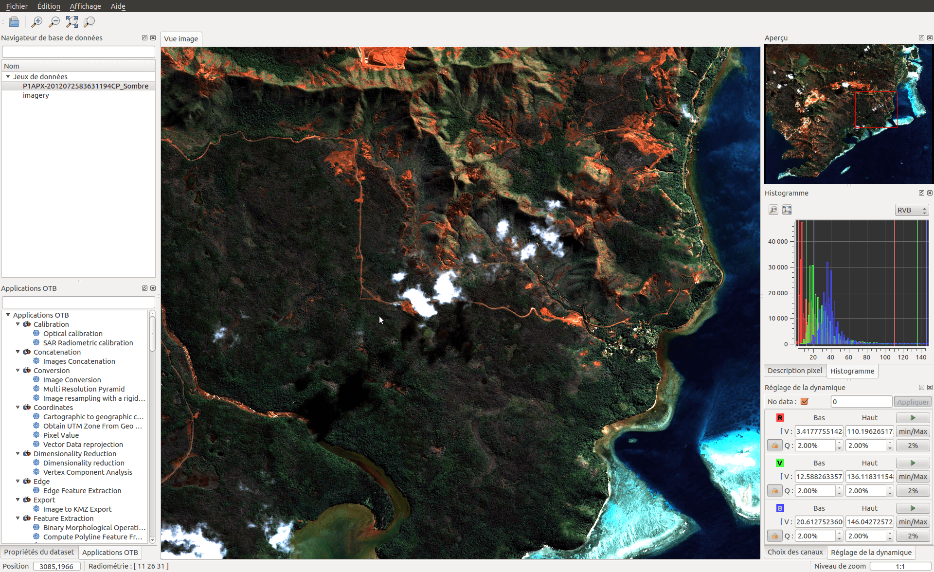
– A Free, Open-Source Remote Sensing Platform for All Levels
Orfeo Toolbox (OTB) is one of the most reliable open-source tools in the world of remote sensing software. It was created by the French Space Agency (CNES) and continues to be supported by a strong community of users and developers. This tool gives users access to powerful image processing features—without needing to pay anything.
What makes OTB stand out is that it works across all major systems—Windows, Mac OS, and Linux. It’s written in C++, which means it’s built for speed and performance. Whether you’re working with high-resolution satellite images, radar data, or multispectral images, OTB has the tools you need to analyze them.
This remote sensing platform handles many important tasks such as image classification, SAR data processing, pansharpening, and ortho-rectification. It’s also great for detecting changes in the environment, building maps, or working on any project where accurate image analysis is needed.
Even though OTB doesn’t come with a built-in visual interface since version 9.0, it connects smoothly with tools like QGIS, Python, and the command line. This makes it easy to use for those who prefer a specific setup or want to automate tasks. Developers also love that it’s customizable—if you need a special tool, you can build your own using its open structure.
How Much Does Orfeo Toolbox Cost?
Orfeo Toolbox is completely free. Yes, totally free. It’s open-source and licensed under Apache 2.0, which means anyone can use it, modify it, and even build on top of it. There’s no hidden cost, no subscription fee, and no need to unlock advanced features later. Everything is available right from the start.
What’s Great About Orfeo Toolbox?
It’s one of the most flexible and cost-effective remote sensing software options out there.
It works well with other platforms, especially QGIS and Python, which makes it easy to integrate into your workflow.
It’s backed by a global community that actively improves it, provides support, and shares helpful documentation.
You can process many types of imagery, from optical to radar, and build your own custom tools if needed.
What to Keep in Mind
While OTB is full of amazing features, it might feel a little technical at first. Since it doesn’t include a built-in user interface anymore, users need to be comfortable using it through QGIS or the command line. That said, once you get used to it, it becomes a powerful tool that can handle complex image processing tasks with ease.
14. Global Mapper
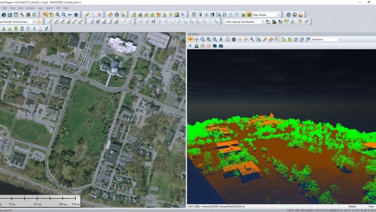
– A Versatile Remote Sensing Platform for Any Project
Global Mapper by Blue Marble Geographics is a flexible and user-friendly remote sensing software that’s perfect for both beginners and professionals. It helps users view and work with topographic and satellite images, making it easier to understand the terrain, no matter where your project is based.
This remote sensing platform is packed with helpful tools. You can use it to digitize maps, calculate line of sight, or measure volume of areas like mines, construction sites, or natural formations. It’s built to work with a wide range of data sources, including aerial photos, LiDAR point clouds, digital elevation models (DEMs), and vector files.
What makes Global Mapper special is how it combines power with simplicity. You don’t need to be a GIS expert to use it. The interface is designed to be easy to learn, while still offering advanced features for people who want to go deeper.
How Much Does Global Mapper Cost?
Global Mapper is more affordable compared to many other remote sensing software tools. You can buy a single license or request volume discounts if your team is bigger. There’s also an optional LiDAR Module that adds even more tools for working with 3D point cloud data. The pricing is flexible depending on your needs.
What’s Great About Global Mapper?
You can view and analyze different types of spatial data in one place—without switching between platforms.
The tools are simple to use but offer deep functionality when needed.
It supports many file formats, which makes it easier to bring in data from almost any source.
What to Keep in Mind
While Global Mapper is friendly and full of features, it may not have the deep AI-powered analysis tools that some higher-end platforms offer. However, for many users, its balance of power, price, and ease of use makes it one of the best choices for everyday remote sensing tasks.
15. Feature Manipulation Engine (FME)
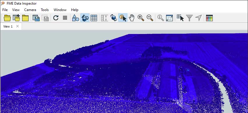
– Smart Automation in Remote Sensing
FME, short for Feature Manipulation Engine, is a powerful remote sensing software that helps you work smarter by connecting data from different sources and automating the way it’s processed. What makes FME stand out is how well it handles interoperability—which means it can take in data from many sources and convert it into the format you need.
As a remote sensing platform, FME supports aerial photos, LiDAR, multispectral images, and more. Whether you’re analyzing elevation, detecting objects, or transforming data for maps, FME gives you a flexible toolkit.
FME also brings in newer tech like computer vision and deep learning, which helps in detecting patterns and automating tasks that would take hours to do manually. You can create workflows called workbenches, where you drag and drop tools to build exactly what you need. This makes it easy to process big data sets without writing complex code.
With FME, you get speed and control. It’s built for users who need to transform large amounts of geospatial data quickly and accurately—making it a favorite in government, utilities, transportation, and environmental work.
How Much Does FME Cost?
FME offers flexible pricing based on how many users and tools you need. There’s a desktop version for individual users and an enterprise option for teams that need more power. While it’s not open-source, many organizations find it cost-effective due to how much time it saves.
What’s Great About FME?
It connects with just about any data source, making it a strong remote sensing platform for real-world projects.
You can build and automate complex workflows without needing to be a coding expert.
It supports deep learning and AI tools for smart analysis of imagery and sensor data.
What to Keep in Mind
FME’s interface is user-friendly, but setting up some advanced processes can take time if you’re just starting out. While the software is extremely flexible, using it to its full potential might require a learning curve.
16. gvSIG
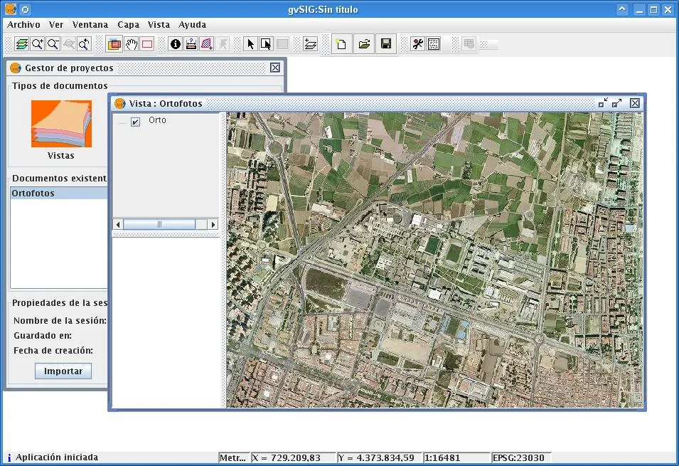
– A Free Remote Sensing Platform with Solid Tools
gvSIG is a free and open-source remote sensing software that’s perfect for users who need reliable tools without a high price tag. It’s widely used in schools, research centers, and by professionals who work with geographic data and satellite images.
This remote sensing platform supports many data formats, making it easy to work with different types of satellite and aerial imagery. gvSIG includes handy tools for georeferencing, which lets you align images with real-world locations. It also offers orthorectification to correct image distortions and mosaicking to merge multiple images into one big map.
gvSIG comes with features like NavTable, which helps organize and view geographic information more easily. The software is designed to work smoothly with raster and vector data, giving users the power to handle everything from simple image edits to more complex analysis.
How Much Does gvSIG Cost?
gvSIG is completely free to download and use. That makes it a great option for students, researchers, and small teams that need powerful remote sensing software but don’t have the budget for commercial platforms. You can also access community support and helpful documentation from users around the world.
What’s Great About gvSIG?
It’s free and open-source, which means you can use it and even customize it however you like.
It supports many remote sensing tasks, from basic editing to advanced geospatial analysis.
Great for learning, research, and real-world projects without spending anything.
What to Keep in Mind
gvSIG may not be as polished as some commercial tools, and it might take a little time to learn your way around. But for users who need a flexible and cost-effective remote sensing platform, gvSIG delivers strong features that get the job done.
17. TerrSet
– Remote Sensing Software Built for Sustainable Development
TerrSet is a powerful and user-friendly remote sensing software designed by Clark Labs. It’s best known for helping users study land change, environment, and sustainability. What makes TerrSet stand out is that it combines both remote sensing and GIS tools into one single remote sensing platform.
This software is packed with tools that support image processing, land use planning, climate modeling, and ecosystem analysis. One of its best-known features is the Land Change Modeler, which helps users predict how landscapes may shift in the future. It also includes tools like the Habitat and Biodiversity Modeler and Climate Change Adaptation Modeler, which are useful in planning and environmental work.
TerrSet supports satellite image classification, image enhancement, change detection, and multi-spectral image analysis. It’s a great fit for people working in conservation, urban planning, agriculture, or environmental research. Its layout is simple enough for beginners to use, but advanced enough for experts too.
How Much Does TerrSet Cost?
TerrSet is a paid remote sensing software, but it is more affordable compared to some other commercial platforms. It also offers discounted pricing for academic institutions. The pricing depends on the license type and whether you need additional modules like climate modeling tools.
What’s Great About TerrSet?
Combines remote sensing and GIS in one software package.
Comes with unique modeling tools for land change and climate studies.
Great for environment-focused projects and future planning.
What to Keep in Mind
TerrSet is mostly used for sustainability and environmental work, so if you’re looking for software strictly for general satellite image editing, you might find some tools you don’t need. But for users focused on environmental analysis and land management, it’s a smart and focused choice.
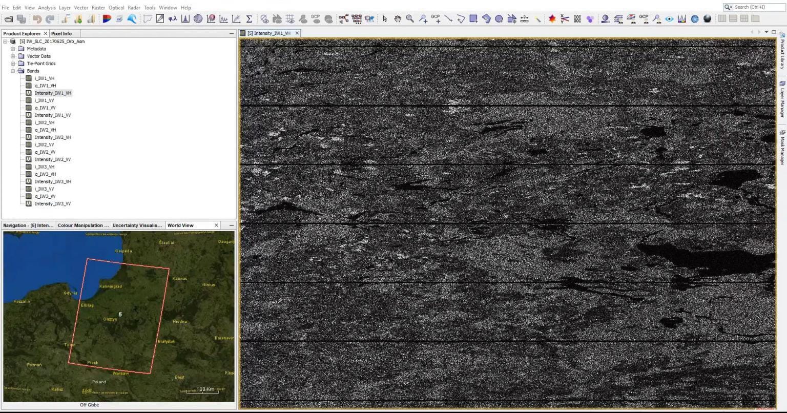
18. SNAP (Sentinel Application Platform)
– Built for Satellite Data Analysis
SNAP, short for Sentinel Application Platform, is a free and powerful remote sensing software developed by the European Space Agency (ESA). It’s designed especially for processing data from the Sentinel satellites, but it also supports other satellite missions.
This remote sensing platform is ideal for users who work with radar (SAR) and optical data. SNAP includes dedicated toolboxes for different sensors like Sentinel-1, Sentinel-2, and Sentinel-3. Each toolbox comes with pre-set workflows and tools, making image correction, atmospheric processing, and classification much easier.
With SNAP, users can perform tasks like image calibration, terrain correction, and change detection. It also supports multi-temporal analysis, which helps track how landscapes change over time. The software works well on Windows, macOS, and Linux, and supports automation through scripting.
How Much Does SNAP Cost?
SNAP is completely free and open-source, so anyone can download and use it without any licensing fees. It’s a great option for academic projects, government work, and even professional use where remote sensing software is needed for serious data analysis.
What’s Great About SNAP?
Built specifically for working with Sentinel satellite data.
Comes with pre-loaded tools for quick and accurate image processing.
Supports radar and optical data, with strong multi-temporal analysis tools.
Works on multiple operating systems and supports automation.
What to Keep in Mind
SNAP has a learning curve, especially if you’re new to satellite data processing. It may also run slower on older computers because it handles large datasets. But for anyone dealing with Sentinel imagery or other satellite missions, SNAP is one of the best free tools available.
19. RSGISLib
– A Powerful Python-Based Remote Sensing Platform
RSGISLib (Remote Sensing and GIS Software Library) is a remote sensing software built for users who prefer working in Python. It’s especially useful for those who want to automate large-scale satellite image processing and analysis.
This remote sensing platform is open-source and packed with tools for tasks like image classification, segmentation, and change detection. RSGISLib works well with multispectral and hyperspectral data, and it’s designed to handle big geospatial datasets efficiently.
Because it’s script-based, RSGISLib is a great fit for developers, researchers, and technical users who need full control over their workflows. It also integrates with other popular Python libraries like GDAL, NumPy, and SciPy, which makes it flexible and powerful for custom solutions.
How Much Does RSGISLib Cost?
RSGISLib is completely free and open-source. You can download it, modify it, and use it in any kind of project, whether academic, personal, or commercial.
What’s Great About RSGISLib?
Built for advanced users who need full control through Python scripting
Handles large geospatial datasets smoothly
Perfect for automating repetitive remote sensing tasks
What to Keep in Mind
RSGISLib is not for beginners. Since it’s code-based, users need a good understanding of Python and remote sensing concepts. But for those who are comfortable with coding, it’s a highly capable and customizable remote sensing platform.
20. SuperMap AI GIS
– A Smart Remote Sensing Platform with AI Power
SuperMap AI GIS is a smart remote sensing platform that blends artificial intelligence with traditional GIS tools. It’s made for users who want to analyze maps, detect objects, and manage geospatial data more efficiently. This remote sensing software brings AI into the picture, helping users understand images faster and make better decisions with accurate data.
This platform offers strong features like deep learning for image analysis, object classification, and detecting changes on land. These tools work together inside one system, so there’s no need to jump between programs. SuperMap AI GIS is great for many industries—like city planning, farming, and environment tracking—where understanding land and changes on the ground really matters.
The software also supports complex tasks like spotting strange patterns, grouping similar areas, or checking how land use has shifted over time. It’s built for both experts and newcomers, making it flexible for small teams or big organizations.
How Much Does SuperMap AI GIS Cost?
You won’t find exact prices for SuperMap AI GIS online. Since every user may need different features or tools, the company prefers to offer custom pricing plans. To get the right deal, it’s best to contact their team directly and discuss what your project needs.
What’s Great About SuperMap AI GIS?
Blends AI with traditional remote sensing software tools for smart and fast geospatial analysis.
Helps with big tasks like image interpretation, land change detection, and spatial modeling—all in one place.
Supports many file types and applications, making it suitable for many industries and teams.
What to Keep in Mind
Because SuperMap AI GIS includes advanced tools, it might take some time to learn, especially for beginners. Also, since there’s no public pricing list, you’ll need to reach out to their team to explore cost options.
Key Factors to Consider Before Choosing Remote Sensing Software for Your Business Needs
Selecting the right remote sensing software is crucial to ensuring the success of your business operations. Here are the key factors to consider:
1. Resolution Requirements
Spatial Resolution: Determine the size of the smallest object you need to detect. Higher spatial resolution is essential for applications like urban planning or precision agriculture.
Spectral Resolution: Consider the number and width of spectral bands needed. Multi-spectral sensors are suitable for general applications, while hyper-spectral sensors are better for detecting subtle differences, such as crop stress or environmental changes.
Radiometric Resolution: Evaluate the sensitivity of the software to variations in reflectance levels. Higher radiometric resolution is ideal for detailed measurements.
Temporal Resolution: Assess how frequently data needs to be collected. For real-time monitoring, platforms with high temporal resolution are necessary.
2. Software Capabilities
Choose software that aligns with your specific application needs:
Image Processing: Tools for image classification, enhancement, and spectral analysis are critical for analyzing satellite imagery.
Change Detection: Software with robust change detection capabilities can help track environmental or infrastructural changes.
Integration with GIS: Ensure compatibility with Geographic Information Systems (GIS) for mapping and spatial analysis.
3. Cost and Accessibility
Open-Source Options: Consider free tools like QGIS or GRASS GIS if budget constraints are a concern. These provide extensive functionalities without licensing fees.
Commercial Software: Evaluate premium options like ArcGIS or ENVI for advanced features and professional support, especially if your business requires high-end processing capabilities.
4. Platform Type
Decide between on-premise or cloud-based solutions:
On-Premise: Offers better control and security, suitable for organizations handling sensitive data.
Cloud-Based: Provides scalability and accessibility, ideal for businesses requiring collaboration across multiple users or locations.
5. Data Complexity and Expertise
Assess whether your team has the expertise to handle complex data formats like spectral data or geospatial coordinates. If not, opt for user-friendly software with built-in machine learning algorithms and geographic modeling tools.
6. Industry Applications
Match software capabilities to your industry:
Agriculture: Tools for crop health monitoring and precision farming.
Urban Planning: High-resolution imagery for smart city development.
Environmental Monitoring: Features for tracking deforestation or climate change impacts.
7. Emerging Technologies
Look for software that integrates with modern technologies like IoT, big data analytics, and cloud computing to future-proof your investment.
By carefully evaluating these factors, you can select remote sensing software tailored to your business needs, ensuring efficient data collection, analysis, and decision-making across various applications.
What are the Applications of Remote Sensing Software for Different Industries?
Remote sensing software is not just a tool—it’s a solution that helps many industries see what the eyes can’t. Whether from satellites, drones, or aerial photos, this kind of software helps turn images into insights. It allows people to monitor, analyze, and make decisions based on changes happening on the ground, even when they can’t be there in person. Let’s look at how different industries are using this powerful technology every day.
1. Agriculture
In farming, remote sensing software helps monitor crop health, soil moisture, and weather patterns. Farmers use it to spot problems early—like pest attacks or dry patches in their fields. By using this data, they can water, fertilize, or treat crops more accurately, which saves money and improves harvests.
2. Urban Planning and Smart Cities
City planners use remote sensing platforms to watch how cities grow and change. These tools help them map new buildings, track road development, and even study traffic movement. It’s also used to make sure new projects won’t harm the environment or break zoning rules. This makes building smarter cities easier and faster.
3. Environment and Conservation
Environmental experts rely on remote sensing software to track changes in forests, water bodies, and wildlife habitats. It helps them see if a forest is shrinking, a river is drying up, or pollution levels are rising. With this data, they can take action to protect the earth’s natural spaces before damage becomes too serious.
4. Oil, Gas, and Mining
For these industries, remote sensing tools help map the land and find safe, efficient paths to explore or drill. These platforms also monitor land movements, which helps avoid accidents or damage to pipelines. Companies can also check on remote areas without sending teams, saving time and cost.
5. Disaster Management
During disasters like floods, wildfires, or earthquakes, remote sensing platforms provide real-time data. Emergency teams use this data to understand which areas are hit the hardest and where to send help first. It also helps them prepare for future disasters by learning from past events.
6. Construction and Infrastructure
Remote sensing software is often used to monitor large-scale construction projects. Engineers and survey teams use it to measure land levels, monitor structural changes, and track progress. It also helps ensure safety and compliance with local building regulations.
7. Climate Science and Weather Monitoring
Scientists use remote sensing to study cloud patterns, track hurricanes, and monitor long-term climate changes. It helps them see how global warming is affecting sea levels, ice caps, or rainfall in different parts of the world. These insights are critical for predicting future climate trends.
8. Defense and National Security
Military and defense organizations use this technology for surveillance, terrain mapping, and border monitoring. These tools provide accurate, up-to-date geographic data, which helps with planning and decision-making during security operations.
In short, remote sensing software is like a high-tech lens for the world. From farming to emergency response, it gives each industry the power to see more, plan better, and act faster. As these tools continue to improve, more industries will find smart ways to use them—making work safer, smarter, and more connected to the real world.
Features of a Remote Sensing Software
A remote sensing software is built to help users understand images of the Earth taken from satellites, drones, or aircraft. But what makes this kind of software powerful is not just how it displays images—it’s how it turns them into useful information. Let’s explore the key features that make remote sensing platforms so helpful across many fields.
1. Image Processing Tools
One of the most important features of any remote sensing platform is image processing. This allows users to clean, sharpen, and adjust satellite or aerial images. Whether it’s removing cloud cover, adjusting color contrast, or stitching images together, these tools help users see details more clearly.
2. Classification and Detection
Remote sensing software can group different land types—like forests, water, roads, or buildings—automatically. This is called classification. It also helps detect changes over time, like spotting new construction, deforestation, or flooding. These features make it easier to monitor large areas without visiting the location.
3. Multi-Sensor Data Support
Many platforms support a wide range of image types from different satellites and sensors. Whether you’re using optical images, radar (SAR), or thermal data, the software brings everything together in one place for easier analysis. This flexibility helps users pick the right data for the job.
4. Georeferencing and Map Alignment
To make sense of images, they need to be lined up with real-world maps. Remote sensing tools offer georeferencing, which places images on accurate coordinates. This helps combine multiple layers of data—like roads, buildings, and land use—into a single clear map.
5. Change Detection
Many remote sensing platforms have built-in tools for comparing images taken at different times. This is useful for spotting changes in land use, construction, farming patterns, or environmental conditions. By detecting these shifts early, users can make faster decisions.
6. 3D Terrain and Elevation Analysis
Some advanced remote sensing software allows users to build 3D models from image data. These models show elevation, slopes, and terrain shapes. This is very helpful in areas like construction, mining, or flood risk studies.
7. Automation and Batch Processing
To save time, many tools allow users to automate repeated tasks. For example, you can apply the same settings to hundreds of images at once. This helps large projects finish faster without doing each step manually.
8. Integration with GIS
Remote sensing software often works smoothly with Geographic Information Systems (GIS). This means users can bring in layers like roads, population maps, or climate zones to make smarter decisions based on both image and location data.
9. AI and Machine Learning
Today, many platforms are using artificial intelligence to help analyze images faster and with more accuracy. AI can detect patterns, find objects, and even predict future changes, making the software smarter and more powerful.
10. User-Friendly Interface
Many remote sensing tools are designed to be simple to use, with drag-and-drop options, easy dashboards, and helpful guides. This makes it easier for beginners and non-experts to get started without needing years of training.
FAQs – Best Remote Sensing Software
1. What is remote sensing software used for?
Remote sensing software helps people study the Earth from images taken by satellites, drones, or planes. It shows things like land, water, roads, or forests and helps users understand changes in the environment over time. It’s great for city planning, farming, and disaster tracking.
2. Which is the best remote sensing software for beginners?
QGIS is a great choice for beginners. It’s free, easy to use, and works well with many types of remote sensing data. ENVI and ArcGIS Pro also have beginner-friendly tools, but they may need some training.
3. What is the most advanced remote sensing software?
ENVI and ArcGIS Pro remain top choices for advanced users. They offer powerful tools for image analysis, change detection, and deep learning. These remote sensing platforms also support different file types and large data sets.
4. Is there any free remote sensing software available?
Yes! QGIS, SNAP (by ESA), and Google Earth Engine are free remote sensing platforms. These tools help you view and analyze satellite images without spending money, making them perfect for students or small projects.
5. What makes a remote sensing software good?
Good remote sensing software should be easy to use, support different image types, offer tools like image classification and change detection, and allow integration with GIS maps. It should also give clear results and run smoothly on your computer.
6. Can I use remote sensing software without a technical background?
Yes, some software like QGIS or cloud-based tools like Google Earth Engine are user-friendly. They have simple dashboards, built-in tutorials, and community support to help you learn step by step.
7. What industries use remote sensing software?
Remote sensing software is used in many industries, such as farming, construction, forestry, disaster response, weather tracking, mining, and urban planning. It helps people make smart choices using real-world image data.
8. How does AI help in remote sensing platforms?
AI helps remote sensing software work smarter. It can find patterns, detect changes, and even predict future trends using image data. This means less manual work and faster, more accurate results.
9. Is cloud-based remote sensing software better?
Cloud platforms like Google Earth Engine are great because they don’t need powerful computers. They run in your browser, offer lots of free data, and are easy to update. However, offline tools are still preferred for certain tasks or private data.
Conclusion
Remote sensing software helps turn satellite and drone images into clear, useful information. It gives people the tools they need to study the Earth and make smart decisions in their work.
If you’re searching for a complete remote sensing platform, ENVI, ERDAS Imagine, or PCI Geomatica are great choices. These tools are strong, trusted, and used by professionals around the world.
For those who want advanced mapping features, ArcGIS Pro and QGIS 3 are great picks. They are popular because they combine GIS tools with remote sensing functions. If you’re working on land cover classification, Trimble eCognition is built just for that. And if you need help with radar images, PolSARPro is made for working with SAR data.
If you prefer open-source options, tools like QGIS 3, Whitebox GAT, GRASS GIS, and SAGA GIS are free to use and packed with powerful features. These platforms are ideal for people who want to explore remote sensing without a big budget.
Thanks to smart software and AI, remote sensing is getting faster, easier, and more accurate. Today, it’s used in farming, city planning, disaster response, and so much more. No matter your industry, the right remote sensing software can help you track changes, plan better, and protect what matters most.

