Understanding the differences between free satellite maps and powerful commercial satellite data for your needs.
The world is constantly being watched from space by special cameras on satellites. These pictures, called satellite imagery, help us see and understand our planet. You might have used free satellite maps like those on popular online platforms such as Google earth, Google Maps & Zoom Earth. But did you know there is also a world of detailed, high-quality paid satellite imagery that is used by businesses, governments, and scientists?
Choosing between free and paid satellite imagery can be confusing. This blog will help you understand when each type is best. We will look at what free options offer and why sometimes, investing in a professional satellite data provider like XRTech Group is the better choice for important projects. The features, quality, and ways of using the data are very different between free and paid services, and these differences will be explained simply.
Understanding Free Satellite Maps: What They Offer
Free satellite maps are easy to find and use. They provide a general view of Earth and are great for many everyday uses. These maps are often made by combining many pictures from different satellites. They are very helpful for looking at places, planning simple trips, or for school projects. However, these free options have certain limits that are important to understand, especially when precise or current information is needed.
Limitations of Free Satellite Maps are often seen:
Lower Resolution: The pictures from free satellite maps often show less detail. They might show objects as large as 10 to 30 meters across as just one pixel. This means small features, like individual cars or specific parts of a building, cannot be clearly seen.
Slower Update Frequency: The pictures on free satellite maps are not always very new. Some areas might be updated only every 5 to 16 days, or even less often. This means that recent changes on the ground might not be shown, which can be a problem if you need to know what is happening right now.
Limited Historical Archives or Analytics: While some free tools let you see older pictures, the full history of a place might not be available. Also, these platforms usually do not offer advanced ways to study the data. You are mostly just looking at the pictures, not getting deep information from them.
Restricted Commercial Usage Rights: If you want to use the satellite imagery for business or for making money, free maps often have rules against this. You might not be allowed to use the pictures for certain commercial purposes without getting special permission or paying a fee.
Lack of Tailored Support: When using free satellite maps, you usually do not get personal help or special services. If you have questions or problems, you might need to find answers yourself or rely on online communities. Professional projects often need dedicated support.
These limits mean that while free satellite maps are great for general use, they may not be enough for tasks that need high accuracy, very recent information, or special kinds of analysis. This is where paid satellite imagery becomes very important.
Why Paid Satellite Imagery is Often Better: Key Differences Explained
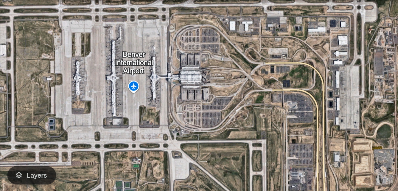
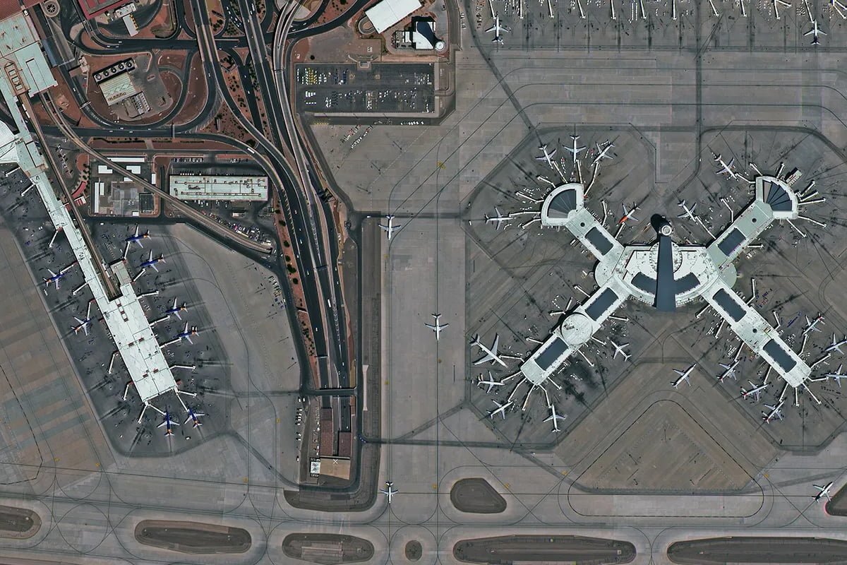
McCarran International Airport of USA
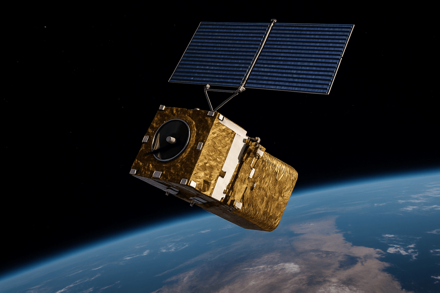
When tasks need more than a general view, paid satellite imagery offers many big advantages. These advantages come from better technology, more satellites, and special services. Here is how paid satellite data stands out, making it a better choice for professional and important uses.
Satellite Image Quality and Resolution
One of the biggest differences is how clear the pictures are. High-resolution satellite imagery, often from paid services, can show very small details. For example, some commercial images can show objects as small as 30 centimeters (about one foot) across as clear pixels. This is much better than the 10-30 meter resolution found in many free satellite maps. This high clarity is made possible by advanced cameras and sensors on the satellites.
Greater Detail: With 30cm satellite imagery, individual cars, road markings, small structures, and even specific types of vegetation can be clearly seen. This level of detail is very important for precise planning and monitoring.
Advanced Sensors: Paid services often use the latest technology in their satellite sensors and camera systems. These are built to capture more light, reduce blur, and collect data with greater precision.
Impact on Specificity: The impact of higher resolution means that specific objects can be identified and measured accurately. This is needed for things like counting trees, measuring buildings, or tracking small changes on the ground.
Understanding Update Frequencies and Revisit Capabilities
How often a satellite takes a new picture of the same place is called its revisit capability or update frequency. For paid satellite imagery, this can be very fast. Some satellites can take pictures of the same spot many times in one day. This is much faster than the every 5-16 days or more for free satellite maps. The ability to get very fresh data is crucial for many fast-changing situations.
Rapid Revisit: Leading satellite data providers, such as XRTech Group, have large satellite constellation networks that allow for very frequent revisits. Some areas can be imaged up to 25 times daily.
Real-Time Analysis: With fast updates, almost real-time analysis of events can be done. This is vital for watching disasters, tracking moving objects, or seeing sudden changes in land use.
Importance of Fresh Data: For things like tracking construction progress or monitoring floods, old data is not useful. New, fresh satellite data ensures that decisions are based on the most current information available.
Accuracy for Professional Use and Survey
The pictures from paid satellite imagery are usually much more accurate in terms of where things actually are on Earth. This is called geolocation accuracy. For professional tasks like mapping, engineering, or land survey, this precision is very important. Free maps might show a building slightly off from its real location, but paid images are carefully corrected to be very exact.
High Geolocation Accuracy: Commercial satellite imagery is processed with great care to make sure that the locations of objects in the picture match their real-world positions very closely.
Crucial for Precision: This accuracy is vital for building plans, defining property lines, or setting up infrastructure projects. If the map is wrong, the project could have big problems.
Reliability for GIS: Businesses that use Geographic Information Systems (GIS) rely on highly accurate satellite data. A strong GIS Company will always prefer paid, precise imagery for their projects.
Advanced Analytics and Derived Products
Beyond just showing pictures, paid satellite imagery often comes with special tools and processes that can pull out deep information from the images. This is called advanced analytics. These tools can perform complex tasks like change detection, which shows how an area has changed over time, or help with city modeling. Different types of maps and models can also be made from these images.
Digital Surface Models (DSM): These show the height of the Earth’s surface, including buildings and trees.
Digital Elevation Models (DEM): These show the bare ground height, with buildings and trees removed.
Digital Orthophoto Maps (DOM): These are air or satellite images that have been corrected to be as accurate as a map. They are a precise base map layer.
Automated Insights: Smart computer programs can be used to count objects, track movements (earth tracking), or find specific features without a person having to look at every detail. This includes real-time analysis and continuous tracking of assets or changes.
Specialized Sensors and Data Types (SAR, Hyperspectral, Multispectral, Wide-Swath)
Paid satellite imagery providers offer more than just regular color pictures. They have satellites with special sensors that can see different things. This expands the possibilities of Remote sensing greatly.
SAR (Synthetic Aperture Radar): This uses radar signals instead of light. SAR satellite imagery can see through clouds, smoke, and works day or night. This is very important for watching things in bad weather or in places that are often cloudy.
Hyperspectral Imagery: These images capture many very narrow color bands, more than what the human eye can see. This helps in understanding what things are made of, like different types of minerals in the ground or pollution in water.
Multispectral Imagery: These images capture several specific color bands, which is useful for seeing plant health (vegetation), identifying different land covers, and studying water bodies.
Wide-Swath Imagery: This refers to images that cover a very large area on the ground in one pass. It is great for monitoring big regions, like entire forests or large bodies of water.
Benefits of Diverse Bands: By using different light and energy bands, experts can learn much more about Earth’s surface, beyond what a simple photo can tell.
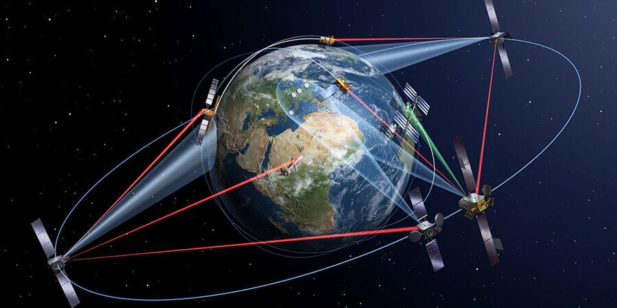
Satellite Constellation Scale and Earth Tracking
A big difference is the number of satellites a satellite data provider owns and controls. A large satellite constellation means more frequent data and better coverage. Companies like XRTech Group have many satellites (over 130 and growing) that work together to provide continuous earth tracking and monitoring.
Global Coverage: A large constellation can image almost any place on Earth frequently.
Persistent Monitoring: This means an area can be watched almost constantly, allowing for real-time analysis of changes or activities.
Timeliness of Data: The sheer number of satellites ensures that when new imagery is needed, it can be acquired and delivered very quickly, supporting critical tracking applications.
Quality of Services and Tailored Support
When you pay for satellite imagery, you also pay for dedicated service and support. This means you get personal help, technical advice, and solutions that are made just for your project. This is a big step up from the limited support found with free satellite maps.
Dedicated Customer Service: Experts are available to help you choose the right data and solve problems.
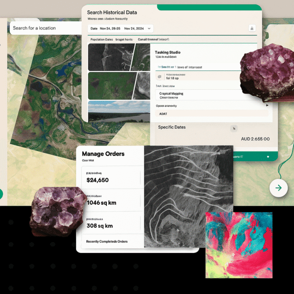
Custom Tasking: You can ask the satellite company to take new pictures of specific areas at certain times.
Mission-Ready Solutions: Providers often offer not just raw data, but also processed information and insights that are ready to be used for your specific goals. XRTech Group is known for delivering “mission-ready solutions built for real-world demands.”
Data Delivery Speed: Commercial providers often have quick delivery times. For example, XRTech Group can process 50 terabytes of data daily and deliver critical information in as little as 1 hour, demonstrating a high quality of services.
When Paid Imagery is Worth It With XRTech Group: Essential Scenarios
While free satellite maps offer valuable insights, they have limitations. There are specific scenarios where upgrading to high-resolution commercial satellite imagery becomes necessary. For these important uses, the investment in paid satellite imagery is clearly justified with XRTech Group.
Use Case
Why Paid Imagery Is Better
Urban Infrastructure & Smart City Planning
Super-high-resolution (30cm) satellite imagery enables precise project modeling and detailed analysis of buildings, roads, and utilities for modern city modeling.
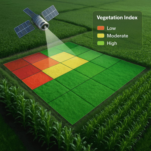
Precision Agriculture
Frequent revisit and vegetation index layers (derived from multispectral satellite imagery) allow for crop health optimization, efficient resource management, and accurate yield estimation. This involves detailed Remote sensing.
Disaster Response
Real-time tasking, thermal bands, and cloud-penetrating SAR data are essential for emergency decisions, damage assessment, and guiding rescue efforts after natural disasters.
Environmental Monitoring
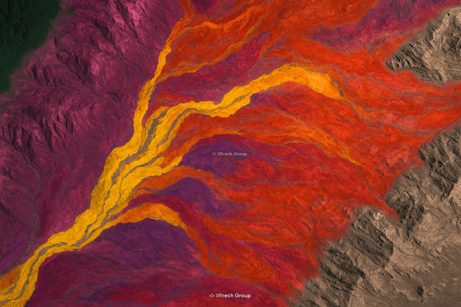
Multi-spectral or hyperspectral analysis is needed to detect subtle land use changes, track deforestation, monitor water quality, and understand ecological shifts, providing deeper insights than simple visual imagery.
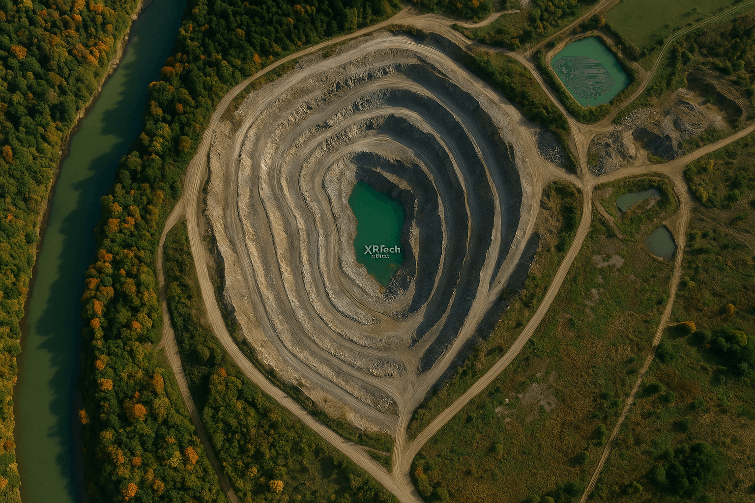
Mining and Resources
Slope detection (using DEM/DSM), excavation tracking, and permit monitoring are possible with 3D models and regular, precise satellite imagery. Detailed mapping and survey are crucial here.
Defense & Intelligence
Night-time imaging (SAR), continuous change detection, exact object tracking, and secure delivery pipelines are vital for national security and strategic intelligence gathering. This is where high accuracy for professional use is paramount.
How XRTech Group Helps Businesses, Governments, NGOs, and Other Organizations
XRTech Group stands as a leading satellite data provider because it helps many types of organizations with their specific needs. Our comprehensive satellite services are designed to deliver actionable intelligence, not just raw data. This allows for better decision-making across various fields and applications.
Helping Businesses and Companies:
Construction and Development: High-resolution satellite imagery and DOM DEM DSM products are used for project planning, monitoring construction progress, and managing land. This ensures that projects are built exactly as planned and on schedule.
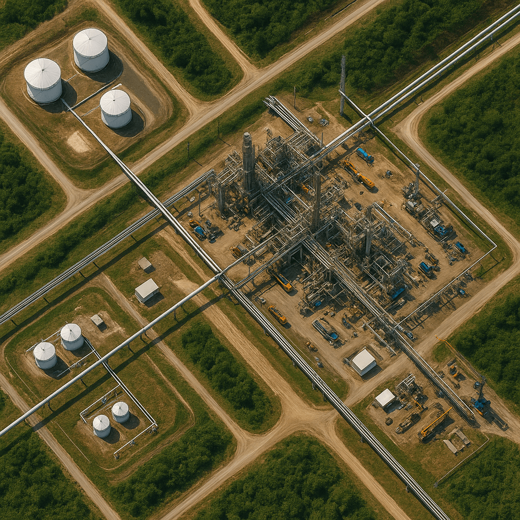
Energy Sector: For oil fields and pipelines, continuous earth tracking and monitoring help ensure safety and operational efficiency. Potential issues can be spotted early from space.
Agriculture: Precision farming is supported with detailed multispectral satellite imagery, allowing farmers to monitor crop health, estimate yields, and manage water and fertilizers more effectively. This leads to better harvests and reduced waste.
Insurance and Real Estate: Accurate satellite imagery provides insights into property conditions, changes over time, and potential risks, helping with assessments and claims.
Supporting Government Applications:
Urban Planning and Smart Cities: Governments use our advanced geospatial solutions for monitoring infrastructure, developing digital models of urban areas (city modeling), and supporting sustainable development. This helps in creating safer and more efficient cities.
Defense & Intelligence: For national security, border security is enhanced, reconnaissance missions are conducted, and strategic infrastructure is monitored. Our high-quality satellite data supports critical intelligence gathering and operations.
Resource Management: Governments can track natural resources, monitor land use changes, and manage environmental impacts, ensuring responsible use of a country’s assets.
Disaster Management: During emergencies like floods or wildfires, real-time analysis and rapid delivery of satellite imagery help in emergency response, damage assessment, and planning recovery efforts. Our SAR imagery is especially useful in these situations.
Assisting NGOs and Other Organizations:
Environmental Protection: NGOs focused on the environment use our satellite imagery for tracking deforestation, monitoring water quality, and checking air pollution levels. Hyperspectral satellite imagery can provide deeper insights into environmental health.
Humanitarian Aid: For remote or crisis-affected areas, satellite data can help in assessing needs, planning aid delivery, and monitoring population movements without putting people on the ground at risk.
Scientific Research: Academic and research institutions use our varied bands and sensors for scientific studies, helping to understand complex Earth systems and changes.
Our commitment to providing tailored geospatial solutions ensures that each organization receives the precise data and insights needed to achieve its goals effectively. The unmatched quality of services and advanced capabilities of our satellite constellation are what make XRTech Group a trusted partner.
Understanding Satellite Imagery Pricing: The Investment in Precision
The cost of paid satellite imagery is an important part of why it is different from free satellite maps. Pricing for commercial satellite data reflects the advanced technology, the large number of satellites, the quick updates, and the special services that are provided. This investment ensures that users get the most accurate, timely, and relevant information for their critical projects.
Pricing for commercial satellite imagery varies based on several important factors:
Resolution: Clearer pictures (higher resolution, like 30cm) generally cost more per square kilometer than less detailed ones.
Area Covered: The larger the area you need images for, the more the total cost might be, though the price per square kilometer might go down for very large areas.
Archival Status (New Tasking vs. Archive): Getting a brand-new picture (new tasking) taken by a satellite is usually more expensive than buying an older picture that is already in the provider’s collection (archive image). New tasking involves directing a satellite to capture a specific area at a specific time, ensuring the freshest possible data.
Collection Priority: If you need the imagery very quickly (emergency tasking, or rapid revisit), it will often cost more than standard delivery.
Specific Bands and Sensors: If you need special kinds of data, like SAR imagery, hyperspectral imagery, or specific multispectral bands, these can influence the price because they involve specialized satellite sensors.
Advanced Products: If you need more than just a raw image, such as processed DOM DEM DSM products or advanced analytical reports, these value-added services will also affect the overall price.
XRTech Group believes in transparent pricing, click here to see our satellite pricing. This means that the costs are clearly laid out, helping clients understand and budget for their geospatial data needs without hidden fees. This clear approach builds trust and makes it easier to access the precise satellite services required.
While the initial cost of paid satellite imagery might seem higher than free options, the value it provides in terms of accuracy, currency, detail, and actionable insights can lead to significant savings and better outcomes for professional and critical applications. It is often seen as an investment that pays for itself through improved efficiency, reduced risks, and more informed decisions.
Conclusion: Making the Right Choice for Your Satellite Imagery Needs
Choosing between free satellite maps and paid satellite imagery depends on what you need the images for. For simple viewing and general curiosity, free tools are perfectly fine. However, for professional projects, critical decision-making, or tasks requiring high detail, fresh data, or special analysis, paid satellite imagery from a reliable satellite data provider is not just an option, but a necessity.
The benefits of high-resolution satellite imagery, frequent update frequencies, precise accuracy for professional use, and advanced analytical capabilities like change detection and specialized SAR or hyperspectral data cannot be matched by free sources. Companies like XRTech Group offer these comprehensive geospatial solutions, supported by a vast satellite constellation and a commitment to high quality of services.
We invite you to consider the advanced capabilities that XRTech Group offers. Our “mission-ready solutions” are designed to meet the real-world demands of businesses, governments, NGOs, and other organizations across various applications. For detailed information on how our commercial satellite imagery can support your specific projects, or to discuss satellite imagery pricing tailored to your requirements, please contact XRTech Group today. Our experts are ready to help you navigate the world of Remote sensing and find the best satellite maps for your success.
Tailings Dam Monitoring: How Advanced Satellite Intelligence Is Transforming Tailings Dam Safety Tailings dams are among the most critical—and high-risk—structures