
Tailings Dam Monitoring with InSAR & AI
Tailings Dam Monitoring: How Advanced Satellite Intelligence Is Transforming Tailings Dam Safety Tailings dams are among the most critical—and high-risk—structures

In today’s world, where environmental challenges are growing faster than ever, Geographic Information System (GIS) technology is emerging as a vital solution. Climate conditions have changed. Forests are disappearing. Water sources are shrinking. Yet, tools like GIS for Environment offer hope because these systems can collect, manage, and visualize environmental data like never before.
GIS for environment work hard to monitor the earth, protect natural resources, and guide responsible development. At XRTech Group, these innovative tools are being used to bring long-lasting, data-driven environmental solutions.
With the support of GIS satellite imagery for environment protection, real-time environmental decisions are being made smarter and faster.
Let’s explore in depth how GIS for environment protection is reshaping conservation, improving planning, and ensuring a greener future for all.

The first step to protecting the environment is knowing what’s happening on the ground—and beneath it. GIS plays a key role in this. Using GIS satellite images, historical maps, and environmental databases, GIS systems visualize everything from forest cover to water quality to species locations.
GIS for environment offer real-world insights that go beyond numbers and graphs. This technology creates visual stories of the land—stories that influence policies, spark conservation efforts, and direct funding to the right places.
For instance, GIS makes it easy to monitor the environment changes in land cover and water levels over years can be mapped clearly. This helps environmental experts understand where problems are starting. Once visible on GIS maps, these patterns lead to smarter actions, not guesses.
GIS for environment protection has become essential because of its flexibility and detail. Forests, water bodies, species, air quality, soil health—all can be analyzed through this technology. GIS makes environmental monitoring personal and precise.
Conservation teams use satellite imagery for environment analysis to detect illegal logging, water pollution, or urban sprawl in protected areas. These images get layered with other data like temperature, elevation, or rainfall to help see the full environmental picture.
And when forest health starts to decline, early signs like color changes in tree cover are captured quickly. This gives environmental groups time to act before a crisis happens. All of this is possible because GIS and environment tracking works in real time, and it works at scale.
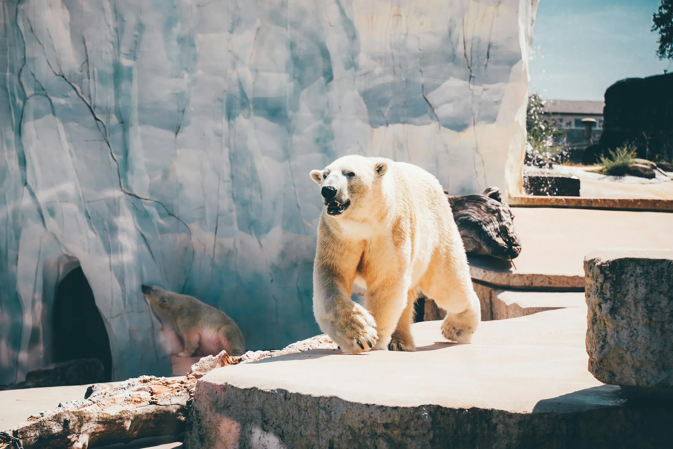
Animals don’t follow city boundaries or fences. That’s why traditional tracking methods often fail to protect them. But now, GIS for environment monitoring teams are building accurate movement models to track how animals migrate, feed, or avoid roads.
For example, when highways cut through natural habitats, animals often face deadly risks. However, with GIS, hotspots of frequent crossings can be identified using movement history and terrain data. Safe crossings or wildlife corridors can then be built in the right locations.
The ability to use data to guide infrastructure like this saves both animal lives and money. It also reduces the impact of human development on wildlife, keeping ecosystems balanced. This use of GIS for environment protection is a powerful example of where technology meets empathy.
Forests are often called the lungs of the Earth. Protecting them means protecting our future. But forests are large and complex, and not all problems are visible from the ground.
That’s where satellite imagery for environment monitoring comes in. From a global view, satellite images paired with GIS technology can detect even the smallest changes in forest cover. Fire damage, pest infestations, drought stress—all can be seen before a full-blown disaster occurs.
Through color-coded maps and vegetation indexes, GIS allows forest managers to take targeted actions—replanting trees, managing water use, or creating firebreaks. This precise approach means resources aren’t wasted, and forest recovery happens faster.
When governments and NGOs use GIS for environment, tree planting is no longer random. Every tree counts because every location is chosen with intention.

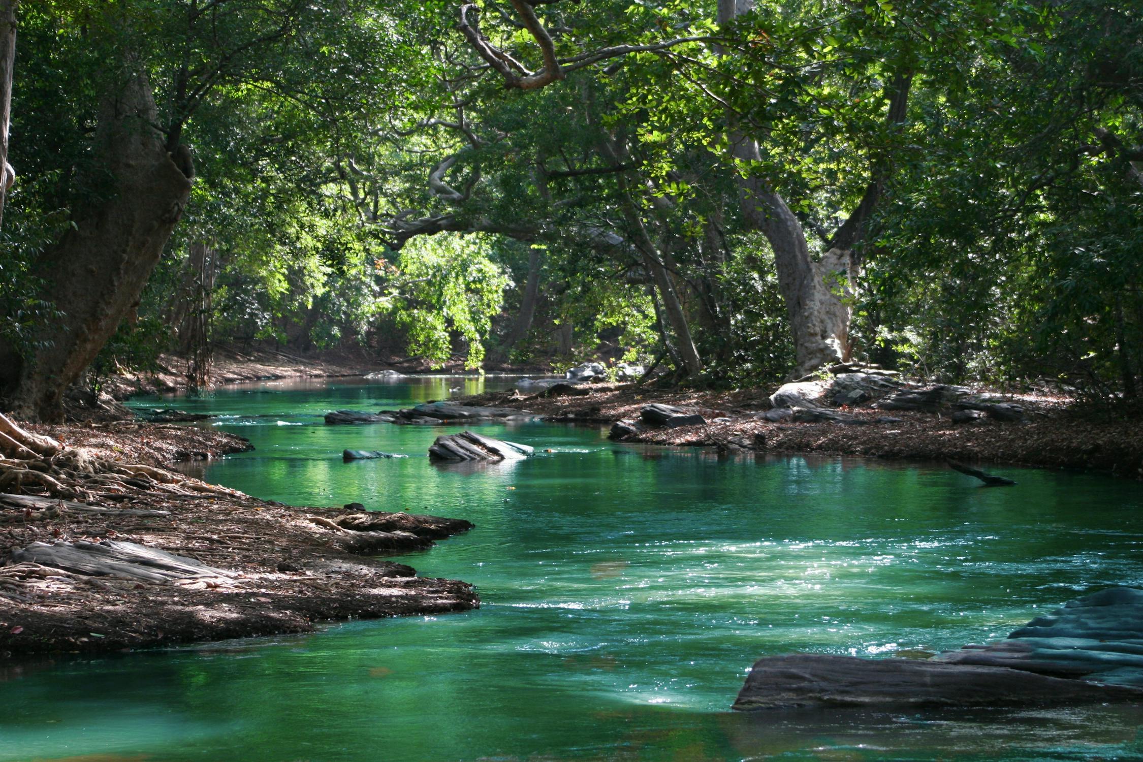
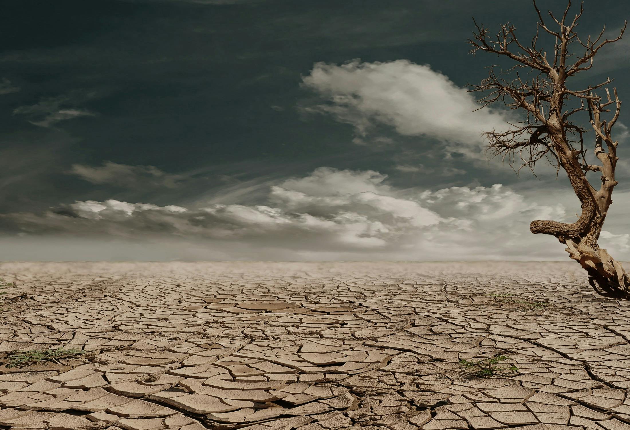
Water is life, but fresh, clean water is becoming scarce. Rivers are drying. Lakes are shrinking. Pollution is spreading. Without constant monitoring, water systems can collapse before people even notice.
GIS helps monitor these changes using satellite imagery for environment insights. Water levels, flow rates, temperature, and pollution data are layered to give a clear view of water health. This helps authorities plan better water management systems.
GIS maps also show how land use nearby affects water quality. For instance, farmlands using heavy chemicals might be harming a river. When this connection is made clear on a GIS map, solutions can be created—like changing farming practices or building buffers.
So, whether it’s tracking wetlands, reservoirs, or underground aquifers, GIS for environment safety ensures water is managed with care.
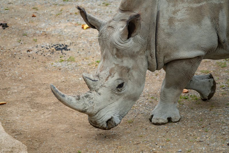
Many animal and plant species are now at risk. Habitat loss, climate change, and pollution are pushing them closer to extinction. To save them, precise and timely data is needed—and GIS delivers exactly that.
Using real-time tracking devices and population maps, scientists and conservationists monitor where endangered animals live, how they move, and what threats surround them. This lets them step in quickly when help is needed.
The data from GIS for environment also helps create new protected areas. When rare species are found in unexpected places, GIS helps prove those areas are valuable and worth saving. As the planet warms, having up-to-date species maps is key to building a survival plan.
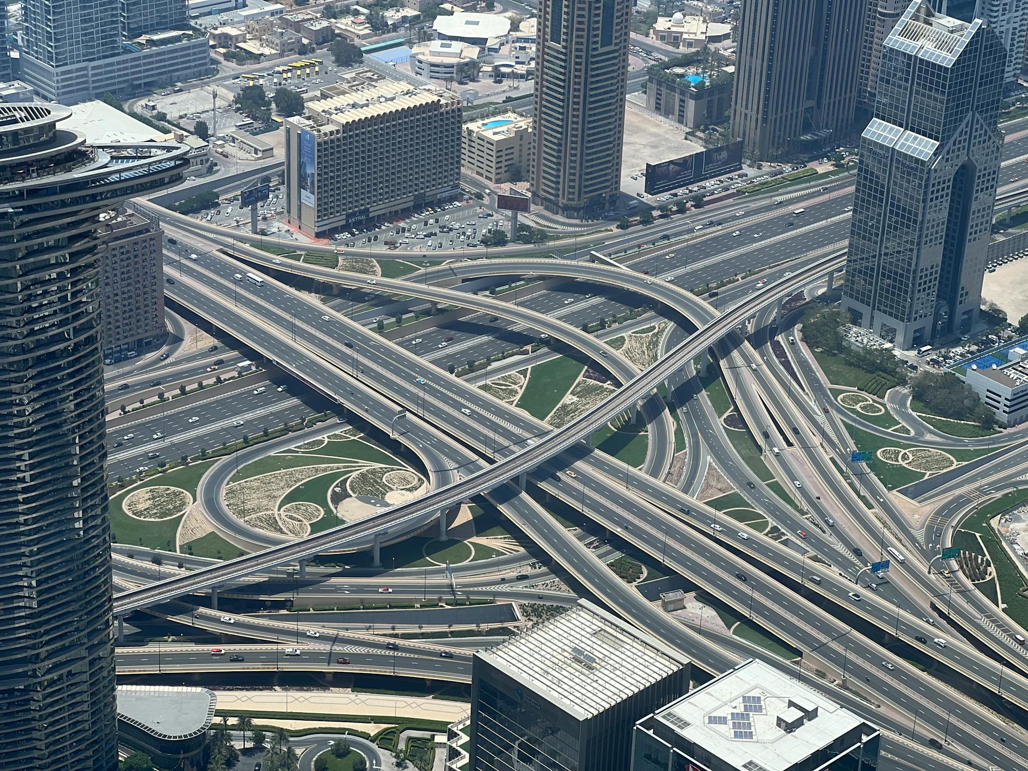
Cities are expanding, but without careful planning, they can destroy nature around them. GIS for environment preservation is helping planners design cities that grow smart—not wide.
Environmental planners use GIS to identify high-risk areas like flood zones, landslide-prone hills, or fragile ecosystems. These areas can be protected by restricting construction or creating green spaces.
GIS also allows better use of existing space. Planners can see where to add bike paths, parks, or community gardens—without disturbing natural balance. For future generations, this means a more livable, breathable city.
Climate change is not a theory anymore. It’s reality. From melting glaciers to rising sea levels and shifting rainfall patterns, the evidence is everywhere. But acting without data leads to delays or bad policies.
With GIS for environment, temperature trends, ice loss, storm patterns, and sea-level changes can be tracked globally. Satellite imagery for environment tracking ensures that both small and large shifts are captured in real time.
Communities living in vulnerable areas—like coastal towns—can be warned early when the data shows danger. City leaders, farmers, and disaster response teams all use this data to protect lives and assets.
The beauty of Environment GIS is that it doesn’t just show change—it helps predict what’s next, so we can prepare better.
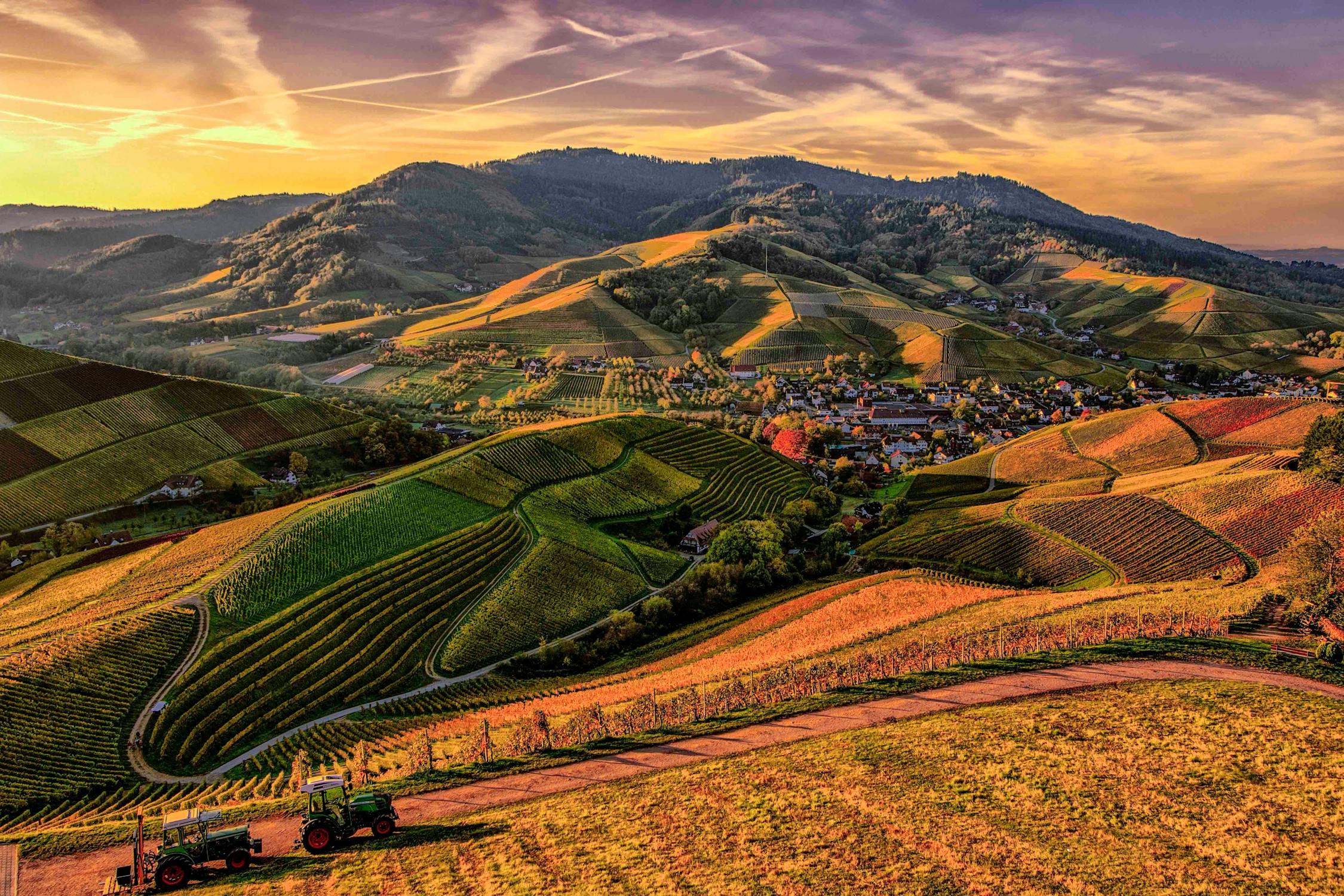
Farming has always relied on nature. But now, climate unpredictability is making it harder for farmers to succeed. Crops fail. Soils erode. Water becomes scarce. But GIS for environment monitoring is helping farming become smarter.
With Agriculture GIS, farmers can map their land, identify the healthiest and weakest areas, and apply resources like water or fertilizer exactly where needed. This reduces waste and improves harvests.
GIS also tracks pests, disease spread, and crop health through satellite imagery for environment updates. If a disease starts in one area, it can be contained before spreading.
In the long run, this helps food systems stay strong—even under environmental pressure. Sustainable agriculture becomes a reality when guided by real data.
As environmental challenges increase, data-driven decision-making is no longer optional. GIS and environmental science together provide the backbone for smart, ethical, and fast responses to nature’s needs.
Whether it’s protecting species, managing land, planning cities, or fighting pollution, GIS for environment applications are growing every year. With every satellite image, with every updated map, smarter choices are being made.
For organizations like XRTech Group, embracing GIS technology isn’t about trends—it’s about commitment to a better future. When nature is understood clearly, it can be protected properly.
XRTech Group’s GIS satellite imagery plays a vital role in protecting the environment by offering precise, up-to-date data that supports informed decision-making. Through the advanced use of Geographic Information Systems, the connection between GIS and environment preservation becomes clear.
The satellite imagery provided by XRTech Group allows environmental scientists, policymakers, and conservationists to monitor natural resources efficiently and track environmental changes over time. By harnessing this technology, efforts to safeguard ecosystems and manage natural resources have been significantly strengthened.
This technology not only reveals current conditions of forests, water bodies, and wildlife habitats but also forecasts potential environmental risks, enabling proactive steps toward preservation.
Therefore, the integration of GIS and environment at XRTech Group empowers organizations to visualize complex environmental data, simplifying the process of addressing ecological challenges. With continuous satellite monitoring, the changes caused by climate shifts, deforestation, or pollution are identified early, which helps protect vulnerable ecosystems before damage becomes irreversible.
Forest Conservation and Management: GIS helps environment to track forest health, monitor illegal logging, and plan reforestation efforts, ensuring sustainable forest ecosystems.
Water Resource Monitoring: With GIS pollution levels and water flow patterns are observed to improve water management and protect aquatic ecosystems.
Wildlife Habitat Protection: With GIS for Environment species distribution and migration are mapped to support the conservation of endangered animals and plants.
Climate Change Impact Assessment: GIS helps to monitor environment changes in land use, temperature, and vegetation cover are analyzed to understand and mitigate climate change effects.
Urban Environmental Planning: GIS informs the design of green spaces, pollution control zones, and sustainable infrastructure within cities.
Disaster Risk Reduction: Flood-prone areas, wildfire risks, and other natural hazards are identified to improve emergency preparedness and minimize environmental damage.
Agricultural Sustainability: Soil quality, crop health, and irrigation needs are monitored to promote sustainable farming practices.
Satellite-Based Land Use and Land Cover Mapping: Precise classification of land types aids in tracking environmental changes such as deforestation and urban expansion.
Environmental Change Detection: By comparing satellite images over time, changes in ecosystems and natural habitats are detected, supporting timely conservation actions.
Pollution and Contamination Monitoring: Satellite data identifies sources and spread of pollutants in air, water, and soil to guide remediation efforts.
Habitat Connectivity Analysis: GIS helps identify wildlife corridors and critical habitats, ensuring ecological networks remain intact for biodiversity.
Water Quality and Hydrological Studies: Remote sensing data supports analysis of water bodies’ health and hydrological cycles, which is vital for managing freshwater resources.
Disaster Impact Assessment: Post-disaster satellite imagery assists in assessing environmental damage caused by events like wildfires, floods, and storms.
Sustainable Development Planning: GIS-based environmental assessments guide projects to balance growth with ecological preservation.
With the comprehensive capabilities of XRTech Group’s GIS satellite imagery solutions, the relationship between GIS and environment is strengthened, providing powerful tools for environmental preservation. This technology supports proactive, science-based management, which is essential for safeguarding natural resources now and in the future.
The health of our planet can no longer be ignored. But the solutions must be modern, effective, and actionable. With GIS and environment solutions becoming more advanced, it’s easier now to respond to every environmental threat with clarity and confidence.
Environmental science and GIS do not work in isolation—they are tools of empowerment. They help humanity reconnect with the earth in a meaningful way. The more data we have, the more responsible our choices become.
At XRTech Group, GIS is not just a service—it is a mission to protect the Earth, support environmental heroes, and leave a legacy of care. Because preserving the environment is not about saving nature from people. It’s about saving people through nature.
GIS, or Geographic Information System, is a technology that collects, analyzes, and visualizes spatial data. In environmental science and GIS, this technology helps track natural resources, monitor ecosystems, and plan sustainable preservation strategies for the environment.
GIS for environment preservation allows scientists and organizations to map forests, water resources, and wildlife habitats. Satellite imagery for environment monitoring plays a crucial role in detecting changes, managing conservation areas, and tracking endangered species effectively.
GIS supports conservation biology by predicting wildlife movement, monitoring species distribution, and managing habitats. It enables better decisions to reduce habitat loss and fragmentation, thereby promoting biodiversity and protecting threatened species.
Satellite imagery for environment monitoring provides real-time and historical data about land cover, deforestation, water quality, and climate impacts. This imagery is integrated with GIS tools to give detailed visualizations and insights for more effective environmental management.
Yes, GIS technology can analyze data on water bodies to detect pollution levels and map the flow of water across different regions. This capability allows for targeted actions to improve water quality and protect aquatic ecosystems.
GIS supports resource management by mapping forests, soil conditions, and wildlife habitats. This information helps allocate conservation funds wisely, plan tree planting, and monitor changes in ecosystems to maintain a balanced environment.
GIS assists urban planners in balancing development with nature conservation. By mapping green spaces and protected areas, GIS enables better planning to reduce environmental impact and create sustainable cities with healthy ecosystems.
GIS provides detailed maps of species habitats and migration patterns. This helps identify critical corridors and crossing points, reducing human-wildlife conflicts and supporting the design of effective conservation zones.
Environmental science and GIS manage data including forest coverage, wildlife populations, water quality, soil erosion, and climate variables. This diverse dataset supports comprehensive environmental monitoring and decision-making.
Organizations can integrate GIS and satellite imagery for environment monitoring to develop data-driven conservation plans. By continuously tracking ecosystems and resource changes, they can respond proactively to threats and support sustainable environmental preservation.
Tailings Dam Monitoring: How Advanced Satellite Intelligence Is Transforming Tailings Dam Safety Tailings dams are among the most critical—and high-risk—structures

From Visible Light to Spectral Intelligence in Modern Satellite Remote Sensing Satellite imaging has moved beyond photography. For decades, Earth