
Tailings Dam Monitoring with InSAR & AI
Tailings Dam Monitoring: How Advanced Satellite Intelligence Is Transforming Tailings Dam Safety Tailings dams are among the most critical—and high-risk—structures
The mining industry in 2026 continues to evolve at a rapid pace. Mining companies are now expected to meet higher Environmental, Social, and Governance (ESG) standards while improving productivity and safety across vast, complex terrains. For decades, the industry has depended on traditional surveys and limited access to real-time data. But today, the introduction of advanced satellite imagery for mining is reshaping how operations are managed—bringing in greater efficiency, safety, and sustainability.
the need to enhance safety and productivity have turned attention toward one innovative solution: satellite imagery for mining.
With improvements in spatial resolution, frequent revisit capabilities, and AI-enhanced analytics, satellite mining has evolved into a core strategy for modern mineral exploration, monitoring, and sustainability. Mining firms are no longer limited to ground-based data or slow manual surveys. Now, mining satellites are making it easier, faster, and safer to gather critical insights from above.
With access to mining satellite technology and imagery, mining companies now have the ability to remotely observe, monitor, and plan across entire mining sites that span tens of kilometers. This level of visibility was once impossible, especially in remote or environmentally sensitive regions.
But satellite-based solutions, such as those provided by XRTech Group, are now offering real-time insights that reduce costs, prevent disasters, and ensure that the environmental impact is minimized.
The use of satellite imagery for mining is no longer limited to surface-level mapping. It’s now an essential tool in nearly every stage of the mining lifecycle—from exploration and site assessment to safety monitoring, tailings management, ESG compliance, and rehabilitation efforts.
Mining operations cover large and often inaccessible areas. Sites are located in remote, rugged, or environmentally challenging terrains, stretching across 50–100 square kilometers or more. Traditional data collection methods like ground surveys or manual inspections are time-consuming, expensive, and often dangerous. Even modern tools like drones, while useful for capturing localized data, fall short when it comes to full-site analysis.
This is where the power of satellite mining solutions becomes clear.
Modern mining satellite platforms now deliver imagery at resolutions as fine as 30cm or better. For example, XRTech Group’s Superview Neo-1 satellite provides 0.3m per pixel resolution across Panchromatic, RGB, and Near Infrared bands with daily revisit capabilities. This level of clarity and frequency allows for highly detailed inspections of land surfaces, water bodies, infrastructure, and geological changes.
This means mining executives can see day-to-day changes in tailings ponds, stockpiles, haul roads, and environmental buffers—all without deploying field teams. With satellite imagery for mining, decision-makers gain insight from global operations instantly.
The impact of this technology is felt across three main pillars of mining: sustainability, safety, and exploration. Each one benefits significantly from the continuous stream of data and insights made possible by satellite imagery for mining.
XRTech Group offers on-demand tasking, letting mining clients capture updated imagery whenever needed. Whether there’s been a recent landslide, flooding, or a scheduled blast, the satellite can be repositioned quickly. The Superview-1 imagery, with 0.5m/px resolution, reveals not only surface-level patterns but also valuable spectral data for mineral content analysis.
This near-instant access supports faster risk assessment, maintenance planning, and resource allocation. Whether mines are operating in remote Australia, Africa, or Latin America, satellite data ensures everyone—on-site and off-site—stays informed.
Safety remains a top concern in mining. Satellite data provides around-the-clock visual access to hazardous areas such as highwalls, benches, tailings storage facilities (TSFs), and haulage routes. Changes in ground movement, deformation, or subsidence can now be detected at the millimetre level.
XRTech Group’s tools monitor both vertical and horizontal displacements using Synthetic Aperture Radar (SAR) and optical sensors. By comparing imagery over time, companies can anticipate risks before they become incidents.
This remote safety monitoring removes the need for human patrols in dangerous zones, keeping workers safer while improving the mine’s ESG score.
Every mining company in 2026 faces public and governmental expectations to reduce environmental damage. This is where satellite mining becomes a reliable tool for compliance and reporting.
Mining satellites track vegetation health, soil moisture, and water bodies around operational zones. With XRTech Group’s platform, companies can spot encroachments into buffer zones, illegal dumping, or sudden changes in tailings pond levels.
Satellite imagery for mining also supports end-of-life mine rehabilitation. By continuously capturing images of restored vegetation and terrain, companies can demonstrate their commitment to ESG regulations with visual proof and timeline-based reports.
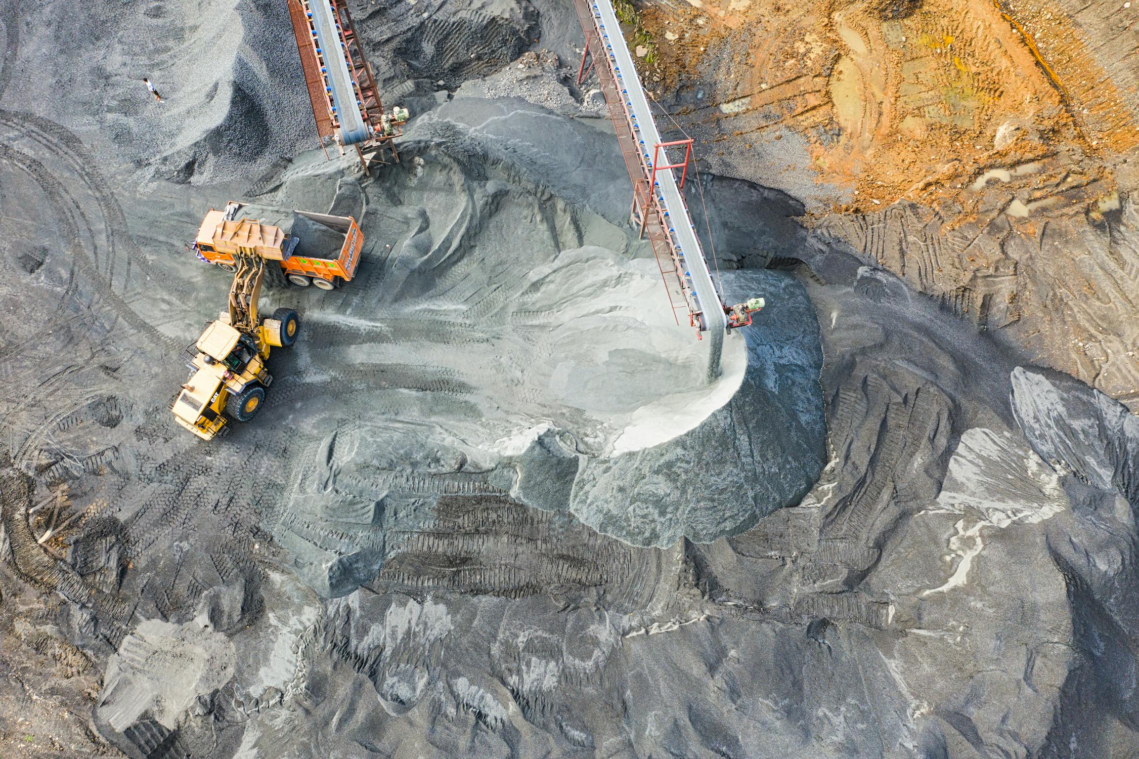
Tailings management is one of the most critical aspects of responsible mining. When poorly managed, tailings ponds can lead to catastrophic environmental disasters. XRTech Group empowers mining firms to detect anomalies in TSFs, such as rising freeboard levels or water overtopping, through satellite imagery for mining.
Using AI-enhanced analysis, satellites measure surface changes and provide alerts before failure conditions arise. Whether assessing structural shifts or identifying unapproved expansions, satellite data ensures continuous and objective monitoring.
Exploration is where satellite mining shines the most. Traditional exploration involves time-consuming sampling and surveys. With satellite-based mineral mapping, companies can now pre-screen vast territories using multispectral and hyperspectral sensors.
These sensors identify mineral compositions by detecting specific reflectance signatures. XRTech’s solutions reveal surface geology and even subsurface features in some conditions—helping explorers target only the most promising zones for follow-up drilling.
This reduces exploration costs significantly while increasing the chances of successful discovery. Satellite imagery for mining is now considered a core tool in locating lithium, cobalt, gold, and rare earth elements.
Unauthorized extraction remains a huge financial and environmental threat, especially in remote areas. Thanks to satellite imagery for mining, firms can now track suspicious activity near or within their concession zones.
XRTech’s satellites capture up-to-date images that reveal vehicle tracks, excavation patterns, or building developments in unauthorized areas. By comparing recent images with archived baselines, mining companies can detect illegal mining within days, not months.
With this intelligence, companies can act fast—coordinating with regulators and security forces to protect their interests.
For mining companies, predicting and planning production is vital. Investors, governments, and trade partners depend on accurate volume estimates. Satellite imagery for mining offers visibility into stockpile volumes, pit depth changes, and production line activity from a top-down view.
XRTech’s geospatial tools analyze extraction patterns and material movement, allowing planners to align operations with real-time production data. This ensures that forecasts match ground realities, reducing risk for stakeholders.
Even transportation logistics benefit from satellite mining solutions. Mining roads, bridges, and rail links can be monitored for condition and usage. This is particularly helpful in areas with seasonal weather changes or weak infrastructure.
Beyond exploration and operations, satellite imagery for mining helps companies comply with legal requirements and prepare for emergencies. As rules around emissions, land usage, and water management grow tighter, XRTech’s data-driven compliance reports make audits smoother and faster.
Satellite-based risk assessment can alert companies to potential landslides, floods, or subsidence zones long before disasters occur. This proactive approach doesn’t just protect employees—it safeguards long-term assets and environmental resources.
What makes XRTech Group stand out is not just access to world-class satellite constellations, but the platform’s ability to transform raw data into actionable insights. Mining companies receive easy-to-use dashboards, alerts, and 3D models instead of raw image files.
XRTech’s models include:
Digital Surface Models (DSM) and Digital Terrain Models (DTM)
Contours and Breaklines for terrain understanding
Orthomosaics for highly accurate map creation
Vegetation Health Maps using NDVI indices
Water Body Mapping for TSF and pond management
These outputs empower teams in geology, planning, safety, and ESG to make informed decisions—all from one place.
AI is changing the way satellite data is analyzed. Machine learning algorithms can now detect patterns, classify landforms, and predict changes based on historical imagery. This is particularly helpful in tracking gradual changes like erosion, vegetation loss, or buildup of tailings.
XRTech integrates AI to streamline repetitive tasks and alert operators only when anomalies occur. This allows companies to manage large-scale monitoring operations with fewer staff, higher accuracy, and less delay.
As the mining industry continues to modernize, AI-powered satellite imagery for mining ensures that data isn’t just collected—but turned into smarter, faster decisions.
Until recently, only large multinational mining corporations had access to high-resolution satellite data. That’s changing quickly. With XRTech’s subscription-based or task-based pricing models, small to mid-sized firms can now harness the power of mining satellites without heavy upfront investment.
Whether you’re running an open-pit copper mine in Peru, exploring gold reserves in Africa, or managing rehabilitation in Australia, XRTech’s scalable solutions adapt to your needs.
These tools aren’t just about technology—they’re about empowering your people to make better decisions that reduce risk, lower costs, and improve outcomes across the mining life cycle.
The modern mining industry is under increasing pressure to minimize environmental harm. Regulatory bodies, investors, and communities expect companies to demonstrate transparency and accountability. Using satellite mining solutions, companies can now meet these expectations by detecting environmental risks in near real-time.
One major concern is the management of tailings storage facilities (TSFs)—the ponds where mining waste is stored. These areas must be monitored constantly to prevent leaks, breaches, or overflows that could cause long-term environmental damage.
XRTech Group enables consistent monitoring of tailings through a combination of Synthetic Aperture Radar (SAR) and optical satellite data. This allows mining operators to detect changes in water levels, pond boundaries, or nearby vegetation. In the event of heavy rainfall or unauthorized activities, early warnings can be issued to prevent contamination or collapse.
Satellites don’t just look at rocks. They also detect changes in soil moisture, vegetation cover, and surface water movement. These changes can indicate environmental stress caused by mining activities. Whether it’s deforestation, erosion, or contaminated runoff, satellite imagery for mining offers early detection and long-term trend analysis.
XRTech’s data tools provide vegetation monitoring, land surface classification, and change detection using Near Infrared (NIR) imaging. With this information, mining companies can adjust their operations to reduce damage or plan rehabilitation efforts once mining ends.
Environmental and Social Governance (ESG) performance is a key benchmark for investors and regulators. With satellite technology, mining firms can maintain a detailed record of land use, ecosystem health, and infrastructure impact over time. These records serve as powerful evidence during environmental assessments, licensing renewals, and public reporting.
XRTech’s ESG monitoring services include:
Vegetation and habitat tracking
Illegal mining detection
Encroachment analysis
Monitoring of waste dumping
Assessment of rehabilitation efforts
Instead of relying on sporadic audits or site visits, companies now have a continuous, high-resolution overview that enhances both transparency and accountability.
Mining is one of the most hazardous industries in the world. Every year, thousands of workers are injured due to poor visibility, landslides, structural failures, or unsafe operating conditions. High-resolution mining satellite data helps reduce these risks dramatically.
By integrating satellite imagery for mining, safety becomes proactive instead of reactive. Surveillance over vast and remote sites allows operators to detect physical changes—like slope movements or ground deformation—long before they become dangerous.
XRTech Group enables millimeter-level detection of subsidence and uplift. This allows companies to spot ground movements in areas surrounding open pits, tailings dams, or underground tunnels. Such subtle movements may indicate future collapses or shifts in earth structure.
XRTech’s solution provides:
Horizontal surface movement tracking
High-density ground measurements
Early warning of potential landslides or collapses
3D elevation modeling for safety planning
This data can be integrated with other mine site monitoring tools to create a comprehensive, real-time safety platform—helping to reduce accidents and protect worker lives.
Another critical advantage of satellite mining data is its ability to operate in all weather conditions and during night hours. Unlike drones or manned inspections, satellites don’t stop when it’s cloudy or dark. This ensures uninterrupted monitoring, especially in regions with unpredictable weather.
Real-time data also helps in reducing the need for frequent human inspections, minimizing the exposure of workers to dangerous conditions and remote locations.
Locating valuable mineral deposits is one of the most resource-intensive phases in the mining lifecycle. Traditional geological surveys require extensive fieldwork, specialized equipment, and significant costs. However, satellite imagery for mining is changing that.
XRTech’s high-resolution, multispectral, and hyperspectral imagery allows companies to visualize surface compositions and identify patterns that may indicate underground minerals. By analyzing geological features, vegetation types, and heat signatures, companies can detect likely mineral zones without setting foot on site.
Hyperspectral imagery captures data across hundreds of wavelengths, revealing details invisible to the human eye. This makes it possible to perform mineral mapping with exceptional precision.
By examining the spectral signature of soil and rock surfaces, companies can detect the presence of:
Iron oxides
Clay minerals
Carbonates
Sulfides
Rare earth elements
This remote identification technique has already proven successful in regions like South Africa and India, where kimberlite pipes (diamond-rich formations) were found using satellite surveys.
Because satellite data can be obtained within hours or days, exploration efforts become faster and more focused. Instead of exploring vast areas blindly, companies can concentrate on regions that show strong mineral indicators.
This reduces costs, minimizes environmental disruption, and speeds up the time it takes to move from exploration to extraction.
Mining companies depend on accurate forecasts for resource management, investor relations, and logistics. With satellite imagery for mining, production levels and infrastructure use can be tracked in near real-time.
XRTech Group enables mining firms to monitor:
Extraction volumes
Equipment utilization
Changes in material stockpiles
Supply chain logistics
This data feeds directly into production planning tools, allowing managers to assess whether operations are on schedule or need adjustments.
Beyond the mine itself, satellite mining technology supports transportation and logistics. Roads, loading zones, and railways can be monitored for traffic patterns or environmental issues. Companies can reroute shipments, optimize delivery schedules, and reduce downtime.
In remote regions with minimal infrastructure, this capability is critical. Reliable satellite data ensures that materials reach processing plants safely and on time.
Illegal mining causes massive revenue losses and environmental destruction, particularly in developing regions. But detecting these operations manually is difficult due to their remote locations. Satellite data solves this issue by delivering continuous surveillance, even in the most inaccessible areas.
With satellite imagery for mining, XRTech Group can detect unauthorized extraction, deforestation, or encroachment. Changes in land cover, vegetation stress, and unauthorized road creation are early signs of illegal activity.
Mining companies and regulators can use this data to:
Identify illegal mining hotspots
Estimate the scale of unauthorized operations
Notify law enforcement or policy bodies
Protect legitimate mining rights and concessions
This level of surveillance ensures that resources are used responsibly, and communities are not left to deal with the aftermath of illegal extraction.
Natural disasters, equipment failures, or environmental accidents can have devastating consequences. Satellite mining data gives companies a powerful risk management tool. With continuous monitoring, early signs of danger can be identified before they escalate.
Satellite-based risk assessment can detect:
Flood risks from changing water levels
Structural weaknesses in tailings dams
Increased slope angles on pit walls
Fire hazards from vegetation stress
Subsidence in underground mine regions
When combined with machine learning algorithms, XRTech Group’s system can provide predictive insights—warning teams about where to intervene. This proactive approach reduces losses, safeguards investments, and protects nearby communities.
At XRTech, we offer a complete range of satellite imagery solutions designed specifically to meet the needs of mining, construction, agriculture, environmental monitoring, and exploration projects. Understanding the different types of satellite imagery we provide — including their resolution, spectral bands, and revisit times — is essential when choosing the right dataset for your project. Below are the key types of satellite imagery available through XRTech and how each type plays a critical role in various industries.
High-resolution optical imagery is one of the most important types of satellite data, especially for general site monitoring, visual inspection, planning, and mapping. These images are captured using visible and near-infrared light, providing clear and detailed views of the Earth’s surface.
XRTech offers access to Very High Resolution (VHR) and High Resolution (HR) optical imagery, with ground resolutions as fine as 0.3 meters per pixel, ideal for detecting small objects and detailed structures.
Panchromatic
Red, Green, Blue (RGB)
Near-Infrared (NIR)
Multispectral and Infrared capabilities also included in some satellites
Superview Neo-1
Resolution: 0.3m/px
Bands: Panchromatic, RGB, NIR
Revisit: Daily (for middle and high latitudes)
Superview-1
Resolution: 0.5m/px
Bands: Panchromatic, RGB, NIR
Revisit: Daily
Superview-2
Resolution: 0.4m/px
Bands: Panchromatic, Purple, Yellow, Red Edge, Red, Green, Blue, NIR1, NIR2
Revisit: 3 days
GF-7
Resolution: 0.65m/px
Bands: Panchromatic, RGB, NIR
GF-2
Resolution: 0.8m/px
Bands: Panchromatic, RGB, NIR
GF-6
Resolution: 2m/px
Bands: Panchromatic, RGB, NIR
GF-1
Resolution: 8m/px
Bands: Panchromatic, RGB, NIR
ZY-3
Resolution: 2m/px
Bands: Panchromatic, RGB, NIR
Revisit: 5 days (1 satellite) / 1–2 days (3 satellites)
ZY-1 02D
Resolution: 30m/px
Bands: Blue, Green, Red, NIR
Revisit: 3 days (WPM camera) / 26 days (MUX camera)
High-resolution imagery is crucial for topographic mapping, land use analysis, surface deformation detection, and construction site tracking.
SAR imagery is extremely valuable because it works regardless of cloud cover, weather conditions, or lighting. SAR uses microwave signals to generate high-resolution images of the Earth’s surface and can even detect ground movement and changes over time using InSAR (Interferometric SAR).
All-weather, day-and-night imaging
Cloud-penetrating technology
Ideal for monitoring terrain changes, infrastructure deformation, and flood mapping
Spotlight Mode: High resolution (e.g., 1m/px)
Stripmap Mode: Wider area coverage with lower resolution (e.g., 3m/px)
L-band, C-band, X-band
Single, Dual, and Full Polarization Options available
GF-3 SAR
Resolution: 1m/px
Band: C-band SAR
Revisit: 10 days
LT-1 SAR
Resolution: 3m/px
Band: L-band SAR
Revisit: 8 days (1 satellite) / 4 days (2 satellites)
Superview Neo SAR Series
Offers additional SAR capabilities
SAR imagery is especially important for industries that require continuous monitoring of structural changes like tailings dams, pipelines, and slopes, even under harsh weather or nighttime conditions.
Hyperspectral imagery provides hundreds of narrow spectral bands, allowing users to detect detailed mineralogical and chemical information that other satellite types can’t offer. This makes it essential for resource exploration and environmental monitoring.
Mineral identification
Soil and vegetation health analysis
Surface composition mapping
GF-5B
Resolution: 30m/px
Spectral Range: 400–2500 nanometers (nm), covering visible to Shortwave Infrared (SWIR)
Ideal for exploration, geochemical mapping, and land use classification
Multispectral and infrared satellite imagery is widely used for environmental monitoring, such as land degradation, vegetation health, and water pollution detection. These images cover broad spectral bands to detect subtle changes in land and water surfaces.
Analysis of vegetation health using NDVI
Monitoring of environmental damage from mining activities
Water body detection and contamination mapping
Most optical satellites listed above offer multispectral bands (RGB + NIR)
GF-4 includes Mid-Wave Infrared (MWIR)
GF-5B includes extended infrared bands
These imagery types are very useful for regulatory compliance and sustainable operations.
XRTech doesn’t just provide raw imagery — we also offer processed satellite data in the form of Digital Orthophoto Maps (DOM), Digital Surface Models (DSM), and Digital Elevation Models (DEM). These products help in 3D modeling, terrain analysis, and infrastructure planning.
3D geological mapping for mining
Slope analysis and risk assessment
Urban planning and development
DOMs with resolutions up to 50cm
DSM and DEM layers for elevation and terrain modeling
These value-added products increase accuracy and efficiency in planning, exploration, and construction activities.
At XRTech, we provide customized satellite imagery solutions for your industry-specific needs. Whether you require high-resolution optical imagery, advanced SAR datasets, or processed products like DSM and DOM, we deliver timely, accurate, and cost-effective data to support your projects.
We also assist in data selection, delivery formats, and integration into your GIS systems — ensuring you get the most relevant satellite imagery for mining, construction, agriculture, or environmental monitoring projects.
The adoption of satellite imagery for mining has moved beyond being a futuristic idea. It’s now a practical and essential tool for mining companies that want to stay competitive, efficient, and compliant.
Through enhanced monitoring, accurate forecasting, safety improvements, and better ESG performance, satellite solutions from XRTech Group empower companies to transform their operations. Whether it’s tracking mineral extraction, preventing disasters, planning logistics, or mapping new exploration zones—satellite data is now at the core of smart mining.
In 2026 and beyond, the mining industry faces many challenges. But with the power of satellite mining data, those challenges can be met with clarity, speed, and confidence. XRTech Group is proud to be at the forefront of this transformation, helping mining companies around the world to operate more safely, sustainably, and intelligently.
Tailings Dam Monitoring: How Advanced Satellite Intelligence Is Transforming Tailings Dam Safety Tailings dams are among the most critical—and high-risk—structures

From Visible Light to Spectral Intelligence in Modern Satellite Remote Sensing Satellite imaging has moved beyond photography. For decades, Earth