How Do Almonds Grow? Complete Farming Guide from Planting to Harvest
Growing almonds is a structured agricultural process that moves from orchard planning to nut harvest and post-season care. Farmers must

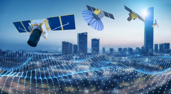
Have you ever looked up at the sky and wondered, what is a satellite, Satellite Types, and how does it affect our daily lives? Honestly, satellites are not just objects floating in space—they are powerful tools that make our modern life much easier and more connected.
From helping with GPS navigation to predicting the weather, satellites are at the core of many essential services we rely on every day. In this blog, we will explore the different types of satellites, the orbit types they travel in, and the numerous functions and uses that keep our world running smoothly.
Satellites have come a long way since their early days, evolving to serve a variety of functions. They’ve become so essential that it’s impossible to imagine a day without them.
Whether it’s for communication, scientific research, or national defense, there’s a type of satellite for almost everything. The satellite types we rely on are often categorized based on their missions or the earth orbits they occupy.
Each type of satellite orbit has distinct characteristics that serve specific purposes, making these tools even more powerful in tackling everything from monitoring climate change to helping us navigate on our smartphones.
Now, let’s take a closer look at the different satellites types and the orbit types they use to make these amazing functions possible.

Let’s first know what is a satellite? A satellite is a device launched into space to orbit a planet or celestial body. While natural satellites like the Moon have always existed, artificial satellites are created by humans and placed into earth orbits for a wide variety of purposes.
These satellites are propelled into space using rockets from both private and government space agencies. Once in space, they are equipped with advanced instruments and cameras to perform specific tasks like observing Earth, studying other planets, aiding communication, or even peering into the far reaches of the universe.
Satellites are designed for different jobs, so we need many types of satellites. Their size, shape, and the way they move around Earth depend on their mission.
Some satellites help with weather prediction, some help us navigate with GPS, and others provide high-resolution satellite images to help make decisions. Each satellite’s job determines its design and how it moves in space.
One of the biggest benefits of satellites is that they can cover large areas and gather information much faster than sensors on the ground.
Since they are in space, satellites can see everything clearly, without clouds or other weather conditions getting in the way.
This means they can capture high-resolution satellite images that are very detailed, making them perfect for things like mapping and monitoring the Earth.
Different earth orbits help satellites do their jobs better. For example, some satellites move in low Earth orbit to take pictures of Earth, while others move higher up to help with communication or weather.
Each orbit type helps the satellite get the best view for its specific task. Whether it’s sending pictures, helping with GPS, or studying the weather, satellites make our lives better by giving us accurate and important information.
Visit- How to See Live Satellite Images of My House in Real Time?
Visit – Sq m to Sq Km – Square Meters to Square Kilometers Converter

Alright, let’s break this down, and I’ll walk you through the fascinating world of satellite types and how their orbits impact everything from the data they collect to how they function.
When we talk about satellite types, we’re often referring to their orbit types—that is, the paths they take around the Earth. After launch, satellites are placed into specific orbits that match their purpose and intended functions. These earth orbits determine everything from how often a satellite can pass over a certain area to the kind of data it gathers. But, it’s not just about orbit types—the altitude, or the height of the orbit, also plays a major role in satellite operations.
Let me take you through the most common types of satellites based on orbit types and explore the characteristics and potential uses of these five different types of satellite orbits.
When talking about satellite types and orbit types, Low Earth Orbit (LEO) often comes up as one of the most frequently used. But what exactly does it mean? Simply put, LEO satellites are positioned much closer to the Earth’s surface compared to other earth orbits. These satellites typically orbit at an altitude of 160 to 2,000 kilometers, which might sound high, but in terms of satellite types, it’s relatively low. For context, commercial airplanes fly at altitudes of just 14 kilometers, making LEO satellites orbit much farther out than regular aircraft but still well within reach.
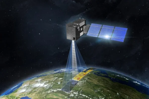
LEO satellites are favored for high-resolution satellite images because their proximity to Earth allows them to capture clearer and more detailed visuals. This is especially useful for applications such as environmental monitoring, agriculture, and urban planning. Their close distance enables better imaging and data accuracy, which is why they are used in many remote sensing and scientific research applications.
One of the significant benefits of satellites in LEO is their speed. They travel at 7.8 km per second, completing an orbit around Earth in just 90 minutes. This rapid movement allows satellites to cover the globe quickly, and the International Space Station (ISS), which orbits within this range, can make up to 16 complete orbits in one day.
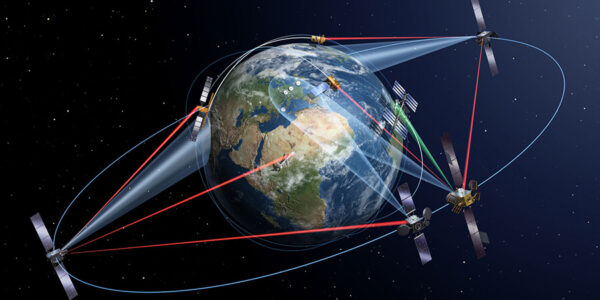
However, due to the speed and low altitude of LEO satellites, they don’t stay in one place long enough to support reliable communications on their own. To solve this, LEO satellites often work together in large constellations. By doing so, they ensure continuous coverage over large areas and improve data transmission, making them ideal for global earth observation and communications.
Medium Earth Orbit (MEO) lies between Low Earth Orbit (LEO) and Geostationary Earth Orbit (GEO), covering an altitude range from 5,000 to 20,000 kilometers. This orbit type is often used for satellite types that require a balance between coverage area and transmission rates. Unlike LEO satellites, MEO satellites do not need to follow a specific path around Earth, offering flexibility for various applications, including navigation and communication.
One of the most common uses for MEO satellites is in positioning and navigation systems, such as the European Galileo system. Galileo helps with everything from guiding jumbo jets across the skies to providing directions on your smartphone. By using a constellation of multiple satellites, Galileo ensures broad coverage, making it possible to deliver global positioning services to millions of users at once.
MEO satellites typically offer a longer orbital period compared to LEO satellites, ranging from 2 to 12 hours. This provides a sweet spot between coverage and data transmission speed. While MEO satellites have fewer devices in orbit compared to LEO, they still manage to provide extensive global coverage. However, the signal strength can be weaker, and the time delay for data transmission is higher than in LEO orbits. Despite this, MEO satellites remain essential for applications that require consistent, medium-range coverage, such as GPS and satellite communication services.
Recently, the advent of high-throughput satellite (HTS) constellations in MEO has improved the data communication capabilities, offering low-latency services to both commercial and government organizations. These satellites are becoming increasingly critical in a world that demands fast, reliable data transmission over wide areas.
Geostationary Orbit (GEO) satellites are positioned far above Earth’s surface at 35,786 kilometers, orbiting above the equator. They travel at the same speed as Earth’s rotation, which takes about 23 hours, 56 minutes, and 4 seconds. This unique characteristic allows GEO satellites to stay fixed in one position relative to Earth, appearing as though they are stationary in the sky. Their ability to maintain a constant view of the same area makes them ideal for applications that require constant monitoring, like weather forecasting and telecommunication.
One of the main advantages of GEO satellites is their ability to cover a vast area. Since they orbit so high above the Earth, a single satellite can cover a large portion of the planet. In fact, just three satellites spaced evenly apart in geostationary orbit can provide nearly global coverage. This wide coverage is similar to how you can see more of a map from a distance, compared to being right up close to it. This is why GEO satellites are commonly used for satellite TV, weather monitoring, and other communication services.
For telecommunication satellites, GEO is the ideal choice. These satellites allow ground-based antennas to stay fixed and point directly at the satellite without needing to adjust their angle. The constant coverage makes GEO satellites highly effective for providing uninterrupted communication services, like TV broadcasts and phone signals. However, there is a downside: the great distance from Earth causes a noticeable delay in signals, especially for real-time communication, which can be a drawback for certain applications.
The fixed nature of GEO satellites makes them particularly useful for applications like weather observation, as they can continuously track weather patterns in specific regions. Despite their distance from Earth, their unique characteristics allow them to serve a wide range of essential functions, though the signal delay remains something to consider in real-time scenarios.
When exploring satellite types, you might come across Sun-synchronous orbit (SSO) satellites, which are a special kind of polar orbit satellite. Unlike standard polar orbits that pass from north to south across the Earth, SSO satellites maintain a unique synchronization with the Sun. This means they always pass over the same spot on Earth at the same local time, allowing for consistent lighting conditions in their images.
SSO satellites are typically positioned between 600 to 800 kilometers above Earth. Their specific orbital inclination ensures that the satellite orbits Earth in a way that allows it to stay aligned with the Sun’s position. This is incredibly useful for applications like high-resolution satellite images because it means the satellite can consistently capture data at the same time of day, even when it revisits a location months or years later. It’s perfect for long-term studies where consistency in lighting is key, such as tracking the effects of climate change, monitoring forest fires, or studying changes in urban landscapes.
One of the main advantages of Sun-synchronous satellites is their ability to collect data with the same solar angle each time. This makes them ideal for earth observation and environmental monitoring because scientists can compare images taken at exactly the same time each day. For instance, these satellites help with weather pattern monitoring, cyclone forecasts, and even tracking deforestation or coastal changes. The orbit types in this class allow scientists to gather accurate, time-lapse data on environmental and geographical changes.
However, because SSO satellites are at a lower altitude compared to some other satellite types, they cover a smaller area in each pass. This means they often require multiple satellites in a constellation to continuously monitor larger regions. But, despite this limitation, their accuracy and consistency make them invaluable for researchers and environmentalists who need to gather long-term, consistent data for monitoring the Earth.
In the world of satellite types and orbit types, Geostationary Transfer Orbit (GTO) plays a key role in getting satellites to their final orbits. When satellites are launched into space, they are not always placed directly into their final orbit. Instead, they are first placed into a transfer orbit, like GTO, which allows them to save energy and resources while moving towards their final destination.
A Geostationary Transfer Orbit is an elliptical orbit that connects a satellite’s starting orbit with its ultimate geostationary orbit (GEO). This orbit type makes it possible for satellites to reach a high-altitude orbit (like GEO) without needing the rocket to carry them all the way there. It’s a more efficient method that uses less fuel, effectively serving as a “shortcut” for spacecraft.
The GTO has an elliptical shape, meaning that the satellite travels in an oval path around Earth. The farthest point from Earth is called the apogee, and the closest point is the perigee. When the satellite reaches the apogee at a distance of 35,786 km, it fires its engine to transition into the circular geostationary orbit. From this orbit, the satellite can remain stationary over a specific area of Earth, making it ideal for telecommunications and weather monitoring.
GTO satellites are typically used for communications satellites that need to reach geostationary orbit. The rocket carrying the satellite will release it into GTO, where the satellite then fires its onboard engine to reach its final orbit. This process is crucial because it reduces the energy required during the launch and final orbital adjustments, making it a cost-effective solution for satellite deployment.
Artificial satellites are essential to modern technology and have a wide range of applications that support industries, science, and everyday life. These man-made devices are launched into different types of orbits to serve specific functions. Based on their purpose, satellites are typically classified into four main categories:
Communication satellites are vital for wireless communications, supporting services like the internet, television broadcasting, and phone connections. These satellites help relay signals over vast distances, making it possible to reach remote areas that lack traditional infrastructure. They are often found in orbits such as LEO (Low Earth Orbit), MEO (Medium Earth Orbit), and GEO (Geostationary Orbit).
Satellites in GEO typically carry transponders, which are devices that receive and transmit radio signals. These satellites help connect distant regions, enabling communication between areas that would otherwise be cut off due to distance or physical barriers. They are essential for global communications, including broadcasting, TV transmission, radio, and internet services.
Using these communication satellites, it is possible to transmit multiple signals at once. For example, broadcasting satellites use individual transponders for each signal, but they can also handle multiple carriers with a single transponder, optimizing signal transmission. Due to their ability to work seamlessly with mobile terminals, communication satellites are particularly suitable for long-distance communication, ensuring constant connectivity no matter the location.
Earth observation satellites are critical for monitoring and studying our planet’s environment. These satellites help track changes in the atmosphere, oceans, land, and cryosphere, providing valuable data for climate research, disaster management, agriculture, and urban development. They typically operate in LEO or GEO, offering both short-term and long-term environmental monitoring. The main purpose of these satellites is to observe Earth from space and report on any changes that could impact our environment.
These satellites play a significant role in providing consistent and repeatable environmental monitoring, which is vital for responding quickly to emergencies like natural disasters or armed conflicts. The type of satellite sensor used in Earth observation depends on the mission’s objectives. Data collected can vary based on the sensor type and the available frequency bands. For example, weather satellites monitor and forecast weather patterns, with GEO being the ideal orbit because it provides a continuous view of the Earth’s weather, enabling scientists to track cloud formations and predict their movement.
In addition, remote sensing satellites focus on various environmental monitoring tasks and geographical mapping. These satellites can orbit Earth in different ways, such as through polar, non-polar LEO, or GEO orbits. A specific type of remote sensing spacecraft, GIS satellites, specializes in providing images for geographical mapping and spatial analysis, making them essential for urban planning, resource management, and scientific research.
Navigation satellites are part of global and regional systems that help pinpoint locations anywhere on Earth. These satellites orbit at altitudes between 20,000 and 37,000 kilometers above the Earth’s surface and send out signals that carry important data, such as their position, time, and health status.
The most well-known navigation systems are Global Navigation Satellite Systems (GNSS), which provide worldwide coverage. Examples of GNSS include GPS (Global Positioning System) in the United States, Galileo in Europe, and BeiDou in China. These satellites broadcast signals that are received by devices, such as smartphones and GPS systems, to determine location and time. They are essential for a wide range of applications, from mapping and navigation to guiding autonomous vehicles.
In addition to GNSS, there are Regional Navigation Satellite Systems (RNSS) that offer coverage over specific regions. For example, India’s IRNSS project is designed to provide reliable location services to Indian citizens. Navigation satellites typically operate in MEO (Medium Earth Orbit), allowing them to cover extensive areas and deliver precise location data to users across the globe. These satellites are crucial for ensuring accurate and reliable positioning, benefiting industries ranging from transportation to logistics.
Astronomical satellites are designed to explore the vastness of space beyond Earth. These satellites collect valuable data about celestial bodies like stars, planets, and other objects in the universe, helping us understand the cosmos’ structure and origins. Unlike Earth-bound telescopes, astronomical satellites operate outside Earth’s atmosphere, offering clearer views of space. They are equipped with advanced imaging technology, such as infrared sensors, which allow them to observe the universe without interference from Earth’s surface or atmospheric conditions.
Essentially, an astronomical satellite functions as a giant telescope in orbit. Because it is free from the atmospheric distortions that affect ground-based telescopes, it provides high-resolution images that are up to ten times more detailed than those captured by the best telescopes on Earth.
These satellites are used to study various celestial phenomena, including the mapping of planetary surfaces, the investigation of star formations, and the examination of distant black holes. Their observations also extend to exploring the origins of different celestial bodies and phenomena. Additionally, satellites like biosatellites help in space-based biological research, allowing scientists to study the effects of space travel on plants, animals, and human cells. These satellites contribute significantly to advancements in medicine and biology.
By gathering comprehensive data about space, astronomical satellites provide valuable insights that help expand our knowledge of the universe.
Satellites play an essential role across various sectors, providing vital services for business operations, scientific research, commercial activities, and much more. Depending on their orbit type and function, satellites can serve unique purposes in different industries. Below is a detailed breakdown of different satellite types and how they support businesses, research, and commercial use.
LEO satellites orbit at altitudes ranging from 160 km to 2,000 km above Earth. They are often used for high-resolution satellite imagery, real-time data collection, and scientific observations.
Uses for Businesses:
Commercial Use:
Research and Science:
Located about 35,786 km above Earth, GEO satellites remain in a fixed position relative to the Earth’s surface, making them ideal for long-duration missions.
Uses for Businesses:
Commercial Use:
Research and Science:
MEO satellites orbit between LEO and GEO at altitudes ranging from 2,000 km to 35,786 km. They are often used for navigation and communications.
Uses for Businesses:
Commercial Use:
Research and Science:
These satellites orbit over the Earth’s poles, allowing them to pass over every part of the Earth’s surface as the planet rotates below.
Uses for Businesses:
Commercial Use:
Research and Science:
SSO satellites orbit in such a way that their path stays aligned with the Earth’s rotation, allowing them to pass over the same points on the Earth’s surface at the same local solar time each day.
Uses for Businesses:
Commercial Use:
Research and Science:
An orbit is the curved path that an object in space follows around another object due to gravity. Gravity pulls objects with mass towards each other, and when they come close enough with enough momentum, they can start orbiting each other. For example, Earth orbits the Sun, and the Moon orbits Earth, but this doesn’t mean the larger object stays completely still. Gravity also causes slight shifts; Earth is pulled a bit off-center by the Moon, which is why we experience tides in our oceans.
In the early days of our Solar System, dust, gas, and ice surrounded the Sun and traveled through space. The Sun’s strong gravity pulled these small particles into orbit, creating a cloud-like structure. Over time, these particles clumped together and eventually formed planets, moons, and asteroids. This is why the planets in our Solar System all orbit the Sun in roughly the same direction and plane.
When we send satellites into space, they are launched by rockets that place them into orbit. Just like throwing a ball from a tall tower, a rocket gives a satellite the initial speed needed to start its orbit. Once the satellite is far enough away from Earth’s surface, gravity takes over and keeps it in orbit, just like the Moon is kept in orbit by Earth’s gravity.
In space, there’s no air resistance, so gravity can continue to pull the satellite around Earth without much additional force. The absence of air friction allows satellites to orbit smoothly, enabling technologies like telecommunications, navigation, weather forecasting, and astronomy observations.
XRTech Group is proud to offer comprehensive satellite imagery solutions, utilizing a fleet of over 60 satellites in space to deliver cutting-edge products and services. With these advanced capabilities, we provide businesses, governments, and industries with high-quality, real-time data to drive informed decisions, enhance operations, and support innovation across a range of sectors. Our solutions are powered by satellite imagery and are optimized with state-of-the-art technologies such as AI and machine learning, providing exceptional insights into the Earth’s surface.
Digital Elevation Models (DEM) Our DEM products offer accurate, high-resolution topographic data that is vital for a variety of industries. These models are used to represent the Earth’s surface and can be used for applications such as:
The high-resolution DEM data generated from satellite imagery is particularly valuable for projects requiring detailed elevation data for terrain analysis.
Digital Orthophoto Maps (DOM) DOM services provide orthorectified imagery that corrects distortions from the Earth’s curvature and terrain. These maps are essential for:
Our DOM solutions ensure accurate and up-to-date maps that are crucial for precise planning and analysis.
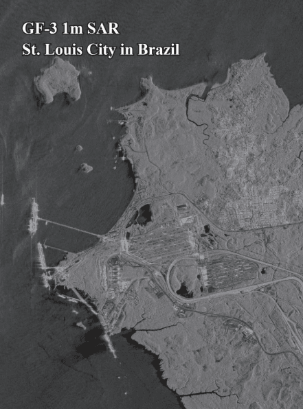
Synthetic Aperture Radar (SAR) Imaging SAR is a powerful tool that uses radar to capture high-resolution imagery, even through cloud cover or in low light conditions. This is particularly useful for industries where visibility is often a challenge, such as:
SAR technology enables us to gather valuable insights, regardless of weather conditions, making it indispensable for critical operations.
Artificial Intelligence (AI) in Satellite Imagery At XRTech Group, we integrate AI into satellite imagery to automate analysis, increase efficiency, and provide deeper insights. With the help of AI, our solutions can:
By combining AI with satellite data, businesses and governments can make smarter, faster decisions with greater accuracy.
Change Detection Our change detection services provide valuable insights into the differences in landscapes over time. With the help of advanced satellite technology, we can monitor:
This service is essential for industries such as agriculture, environmental monitoring, and urban planning, helping to track long-term trends and react to immediate changes.
Agriculture
Energy and Utilities
Urban Planning and Construction
Environment and Climate Monitoring
Disaster Management
Defense and Security
With a fleet of over 60 active satellites and cutting-edge technologies like AI, SAR, and change detection, XRTech Group is at the forefront of the satellite imagery industry. Our products and services are designed to deliver unparalleled insights across multiple industries, enabling businesses to make data-driven decisions that optimize operations, minimize risks, and drive innovation.
Whether you’re looking for high-resolution satellite images, real-time data, or advanced analytics, we have the tools and expertise to meet your needs. Our satellite imagery solutions are not just about gathering data — they’re about transforming that data into actionable insights that drive real-world impact.
Feel free to contact us to explore how we can help your business or industry achieve its goals with satellite imagery solutions.

Growing almonds is a structured agricultural process that moves from orchard planning to nut harvest and post-season care. Farmers must

Rapid Detection and Response to Marine Oil Spills XRTech Group enables governments, coast guards, and energy operators to rapidly detect