By Mustafa Jawaad, General Manager, XRTech Group
Short answer: No. There is no public service, app or website that streams a live satellite view or live video of your house, or of any private address, free or paid. Satellites take still photos as they pass overhead. You can only access the latest available satellite views of your house: a free view in Google Maps or Google Earth that is usually months to a few years old, a free image from the last few days that is too coarse to show the house itself, or a sharp 30 to 50 cm satellite picture of your house with an exact capture date, either from an archive or captured to order through new satellite tasking. For a true live view of your house, the only real options are a drone or a home security camera.
See your home from satellite right now, free: open Google Maps, type your address, then open Layers and choose Satellite. That view is often months or years old. For a newer picture with an exact capture date, search the archive in the XRTech satellite imagery portal, or order new tasking if nothing recent exists. Both are explained in options 5 and 6 below.
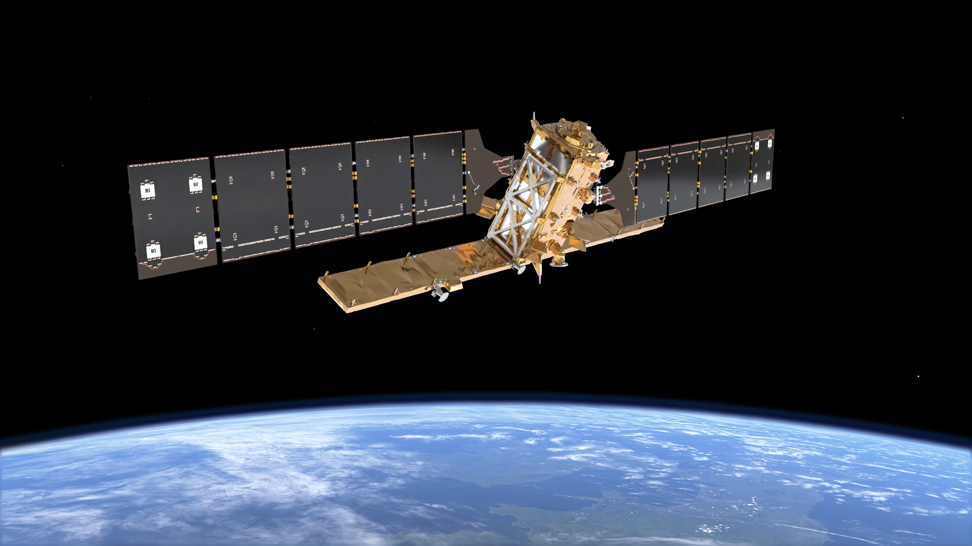
At XRTech Group we supply imagery from a fleet of more than 130 optical and radar satellites, and "can I see my house live?" is one of the questions we hear most from homeowners, overseas property buyers and insurance clients. So this guide skips the theory and covers what you actually need: why live satellite images of your house do not exist, how to check how old your current view is, which free tools show the newest picture, and what a fresh high-resolution image of your address really costs.
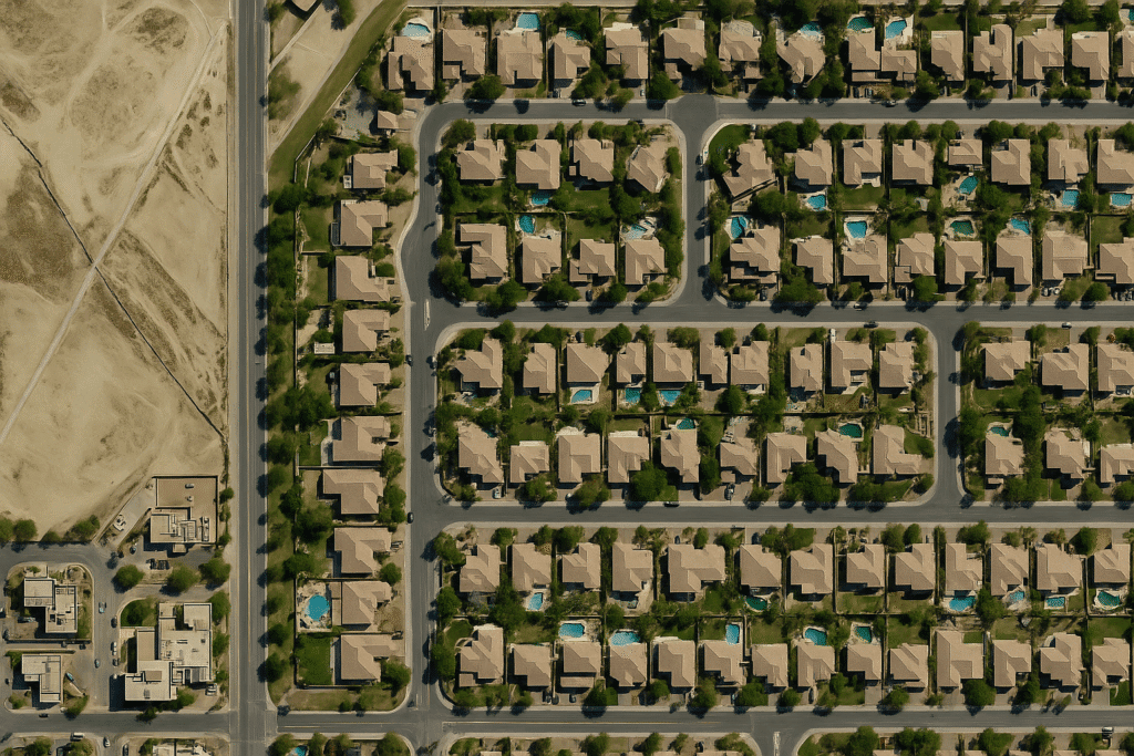
At 30 to 50 cm, a satellite picture of your house shows the roof, pool, driveway and parked cars. However, it is still a photo taken at one moment, not a live feed.
Live Satellite Images of My House: Every Option Compared
Each option below trades freshness against detail. So first decide what you need to see: your actual roof and yard, or just the area around it.
Option
How recent
Can you see your house?
Cost
Google Earth, Google Maps, Apple Maps, Bing Maps
Months to several years old
Yes, often sharp in cities
Free
Esri World Imagery Wayback
Past versions, each dated
Yes, in most towns
Free
Sentinel-2 in Copernicus Browser
2 to 5 days old
No, 10 m pixels show the block, not the house
Free
NASA Worldview, Zoom Earth
Minutes to hours old
No, 250 m to 1 km pixels
Free
Commercial archive image
Days to years old, exact date shown
Yes, at 30 to 80 cm
From USD 5 per km²
New satellite capture (tasking)
Usually within days, weather permitting
Yes, at 30 to 80 cm
From USD 8 per km²
Drone or home camera
Live
Yes, in full detail
Your own device
In short, free tools give you either detail or freshness, never both. A paid image is the only way to get both, and even then it is a recent photo rather than a live view.
What Does a "Live Satellite View" of My House Actually Mean?
People use "live" for four very different things, and most apps blur the line between them:
- Live video: a continuous feed of your house, like a CCTV camera. No public or commercial satellite offers this.
- Near real-time: an image delivered minutes to hours after capture. It exists, but mostly for weather and disasters at coarse resolution, or for clients who pay to task a satellite.
- Recent: an image captured in the last few days or weeks, with a known date. This is the realistic target for your house.
- Basemap: the seamless layer in Google Maps or Apple Maps. It is stitched from many dates and is often one to three years old, and sometimes older in rural areas.
Therefore, when an app or website promises a "live satellite view," check which of these it really means. Almost always, it is a basemap or near real-time weather imagery.
Why You Can't See Your House in Real Time From Space
The limits are physical and commercial, not a secret policy. Here is what stands in the way:
- Satellites that can see a house never stay still. High-resolution satellites orbit roughly 500 to 700 km up at about 7.5 km per second. As a result, each one has your address in view for only a few minutes, usually once a day at most.
- Satellites that do stay still are too far away. Geostationary weather satellites hover over one spot at 35,786 km, about 60 times farther out. Their sharpest pixels cover around 500 m, so your whole neighbourhood fits inside a single pixel.
- Clouds and darkness block the view. Optical cameras need daylight and clear sky, yet roughly two thirds of the planet is under cloud at any moment. Radar satellites see through both, but their images look nothing like a photo.
- Data takes time to reach you. Every image is sent down to a ground station, corrected for terrain and viewing angle, and checked before release. The fastest commercial pipelines take minutes to hours, while free map layers take months.
- Watching one house nonstop would cost a fortune. It would take hundreds of high-resolution satellites overhead in rotation. Operators sell images per square kilometre to governments and businesses instead, and no one runs a live consumer feed.
So the honest answer to "can I see live satellite images of my house in real time?" stays no for the foreseeable future, even as images get sharper and more frequent.
Is Google Earth Live? How Old Is the Satellite View of My House?
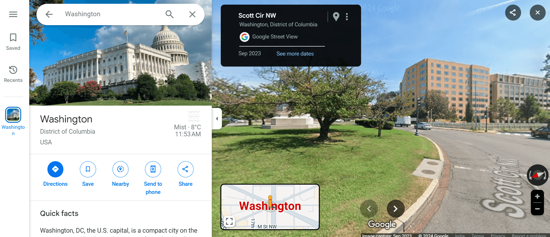
No, Google Earth is not live, and neither is the satellite layer in Google Maps. Both show a mosaic stitched from many images taken on different dates. In addition, the sharpest views of cities usually come from aircraft, not satellites, which is why your street can look clearer than the countryside nearby. Google refreshes busy cities more often than rural areas, publishes no schedule, and does not take update requests for individual homes. For a full walkthrough, see how to see your house on Google Earth.
How to find the date of the image of your house
- Install the free Google Earth Pro desktop app and search your address.
- Zoom in on your house and read the "Imagery Date" in the bar at the bottom of the screen.
- Click the clock icon (Historical Imagery) to step back through older images of the same spot.
If even the newest view is older than you need, a dated commercial image is the next step. For refresh patterns by region, see our guide on how up to date Google Earth is.
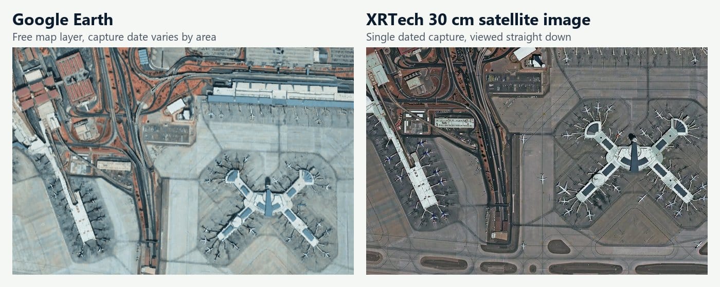
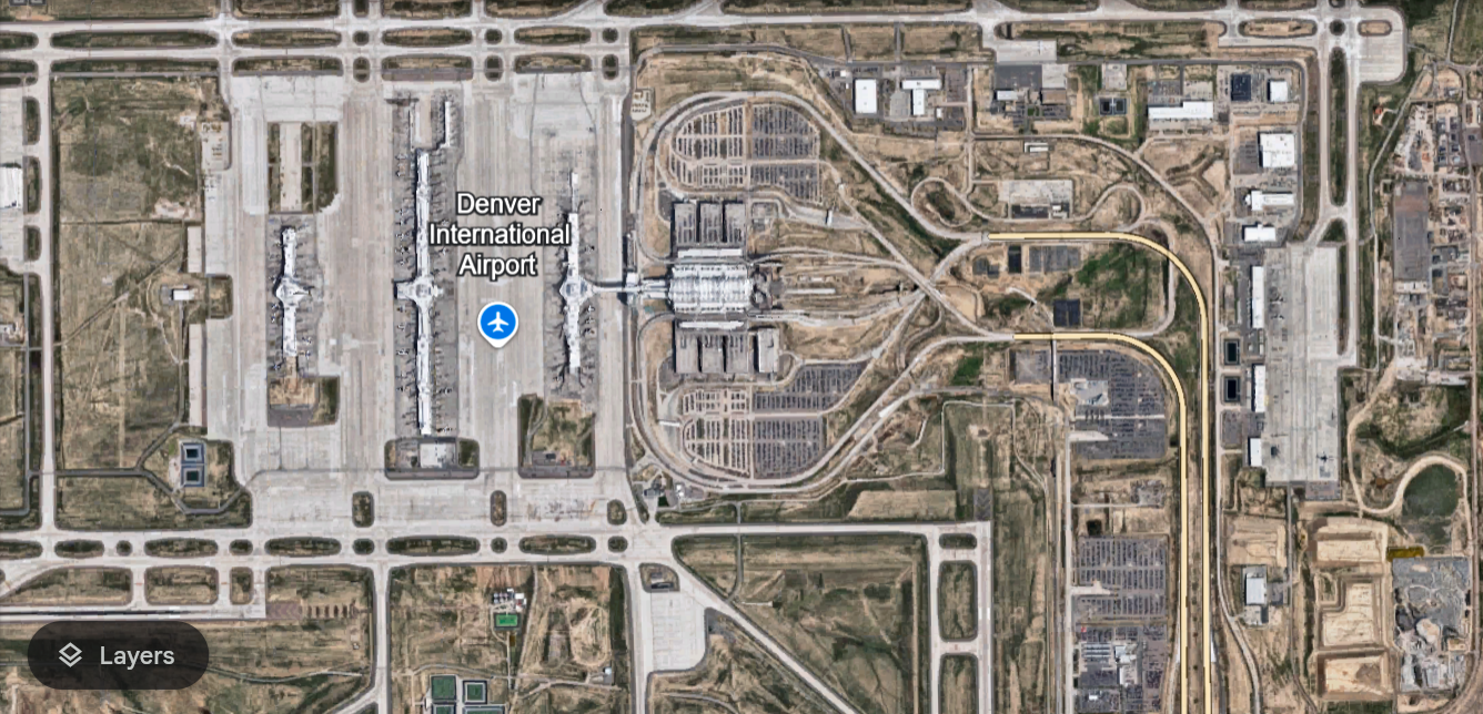
Same terminal at Harry Reid International Airport, Las Vegas. On the right, in an XRTech 30 cm satellite image, aircraft, gate markings and parked cars are crisper, and every pixel comes from one dated capture. Left image: Google Earth.
Google Maps Live View, Street View and Immersive View are not live either
Google Maps Live View is a walking navigation mode that places arrows over your phone camera, so it never shows your house from above. Street View photos are taken by cars and backpack cameras, and each panorama shows its capture month. Immersive View builds a 3D model of a city and simulates weather and time of day, yet the model itself comes from older imagery. In fact, live traffic is the only truly live layer in Google Maps, and it comes from phone location data, not satellites.
How Can I See a Live Satellite Picture of My House in Real Time? The 6 Closest Options
Since a live feed is off the table, the real goal is the newest, sharpest image you can get. Work down this list until one option meets your need.
1. Find the newest free high-resolution view
Open Google Earth Pro, Apple Maps, Bing Maps and Esri World Imagery Wayback side by side, and note the date of each. Wayback is especially useful because it lists every past version of the Esri basemap, so you can see exactly when your house, extension or pool first appeared. It costs nothing and often turns up an image a year newer than the one you saw first. We compare every free source in our guide to free updated satellite imagery of your property.
2. See your area from the last few days with Sentinel-2
The European Sentinel-2 satellites photograph almost all land every two to five days, and the images are free in the Copernicus Browser. Search your address, pick the latest date with low cloud, and you will see your neighbourhood as it looked this week. However, each pixel covers 10 by 10 m, so a typical house is only one or two pixels. It works for checking a flood, a burn scar or a large clearing, not your roof. For more free sources, see our list of the best free satellite imagery sources.
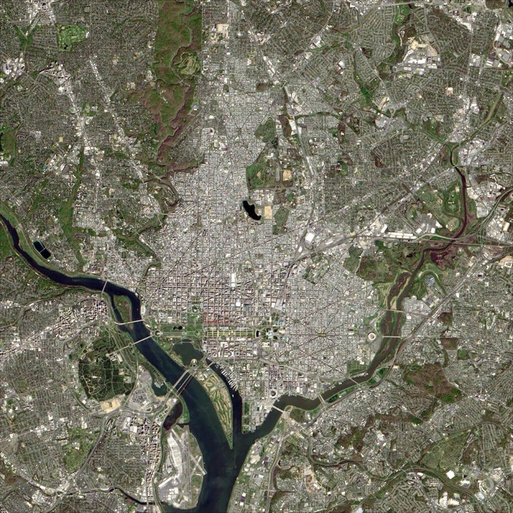
Free satellite data is fresh but coarse. In this 30 m Landsat 9 image of Washington DC, rivers, parks and the street grid stand out, yet no single house is visible. Sentinel-2 at 10 m is three times sharper and still cannot show a home.
3. Watch weather and wildfires in near real time
NASA Worldview shows the whole planet within about three hours of capture, and Zoom Earth plays weather satellite loops refreshed roughly every 10 minutes. These are the closest thing to a live satellite view that anyone can open for free. Even so, the pixels are hundreds of metres wide, so they show the storm over your city, not your house. Our page on live satellite images of Earth in near real time covers more of these tools.
4. Check free aerial photos from your government
Many national mapping agencies publish free aerial photos that are far sharper than free satellite data. In the US, for example, the NAIP programme photographs the lower 48 states at about 60 cm every two to three years, and you can download it through USGS EarthExplorer. Elsewhere, search your national geoportal for "orthophoto" to see whether a similar layer covers your area.
5. Search the archive for a recent image of your house
Commercial satellites photograph cities and suburbs constantly, so an image of your address from the last few weeks or months often already sits in an archive. At 30 to 50 cm you can see the roof, pool, solar panels and cars, and every scene comes with its exact capture date and time. You can search this archive yourself in the XRTech satellite imagery portal by following the steps below, or send us your address and we will check the catalogue for you. For a wider overview, read how to buy high resolution satellite imagery.
6. Order new satellite tasking of your house
If the archive has no recent image, request new tasking in the XRTech portal: set your area and date window, and a satellite captures your address on its next suitable pass. Collection usually happens within a few days, depending on weather and how many other orders target the same area. Moreover, if clouds are the problem, radar satellites can capture the site through cloud and at night, which helps after storms and floods. Learn more in our guide to SAR satellite imagery.
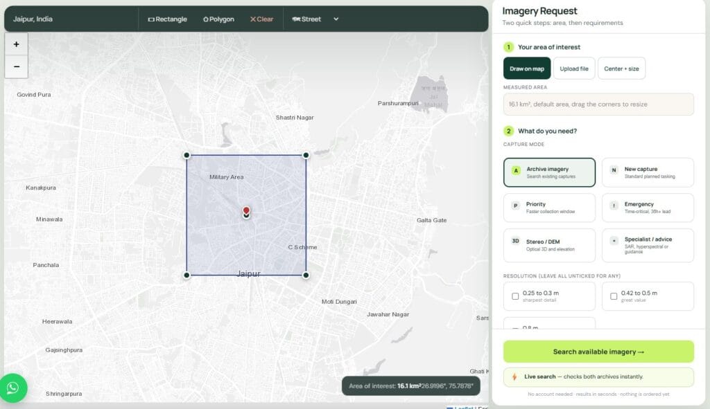
New tasking in the XRTech portal: draw your area of interest on the map, then pick a capture mode such as archive, new tasking, priority, emergency or stereo, and send the request with your date window.
How to Get a Satellite Picture of My House, Step by Step
Ordering an image is simpler than most people expect. Here is the process we walk homeowners and property buyers through:
- Get your coordinates. Right-click your house in Google Maps and copy the latitude and longitude, or use our latitude and longitude converter.
- Open the portal and draw your area. Search the coordinates in the XRTech portal and draw a box around your property. Because orders have a minimum area, the box will also cover the wider neighbourhood.
- Filter the archive. Set your date range, keep cloud cover under 10%, and prefer a low off-nadir angle (under about 20°) so roofs are seen from straight above rather than at a slant.
- Preview before you pay. Check the thumbnail to confirm your house is cloud free and the date is right.
- Choose the format. A colour pan-sharpened JPEG or GeoTIFF suits most homeowners, and GeoTIFF also opens in GIS software with map coordinates.
- Request a new capture if nothing fits. If no recent image shows your house clearly, ask for tasking and set your date window.
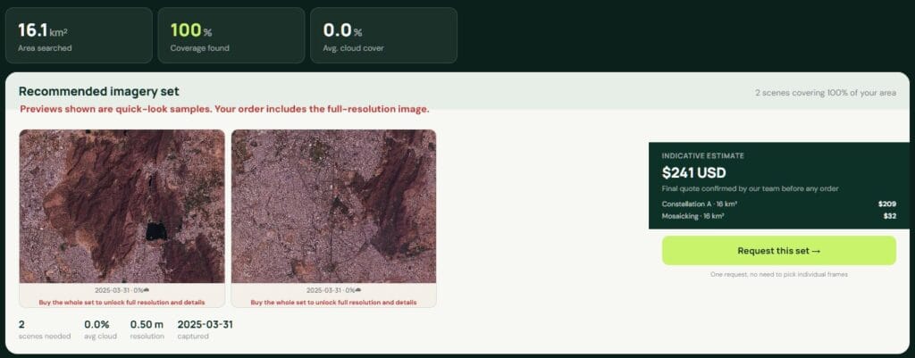
Archive search in the XRTech portal: each matching scene shows a 0.5 m preview, how much of your area it covers, its cloud cover and an instant indicative price, so you can check your house is clear before you order.
What a satellite picture of your house costs
Imagery is priced per square kilometre with a minimum order area, so one house costs the same as its whole neighbourhood. These are XRTech's current list prices:
Resolution
Archive image (older than 90 days)
New capture (tasking)
51 to 80 cm
USD 5 per km², minimum 25 km²
USD 8 per km², minimum 100 km²
31 to 50 cm
USD 13 per km², minimum 25 km²
USD 20 per km², minimum 100 km²
30 cm
USD 20 per km², minimum 25 km²
USD 30 per km², minimum 100 km²
In practice, a 30 cm archive image of your house starts at about USD 500 (25 km² at USD 20), while a brand-new 30 cm capture starts at about USD 3,000. Images from the last 90 days are quoted separately. If you only want to see your area once, a free source above may be enough. On the other hand, if you need a dated record for an insurance claim, a dispute or a purchase, a paid image is evidence you can rely on.
Want to know if a recent image of your house exists?
Send us your address or coordinates. We check the archives, tell you the newest capture date and resolution, and quote before you pay anything.
Ask Us on WhatsAppCan Satellites See My House? What Each Resolution Shows
Yes, modern commercial satellites can clearly see your house. What you can make out depends on resolution, meaning the ground distance that one pixel covers:
Resolution
What you see at your house
Typical source
250 m to 1 km
Your city and the weather over it
NASA Worldview, weather satellites
10 to 30 m
Your neighbourhood and large fields, but no single houses
Sentinel-2, Landsat (free)
3 m
Your house as a small blob, plus main roads
Daily mapping constellations (paid)
80 cm to 1 m
House outline, roof shape, driveway
GF-2 and similar satellites
50 cm
Pool, garden, individual cars
Most commercial satellites
30 cm
Roof details, solar panels, fences, car type
WorldView Legion, SuperView Neo, Pléiades Neo
15 cm and finer
Road markings and small garden features
HD processed satellite products, aircraft
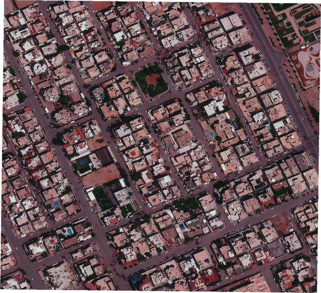
At 50 cm, every building, street and plot in this Riyadh neighbourhood is easy to pick out, including individual houses.

A 15 cm HD satellite image of Abu Dhabi. At this level, the satellite view of your house comes close to a low-altitude aerial photo.
What satellites cannot see
Even the sharpest satellite cannot recognise a face, read a number plate, or see inside or under a roof. A person standing outside covers just one or two pixels at 30 cm. Thermal satellites do exist, but their pixels are around 70 m or wider, so they cannot show heat from a single room. And every satellite image, however sharp, captures a single moment in time.
How Do I Get an Aerial or Sky View of My House?
An aerial view comes from an aircraft or a drone rather than a satellite, and it is usually sharper because the camera is only a few hundred metres up. You have four routes:
- Google Earth in 3D: in many cities you can tilt the view and see your house as a 3D model built from aerial photos. It is free, but often a year or more old.
- Government orthophotos: the free national aerial layers described in option 4 above.
- Aerial survey subscriptions: specialist firms fly major metro areas in the US, Australia, Canada and parts of Europe several times a year at around 5 to 10 cm. They suit roofers, insurers and surveyors more than one-off buyers.
- A drone: the only way to get a live aerial view of your house on demand, covered below.
If your property lies outside covered cities, or you need a dated image of land in another country, satellite imagery is usually the only aerial view available. When precise measurements matter, our land survey services combine satellite data with ground control.

Can I See a Live View of My House in Real Time? Use a Camera or a Drone
So if your real question is how to see my house in real time, or how to get a live view of my house right now, skip satellites entirely. These tools actually deliver it:
- Outdoor security cameras and video doorbells: they stream live video to your phone from anywhere, record events, and cost far less than one high-resolution satellite image.
- A consumer drone: it streams a live aerial view to your phone or controller, typically from up to about 120 m. Most countries require drone registration and restrict flights near airports, over people and in some city zones, so check your aviation authority's rules first.
- Someone on site with a phone: for owners living abroad, a scheduled video call with a neighbour or property manager is often the fastest check of all.
Then, for the bigger picture, such as construction progress on a plot abroad or damage across the area after a storm, pair that live view with a dated satellite image every few weeks.
Who Can See Satellite Images of My House? Privacy Explained
In most countries, imaging land from space is legal, and anyone can buy a commercial satellite image of any address. Licensing rules control how imagery is distributed, and a few countries restrict sharp images of sensitive sites.
You can, however, limit street-level photos. Google lets you request a permanent blur of your house in Street View through "Report a problem" on the panorama, as explained in its Street View privacy policy, and Apple accepts similar requests for Look Around. Satellite and aerial map layers, by contrast, do not offer this for individual homes.
Near Real-Time Satellite Imagery: What Exists Today and What Comes Next
Near real-time imagery is already routine for weather, disasters and paying clients. Here is what is available now, and where it is going.
Available today
- Weather satellites such as GOES, Himawari and Meteosat scan whole continents every 10 to 15 minutes and selected areas as often as every minute, at 0.5 to 2 km per pixel.
- Daily mapping constellations photograph nearly all land every day at about 3 m.
- Very high resolution satellites at 30 cm can revisit the same city several times a day when working as a fleet, and urgent orders can be delivered within hours of capture.
- Radar constellations image through cloud and at night, which makes them the fastest option after floods and storms.
- Video satellites already record short clips of moving cars and ships from orbit, but only during brief passes over chosen targets.
What comes next
Over the coming years, larger constellations, satellites in very low orbits aiming for around 10 cm detail, and onboard AI that flags changes before images even reach the ground will cut the wait from hours to minutes. Still, a continuous live view of your house would need a satellite hovering overhead at all times, close enough to resolve a roof. Physics, cost and licensing make that unlikely for the public, so recent, dated imagery on demand is where the market is heading. To see how often one spot can be photographed, read our explainer on satellite revisit rates, or compare the types of satellites in Earth's orbits.
When Is a Recent Satellite Image of Your House Worth Paying For?
For curiosity, the free views above are enough. A paid, dated image earns its cost when you need proof or a decision:
- Insurance claims: before and after images with capture dates support storm, flood and fire claims. See satellite imagery for insurance.
- Buying property or land remotely: confirm the plot, access roads and nearby construction before you transfer money. See satellite imagery for real estate.
- Boundary and encroachment disputes: a dated archive shows when a fence, wall or extension first appeared.
- Building a house abroad: track construction progress every few weeks without flying out. See satellite imagery for construction monitoring.
- Solar and roof planning: measure roof area and nearby shading from a 30 cm image before you request installer quotes.
Frequently Asked Questions About a Satellite View of My House
Can I see a satellite view of my house in real time for free?
No. Free tools show either sharp images that are months or years old (Google Earth, Apple Maps, Bing Maps) or fresh images from the last few days at 10 m or coarser (Sentinel-2, NASA Worldview), which cannot show a single house. A live view needs your own camera or drone.
How often does Google Earth update the image of my house?
There is no fixed schedule. Large cities are often refreshed every one to two years, while rural areas can wait three years or longer. Check the Imagery Date in Google Earth Pro to see exactly how old your view is.
Why is my house blurry or outdated on Google Maps?
Google Maps stitches images from many dates and sources. Cities usually get sharp aerial photos, while rural or less visited areas may use older, softer satellite images. Google does not accept update requests for individual homes.
Can I request a new satellite image of my house?
Not from Google, but you can order a new capture from a commercial provider. You choose the area and date window, and the satellite collects it on its next clear pass, usually within days. Minimum order areas apply.
How much does a satellite picture of my house cost?
At XRTech, archive imagery costs USD 5 per km² at 51 to 80 cm and USD 20 per km² at 30 cm, with a 25 km² minimum. New captures start at USD 8 per km² with a 100 km² minimum. So a 30 cm archive image covering your house starts at about USD 500.
Can satellites see people or inside my house?
No. A person is only one or two pixels in the sharpest commercial imagery, so faces and number plates cannot be recognised. Satellites cannot see through roofs, and optical satellites cannot see through clouds.
Can a satellite see my house at night?
Optical satellites cannot, because they rely on sunlight. Radar satellites can image your area at night and through cloud, but the result looks like a grey texture map rather than a photo. Night-light satellites show city lights only at around 750 m per pixel.
Is there any live satellite feed of Earth?
Yes, but not of your house. NASA streams live video from the International Space Station, and weather satellites send new full-disk images every 10 to 15 minutes. Neither can be pointed at a single address or resolve a house.
What is the most recent free satellite image of my house?
Usually a Sentinel-2 image from the last two to five days, available free in the Copernicus Browser. It shows your area at 10 m, so it confirms large changes such as flooding, but not details of the house itself.
Is there an app that shows a live satellite view of my house?
No. There is no app or website that streams a live satellite view of your house. Apps sold as live satellite maps show the same stored imagery as Google Maps, or live weather and satellite tracking data, not your home. The closest you can get is the latest dated image in an archive such as the XRTech portal, or a new capture ordered through satellite tasking.
Is it legal for someone to look at satellite images of my house?
In most countries, yes. Commercial imagery is licensed and legal to buy, and at today's resolutions it cannot identify people. Street View is different: you can ask Google to blur your house there permanently.
Get a Recent Satellite Picture of Your House
Search archive imagery for your address, see every capture date and resolution before you order, or request a new capture. Prefer help? Message your coordinates to our team on WhatsApp at +971 58 885 3151, and we reply within 24 hours with the newest image available and a quote.
Search Imagery for My AddressSources
- ESA: Sentinel-2 mission overview
- Copernicus Data Space Ecosystem: Copernicus Browser
- NASA Earthdata: Worldview
- NOAA: GOES-R geostationary weather satellites
- USGS: EarthExplorer (Landsat and NAIP)
- Esri: World Imagery Wayback
- Google: Street View privacy and blurring
- XRTech Group: What is satellite imagery?

Mustafa Jawaad
General Manager, XRTech Group
Mustafa helps governments and critical industries get satellite and UAV data in days rather than weeks, from archive search and new satellite tasking to processed maps, so teams can plan infrastructure faster and with less risk. Connect on LinkedIn.