Benefits of Satellite Oil and Gas Pipeline Monitoring
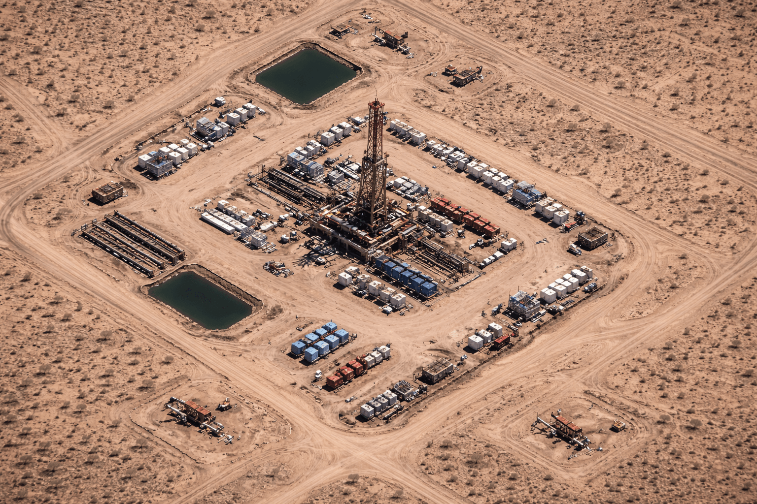
In the modern industrial era, the energy sector faces the dual challenge of maintaining vast and often inaccessible pipeline networks while meeting increasingly strict safety and environmental regulations. Traditional oil and gas pipeline inspection methods based on manual patrols, helicopter surveys, and fixed ground sensors are slow, costly, and highly dependent on human availability and weather conditions. These approaches also expose workers to dangerous environments and often fail to provide continuous visibility along long pipeline corridors.
XRTech Group, through its strategic partnership with China Siwei, has introduced a digital transformation of pipeline monitoring by deploying a constellation of more than 130 high-resolution satellites. This space-based monitoring ecosystem enables continuous observation of pipeline routes across deserts, forests, mountains, and offshore zones. By replacing manual inspection with satellite intelligence, XRTech ensures higher operational reliability, stronger environmental protection, and measurable economic benefits for oil and gas operators.
This analysis explains the technical and operational advantages of satellite-based pipeline monitoring, from millimeter-scale deformation detection to strategic energy intelligence.
1. Enhanced Structural Integrity and Safety via InSAR
The most important advantage of satellite pipeline monitoring is its ability to identify structural risks before they result in leaks or ruptures. Ground movement caused by subsidence, landslides, earthquakes, and thawing permafrost places mechanical stress on pipeline welds and joints.
XRTech Group uses Interferometric Synthetic Aperture Radar (InSAR) to detect surface displacement as small as 1 to 2 millimeters. This precision allows engineers to observe gradual deformation trends that are invisible to conventional inspections. InSAR monitoring makes it possible to identify unstable terrain, shifting slopes, and early warning signs of mechanical stress long before damage occurs.
Because SAR is an active radar sensor, it does not rely on sunlight and is unaffected by clouds, fog, smoke, or darkness. This allows continuous monitoring of pipelines in tropical rainforests, coastal zones, and polar regions where optical imaging is unreliable. Pipelines remain visible and measurable at all times, ensuring persistent surveillance regardless of weather or season.
2. Drastic Operational Cost and Time Savings
Replacing manual inspections with satellite monitoring produces significant reductions in operational expenditure. Pipeline corridors often extend for thousands of kilometers, making physical patrols expensive and difficult to manage.
Satellite monitoring provides complete corridor visibility from a central operations center. This reduces the need for large field teams to travel through hazardous terrain and lowers exposure to extreme temperatures, wildlife, and unstable ground. Helicopter surveys and repeated site visits become unnecessary for routine monitoring.
XRTech’s Siwei Earth cloud platform processes up to 50 terabytes of satellite data per day and provides a response time of approximately 1.5 hours. For urgent cases, imagery can be delivered in as little as one hour. Traditional aerial surveys require long scheduling windows and may take weeks to produce usable results.
From a scalability perspective, a single satellite pass can capture hundreds of square kilometers in one acquisition. Medium-resolution wide-area monitoring can be performed at costs as low as 1 to 5 dollars per square kilometer, enabling continuous observation of entire pipeline networks at a fraction of the cost of manual inspection programs.
3. Environmental Stewardship and Regulatory Compliance
Oil and gas pipeline operators face intense regulatory scrutiny regarding emissions, spills, and land disturbance. Satellite data provides objective, verifiable measurements that support environmental compliance and ESG reporting.
Advanced hyperspectral sensors, such as those onboard the GF-5B satellite, analyze hundreds of spectral bands to identify the chemical fingerprints of leaking gases, including methane and carbon dioxide. These spectral patterns allow precise localization of invisible gas leaks that cannot be detected by visual inspection.
In spill scenarios, SAR satellites such as GF-3 detect oil slicks on water regardless of weather or lighting conditions. When combined with ocean current and wind models, XRTech can predict the movement of a spill and identify areas at risk within hours, enabling faster containment and response.
Vegetation monitoring using high-resolution multispectral imagery reveals plant stress along pipeline rights-of-way. Changes in vegetation health often serve as the earliest indicator of underground leakage or soil contamination. Satellite imagery also ensures that pipeline construction and maintenance activities do not encroach into protected ecological zones.
4. Infrastructure Construction and Change Detection
Pipeline construction involves complex engineering decisions that must balance cost, terrain, and environmental impact. Satellite imagery provides continuous oversight throughout the construction lifecycle.
XRTech generates Digital Elevation Models and Digital Orthophoto Maps to create realistic three-dimensional terrain visualizations. These models support route optimization, slope analysis, and cut-and-fill calculations, reducing material costs and minimizing environmental disturbance.
AI-based change detection compares satellite images from different acquisition dates to automatically identify construction progress. Foundation work, trenching, and pipe laying can be verified remotely, ensuring that projects remain aligned with schedules.
Pipelines are also threatened by unauthorized construction and third-party activities such as illegal mining or farming. Frequent satellite revisits, including daily coverage in some regions, allow early detection of encroachments and reduce the risk of accidental pipeline strikes.
5. Strategic Intelligence and Economic Insights
Satellite monitoring of pipelines provides information beyond safety and engineering. It also delivers strategic intelligence related to energy markets and supply chains.
Satellites can measure volume changes in floating-roof oil storage tanks by analyzing shadow geometry. Tracking these changes across refineries and ports enables monitoring of global crude oil inventories.
Pipeline throughput monitoring and tanker movement observation provide insights into production rates and export flows. Governments and commercial operators use this data to support strategic planning and energy trading decisions.
6. Crisis Management and Disaster Resilience
During natural disasters, ground access to pipelines may be blocked or unsafe. Satellite imagery provides immediate situational awareness when physical inspection is impossible.
After earthquakes, floods, or sandstorms, XRTech can deliver high-resolution imagery and waterline mapping within 24 hours. This allows operators to assess damage, identify vulnerable sections of the pipeline, and plan emergency interventions.
Multispectral and thermal imagery also supports fire detection. AI-driven early warning systems identify abnormal heat signatures and provide near real-time alerts for wildfires or facility blazes.
7. The XRTech Technical Advantage: Sensors and Fleet
XRTech Group’s monitoring capabilities are built on a specialized satellite constellation designed for infrastructure observation. SuperView Neo-1 provides 30-centimeter optical resolution, allowing identification of vehicles, construction activity, and small encroachments. The SAR constellation offers all-weather radar imaging at approximately 1-meter resolution, ensuring deformation monitoring in cloud-covered regions.
Revisit rates of up to 25 times per day enable high-frequency change detection for sensitive pipeline segments. Hyperspectral sensors such as GF-5B provide 330 spectral bands for chemical fingerprinting of gas leaks and mineral anomalies. As a non-US satellite data provider, XRTech avoids export license restrictions, ensuring faster data delivery for international clients.
8. Integrated Synergy: Satellites, Drones, and AI
XRTech Group delivers monitoring as a multi-tier system rather than isolated data products. The satellite layer provides wide-area surveillance and historical analysis using archives dating back to 1999. The drone layer enables targeted inspections of tanks, flare stacks, and pressure vessels when anomalies are detected from space.
AI analytics form the core of this ecosystem by automatically extracting pipeline corridors, detecting land-use changes, and identifying risk zones. Large volumes of satellite data are transformed into actionable GIS layers and engineering-ready reports rather than raw imagery.
Conclusion: A Future of Precision and Freedom
Satellite oil and gas pipeline monitoring offers a safer, faster, and more comprehensive alternative to manual inspection. By detecting millimeter-scale deformation before failure, identifying leaks through hyperspectral analysis, and delivering disaster assessments within hours, XRTech Group provides operators with predictive control over critical energy assets.
Whether monitoring long desert pipelines, offshore export routes, or environmentally sensitive corridors, XRTech delivers the precision, speed, and operational freedom required for modern energy infrastructure management.
Blog Summary
Satellite oil and gas pipeline monitoring replaces manual patrols with continuous space-based observation across long and remote pipeline routes.
InSAR deformation monitoring detects ground movement as small as 1–2 mm, helping prevent pipeline stress, leaks, and structural failure.
SAR all-weather imaging enables pipeline surveillance through clouds, smoke, and darkness in deserts, rainforests, and offshore regions.
Hyperspectral satellite sensors identify methane and CO₂ leaks by detecting chemical spectral signatures invisible to the human eye.
3D terrain models using DEM and DOM support safer pipeline route planning, construction monitoring, and encroachment detection.
Satellite change detection with AI tracks construction progress and unauthorized activity near pipeline corridors in near real time.
Rapid disaster mapping from satellites provides flood, fire, and earthquake damage assessments within 24 hours for emergency response.
XRTech Group’s satellite pipeline solutions reduce inspection costs, improve regulatory compliance, and deliver global energy intelligence.

