The Future of Geospatial Intelligence: Satellite Imagery and 5G Drone Solutions
XRTech Group delivers high-impact, scalable solutions through cutting-edge satellite imagery, advanced AI modeling, and pioneering 5G-connected drone technology. We empower businesses and governments globally to make smarter, faster, and safer decisions.
Who We Are & What We Do
XRTech Group is a pioneer in satellite imagery and 5G-connected drone solutions since 2019. We are a global distributor for China Siwei Surveying and Mapping Technology Co., Ltd (China Siwei), bringing over 8 years of expertise in advanced drone deployment solutions. We specialize in satellite data, drone products, industrial products, and supply chain management.
Our Core Focus – Delivering Actionable Intelligence
Our mission is built on continuous development, a customer-centric approach, and creating impactful, life-saving solutions. We focus on three core solution pillars:
Satellite Imagery Solutions
Providing cutting-edge satellite imagery data, including Very High Resolution (VHR), SAR, and Hyperspectral data.
AI Modelling & Platform Development
Extending services to advanced AI modeling and platform development suited for diverse business use cases.
5G Drone-in-a-box Solutions
Offering specially designed systems for security and armed forces, ensuring secure data residency and real-time responsiveness.

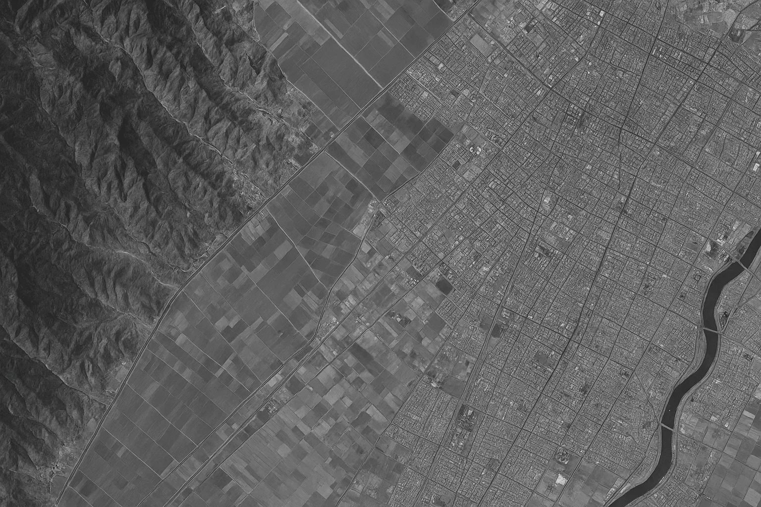
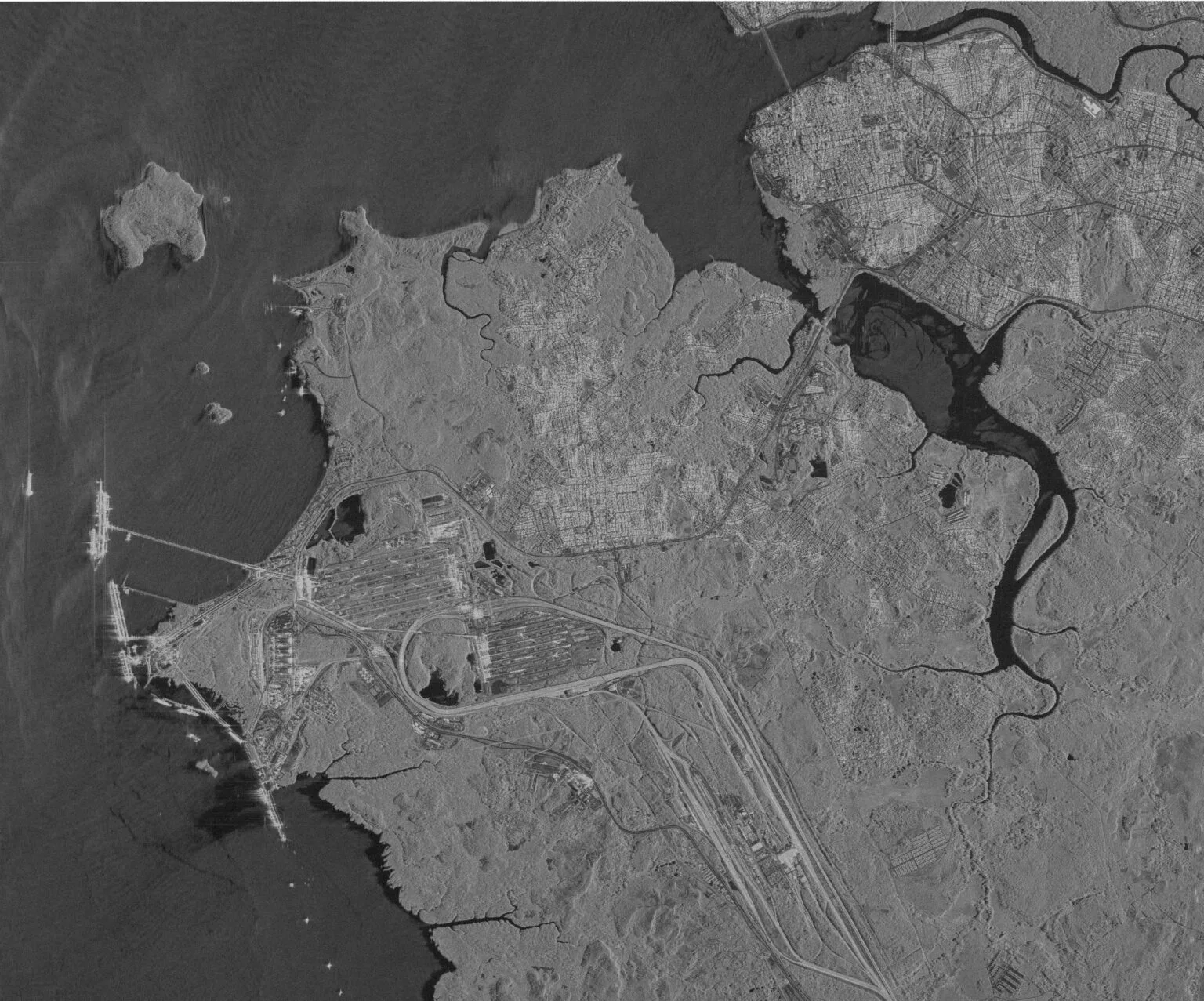
Satellite Geospatial Solutions
Unlock the full potential of Earth Observation (EO) with high-resolution satellite remote sensing and analysis. We provide access to a powerful constellation of over 130+ satellites, ensuring coverage across any terrain or condition.
Types of Satellite Imagery
Optical Imagery
Captures Panchromatic (black-and-white for detail), Multispectral (multiple wavelengths for land use), and Infrared (thermal data for heat).

Hyperspectral Imagery
Analyzes hundreds of narrow light bands (400–2500 nm). Invaluable for detailed material composition analysis, aiding environmental studies and mining exploration.
Radar Imagery (SAR)
Synthetic Aperture Radar provides all-weather, day-and-night imaging capabilities. Uses L, C, and X bands for precision in urban development and defense.
Value-Added Products

Digital Elevation Models (DEM/DSM/DTM)
Essential 3D bare-earth models of terrain and surface features. Delivered with 2–10 meter spacing and high accuracy (±3m vertical RMSE) for engineering, hydrology, and land development.
Learn More
Digital Orthophoto Maps (DOM)
Geometrically corrected imagery providing pixel-perfect clarity (up to 50 cm resolution) for accurate base mapping of roads and buildings.
Learn More
3D Geographical Scenes & City Models
High-resolution 3D models of urban environments, supporting Digital Twin implementation for urban planning and scenario modeling.
Learn MoreSatellite Applications Across Industries

Urban Management
Smart City Development with 3D models, InSAR monitoring for infrastructure deformation, and urban growth tracking.
Learn More
Mining & Natural Resources
Exploration and Resource Management, detecting mineral deposits with Hyperspectral imagery, and monitoring infrastructure safety.
Learn More
Disaster Management
Rapid-response EO imagery for flood, fire, and earthquake monitoring. Data delivered often within 24 hours during crises.
Learn More
Agriculture
Precision Agriculture with crop health monitoring, yield estimation, and soil moisture monitoring.
Learn More
Military & Intelligence
Geospatial Intelligence (GEOINT), border surveillance (using SAR and optical fusion), and strategic infrastructure monitoring.
Learn More
Oil & Gas / Energy
Pipeline integrity monitoring using InSAR, crude oil inventory monitoring, and facility surveillance.
Learn MoreDrone and Autonomous Solutions
As an authorized DJI and Autel UAV drone company, XRTech Group offers leading-edge drone hardware integrated with autonomous systems for safety, speed, and efficiency.
Brands, Drone Types & Key Models

DJI Enterprise Series
DJI Matrice 350 RTK, DJI Matrice 30 Series, and DJI Mavic 3 Enterprise Series (including the Mavic 3 Thermal). These are ideal for tough industrial inspections and emergency services.

Autel Robotics Series
Autel EVO Max 4T, Autel ALPHA, and Autel EVO II Dual 640T V3. These often feature high-resolution 640x512 thermal cameras.
Autonomous Drone-in-a-Box Solutions

Docks
DJI Dock 2, Autel EVO Nest, and Autel Dragonfish Nest. These systems serve as base stations for automated takeoff, landing, charging, and data transfer without manual input.
Learn More
5G Ecosystem Products
We offer XRT Cloud Box for DJI and 5G Automated Battery Swapping Stations for DJI Matrice 350/300 RTK and M30/30T RTK. We were the first to introduce 5G modules for DJI drone systems.
Learn More
Thermal & Night Vision
We provide advanced UAV AI Night Vision Solutions (models S2 PLUS, S2PRO, S3, S8), providing full color down to 0.0001 Lux illumination. Thermal drones detect heat through fog, smoke, or darkness.
Learn MoreDrone Applications
Security & Surveillance
Perimeter monitoring, crowd control, and event security with real-time video feeds.
Learn More
Infrastructure Inspection
Power lines, pipelines, and cell towers inspection with thermal imaging.
Learn More
Search & Rescue
Rapid deployment for missing persons in difficult terrain with thermal cameras.
Learn More
Precision Mapping
High-accuracy topographic surveys and 3D modeling with RTK positioning.
Learn More
Agricultural Monitoring
Crop health analysis, irrigation planning, and yield estimation with multispectral sensors.
Learn More


Last-Mile Delivery
Automated package delivery in urban and remote areas with payload up to 5kg.
Learn MoreWhy Choose XRTech Group?
Choose XRTech Group for Precision, Speed, and Freedom in your geospatial operations.
Unmatched Scale & Speed
Access to 130+ global satellites for comprehensive coverage. We deliver EO imagery in under 7 days (sometimes as fast as 4 days) and custom DEMs in under 21 days.
Pioneering 5G Technology
We were the first to introduce 5G modules for DJI drone systems, enabling seamless, scalable deployments and real-time responsiveness.
Global Access, No Delays
As a non-U.S. provider of high-resolution satellite imagery, we bypass export control bottlenecks, ensuring faster data delivery and fewer restrictions for international projects.
Engineering-Grade Accuracy
Our high accuracy satellite imagery outputs meet demanding standards (CE90 and RMSE specs). Our DEMs boast ±3m vertical RMSE.
Secure Autonomous Operations
Our drone-in-a-box solutions offer advanced parachute systems for added safety, and guarantee on-premise data residency for security and armed forces applications.
Flexible & Risk-Free Investment
We offer flexible, project-wide licensing, highly competitive pricing (starting at $1/km² for some options).
Global Impact & Success Stories
Real-Time Insight. Actionable Results. See the speed and clarity of our Earth Observation data in critical situations.
Derna, Libya Flood Mapping
In Derna, Libya, just 24 hours after devastating floods, our high-resolution imagery and EO data were delivered—while others were still preparing quotes. We provided clear waterline mapping and enabled evacuation zone modeling, turning data into immediate action.
Read Case Study
Client Testimonials
"We received high-resolution satellite imagery 2x faster than Maxar or Airbus vendors."
— Infrastructure Planner, Asia
"Others said 3 weeks. XRTech delivered high resolution satellite imagery in 4 days — as was needed."
— National Mapping Lead, Africa
"Clear licensing, human support, and fast turnaround — finally."
— NGO Partner, MENA
Ready to Transform Your Operations?
Join businesses and governments worldwide who trust XRTech Group for precision geospatial intelligence and autonomous drone solutions.