Digital Orthophoto Maps (DOM) by XRTech Group
Unmatched Clarity and Precision for Geospatial Mapping. Leveraging high-resolution satellite imagery to deliver geometrically corrected, pixel-perfect aerial maps for your most demanding projects.
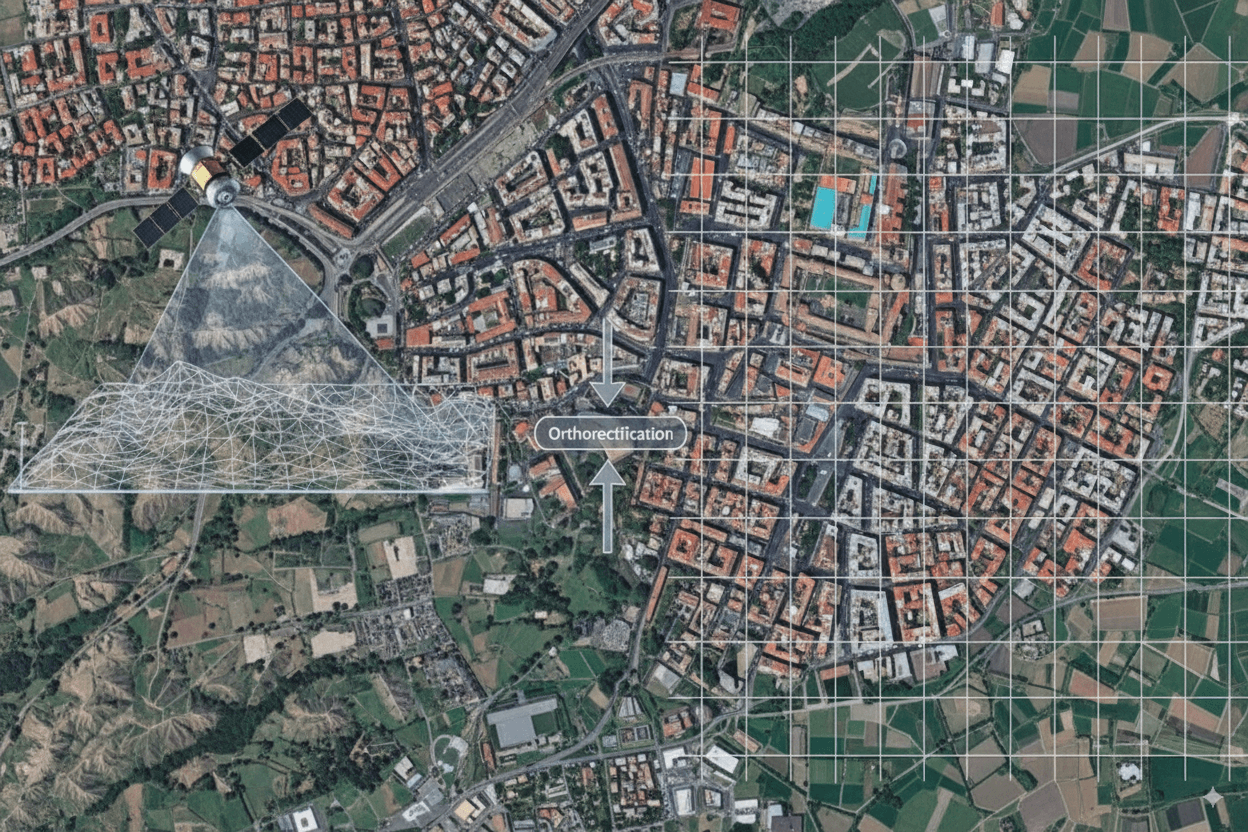
I. What is a Digital Orthophoto Map (DOM)?
A Digital Orthophoto Map (DOM) is a Value-Added Product that XRTech Group derives from our satellite imagery. Unlike standard satellite images which contain distortions due to terrain and camera angles, a DOM is a georeferenced image that has been meticulously corrected for these effects.
The key process is Orthorectification, where the imagery is corrected using a precise Digital Elevation Model (DEM). This ensures the resulting image is perfectly aligned to the Earth and functions as a true-to-scale map, providing a reliable foundation for projects in urban planning, land surveying, and infrastructure development worldwide.
II. Why DOMs are Essential: Core Benefits
DOMs are vital geospatial tools because they offer the reliability and clarity needed for professional engineering and planning.
Pixel-Perfect Clarity
DOMs provide unparalleled clarity for mapping the world, allowing for confident identification of features.
Accurate Measurements
Because DOMs are true-to-scale, they allow for precise distance, area, and location measurements directly on the image.
Detailed Feature Extraction
Enable the extraction of crucial details like buildings, roads, and other objects essential for urban planning projects.
GIS Integration
DOMs are ideal for creating accurate base maps for various GIS applications, serving as a reliable foundational layer.
Engineering-Grade Foundation
Offer a reliable foundation for decision-makers to understand land features with unmatched accuracy for engineering designs.
Long-Term Monitoring
The consistent accuracy makes DOMs invaluable for tracking changes in landscapes and evaluating urban growth or environmental shifts.
III. Technical Specifications of XRTech Group’s DOM Services
| Technical Aspect | Details |
|---|---|
| Spatial Resolution | 50 cm resolution. |
| Mapping Precision | 8m CE90 precision. |
| Input Data Resolution | Derived from high-resolution satellite imagery (down to 0.3m/px). |
| Correction Foundation | Corrected using Digital Elevation Models (DEMs) with an accuracy of ±3m vertical RMSE. |
| Processing | Created using advanced software tools supporting orthorectification, fusion, blending, color correction, and mosaicking. |
| Delivery Formats | Delivered in standard industry formats: GeoTIFF, IMG, SHP, and DWG, ensuring seamless integration. |
| Delivery Methods | Available via secure cloud delivery or physical HDD. |
IV. Applications Powered by DOM Services
DOMs are integrated into several of XRTech Group's core Satellite Data Applications across various industries.
1. Urban Planning and Infrastructure
DOMs are indispensable for providing accurate urban planning foundations, enabling planners to optimize expansion and create efficient layouts. They are used for extracting details like buildings and roads and are crucial input data for creating 3D City Models.
2. Land Surveying and Engineering
A cornerstone for mapping and providing accurate base maps for GIS applications. The DOM service ensures geometrically corrected imagery for precise analysis in engineering and surveying projects. They are vital for long-term monitoring of construction engineering projects.
3. Marine and Coastal Engineering
DOMs are essential for mapping details like port infrastructure, coastal developments, and shallow water features. This supports marine planning and coastal engineering projects with high accuracy.
4. Mining and Natural Resources
DOMs are essential tools used in 3D geological mapping of mining land. They help enhance exploration and operational efficiency by providing clear visual representations of mining areas.
5. Insurance and Risk Management
DOMs are valuable for long-term monitoring of landscapes and property conditions, assisting in property valuation and detailed damage assessment for insurance and risk management.
V. Why Choose XRTech Group for DOM Services
When precision and speed matter, XRTech Group provides a superior platform for acquiring Digital Orthophoto Maps.
Unmatched Accuracy
Our DOMs are derived from sub-meter imagery and corrected using engineering-grade DEMs (±3m vertical RMSE), guaranteeing the highest detail.
Industry-Leading Speed
We provide fast turnarounds, delivering raw imagery in under 7 days and the foundational DEMs in under 21 days.
Global Data Access
Access to a vast constellation of 130+ satellites ensures complete global coverage for any project location.
No Export License Delays
As a non-U.S. provider, we avoid export control bottlenecks, delivering your data up to 2x faster than competitors.
Seamless Integration
Data is delivered in industry-standard formats (GeoTIFF, SHP, DWG) for easy integration into your existing GIS and CAD workflows.
Flexible & Trusted Partnership
We offer simple, project-wide licensing and are trusted by governments, NGOs, and enterprises globally.
Get Your Project Started with Precision DOMs
Empower your planning, surveying, and engineering projects with the unmatched accuracy of XRTech Group's Digital Orthophoto Maps. Contact our experts to discuss your requirements and receive a custom quote.