
Tailings Dam Monitoring with InSAR & AI
Tailings Dam Monitoring: How Advanced Satellite Intelligence Is Transforming Tailings Dam Safety Tailings dams are among the most critical—and high-risk—structures
In modern Earth observation, satellite imagery resolution plays a central role in how we understand the world from above. From tracking vehicles on highways to monitoring climate driven environmental changes, resolution determines what we can see, how clearly we see it, and how confidently we can act on that information. At XRTech Group, satellite imagery resolution is not just a technical term. It is the foundation that supports accurate mapping, reliable analysis, and smarter decision making across industries.
As demand for high resolution satellite imagery grows across infrastructure planning, agriculture, mining, defense, and disaster response, understanding resolution has become essential. Many organizations invest in satellite data without fully understanding what level of resolution they truly need. This often leads to unnecessary costs or inaccurate results. This guide explains satellite imagery resolution in clear and simple terms and shows how XRTech Group helps clients choose the right resolution for real world needs.
Satellite imagery resolution refers to the level of detail a satellite sensor can capture on the Earth’s surface. In simple words, it describes how much ground area is represented by a single pixel in an image. A pixel is the smallest unit of a digital image. The smaller the area covered by one pixel, the higher the resolution and the more detail the image contains.
For example, a satellite image with a resolution of 0.3 meters means that each pixel represents a square of 0.3 meters by 0.3 meters on the ground. At this level of detail, individual vehicles, road markings, building edges, and small construction features become clearly visible. In contrast, a 10 meter resolution image would show large land patterns but not fine details.
Resolution directly affects what objects can be detected, measured, and analyzed. High resolution satellite imagery allows precise interpretation, while lower resolution imagery supports large area monitoring and trend analysis.
Spatial resolution is the most commonly discussed type of resolution. It defines how small an object can be detected on the ground. XRTech Group categorizes spatial resolution into clear technical tiers based on real world applications.
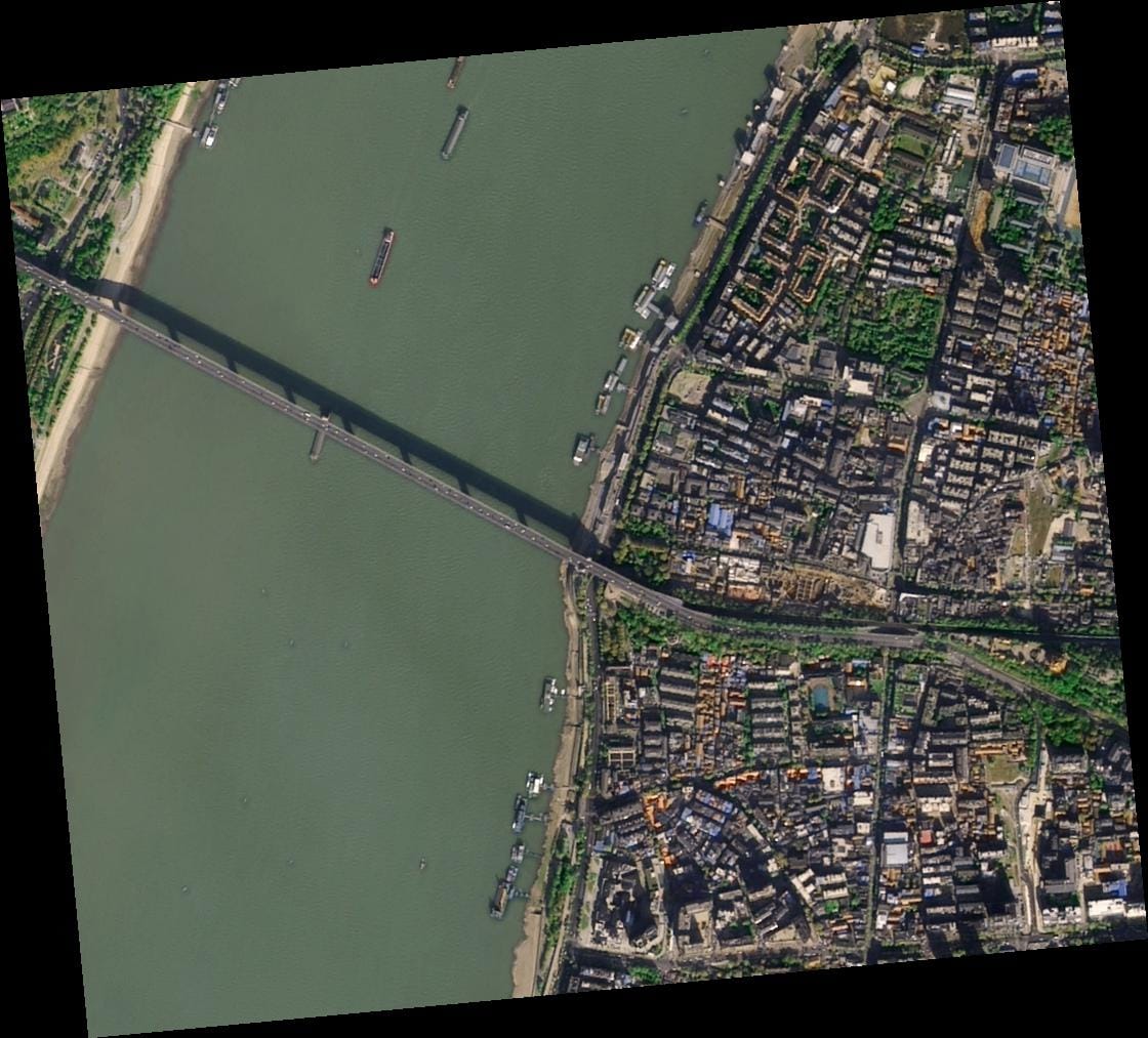
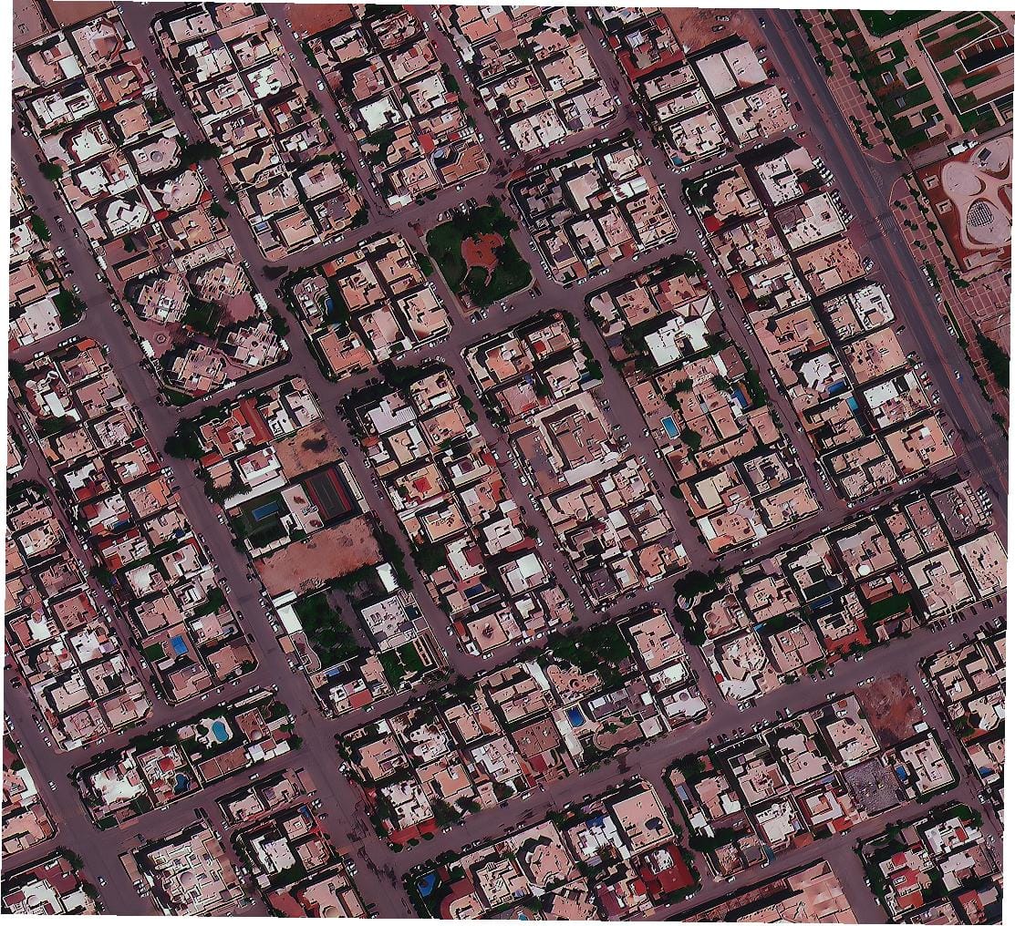
Super high resolution imagery refers to data with a spatial resolution of 30 centimeters. This is the sharpest commercially available satellite imagery. Sensors such as SuperView Neo 1 provide this level of detail.
At 30 centimeter resolution, users can identify road markings, individual vehicles, small structures, trench lines, and early stage construction activity. This resolution is widely used for defense intelligence, urban planning, critical infrastructure monitoring, and high accuracy mapping.
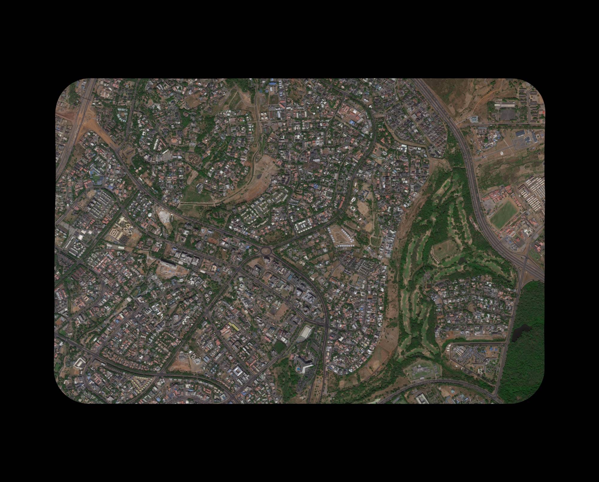
Very high resolution imagery ranges from 31 centimeters to 50 centimeters. Satellites such as SuperView 2 with 0.4 meter resolution and SuperView 1 with 0.5 meter resolution fall into this category.
This level of resolution is ideal for city scale analysis, building structure identification, urban growth monitoring, and detailed land use classification. It balances clarity with wider coverage and is commonly used for smart city development and infrastructure assessment.
High resolution imagery ranges from 51 centimeters to 80 centimeters. Sensors like GF 7 with 0.65 meter resolution and GF 2 with 0.8 meter resolution provide strong clarity for regional projects.
This resolution supports transportation planning, corridor mapping, large construction monitoring, and regional land surveys. It also enables stereo mapping for elevation data extraction.
Medium resolution imagery ranges from 2 meters to 50 meters. This category is used for large scale environmental monitoring, deforestation tracking, crop health assessment, and climate studies.
Although fine details are not visible, medium resolution imagery allows efficient coverage of vast areas and supports long term monitoring and trend analysis.
While spatial resolution explains where things are, spectral resolution explains what those things are. Spectral resolution refers to the ability of a satellite sensor to capture data across different wavelengths of light.
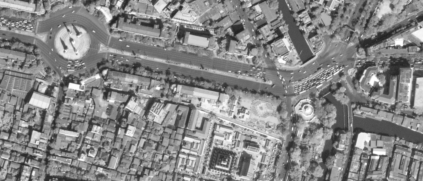
Panchromatic imagery captures a single broad band of visible light. It produces high resolution black and white images with excellent structural clarity. Because all light is captured in one channel, panchromatic imagery achieves the highest spatial resolution.
This type of imagery is ideal for mapping, infrastructure analysis, urban planning, and base maps where shape and structure matter most.
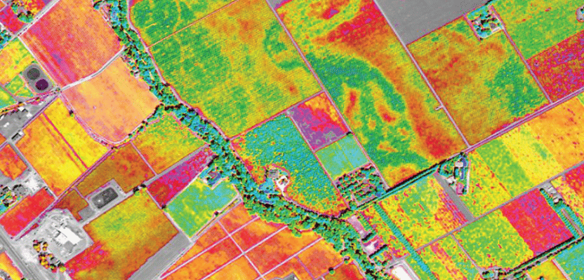
Multispectral imagery captures data across multiple discrete bands such as red, green, blue, and near infrared. Advanced sensors also include specialized bands like red edge, purple, and yellow.
Multispectral imagery reveals surface conditions that the human eye cannot detect. Near infrared and red edge bands are especially valuable for vegetation health analysis, crop stress detection, and environmental monitoring.
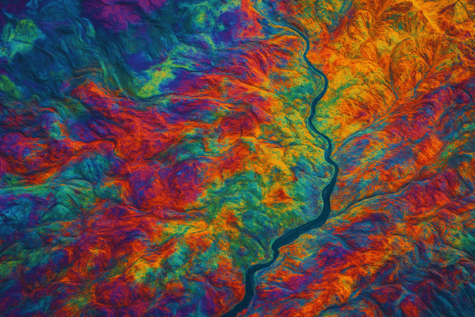
Hyperspectral imagery captures hundreds of narrow wavelength bands, typically ranging from 400 to 2500 nanometers. Each material reflects light differently, creating a unique spectral signature.
This allows hyperspectral sensors to identify minerals, detect chemical pollution, analyze soil composition, and support advanced geological exploration. XRTech Group provides access to hyperspectral satellites capable of delivering these insights at scale.
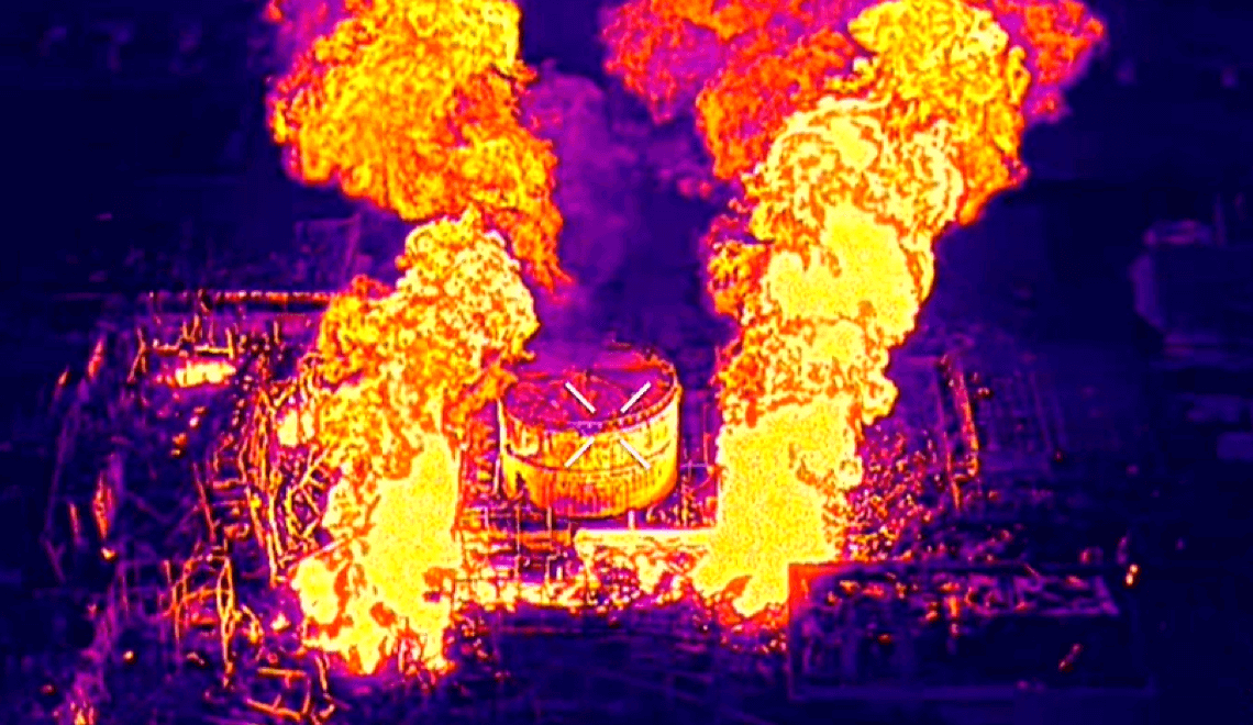
Infrared and thermal imagery measure heat rather than reflected sunlight. These sensors are used for wildfire detection, industrial equipment monitoring, night surveillance, and identifying heat anomalies.
Thermal resolution is especially important for emergency response and energy infrastructure analysis.
Selecting the right satellite imagery resolution depends on several practical factors.
Large national projects often require medium resolution imagery for efficiency. Site specific monitoring requires sub meter resolution to capture precise details.
Projects that require frequent updates such as construction monitoring or disaster response depend on satellite constellations with high revisit rates. XRTech Group offers systems capable of revisiting the same location up to 25 times per day.
In cloudy or tropical regions, optical imagery may be limited. In such cases, SAR satellite imagery becomes essential because it can capture data through clouds and darkness.
Higher resolution imagery generates larger data files. Organizations must consider storage, processing power, and analysis capability when selecting resolution.
Through our partnership with China Siwei, we provide access to over 130 satellites with the following capabilities:
| Satellite / Constellation | Spatial Resolution | Spectrum Bands |
|---|---|---|
| Superview Neo-1 | 0.3m (30cm) | Pan, RGB, NIR |
| Superview-2 (GFDM) | 0.4m | Pan + 8 Multispectral (inc. Red Edge) |
| Superview-1 | 0.5m | Pan, RGB, NIR |
| GF-7 | 0.65m | Stereo mapping + Laser Altimeter |
| GF-2 | 0.8m | Pan, RGB, NIR |
| ZY-3 | 2.0m | Dedicated Stereo Mapping |
| GF-3 SAR | 1.0m | All-weather Radar |
| GF-4 | 50.0m | Geosynchronous (20-sec revisit) |
Summary: Resolution ranges from ultra-high 0.3m (30cm) to geosynchronous 50m, covering panchromatic, multispectral, stereo, and radar capabilities.
Resolution and accuracy are often confused but they are not the same.
Resolution defines how small an object can be seen. Accuracy defines how close the pixel location is to its true position on Earth.
XRTech Group ensures high geolocation accuracy across its imagery products. Horizontal accuracy meets standards such as 8 meters CE90. Vertical accuracy for digital elevation models reaches plus or minus 3 meters RMSE.
Accurate imagery enables reliable measurements, proper overlay with GIS data, and trustworthy analysis results.
XRTech Group offers a complete Earth observation solution focused on precision, speed, and flexibility.
We deliver analysis ready satellite imagery in as fast as 24 hours for emergency situations.
Our data integrates seamlessly with GIS and CAD platforms using industry standard formats.
As a non US provider, XRTech Group avoids export control delays, ensuring faster global delivery.
With access to a massive satellite constellation, clients receive consistent coverage and reliable revisit rates. Contact us Now!
Choosing the right spatial resolution depends on project goals, area size, required detail, and budget. There is no one-size-fits-all solution, but understanding the capabilities of each resolution tier helps you make smarter decisions. Consider these factors before selecting:
What level of ground detail is essential for your analysis
How precise visual representations need to be for decision-making
Which spectral bands are required for your project
Size of the area to be monitored and revisit frequency needed
Spatial resolution is critical for applications like land cover mapping, climate change monitoring, biodiversity assessment, wildfire prevention, environmental modeling, and policy evaluation. Selecting the right resolution ensures accurate interpretation of spatial patterns.
Satellites: SuperView Neo-1
Detail Level: Maximum precision for individual objects
Key Applications:
Detecting crop diseases, pests, and irrigation issues in precision agriculture
Identifying soil erosion and localized land degradation
Field boundary detection and high-precision field mapping
Livestock observation and management
Deforestation detection and forestry monitoring
Detecting local anomalies or unauthorized construction
3D city modeling, building footprint extraction, and infrastructure monitoring
Why Choose Super High: Ideal for small areas where detailed ground features matter, providing actionable insights for site-level decisions
Satellites: SuperView-2 (0.4m), SuperView-1 (0.5m)
Detail Level: Sharp structural visibility across urban and semi-urban areas
Key Applications:
Urban planning and city infrastructure analysis
Tracking construction progress
Medium-scale agricultural monitoring, including crop patterns and vegetation health
Forest monitoring at plot level
Base mapping for GIS and CAD applications
Why Choose Very High: Excellent balance of coverage and clarity, suited for municipal, regional, and industrial projects requiring structural detail
Satellites: GF-7 (0.65m), GF-2 (0.8m)
Detail Level: Good clarity for large-scale land surveys and regional planning
Key Applications:
Monitoring regional agricultural growth and crop conditions
Large-scale infrastructure and transportation network planning
Forest and land cover mapping across wider areas
Environmental monitoring for soil, water, and vegetation patterns
Why Choose High: Covers larger areas with sufficient detail for regional decision-making, reducing costs compared to ultra-high resolution imagery
Satellites: ZY-3 (2m), GF-4 (50m)
Detail Level: Broader overview with less structural detail, ideal for landscape-level analysis
Key Applications:
Crop growth monitoring and yield estimation
Regional vegetation and biodiversity assessments
Large-scale water body and land use monitoring
Tracking urban expansion and environmental trends
Climate modeling and trend mapping over broad regions
Why Choose Medium: Optimized for projects where wide coverage matters more than individual object detail, enabling efficient large-area monitoring
Satellite imagery resolution shapes how we see and understand the Earth. Choosing the right resolution is not about selecting the highest detail available but about matching data capabilities to project goals.
By understanding spatial, spectral, temporal, and radiometric resolution, organizations can reduce costs, improve accuracy, and gain meaningful insights.
XRTech Group helps clients navigate these choices with confidence, delivering the right satellite data at the right resolution for every mission.
Definition of Satellite Imagery Resolution: Measures the detail captured by a satellite, determined by the area on the ground represented by a single pixel. Higher resolution allows more precise visualization.
Types of Spatial Resolution:
Super High Resolution (30 cm): Extreme detail for small areas, suitable for precision agriculture, 3D city modeling, and construction monitoring.
Very High Resolution (31–50 cm): Detailed imagery for urban planning, building identification, and infrastructure surveys.
High Resolution (51–80 cm): Ideal for regional land surveys, forest management, and large-scale environmental monitoring.
Medium Resolution (2–50 m): Broad coverage for crop monitoring, biodiversity assessment, climate studies, and urban expansion analysis.
Spectral Resolution: Describes the sensor’s ability to capture different light wavelengths. Includes Panchromatic (high detail black-and-white), Multispectral (RGB, NIR, Red Edge for vegetation), Hyperspectral (hundreds of narrow bands for material and chemical analysis), and Infrared/Thermal imagery (heat detection).
Resolution vs Accuracy: High resolution shows more detail, while accuracy ensures geolocation correctness. XRTech provides horizontal accuracy of 8 meters CE90 and vertical accuracy of ±3 meters RMSE for DEMs.
Factors in Choosing Resolution: Project scale, revisit frequency, weather conditions, sensor type, data volume, and budget all determine the ideal imagery.
XRTech Satellite Capabilities: Access to over 130 satellites, including SuperView Neo-1 (30 cm), SuperView-2 (40 cm), SuperView-1 (50 cm), GF-7 (65 cm), GF-2 (80 cm), ZY-3 (2 m), GF-3 SAR (1 m), and GF-4 (50 m geosynchronous).
Applications Across Industries: Agriculture, forestry, urban planning, disaster management, environmental monitoring, mineral exploration, and infrastructure assessment benefit from selecting the right resolution.
XRTech Advantage: Rapid delivery, global coverage, flexible formats, no export restrictions, integration-ready data for GIS and CAD systems, and a one-stop platform for Earth Observation intelligence.
Tailings Dam Monitoring: How Advanced Satellite Intelligence Is Transforming Tailings Dam Safety Tailings dams are among the most critical—and high-risk—structures

From Visible Light to Spectral Intelligence in Modern Satellite Remote Sensing Satellite imaging has moved beyond photography. For decades, Earth