The answer changed in February 2025. XRTech Group now provides access to the finest commercially available satellite imagery — 25cm native resolution from SuperView Neo-1 03/04, with HD resampled 15cm processing available for select projects.
What Is the Highest Resolution Satellite Imagery in 2026?
The highest resolution satellite imagery commercially available in 2026 is 25cm native panchromatic resolution from the SuperView Neo-1 03 and 04 satellites, launched by China Siwei in February 2025. XRTech Group provides direct access to this imagery as an authorised reseller. For select projects, HD resampled processing achieves an effective 15cm output resolution. Archive data delivers from $20/km² in 48 hours with no export licence restrictions for buyers worldwide.
The highest resolution satellite imagery in 2026 is no longer limited to 30cm. Following the launch of SuperView Neo-1 03 and 04 in February 2025, XRTech Group now delivers 25cm native panchromatic imagery — the finest resolution available from any commercial satellite — alongside HD resampled processing at 15cm for applications that require maximum ground detail. Maxar and Airbus remain strong providers at 30cm. But for buyers who need the absolute finest resolution without export licence delays, XRTech Group's access to the China Siwei constellation is the definitive answer. Explore the full XRTech Group satellite constellation to see every sensor available.
In a world driven by data, the view from space has never been more detailed or more accessible. From monitoring urban growth and managing natural disasters to making smarter investment decisions in real estate and agriculture, high-resolution satellite imagery is no longer a luxury — it is a necessity. This guide answers the central question in full: who has the highest resolution satellite imagery in 2026, what does it cost, and how do you access it without delays.
What Does "High Resolution" Actually Mean in Satellite Imagery?
Before we can crown a winner, we need to speak the same language. When experts talk about satellite image resolution, they're usually referring to something called Ground Sample Distance (GSD). It might sound technical, but the concept is quite simple.
Imagine a single pixel — the tiniest dot — in your satellite image. The GSD is the real-world size of that dot on the ground. So, if a satellite has a 30cm GSD, it means that one pixel in the image represents a 30cm by 30cm square on Earth. The smaller the GSD number, the higher the resolution and the more detail you can see.
Ground Sample Distance (GSD) — What You Can Resolve at Each Level
- 1-meter resolution: You can distinguish large objects, like individual houses or cars.
- 50cm resolution: You can see more detail, like the type of car or large markings on a road.
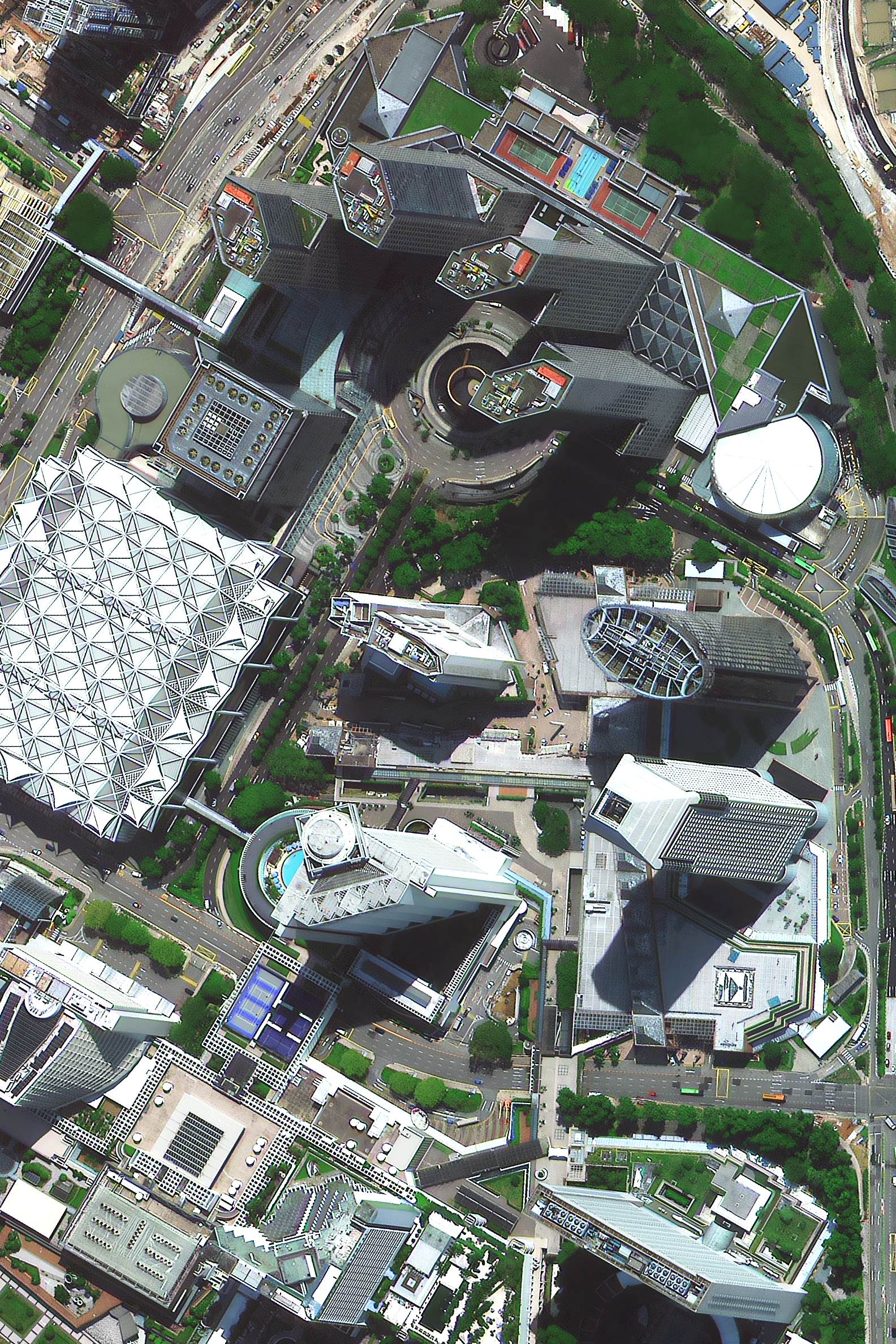
- 30cm resolution: You're getting into incredible detail. You can identify specific features on a roof, see manhole covers, or even individual shrubs in a garden.
- 25cm resolution (new in 2026): Even finer still. With SuperView Neo-1 03/04 you can resolve roof tile patterns, parking bay markings, and small ground objects with clarity that 30cm simply cannot match.
Think of it like the difference between an old standard-definition TV and a brand-new 8K TV. Both show you a picture, but the 8K screen has millions more pixels packed into the same space, creating a much sharper, clearer, and more detailed image. In the world of satellite data, 25cm GSD is the new commercial 8K standard in 2026.
The Providers: Who Offers the Finest Satellite Imagery?
Now for the main event. Several key players in the geospatial industry offer top-tier high-resolution imagery. While they all provide incredible detail, their services, constellations, and business models differ significantly.

Authorised China Siwei reseller. SuperView Neo-1 03/04 (launched February 2025) delivers 25cm native panchromatic — the finest commercial resolution available. HD resampled processing achieves 15cm effective output. No ITAR or EAR export restrictions. Archive from $20/km² in 48 hours.
Buy 25cm Imagery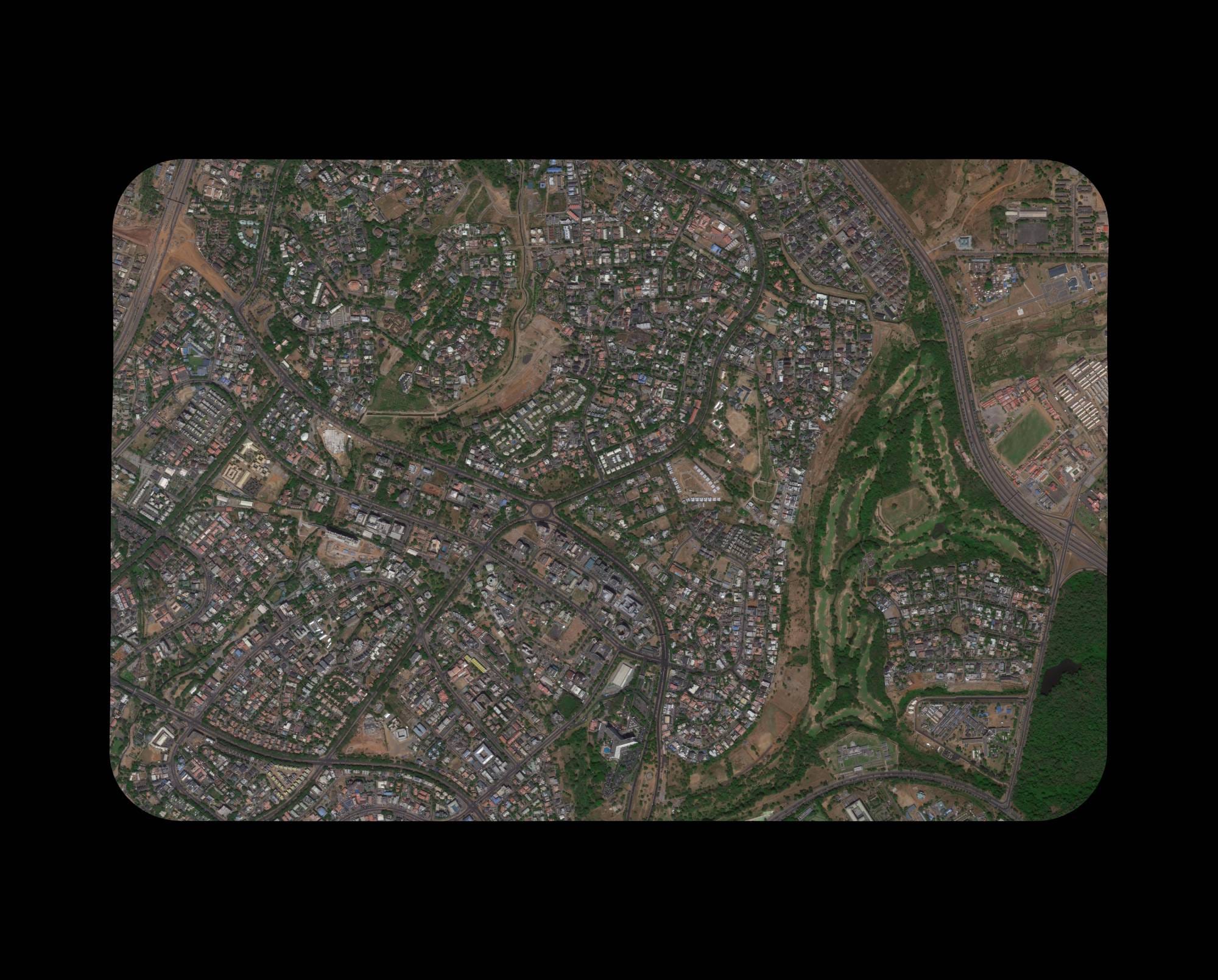
WorldView-3 and the WorldView Legion constellation. Long-established provider delivering 30cm panchromatic and approximately 1.2m multispectral imagery. US-based — subject to ITAR and EAR export controls which can delay delivery for international buyers.
Pléiades Neo constellation. European competitor to Maxar offering native 30cm resolution with a strong global distribution network. Good revisit rates and a broad range of add-on processing services.
A note on sensor types: The providers above deliver optical (panchromatic) imagery — the standard benchmark for ground resolution comparisons. SAR (Synthetic Aperture Radar) satellites operate differently and are covered in the next section. XRTech Group provides both optical and SAR data.
SAR Satellite Imagery Providers at 25cm Resolution
The 25cm resolution benchmark is not exclusive to optical imagery. A small group of SAR (Synthetic Aperture Radar) satellite providers have reached 25cm azimuthal resolution in their spotlight imaging modes. It is important to understand the distinction: optical 25cm and SAR 25cm describe fundamentally different things and serve different use cases.
Optical vs SAR Resolution: What the Numbers Actually Mean
Optical resolution (GSD) measures how large each pixel is on the ground — a 25cm optical pixel covers a 25cm × 25cm area uniformly in two dimensions. SAR azimuthal resolution measures detail in the along-track direction only; range resolution in the perpendicular direction is separate and often coarser. A SAR image described as "25cm" may have 25cm resolution in one axis and different resolution in the other, depending on the mode.
Both technologies are valuable, but they are not directly comparable. Optical imagery gives you colour, material appearance and fine visual detail. SAR penetrates cloud and darkness and measures surface deformation, moisture and roughness. XRTech Group delivers both optical and SAR satellite imagery.
Finnish SAR satellite company with a small satellite constellation. ICEYE offers 25cm azimuthal resolution in their highest-resolution spotlight modes — all-weather, day-and-night imaging independent of cloud cover. ICEYE focuses on change detection, maritime surveillance and flood monitoring. Their data is available through various distribution partners globally.
US-based SAR startup delivering 25cm resolution data, often distributed through partners including European Space Imaging (EUSI). Umbra's compact satellite design achieves high resolution in spotlight mode, with applications in infrastructure monitoring, ship tracking and time-critical intelligence tasks. Subject to US export licence requirements for certain regions.
South Korean earth observation company managing the SpaceEye-T satellite at 25cm native optical resolution, alongside KOMPSAT-3A at 55cm and KOMPSAT-5 SAR. SIIS covers the commercial and government distribution of Korean satellite data. Regional availability and export approvals vary by destination country and project type.
Contextual Notes on "Native" Resolution Claims in 2026
Maxar / WorldView Legion: Classified as 30cm native panchromatic. Like XRTech Group's HD 15cm offering, Maxar's WorldView Legion can be enhanced through processing to approximately 15cm HD output. This is a processed product, not a native sensor resolution — the same distinction that applies to XRTech Group's HD 15cm service.
Airbus Pléiades Neo: 30cm native optical resolution. No comparable HD enhancement product is currently marketed at the 15cm level.
SIIS SpaceEye-T: 25cm native optical. Managed by SI Imaging Services, which also distributes KOMPSAT-3A (55cm) and KOMPSAT-5 (SAR). Availability varies by region and requires approval from Korean distribution channels.
XRTech Group advantage: The only provider in this comparison offering 25cm native optical data with no ITAR or EAR export restrictions, 48-hour archive delivery and a free sample tile with every quote. For international buyers in the Middle East, Africa and Asia, XRTech Group is the most accessible route to the finest available optical resolution.
XRTech Group in 2026: 25cm Native and HD 15cm Resampled
This is where the landscape changed materially in early 2025. Through XRTech Group's strategic partnership with China Siwei, buyers now have direct access to two satellites that deliver the finest commercially available resolution on Earth.
SuperView Neo-1 03/04 — The World's Finest Commercial Satellite Imagery
Launched February 2025, the SuperView Neo-1 03 and 04 satellites represent the most significant resolution advance in commercial earth observation since WorldView-3 entered orbit in 2014. These satellites deliver 25cm native panchromatic resolution — a quarter-centimetre improvement that meaningfully increases the detail available for urban mapping, infrastructure inspection and precision land analysis.
The earlier SuperView Neo-1 01 and 02 satellites continue operating at 30cm resolution, extending the constellation's combined capacity and revisit frequency. XRTech Group delivers data from all four satellites through a single commercial channel with no export licence requirements.
What Is HD 15cm Satellite Imagery?
HD 15cm imagery is a processed output, not a native sensor resolution. The technique applies advanced pan-sharpening and sub-pixel resampling to the 25cm native data from SuperView Neo-1 03/04, fusing panchromatic sharpness with multispectral colour channels and applying resolution-enhancement algorithms to produce an effective ground sample distance of approximately 15cm.
The result is a colour image with detail that surpasses what standard 25cm data can resolve for applications such as urban asset mapping, roof-level infrastructure analysis and high-precision land boundary delineation. HD processing is available on request — contact XRTech Group to discuss whether HD 15cm output is suitable for your specific project.
No Export Licence Restrictions
XRTech Group is a non-US provider operating outside US ITAR and EAR export control frameworks. Buyers in the Middle East, Africa and Asia receive 25cm imagery on standard commercial terms without licence applications or review periods.
Delivery Up to 2x Faster
Without ITAR bureaucracy, XRTech Group regularly delivers critical high-resolution imagery up to twice as fast as US-based providers. Archive 25cm data delivers in 48 hours. Emergency tasking within 24 hours of the satellite pass.
Free Sample Before You Commit
XRTech Group provides a free 25cm satellite imagery sample for your specific area of interest with every formal quote. Verify resolution quality and cloud cover before placing any order.
Transparent Pricing from $20/km²
Archive 25cm imagery from $20/km². New 25cm tasking from $30/km². Priority and emergency tasking rates available. No subscription, no hidden fees. Free sample tile with every formal quote.
We provide free samples of our highest resolution satellite images so you can verify quality before placing an order. Available sample areas include Nigeria 30cm optical, Nigeria 40cm, Nigeria 30cm SAR, Riyadh 50cm, China 80cm, China 2m, and Abu Dhabi HD 15cm. Request your free sample for your area of interest today.
Full Provider Comparison: Highest Resolution Satellite Imagery 2026
The following table covers the key commercial providers of the highest resolution satellite images in 2026, including resolution, constellation, and delivery considerations.
| Provider | Key Satellite(s) | Finest Resolution | Export Restrictions | Archive Delivery |
|---|---|---|---|---|
| XRTech Group | SuperView Neo-1 03/04 | 25cm native · 15cm HD | None (non-US provider) | 48 hours |
| XRTech Group | SuperView Neo-1 01/02 | 30cm native | None (non-US provider) | 48 hours |
| Maxar Technologies | WorldView-3 / WorldView Legion | ~30cm panchromatic | US ITAR / EAR apply | Varies (licence dependent) |
| Airbus | Pléiades Neo | ~30cm panchromatic | Limited restrictions | 48–72 hours typical |
| XRTech Group | SuperView-2 (GFDM) | 42cm panchromatic | None | 48 hours |
| XRTech Group | SuperView-1 | 50cm panchromatic | None | 48 hours |
| SIIS (SI Imaging Services) | SpaceEye-T | 25cm optical | Korean approval required | Regional availability varies |
| ICEYE | ICEYE Constellation | 25cm azimuthal (SAR) | Limited (EU-based) | Hours (SAR) |
| Umbra | Umbra SAR Constellation | 25cm (SAR) | US ITAR may apply | Hours (SAR) |
Optical resolution values are native panchromatic GSD. SAR azimuthal resolution (ICEYE, Umbra) is not directly comparable to optical GSD — it measures along-track resolution in spotlight mode only. HD 15cm is a processed output from 25cm native data. All XRTech Group optical deliveries use WGS84 datum in GeoTIFF, SHP or DWG format. XRTech Group SAR data available via our SAR page.
It Is Not Just About Pixels: What Else Matters When Choosing Satellite Imagery?
While having the highest resolution satellite imagery is fantastic, it's only one piece of the puzzle. The "best" satellite data for your project depends on a combination of factors. An expert provider will help you navigate these, but here are the key considerations:
Revisit Rate: How Often Can You Get a New Image?
The revisit rate is the time it takes for a satellite to be able to capture an image of the same location again. If you're monitoring a rapidly changing situation, like a construction site or a flood zone, you need a satellite that can come back frequently. Some of our satellites offer daily revisits, giving you a powerful tool for change detection.
Spectral Bands: Seeing the Invisible
What if you need to see more than the human eye can? That's where spectral bands come in. Multispectral imagery captures light in different wavelengths, like near-infrared (NIR), which is invaluable for assessing vegetation health in agriculture. Hyperspectral imagery takes this even further, capturing hundreds of bands to identify specific minerals for mining exploration or detect pollution signatures.
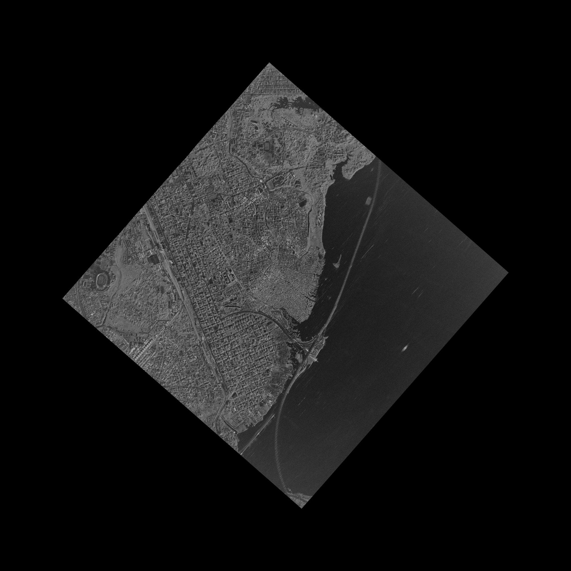
SAR Imagery: The All-Weather, All-Night Solution
What happens when your area of interest is covered in clouds or it's nighttime? Optical satellites can't see through them. This is where Synthetic Aperture Radar (SAR) comes in. SAR satellites send out their own signals and read the echoes, effectively creating an image regardless of weather or time of day. This is essential for reliable infrastructure monitoring and maritime surveillance.
Delivery Speed and Licensing: Getting Your Data When You Need It
Finally, the best data in the world is useless if you can't get it quickly and use it easily. As mentioned, XRTech Group's unique structure allows for incredibly fast delivery. Furthermore, we offer simple, project-wide licensing that is publication-friendly, making it easy for teams to collaborate without getting tangled in restrictive legal agreements.
Seeing Is Believing: Real-World Applications of 25cm Satellite Imagery
So, what can you actually do with 25cm and 30cm resolution imagery? The level of detail unlocks possibilities that are simply not feasible with lower-resolution data.
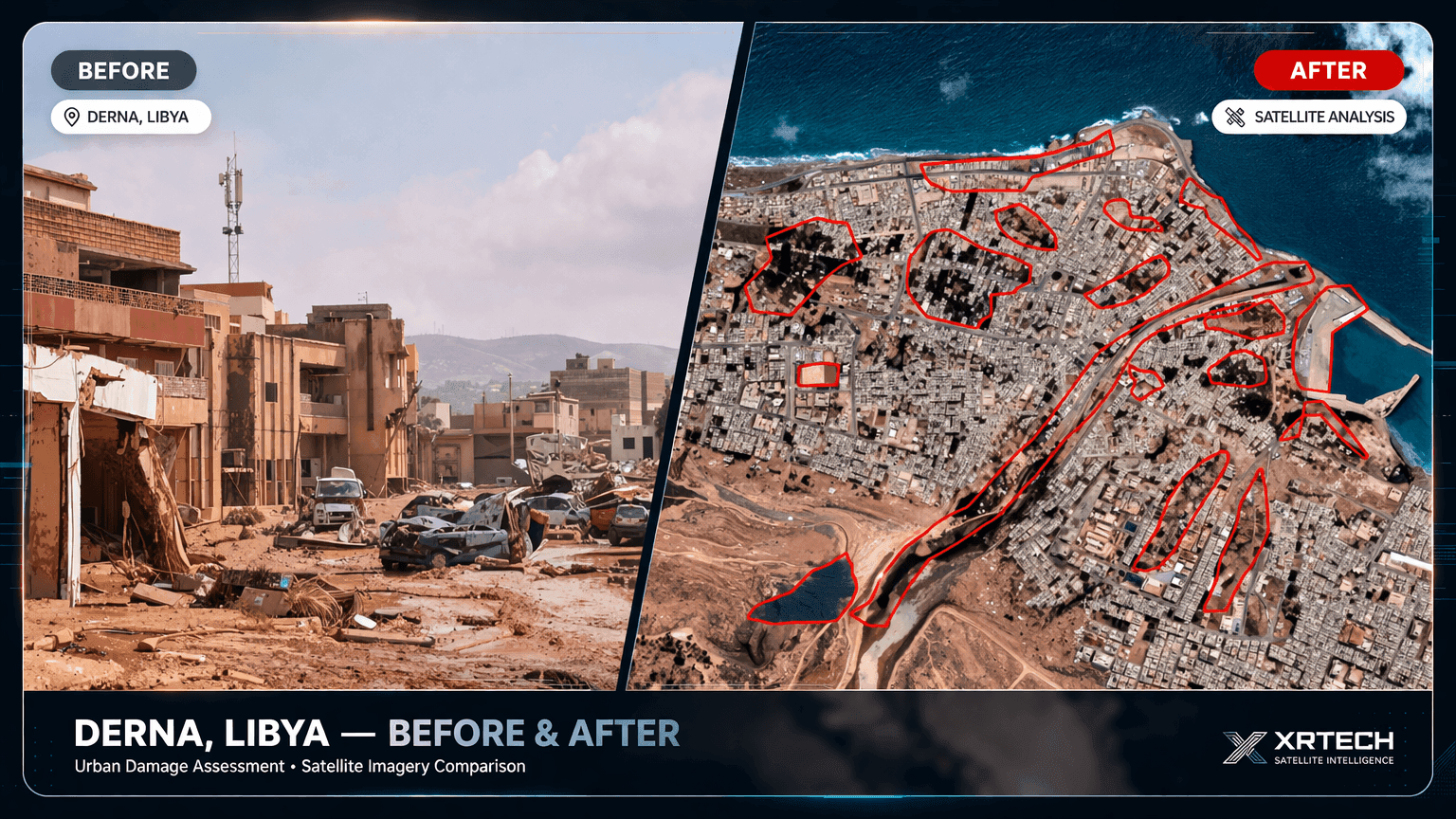 Disaster Response
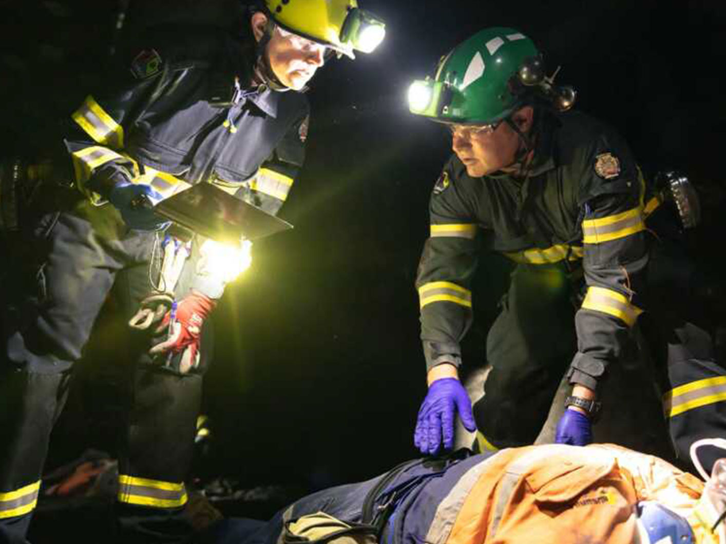
Emergency Response and Disaster Mapping
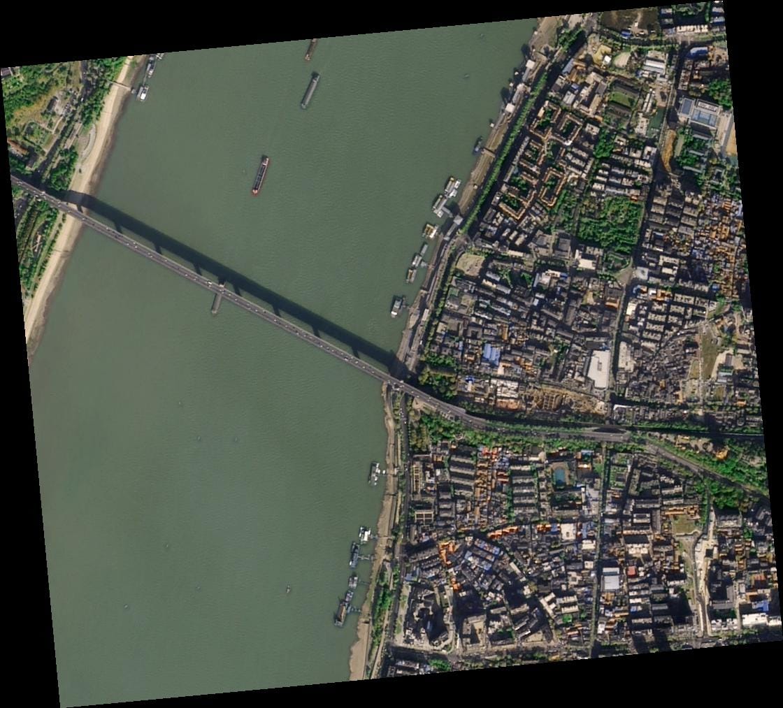
After a hurricane or earthquake, responders need to know exactly what they're facing. While 1m imagery can show that a neighborhood is damaged, 25cm and 30cm imagery can show which specific houses have collapsed roofs, which roads are blocked by debris, and where it's safe to land a helicopter. This detail saves lives by allowing resources to be deployed more effectively.
Urban Planning
Precision Urban Planning and Smart City Mapping
With 30cm and 25cm imagery, city planners can move beyond mapping general building footprints. You can identify individual street features like benches, crosswalks, and even fire hydrants. This level of granularity is critical for developing smart city initiatives, managing public assets, and planning new infrastructure with incredible precision. For real estate developers, it means conducting site analysis with a level of detail that was once only possible with on-the-ground surveys.
 Construction
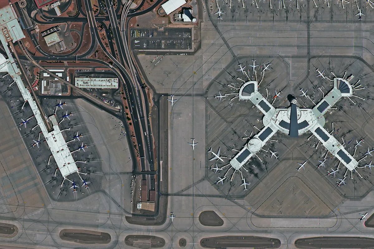
Construction and Infrastructure Monitoring
Weekly or monthly satellite captures document progress across any number of active sites. At 25cm resolution you resolve foundation details, identify specific equipment types, and detect unauthorised activity without deploying a field team — making remote monitoring cost-effective even for large-scale infrastructure projects.
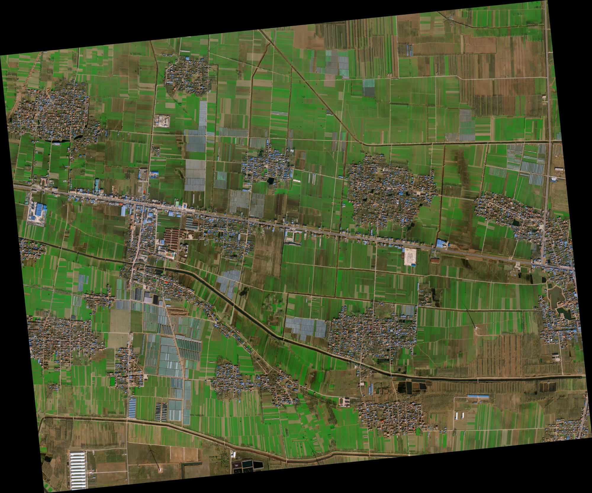
Oil and Gas
Pipeline and Energy Infrastructure Inspection
For industries like oil and gas, managing thousands of kilometers of pipeline is a monumental task. High-resolution imagery allows for the remote inspection of pipeline corridors to detect potential risks like nearby construction or land erosion. Combined with SAR data for subsidence monitoring, it creates a powerful solution for ensuring infrastructure integrity.
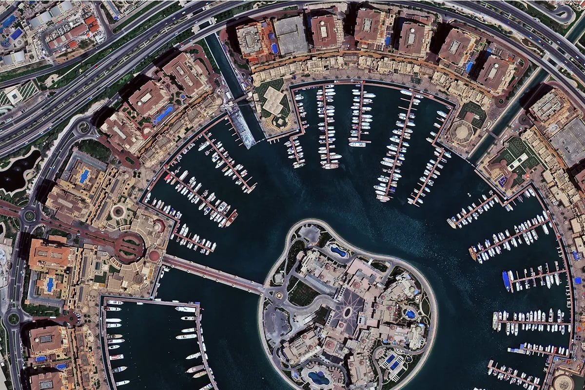
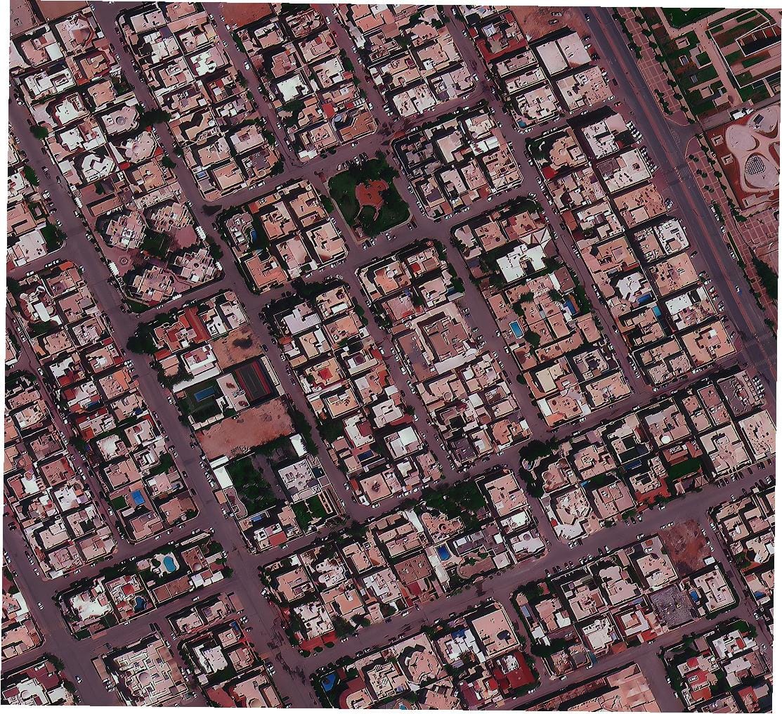
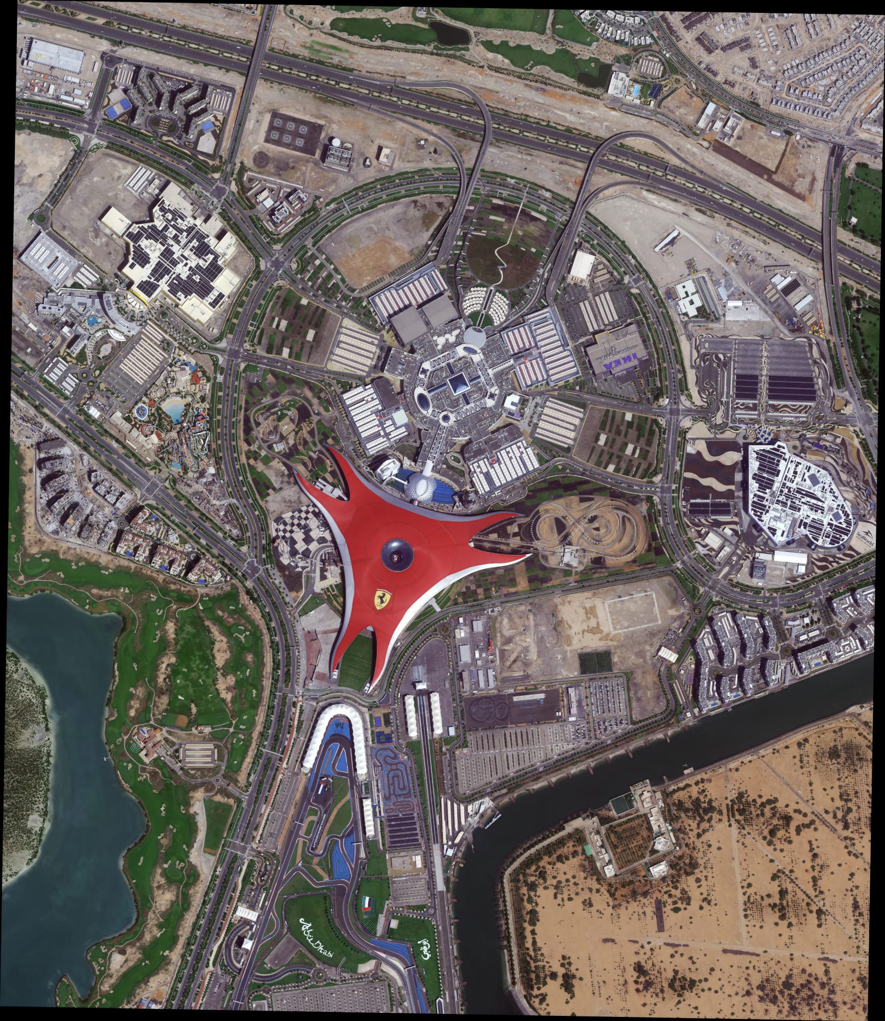 HD 15cm Sample
HD 15cm Output — Abu Dhabi Sample
This is an actual HD 15cm resampled imagery output from XRTech Group, processed from native 25cm data. The visual detail achieved by HD processing is visible at this scale — resolving features that standard 30cm data cannot distinguish.
 Mining
Mining, Mineral Exploration and Resource Management
25cm optical combined with 330-band hyperspectral imagery from GF-5B gives exploration teams surface mineralogy identification alongside precise ground feature mapping. The most detailed commercial remote sensing package available in 2026 — all accessible through a single XRTech Group order without export restrictions.
Ready to Access 25cm Satellite Imagery?
A free sample tile for your specific area of interest is included with every formal quote from XRTech Group. Archive 25cm from $20/km², delivered in 48 hours worldwide with no export licence restrictions.
Talk to an Imagery ExpertChoosing the Right Partner for the Highest Resolution Satellite Imagery
So, who has the highest resolution satellite imagery? The answer is that the top tier of providers — including Maxar, Airbus, and XRTech Group (with our partner China Siwei) — all operate at the 30cm resolution mark. But in 2026, XRTech Group goes further: through SuperView Neo-1 03/04, we deliver 25cm native resolution and HD 15cm processed output — the finest commercially available satellite imagery on Earth.
The conversation, therefore, shifts from "who has the best pixels?" to "who provides the best solution?" The best partner for you is the one who not only has access to the finest resolution but also understands your project's unique needs regarding revisit rate, spectral bands, delivery speed, and cost-effectiveness.
At XRTech Group, we pride ourselves on being more than just a data vendor. We are a solutions provider. By leveraging our powerful constellation and cutting-edge capabilities, all while bypassing the logistical hurdles of traditional providers, we deliver not just data, but actionable intelligence. We invite you to buy high-resolution satellite imagery and discover how our unique advantages can bring unparalleled clarity and speed to your next project.
Summary: Highest Resolution Satellite Imagery in 2026
- The finest commercial satellite resolution in 2026 is 25cm native panchromatic from SuperView Neo-1 03/04, launched February 2025
- HD 15cm resampled output is available from XRTech Group for select projects requiring maximum ground detail
- Maxar and Airbus both deliver approximately 30cm panchromatic — one resolution tier below the new standard
- XRTech Group delivers 25cm imagery with no ITAR or EAR export restrictions for buyers worldwide
- Archive 25cm imagery from $20/km² with 48-hour delivery and a free sample tile with every formal quote
- Resolution alone does not determine the best solution — revisit rate, spectral bands, SAR capability and delivery speed all matter