
Tailings Dam Monitoring with InSAR & AI
Tailings Dam Monitoring: How Advanced Satellite Intelligence Is Transforming Tailings Dam Safety Tailings dams are among the most critical—and high-risk—structures

In satellite imagery and Earth observation, knowing where something happens is only half of the story. Knowing when it happens is just as important. This is where satellite revisit rates become critical. A revisit rate explains how often a satellite or a group of satellites can capture imagery of the same location on Earth. Whether the goal is to monitor crops, track construction progress, observe disaster impacts, or support national security, revisit rates directly influence how useful satellite data can be.
At XRTech Group, revisit rate planning is a core part of helping clients select the right satellite imagery. With access to more than 130 satellites through a strategic partnership with China Siwei, XRTech offers some of the most flexible and reliable revisit options available today.
This guide explains satellite revisit rates in clear and simple terms. It covers what revisit rates are, what affects them, how they are calculated, and why they matter across industries.
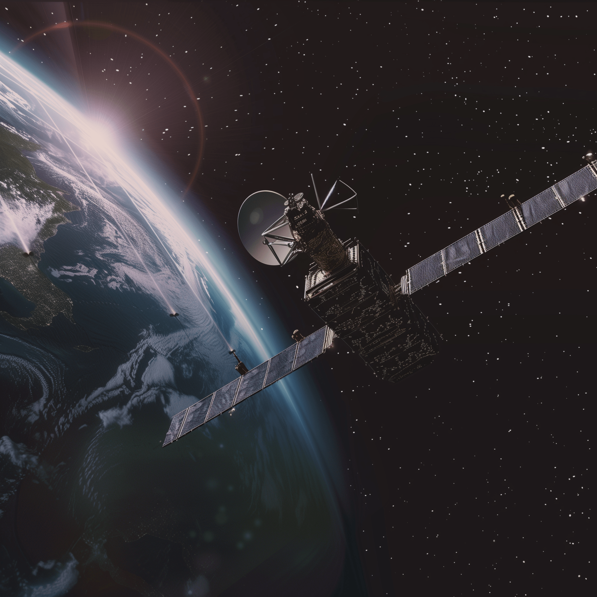
A satellite revisit rate is the amount of time between two consecutive observations of the same geographic location by a satellite system. In other words, it describes how often a satellite can return to see the same place on Earth.
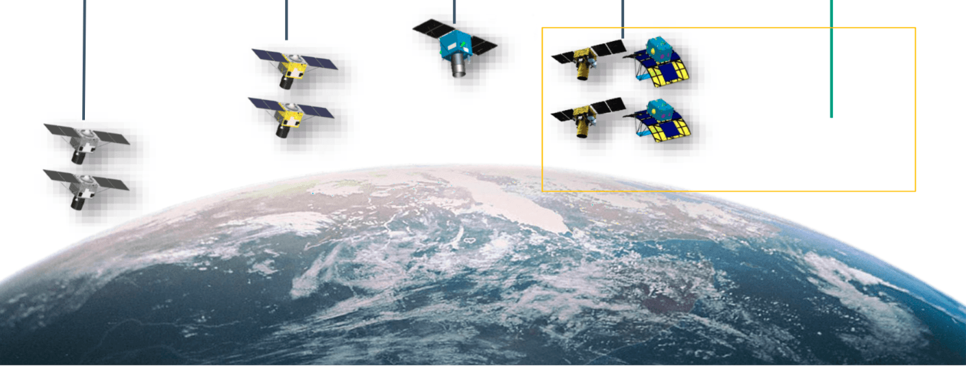
It is important to understand that revisit rate does not always mean a single satellite coming back overhead. In most modern systems, revisit rates are achieved using constellations of satellites. A constellation allows multiple satellites to pass over the same location at different times, reducing the wait between observations.
There is also a difference between theoretical revisit and effective revisit. A satellite might be able to pass near a location, but cloud cover, lighting conditions, or sensor limitations may prevent usable imagery. Effective revisit refers to how often high quality, usable data is actually collected.
Revisit rates are a key factor in time sensitive monitoring and change detection. The faster the revisit, the more accurately changes on the ground can be tracked.
In satellite imagery and Earth observation, knowing where something happens is only half of the story. Knowing when it happens is just as important. This is where satellite revisit rates become critical. A revisit rate explains how often a satellite or a group of satellites can capture imagery of the same location on Earth. Whether the goal is to monitor crops, track construction progress, observe disaster impacts, or support national security, revisit rates directly influence how useful satellite data can be.
At XRTech Group, revisit rate planning is a core part of helping clients select the right satellite imagery. With access to more than 130 satellites through a strategic partnership with China Siwei, XRTech offers some of the most flexible and reliable revisit options available today.
This guide explains satellite revisit rates in clear and simple terms. It covers what revisit rates are, what affects them, how they are calculated, and why they matter across industries.

A satellite revisit rate is the amount of time between two consecutive observations of the same geographic location by a satellite system. In other words, it describes how often a satellite can return to see the same place on Earth.
It is important to understand that revisit rate does not always mean a single satellite coming back overhead. In most modern systems, revisit rates are achieved using constellations of satellites. A constellation allows multiple satellites to pass over the same location at different times, reducing the wait between observations.
There is also a difference between theoretical revisit and effective revisit. A satellite might be able to pass near a location, but cloud cover, lighting conditions, or sensor limitations may prevent usable imagery. Effective revisit refers to how often high quality, usable data is actually collected.
Revisit rates are a key factor in time sensitive monitoring and change detection. The faster the revisit, the more accurately changes on the ground can be tracked.
Several technical and geographic factors determine how often a satellite can observe the same location.
The most important factor is the number of satellites working together. A single satellite must complete its orbit and wait for the Earth to rotate beneath it before revisiting the same point. This can take days.
A constellation solves this problem. By placing multiple satellites in similar orbits, coverage gaps are reduced. For example, the SuperView Neo system uses 28 satellites, allowing it to achieve up to 25 revisits per day for many locations. This makes near continuous monitoring possible on a global scale.
The type of orbit also affects revisit rates.
Low Earth Orbit satellites operate at altitudes between roughly 500 and 800 kilometers. These satellites move quickly relative to the Earth and provide high resolution imagery. Most commercial imaging satellites fall into this category. Their revisit rates typically range from hours to days depending on constellation size and sensor agility.
Geosynchronous orbit satellites operate much farther from Earth at about 36,000 kilometers. These satellites rotate at the same speed as the Earth and appear fixed over one region. GF 4 is a unique example. It provides a staring capability with revisit intervals as fast as 20 seconds. This makes it ideal for real time monitoring of large regions.
Modern satellites are highly agile. They can tilt their sensors to capture imagery even when they are not flying directly overhead. This ability is measured by the off nadir angle.
Satellites with standard viewing angles of plus or minus 30 degrees already achieve frequent revisits. More advanced systems like SuperView Neo 1 extend viewing angles to plus or minus 45 degrees. This wider field of regard allows satellites to capture targets sooner and more often.
Revisit frequency is not the same everywhere on Earth. Polar orbiting satellites naturally pass over higher latitudes more often because their orbital paths converge near the poles. As a result, revisit rates are generally higher in middle and high latitude regions.
XRTech leverages this orbital behavior to provide daily revisits for high latitude monitoring, which is especially useful for northern infrastructure, energy projects, and environmental studies.
Through our partnership with China Siwei, XRTech Group offers one of the most diverse ranges of revisit capabilities in the industry.
| Satellite / Constellation | Revisit Rate | Primary Feature |
|---|---|---|
| SuperView Neo System | Up to 25 times per day | Persistent global monitoring |
| GF-4 | 20 Seconds | Geosynchronous “staring” for real-time monitoring |
| SuperView Neo-1 | Daily | 0.3m Ultra-High Resolution |
| SuperView-1 | Daily | 0.5m High Resolution anywhere |
| ZY-3 (3 Satellites) | 1–2 Days | Dedicated stereo mapping |
| SuperView-2 | 3 Days | 0.4m Resolution with 8 multispectral bands |
| ZY-1 02D | 3 Days (WPM) / 26 Days (MUX) | Hyperspectral and multispectral data |
| LT-1 SAR (2 Satellites) | 4 Days | All-weather L-band radar |
| GF-6 / GF-1 | 4 Days | Wide-swath agricultural and land monitoring |
| GF-7 / GF-2 | 5 Days | High-accuracy mapping and sub-meter imagery |
| GF-3 SAR | 10 Days | All-weather C-band radar for maritime |
| GF-5B | 12 Days | Advanced environmental/chemical analysis |
XRTech Group offers one of the most diverse revisit portfolios in the satellite imagery industry.
The SuperView Neo system delivers ultra high frequency monitoring with up to 25 revisits per day, enabling persistent Earth observation. GF 4 provides real time monitoring with a 20 second collection frequency. SuperView Neo 1 offers daily revisit at 0.3 meter resolution, combining detail with speed.
SuperView 1 provides daily global coverage at 0.5 meter resolution. ZY 3 with three satellites offers one to two day revisits optimized for stereo mapping. SuperView 2 revisits every three days with 0.4 meter resolution and eight multispectral bands.
For specialized missions, ZY 1 02D provides hyperspectral and multispectral data with revisit cycles tailored to deep analysis. SAR systems like LT 1 and GF 3 ensure monitoring continues even through clouds and darkness.
This wide range allows XRTech to match revisit frequency precisely to project needs.
Optical satellites depend on sunlight and clear skies. While they provide highly detailed visual information, cloud cover can limit usability. This is why revisit rate alone does not guarantee data availability.
SAR satellites solve this problem. Radar sensors can collect imagery day or night and through clouds, smoke, and rain. Although SAR imagery looks different from optical imagery, it is essential for consistent monitoring in challenging weather conditions.
XRTech Group integrates both optical and SAR satellites into monitoring strategies. This ensures reliable revisit coverage regardless of environmental conditions.
Some industries depend heavily on high frequency satellite monitoring.
In disaster management, frequent revisits help identify flood boundaries, wildfire spread, and damaged infrastructure. During the Derna Libya flood response, XRTech delivered actionable imagery within 24 hours to support emergency operations.
In maritime security, daily or near daily revisits are required to track vessel movement and detect dark activity in shipping lanes.
In agriculture, frequent imagery supports crop health monitoring, irrigation planning, and yield optimization throughout the growing season.
In military and intelligence operations, persistent observation helps track asset movement and logistical changes in near real time.
Not all satellites are designed for frequent revisits. Some prioritize data depth rather than speed.
Hyperspectral satellites like GF 5B capture hundreds of narrow spectral bands. These sensors are complex and heavy, and their mission focuses on material identification rather than daily monitoring. As a result, revisit cycles can be around 12 days.
Similarly, high power radar systems like GF 3 SAR focus on wide area maritime and environmental analysis, resulting in longer revisit intervals.
These satellites are ideal for baseline studies, geological surveys, and environmental assessments where conditions do not change rapidly.
Change detection is one of the most valuable uses of satellite imagery. It helps organizations understand what has changed, when it changed, and how fast it is happening. Revisit rate plays a direct role in how accurate and reliable this analysis becomes.
Frequent satellite imagery improves change detection because it reduces gaps in time. When images are collected often, changes can be observed closer to the moment they occur. This lowers the risk of missing important events such as sudden flooding, rapid construction activity, or crop stress that develops within days.
Time series analysis is a simple concept when explained clearly. It means looking at a sequence of images of the same location taken over time. Instead of comparing only two images, multiple observations are stacked in order. This reveals patterns, trends, and gradual changes that are not visible in single snapshots. Time series satellite data helps identify growth, decline, or stability across weeks, months, or years.
Before and after comparisons are the most common form of change detection. A recent image is compared with an older one to highlight differences. With high revisit rates, these comparisons become more precise because the time gap between images is smaller. This allows analysts to isolate the true cause of change rather than guessing what happened during long gaps.
Not all changes happen at the same speed. Sudden changes include floods, landslides, fires, and structural damage. These require high frequency revisit rates to capture events as they unfold. Slow changes include land degradation, urban expansion, vegetation growth, and shoreline movement. These benefit from consistent revisit schedules over longer periods.
Selecting the right revisit rate starts with asking the right questions. The first step is understanding what you need to observe and how quickly that situation changes. A project monitoring daily activity will require a different revisit frequency than one focused on long term trends.
One important question is whether the goal is monitoring or mapping. Monitoring projects focus on tracking changes over time and often require frequent imagery. Mapping projects focus on accuracy and detail and may not need constant updates once the baseline is created.
Emergency response and long term analysis also demand different revisit strategies. Emergency situations such as floods or wildfires require rapid and repeated observations to support decision making in real time. Long term analysis such as land use planning or environmental studies can rely on regular but less frequent revisits.
Budget considerations are another key factor. Higher revisit rates often require larger satellite constellations or priority tasking. However, selecting a revisit rate that is higher than necessary can increase costs without adding value. The goal is to match revisit frequency with actual operational needs.
XRTech advisors help optimize revisit planning by evaluating project goals, timelines, geographic location, and data requirements. By combining optical and SAR satellites, archive imagery, and new tasking options, XRTech designs revisit strategies that balance cost, accuracy, and reliability. This ensures clients receive the right data at the right time without unnecessary complexity. Contact us Now!
Satellite revisit time is not based on orbital period alone. It is determined by the interaction of constellation size, sensor agility, orbit type, and target location.
Increasing the number of satellites multiplies revisit opportunities. A single ZY 3 satellite revisits every five days, but a three satellite constellation reduces this to one or two days. The SuperView Neo system achieves up to 25 revisits per day using a 28 satellite architecture.
Sensor agility further reduces revisit time by expanding viewing angles. Extended off nadir viewing allows satellites to capture targets sooner without waiting for a direct overpass.
Orbit type determines whether a satellite revisits periodically or continuously. Low Earth Orbit satellites require multiple passes, while geosynchronous satellites like GF 4 provide continuous observation.
Target latitude also plays a role. Higher latitudes benefit from more frequent passes due to orbital convergence.
Choosing the right revisit rate ensures that satellite imagery delivers meaningful value. High revisit rates are essential for time sensitive monitoring, while longer revisit cycles support deep analytical studies.
XRTech Group helps clients balance revisit frequency, resolution, cost, and application needs. By combining archive access, new tasking, optical imagery, and SAR data, XRTech delivers consistent and reliable Earth observation insights.
XRTech Group provides an unblinking eye in the sky through unmatched satellite access and operational flexibility.
Clients benefit from real time situational awareness, global coverage through 130 plus satellites, and reliable data delivery regardless of weather conditions. As a non US provider, XRTech avoids export delays and delivers imagery in days instead of weeks.
Flexible pricing starting at one dollar per square kilometer for archive data makes persistent monitoring affordable. From emergency response to long term planning, XRTech ensures that revisit rates align with real world needs.
Satellite revisit rates are a foundation of effective Earth observation. Understanding how often a location can be observed helps organizations choose the right data, avoid blind spots, and make confident decisions.
Whether the goal is real time monitoring or deep environmental analysis, XRTech Group provides the expertise, satellite access, and delivery speed required to turn revisit frequency into real insight.
With the right revisit strategy, satellite imagery becomes more than pictures from space. It becomes a reliable tool for understanding change as it happens.
Tailings Dam Monitoring: How Advanced Satellite Intelligence Is Transforming Tailings Dam Safety Tailings dams are among the most critical—and high-risk—structures

From Visible Light to Spectral Intelligence in Modern Satellite Remote Sensing Satellite imaging has moved beyond photography. For decades, Earth