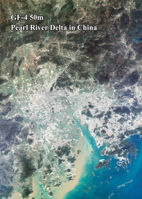
GF-4 Satellite Imagery

Launched in December 2015, the GF-4 satellite is a pioneer in remote sensing as China's first geosynchronous orbit satellite. Operating at an altitude of 36,000 km, it provides real-time regional monitoring, allowing for continuous observation of specific areas for extended periods. Its unique capabilities make it a critical asset for time-sensitive applications like disaster management and persistent surveillance.

Artistic representation of the GF-4 geosynchronous satellite in orbit.

Resolution

50m VNIR

Revisits

20 Seconds

Swath Width

400 km

Orbit

Geosynchronous

Bands

VNIR & MWIR

Mission Life

8 Years

Technical Specifications

Launch DateDecember 29, 2015
Orbit TypeGeosynchronous
Altitude36,000 km
Mission Lifetime8 years
Swath Width400 km
Revisit Capacity20 seconds
VNIR Resolution50m
MWIR Resolution400m
VNIR Spectral Bands 0.45-0.90μm (Pan)
0.45-0.52μm (Blue)
0.52-0.60μm (Green)
0.63-0.69μm (Red)
0.76-0.90μm (NIR)
MWIR Spectral Band3.5-4.1μm

Features and Benefits

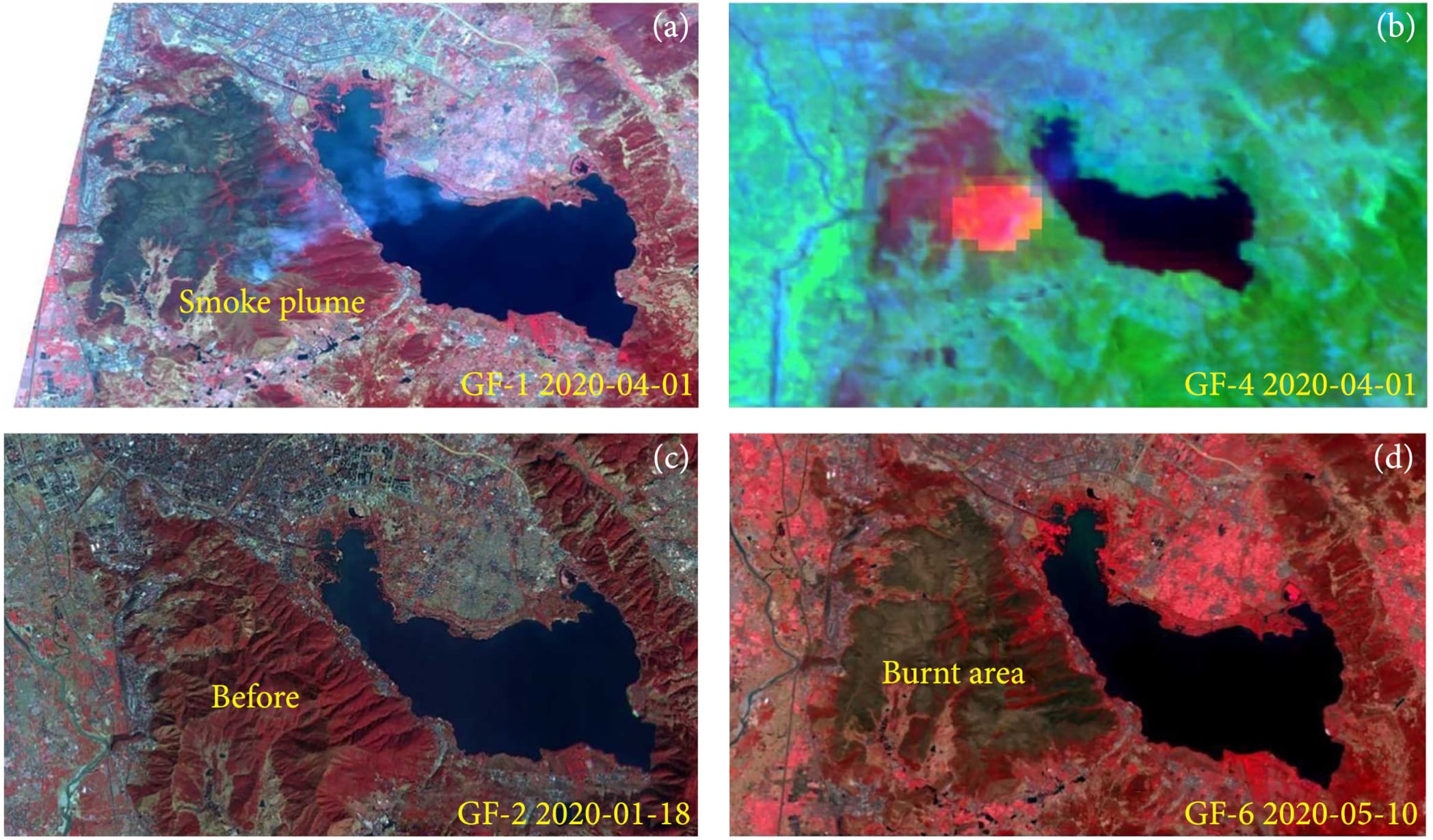
  • Continuous Monitoring: Its geosynchronous orbit allows for constant, real-time observation of a specific area, invaluable for tracking dynamic events as they unfold.
  • Rapid Data Updates: With a 20-second revisit time, GF-4 delivers near-instantaneous updates, which is critical for emergency response and time-sensitive monitoring.
  • Dual Optical & Infrared: The ability to acquire both VNIR and Mid-Wave Infrared (MWIR) imagery provides a comprehensive view, enabling thermal analysis in addition to visible observations.
  • Wide-Area Coverage: A vast 400km swath width enables broad regional monitoring, making it efficient for observing large-scale phenomena.

Applications

Disaster Management: Ideal for real-time flood risk mapping, forest fire detection and tracking, and overall disaster assessment and response.
Environmental Monitoring: Track large-scale events like dust storms, volcanic ash clouds, and major pollution events with its wide swath and continuous coverage.
Military & Intelligence: Conduct persistent surveillance over strategic areas of interest, monitor borders, and track assets for national security operations.
Marine Security: Continuously monitor large marine areas, coastal zones, and key shipping lanes to track vessel movements and identify anomalies.
Oil & Gas Monitoring: Use MWIR capabilities to identify heat signatures from gas flares, pipeline leaks, or overheating equipment over large operational areas.
Urban & Traffic Management: Monitor traffic flow, urban heat islands, and large-scale changes in metropolitan areas in near real-time.

Why Choose XRTech Group for GF-4 Imagery?

We provide more than just satellite data; we deliver comprehensive solutions tailored to your project's specific needs, ensuring you get actionable insights quickly and efficiently.

Expert Consultation

Our geospatial experts provide a free consultation to understand your needs and recommend the best acquisition parameters to ensure optimal results for your project.

Rapid Delivery

Leveraging our direct partnership and access to a vast 130+ satellite constellation, we offer fast turnaround times, delivering imagery in days, not weeks.

Seamless Integration

We deliver data in industry-standard formats (like GeoTIFF) compatible with your GIS, CAD, or modeling software, with a team ready to support your workflow.

GF-4 Sample Imagery

Sample imagery from GF-4 showing continuous monitoring of a forest fire.
Example of GF-4 data showing wide-area weather patterns.

Request Product Details

Satellite Imagery Advisor

Brief questions. Practical guidance. Get an indicative estimate instantly, and we only proceed to a formal quote once the basics are clear.

Advisor mode: this form will recommend the lowest resolution and type that fits your objective so you do not overpay.
Step 1 — Area & Location
1 / 4
Start simple: Upload a KML/KMZ/ZIP if you have it. If not, a bounding box or center plus dimensions works fine. We will calculate area for you where possible.
Upload AOI file (KML / KMZ / ZIP) — recommended
Preferred: a single polygon AOI. We compute the area automatically.
Enter corner coordinates (bounding box)
Use min/max latitude and longitude.
Enter center coordinate + width & height
Good for quick feasibility when exact boundaries are not available.
Describe location (city / region / site name)
We will follow up to confirm an AOI boundary if needed.
Advisor note: If speed is the priority, we usually check archive first. If you need a specific date window or fresh capture, choose new tasking.
Archive imagery
Previously captured imagery, typically faster delivery.
New capture (tasking)
Satellite is tasked for your AOI; weather and availability can affect capture date.
Not sure, advise me
We will recommend the most feasible option based on area, timing, and objective.
Minimum order guidance
Archive imagery: typically 15 to 25 km²
New capture: typically 50 to 100 km²
Feasibility depends on satellite, location, and timing.
Pick a date window. We will advise what is realistic for your area and cloud conditions.
Resolution guidance: Higher resolution increases detail and cost. We will recommend the lowest resolution that meets your objective.
I know what I need
Select 30cm, 50cm, 75cm, or 1m.
Advise me based on my objective
Answer a quick question about what you need to see.
Almost done. You will see an indicative estimate. If you agree, we will run feasibility and send a formal quote.
I understand this is an indicative estimate and request feasibility and a formal quote.
We handle requests confidentially. No data is shared with third parties.
Protected by spam filter and bot detection. Genuine enquiries only.
Live Summary
Updates as you answer
Area (km²)
AOI method
Coordinates / Location
Imagery type
Date range
Resolution

Indicative Estimate

Based on XRTech published pricing. Final price confirmed after feasibility check.
Complete Steps 1 to 3 to see an estimate.
Once you submit, XRTech will:
  • Archive: run a coverage check in your date range
  • Tasking: confirm window and issue order form or invoice

Quote Request Sent

Your satellite imagery request has been sent to admin@xrtechgroup.com. XRTech will review feasibility and send a formal quote within 24 hours. A free sample tile for your AOI is included in the quote response.