
Tailings Dam Monitoring with InSAR & AI
Tailings Dam Monitoring: How Advanced Satellite Intelligence Is Transforming Tailings Dam Safety Tailings dams are among the most critical—and high-risk—structures
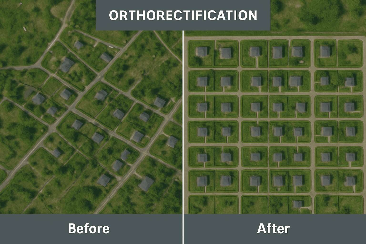
When a satellite captures an image of the Earth, it is not always looking straight down. The sensor has an angle, the Earth’s surface is uneven, and the planet itself curves away from view. These factors cause distortions, shifting objects away from their true positions. Without orthorectification, features may appear in the wrong place, measurements of distance or area become unreliable, and overlaying other geospatial data results in misalignment.
For industries like mining, construction, agriculture, environmental monitoring, and urban planning, these errors can create significant problems. Engineers may struggle to measure accurately, planners might design with uncertainty, and analysts risk drawing incorrect conclusions. This is where orthorectification becomes essential. It transforms raw satellite imagery into map-ready images where every pixel is placed in its proper location on the Earth’s surface.
Orthorectification is the process of correcting distortions in satellite or aerial imagery caused by the tilt of the sensor, terrain variations, and other geometric factors. Its main goal is to ensure that every point in an image is represented as if captured directly beneath the sensor. In other words, orthorectification places features in their true ground positions while maintaining a uniform scale.
By creating “orthophotos,” this process combines the visual clarity of imagery with the geometric accuracy of maps. The result is a product that is both easy to interpret and reliable for measurements, analysis, and GIS integration.
Distortions in satellite imagery come from two primary sources:
The Observer (Satellite or Sensor Factors):
Sensor tilt
Motion of the platform
Motion of the scanning system
The Observed (Earth and Environmental Factors):
Terrain relief (hills, mountains, valleys)
Earth’s curvature
Atmospheric effects
For example, the effect of sensor tilt could be minimized if images are collected directly at nadir. However, for satellites, tilting the sensor allows flexibility and revisits of the same area. While satellite images generally experience less distortion than aerial images due to higher altitude and stable orbits, removing or reducing distortions is necessary for accurate measurements.
Orthorectification can be more challenging in areas with steep terrain, high-rise buildings, or dense vegetation. When using a Digital Terrain Model (DTM), only the ground base of vertical features like buildings and trees is rectified to the correct position. Above-ground features may appear to lean, and steep surfaces can cause occlusions and shadows, resulting in gaps in the orthophoto.
To address this, true orthorectification is applied.
True orthorectification, or “true ortho,” ensures that above-ground structures, such as buildings, towers, and other tall features, are positioned correctly and appear upright. It also compensates for gaps caused by occlusions in high-relief areas.
True orthophotos are produced by combining data from a Digital Surface Model (DSM) rather than a simple DTM. DSMs capture the heights of buildings, trees, and other structures, allowing orthophotos to display above-ground features accurately, which is particularly useful for urban mapping and 3D city models.
Without orthorectification, raw satellite images contain tilt and relief displacement. For example, a tall building may appear to lean, or a steep mountain might look distorted. Correcting these distortions is crucial for:
Precision Measurements: Orthorectified images have a uniform scale, enabling accurate calculation of distances, areas, and volumes.
GIS Alignment: Images align perfectly with GPS coordinates, CAD files, and existing GIS layers.
Reliable Base Maps: Orthophotos serve as pixel-perfect reference maps for urban planning, infrastructure development, and resource management.
Consistent Monitoring: By removing distortions, images captured at different times can be compared accurately to detect subtle changes in construction sites, forests, or coastal areas.
Orthorectification transforms raw satellite imagery into map-ready, geometrically accurate images, ensuring every feature is placed in its true ground location. This process is crucial for industries such as urban planning, construction monitoring, mining, agriculture, and environmental management, where precise spatial information drives decision-making. XRTech Group uses advanced orthorectification techniques to deliver high-resolution, distortion-free satellite data ready for immediate GIS, CAD, and analytics applications.
The orthorectification workflow combines satellite sensor data, elevation models, and computational algorithms to correct distortions caused by sensor tilt, terrain variations, and Earth’s curvature. The key steps include:
Digital Elevation Models (DEMs) provide the height of the terrain at each pixel, allowing for accurate correction of terrain-induced distortions. Using DEMs ensures that features like hills, valleys, and slopes are properly aligned, so distances, areas, and angles measured on the orthophoto match reality. For high-relief areas, DEMs extracted from stereo satellite imagery, LiDAR, or radar interferometry are often used to improve precision.
Advanced geometric correction algorithms adjust the imagery so that each pixel corresponds to the correct geographic location. Techniques such as block adjustment, polynomial transformations, and map projection alignment are applied to remove tilt and displacement effects. This ensures that the final image can be accurately overlaid with existing GIS layers, cadastral maps, and vector datasets.
Orthorectification accounts for the specific characteristics of the satellite sensor, including focal length, off-nadir angles (ONA), and internal distortions. Calibrating for these parameters corrects the perspective and ensures that even objects captured at an angle appear in their true position on the ground. This is especially critical for high-resolution VHR optical sensors and SAR or hyperspectral data, where precision is paramount.
In many cases, multiple satellite images are combined to cover a larger area. Resampling methods, such as nearest neighbor, bilinear interpolation, or cubic convolution, adjust pixel values while preserving spatial accuracy. Mosaicking then fuses these images seamlessly, correcting for differences in lighting, color, and sensor conditions. The result is a continuous, high-resolution orthophoto suitable for GIS analysis, urban planning, or environmental monitoring.
Ground Control Points provide real-world reference coordinates that enhance the accuracy of orthorectified images. By integrating GCPs, XRTech Group can further reduce residual positional errors, particularly in mountainous regions or urban areas with high-rise buildings, ensuring precision at every scale.
The quality and reliability of orthophotos ultimately depend on the accuracy of the DEM, sensor metadata, and any GCPs used. XRTech Group combines these inputs with proprietary processing pipelines to deliver true orthorectified images that are ready for professional use without additional preprocessing.
By following this comprehensive orthorectification workflow, raw satellite imagery is transformed into actionable geospatial data. These orthophotos enable accurate distance measurements, area calculations, change detection, and spatial analysis—all critical for applications in resource management, infrastructure development, environmental monitoring, and disaster response.
To perform orthorectification effectively, you need:
Rational Polynomial Coefficients (RPCs): These model the positional relationship between the image and the ground. Most satellite images come with RPC files.
Digital Elevation Models (DEMs): Essential for terrain correction.
Ground Control Points (GCPs): Optional but increase positional accuracy.
Orthorectification can be performed using RPC-based software or the physical sensor model, depending on data availability and the desired accuracy.
Orthorectification combines the advantages of maps and imagery in one product. Some key benefits include:
Uniform Scale: Every feature is represented consistently, making measurements reliable without field verification.
Freedom from Distortion: Roads, buildings, and other structures appear in their true position.
Integration with GIS: Orthophotos can be overlaid with vector or raster data for advanced analysis.
Up-to-Date Data: Facilitates rapid map production and crisis response.
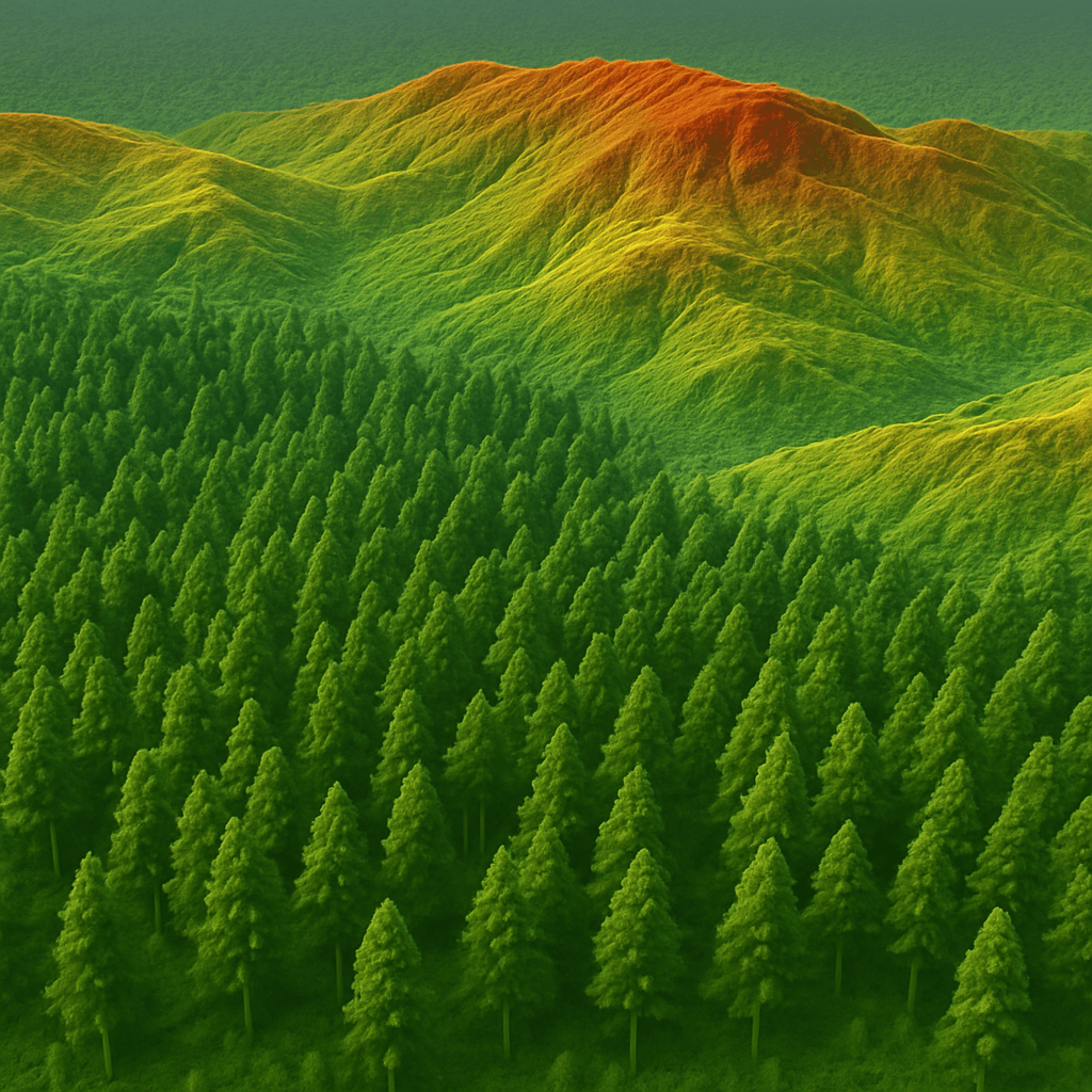
Enhanced Visualization: Orthophotos can be draped over DEMs for 3D visualization.
These benefits open doors to applications in urban planning, environmental monitoring, forestry, agriculture, mining, and construction.
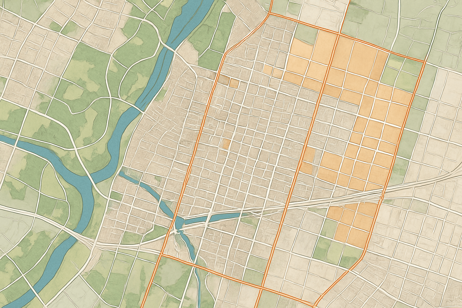
Orthorectified imagery has a wide range of applications across industries:
Urban Planning: Assess land use, track construction, and create 3D city models.
Construction Progress Monitoring: Compare designs with actual site layouts for accuracy.
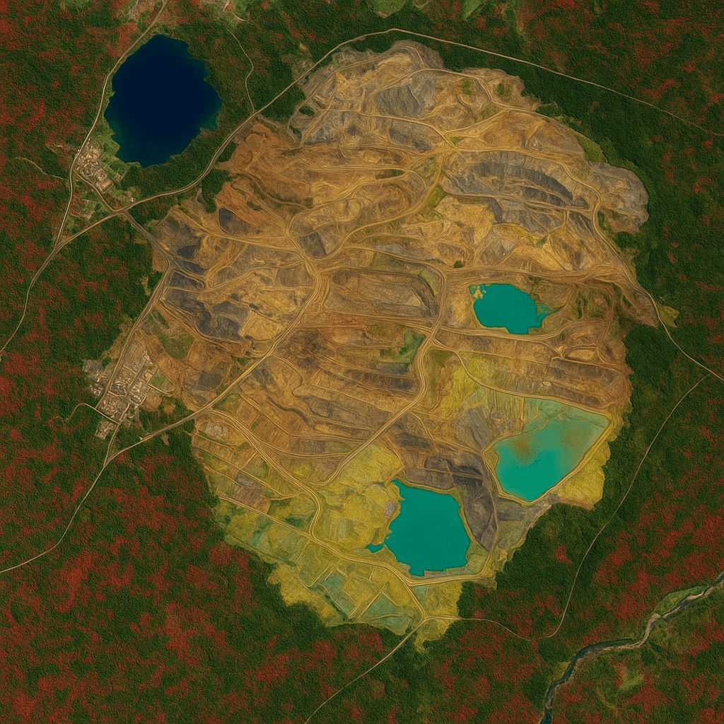
Mining and Mineral Exploration: Monitor tailing dams, overburden, and active mining areas.
Oil and Gas: Track infrastructure and pipeline alignment remotely.
Environmental Monitoring: Detect deforestation, coastal erosion, and water pollution.
Agriculture: Map fields for precision farming and assess crop health.
Infrastructure & Transport: Plan roads, highways, and rail corridors with precision.
Orthorectified images allow professionals to measure, plan, and analyze confidently without visiting sites physically.
Satellite imagery may be delivered in three geometric processing levels:
Primary: Raw images free from radiometric distortion but not orthorectified. Suitable for experienced users with DEMs and GCPs. Cannot be used directly in GIS.
Projected: Images projected to a map coordinate system, but terrain distortions remain. Can be overlaid with GIS layers but may have misalignment in steep areas.
Ortho: Fully orthorectified images, free from distortions and aligned with ground coordinates. Ready for GIS and analysis without additional processing.
XRTech Group provides high-quality orthorectified imagery for industries worldwide. Our services offer:
High-Resolution Data: Images up to 30 cm per pixel for detailed analysis.
Rapid Delivery: Critical Earth Observation imagery within 24 hours.
Global Reach: Access over 130+ satellites across remote and politically sensitive regions.
Comprehensive Products: 3D city models, DSMs, DEMs, and AI-based change detection.
Flexible Formats: GeoTIFF, SHP, DWG/DXF, LAS/LAZ for GIS and CAD integration.
We combine technical expertise with unmatched data quality to deliver ready-to-use solutions. Contact us Now!

XRTech Group provides access to a massive satellite network with advanced sensors and multiple spectral bands:
Constellation: Over 130 satellites, including Superview Neo, GF series, and ZY series for stereo mapping.
Sensors: VHR Optical for sharp visuals, SAR for all-weather monitoring, and Hyperspectral sensors for chemical analysis.
Spectral Bands: Panchromatic, RGB, Near-Infrared (NIR), Red Edge, Purple, Yellow, and SWIR.
This allows precise data collection for mapping, monitoring, and analysis across diverse industries.
Orthorectified images are essential in many workflows:
Topographic Mapping: Update maps by digitizing roads, rivers, forests, and buildings.
Land Surveying: Use as base maps for property boundaries and field planning.
Highway Design: Perform corridor studies, route analysis, and preliminary planning.
Urban Planning: Analyze land use and track changes over time.
Coastal Monitoring: Detect erosion, flooding, and sea level changes.
Forest Management: Map forest health and monitor deforestation trends.
Orthophotos can also be draped on DEMs for 3D visualization, enabling advanced insights and planning.
For those who prefer hands-on control, XRTech Group acknowledges that orthorectification can be performed directly using open-source tools like GDAL (Geospatial Data Abstraction Library). With the gdalwarp utility, you can transform raw satellite imagery into orthorectified, map-ready products by applying the image’s RPCs along with a DEM:
Here’s what each part does:
-rpc applies the Rational Polynomial Coefficients embedded in the satellite image metadata.
-to RPC_DEM=dem.tif uses the digital elevation model to correct terrain distortions.
The resulting file (ortho_image.tif) is your orthorectified image, ready for GIS, mapping, or analysis.
While GDAL is powerful, orthorectification in real-world applications presents challenges. Choosing an accurate DEM, selecting the right resampling methods, validating positional accuracy, and handling large datasets require specialized expertise and infrastructure. For professional-grade satellite imagery, these factors are critical to ensure reliable results.
At XRTech Group, we make orthorectification effortless. Every satellite image we deliver is automatically corrected, so you can focus on your analysis, planning, or project instead of preprocessing.
Our imagery is fully orthorectified using high-quality DEMs, along with ground control points when available. If you provide your own elevation data, we seamlessly integrate it for maximum accuracy.
All orthorectified images are projection-ready for immediate use in GIS, CAD, and analytics platforms. There is no need to source DEMs, configure GDAL commands, or manage complex processing pipelines.
The result is reliable, map-ready satellite imagery that you can trust from the moment it’s delivered, enabling precise measurements, confident decision-making, and fast project turnaround.
Orthorectification Defined: Converts raw satellite imagery into accurate, scale-consistent images for mapping and analysis.
Importance: Eliminates tilt and relief distortions, ensuring GPS alignment, reliable measurements, and precise overlay with GIS layers.
How It Works:
Input Digital Elevation Models (DEMs) to account for terrain height.
Perform geometric correction using algorithms and block adjustments.
Apply sensor calibration, considering Off-Nadir Angle and satellite characteristics.
Resample and mosaic multiple images for seamless high-resolution orthophotos.
Optional Ground Control Points (GCPs) improve accuracy in complex terrain.
True Orthorectification: Corrects high-rise buildings, bridges, and aboveground features using Digital Surface Models (DSMs).
Applications Across Industries:
Urban Planning & Construction: Digital twins, site monitoring, footprint verification.
Mining & Oil & Gas: Terrain analysis, pipeline monitoring, overburden and tailings evaluation.
Environmental & Forestry: Track deforestation, coastal erosion, and natural resource management.
Agriculture: Precision mapping, irrigation planning, and crop monitoring.
Insurance & Risk Assessment: Property verification and post-disaster analysis.
XRTech Group Advantage:
Global Coverage: 130+ satellites with VHR, SAR, and hyperspectral sensors.
High-Resolution Data: Imagery as sharp as 30cm per pixel.
Rapid Turnaround: Analysis-ready Earth Observation data delivered in 24 hours.
Ready-to-Use Orthoimages: Fully orthorectified imagery for GIS, CAD, and analytics.
Comprehensive Solutions: DSM/DEM, 3D city models, AI-driven analytics.
Zero-Risk Commitment: 30-day satisfaction guarantee for reliable data.
Tailings Dam Monitoring: How Advanced Satellite Intelligence Is Transforming Tailings Dam Safety Tailings dams are among the most critical—and high-risk—structures

From Visible Light to Spectral Intelligence in Modern Satellite Remote Sensing Satellite imaging has moved beyond photography. For decades, Earth