Earth Observation and Geospatial Solutions Worldwide
XRTech Group is a geospatial solutions company delivering high-resolution satellite imagery, SAR radar data, DEM terrain models and GIS products from 130+ satellites. Archive from $1/km² in 48 hours. While other providers often quote 2 to 3 weeks, XRTech delivers within 48 hours. No export licence delays. Free sample with every quote.
What is a Geospatial Solutions Company?
A geospatial solutions company collects, processes and delivers location-based Earth observation data - including satellite imagery, SAR radar, DEM terrain models and GIS products - that organisations use to make decisions about land, infrastructure, agriculture, environment and urban planning. XRTech Group provides optical satellite imagery from 25cm to 2m, SAR all-weather radar, Digital Elevation Models, hyperspectral imagery with 330 spectral bands and GIS-ready data products from 130+ satellites. Archive imagery delivers in 48 hours from $1/km², while many traditional providers quote up to 3 weeks for delivery. No ITAR or EAR export restrictions apply for buyers worldwide.
Geospatial Solutions Built for Every Earth Observation Need
From archive optical imagery to radar data and terrain models, XRTech Group delivers the full spectrum of geospatial data products from one authorised source - globally, without export restrictions.
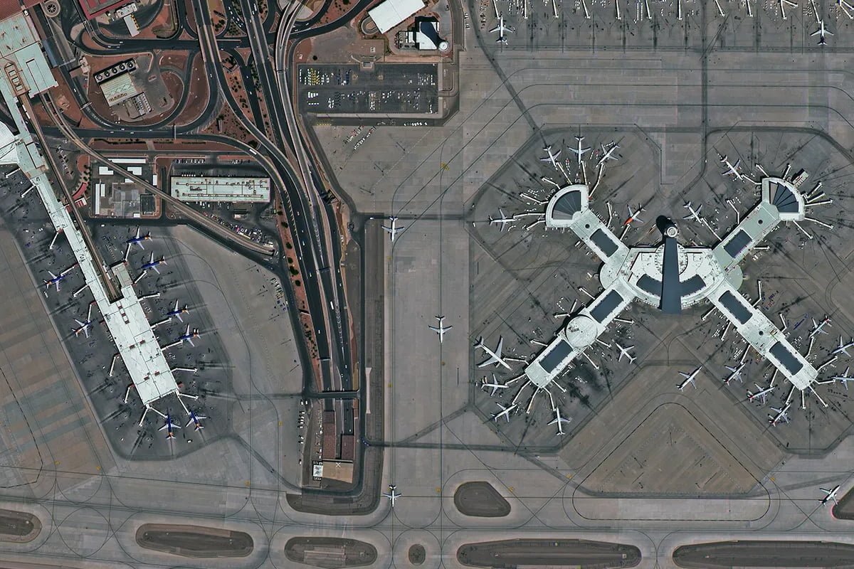
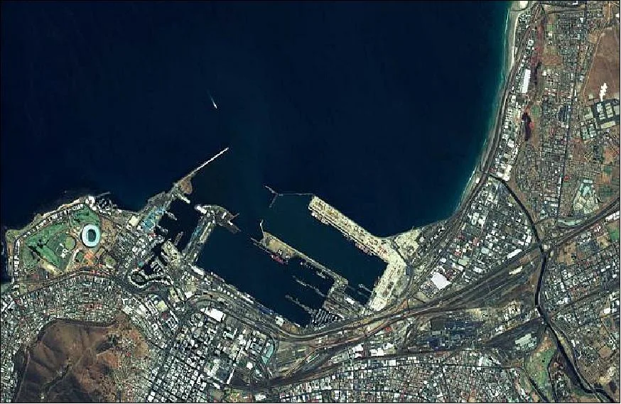
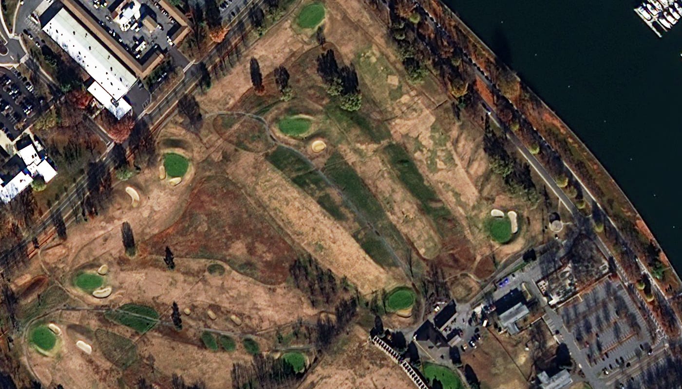
High-Resolution Optical Imagery
Archive and tasking optical data from 25cm to 2m resolution. Panchromatic, multispectral and pan-sharpened products as orthorectified GeoTIFF. ArcGIS, QGIS and AutoCAD compatible.
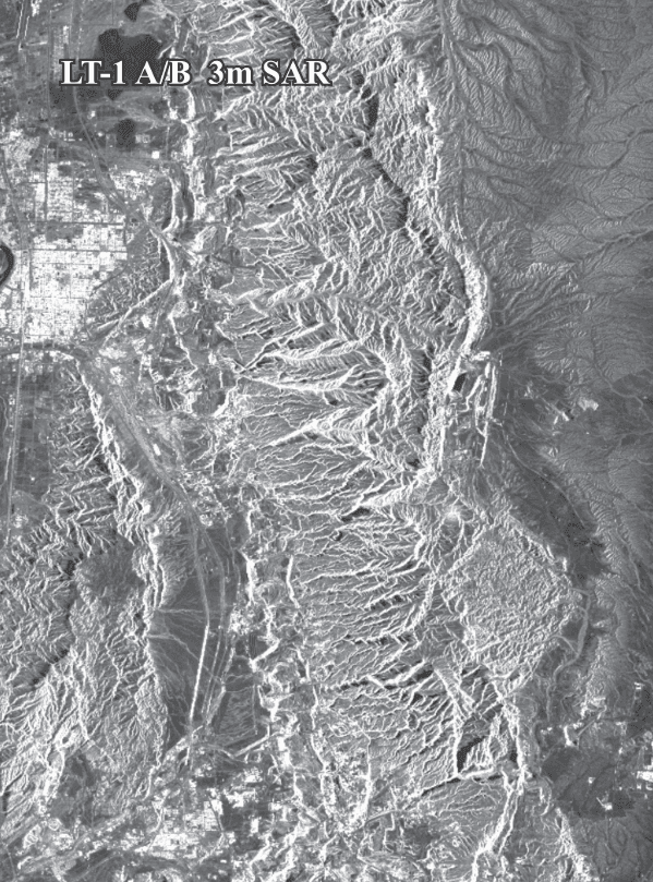
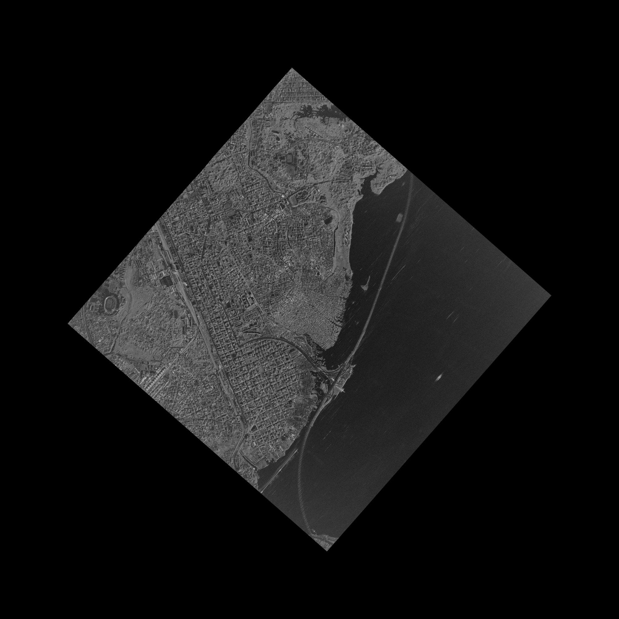
SAR Radar Satellite Data
C-band, X-band and L-band SAR for all-weather, day-and-night monitoring. Spotlight, Stripmap and ScanSAR modes. Oil spill detection, flood mapping and infrastructure monitoring.
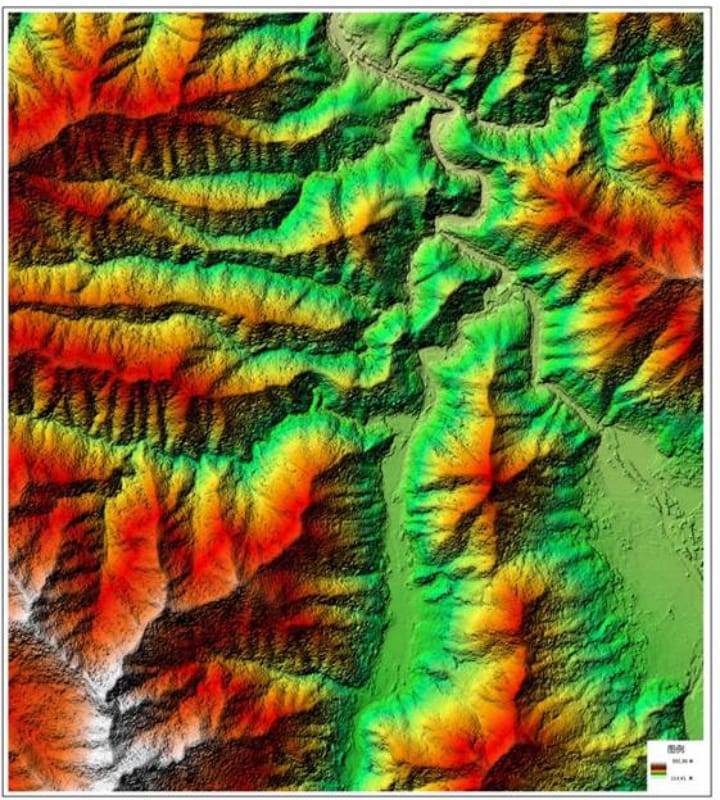
Digital Elevation Models (DEM)
DEM, DSM and DTM terrain products at 2–10m grid spacing with ±3m vertical RMSE. Hydrological analysis, flood modelling, road and dam planning.
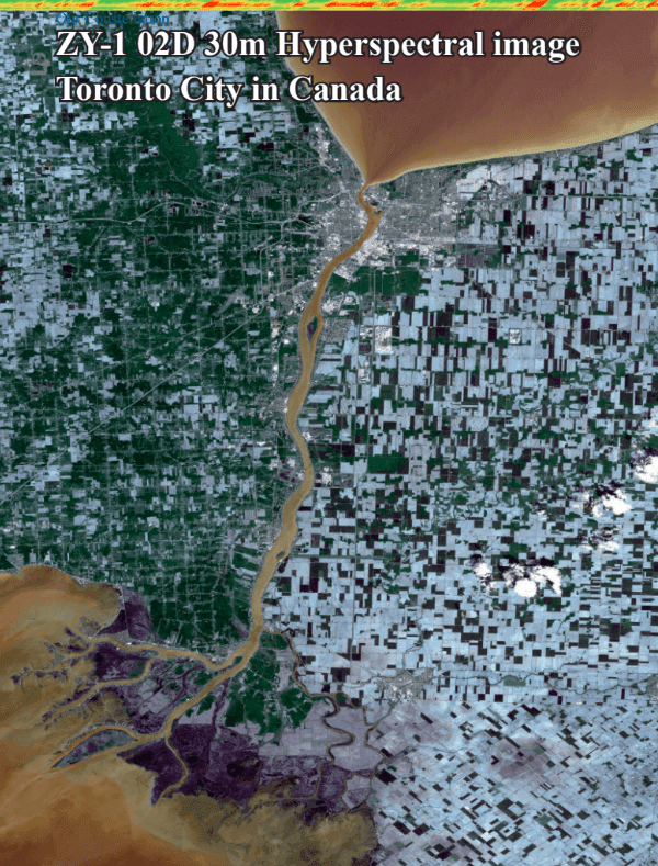
Hyperspectral Satellite Imagery
GF-5B AHSI with 330 spectral bands from 400–2500nm VNIR and SWIR. Mineral exploration, crop disease detection, CO₂ monitoring and water quality analysis.
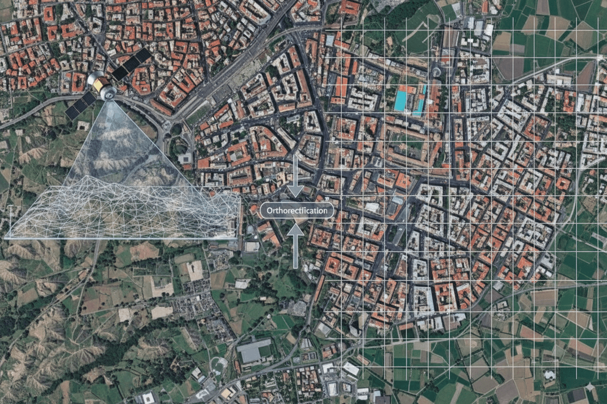
Digital Orthophoto Maps (DOM)
Geometrically corrected, georeferenced satellite imagery at 50cm resolution with 8m CE90 accuracy. Ready as a GIS base layer for urban planning and property mapping.
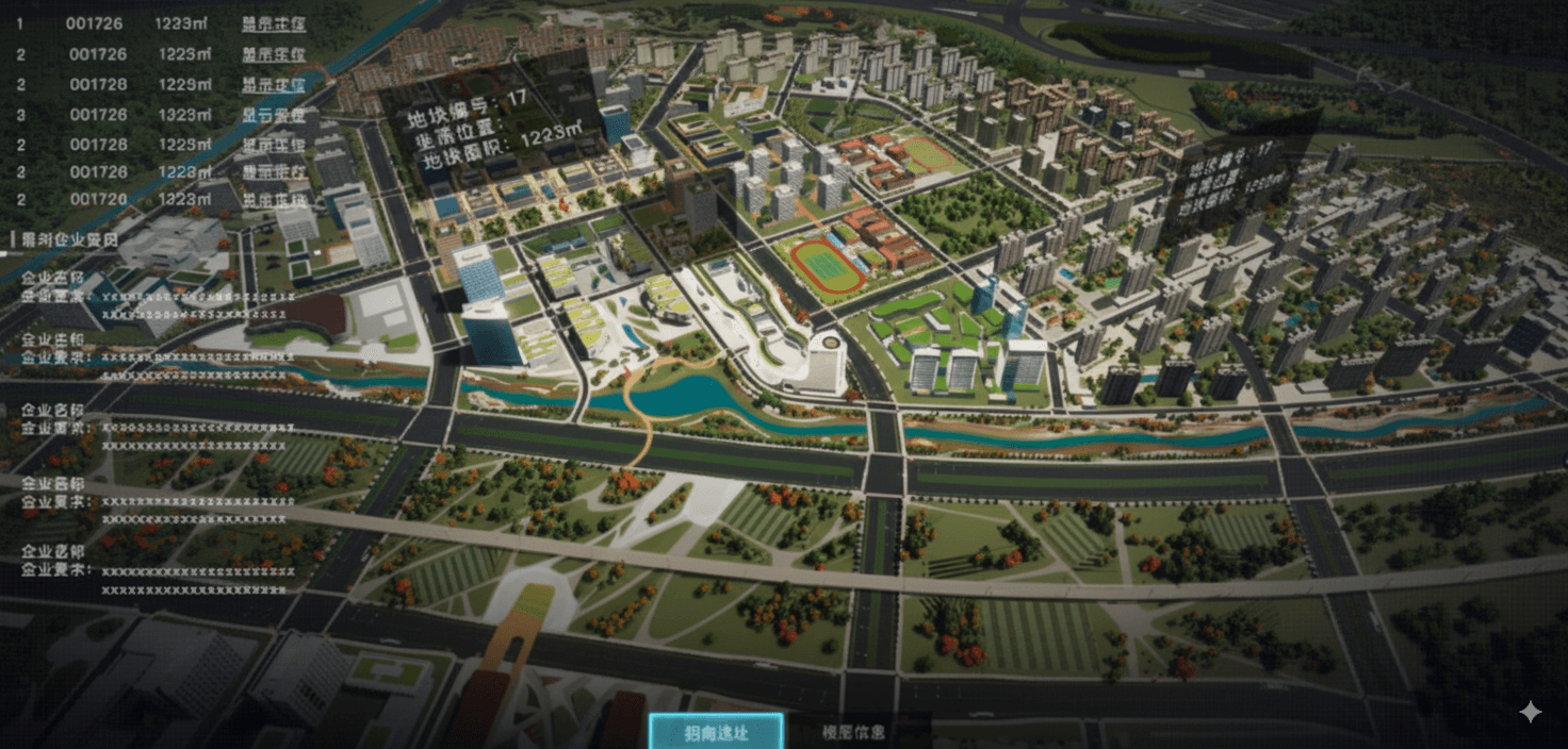
3D City Models and Digital Twins
Photorealistic 3D urban models from stereo and tri-stereo satellite imagery. Smart city simulations, zoning, mobility planning and digital twin applications.
What Makes XRTech Group Different from Other Geospatial Companies
Buyers across the Middle East, Africa and Asia choose XRTech Group for speed, pricing transparency and freedom from export restrictions that US-based providers cannot match.
No Export Licence Delays
XRTech Group is a non-US geospatial solutions company. No ITAR, no EAR. Buyers worldwide receive satellite data within 48 hours on standard commercial terms with no licence applications.
Fastest Delivery in the Industry
Archive in 48 hours. New tasking in under 7 days. Emergency tasking within 24 hours of the satellite pass. Proven in the Derna Libya flood response where XRTech delivered while competitors were still quoting.
130+ Satellite Network
Optical, SAR, hyperspectral and multispectral sensors from one authorised source. SuperView Neo-1 delivers 25cm native resolution launched February 2025. No single provider dependency.
Transparent Fixed Pricing
Published per-km² rates from $1. No hidden fees, no subscriptions. A free sample tile is included with every formal quote so you verify quality before committing to any order.
GIS-Ready Processed Delivery
Orthorectified, pan-sharpened and colour-balanced data. Level 2A GeoTIFF loads directly into ArcGIS, QGIS, ENVI and AutoCAD. WGS84, UTM or custom coordinate systems available.
Expert Technical Support
Our team advises on the right resolution, sensor and processing level for your project. WhatsApp: +971 58 885 3151. Response in under 24 hours on all formal requests.
Geospatial Solutions Across Every Industry
Earth observation data from XRTech Group is applied across agriculture, urban planning, environmental monitoring, construction, energy and disaster management worldwide.
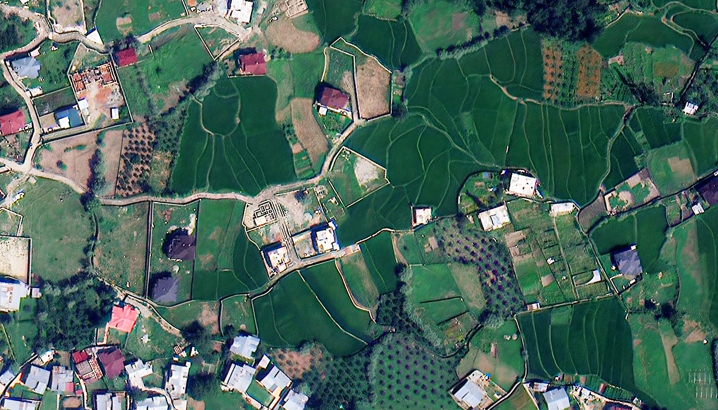 Agriculture
Crop Monitoring, Field Mapping and Yield Estimation from Orbit
Multispectral satellite imagery with Red Edge and NIR2 bands detects crop stress before it is visible to the eye. Map field boundaries precisely, verify subsidy applications and estimate yield across thousands of hectares in a single imagery order.
- NDVI and NDWI crop health indices at 50cm resolution
- Irrigation coverage and field boundary mapping
- Subsidy claim verification with independent satellite evidence
- Yield estimation and harvest planning support
 Urban Planning
Base Maps, 3D City Models and Urban Growth Analysis
Rapidly growing cities across Africa, the Middle East and Asia need current, accurate base maps. XRTech Group delivers 30cm orthorectified imagery and 3D city models from stereo satellite captures - giving planners the spatial foundation for infrastructure, zoning and smart city development.
- 30cm orthorectified base maps for GIS and CAD
- Building footprint extraction and change detection
- 3D city models for zoning and mobility planning
- Urban expansion monitoring with multi-date captures
 Construction
Track Construction Progress from Orbit Without Site Visits
Weekly or monthly satellite captures document foundation works, equipment positions and structural progress across any number of active sites. At 30cm resolution you resolve foundation details and identify specific equipment types without deploying a field team.
- Weekly or monthly automated progress documentation
- Multi-site monitoring from a single imagery order
- Verify milestones and detect unauthorised site activity
- Material stockpile volume estimation from multi-date images
 Oil and Gas
Pipeline Monitoring, Oil Spill Detection and Asset Verification
GF-3 C-band SAR detects oil spills on water surfaces day or night through cloud cover, providing early warning before environmental damage escalates. Detect pipeline encroachments and verify remote facility conditions without sending field teams to difficult or unsafe locations.
- Oil spill detection with C-band SAR any time of day
- Pipeline corridor encroachment detection
- Remote wellhead and refinery condition verification
- InSAR deformation monitoring for pipeline safety
 Mining
Mineral Exploration and Mine Site Monitoring at Scale
GF-5B 330-band hyperspectral imagery identifies mineral signatures, clay alteration zones and iron oxide anomalies from orbit. Combine with 30cm optical for stockpile volume estimation and SAR for subsidence detection across remote mine sites that are expensive to access on the ground.
- Spectral fingerprinting for mineral target identification
- Tailings dam extent and stability monitoring
- Stockpile volume from multi-date optical captures
- Land disturbance tracking for compliance reporting
 Disaster Response
Emergency Satellite Imagery in 24 Hours for Rapid Response
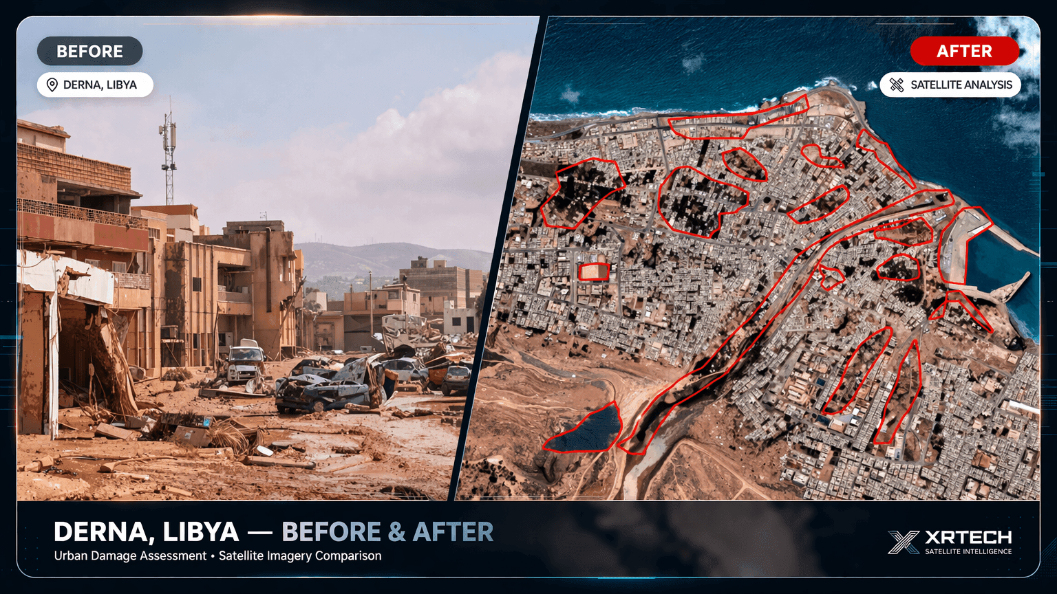
When disaster strikes, every hour of delayed decision-making increases loss of life and infrastructure damage. XRTech Group delivers emergency satellite imagery within 24 hours of the satellite pass - as demonstrated in the Derna Libya flood response, where XRTech delivered 30cm data while other providers were still preparing quotes.
- Flood extent mapping through cloud with C-band SAR
- Before-and-after damage assessment at building level
- Access route identification for first responders
- Debris mapping and evacuation zone planning
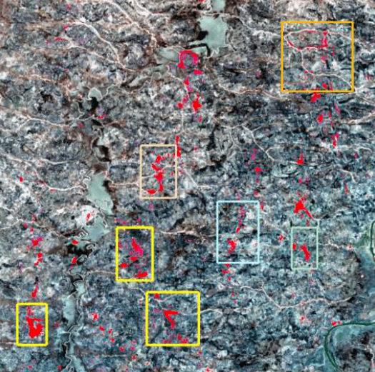
Why Change Detection Is Critical and What It Costs Without It
Change detection uses two or more satellite images of the same area captured at different times to identify exactly what has changed on the ground. It is the most cost-effective way to monitor large areas without continuous field presence - and the consequences of missing critical changes are severe.
Flood and Disaster Damage Assessment
Comparing pre-event and post-event satellite captures identifies exactly which structures, roads and infrastructure were damaged. Relief teams receive an actionable map within 24 hours instead of spending days on ground assessment that may not even be safe to conduct.
Urban Expansion and Land Use Change
Annual or biannual satellite captures over the same city boundary track exactly where new buildings, roads and settlements have appeared. Urban planners use this data to update cadastral records, identify illegal construction and plan infrastructure investment.
Infrastructure Deformation and Subsidence
InSAR (Interferometric SAR) detects millimetre-level ground movement over pipelines, dams, bridges and buildings. Monitoring deformation before failure occurs is far less expensive than emergency repair and reputational damage from a preventable infrastructure incident.
The window between a change occurring and the decision-maker needing to respond. Satellite change detection closes that gap from weeks to hours.
Archive imagery from $1/km² monitored quarterly costs a fraction of deploying field teams to the same area even once per year, with far greater coverage consistency.
A field team inspects a sample of the area. A satellite captures every square metre. Nothing is missed. Change detection works on the complete AOI every time, not a random sample.
Why Decision Speed Matters and How Geospatial Data Provides It
In flood response, every 6 hours of delay in identifying evacuation routes costs lives. In construction, a two-week delay in detecting an encroachment costs more than the monthly imagery bill. In oil and gas, an undetected pipeline encroachment identified after a rupture costs tens of millions. The value of geospatial solutions is measured not in the cost of the data but in the cost of the decisions made without it.
XRTech Group engineers the entire delivery chain around decision timelines. Archive imagery confirms in 48 hours whether a previous capture exists. New tasking initiates within hours of a request. Emergency imagery for time-critical situations delivers within 24 hours of the satellite pass - not of your order confirmation, but of the satellite's actual capture of your area.
Benefits of Geospatial Solutions for Your Organisation
Satellite earth observation gives organisations a persistent, scalable view of the physical world that no ground-based method can match in coverage, speed or cost-efficiency.
See Anywhere on Earth Without Being There
Satellite imagery gives your team instant access to any location - from remote mining sites in central Africa to coastal infrastructure in Southeast Asia. No travel, no access permissions, no safety risk. A single imagery order covering hundreds of square kilometres delivers in 48 hours for less than the cost of one field visit.
Access Historical Records Going Back to 1999
The XRTech Group archive holds satellite captures from 1999 onward. Compare land use change, urban expansion, deforestation, coastal erosion and infrastructure development across any time period for any location. Ideal for legal disputes, environmental baseline reports, insurance claims and long-term planning studies.
Dramatically Lower Cost Than Field Surveys
Archive satellite imagery at $1–20/km² delivers analysis-ready data for a fraction of the cost of ground surveys, drone flights or aerial photography - especially for large or remote areas inaccessible to field teams.
Sub-Metre Accuracy for Professional Use
25cm native resolution from SuperView Neo-1 resolves individual objects, building details and vegetation boundaries with accuracy that meets professional GIS, engineering and environmental reporting standards.
Monitor Change Over Time at Any Scale
Schedule recurring captures daily, weekly or monthly to track construction progress, environmental change, crop growth cycles and urban expansion across thousands of km² simultaneously - impossible with ground teams.
SAR Sees Through Cloud and Darkness
C-band, X-band and L-band SAR radar operates independent of weather, smoke, dust and lighting. Essential for flood monitoring, disaster response and monitoring tropical regions with persistent cloud cover year-round.
Delivered Ready for Your GIS Workflow
All geospatial products arrive orthorectified and georeferenced. GeoTIFF, SHP and DWG formats load directly into ArcGIS, QGIS, AutoCAD and Google Earth Engine with no preprocessing required from your side.
Independent, Verifiable Evidence
Satellite imagery is accepted as independent evidence in insurance claims, environmental compliance reports, legal disputes and regulatory submissions. Timestamped and georeferenced data that no party can dispute.
Common Business Challenges That Geospatial Solutions Solve
Organisations across government, energy, agriculture and infrastructure face problems that cannot be solved efficiently with ground-based methods alone. Satellite geospatial data resolves each one cost-effectively.
You cannot monitor large remote sites without expensive field teams
Remote mining sites, pipeline corridors, forestry concessions and infrastructure projects often span hundreds or thousands of km². Deploying field teams is costly, slow and sometimes unsafe. Traditional aerial surveys are expensive and weather-dependent.
30cm satellite imagery covers any area in 48 hours from $20/km²
A single satellite pass captures your entire area of interest at 30cm resolution. Orthorectified GeoTIFF delivered within 48 hours. Set up recurring monthly captures for ongoing monitoring. One imagery order replaces months of field survey costs.
US satellite providers impose export licence delays and regional restrictions
Buyers in the Middle East, Africa and Asia regularly face ITAR and EAR export control delays from US-based imagery providers. Licence applications take weeks or months. Some regions face outright restrictions, making US providers impractical for time-critical projects.
XRTech Group is non-US with zero export restrictions worldwide
As an authorised China Siwei reseller, XRTech Group operates outside US export control frameworks. No ITAR, no EAR, no licence application, no regional restrictions. Buyers in any country receive the same 48-hour delivery on standard commercial terms.
Cloud cover makes optical imagery unusable for tropical and coastal regions
Persistent cloud cover over tropical forests, monsoon regions and coastal areas means optical imagery is often unusable for months at a time. Agriculture, forestry and environmental teams struggle to get consistent usable data when they need it.
SAR radar data works day and night regardless of cloud or weather
GF-3 C-band SAR penetrates cloud, rain, smoke and darkness. XRTech Group delivers SAR for flood mapping, forest biomass monitoring, oil spill detection and change detection in regions where optical imagery cannot function reliably. SAR and optical can be ordered together for complete coverage.
Agriculture and forestry teams lack objective field-scale data for large areas
Manually scouting crop conditions across thousands of hectares is impractical. Data quality depends on individual scouts with no consistent baseline. Fraud in subsidy schemes is difficult to detect at scale without independent evidence.
Multispectral NDVI data covers any field area from $1/km²
XRTech Group delivers 8-band multispectral imagery with Red Edge, NIR and NIR2 bands for NDVI and crop stress analysis. A single order covers thousands of hectares. Detect crop stress before it is visible to the eye, map field boundaries precisely and verify subsidy claims with independent satellite evidence.
Urban planners lack up-to-date accurate base maps for fast-growing cities
Many cities across Africa, the Middle East and Asia are expanding rapidly. Cadastral maps are outdated. Illegal construction is difficult to track. Infrastructure planning without accurate current base maps results in costly errors and resource misallocation.
DOM and 3D city models provide current orthorectified base maps at 50cm
XRTech Group's Digital Orthophoto Maps at 50cm and 3D city models from stereo satellite imagery give urban planners a current, georeferenced base map for GIS and CAD integration. Identify new construction, map road networks and extract building footprints at city scale without a ground survey team.
How to Order Satellite Data and Geospatial Products from XRTech Group
From defining your area of interest to receiving analysis-ready data, the process is transparent, fast and guided by our technical team at every stage.
Define Your Area of Interest
Upload a KML or KMZ file or describe your area. Tell us your required resolution, date range and cloud cover threshold. Use our free satellite area calculator to measure your AOI first.
Search Archive or Schedule Tasking
We search the global archive for existing captures or schedule fresh satellite tasking on your chosen date with your specified parameters. Availability is confirmed within hours.
Receive Fixed Quote and Free Sample
We send transparent fixed per-km² pricing with a free sample imagery tile for your area. You verify resolution and cloud cover quality before committing to any order.
Receive Your Geospatial Data
Fully processed, orthorectified data delivered as GeoTIFF to cloud storage or email. Loads directly into ArcGIS, QGIS, AutoCAD or Google Earth Engine with no additional processing.
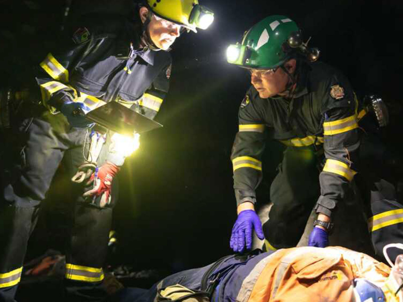
Live Case Study
Derna, Libya: Geospatial Data Delivered in 24 Hours During Active Flood Response
In September 2023, catastrophic floods hit Derna, Libya. XRTech Group delivered 30cm optical satellite imagery within 24 hours of tasking while competing providers were still preparing quotes. The geospatial data enabled flood extent mapping, evacuation zone modelling and relief coordination across a region with no safe ground access.
- Flood waterline mapped precisely to support evacuation decisions
- Data delivered while other vendors were still preparing quotations
- No ITAR or EAR export restrictions applied
- GeoTIFF loaded directly into relief teams' GIS platforms
Geospatial Solutions Pricing by Resolution and Data Type
Fixed per-km² rates with no hidden fees, no subscription and no export surcharge. A free sample tile is included with every formal quote.
- Min 25km² archive · 100km² tasking
- Archive in 48h · Tasking in 7 days
- Stereo $60/km² · Tri-stereo $90/km²
- Pan + 4-band MS available
- Min 25km² archive · 100km² tasking
- 4 agile satellites · Daily revisit
- 2M km² per day capacity
- Best value for large-area projects
- Min 25km² archive · 100km² tasking
- Best value wide-area coverage
- Pan-sharpened multispectral available
- Agriculture, land mapping, forestry
- Red, Green, Blue, NIR, Red Edge, NIR2
- NDVI, NDWI analysis ready
- Daily global coverage option
- Precision agriculture and forestry
What Clients Say About XRTech Group's Geospatial Solutions
"We received 30cm satellite imagery 2x faster than our previous vendor. The data arrived orthorectified and ready to load into ArcGIS with zero processing on our side. This is the standard every geospatial solutions company should meet."
"Others said 3 weeks. XRTech delivered in 4 days. For a disaster response project where every hour matters, that speed difference was the entire value of the geospatial data. We will not use another provider."
"Clear licensing, human support and no export licence paperwork. The absence of ITAR restrictions made XRTech Group the only viable geospatial solutions provider for our project across the MENA region."
Frequently Asked Questions About Geospatial Solutions
Free Browser-Based Geospatial Tools from XRTech Group
Plan your satellite imagery order, measure your area of interest and convert coordinates - all free, no account required, running directly in your browser.
Satellite Area Calculator
Draw polygons on live satellite maps and measure land area instantly. Export as KML, CSV or PNG. Free, no login.
Open CalculatorKML / KMZ File Viewer
View and inspect KML and KMZ files in your browser on a satellite map. Upload your AOI and verify boundaries before ordering.
Open ViewerCoordinate Converter
Convert between Decimal Degrees, DMS, UTM, MGRS, Geohash and Plus Codes. Click the map to get all formats instantly.
Open Converter