
Tailings Dam Monitoring with InSAR & AI
Tailings Dam Monitoring: How Advanced Satellite Intelligence Is Transforming Tailings Dam Safety Tailings dams are among the most critical—and high-risk—structures
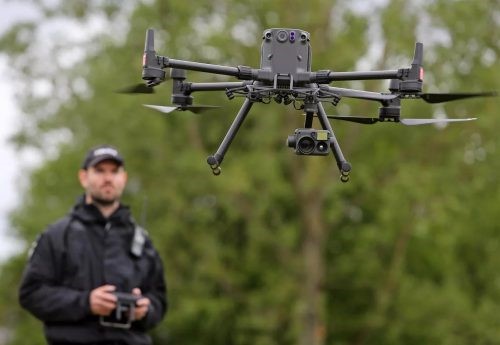
Drone inspection technology is now widely used across industries where routine monitoring and asset assessment are part of operations. A UAV inspection allows inspectors to collect high-resolution visual and thermal data without entering hazardous spaces or climbing tall structures. By using modern inspection drones, companies reduce risk, increase efficiency, and improve the accuracy of maintenance decisions.
Instead of relying on scaffolding, rope access, or manned aerial platforms, a drone can fly up structures such as telecom towers, wind turbines, bridges, or power infrastructure and record detailed data in minutes. This shift helps organizations perform safe and fast maintenance checks while eliminating many slow and risky manual steps.
For example, a manual telecom tower inspection may require climbing multiple levels to reach cables and metal joints. An industrial boiler inspection may require workers to climb over fifty feet on scaffolding. With inspection drones, these tasks are completed from the ground. A trained operator can fly a drone directly to the inspection point and capture clear visual data, thermal readings, or LiDAR scans.
Because of this transformation, more companies now rely on drone inspection services as part of their standard maintenance workflow. UAV inspection solutions also support aerial data collection programs, predictive maintenance systems, and digital twin applications. As demand grows, the drone sector continues to create specialized job roles across surveying, asset monitoring, structural assessment, mapping, and automated industrial inspection.

Choosing the best inspection drone depends on the environment, flight range, and type of inspection work. The market now includes a wide range of platforms designed for UAV inspection, from compact drones to heavy-duty industrial systems with high-resolution imaging sensors, LiDAR, and thermal capabilities.
For large land surveys, mapping mines, or monitoring long corridors such as pipelines or transmission lines, fixed-wing drones are ideal because they offer longer endurance and coverage area. Their extended flight time makes them suitable for aerial mapping and remote inspection applications.
For low-altitude inspections near buildings, bridges, solar farms, or construction sites, a multirotor or quadcopter provides precise maneuverability and stable hover capacity. These drones are often used for visual and thermal inspections where agility and close-range positioning are required.
When operating in confined spaces such as storage tanks, industrial boilers, cement silos, or underground mines, inspectors need rugged platforms designed for GPS-denied environments. A drone like the Autel EVO II Dual 640T V3 is a strong example of a specialized drone inspection tool. It offers a dual-camera system that includes a 50-megapixel visual sensor and a 640×512 thermal sensor. It also includes 360-degree obstacle avoidance to safely navigate narrow or cluttered spaces.
These features make it suitable for internal industrial inspections, safety monitoring, search-and-rescue operations, and tasks in dust-filled or low-visibility environments. As UAV inspection applications continue to expand, industrial drones will remain essential for safe, accurate, and repeatable data collection.
Drone inspection workflows often begin with a visual inspection. A visual inspection is a detailed review of an asset using the naked eye to identify defects, wear, corrosion, cracks, leaks, or structural changes. In a UAV inspection, the drone’s camera becomes the inspector’s eyes, capturing high-resolution images and video so the inspection can be analyzed safely from the ground.
Before drone technology, a visual inspection required physical access. Inspectors climbed cell towers, walked across roofs, used lifts, or built scaffolding to reach every point of a structure. In industrial environments such as pressure vessels, boilers, or confined spaces, inspectors relied on rope access or internal scaffolding. These methods introduced risk, cost, and long project timelines.
Now, inspection drones make this process faster and safer. A drone can collect visual data from all angles within minutes. Inspectors can review data live during flight and perform a more detailed analysis later on a workstation. The ability to zoom, capture thermal imaging, or scan from multiple viewpoints improves accuracy and documentation.
Visual inspections remain essential because early detection prevents failures. For example, finding rust, loose bolts, or deformities on a tower costs far less than emergency repairs after a failure. In critical infrastructure such as offshore platforms, refineries, power lines, or pressure systems, early identification prevents catastrophic outcomes.
Visual inspections also play a direct role in public and worker safety. A damaged pressure vessel, corroded bridge beam, or cracked wind turbine blade can lead to injury or structural collapse if unnoticed. A structured drone inspection program helps avoid these risks.
Although many drone inspections are visual, UAV platforms now support advanced sensors that enable additional inspection types. Multispectral sensors help detect crop health issues in agriculture. Thermal payloads are used in HVAC inspections to locate heat loss or moisture. LiDAR systems support high-precision 3D models for digital twins, deformation analysis, and engineering review.
Modern industrial-grade inspection drones can carry multiple payloads at once to support complex inspection workflows. A strong example is the DJI Matrice 400, which is built for large-scale mapping, power-line inspection, offshore inspection, and construction monitoring.
Key capabilities of the Matrice 400 include:
Payload capacity up to 6 kg supporting LiDAR, thermal, and RGB sensors at the same time
Long flight endurance of up to 59 minutes
Advanced obstacle detection powered by rotating LiDAR and mmWave radar
IP55 weather protection for operation in rain, dust, or offshore environments
These capabilities make modern UAV inspection platforms suitable for high-risk environments where traditional access methods are time-consuming or unsafe. As sensors evolve and autonomous flight improves, inspection drones will continue replacing manual access in construction, infrastructure, mining, transportation, utilities, and energy sectors.
Drone inspection workflows support the first and most important stage of asset maintenance. In any industry, whether inspecting a pressure vessel, bridge, pipeline, or power line, the process follows a simple sequence. First you inspect the asset, and then you repair it if the inspection shows defects or degradation. This sequence applies across all maintenance programs.
A UAV inspection improves the inspection phase by allowing inspectors to collect visual or thermal data without physically entering high-risk areas. Instead of climbing towers, entering boilers, or accessing chimneys, inspectors can fly inspection drones to capture detailed imagery and condition data safely from the ground.
If an issue is detected during a drone inspection, repairs still require manual work. A UAV inspection does not replace technicians or skilled maintenance teams. Instead, it gives them accurate information so they can plan repairs more efficiently and avoid unnecessary access at height.
Drone inspection technology is an additional tool rather than a replacement for all other inspection methods. Inspectors may still choose hands-on review when close visual judgement or tactile testing is required. In some cases, a simple handheld camera system or rope access method may be more suitable.
However, when access is difficult, time is limited, or risk is high, inspection drones are often the ideal choice. They reduce manual exposure, support compliance with safety standards, and speed up the maintenance cycle while improving data accuracy.
Drone inspection improves safety, reduces cost, and accelerates the full inspection workflow. A UAV inspection replaces manual access in many cases, removing the need to climb towers, enter confined spaces, or build temporary structures.
Most inspections do not require physical repairs. In many industries, only 10%–20% of inspections result in corrective action. This means inspection drones can complete up to 80%–90% of inspection tasks without requiring scaffolding, lifts, or rope access. This single benefit generates substantial cost savings.
Scaffolding is one of the most expensive parts of traditional inspection work. When scaffolding is only required after an issue is confirmed, companies reduce inspection expenses by up to 80%–90%, sometimes saving tens or hundreds of thousands of dollars per asset.
Manual inspections also increase downtime. Building and removing scaffolding may take days, and shutting down a plant, refinery unit, or power asset creates revenue loss. A drone inspection reduces downtime because flight time and data capture take minutes—not days.
Liability and insurance costs also decrease. With less work at height, fewer confined space entries, and fewer high-risk access points, companies demonstrate safer processes and reduce exposure.
Reduced Risk
Drone inspection reduces worker exposure to height, confined spaces, and unstable structures.
Lower Temporary Access Costs
Most inspections no longer require scaffolding, lifts, or rope access.
Reduced Downtime
Faster visual assessments mean faster approvals and fewer shutdown hours.
Lower Liability & Insurance Costs
Less human exposure leads to fewer incidents and lower insurance premiums.
More Frequent Inspections
UAV inspection cost is low, enabling routine monitoring and early issue detection.
High-Quality Inspection Records
Drone inspection provides archived visual evidence and repeatable datasets for asset lifecycle planning.
Drone inspection follows industry inspection standards. In high-risk sectors such as oil and gas, energy, nuclear, and chemical processing, inspections are required by regulation—not preference. Failure to comply may result in shutdowns, penalties, or legal consequences.
API (American Petroleum Institute) — used in oil and gas platforms, tanks, and pressure systems
ASME (American Society of Mechanical Engineers) — governs boilers and pressure vessels
ISO, IEC, and other governing frameworks depending on geography and sector
These organizations define how inspections must be performed, but they do not mandate or endorse specific inspection tools. If inspection drones capture data equal or superior to manual visual review, the data can qualify under most standards.
Most regulated industries require inspection approval from a certified third-party organization. These bodies verify that the data collection method—whether manual or UAV—is accurate and meets compliance requirements.
Inspectors certified by these bodies assess whether the tool is acceptable in each situation. If the UAV inspection delivers visual clarity equal to an in-person assessment, the drone can be approved for that inspection.
Class societies including Bureau Veritas and American Bureau of Shipping (ABS) have already accepted drone-collected data in certified inspections. In these cases, the certification applies to the final recorded data—not the drone model.
Yes—when the drone provides reliable and comparable inspection data. Approval depends on the inspector’s judgment and alignment with required inspection codes.
In high-risk industries, inspection drones are no longer experimental—they are now a standard tool used in refineries, utilities, mining, aviation, infrastructure, and renewables.
Drone inspection is now used across major industries because it improves safety, reduces inspection costs, and provides faster and more accurate data than manual inspections. As UAV inspection technology continues to evolve, more organizations are replacing traditional methods with inspection drones to support maintenance, compliance, and operational efficiency.
These industries use drones differently depending on the environment. Indoor inspections require compact drones that can fly without GPS and navigate confined spaces safely. Outdoor inspections require long flight endurance, high-resolution imaging, thermal capability, and advanced navigation for large assets and wide coverage.
Below is a breakdown of how different sectors use drone inspection, the assets being monitored, and the core benefits.
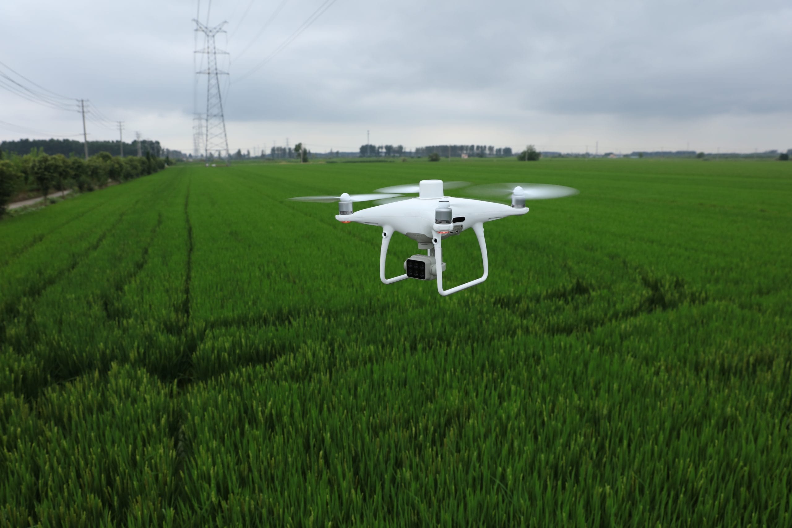
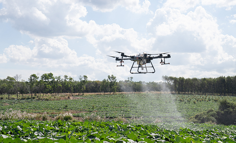
Agriculture is one of the fastest-growing sectors adopting inspection drones. A UAV inspection in farming supports routine evaluation of crops, soil, irrigation systems, and livestock health. Instead of field workers walking long distances, a drone can scan large farmland quickly and collect high-resolution visual and multispectral data.
Farmers use drone inspection to identify crop disease, drought stress, pest exposure, flood damage, or nutrient imbalance early. This approach is called precision agriculture because every decision is based on accurate aerial data.
Using inspection drones increases productivity because data is collected in minutes, not hours. As a result, crop yield improves, irrigation efficiency increases, and operational costs decrease.
Crop health and vegetation condition
Soil and moisture levels
Irrigation systems and drainage performance
Orchard, vineyard, and plantation canopies
Livestock tracking and herd monitoring
Chemical facilities are adopting drone inspection and UAV inspection solutions to monitor assets without exposing workers to hazardous materials. In this sector, even a minor leak or corrosion failure can contaminate soil, air, or groundwater. Therefore, using inspection drones improves safety and helps ensure compliance with strict environmental and safety regulations.
A drone inspection also removes the need for manual climbing or scaffolding around large tanks, elevated pipe racks, and confined structures. This reduces costs and minimizes human exposure to toxic chemicals, fumes, and high-risk industrial environments.
Inspection drones in chemical plants capture high-resolution visual data and thermal data for leak detection, corrosion tracking, and structural integrity assessments. This supports early maintenance planning and reduces operational downtime.
Pipe racks and elevated lines
Chemical conduits and cables
Pressure vessels and large storage tanks
Heat exchangers and suction ducts
Fermenter tanks and fiberglass storage units
Chemical silos, bins, and processing towers

Construction teams now rely on drone inspection workflows to track progress, improve accuracy, and report site conditions in real time. Using a UAV inspection removes the need for regular manual walk-throughs and allows project managers to monitor large sites quickly.
Inspection drones create detailed visual data, orthomosaic maps, and 3D models of construction areas. This improves documentation and allows teams to detect safety risks and structural issues early. These insights help prevent costly errors and delays.
One major advantage is that drone inspection technology enables frequent site monitoring without interrupting work. Teams can verify measurements, track material movement, assess stockpiles, and share progress data with stakeholders instantly.
Faster reporting and improved accuracy
Real-time monitoring to prevent project delays
Safer inspection of roofs, scaffolding areas, and high structures
Better pre-planning through detailed mapping and modelling
Reduced need for manned aerial surveys and manual checks
Improved transparency and communication with project owners
Construction companies choosing inspection drones report better site control, improved safety compliance, and more accurate budgeting because problems are identified early rather than after expensive work has been completed.
Land
The ground conditions of the entire site area.
Construction Site (Building + Surroundings)
Includes the structure under construction and all nearby activity zones.
Stockpiles and On-Site Aggregates
Materials stored on the site that need regular monitoring for quantity and safety.
Fencing and Safety Barriers
Ensures proper protection is in place to keep unauthorized persons away from the site.
Crew Safety Conditions
Helps identify any potential hazards that could affect workers before accidents occur.
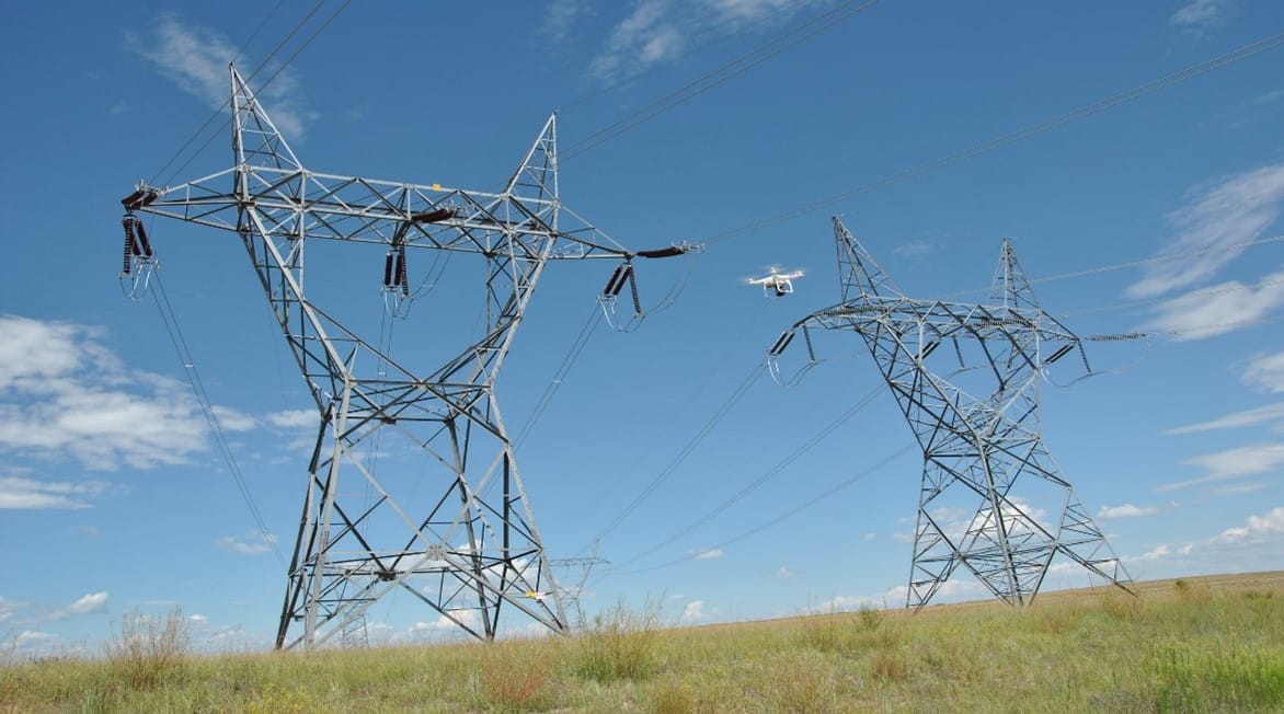
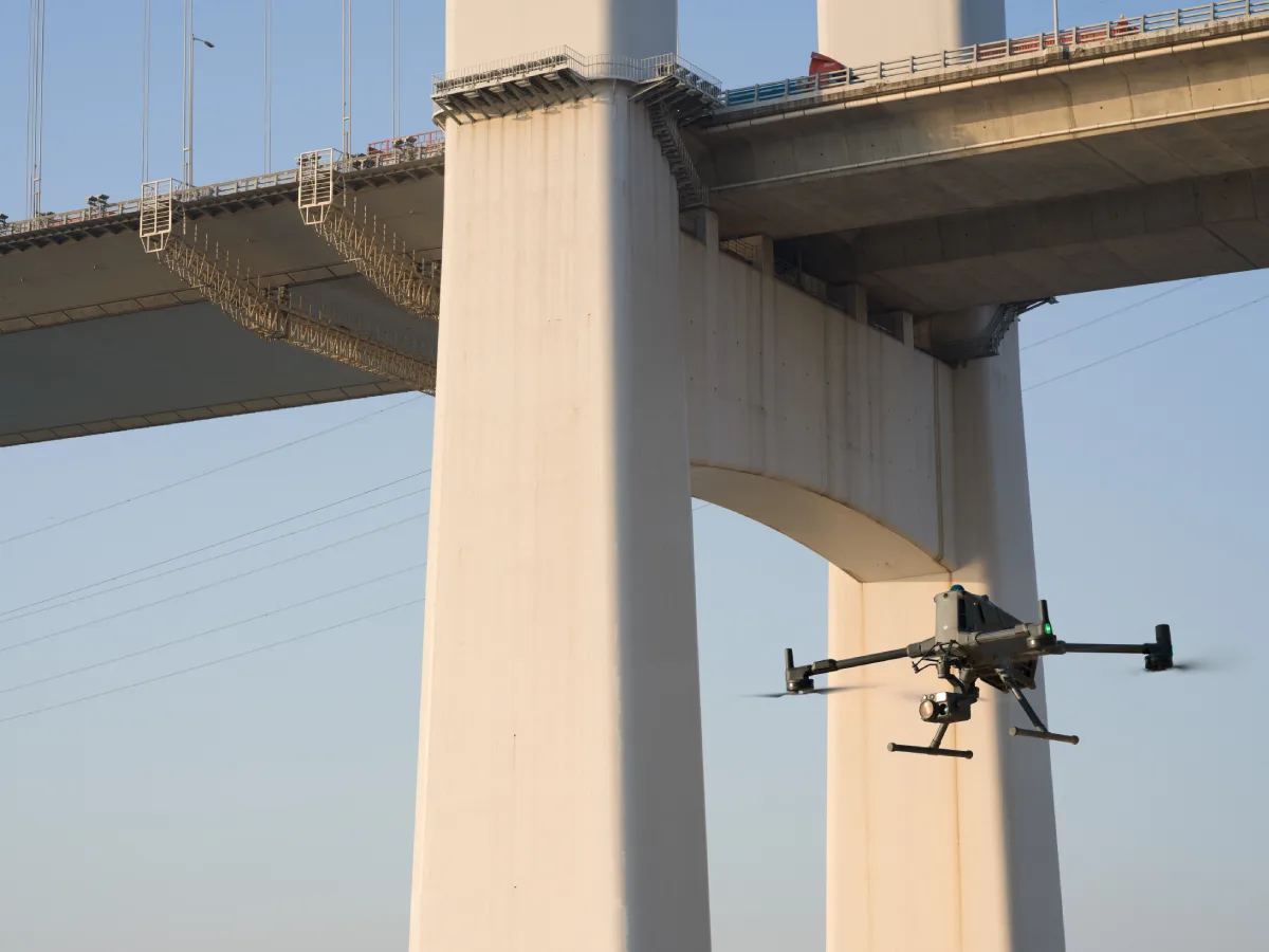
Drone inspection is now a core method for monitoring infrastructure and utility assets at scale. This sector includes bridges, railways, roads, power lines, airports, and telecom towers. Using inspection drones allows teams to collect high-resolution images, thermal data, and measurements without relying on scaffolding, rope teams, or helicopters.
A UAV inspection enables faster damage assessment, especially after floods, earthquakes, hurricanes, or industrial failures. Instead of weeks of manual inspections, drones can scan an entire structure within hours, providing visual data and 3D models for structural assessments and repair planning.
For example, inspecting a bridge manually may require rope access, heavy equipment, and lane closures. With an inspection drone, the same task can be completed safely and quickly, reducing cost, risk, and downtime.
Wind turbines
Utility towers and power distribution poles
Bridges and tunnels
Railways and road networks
Airport runways and aviation towers
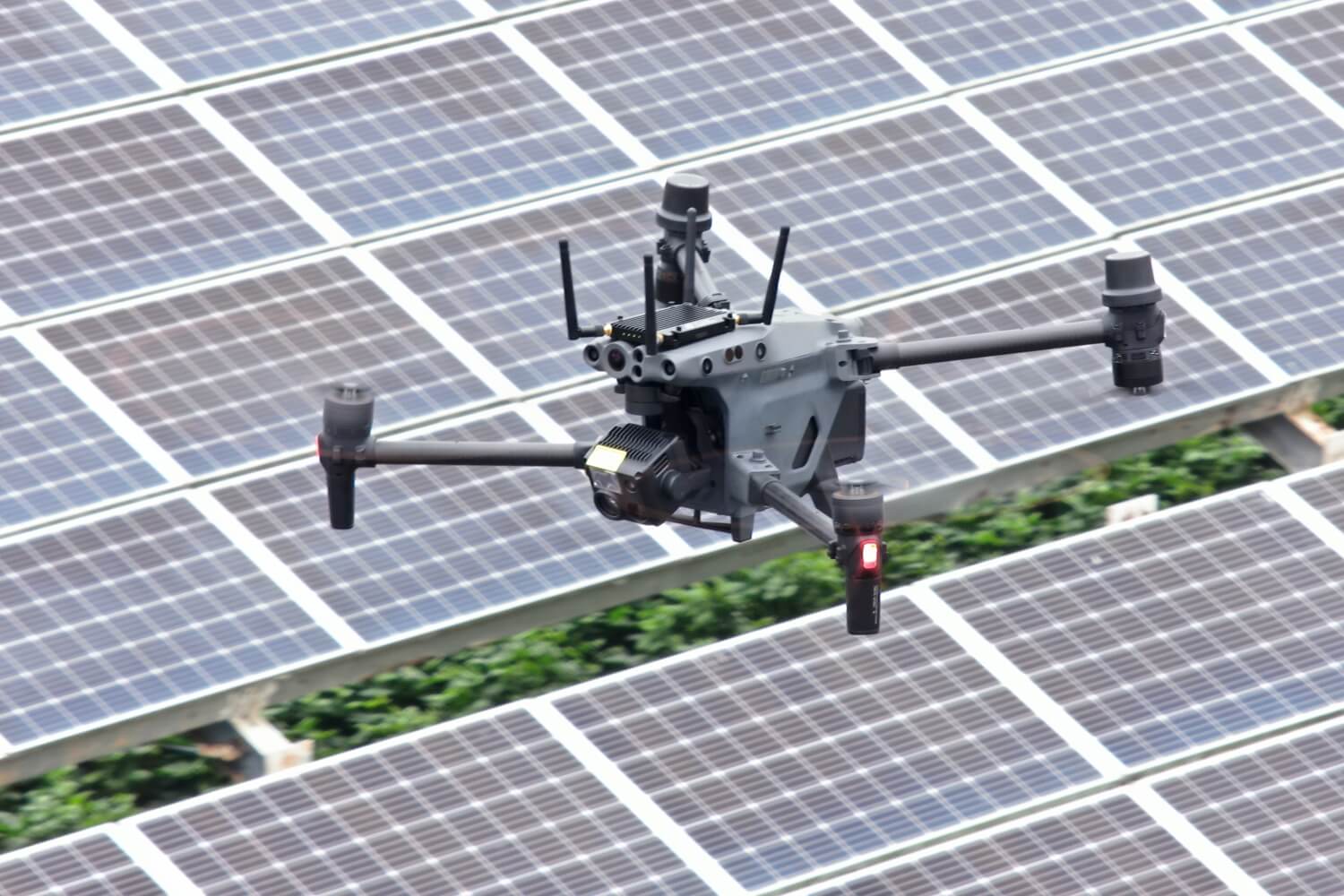
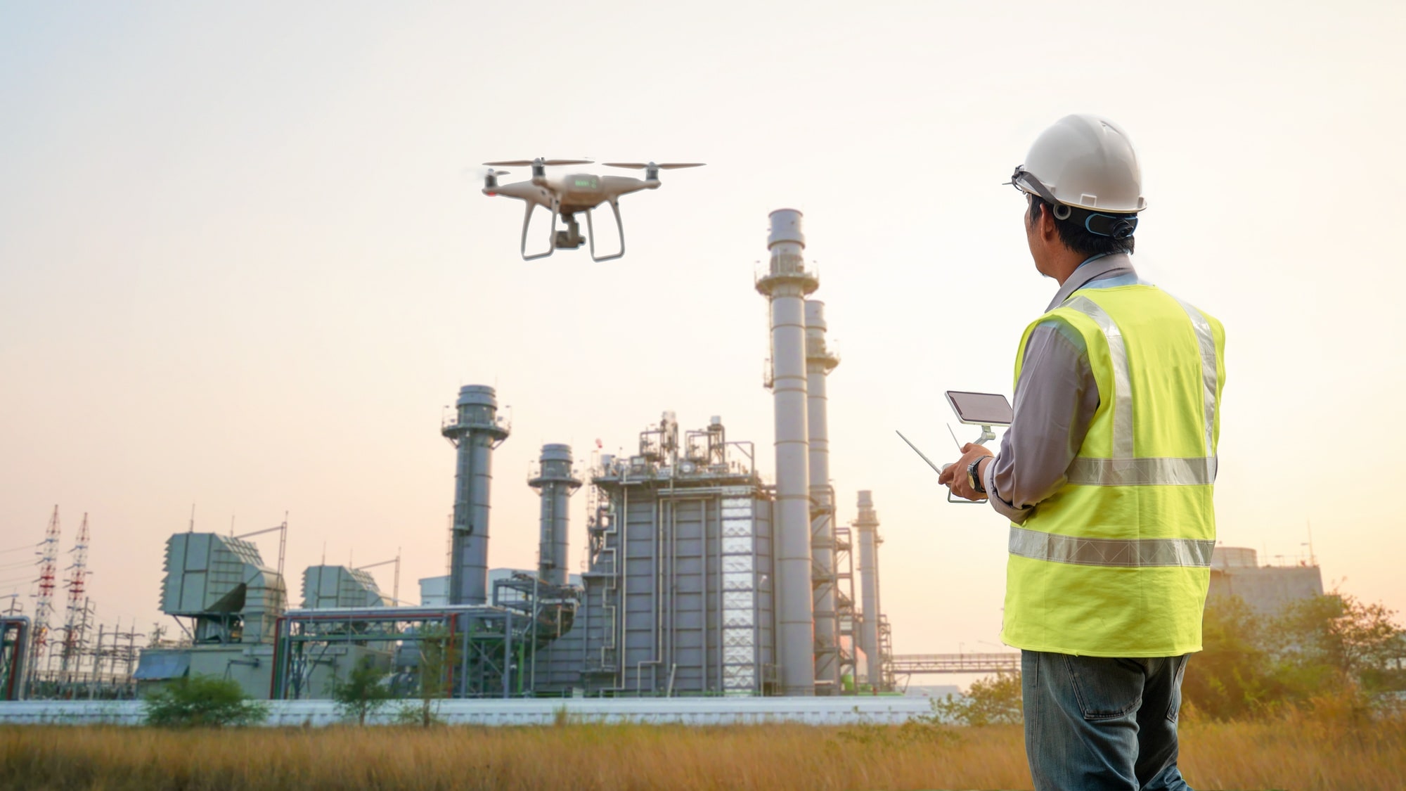
Power plants rely heavily on drone inspection and UAV inspection solutions to meet safety regulations and reduce operational downtime. Inspection drones are now used in coal plants, nuclear facilities, hydropower plants, and renewable sites.
Traditional inspections require scaffolding, rope teams, or long shutdown periods. With inspection drones, operators can collect thermal imagery, corrosion analysis, and visual evidence while the asset remains operational. This increases uptime and lowers inspection costs.
Solar farms and individual panels
Wind turbine blades and nacelles
Boilers, chimneys, and heat recovery steam generators
Nuclear reactors and radiation-restricted zones
Transformers and transmission equipment
Using inspection drones in power generation also improves compliance reporting, reduces worker exposure, and supports preventive maintenance with repeatable, high-frequency inspections.
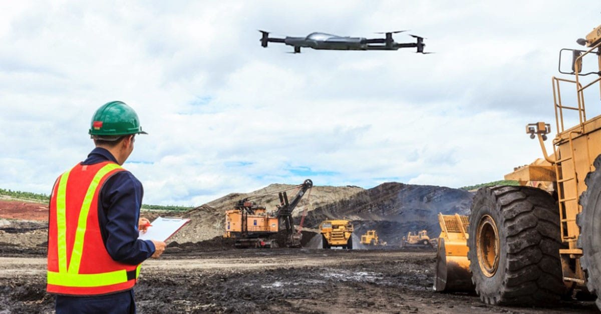
Mining companies now use drone inspection technology to assess underground and surface operations. Mines contain confined spaces, unstable structures, and debris hazards, making UAV inspection safer and more effective than sending personnel or equipment into risk zones.
Inspection drones can enter stopes, ore passes, and collapsed areas where humans are prohibited. New LiDAR-enabled inspection drones create precise 3D models of voids, slopes, stockpiles, and tunnel geometry. These models help engineers detect roof instability, unclaimed ore, and equipment risks.
The biggest advantage is safety. A drone inspection removes the need for miners to enter dangerous zones, while still providing essential visibility of underground conditions. Mining operators also gain financial value by reducing equipment damage and identifying recoverable ore.
Stopes and ore passes
Conveyor systems
Crushers and feeders
Grinding mills and SAG mills
Drop raises and shafts
Mine stockpiles and haul roads
A UAV inspection accelerates reporting, improves operational planning, and protects workers while delivering better situational awareness underground and at the surface.
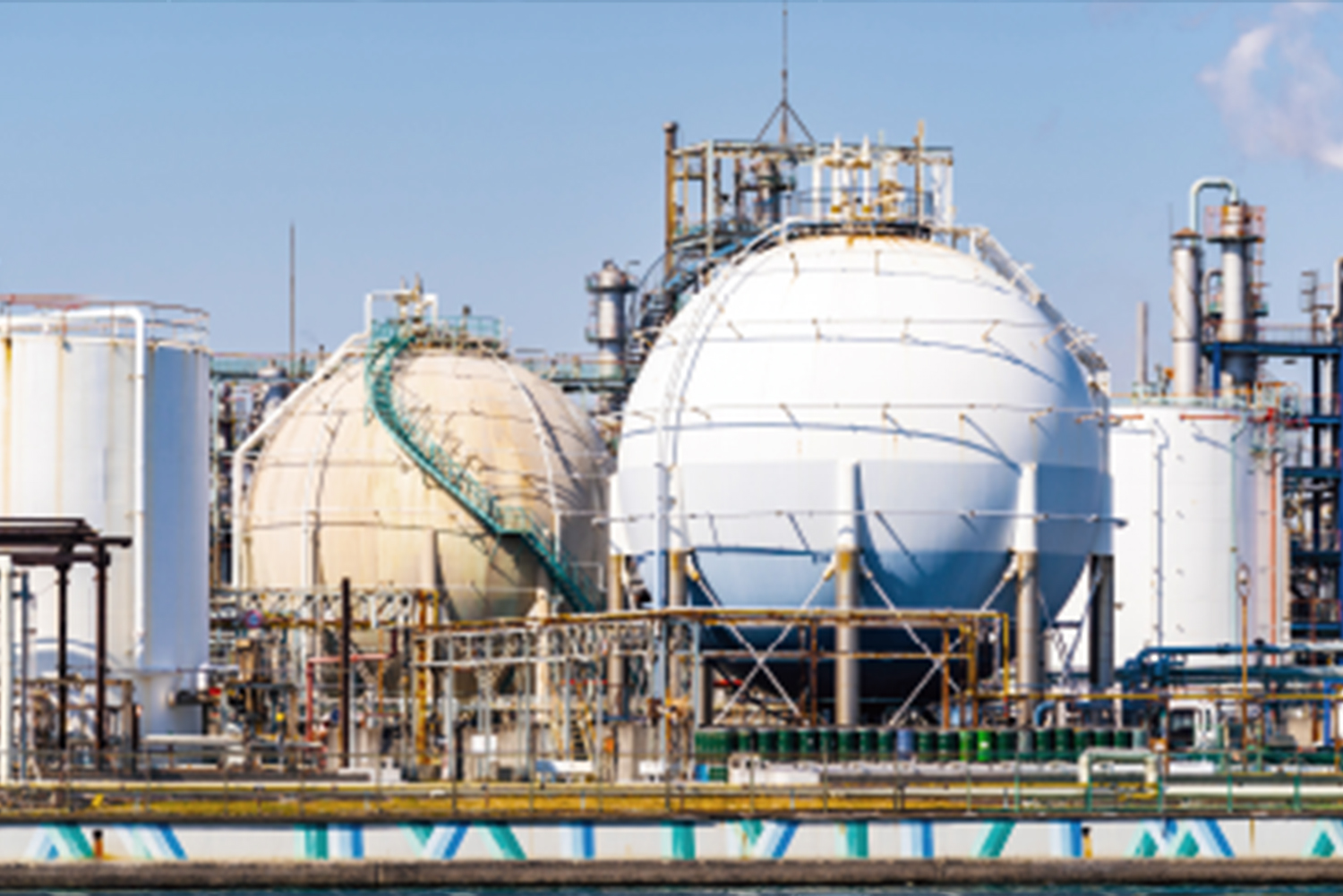
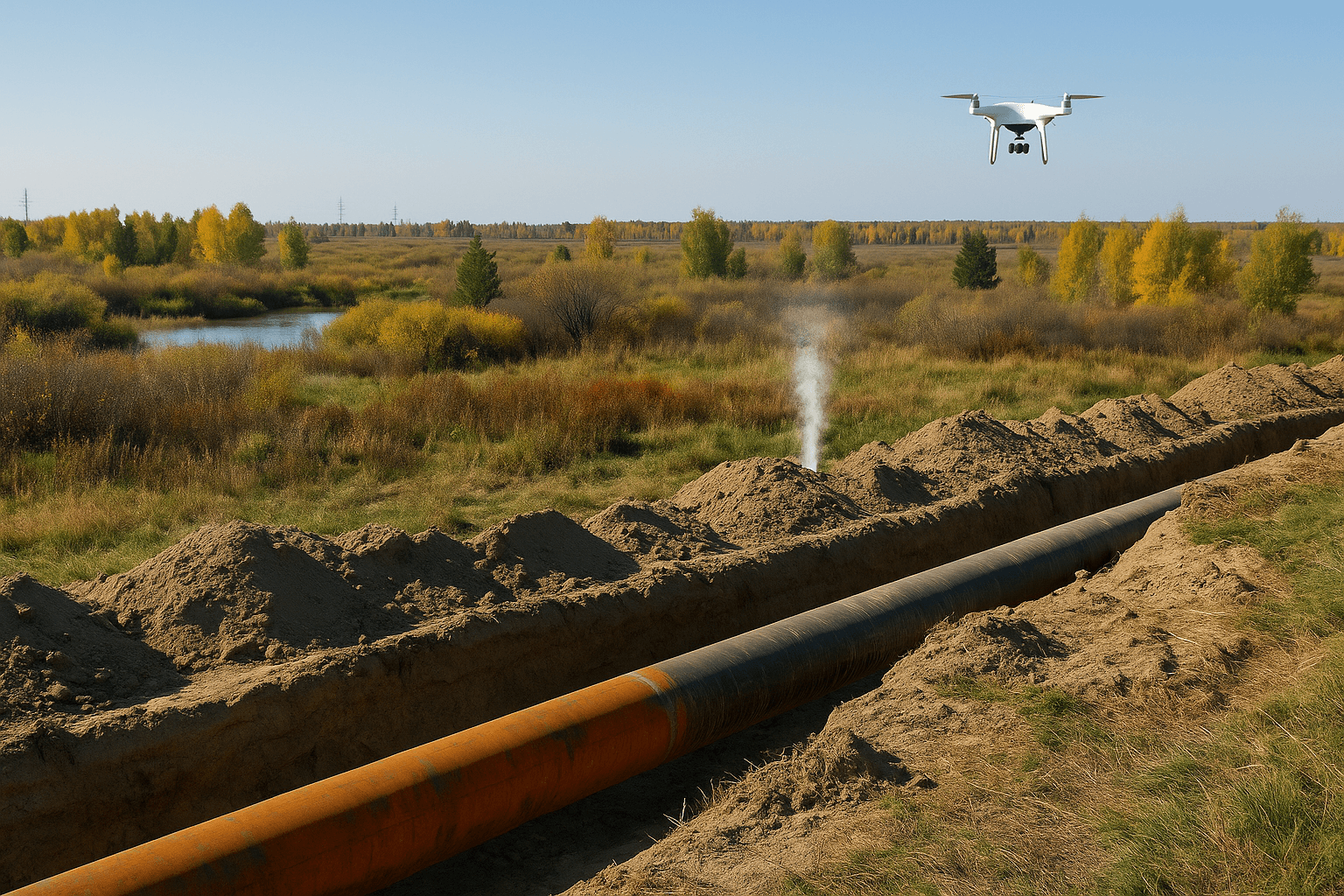
Drone inspection is now standard in the oil and gas sector because it helps teams inspect hazardous and hard-to-reach assets without exposing workers to confined spaces, toxic emissions, or unstable structures. The industry works with pressure vessels, refinery systems, flare stacks, pipelines, offshore assets, and fuel storage tanks. Using inspection drones removes the need to build scaffolding or send workers into dangerous tanks or vessels.
A UAV inspection in oil and gas allows inspectors to collect high-resolution visual or thermal data inside tanks, flare stacks, or risers within minutes, instead of days. This reduces downtime, prevents unnecessary shutdowns, and increases compliance with strict safety and environmental regulations.
For example, inspecting a refinery riser or fluid catalytic cracking (FCC) unit normally requires confined-space entry and rope access. With an inspection drone, inspectors review internal conditions remotely, reducing cost and eliminating risk.
Storage tanks and pressure vessels
Offshore rigs and drilling platforms
FPSOs and refineries
Flare stacks, chimneys, and smokestacks
Public safety agencies rely on UAV inspection technology to collect fast, accurate aerial data in emergencies or during planned safety assessments. Inspection drones support firefighters, police, investigators, and emergency response teams by providing real-time intelligence without placing responders in danger.
A drone inspection can identify spread patterns during a wildfire, locate missing people during a search and rescue mission, or provide evidence in an accident investigation. Public safety teams also use drones for non-emergency inspections such as stadium security checks, disaster planning, and infrastructure vulnerability assessments.
This approach improves situational awareness, speeds up decision-making, and reduces response time when every second matters.
Visual inspections during fires and disaster response
Crime scene mapping and evidence documentation
Accident reconstruction and traffic analysis
Search and rescue operations
Emergency response planning using 2D and 3D drone maps
Security checks for stadiums, ports, and public venues
Pipelines, jetties, and well sites
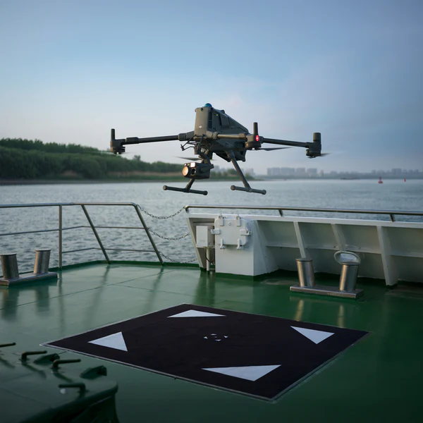
Drone inspection technology is transforming the maritime industry by making ship inspections safer, faster, and more compliant with international survey standards. Today, inspection drones are used for class surveys and periodic inspections that would traditionally require confined-space entry, rope access, or scaffolding.
During a maritime class survey, data such as close visual inspections and ultrasonic thickness measurements must be collected to verify a vessel’s safety and structural condition. With advanced UAV inspection tools like ultrasonic payloads and high-resolution imaging systems, inspectors can capture corrosion details, weld integrity, and structural fatigue without entering hazardous areas such as cargo tanks or ballast tanks.
Using drone inspections in the maritime sector reduces manual entry into dark, humid, and oxygen-restricted tanks. It improves survey turnaround time, lowers operational cost, and helps prevent injuries from slips, falls, or toxic exposure.
A major advantage of using inspection drones in ships is the ability to create a digital twin. This enables long-term monitoring of corrosion, deformation, and maintenance history—providing more accurate lifecycle documentation and decision-making.
Ballast tank inspections
Cargo tank inspections
Hull surveys and shell plating checks
Crane structure inspections
Corrosion monitoring and crack detection
Ultrasonic thickness (UT) measurements
General visual inspections for annual class compliance
Sewer and water treatment inspections involve harsh, confined, and hazardous environments with risks such as toxic gases, unstable ground, flooding, and poor visibility. UAV inspection technology now allows inspectors to gather accurate visual and LiDAR data from underground networks without physical entry.
Purpose-built inspection drones for confined spaces can navigate narrow tunnels, manholes, and pipelines while capturing HD, thermal, and 3D scan data. This reduces human exposure to dangerous atmospheres and eliminates reliance on rope access or crawling through pipelines.
With drone inspection mapping workflows, teams can generate detailed digital models of sewer systems for compliance reporting, preventative maintenance planning, and infrastructure modernization. This supports regulatory expectations for traceability and reduces manual inspection errors.
Wastewater treatment plants
Desalination plants
Tanks and clarifiers
Water towers
Stormwater networks
Underground reservoirs
Pipelines, culverts, and drain systems

The insurance sector now relies on inspection drones for fast, precise assessments after storms, industrial incidents, fires, and infrastructure failures. A drone inspection allows adjusters to inspect roofs, collapsed structures, accident sites, or disaster zones without physical risk.
Teams using UAV inspection workflows can collect high-resolution visual, thermal, and 3D mapping data that documents damage thoroughly and objectively. This increases claim accuracy, reduces fraud, and accelerates settlement times.
Insurance companies are also adopting routine drone inspection programs for risk assessment before issuing policies—especially in high-risk facilities such as refineries, chemical plants, and offshore structures.
Damage documentation after storms, fires, or disasters
Roof inspections without ladders or lifts
3D scene reconstruction for claims verification
Pre-insurance risk evaluations
Evidence collection for legal and compliance reporting
Choosing the best inspection drones depends on the task, environment, and sensor requirements. Below is a streamlined breakdown of leading platforms built for professional UAV inspection work.
Long range, long endurance, multi-sensor capability
These drone inspection platforms are ideal for refineries, bridges, solar farms, large industrial plants, offshore assets, and power infrastructure.
| Drone Model | Why It’s Used | Key Features |
|---|---|---|
| DJI Matrice 350 RTK | Best for tough jobs and high-precision aerial inspections. Ideal for solar plants and utilities. | Up to 55 min flight time. Triple payload support including Zenmuse H20T thermal. Centimeter-level RTK accuracy. Operates −20°C to +50°C. |
| DJI Matrice 400 | Designed for industrial mapping and offshore inspections. Excellent for power-line and construction monitoring. | Carries up to 6 kg payloads including LiDAR, thermal, and RGB. Up to 59 min flight time. mmWave radar and rotating LiDAR for obstacle sensing. IP55 weather resistance. |
| DJI Matrice 300 RTK | Strong performer for aerial mapping and thermal inspection. | 55 min flight time. Multiple payload capacity including H20T thermal. 6-direction optical sensing. Reliable in harsh weather. |
Portable, powerful, and adaptable
These models provide high-quality results for rooftop inspections, solar farms, telecom towers, and building assessments.
| Drone Model | Why It’s Used | Key Features |
|---|---|---|
| DJI Mavic 3 Thermal (M3T) | Best mix of portability and inspection-grade output. Ideal for solar and roofing assessments. | 640×512 thermal camera. RTK positioning. 45 min flight time. Omnidirectional obstacle sensing. |
| Autel EVO Max 4T | Powerful platform for thermal and visual analysis in complex sites. | 640×512 thermal camera. 720-degree obstacle avoidance. Works −20°C to +50°C. |
| Autel EVO II Dual 640T V3 | Excellent thermal clarity for detailed visual diagnostics. | Dual thermal and 50MP RGB system. 360° obstacle avoidance. Used for roof inspections, search and rescue, and industrial inspection. |
Fully automated repeatable inspections
Autonomous systems are redefining UAV inspection by enabling continuous monitoring without an on-site pilot.
DJI Dock 2/ Dock 3
Compatible with DJI Matrice 3TD and built for automated missions in industrial environments. Captures thermal, visual, and zoom data and supports remote operations.
Autel EVO Nest
Supports the Autel EVO line for automated launch, landing, charging, and AI-driven missions.
Continuous monitoring
Real-time alerts for anomalies
Zero human exposure in hazardous sites
Faster maintenance workflows and reporting
The use of inspection drones continues to accelerate as industries look for safer and faster methods to collect critical data. Today, a drone inspection offers reliable access to areas where traditional inspections are slow, costly, or dangerous. As technology evolves, new sensors, AI automation, and autonomous flight systems are making UAV inspection workflows more precise and scalable.
Industries across energy, telecommunications, construction, mining, and utilities now rely on inspection drones for routine monitoring, emergency response, and regulatory compliance. While this guide highlights major industries using drones, the applications continue to expand. Every year, new use cases emerge—from underwater hull scanning to automated offshore turbine assessments—proving how adaptable drone technology has become.
As more businesses adopt drone inspection programs, the economic and safety impact will continue to grow. The future points toward full autonomy, real-time AI analysis, seamless sensor fusion, and integration with digital twins to support predictive maintenance.
Drone inspection technology is transforming how industries maintain, monitor, and protect critical assets. Instead of relying on risky manual methods, inspection drones now provide fast, accurate, and repeatable data without exposing teams to unsafe environments. As more sectors adopt UAV inspection workflows, safety improves, operational costs drop, and inspections become more consistent and data-driven.
Across construction, mining, energy, telecommunications, utilities, and maritime sectors, inspection drones offer a measurable advantage by reducing downtime, eliminating unnecessary scaffolding, and supporting predictive maintenance. With progress in automation, AI analytics, and advanced sensor payloads, the future of drone inspection will continue to evolve toward fully autonomous asset monitoring.
Industries wanting to improve maintenance workflows, regulatory compliance, and long-term asset reliability will benefit from integrating drone-based inspection programs now rather than later.
XRTech Group provides professional drone solutions, LiDAR systems, thermal payloads, automation platforms, and industry-specific workflows designed for safe and efficient inspections. Whether you need advisory support, hardware, remote inspection workflows, or autonomous drone-in-a-box systems, our team can help you scale with confidence.
📍 Serving enterprise operations across construction, energy, infrastructure, mining, and public safety.
👉 Book a free consultation or request a live demonstration today.
1. What is a drone inspection?
A drone inspection is the use of a UAV to collect visual, thermal, or LiDAR data for assessing the condition of an asset without requiring physical access.
2. Why are inspection drones used?
Inspection drones are used because they improve safety, reduce downtime, lower inspection costs, and provide higher-quality visual data than manual inspections.
3. What industries use UAV inspection?
Drone inspections are used in construction, mining, energy, oil and gas, telecommunications, utilities, maritime, water treatment, infrastructure, and insurance.
4. What sensors can inspection drones carry?
Inspection drones support thermal cameras, LiDAR, RGB cameras, multispectral sensors, gas leak sensors, radiometric tools, and ultrasonic thickness payloads.
5. Can drone inspections replace scaffolding?
Yes. In many cases, a drone inspection replaces scaffolding by capturing the required inspection images remotely and safely, reducing cost and downtime.
6. Are drone inspections accurate?
Yes. Modern inspection drones using RTK positioning, LiDAR, and high-resolution thermal imaging provide centimeter-level accuracy suitable for engineering-grade inspection.
7. Can drones be used indoors?
Yes. Dedicated indoor inspection drones with obstacle avoidance and SLAM navigation can map confined spaces such as tanks, silos, and industrial vessels.
8. Do drone inspections require certification?
Most countries require licensed pilots and compliance with aviation regulations. Some industries also require certified inspectors and approved workflows.
9. How long does a drone inspection take?
A drone inspection typically takes minutes to hours, depending on asset size and mission type, which is significantly faster than manual inspection methods.
10. What drones are best for inspection work?
Leading inspection drones include the DJI M350 RTK, DJI Matrice 400, Autel EVO Max 4T, DJI Mavic 3 Thermal, and indoor-capable drones with collision-tolerant design.
Tailings Dam Monitoring: How Advanced Satellite Intelligence Is Transforming Tailings Dam Safety Tailings dams are among the most critical—and high-risk—structures

From Visible Light to Spectral Intelligence in Modern Satellite Remote Sensing Satellite imaging has moved beyond photography. For decades, Earth