GF-1 B/C/D Satellite Imagery
Launched in March 2018, the GF-1 B/C/D satellites form a powerful constellation that enhances global remote sensing capabilities. Working in conjunction with GF-1A, this series provides a reliable stream of 2m panchromatic and 8m multispectral imagery, offering a perfect balance of detail and coverage for large-scale monitoring projects.

Resolution
2m Pan
Revisits
1-4 Days
Swath Width
66 km
Accuracy
50m CE90
Bands
5
Mission Life
5-8 Years
Technical Specifications
| Launch Date | March 31, 2018 |
| Altitude | 645 km |
| Orbit Type | Sun-Synchronous |
| Mission Lifetime | 5-8 years |
| Panchromatic Resolution | 2m |
| Multispectral Resolution | 8m (PMC), 16m (WFI on GF-1A) |
| Swath Width | 66 km (PMC), 830 km (WFI on GF-1A) |
| Revisit Capacity | ~1 day (Constellation), 4 days (Single) |
| Geolocation Accuracy | 50m CE90 (GF-1A) |
| Spectral Bands (PMC) |
Pan: 0.50-0.80μm Blue: 0.45-0.52μm Green: 0.52-0.59μm Red: 0.63-0.69μm NIR: 0.77-0.89μm |
Features and Benefits
- High Revisit Frequency: With the full constellation, achieve a revisit capacity of approximately 1 day, ensuring you never miss critical changes on the ground.
- Balanced Resolution: The 2m panchromatic and 8m multispectral resolution is a cost-effective choice for detailed mapping over moderately sized areas.
- Wide-Area Awareness: Combined with GF-1A's 830km wide-swath imager, the constellation provides excellent regional coverage and situational awareness.
- Proven Multispectral Analysis: Standard Red, Green, Blue, and Near-Infrared (NIR) bands are essential for vegetation health monitoring (NDVI), land use classification, and environmental studies.
Applications
Why Choose XRTech Group for GF-1 Imagery?
We provide more than just satellite data; we deliver comprehensive solutions tailored to your project's specific needs, ensuring you get actionable insights quickly and efficiently.
Expert Consultation
Our geospatial experts provide a free consultation to understand your needs and recommend the best acquisition parameters to ensure optimal results for your project.
Rapid Delivery
Leveraging our direct partnership and access to a vast 130+ satellite constellation, we offer fast turnaround times, delivering imagery in days, not weeks.
Seamless Integration
We deliver data in industry-standard formats (like GeoTIFF) compatible with your GIS, CAD, or modeling software, with a team ready to support your workflow.
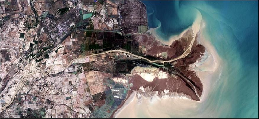
GF-1 Series Sample Imagery