SJ-9A & SJ-9B Satellite Imagery

The SJ-9A and SJ-9B satellites are technology demonstration platforms offering distinct and complementary Earth observation capabilities. SJ-9A provides 2.5m high-resolution optical and multispectral imagery, while SJ-9B is equipped with a long-wave infrared sensor for thermal monitoring, making this pair a unique asset for diverse analytical tasks.

Artistic representation of the SJ-9A and SJ-9B satellites in orbit.

SJ-9A Pan Res.

2.5m

SJ-9A MS Res.

10m

SJ-9B IR Res.

73m

Sensor Types

Optical & IR

Technical Specifications Comparison

Attribute SJ-9A (Optical) SJ-9B (Infrared)
InstrumentPMS CameraLong Wave IR Sensor
Resolution2.5m (Pan), 10m (MS)73m
Swath Width30 km18 km
Max Off-Nadir Angle±35°±35°
Spectral Bands Pan: 0.45-0.89µm
Blue: 0.45-0.52µm
Green: 0.52-0.59µm
Red: 0.63-0.69µm
NIR: 0.77-0.89µm
Long Wave IR: 8-12µm

Features and Benefits

  • Complementary Data: SJ-9A provides high-resolution visual data, while SJ-9B offers thermal data, allowing for a more comprehensive analysis of an area.
  • High-Resolution Optical: SJ-9A's 2.5m panchromatic resolution is excellent for detailed base mapping, infrastructure analysis, and land use classification.
  • Thermal Detection: SJ-9B's long-wave infrared sensor is ideal for detecting heat patterns, monitoring temperature changes, and identifying thermal anomalies.
  • Multispectral Analysis: SJ-9A's four multispectral bands enable standard vegetation analysis (NDVI), water body delineation, and environmental monitoring.

Applications

SJ-9A (Optical) Applications:
  • Urban Planning & Base Mapping
  • Land Use & Land Cover Classification
  • Agriculture & Forestry Monitoring
  • Post-Disaster Visual Assessment
SJ-9B (Infrared) Applications:
  • Thermal Anomaly Detection (Fires, Volcanoes)
  • Industrial Heat Monitoring
  • Water Temperature Analysis
  • Defense & Security Thermal Surveillance

Why Choose XRTech Group for SJ-9 Imagery?

We provide more than just satellite data; we deliver comprehensive solutions tailored to your project's specific needs, ensuring you get actionable insights quickly and efficiently.

Expert Consultation

Our geospatial experts provide a free consultation to understand your needs and recommend the best acquisition parameters to ensure optimal results for your project.

Rapid Delivery

Leveraging our direct partnership and access to a vast 130+ satellite constellation, we offer fast turnaround times, delivering imagery in days, not weeks.

Seamless Integration

We deliver data in industry-standard formats (like GeoTIFF) compatible with your GIS, CAD, or modeling software, with a team ready to support your workflow.

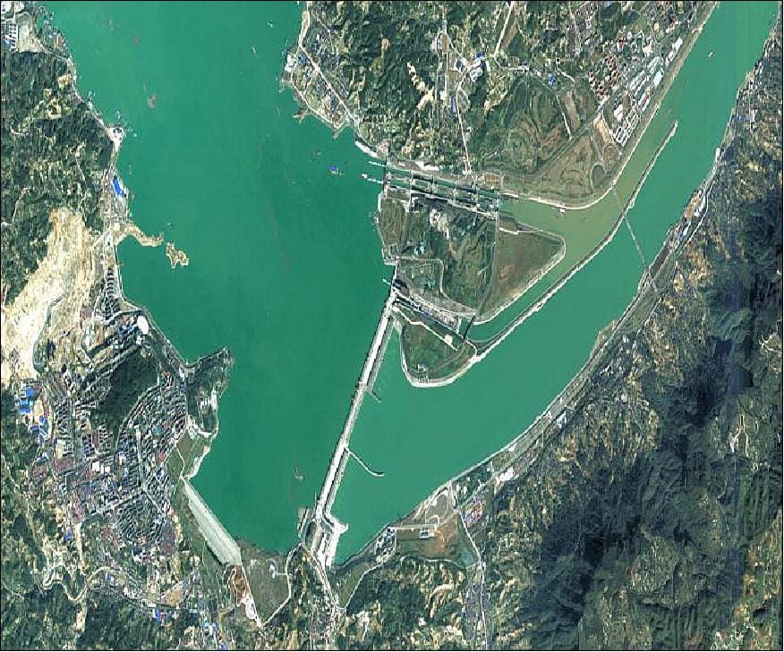
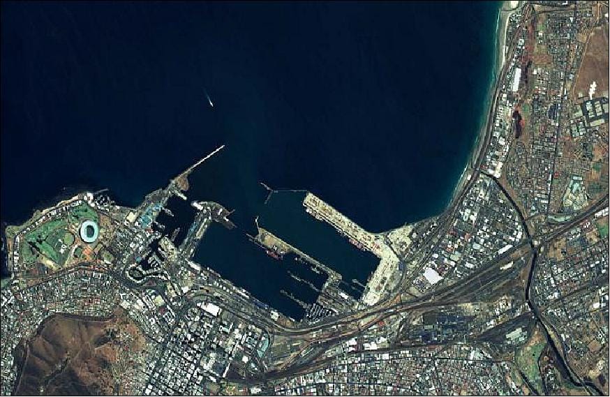
SJ-9 Series Sample Imagery

Sample 2.5m optical satellite imagery from the SJ-9A satellite.
Example of 73m long-wave infrared thermal data from the SJ-9B satellite.

Request Product Details

Satellite Imagery Advisor

Brief questions. Practical guidance. Get an indicative estimate instantly, and we only proceed to a formal quote once the basics are clear.

Advisor mode: this form will recommend the lowest resolution and type that fits your objective so you do not overpay.
Step 1 — Area & Location
1 / 4
Start simple: Upload a KML/KMZ/ZIP if you have it. If not, a bounding box or center plus dimensions works fine. We will calculate area for you where possible.
Upload AOI file (KML / KMZ / ZIP) — recommended
Preferred: a single polygon AOI. We compute the area automatically.
Enter corner coordinates (bounding box)
Use min/max latitude and longitude.
Enter center coordinate + width & height
Good for quick feasibility when exact boundaries are not available.
Describe location (city / region / site name)
We will follow up to confirm an AOI boundary if needed.
Advisor note: If speed is the priority, we usually check archive first. If you need a specific date window or fresh capture, choose new tasking.
Archive imagery
Previously captured imagery, typically faster delivery.
New capture (tasking)
Satellite is tasked for your AOI; weather and availability can affect capture date.
Not sure, advise me
We will recommend the most feasible option based on area, timing, and objective.
Minimum order guidance
Archive imagery: typically 15 to 25 km²
New capture: typically 50 to 100 km²
Feasibility depends on satellite, location, and timing.
Pick a date window. We will advise what is realistic for your area and cloud conditions.
Resolution guidance: Higher resolution increases detail and cost. We will recommend the lowest resolution that meets your objective.
I know what I need
Select 30cm, 50cm, 75cm, or 1m.
Advise me based on my objective
Answer a quick question about what you need to see.
Almost done. You will see an indicative estimate. If you agree, we will run feasibility and send a formal quote.
I understand this is an indicative estimate and request feasibility and a formal quote.
We handle requests confidentially. No data is shared with third parties.
Protected by spam filter and bot detection. Genuine enquiries only.
Live Summary
Updates as you answer
Area (km²)
AOI method
Coordinates / Location
Imagery type
Date range
Resolution

Indicative Estimate

Based on XRTech published pricing. Final price confirmed after feasibility check.
Complete Steps 1 to 3 to see an estimate.
Once you submit, XRTech will:
  • Archive: run a coverage check in your date range
  • Tasking: confirm window and issue order form or invoice

Quote Request Sent

Your satellite imagery request has been sent to admin@xrtechgroup.com. XRTech will review feasibility and send a formal quote within 24 hours. A free sample tile for your AOI is included in the quote response.