
Buy 30cm High Resolution Satellite Imagery for Large Areas
30cm (0.3m) high resolution satellite imagery from XRTech Group: true native SuperView Neo-1 and Beijing-3B archive at $20/km² and new tasking from $30/km², anywhere on Earth.
✓Native 0.3m detail, never upsampled from 50cm
✓Wide-area collection for cities, corridors and provinces
✓Orthorectified, cloud-free mosaics and stereo pairs
Built for government agencies and enterprises in mapping, engineering, construction, energy and insurance, from single sites to whole countries.
0.3m
True native ground sample distance on the sensor
1.5M km²
Daily SuperView Neo-1 collection capacity, as reported by XRTech Group
250 km²
Area where volume pricing begins
Global
Any country, with no US export licence delays
Native 0.3m, not resampledSuperView Neo-1 and Beijing-3B both capture 30cm panchromatic data on the sensor.
What 30cm means
What Is 30cm High Resolution Satellite Imagery?
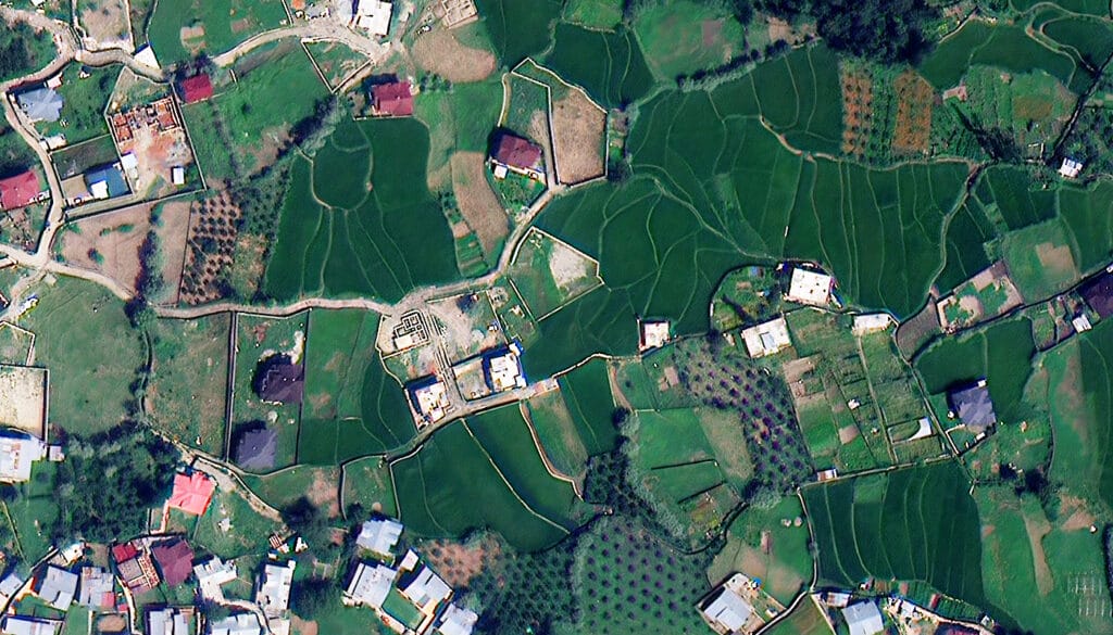
30cm high resolution satellite imagery, also called 0.3m resolution imagery, is optical imagery in which every pixel covers 0.3m by 0.3m of ground. It is the sharpest native resolution that commercial satellites collect at production scale: cars can be told apart by type, lane markings are readable, building outlines hold to sub-metre accuracy and a construction site can be followed slab by slab. XRTech Group supplies it from SuperView Neo-1 and Beijing-3B, as archive scenes from $20/km² or new tasking from $30/km², with worldwide coverage and flexible team-wide licensing.
Native resolution is the part buyers should check first. A true 30cm sensor records 0.3m of ground per pixel on its focal plane. Some imagery sold as "30cm" is resampled from 50cm data: it looks crisp on screen but blurs edges, shifts measurements and weakens AI training sets. Every 30cm product XRTech Group supplies is native, and our 15cm HD product is clearly labelled as enhanced.
For large-area work, 30cm is where very high resolution (VHR) satellite data replaces most aerial survey. One programme can start at a single city and grow to thousands of square kilometres across several countries without flight permits, ground crews or airspace approvals, and the same area can be revisited for change detection. Volume pricing starts at 250 km².
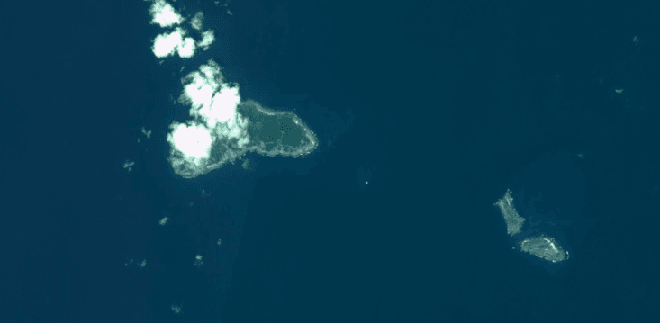
8m
Moderate Resolution
Good for regional land cover and very large areas. Coastlines, islands and land use show clearly, but individual buildings, roads and vehicles do not.
Highest Detail · True Native
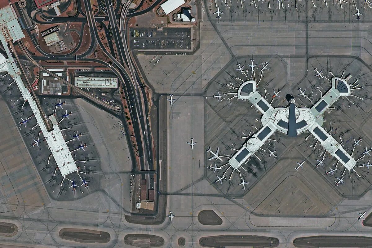
30cm
Very High Resolution (VHR)
Vehicles by type, road markings, building outlines and construction stages are all visible, which makes it the level for mapping, monitoring and AI training.
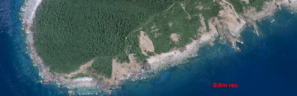
0.8m
High Resolution
Shorelines, tree cover, roads and large structures are visible, but individual vehicles are not reliably resolved and measurements stay coarse.
Large orders, solved
Wide-Area 30cm Imagery Without the Usual Delays
Ordering 30cm imagery for one site is simple. Ordering it for a metro region, a 600 km pipeline or a national basemap is where projects stall. These are the four problems large buyers bring to XRTech Group, and how we handle each one.
Regions Covered in Days, Not Seasons
A single 30cm satellite with a 12km swath needs many passes to image a province. We plan your area across SuperView Neo-1 and Beijing-3B together, using multistrip collection that images parallel strips in one window, and we fill the rest from the archive first so your team is not waiting on the weather.
• Multistrip mode for wide areas in a single collection window
• Archive and new tasking combined to close gaps quickly
• Phased delivery, so work starts on the first tiles
• Collection reports showing what is captured and what is pending
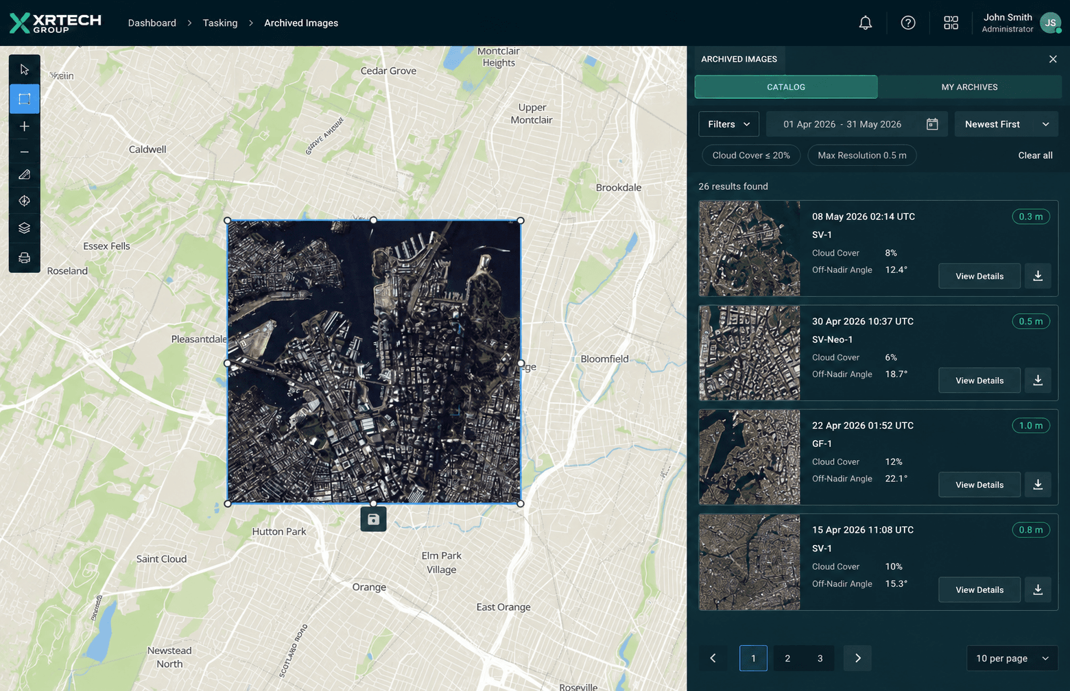
Archive search in secondsCapture date, cloud cover and an indicative price for every 30cm scene over your area.
Archive imagery
Buy 30cm Archive Imagery
The 30cm archive is the fastest, lowest-cost route to very high resolution coverage over large areas. XRTech Group searches the SuperView Neo-1 and Beijing-3B catalogues over your area of interest, ranks scenes by date, cloud cover and viewing angle, and delivers within 48 hours of order approval. Archive 30cm imagery costs $20/km² with a 25 km² minimum.
✓Catalogue search across two native 30cm constellations
✓Filter by capture date, cloud cover and off-nadir angle
✓Neighbouring scenes merged into one mosaic for wide areas
✓Before and after scenes for change detection and claims
New tasking
Order New 30cm Satellite Tasking
When the archive is too old or too cloudy, task a satellite to collect fresh 30cm imagery on your dates. XRTech Group schedules the collection across SuperView Neo-1 and Beijing-3B from $30/km² (minimum 100 km²). Priority tasking is $45/km² and emergency tasking is $80/km² for deadlines that cannot move.
✓Multistrip mapping for cities, provinces and borders
✓Corridor collection along pipelines, roads, rail and power lines
✓Stereo and tri-stereo for DEM, DSM and 3D city models
✓Cloud cover and viewing angle guarantees as add-ons
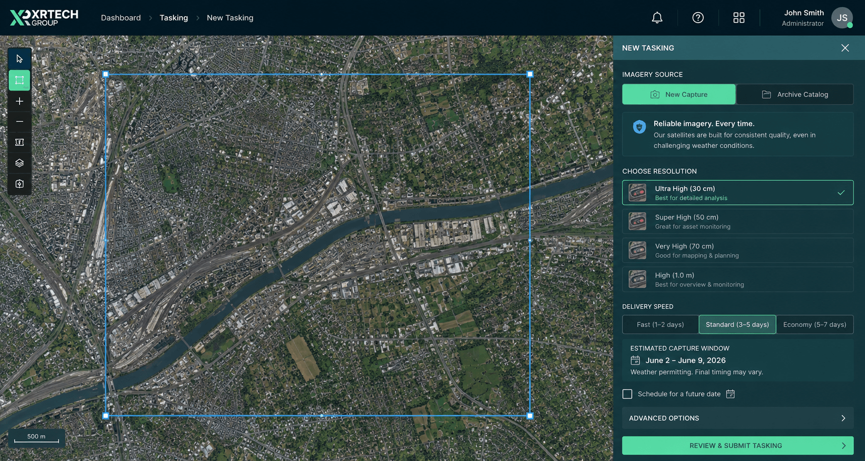
Tasking on your termsSet the area, dates, cloud limit and viewing angle, then submit for a firm quote.
30cm pricing
30cm Satellite Imagery Price: Fixed per km²
These are XRTech Group's 30cm list prices in US dollars per km², for SuperView Neo-1 and Beijing-3B data. They apply to any location worldwide. Volume pricing starts at 250 km², and regional or multi-year programmes receive a custom rate per km² in writing.
Archive
Captured over 90 days ago | SuperView Neo-1, Beijing-3B
Price per km²:
USD 20/km² (min. 25 km²)
Delivery:
48 hours after order approval
Lowest cost per km² for wide-area basemaps.
Select ArchiveBest for bulk
Bulk Programme
250 km² and above | archive and tasking combined
Price per km²:
Volume rate below list price
Included:
Free coverage check and sample tile
Phased delivery, cloud-free mosaic and flexible team-wide licensing.
Request Volume QuoteNew Tasking
Fresh capture on your dates
Price per km²:
USD 30/km² (min. 100 km²)
Stereo pair:
USD 60/km²
Tri-stereo at 3× the mono price for 3D models.
Select TaskingPriority and Emergency
Time-critical 30cm collections
Priority tasking:
USD 45/km²
Emergency tasking:
USD 80/km²
For disaster response, claims and security deadlines.
Select UrgentWhat changes the price of 30cm imagery?
Area: volume pricing from 250 km²; minimum 25 km² archive and 100 km² tasking
Archive or tasking: archive $20/km², new tasking $30/km²
Urgency: priority $45/km², emergency $80/km²
Cloud cover limit: 10% or less +$8/km², 5% or less +$15/km²
Viewing angle: 15° or less +$3/km², 10° or less +$9/km²
Stereo: stereo 2×, tri-stereo 3× the mono price
30cm Satellite Imagery Samples from Around the World
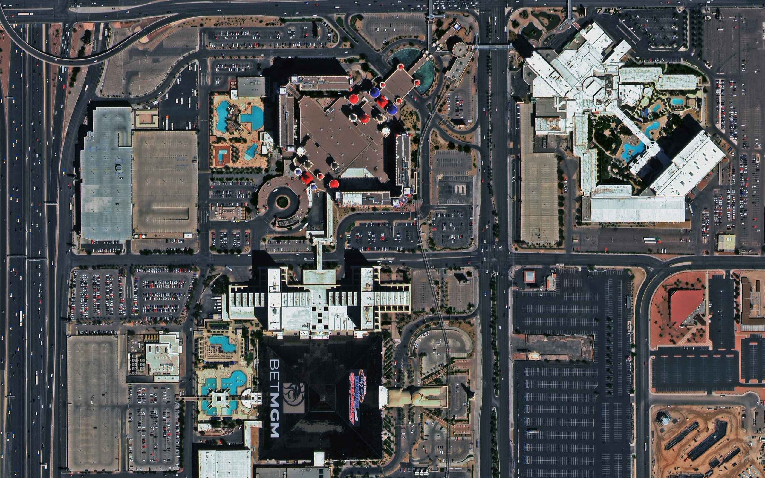
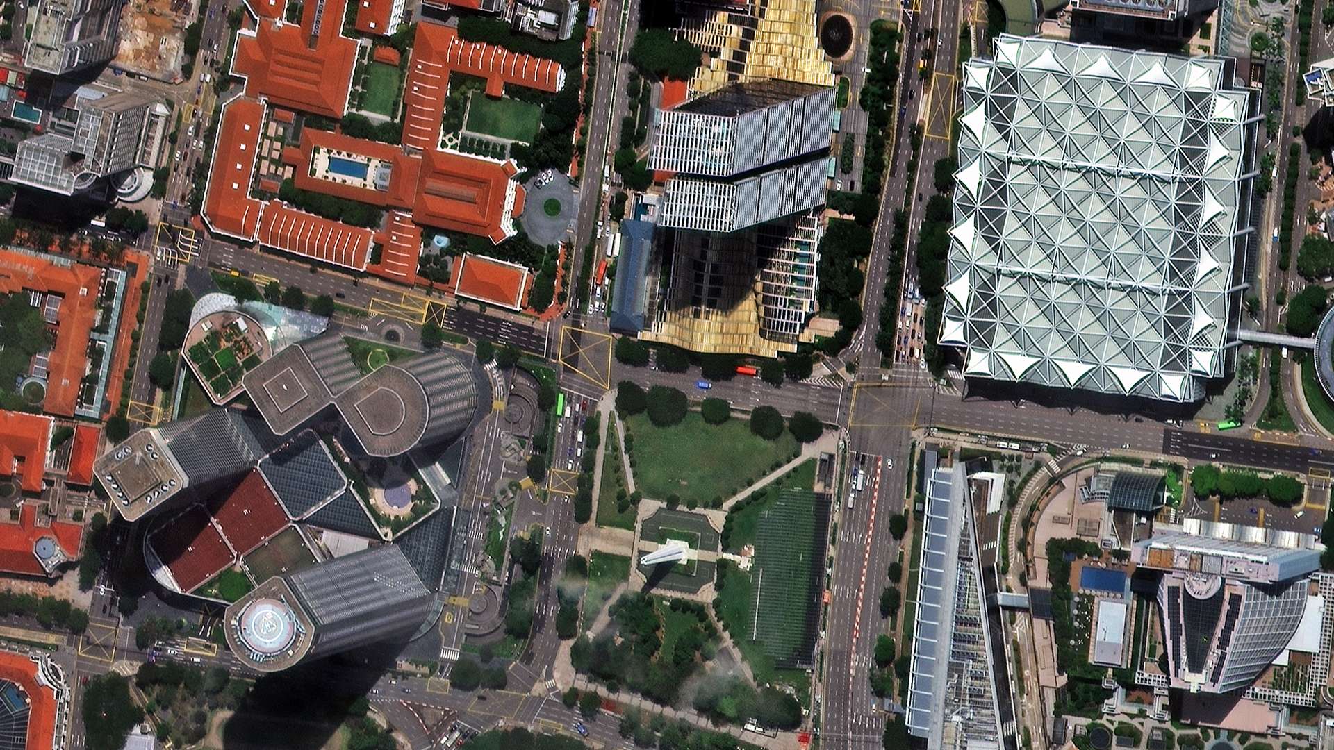
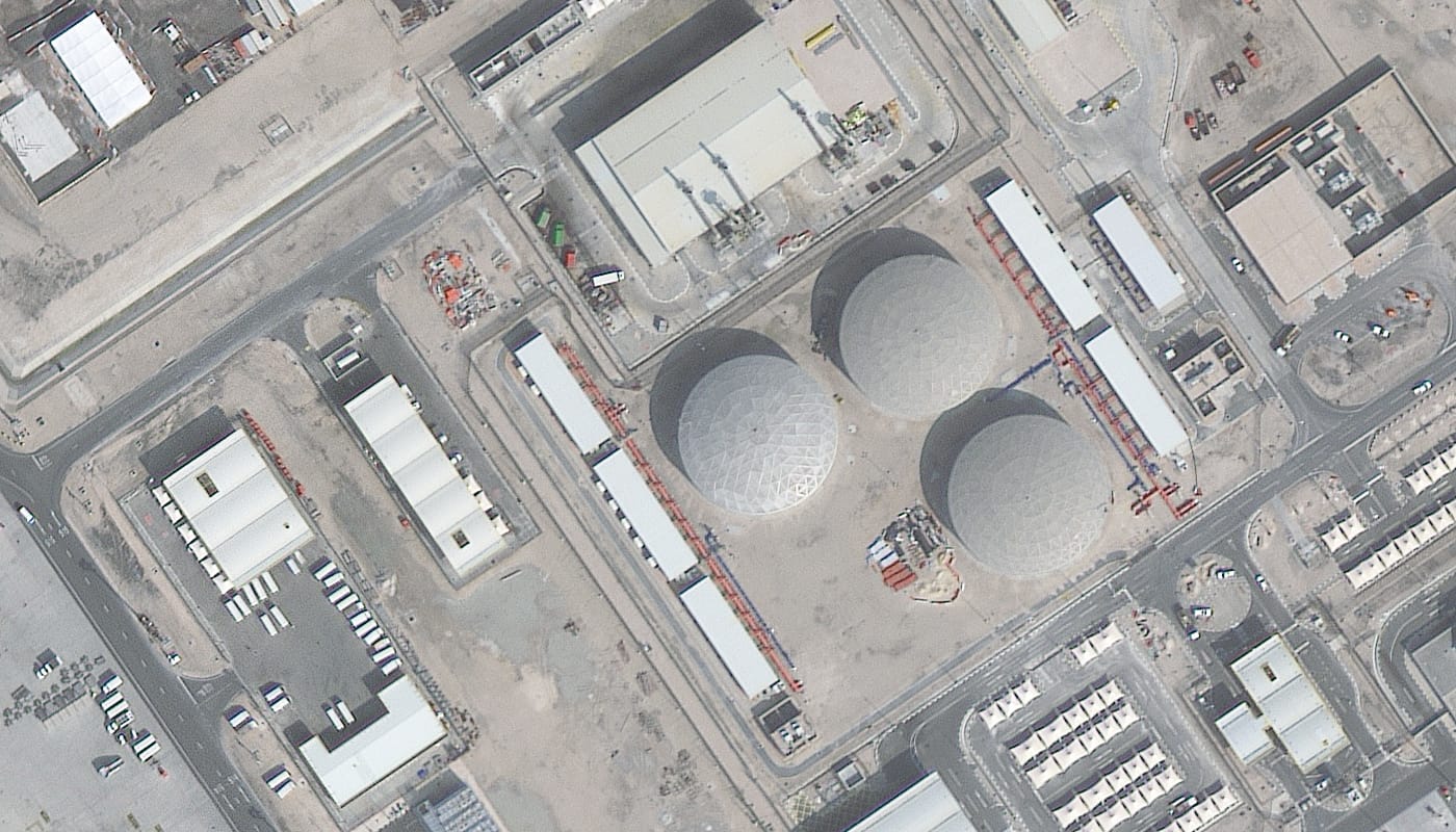
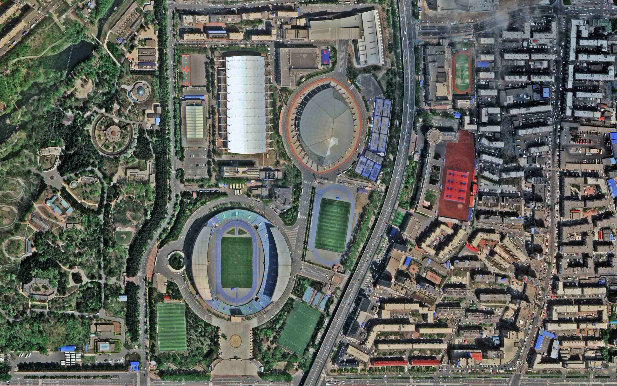
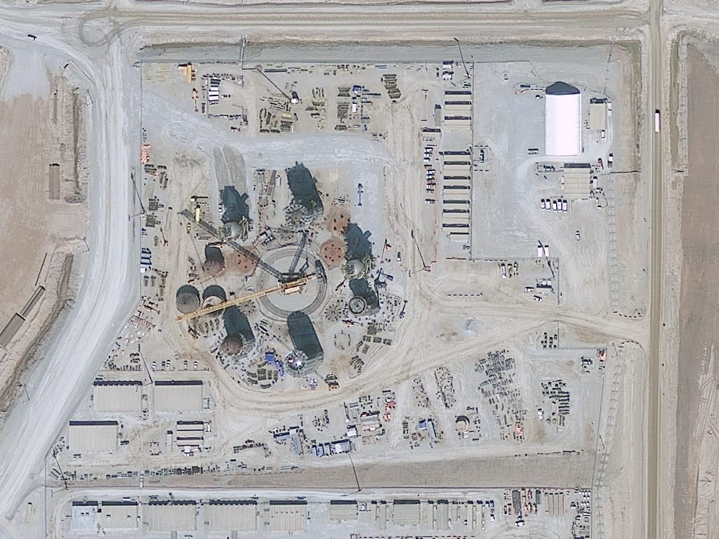
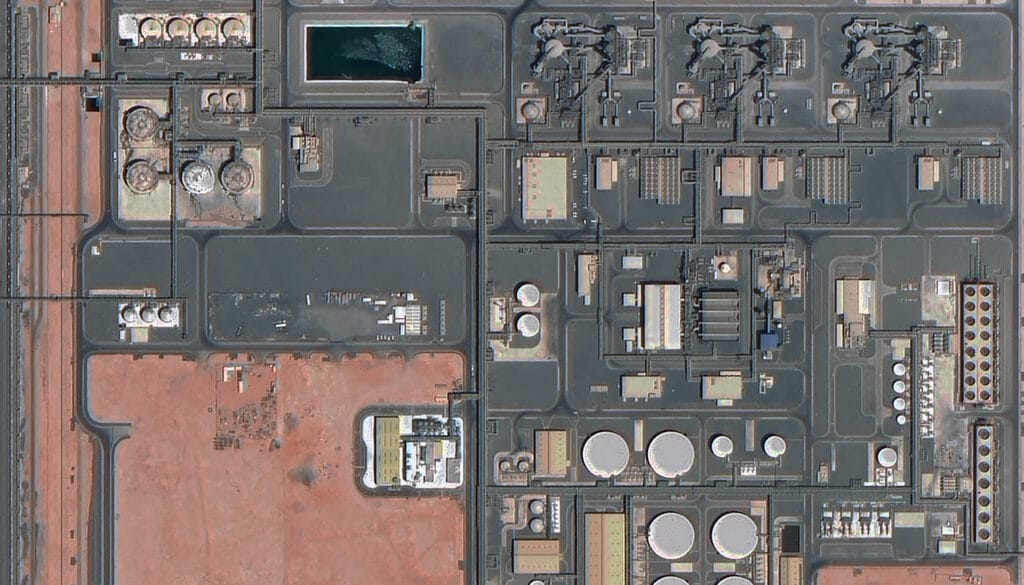
Every image below is native 30cm data from SuperView Neo-1 or Beijing-3B, collected across four continents. Ask for a free sample tile over your own area with any formal quote, so your team can judge the detail before committing to a large order.
Las Vegas, USA · SuperView Neo-1
Singapore · SuperView Neo-1
Doha, Qatar · Beijing-3B
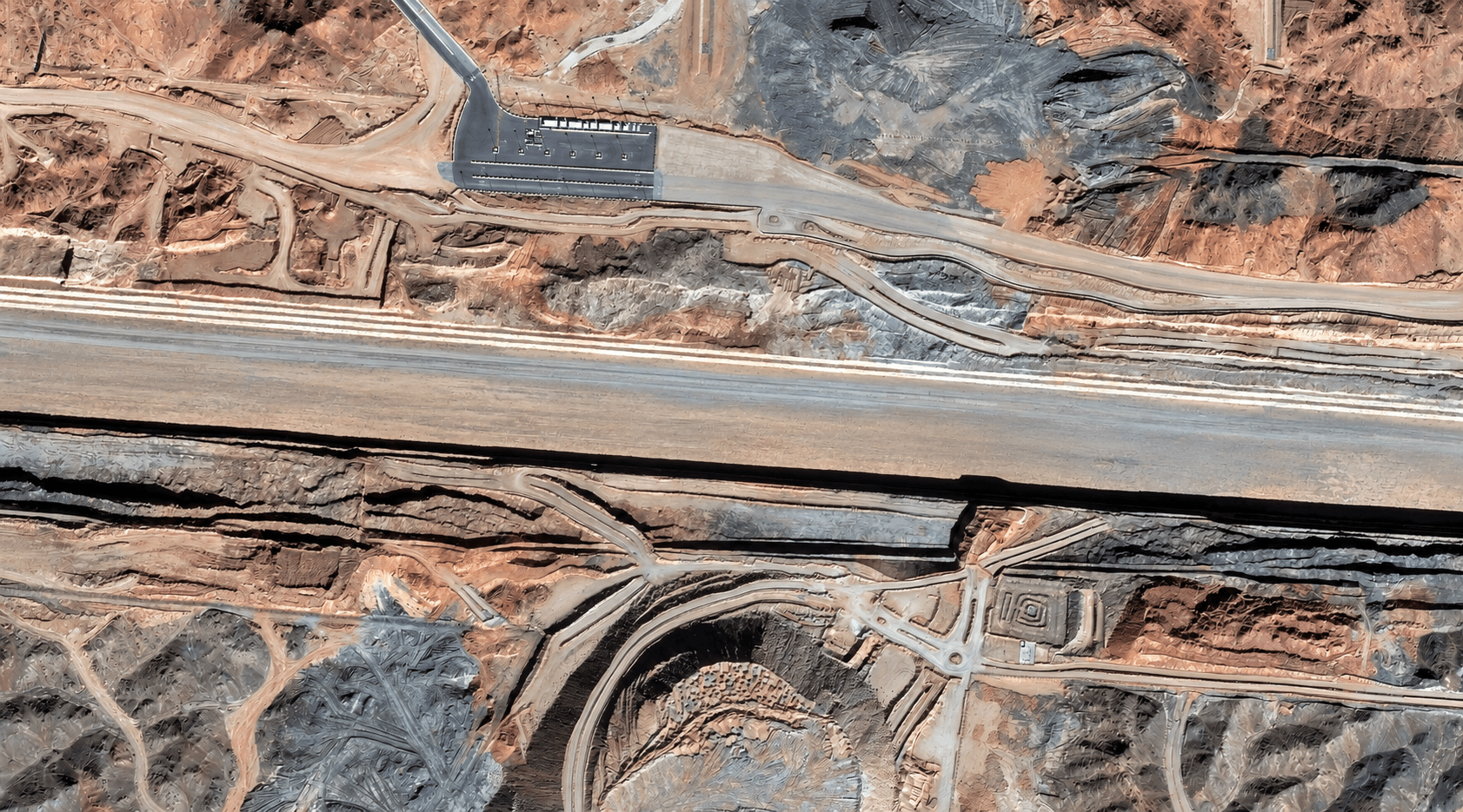
Saudi Arabia · 30cm
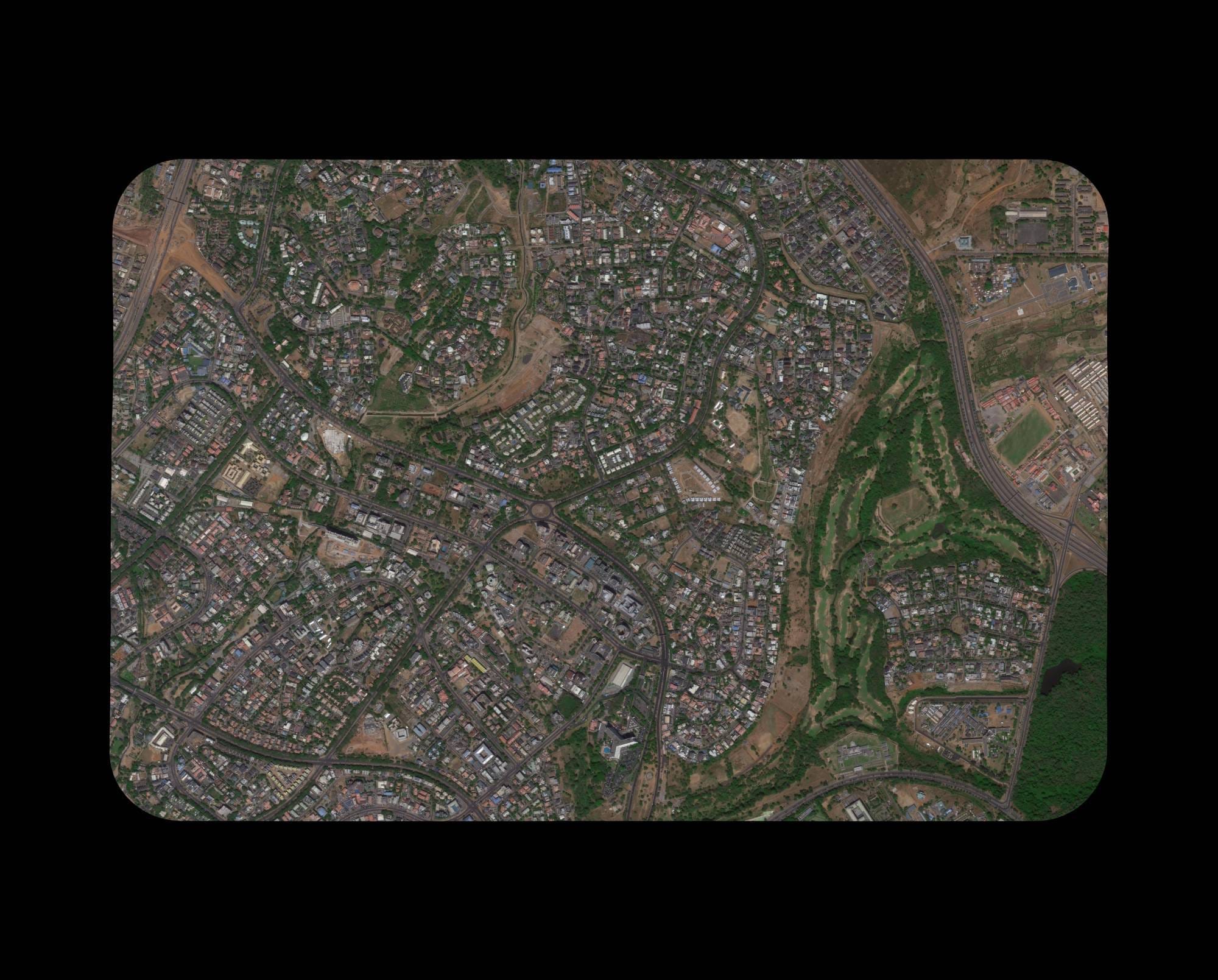
Nigeria · 30cm optical
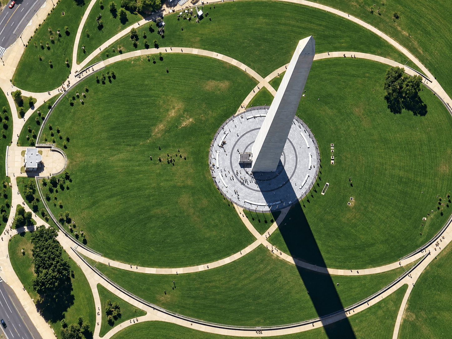
Washington DC, USA · 30cm
Changchun, China · SuperView Neo-1
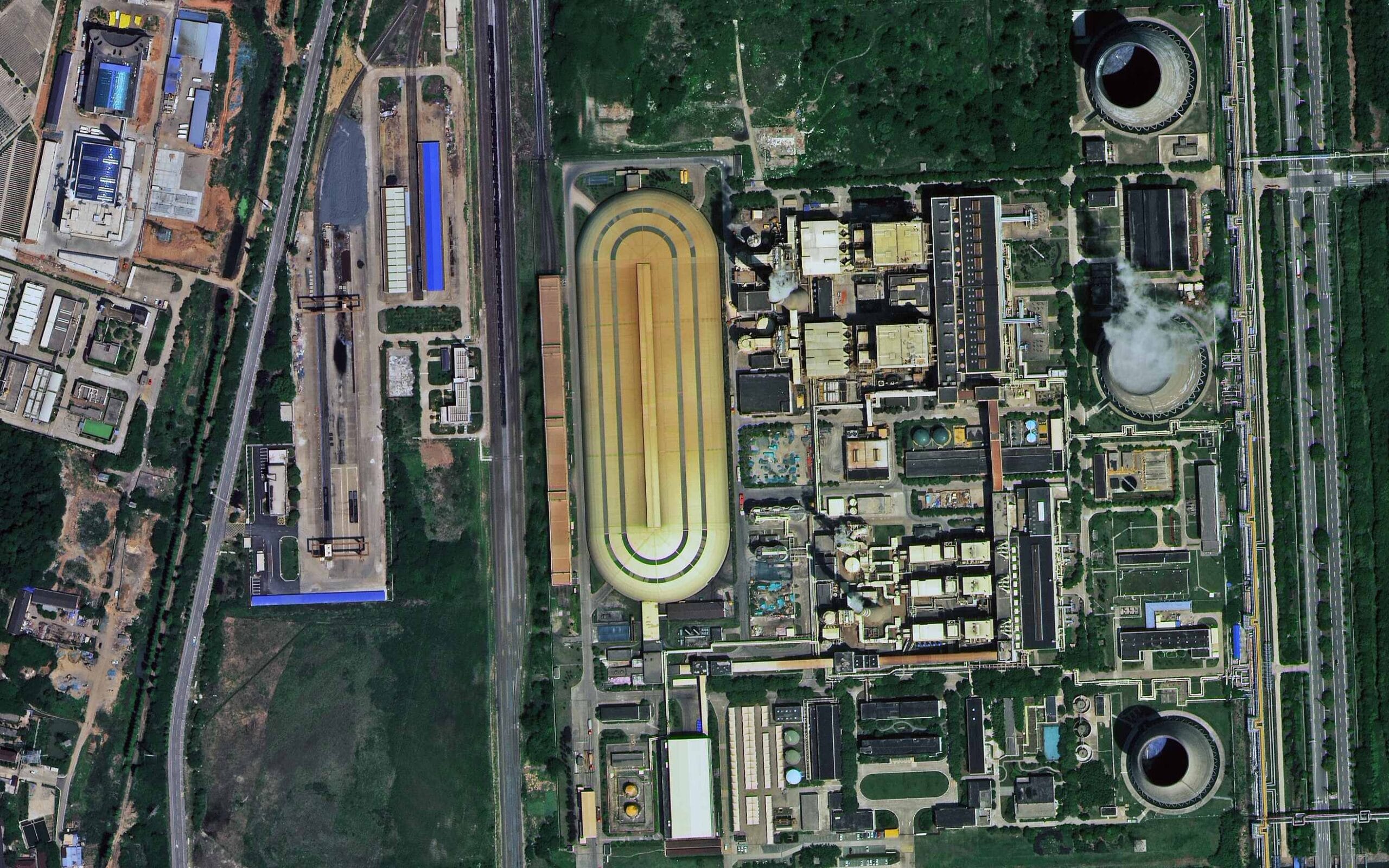
Nanjing, China · SuperView Neo-1
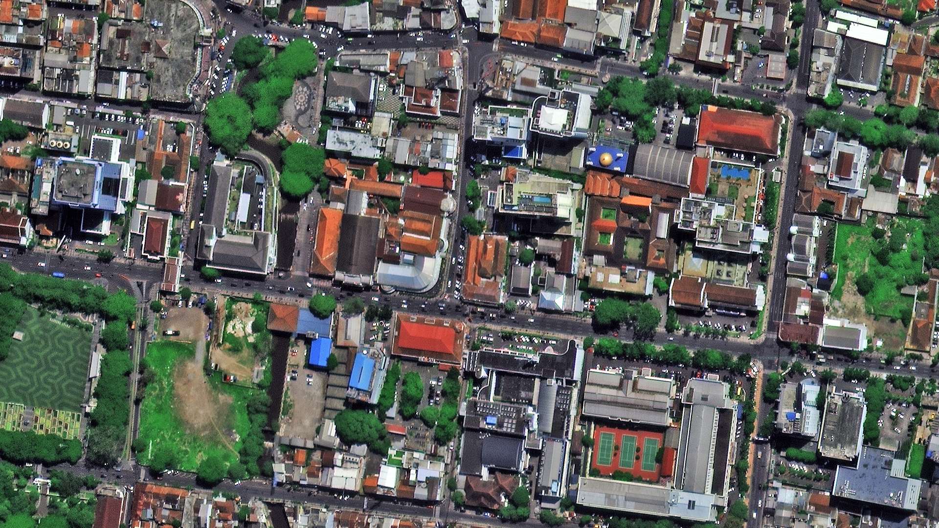
Bandung, Indonesia · SuperView Neo-1
30cm satellites
Satellites That Collect 30cm Imagery
Through partner constellations, XRTech Group sources 30cm imagery from two native 30cm satellite systems and offers a sharper 25cm option when a project needs it. A single order can mix satellites to get the best capture date, viewing angle and cloud cover across every part of your area. Other 30cm-class systems on the market include WorldView-3, WorldView Legion and Pléiades Neo.
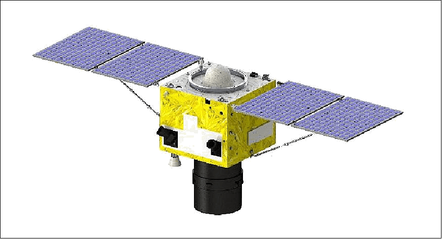
SuperView Neo-1 (01/02)
30cm
The main source for wide-area 30cm work, with daily revisit capability and multistrip, corridor, multi-target and stereo collection modes. SuperView Neo-1 specs →
30cm PAN · 1.2m MS, 4 bands
12km swath · 3.5m CE90
Mono, stereo, tri-stereo
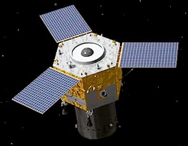
Beijing-3B (BJ3N)
30cm
An agile 30cm satellite with onboard AI processing that adds extra collection chances over busy or cloudy areas. Beijing-3B specs →
30cm PAN · 1.2m MS, 4 bands
11.5km swath · up to 45° off-nadir
Mono, stereo, tri-stereo
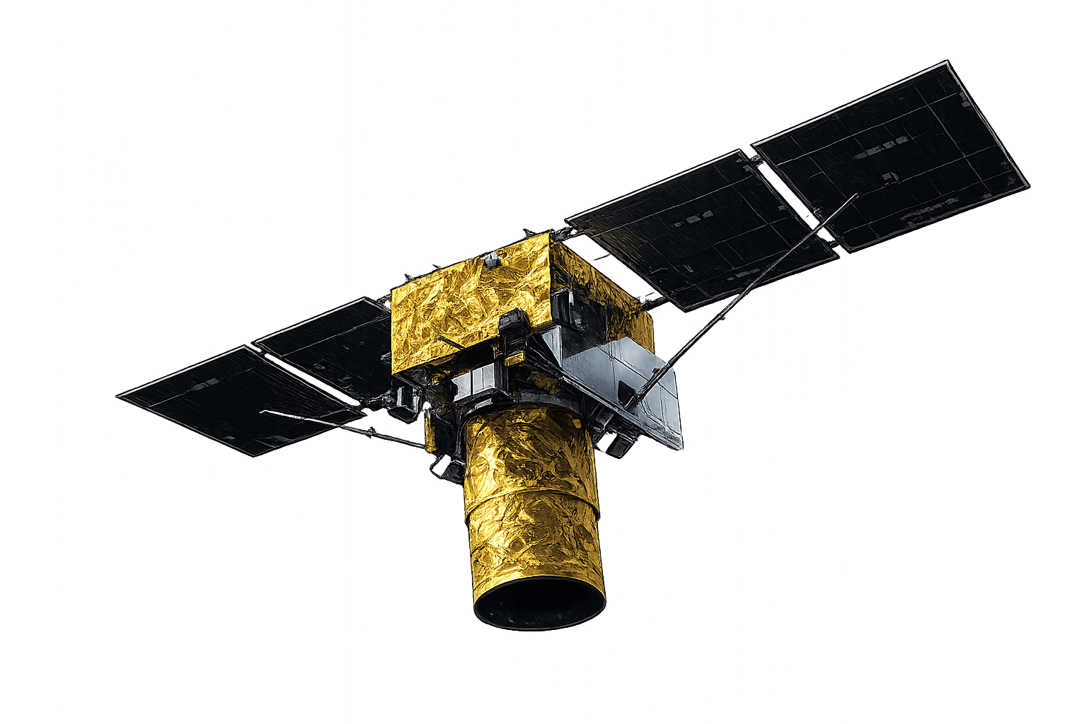
SuperView Neo-1 (03/04)
25cm
The step up when 30cm is not enough, for engineering detail, small objects and premium urban mapping. 25cm imagery →
25cm PAN · 1m MS, 4 bands
Daily-capable revisit
Stereo and agile modes
How to order
How to Buy 30cm Imagery in 4 Steps
There are two ways to buy 30cm imagery: order it yourself in the XRTech self-service portal, or fill in the quote form and our team does it all for you. For areas over 250 km², multi-site programmes or several countries, the form is the faster route to a coverage check and volume quote.
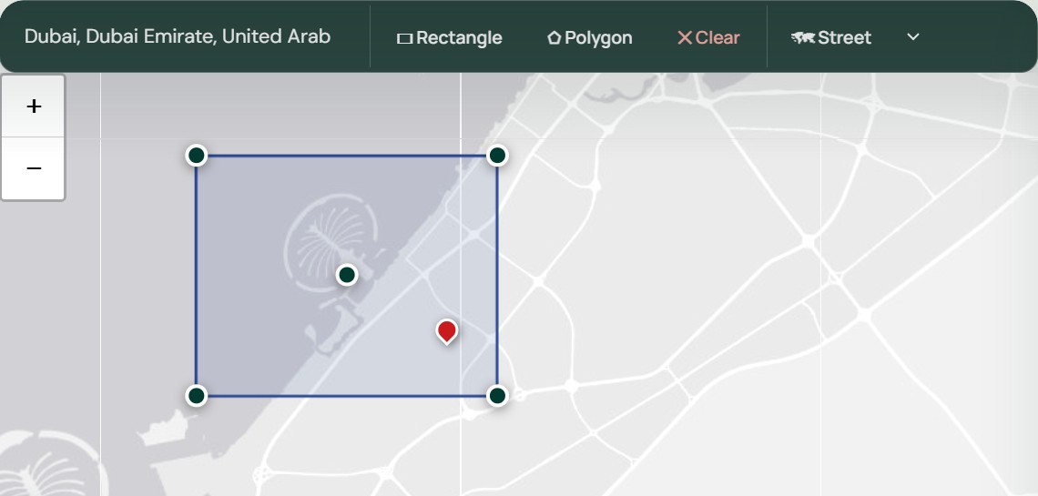
Step 1: Draw or upload your area of interest
Open the XRTech satellite imagery portal and draw your area, or upload a KML, KMZ or SHP file. No account or login is needed. For regional programmes, corridors or hundreds of separate sites, send the boundary files to our team instead.
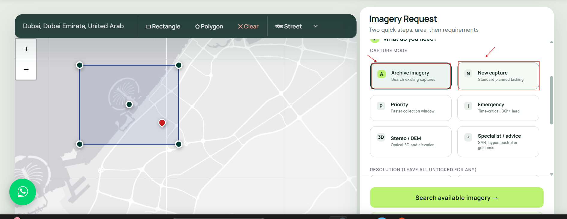
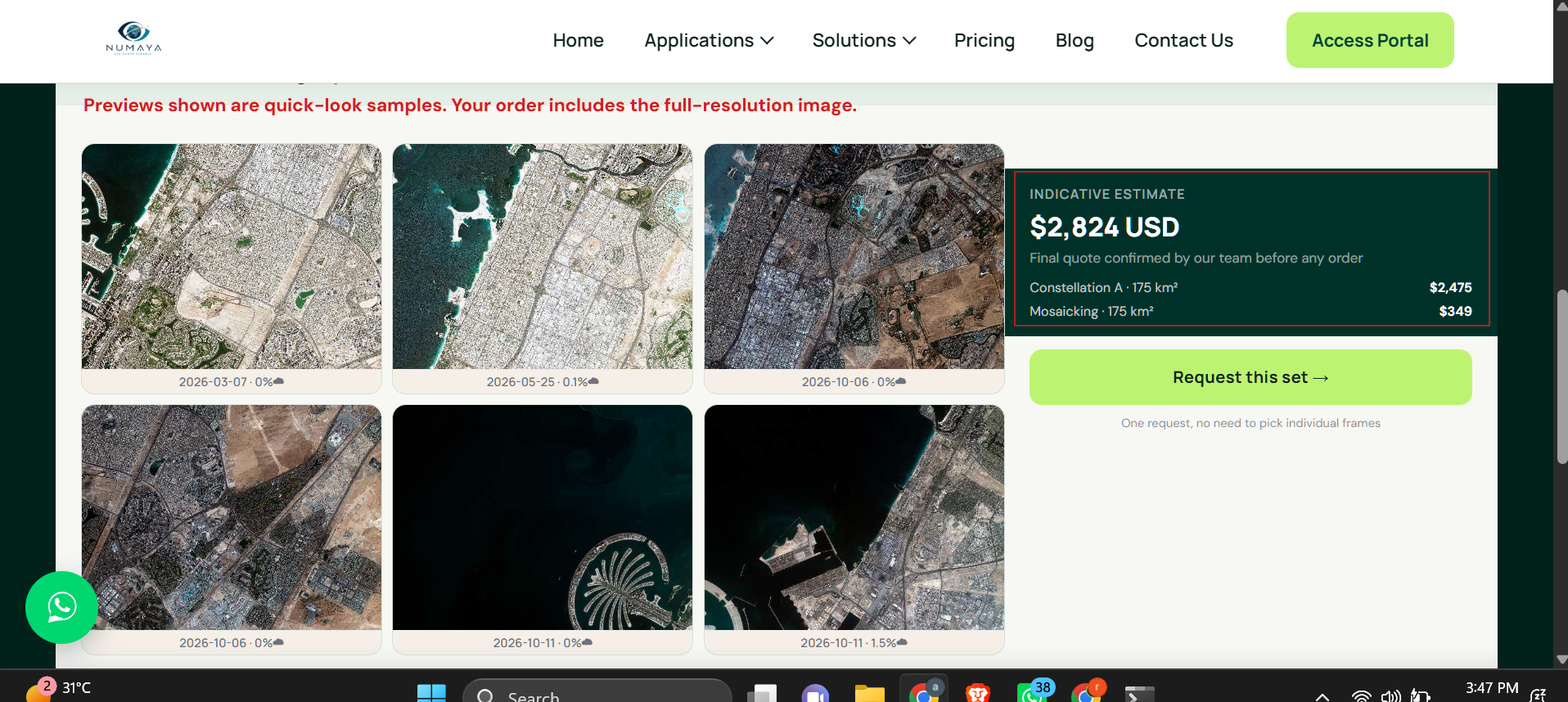
Results
Trusted by Teams Around the World
Governments, planners and responders choose XRTech to buy high-resolution satellite images when timelines are tight.
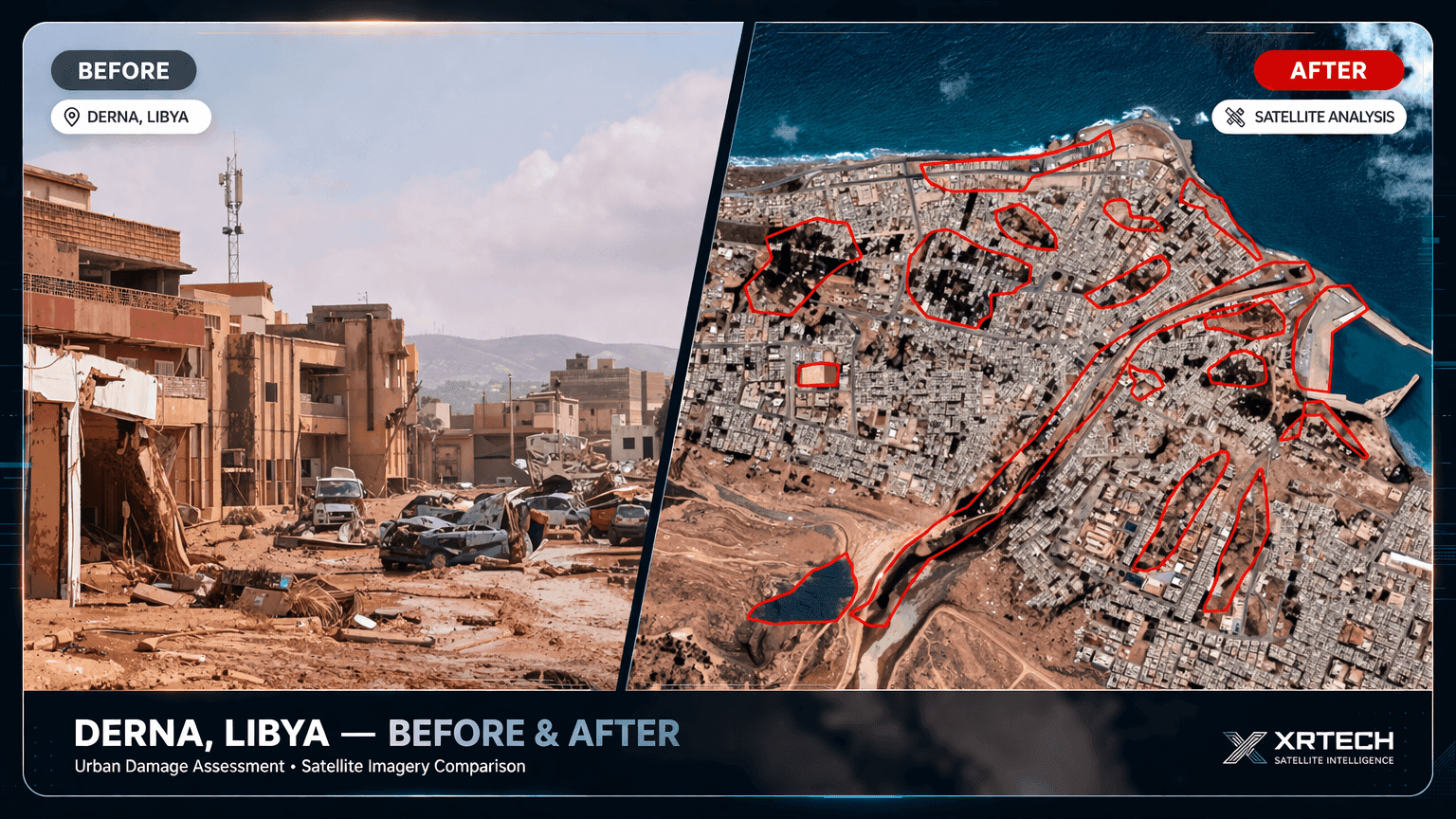
Derna, Libya: Flood Imagery in 24 Hours
Delivered while others were still quoting: clear waterline mapping and evacuation zone modelling for relief teams.
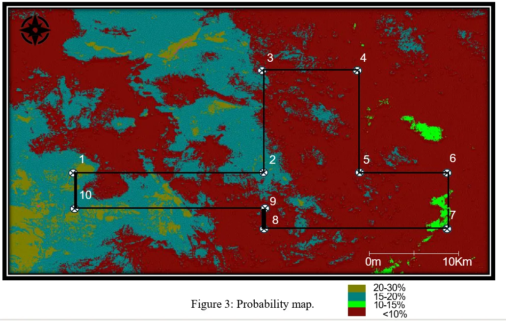
Gold Exploration in Africa
High-resolution imagery and AI analysis narrowed exploration targets before fieldwork.
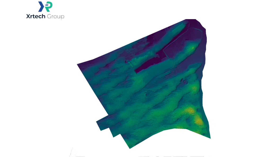
Flood-Ready Planning in Abu Dhabi
Stereo imagery and elevation data supported flood-ready urban planning.

“We received high-resolution satellite imagery 2x faster than Maxar or Airbus vendors.”
Infrastructure Planner, Asia
When timelines are tight, speed makes the difference. XRTech delivers.

“Others said 3 weeks. XRTech delivered high resolution satellite imagery in 4 days, as was needed.”
National Mapping Lead, Africa
Fast, dependable delivery helped this team meet critical project milestones.

“Clear licensing, human support, and fast turnaround, finally.”
NGO Partner, MENA
Our transparent process and responsive team mean fewer delays and smoother execution.
Why XRTech Group
Why Governments and Businesses Choose XRTech for 30cm Imagery
01
Two native 30cm constellations
SuperView Neo-1 and Beijing-3B give more collection chances over your area than a single satellite, backed by tasking access to 130+ satellites across partner constellations for every other resolution.
02
Planned for large areas
Multistrip and corridor modes, archive and tasking combined, and phased delivery keep national and regional programmes moving on schedule.
03
Analyst-checked quality
Every scene is checked for cloud, haze and geometry before delivery.
04
Analysis-ready products
Order orthorectified imagery, DEMs, stereo pairs and 3D city models from the same 30cm collection.
05
Team-wide licensing, no export delays
Flexible team-wide licensing and no US export licence checks, so procurement moves faster in every region.
06
Free coverage check and sample
See real archive coverage and a sample tile of your own area before you sign a purchase order.
Who buys 30cm
Who Uses 30cm Satellite Imagery
30cm high resolution satellite imagery is for organisations that need sub-metre detail over large or scattered areas, often more than once. These are the sectors where it pays back fastest.
National Mapping: Base Maps and Cadastre at 30cm
Mapping agencies and municipalities use 30cm imagery to refresh base maps, cadastre and address registers, and to spot unpermitted buildings across whole cities in one pass.
• Building footprint and road network extraction
• Cadastre, zoning and land-use updates
• Unauthorised construction detection
• Census, addressing and utility mapping



Quote within 24 hours
Get a 30cm Quote for Your Area
Tell us where and how much. Within 24 hours XRTech Group replies with archive coverage, cloud cover, a price per km² and a free 30cm sample tile, for any location worldwide.
FAQ
30cm Satellite Imagery: Your Questions Answered
What is 30cm high resolution satellite imagery?
30cm high resolution satellite imagery is optical imagery where each pixel represents 0.3m by 0.3m on the ground. It is the sharpest native resolution commercial satellites collect at scale, enough to identify vehicles by type, read road markings and map building outlines to sub-metre accuracy. XRTech Group supplies native 30cm imagery worldwide from SuperView Neo-1 and Beijing-3B.
How much does 30cm satellite imagery cost?
XRTech Group sells 30cm archive imagery at $20/km² (minimum 25 km²) and new 30cm tasking at $30/km² (minimum 100 km²). Priority tasking is $45/km², emergency tasking is $80/km², and a stereo pair is $60/km². Cloud cover limits and viewing angle guarantees are optional add-ons, and volume pricing applies from 250 km².
Can I buy 30cm imagery for a single site or a small project?
Yes. XRTech Group sells 30cm archive imagery from 25 km² and new tasking from 100 km², for one site or many. Request a quote with your area and we reply within 24 hours with coverage, cloud cover and a price per km².
Do you offer bulk or volume discounts on 30cm imagery?
Yes. Volume pricing starts at 250 km², and the rate per km² drops as the total area grows. The final rate depends on total area, the mix of archive and new tasking, delivery deadlines and cloud limits. Regional, national and multi-year monitoring programmes get a custom written rate. Send your boundary file and XRTech Group replies with a volume quote within 24 hours.
Which satellites provide 30cm imagery?
Native 30cm-class commercial satellites include SuperView Neo-1, Beijing-3B, WorldView-3, the WorldView Legion constellation and Pléiades Neo. XRTech Group supplies SuperView Neo-1 and Beijing-3B 30cm imagery, plus 25cm imagery from SuperView Neo-1 03/04 for projects that need more detail.
What is the difference between native 30cm and enhanced 30cm imagery?
Native 30cm imagery is captured at 0.3m ground sample distance on the satellite sensor, so every pixel holds real ground information. Enhanced or resampled 30cm is produced from coarser data, often 50cm, and processed to look sharper. Native data is the right choice for measurement, engineering and AI training. All 30cm imagery from XRTech Group is native.
What can you see in 30cm satellite imagery?
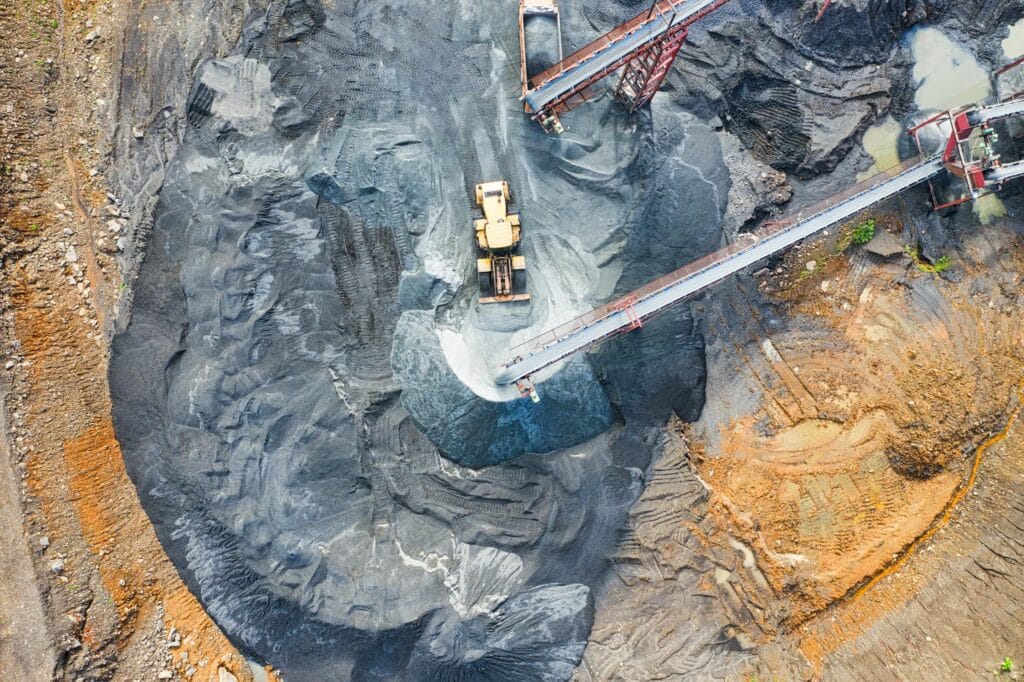
At 30cm you can identify cars, trucks and buses by type, read lane and parking markings, see rooftop equipment, count trees and follow construction stage by stage. Geologists use it to map outcrops and surface features for mineral exploration, and data teams use it to train object detection models. People appear only as a few pixels and cannot be identified, and number plates cannot be read.
How long does delivery of 30cm imagery take?
Archive 30cm imagery is delivered within 48 hours of order approval. New tasking depends on weather and satellite capacity over your area, and emergency tasking is prioritised for collection within 24 hours, as reported by XRTech Group. Large orders are delivered in phases, archive first, so your team can start work straight away.
Can you cover a whole city, region or country at 30cm?
Yes. XRTech Group plans wide-area 30cm programmes using archive scenes first, then multistrip tasking across SuperView Neo-1 and Beijing-3B to fill the rest. The result is one colour-balanced, cloud-free mosaic delivered in phases, for any country, with no US export licence delays.
Do I need an export licence or permit to buy 30cm satellite imagery?
No. XRTech Group is a non-US satellite imagery provider, so 30cm orders are not subject to US ITAR or EAR export controls. Buyers in the Middle East, Africa, Asia and other regions can buy 30cm imagery under standard commercial terms, without the export licence checks and delays that can apply to US-sourced data.
What formats and processing levels are available?
30cm imagery is delivered as GeoTIFF in natural colour or 4-band (blue, green, red, near-infrared), pan-sharpened to 0.3m. You can order basic Level 1B for your own processing or orthorectified Level 2A, in WGS84 or UTM, ready for QGIS, ArcGIS and CAD.
Can I make a DEM or 3D model from 30cm imagery?
Yes. SuperView Neo-1 and Beijing-3B collect stereo and tri-stereo 30cm imagery. A stereo pair costs $60/km² and supports a digital elevation model with about ±3m vertical accuracy (RMSE), as well as DSM, DTM and 3D city models. Tri-stereo is 3× the mono price and gives the best results in dense cities.
Is 30cm the right resolution, or do I need 25cm or 50cm?
Choose 30cm for detailed mapping, asset monitoring and AI training over large areas. Choose 25cm when small objects or engineering detail matter more than cost. Choose 40cm or 50cm when you need wider coverage at a lower price per km². The resolution guide compares every option.
Reviewed by Mustafa Jawaad, General Manager, XRTech Group. Prices are XRTech Group's published 30cm list prices in USD per km²; volume pricing applies from 250 km².