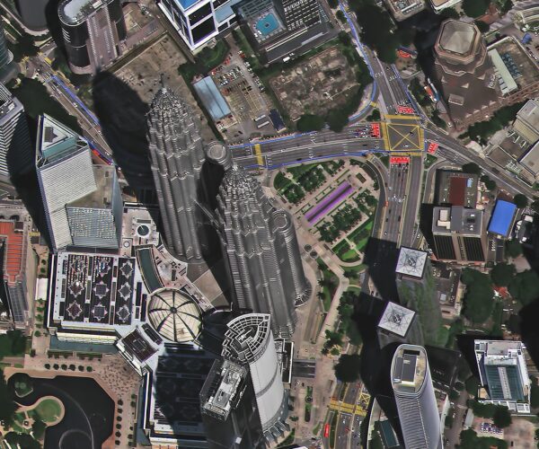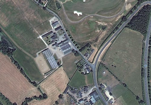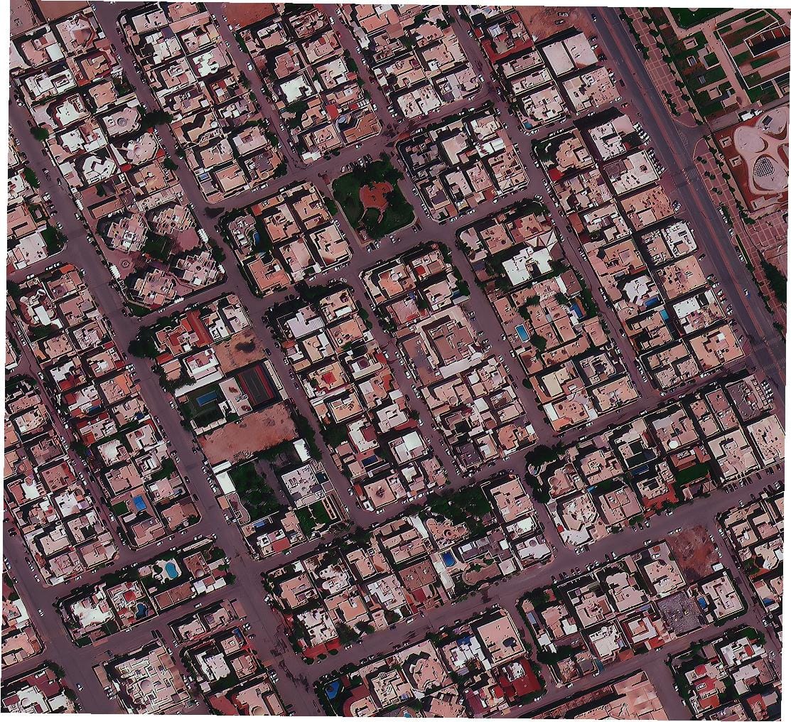
Can I See a Live Satellite Picture of My House in Real Time? This is a question many people ask out of curiosity or for practical reasons. Advances in technology have made satellite imagery more accessible than ever. Platforms like Google Earth or government agencies provide stunning views of Earth from above, but the idea of seeing a live satellite picture of my house remains limited.
While satellites capture images of your location, those images are usually not updated in real-time. The reasons are related to technical limitations, privacy concerns, and the way satellites operate. Some tools claim to offer live tracking, but they often rely on pre-recorded data. If you’re wondering, “Can I really view a live satellite picture of my house?” the answer involves understanding how satellites work and the available tools.
In this blog, we’ll explore whether real-time satellite imagery is possible, how these systems function, and how close we are to achieving real-time access. You’ll also discover tools that let you view near-real-time data and whether you can truly see live satellite images of your house in real time. Stay curious as we uncover the reality behind this fascinating technology!
The truth is, with today’s technology, it’s not possible yet. As of 2025, satellites that capture Earth’s images don’t send constant live feeds. Instead, they take pictures at specific times and process them before releasing them. This means any images you see, even with advanced tools, are not in real-time.
Even though some companies offer “near-real-time” views, there is always a delay because capturing, processing, and transmitting data takes time. Plus, showing live satellite pictures of my house could create privacy problems, as everyone expects their homes to remain private.
Still, technology is improving quickly. While live satellite images aren’t available now, tools are becoming more advanced and offering better, quicker updates.
Know More – How often does google earth update
To see real-time satellite images of your house, it’s important to understand that such imagery is not currently available for the public. Real-time satellite imagery is difficult to obtain due to technological, privacy, and logistical challenges. However, there are 3 alternatives that can help you see (near) live or recent satellite images of your house:

Google Earth: Google Earth allows you to explore satellite images of your location, though they aren’t real-time. The images are updated periodically, and you can zoom in to view your house or other landmarks. The updates are typically done once a year or so, depending on the area.
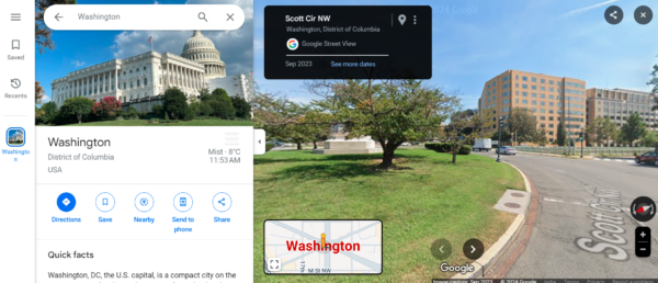
Google Maps: Google Maps provides a similar service, offering images of your house through satellite view. However, as with Google Earth, these are not real-time images. The Google Streets feature, available through Google Maps, allows you to view your house from a 360-degree street-level perspective. While this isn’t recent imagery, it gives a good idea of your surroundings.
Zoom Earth: For near-real-time satellite imagery, you can use platforms like Zoom Earth. This service provides live weather tracking and updates, such as wildfires, storms, and other events. However, these images are not specific to your house and are more focused on large-scale events.
XRTech Group: Get free satellite imagery from XRTech Group for professional use, including archived and newly requested images. Access data from 60+ satellites with a cloud-based platform for seamless ordering and processing. Benefit from value-added services like 3D modeling, digital maps, and geospatial analysis. High-resolution imagery supports industries like urban planning, agriculture, and environmental monitoring. Enhance decision-making with precise, up-to-date satellite data and advanced analysis tools. Contact us now to get free satellite images of your house.
While real-time satellite images are not yet possible for public use due to privacy concerns and technical limitations, these tools provide the most recent and accessible alternatives for viewing your house.
Get Free Satellite Imagery to Watch Anything – Check out Top 20 Latest Sources for Free Satellite Images and Maps of Our Planet
Tools like Google Earth, Zoom Earth, and platforms run by organizations like NASA or government agencies have transformed how we explore our planet. These tools provide high-resolution images of Earth, allowing users to zoom into locations with impressive detail. From everyday users curious about their neighborhoods to scientists analyzing land changes, these platforms offer a fascinating look at our world.
However, these images are not live. They rely on data from satellites and aerial surveys that capture snapshots at different times. Platforms like Google Earth use a combination of satellite imagery and pre-recorded data, updated periodically but not in real time. Zoom Earth, on the other hand, focuses on near-real-time updates, showing weather patterns or wildfires, but still with a slight delay. NASA and government agencies often use satellite imagery for research and monitoring purposes, like climate change or disaster response, but their priority isn’t providing live views to the public. Get free satellite imagery from XRTech Group for professional use, including urban planning and environmental monitoring. Access high-resolution images from top satellites like SuperView-1, GF-2, and ZY-3 with on-demand tasking and historical archives.
Visit: Latitude Longitude Converter
Visit – Types of Satellite in our Orbit
Providing real-time satellite imagery is a technical challenge. Satellites orbit the Earth at high speeds, capturing data in short intervals as they pass over specific locations. After collecting the data, it must be processed, analyzed, and formatted before it becomes usable. This process introduces delays, making real-time imagery practically impossible with current systems.
Additionally, privacy is a significant concern. Live satellite pictures of Earth could expose sensitive locations, activities, or personal properties, raising ethical and legal issues. Government agencies and companies prioritize protecting privacy over delivering real-time images. The cost of operating satellites capable of providing live feeds would also be incredibly high, making it less feasible for widespread public use.
Despite these challenges, the demand for real-time satellite imagery continues to grow. Such technology could revolutionize many fields:
For commercial applications, industries like logistics, mapping, and telecommunications could optimize operations with real-time satellite feeds. While it’s currently out of reach, advancements in satellite technology and data processing may bring us closer to this future, providing both practical benefits and a better understanding of our planet.
Real-time satellite imagery is not readily available for the public in the sense of live, on-demand imagery of specific locations like a street camera or live TV feed. However, near-real-time satellite imagery can be accessed, which offers relatively recent images with a slight delay, typically ranging from a few minutes to several hours or even a day.
For example, NASA’s Worldview provides near-real-time imagery, updating satellite images every few hours. The imagery is useful for monitoring global weather patterns and environmental changes, but it is not updated constantly. Similarly, companies like Planet Labs and Maxar Technologies provide commercial satellite images, often with delays of several hours or days, depending on the satellite pass and cloud cover.
In contrast, certain specialized systems, such as weather satellites or those tracking space stations, offer more continuous tracking, but they generally provide data and not full images of specific places on Earth in real-time.
To summarize, while true real-time satellite imagery of specific locations is not available to the general public, you can access relatively recent satellite imagery through services that update every few hours or daily.
Real-time or near-real-time satellite imagery is facilitated through highly advanced systems involving satellites, ground stations, and data processing. Here’s how these systems generally function:
Satellite Imaging:
Transmission of Data:
Data Processing:
Dissemination:
Technological Advances:
Near-Real-Time Options:
Future Potential:
XRTech Group provides advanced, high-resolution satellite imagery to support various industries such as agriculture, energy, urban planning, and environmental monitoring. These high-quality images are critical for precise mapping, monitoring, and analysis, helping businesses make data-driven decisions that drive efficiency, sustainability, and growth.
Our satellite planet imaging solutions offer near-real-time monitoring of Earth’s dynamic changes. Whether it’s tracking weather systems, managing disaster responses, or monitoring environmental conditions, our advanced technology delivers timely, accurate insights for better decision-making.
XRTech’s geospatial solutions empower organizations to analyze land use, monitor resources, detect anomalies, and track deforestation using our powerful remote sensing technology. These services provide essential data to guide informed decisions that support business goals.
Our satellite mapping services offer highly detailed images to aid urban planning, infrastructure development, and environmental management. These maps help ensure clarity, accuracy, and long-term strategic planning for growing cities and regions.
We specialize in tailored geospatial solutions that meet the specific needs of each client. From precision agriculture and pipeline monitoring to smart city projects and maritime security, our services leverage cutting-edge satellite technology to provide customized insights.
By integrating AI with satellite imaging, XRTech accelerates data processing for predictive analysis. Our AI-powered analytics help businesses optimize resources, predict crop yields, and improve operational efficiency—resulting in faster and smarter decisions.
While it’s not currently possible to view real-time satellite images of individual homes, XRTech’s satellite imagery services provide near-real-time insights that allow businesses and organizations to make informed decisions quickly. Learn more about how our satellite imagery solutions work and what they can offer!
XRTech Group offers cutting-edge satellite imagery solutions designed for high-resolution optical and radar imagery. These products cater to industries like urban planning, agriculture, defense, and environmental monitoring. With our advanced satellite imagery, you get precise, actionable data that aids decision-making. Whether you need frequent revisit cycles, enhanced spectral range, or historical archives, we provide the tools for better insights.
Take your projects to the next level with XRTech’s value-added satellite products. These include 3D models, Digital Surface Models (DSM/DEM), and Digital Orthophoto Maps (DOM). With these high-resolution models and maps, your teams can gain deeper insights and streamline decision-making.
With XRTech Group’s advanced remote sensing solutions, businesses in a variety of industries—including agriculture, urban planning, defense, and environmental management—can unlock the potential of satellite technology. Our satellite analytics provide real-time data that helps businesses optimize operations, make informed decisions, and promote sustainable growth.
XRTech provides satellite data services that integrate seamlessly into GIS systems, offering both real-time and archive data. Our services ensure you have access to precise, actionable geospatial data, helping you make well-informed decisions for urban planning, agriculture, environmental monitoring, and disaster management.
XRTech Group offers a wide array of satellite data services that deliver real-time and archive data collections from diverse satellite constellations. Our comprehensive satellite data services provide accurate, timely, and actionable geospatial information that is essential for effective decision-making. Whether you’re managing urban growth, monitoring agricultural outputs, or responding to environmental crises, our satellite data services help ensure you have the right insights at the right time.
XRTech Group offers powerful software tools designed to automate the processing of satellite imagery and geospatial data. These tools enable the integration of satellite data into your workflows, allowing for accurate adjustments, orthorectification, color correction, and more. Our software solutions ensure that the data you work with is precise, making it easier to analyze and make decisions based on high-quality satellite imagery.
With XRTech Group’s satellite imagery solutions, industries ranging from agriculture to environmental management can harness the power of high-resolution satellite data to drive efficiency, innovation, and better decision-making. Whether you’re looking to monitor land use, track natural disasters, or optimize urban planning, XRTech offers the tools and expertise you need to unlock the potential of satellite technology.
If you’re in need of high-resolution satellite imagery for various applications, XRTech Group offers an array of options that provide detailed, accurate, and actionable data. Whether for urban planning, environmental monitoring, agriculture, or defense, the satellite imagery we provide is tailored to meet your specific requirements. Here’s a breakdown of the types of imagery you can purchase:
Optical Imagery
Optical images offer clear, high-definition views of Earth’s surface in true color. This type of imagery is ideal for applications such as land-use monitoring, urban development, and environmental studies, giving users clear insights into the condition of the landscape.
Radar Imagery (SAR Products)
Synthetic Aperture Radar (SAR) imagery is perfect for all-weather monitoring. Unlike optical images, SAR can capture data even under cloudy conditions or during the night. This feature makes it particularly useful for tracking changes in the environment, monitoring disaster zones, and ensuring infrastructure integrity.
Multispectral Imagery
Multispectral imagery captures data in multiple wavelengths of light, including visible, infrared, and other non-visible bands. This type of imagery is essential for monitoring vegetation health, assessing crop growth, or analyzing land cover changes. It provides a broader spectrum of information than standard optical imagery, allowing for more precise environmental and agricultural analyses.
Digital Surface Models (DSM/DEM)
Digital Surface Models (DSM) and Digital Elevation Models (DEM) are used to represent the elevation of the Earth’s surface. These models are invaluable for applications such as flood risk assessment, urban planning, and environmental monitoring, as they provide accurate 3D information about landscapes.
3D Geographical Scenes & City Models
These high-resolution 3D models offer a detailed, realistic view of urban and natural landscapes, useful for infrastructure projects, environmental monitoring, and urban planning. They allow users to interact with a virtual version of the city or terrain, making them essential tools for decision-making.
Value-Added Products
Beyond basic satellite imagery, XRTech offers a variety of value-added products like Digital Orthophoto Maps (DOM), 3D models, and Digital Surface Models (DSM/DEM). These products enhance your analysis by providing more depth and precision, making them perfect for urban planning, agriculture, and environmental monitoring.
High-Revisit Imaging Solutions
For projects requiring frequent updates, XRTech offers high-revisit satellite imaging solutions that capture data with regular frequency. This ensures that you stay updated on changes in your area of interest, making it especially useful for monitoring dynamic environments, such as construction sites or natural disaster areas.
Whether you’re in agriculture, urban planning, defense, or environmental management, purchasing satellite imagery from XRTech ensures that you have access to high-resolution, precise data tailored to your project needs. Additionally, we provide customizable data collections and global access to give you the most relevant, up-to-date information.
For more information on how to buy satellite images and inquire about pricing, contact XRTech Group today. Our satellite imagery solutions can empower your projects with cutting-edge technology for better, data-driven decision-making.
No, you cannot view your house in real-time through satellites. Most satellite images are taken periodically, not continuously. For now, you can only view recent images, not live footage.
Google Earth does not provide real-time satellite imagery. It uses static images captured periodically, but it can offer a near-real-time view depending on when the images were last updated.
You can use tracking apps or websites to follow real-time satellite locations, like in the case of some weather satellites or space stations. However, viewing a live satellite image of your house is not possible yet.
Yes, you can see your house using Google Earth, but the images may not be in real-time. Google Earth uses satellite imagery that may be a few months or even years old, depending on the area.
No, Google Maps’ live view feature is not real-time. The real-time navigation feature uses GPS and live data, but the satellite imagery is not updated live.
You can use services like Google Earth, Google Maps, or other online satellite services to view aerial images of your house, but these will not be real-time images.
You can see your house online using mapping services like Google Maps or Bing Maps, which provide aerial or street view images.
No, Street View images on Google Maps are not live. They are taken periodically when Google cars drive around taking pictures, and these views are updated only occasionally.
Real-time satellite images are not available for public use. There are satellites that provide near-real-time imagery, but they often come with delays, and the resolution may not show detailed views of individual homes.
Yes, you can see your house in Google Maps, either through satellite view or street view, but the images are not live and may be several months or years old.
Yes, satellites orbiting the Earth can capture images of your house, but those images are not live and may not show fine details like people or cars.
You can view satellite images of your house using online tools like Google Earth or services that offer satellite imagery. However, these images are not live and may be outdated.
Some of the best free satellite imagery sources include Google Earth, NASA Worldview, and USGS Earth Explorer. These services provide access to various satellite images, but they are not real-time.
Free Aerial View of Airports | Satellite Images of Denver and Las Vegas Airports
Photos of the New 7 Wonders of the World | Satellite Imaging
Explore Burj Khalifa from Space: High Resolution Satellite Images of Dubai’s Iconic Landmark
Free Satellite Imagery of Mount Everest: High-Resolution Aerial Views
Satellite Imagery of Antarctica: High-Resolution Satellite Photos of Antarctica
What is Digital Elevation Model
What is Satellite Imagery? Types, Uses & How to Get – Full Guide
Can I See a Live Satellite Images of My House in Real Time? | Satellite View of My House
Satellite Types in Earth’s Orbits: Functions, Uses & High-Resolution Satellite Images

Satellite imagery has become one of the most powerful tools for understanding our world, capturing every detail of Earth from

Understanding the Growing Market for Maxar Competitors Satellite imagery and geospatial intelligence have become essential for governments, industries, and research