
Beijing-3A Satellite Imagery: 50cm Resolution with Agile Tasking
50cm Panchromatic · 2m Multispectral · 4-Day Revisit
Buy Beijing-3A satellite imagery from an agile optical satellite built by Aerospace Dongfanghong for 21AT. Using autonomous mission planning and in-orbit image processing, Beijing-3A captures 50cm panchromatic and 2m multispectral imagery, with mono, stereo, and tri-stereo acquisition available for both new tasking and archive orders.
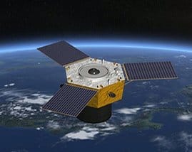
An Agile Satellite Built for Fast, Precise Tasking
Beijing-3A is an agile remote sensing optical satellite developed by Aerospace Dongfanghong Satellite Co., Ltd of the Fifth Academy of Aerospace Science and Technology Group, operated by 21AT (Twenty First Century Aerospace Technology Company Ltd). Built on the CAST3000E high-performance agile satellite platform, it combines ultra-high agility, stability, and pointing precision with autonomous mission planning and in-orbit image processing, allowing it to plan and execute imaging tasks with minimal ground intervention.
Launched on June 11, 2021, Beijing-3A carries two imagers: a 0.5m panchromatic camera and a 2m multispectral sensor, delivering data used for land and resource management, agricultural studies, ecological and environmental monitoring, and urban planning. The satellite flies a sun-synchronous orbit at approximately 500km altitude, with a 97-degree inclination and a 4-day revisit cycle at mid-latitudes.
What sets Beijing-3A apart from older-generation optical satellites is its onboard autonomy. Rather than relying solely on ground-based command sequences, the satellite's in-orbit image processing and autonomous mission planning allow it to make real-time adjustments during a pass, improving pointing accuracy and reducing the lead time typically required between tasking request and collection. This is part of a broader shift in Chinese commercial Earth observation toward intelligent, self-managing satellite systems, and it directly benefits customers who need fast turnaround on time-sensitive AOIs.
Beijing-3A also anchors a growing constellation. Its follow-up satellite, Beijing-3B, launched in August 2022 with an upgraded 0.3m panchromatic imager, and a four-satellite Beijing-3C group joined the constellation in May 2024, each carrying the same 0.5m panchromatic and 2m multispectral configuration as Beijing-3A. Together, these satellites give 21AT a multi-satellite tasking pool that improves revisit frequency and collection capacity well beyond what a single satellite could offer.
Imaging Modes & Delivery Options
Beijing-3A supports multiple acquisition and product configurations, giving flexibility depending on whether a project needs simple visual imagery or elevation-ready stereo data.
Mono Imagery
Standard single-pass collection, available through both new tasking and catalog archive.
Stereo & Tri-Stereo
Multiple viewing angles in a single or coordinated pass, suited to elevation modeling and 3D reconstruction.
Pansharpened True Color
3-band RGB pansharpened output combining panchromatic sharpness with multispectral color.
Bundle & False Color
Bundle products (1 panchromatic + 4 multispectral bands) and false color composites for vegetation and NIR analysis.
File Formats & Delivery Package
Every Beijing-3A order arrives as a structured package rather than a single raw file, so it's ready to load directly into standard GIS and remote sensing software without extra conversion steps.
| Coordinate Reference System | Geographic, WGS84 |
| Data Files | GeoTIFF (catalog); GeoTIFF or TIFF (tasking) |
| Metadata | XML and TXT formats included |
| Masks | Cloud mask and transparency mask (SHP) |
| Visuals | GeoTIFF preview |
| Thumbnails | JPEG and PNG |
| NoData Value | 0 |
| Package Format | ZIP archive containing all above files |
| Output Clipping | AOI-clipped imagery on delivery |
Full Technical Specifications
Sensor & Mission
| Operator | 21AT (Twenty First Century Aerospace Technology) |
| Contractor | CAST / Aerospace Dongfanghong |
| Configuration | CAST3000E agile platform |
| Panchromatic Resolution | 0.5m (50cm) at nadir |
| Multispectral Resolution | 2m, 4 spectral bands |
| Swath Width | 23.5 km |
| Positioning Accuracy | < 10m CE90 absolute |
| Mapping Precision | Better than 1:10,000 map scale |
| Dynamic Range | 12-bit |
| Bit Depth (Delivery) | 8-bit or 16-bit |
| Incidence Angle | Up to 45° |
| Acquisition Modes | Mono, stereo, tri-stereo |
| Mass | 1,200 kg |
| Mission Life | 8 years |
Orbit & Coverage
| Orbit Type | Sun-Synchronous (SSO) |
| Altitude | ~500 km |
| Inclination | 97.0° |
| Equatorial Crossing | ~11:00 AM local time (LTAN) |
| Launch Date | June 11, 2021 |
| Revisit Rate | Every 4 days (at 40°N) |
| Archive Availability | Since 2024 |
| New Tasking | Available |
| Minimum AOI | 2 km wide; minimum charge as per 50 km² |
| Cloud Coverage Range | 5–100% |
Spectral Bands
| Panchromatic | 450–700 nm |
| Blue | 450–520 nm |
| Green | 520–590 nm |
| Red | 630–690 nm |
| Near-Infrared (NIR) | 770–890 nm |
How Beijing-3A Compares Across the Beijing-3 Series
Beijing-3A was the first of a growing constellation. Later satellites in the series improved on resolution and added tasking capacity, though Beijing-3A remains a strong balance of accuracy, swath width, and cost for most land and resource monitoring projects. For a wider view of what's available across XRTech's full constellation, see our satellite imagery pricing and ordering guide.
| Beijing-3A | 0.5m pan / 2m MS, launched June 2021 |
| Beijing-3B | 0.3m pan, launched August 2022 |
| Beijing-3C (4 satellites) | 0.5m pan / 2m MS, launched May 2024 |
Why Buy Beijing-3A Satellite Imagery
- 50cm Satellite ImagerySharp enough for detailed infrastructure, urban, and land-use analysis without the cost premium of ultra-high-resolution sensors.
- Autonomous Mission PlanningIn-orbit image processing and autonomous planning support fast, precise tasking with less lead time than older-generation satellites.
- Mono, Stereo & Tri-StereoFlexible acquisition modes support both standard imagery and elevation-ready 3D data from the same platform.
- Mapping-Grade AccuracyPositioning accuracy better than 10m CE90 supports mapping to better than 1:10,000 scale.
- Growing ArchiveCatalog imagery available since 2024, alongside active new tasking for time-sensitive projects.
Applications for Beijing-3A Satellite Imagery
Beijing-3A's resolution, accuracy, and flexible acquisition modes suit a wide range of land and infrastructure-focused projects.
Land & Resource Management
Support cadastral, land-use, and natural resource management with mapping-grade positional accuracy.
Agricultural Studies
Track field conditions and land allocation with multispectral data and a 4-day revisit cycle.
Environmental Monitoring
Monitor ecological change and environmental compliance with reliable, repeatable imagery.
Urban Planning
Support city growth planning and infrastructure assessment with 50cm panchromatic detail.
3D Elevation Modeling
Use stereo and tri-stereo acquisition to generate DEMs and 3D terrain models for engineering and planning work.
Infrastructure Assessment
Evaluate roads, utility corridors, and built infrastructure remotely with mapping-grade accuracy.
Disaster & Change Detection
Compare pre- and post-event imagery to assess damage and track recovery over time.
Water Resource Studies
Monitor reservoirs, irrigation networks, and watershed conditions with multispectral NIR data.
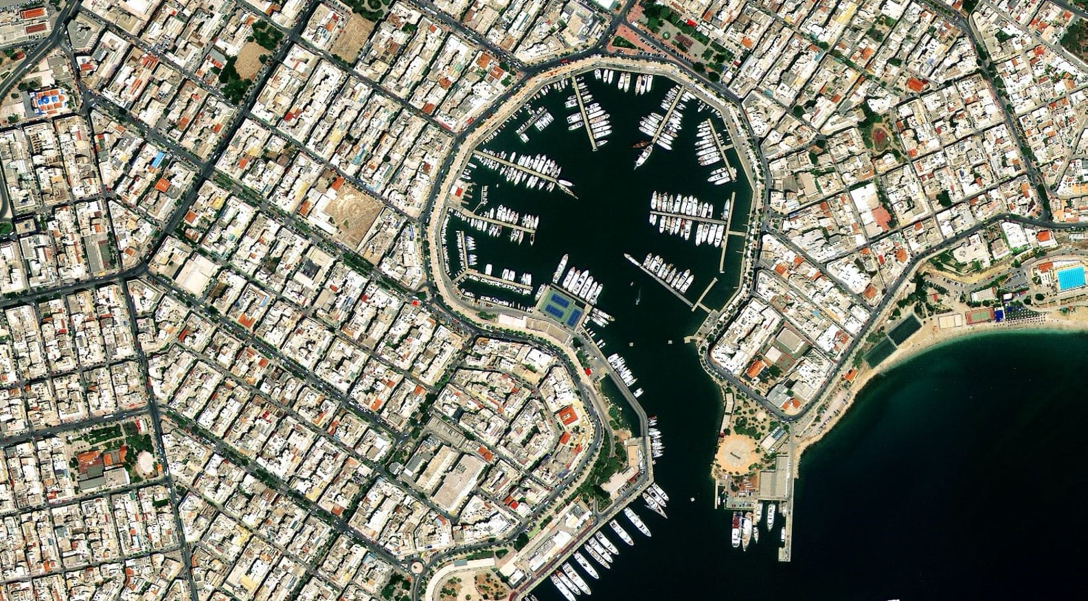
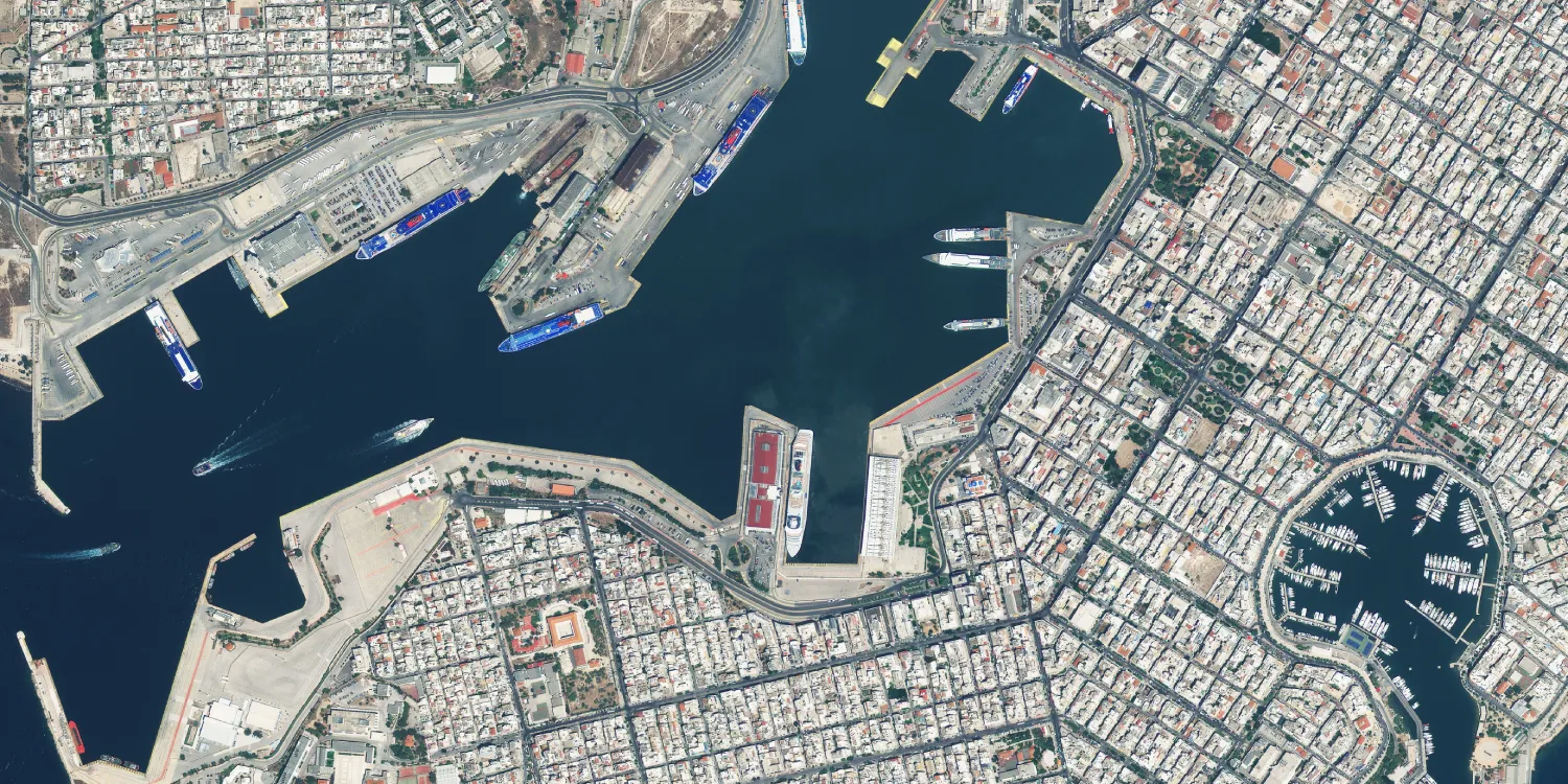
Beijing-3A Sample Imagery
End-to-End Support for Beijing-3A Tasking
Expert Consultation
Our geospatial specialists help define AOI, acquisition mode, and tasking priority to match your project's requirements.
Rapid Delivery
Direct access to a 130+ satellite constellation network means faster turnaround on both archive search and new-capture tasking.
Seamless Integration
Imagery delivered in industry-standard formats like GeoTIFF, ready to drop into your existing GIS, CAD, or modeling workflow.
Common Questions About Beijing-3A
What resolution does Beijing-3A capture?
Beijing-3A captures 0.5m (50cm) panchromatic and 2m multispectral imagery at nadir, with a swath width of 23.5km.
Is archive imagery available, or only new tasking?
Both. Catalog archive imagery is available from 2024 onward, and new tasking is currently available for fresh collections over your area of interest.
Can Beijing-3A collect stereo or tri-stereo imagery?
Yes. Alongside standard mono collection, Beijing-3A supports stereo and tri-stereo acquisition modes suited to elevation modeling and 3D reconstruction.
How accurate is Beijing-3A imagery for mapping?
Positioning accuracy is better than 10m CE90 absolute, supporting mapping precision better than 1:10,000 scale.
What is the minimum order size?
The minimum AOI width is 2km, with a minimum charge calculated as per 50km², subject to standard tasking or catalog terms.
What file formats and masks come with a Beijing-3A order?
Orders are delivered as a ZIP package containing GeoTIFF or TIFF imagery, XML and TXT metadata, cloud and transparency masks in SHP format, a GeoTIFF visual, and JPEG/PNG thumbnails, referenced to WGS84.
How does Beijing-3A differ from Beijing-3B and Beijing-3C?
Beijing-3A and the four-satellite Beijing-3C group both capture 0.5m panchromatic and 2m multispectral imagery. Beijing-3B, launched in August 2022, carries an upgraded 0.3m panchromatic imager for even sharper detail.
What cloud coverage conditions are accepted for tasking?
Standard tasking accepts cloud coverage between 5% and 100%, with cloud-free or low-cloud priority available depending on project requirements.
Ready to Order Beijing-3A Satellite Imagery?
Talk to our geospatial team about archive availability or new tasking for your area of interest, with pricing tailored to your project.