
Buy TripleSat Satellite Imagery: 80cm Resolution, Daily Revisit, Global Archive Since 2016
80cm Panchromatic · 3.2m Multispectral · 24km Swath
Order TripleSat satellite imagery from a three-satellite constellation built for responsive daily tasking. Operated by 21AT and Surrey Satellite Technology Ltd. (SSTL), the TripleSat constellation delivers 80cm panchromatic and 3.2m multispectral imagery, backed by one of the largest continuously growing optical archives available, with data stretching back to 2016.
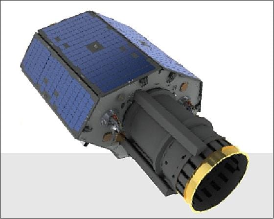
Order TripleSat: A Constellation Built for Speed and Reliability
The TripleSat constellation reached orbit on July 10, 2015, launched from the Satish Dhawan Space Centre in Sriharikota, India aboard a PSLV-XL vehicle. TripleSat-1, 2, and 3 are identical DMC-3 (SSTL-300S1) satellites built by Surrey Satellite Technology Ltd. and jointly operated with Beijing-based 21AT (Twenty First Century Aerospace Technology). A fourth identical satellite, TripleSat-4, joined the constellation on September 16, 2018, expanding tasking capacity further. Each satellite carries an expected mission life of at least 7 years, phased equally apart in the same orbital plane to enable coordinated daily coverage of any point on Earth.
When customers buy TripleSat satellite imagery, they're accessing one of the most tasking-focused constellations in commercial Earth observation. 21AT prioritizes new collections over archive sales, which translates into some of the shortest tasking turnaround times in the industry, including in historically difficult-to-task regions. Combined with nearly a decade of accumulated archive imagery dating back to 2016, TripleSat supports both fresh, time-critical tasking and long-term historical comparison from the same source.
Why Buy TripleSat Satellite Imagery
Wide Imagery Footprint
At roughly 24km across at nadir, TripleSat scenes are among the widest of any high-resolution constellation, meaning fewer scenes are needed to cover large areas of interest.
Daily Collections, Anywhere
The coordinated satellite constellation can be tasked to collect imagery of virtually any location on the planet on a daily basis.
A Focus on Fast Tasking
21AT's tasking-first operating model means industry-leading turnaround, even in competitive or historically difficult regions.
Full Technical Specifications
Sensor & Mission
| Provider | 21AT & Surrey Satellite Technology (SSTL) |
| Satellites | 3 (TripleSat-1/2/3), plus TripleSat-4 (2018) |
| Delivered Resolution (Nadir) | 0.8m panchromatic / 3.2m multispectral |
| Native Sensor GSD (Nadir) | 1m panchromatic / 4m multispectral |
| 25° Off-Nadir Resolution | 1m panchromatic / 4m multispectral |
| Swath Width (Nadir) | ~24 km (23.8 km measured) |
| Positioning Accuracy | < 20m CE90 (< 50m 1-sigma without ground control) |
| Dynamic Range | 10-bit |
| Stereo Imaging | Available |
| Daily Collection Capacity | ~634,000 km² (higher with 4th satellite) |
| Onboard Storage | 544 GB per satellite |
| Downlink | 500 Mbps, X-band (imagery); S-band (telemetry) |
Orbit & Satellite Bus
| Orbit Type | Sun-Synchronous (SSO), circular |
| Altitude | 651 km |
| Inclination | 98.1° |
| Orbital Period | 97.7 minutes |
| Equatorial Crossing | ~10:30 AM local time (LTAN) |
| Launch Date | July 10, 2015 (16:28 UTC) |
| Launch Vehicle / Site | PSLV-XL, Satish Dhawan Space Centre, India |
| Satellite Model | DMC-3 / SSTL-300S1 |
| Dimensions / Mass | ~3m tall × 0.87m diameter, 458 kg |
| Mission Life | 7+ years per satellite |
Spectral Bands
| Panchromatic | 450–650 nm |
| Blue | 440–510 nm |
| Green | 510–590 nm |
| Red | 600–670 nm |
| Near-Infrared (NIR) | 760–910 nm |
Sensor Resolution by Off-Nadir Angle
TripleSat's native sensor GSD shifts slightly as the satellite images further off-nadir. The table below shows the raw sensor resolution at each collection angle before resampling to standard delivered products.
| Off-Nadir Angle | Panchromatic GSD | Multispectral GSD |
|---|---|---|
| Nadir (0°) | 1.0 m | 4.0 m |
| 5° | 0.99 m | 3.96 m |
| 25° | 1.2 m | 4.8 m |
| 35° | 1.58 m | 6.32 m |
Revisit Frequency by Off-Nadir Angle
Revisit frequency depends on how far off-nadir the constellation is willing to image and the latitude of the target. Wider tasking angles trade a small amount of resolution for faster revisit.
| Off-Nadir Angle | Latitude Band | Revisit Frequency |
|---|---|---|
| 35° or higher | All latitudes | Daily |
| 25° | ±0–40° | 2 days |
| 25° | Beyond ±50° | Daily |
| 15° | ±0–30° | 3 days |
| 15° | ±40–60° | 2 days |
| 15° | Beyond ±70° | Daily |
Key Features and Benefits
- Reliable Visual & Spectral Detail80cm panchromatic and 3.2m multispectral resolution delivers dependable imagery for both visual interpretation and quantitative spectral analysis.
- Half a Million km² Daily CapacityThe coordinated constellation supports wide-area monitoring at scale, well suited to national or multi-region projects.
- Nearly a Decade of ArchiveContinuous data since 2016 supports historical comparison, baseline mapping, and long-term change detection from a single consistent sensor family.
- Optimized Cloud-Free TaskingTasking prioritizes cloud-free results, improving reliability for time-sensitive projects that can't afford a wasted collection window.
- Daily Revisit TargetingSupports agricultural cycle monitoring, disaster response, and urban growth tracking with near-daily tasking potential.
Applications for TripleSat Satellite Imagery
TripleSat's combination of wide swath, daily revisit, and deep archive suits projects that need consistent, repeatable coverage over time as much as one-off high-detail captures.
Agriculture
Track crop cycles and field conditions with daily revisit potential across full growing seasons.
Disaster Response
Fast tasking turnaround supports time-critical damage assessment after floods, storms, and other events.
Urban & Infrastructure Planning
Wide swath coverage supports efficient city and regional-scale mapping projects.
Environmental Monitoring
Nearly a decade of archive supports long-term environmental change and land-cover trend analysis.
TripleSat Satellite Imagery Samples
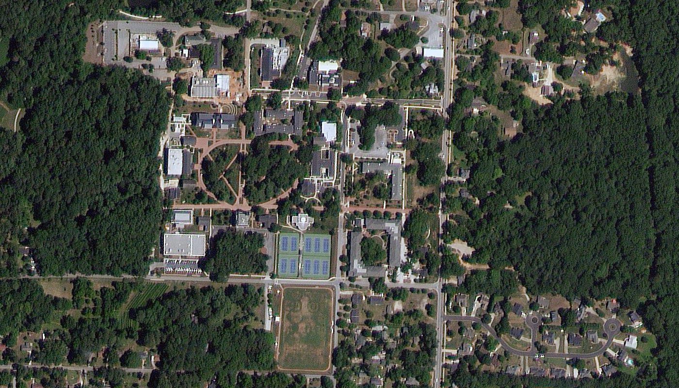
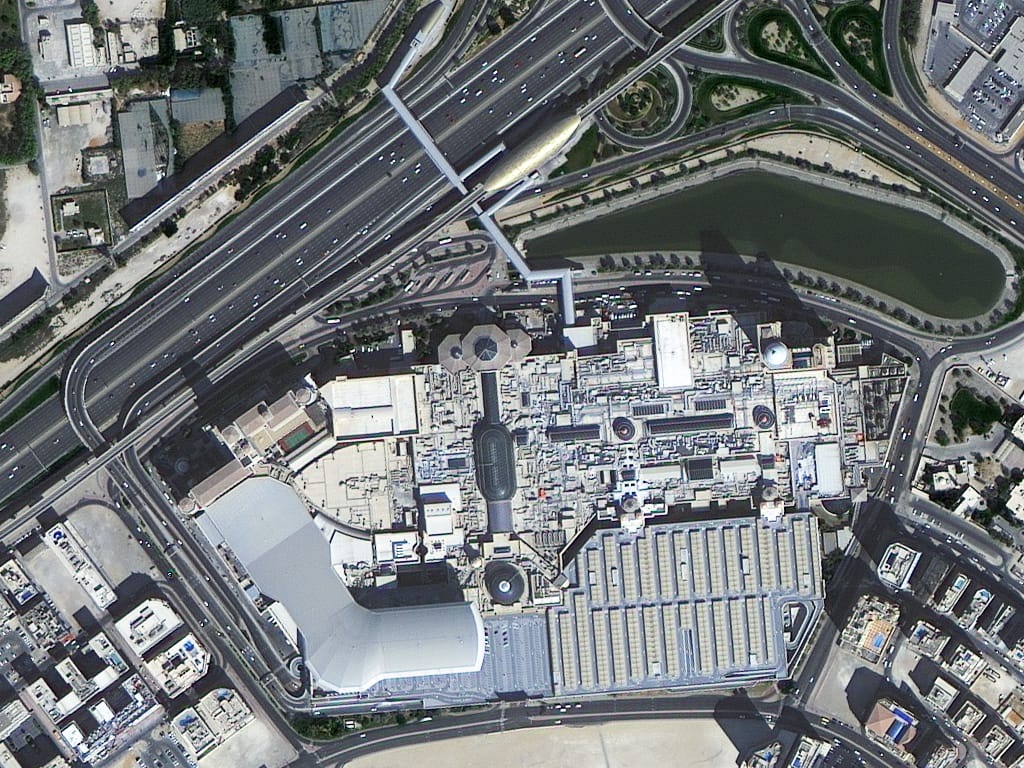
TripleSat Imagery Captured Worldwide
TripleSat has collected imagery across a wide spread of geographies and climates, from dense coastal cities to inland heritage sites, demonstrating the constellation's global tasking reach.
End-to-End Support to Buy TripleSat Satellite Imagery
Expert Consultation
Our geospatial specialists help define AOI, revisit needs, and tasking angle trade-offs to match your project's requirements.
Rapid Delivery
Direct access to a 130+ satellite constellation network, including TripleSat's tasking-first capacity, means faster turnaround.
Seamless Integration
Imagery delivered in industry-standard formats like GeoTIFF, ready to drop into your existing GIS, CAD, or modeling workflow.
Common Questions About Ordering TripleSat
What resolution is TripleSat satellite imagery delivered at?
Standard delivered products are 0.8m panchromatic and 3.2m multispectral at nadir, resampled from a native 1m panchromatic / 4m multispectral sensor. Off-nadir collections deliver at roughly 1m panchromatic and 4m multispectral.
How far back does the TripleSat archive go?
Continuous archive coverage is available from 2016 onward, giving nearly a decade of historical imagery for change detection and baseline comparison.
How fast can I order TripleSat new tasking?
21AT's tasking-first operating model typically produces some of the shortest turnaround times in the industry, though exact timelines depend on area size, cloud conditions, and target region.
How wide is a single TripleSat scene?
Approximately 24km at nadir, one of the widest footprints of any high-resolution optical constellation, which reduces the number of scenes needed to cover large areas.
Is stereo imagery available from TripleSat?
Yes, stereo acquisition is supported and can be used to generate digital elevation models and 3D terrain products.
What accuracy can I expect without ground control points?
Standard positioning accuracy is under 20m CE90, or under 50m at 1-sigma for nadir-pointing collections without ground control points or star tracker blinding.
Ready to Buy TripleSat Satellite Imagery?
Talk to our geospatial team about archive availability or new tasking across the TripleSat constellation, with pricing tailored to your area of interest.