Unlock Real-Time Mineral Data & Optimize Mining Operations with Mining Satellite Imagery
Trusted by governments, planners, and responders across Middle East, Africa & Across The World.
We respond in under 24 hours. Free mining satellite imagery samples can be included.


Mining Satellite Imagery
At XRTech Group, we deliver powerful satellite mining solutions tailored to the modern needs of the mining and natural resource industries. By combining high-resolution satellite imagery, digital elevation models (DEMs), and AI-powered analytics, we empower operators to improve exploration accuracy, monitor operations, reduce risks, and support sustainability from space.
Our advanced mining satellite systems—including hyperspectral and multispectral platforms—offer precise spectral fingerprinting of the Earth’s surface, enabling mineral detection and landform analysis with unmatched spatial and temporal resolution. Whether you’re identifying geological structures or assessing vegetation and access routes, our imagery solutions support every stage of the mining lifecycle.
Mining teams, researchers, and geologists benefit from actionable insights across wavelengths not visible to the human eye, including near-infrared, short-wave infrared, and thermal bands. This enables accurate interpretation of surface lithologies, detection of clays and oxides, and analysis of soil types.
From mapping infrastructure to monitoring environmental impacts, XRTech’s satellite mining imagery supports exploration, development, and compliance with confidence. With thematic maps and spectral analysis, our solutions drive smarter resource management and long-term operational success.

Exploration and Resource Management
High-resolution mining satellite imagery aids in identifying mineral deposits, planning exploration activities, and monitoring environmental impact. 3D geological mapping of mining land using DEM and DOM datasets provides a comprehensive visual representation of mining areas, enhancing exploration and operational efficiency.

Environmental Impact Monitoring
Mining Satellite-based environmental monitoring tracks deforestation, water pollution, and land degradation around mining sites, ensuring compliance with environmental regulations.

Infrastructure and Safety Monitoring
Real-time monitoring of mining infrastructure such as tailings dams and pipelines, using InSAR technology to detect deformation and prevent disasters.

Emergency Response in Mining
AI-driven disaster response platforms enable quick action during incidents like landslides or gas leaks, minimizing damage and ensuring worker safety.

Unlock critical terrain intelligence for smarter mining decisions
Use XRTech Group’s advanced satellite mining imagery to evaluate terrain, estimate overburden, and detect geohazards before on-site work begins. Our mining satellite data delivers precise digital elevation models and surface analysis, cutting survey costs and speeding up feasibility assessments with unmatched spatial accuracy.

Track surface changes across your mining site in real time
XRTech Group’s satellite mining solutions help monitor land disturbance with routine, high-resolution satellite imagery. Record pre-mining baselines, operational activity, and site rehabilitation using one central mining satellite platform—ideal for audits, compliance, and stakeholder transparency.

Accelerate mineral discovery with advanced satellite intelligence
XRTech Group empowers satellite mining projects with hyperspectral and SWIR satellite imagery to detect precise mineral compositions and subsurface geology. Focus drilling on the most promising areas using powerful mining satellite analytics and remote sensing data.

Simplify regulatory audits with satellite-powered Mining insights
XRTech Group’s mining satellite monitoring delivers verifiable satellite imagery on land rehabilitation, water use, and environmental impact. Minimize manual inspections and meet compliance needs with automated alerts and clear, consistent documentation.

What You Get
Enhanced Mining Efficiency Through Earth Surface Data Sets
Get a firsthand look at the power of our Earth Observation and high resolution satellite imagery data delivery in critical situations. Leverage XRTech Group’s advanced satellite mining insights
Key Challenges in the Mining Industry
The mining sector faces critical challenges due to outdated methods and limited real-time insight. XRTech Group addresses these concerns through advanced satellite mining technologies that ensure operational safety, compliance, and sustainability.
Inefficient Operations & Maintenance
Poor machinery performance and recurring site issues cause costly downtimes and reduced productivity.
Safety Risks & Hazard Detection
Lack of real-time hazard awareness increases accident potential and disrupts operations.
Environmental Compliance Pressures
Failure to monitor and manage impact zones can trigger fines, legal action, and loss of trust.
Data Fragmentation & Resource Mismanagement
Inaccurate reserve estimation and disconnected systems weaken mining satellite decision-making and resource planning.

# OUR BENEFITS
Hyperspectral Imaging Advantage
XRTech Group’s satellite mining solutions harness hyperspectral imaging to pinpoint mineral compositions and analyze complex geological formations with extreme precision. By capturing hundreds of narrow wavelength bands, our satellite imagery delivers deeper physical and chemical insights than traditional multispectral data.
This advanced mining satellite technology replaces outdated, manual inspections—enabling early detection of issues like chemical leaks, reducing environmental risks, and improving safety across every stage of the mining lifecycle.

01
Smart Site Intelligence for Sustainable Satellite Mining
At XRTech Group, our mining satellite technology delivers daily revisit satellite imagery across vast exploration zones—enabling smarter, faster, and more sustainable feasibility assessments.
With precise hyperspectral satellite mining data, decision-makers can pinpoint viable mineral reserves and evaluate operational risks. Our solutions also ensure continuous tracking of site disturbances and environmental threats from space—before they escalate.

02
Real-Time Threat Detection with Hyperspectral Satellite Mining
XRTech’s hyperspectral mining satellite imagery reveals hidden threats using advanced spectral analysis. Detect chemical leaks, erosion patterns, and stress indicators early—protecting people, assets, and the surrounding environment.
This real-time data reduces operating costs, improves compliance, and supports proactive ecosystem restoration—paving the way for responsible and resilient mining operations.
Biodiversity Insight & Vegetation Health Monitoring
Our satellite imagery offers 50x more detail than standard systems—making XRTech’s hyperspectral tech essential for monitoring habitat health in mining zones.
Track vegetation degradation, identify potential leakages, and map sensitive ecosystems. These insights help mining companies preserve biodiversity, strengthen regulatory alignment, and enhance their environmental responsibility.

03
Data-Driven Mine Closure & Remediation from Space
XRTech’s 5m resolution satellite mining datasets support every mining phase—from active extraction to post-closure rehabilitation.
Monitor water quality (pH, heavy metals, turbidity), detect contamination sources from tailing dams or legacy waste, and design smart remediation plans. Our mining satellite solutions also enable early warning systems to prevent environmental disasters before they occur.
Why Teams Switch to XRTech
Buy Satellite Imagery that Offers Precision, Speed, and Freedom – All in One Platform
Teams around the world are choosing XRTech for Earth Observation data and high resolution satellite imagery because we go beyond imagery — we deliver mission-ready solutions built for real-world demands.
Access to 130+ Satellites
A powerful satellite constellation including optical, SAR, stereo, and hyperspectral satellite sources ensures coverage across any terrain or condition.
Fast Turnaround Times
Get EO satellite imagery in under 7 days and DEMs in under 21 days, even for large or remote areas.
High Accuracy Satellite Imagery Outputs
Enjoy sub-meter satellite imagery resolution with CE90 and RMSE specs that meet even the most demanding project standards.
Compatible Imagery Data Formats
Satellite imagery data delivered in formats you already use — GeoTIFF, SHP, DWG, and UTM — for seamless integration with your GIS or CAD workflows.
No Export License Delays
As a non-U.S. high resolution satellite imagery provider, we avoid export control bottlenecks, getting your data to you faster and with fewer restrictions.
Flexible Licensing
Our high resolution satellite imagery is designed to match your operational realities, whether you're mapping a floodplain or planning national infrastructure.
Specs Snapshot
Satellite Imagery Engineered for Precision. Delivered for Productivity.
Sub-meter resolution high-resolution satellite imagery with support for 8-bit, 11-bit, and 16-bit depth — ortho-ready and optimized for analysis.
DEM images available at 2–10 meter spacing with ±3m vertical RMSE, suitable for engineering, hydrology, and land development.
Satellite imagery delivered in industry-standard formats: GeoTIFF, IMG, SHP, DWG, ready for GIS, CAD, or modeling workflows.
Receive your satellite imagery data via secure cloud delivery or physical HDD, depending on your project needs.
Flexible support for WGS84, UTM, or custom coordinate systems.
Simple, project-wide licensing that’s publication-friendly and built for collaborative teams.
Pricing Plans
Our Flexible High-Resolution Satellite Imagery Pricing Built to Match your Project Scale.
Choose a plan that fits your needs — from rapid response satellite imagery to full-scale DEM + analysis packages. No hidden fees, no license confusion.
51-80cm | Applicable up to 4 bands
- Archive Image (>90 days):
- New Tasking Image:
31-50cm | Applicable up to 4/8 Bands*
- Archive Image (>90 days):
- New Tasking Image:
30cm | Applicable up to 4 Bands
- Archive Image (>90 days):
- New Tasking Image:
30-Day Money-Back Guarantee
Zero risk. Full confidence. We stand by the quality of our satellite imagery, satellite data and service. If you’re not satisfied with your deliverables within 30 days, we’ll refund your project — no questions asked.
Buy Satellite Imagery From The High-Resolution Satellite Constellation
Superview Neo-1 High-Resolution Satellite Imagery
Feature | Details |
Resolution | 0.3m/px |
Spectrum Bands | Panchromatic, Red, Green, Blue, NIR |
Revisit | Daily for middle and high latitudes area |

Superview - 1 High-Resolution Satellite Imagery
Feature | Details |
Resolution | 0.5m/px |
Spectrum Bands | Panchromatic, Red, Green, Blue, NIR |
Revisit | Daily |

Superview - 2 High-Resolution Satellite Imagery
Feature | Details |
Resolution | 0.4m/px |
Spectrum Bands | Panchromatic, Purple, Yellow, Red Edge, Red, Green, Blue, NIR1, NIR2 |
Revisit | 3 Days |

GF-7 High-Resolution Satellite Imagery
Feature | Details |
Resolution | 0.65m/px |
Spectrum Bands | Panchromatic, Red, Green, Blue, NIR |
Revisit | 5 Days |

GF-2 High-Resolution Satellite Imagery
Feature | Details |
Resolution | 0.8m/px |
Spectrum Bands | Panchromatic, Red, Green, Blue, NIR |
Revisit | 5 Days |

GF-6 High-Resolution Satellite Imagery
Feature | Details |
Resolution | 2m/px |
Spectrum Bands | Panchromatic, Red, Green, Blue, NIR |
Revisit | 4 Days |

GF-1 High-Resolution Satellite Imagery
Feature | Details |
Resolution | 8m/px |
Spectrum Bands | Panchromatic, Red, Green, Blue, NIR |
Revisit | 4 Days |

ZY-3 High-Resolution Satellite Imagery
Feature | Details |
Resolution | 2m/px |
Spectrum Bands | Panchromatic, Red, Green, Blue, NIR |
Revisit | 5 days( only I satellite ) / 1-2 days ( 3 satellites ) |

GF-4 High-Resolution Satellite Imagery
Feature | Details |
Resolution | 50m/px |
Spectrum Bands | Visible Light, Near-Infrared, Mid-Wave Infrared |
Revisit | 20sec |

GF-3 SAR High-Resolution Satellite Imagery
Feature | Details |
Resolution | 1m/px |
Spectrum Bands | C-band SAR |
Revisit | 10 Days |

LT-1 SAR High-Resolution Satellite Imagery
Feature | Details |
Resolution | 3m/px |
Spectrum Bands | L-band SAR |
Revisit | 8 days( For I satellite) / 4 days(For 2 satellites) |

GF-5B High-Resolution Satellite Imagery
Feature | Details |
Resolution | 30m/px |
Spectral Range | 400-2500 nanometers (nm) |
Revisit | 12 days |

ZY-1 02D High-Resolution Satellite Imagery
Feature | Details |
Resolution | 30m/px |
Revisit | 3 days(WPM camera) / 26 days(MUX camera) |
Instrument | Spectral Bands (nm) |
MUXCam | Blue, Green, Red, Near-Infrared |
PanMUX | Panchromatic, Green, Near-Infrared |
IRS | B1, B2, B3, B4 |
WFI | Blue, Green, Red, Near-Infrared |

Testimonial
Our Satellite Imagery's Client Feedback & Reviews
Our clients don’t just get high-resolution satellite images and data — they get speed, clarity, and support that exceeds expectations. Here’s what they’re saying:


Why Leading Mining Companies Trust XRTech Group Satellite Imagery
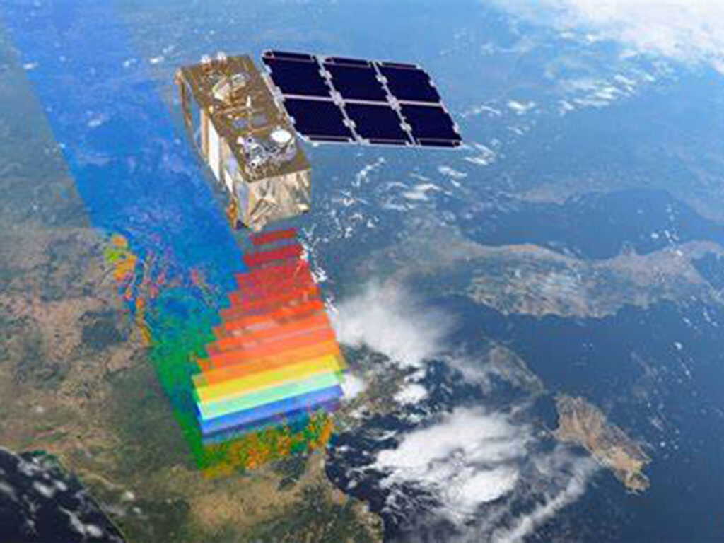
At XRTech Group, we power smarter mining operations through the most advanced satellite mining solutions on the planet. Trusted by mining leaders for over a decade, our precision-driven data supports every stage—from exploration to rehabilitation—with unmatched speed, scale, and accuracy.
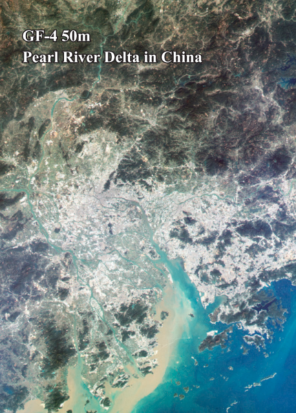
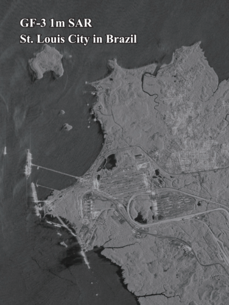
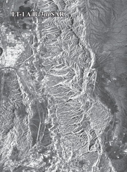
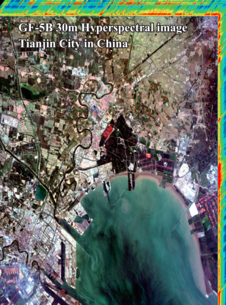
With access to over 130+ global mining satellite constellations and millions of high- and medium-resolution images, we deliver real-time satellite imagery tailored for your project—fast, reliable, and ready to integrate into your workflows.
Precision That Scales with You
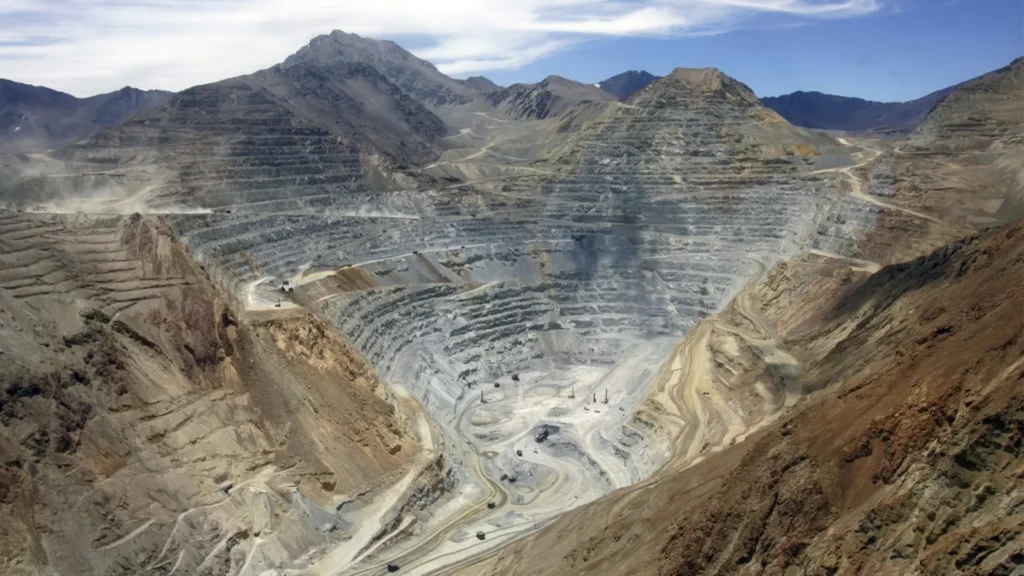
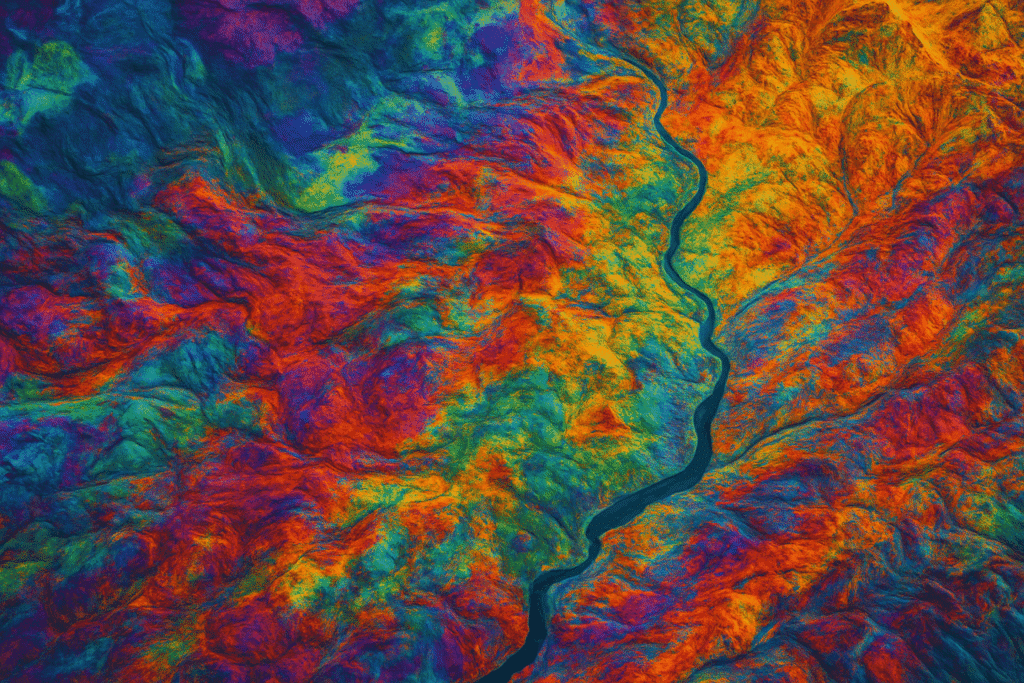
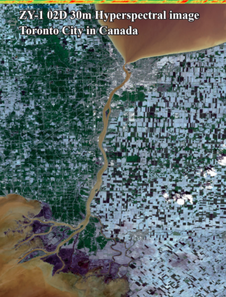
Whether you’re surveying remote terrains or monitoring large-scale dig operations, our high-resolution satellite mining imagery enhances operational planning, site analysis, and regulatory compliance. From 4-band and 8-band multispectral imagery to SWIR and hyperspectral data, our imaging capabilities help geologists locate mineral deposits, analyze structural features, and reduce fieldwork costs.
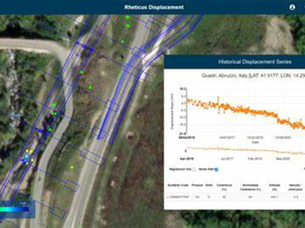
Real-Time Monitoring for Smarter Decisions
Track site activity across time with a complete satellite image archive and time-series analysis. Get visual updates on infrastructure expansion, pit development, and land-use changes—ideal for GIS, AutoCAD, and remote sensing platforms. Our time-based satellite mining data supports operational insights, compliance reporting, and stakeholder transparency.
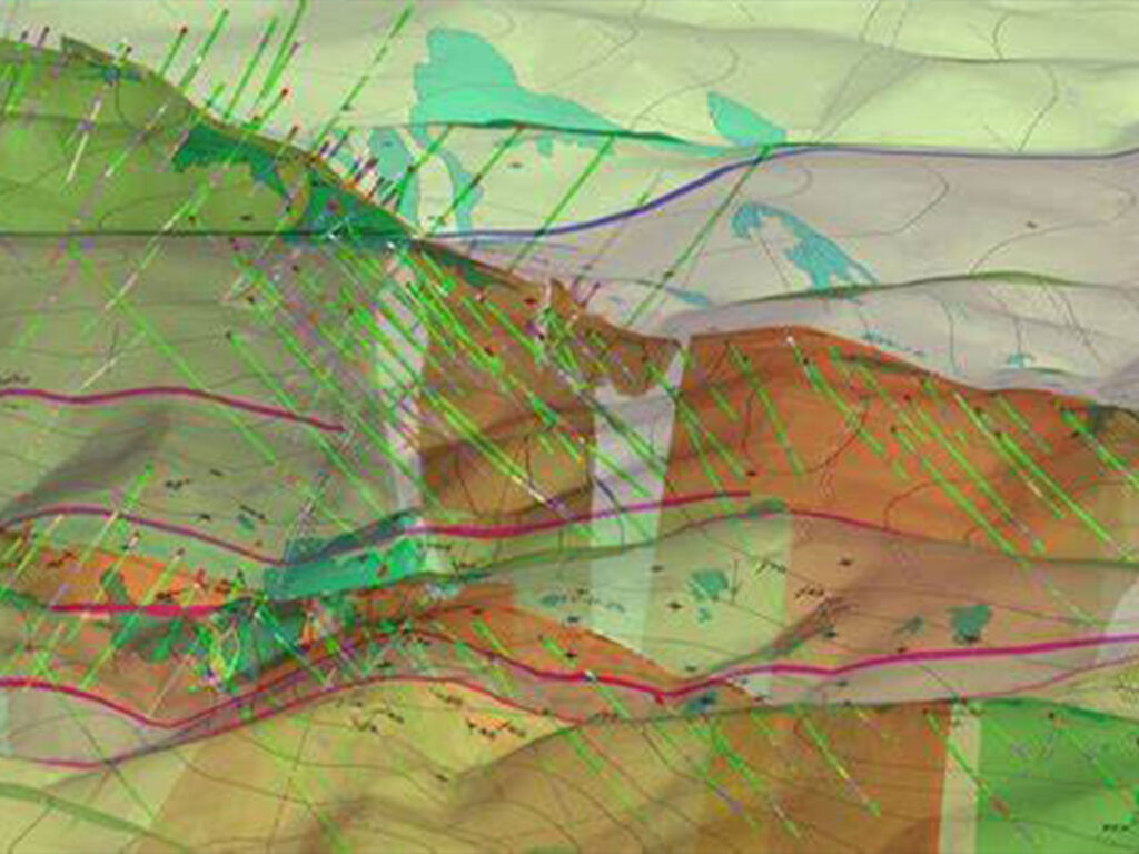
Advanced Mapping Tools for Mining Success
XRTech Group delivers topographic intelligence like digital elevation models (DEMs), terrain contours, and 3D mapping—essential for understanding landscape conditions before you break ground. These tools help teams visualize complex terrain, calculate overburden, and enhance drill site selection.
Land-Use and Environmental Intelligence
Our mining satellite imagery helps you stay ahead of encroachment threats, monitor ecological impacts, and support surface restoration. Compare active conditions with historic satellite imagery to ensure your closure plans return the site to its original ecological state.
On-Demand Imagery, 24/7 Access
Through our intuitive platform, you can define your area of interest—whether it’s a remote site or entire mineral belt—filter for cloud-free, high-res images, and submit your request within minutes. A dedicated XRTech advisor will get back to you with customized options and pricing, fast.