
Sentinel-1 Satellite Imagery: All-Weather C-Band SAR Radar Data
C-Band SAR · Day & Night, All-Weather · Archive Since 2014
Access Sentinel-1 satellite imagery from ESA's Copernicus radar constellation, delivering continuous C-band synthetic aperture radar (SAR) coverage of land and sea regardless of cloud cover or darkness. XRTech Group provides processed, analysis-ready Sentinel-1 SAR data for maritime surveillance, ground deformation monitoring, and environmental tracking, drawn from an archive stretching back to 2014.
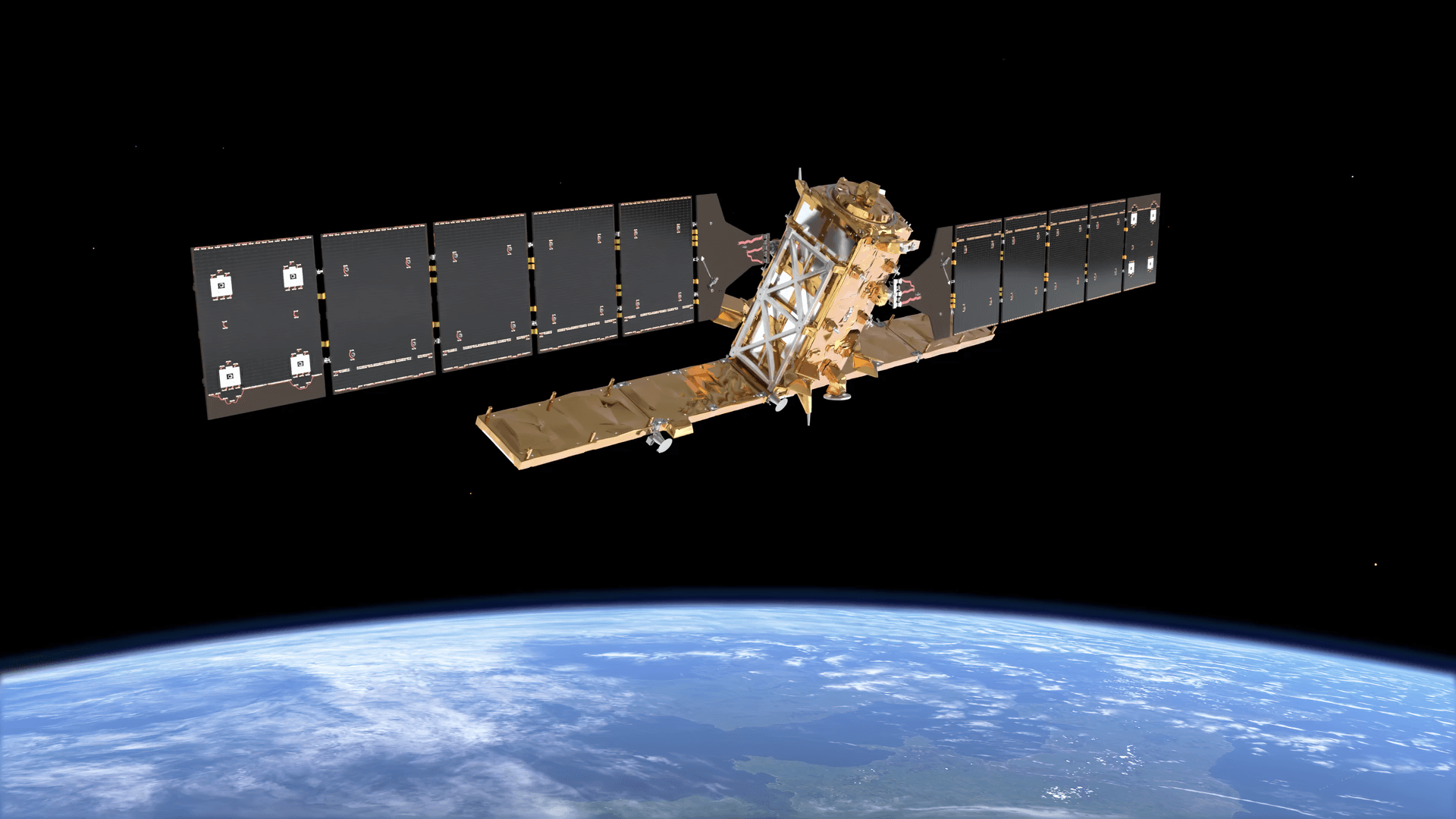
Sentinel-1 Imagery: View And Download Satellite Data
Sentinel-1 is a polar-orbiting radar imaging mission operated by the European Space Agency (ESA) as part of the European Union's Copernicus Earth observation programme. Unlike optical satellites, Sentinel-1 uses C-band synthetic aperture radar (SAR), which actively transmits and receives its own radar signal rather than relying on reflected sunlight. That means Sentinel-1 satellite imagery can be captured continuously, day or night, and directly through cloud cover, fog, and most weather conditions, a capability optical sensors simply cannot match.
The constellation flies in a sun-synchronous orbit at roughly 693km altitude, and has evolved across four satellites since the programme began. Sentinel-1A launched in April 2014 and operated for over twelve years, well beyond its planned seven-year design life, before ESA formally concluded its operational mission on June 29, 2026. Sentinel-1B launched in 2016 but was lost earlier, following a radar power supply anomaly on December 23, 2021, with ESA declaring the mission over in August 2022. Sentinel-1C, launched in December 2024, and Sentinel-1D, launched in November 2025, now form the active operational constellation, maintaining continuous global SAR coverage without interruption.
Because Sentinel-1 is part of the Copernicus programme, its raw radar data is made freely available by ESA. XRTech Group's role is to source, process, and deliver that data in analysis-ready form, tailored to your project's area of interest, acquisition mode, and polarization requirements, so you get usable SAR products rather than raw satellite output.
Acquisition Modes & Resolution
Sentinel-1 captures data in several acquisition modes, trading resolution for coverage area depending on the application. Understanding this trade-off is key to selecting the right product for a given project.
| Mode | Spatial Resolution | Scene Size | Typical Use |
|---|---|---|---|
| Stripmap (SM) | 10 m | 80 km | Detailed regional monitoring |
| Interferometric Wide Swath (IW) | 20 m | 250 km | Standard land and InSAR monitoring |
| Extra Wide Swath (EW) | 100 m | 400 km | Maritime and polar/ice monitoring |
Polarization Channels
Sentinel-1 transmits and receives radar signals in different polarization combinations, and the choice of channel affects what a scene can reveal about surface texture, moisture, and material type.
| VV (Vertical-Vertical) | Strong response from water and smooth surfaces; standard for maritime and ice monitoring |
| VH (Vertical-Horizontal) | Sensitive to vegetation structure and volume scattering; useful for forest and crop monitoring |
| HH (Horizontal-Horizontal) | Effective for sea ice and some land surface classification |
| HV (Horizontal-Vertical) | Cross-polarized channel, sensitive to structural complexity similar to VH |
Applications for Sentinel-1 SAR Imagery
Sentinel-1's all-weather, day-and-night capability makes it uniquely suited to monitoring applications where cloud cover or timing constraints would otherwise block optical imagery entirely.
Maritime Surveillance
Detect oil spills, track ship traffic (supported by AIS integration on newer satellites), and monitor sea-ice dynamics.
Ground Deformation (InSAR)
Measure centimeter-level ground displacement from earthquakes, volcanic unrest, and landslides using interferometric SAR.
Environmental Tracking
Assess forest biomass, soil moisture, and agricultural crop distribution regardless of cloud cover or time of day.
Disaster Response
Map flood extent and storm damage even under heavy cloud cover, when optical satellites are unable to collect usable imagery.
Sea Ice & Polar Monitoring
Track ice extent, movement, and break-up patterns using wide-swath EW mode across polar regions.
Oil Spill Detection
Identify surface oil slicks on open water, where radar backscatter differences reveal contamination invisible to the naked eye.
Agricultural Monitoring
Track crop growth stages and soil moisture conditions across full growing seasons independent of weather.
Infrastructure Stability
Monitor subsidence and structural movement around cities, mines, and large infrastructure projects over time.
Full Technical Specifications
Sensor & Coverage
| Provider | European Space Agency (ESA), Copernicus |
| Active Satellites | 2 (Sentinel-1C, Sentinel-1D) |
| Radar Band | C-band SAR |
| Resolution (by mode) | 10m (SM) / 20m (IW) / 100m (EW) |
| Positional Accuracy | 1–3m at nadir |
| Polarization | VV, VH, HH, HV |
| Stereo Imaging | Not applicable (SAR) |
| Daily Coverage Capacity | ~500,000 km² |
| InSAR Capable | Yes |
Orbit & Mission
| Orbit Type | Sun-Synchronous, polar orbiting |
| Altitude | ~693 km |
| Revisit Cycle | Every 6–12 days depending on configuration |
| Data Archive | From 2014 to present |
| Sentinel-1A | April 2014 – June 2026 (retired) |
| Sentinel-1B | 2016 – August 2022 (retired, power failure) |
| Sentinel-1C | Launched December 2024 (active) |
| Sentinel-1D | Launched November 2025 (active) |
The Sentinel-1 Mission Timeline
Sentinel-1A launches, becoming the first satellite of the Copernicus programme and establishing continuous C-band SAR coverage.
Sentinel-1B launches, doubling revisit frequency alongside Sentinel-1A.
Sentinel-1B suffers a radar power supply anomaly on December 23, 2021. After recovery attempts fail, ESA formally ends the mission on August 3, 2022.
Sentinel-1C launches, re-establishing full constellation coverage alongside Sentinel-1A.
Sentinel-1D launches, positioned to work in tandem with Sentinel-1C ahead of Sentinel-1A's planned retirement.
Sentinel-1A concludes its operational mission after more than twelve years, handing full active duty to Sentinel-1C and Sentinel-1D.
Key Features and Benefits
- True All-Weather ImagingC-band radar penetrates cloud cover, fog, and darkness, delivering reliable imagery when optical satellites simply can't collect a usable scene.
- Consistent Global CoverageSentinel-1 monitors land, ice, and water across every region, supporting international and cross-border monitoring projects.
- Interferometric SAR (InSAR)Measures subtle ground movement over time, critical for earthquake, landslide, and geological hazard monitoring.
- Deep Historical ArchiveContinuous data from 2014 to present, including the full historical Sentinel-1A and Sentinel-1B archives, supports long-term change detection.
- Frequent RevisitWith Sentinel-1C and Sentinel-1D operating together, revisit frequency across most regions runs every 6 to 12 days.
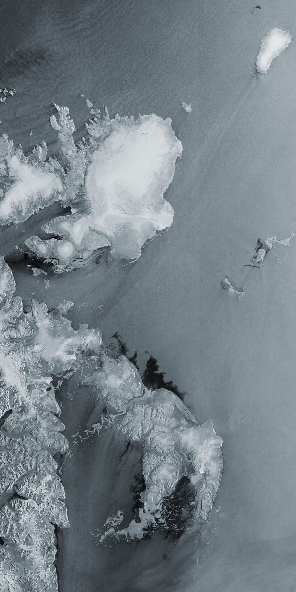
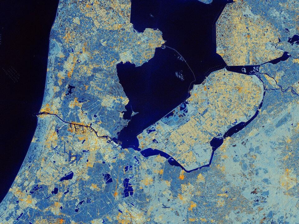
Sentinel-1 SAR Sample Imagery
End-to-End Support for Sentinel-1 SAR Data
Expert Consultation
Our geospatial specialists help select the right acquisition mode and polarization for your specific monitoring goal.
Rapid Delivery
Direct access to a 130+ satellite constellation network, including SAR and optical sensors, means faster turnaround on processed data.
Seamless Integration
Imagery delivered in industry-standard formats, ready to drop into your existing GIS, CAD, or modeling workflow.
Common Questions About Sentinel-1
Which Sentinel-1 satellites are currently active?
Sentinel-1C and Sentinel-1D are the current active satellites collecting new data. Sentinel-1A retired in June 2026 after more than 12 years of service, and Sentinel-1B was lost to a power failure in 2022.
Is historical Sentinel-1A and 1B data still available?
Yes. Both satellites' full archives remain accessible for research, historical analysis, and long-term change detection, even though neither is collecting new imagery.
Why use radar imagery instead of optical satellite imagery?
SAR imaging works day or night and through cloud cover, fog, and most weather conditions, since it generates its own radar signal rather than relying on reflected sunlight. This makes it reliable for time-critical or persistently cloudy regions where optical imagery often fails.
What is InSAR and what is it used for?
Interferometric SAR compares radar phase data from repeated passes over the same area to detect ground movement at centimeter-level precision, commonly used for earthquake, landslide, volcanic, and subsidence monitoring.
Which acquisition mode should I choose?
Stripmap (10m) suits detailed regional analysis, Interferometric Wide Swath (20m) is the standard choice for land and InSAR monitoring, and Extra Wide Swath (100m) is best for large-area maritime or polar monitoring where coverage matters more than fine detail.
Does Sentinel-1 support stereo or 3D imaging?
No. As a SAR sensor, Sentinel-1 does not offer stereo acquisition in the way optical satellites do; elevation-focused analysis instead relies on InSAR phase comparison across repeat passes.
Ready to Access Sentinel-1 SAR Imagery?
Talk to our geospatial team about acquisition mode, polarization, and processing options for your area of interest.