Satellite Imagery for Oil and Gas Exploration and Drilling
Accurate geological data is the foundation of successful oil and gas drilling. XRTech Group provides high-resolution satellite imagery for oil and gas exploration that helps energy companies reduce uncertainty, improve drilling accuracy, and lower operational risk before any well is drilled.
From offshore oil rigs to desert drilling fields and forested basins, XRTech Group delivers satellite-based monitoring for oil wells and exploration blocks anywhere in the world. Our satellite systems allow exploration teams to analyze large areas quickly, without relying on slow and hazardous ground surveys.
Using advanced Earth observation satellites, XRTech supports the full upstream lifecycle, from early-stage basin analysis to oil well placement and production monitoring.
Mapping Remote and Challenging Oil and Gas Fields
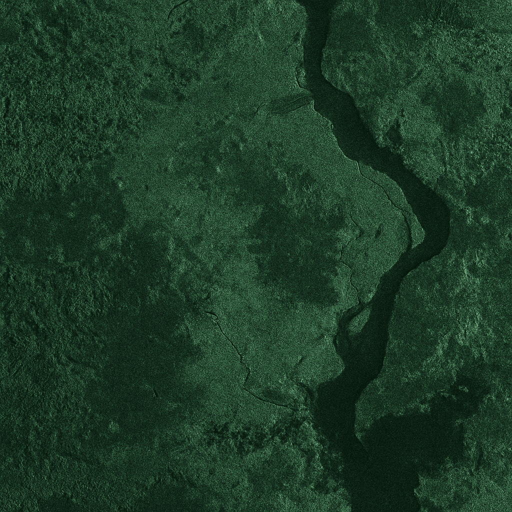
Oil and gas exploration often takes place in regions that are difficult or dangerous to access, including jungles, offshore platforms, arctic zones, deserts, and mountainous terrain. XRTech Group applies optical, SAR, and hyperspectral satellite imagery to provide consistent coverage across these environments.
For areas with dense vegetation or persistent cloud cover, XRTech uses radar-based terrain extraction to generate Bare Earth Digital Elevation Models (DEM). These models remove vegetation and surface clutter, allowing geologists to study true ground structure, fault systems, and basin geometry beneath forests and wetlands.
Because SAR satellite imagery works day and night and through clouds, oil and gas drilling projects can be monitored year-round, including during monsoon seasons and storms.
Geological and Structural Feature Detection
XRTech Group processes satellite imagery using calibrated spectral band combinations designed to highlight geological features relevant to oil and gas exploration.
Through multispectral and hyperspectral satellite analysis, XRTech enhances:
Rock type and soil differentiation
Structural lineaments and fracture systems
Basin boundaries and uplift zones
Alteration minerals linked to hydrocarbon systems
Vegetation indices and spectral filtering techniques are also used to identify:
Old oil well pads hidden by vegetation
Historical access roads and seismic lines
Surface anomalies related to subsurface faults
These methods allow exploration teams to:
Improve interpretation of seismic data
Refine exploration targets
Reduce uncertainty in oil well location selection
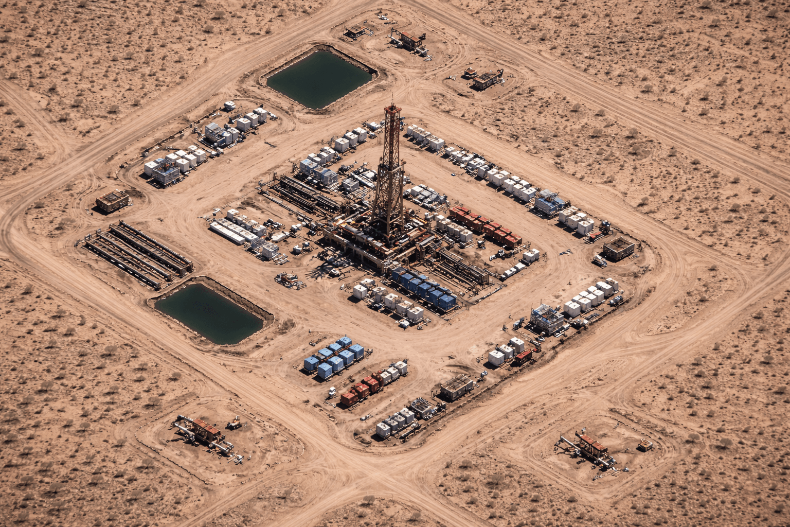
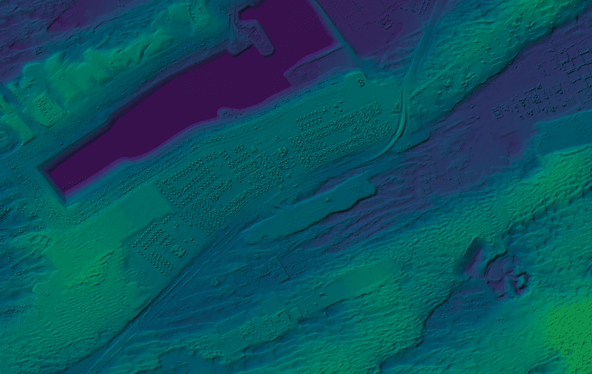
3D Terrain Modeling for Oil Well and Rig Planning
XRTech Group produces:
Integrated 3D terrain models
These datasets provide precise elevation, slope, and surface geometry for drilling and infrastructure planning.
Oil and gas engineers use these products to:
Select safe oil well locations
Design drilling pads and rig foundations
Plan access roads and logistics routes
Assess flood risk around oil rigs
Optimize pipeline corridors from wells to processing facilities
Three-dimensional visualization allows geologists and drilling planners to evaluate surface conditions together with geological structure, improving drilling success rates and reducing costly site changes.
Supporting Seismic Surveys and Well Databases
Satellite imagery plays a key role in validating seismic and well data used in exploration.
XRTech Group applies satellite analysis to:
Detect seismic survey lines
Update oil well coordinate databases
Verify drilling site positions
Identify surface expressions of buried faults
By integrating satellite imagery with seismic data, XRTech improves subsurface modeling accuracy and reduces the need for repeated field verification surveys.
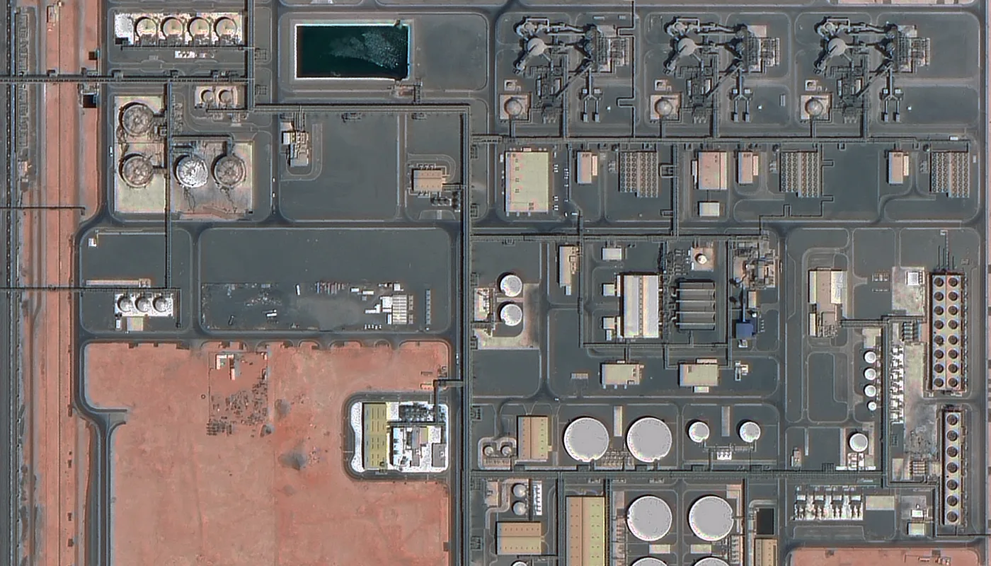
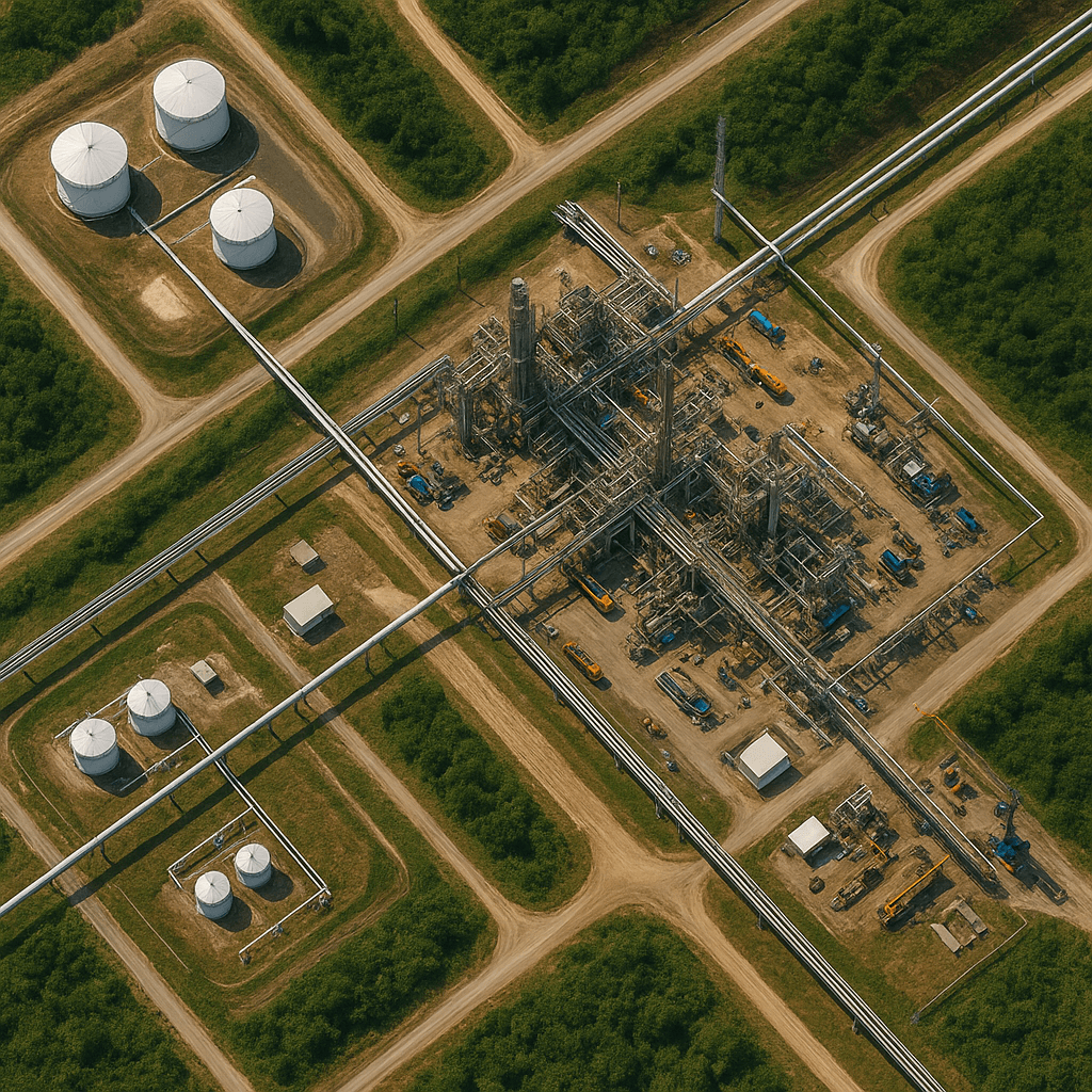
Oil and Gas Monitoring with Satellites
Beyond exploration, satellites are used to monitor active oil and gas operations.
XRTech Group supports:
Oil well pad monitoring
Oil rig activity observation
Pipeline route tracking
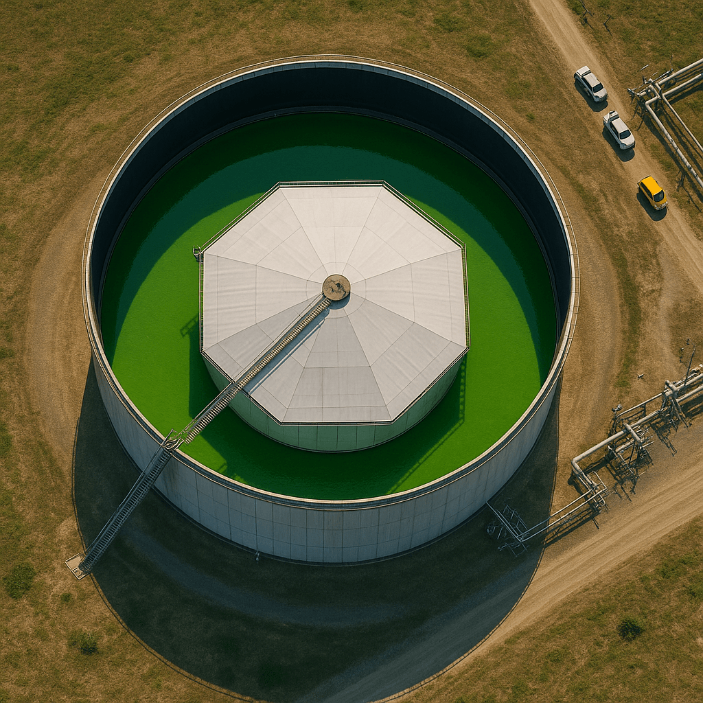
Storage facility inspection
Offshore platform surveillance
Using time-series satellite imagery, XRTech detects:
New drilling activity
Surface disturbance around wells
Unauthorized construction near rigs
Land subsidence caused by extraction
This enables early detection of operational risks and environmental impact.
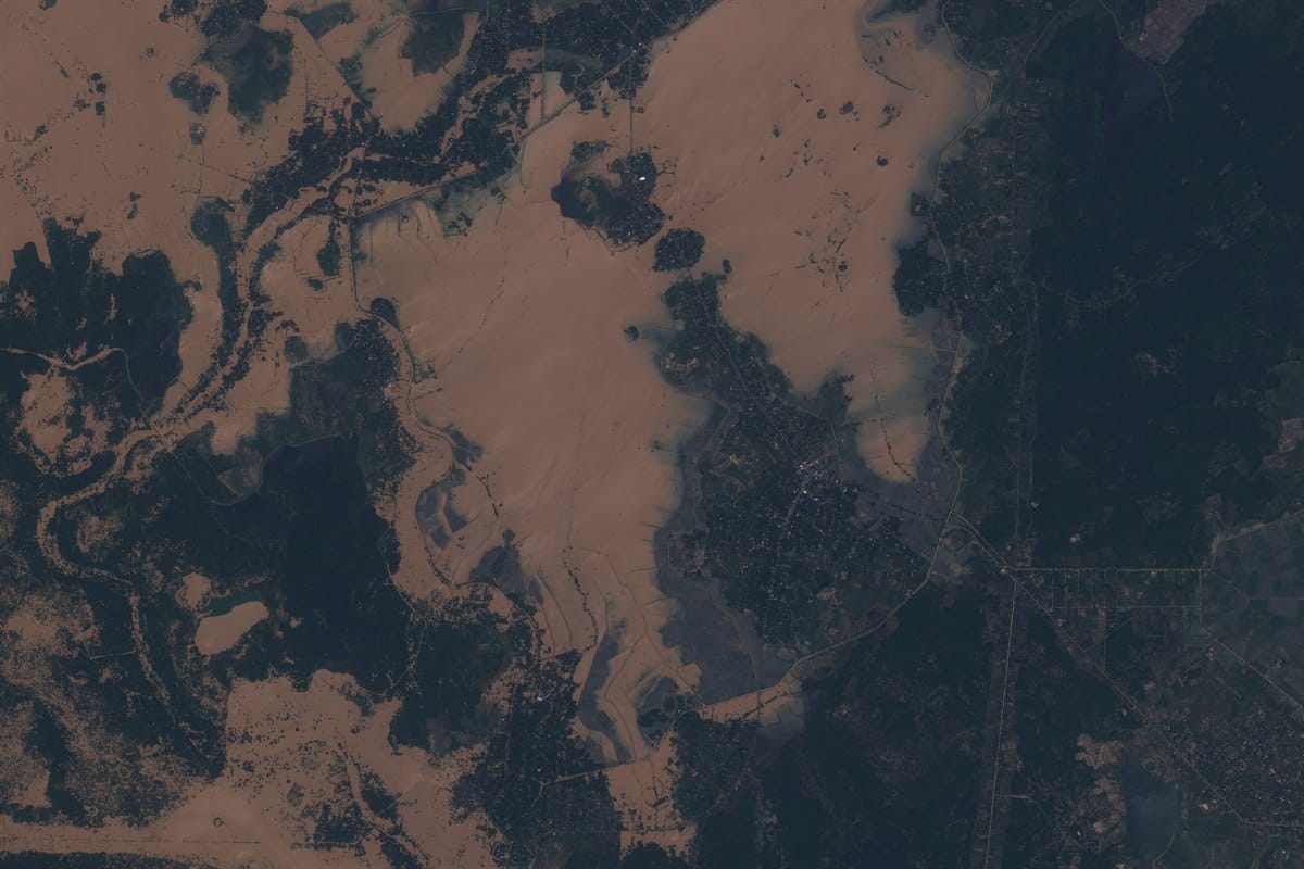
Environmental and Regulatory Monitoring
Satellite imagery supports environmental control around oil and gas drilling sites.
XRTech Group uses satellites to:
Track vegetation loss near oil wells
Monitor land degradation
Detect unauthorized land use
Support environmental compliance reporting
Thermal and spectral sensors can also detect:
Gas leakage patterns
Heat anomalies around oil rigs
Surface changes linked to spills
This ensures drilling operations remain within regulatory boundaries and reduces long-term environmental risk.
Key Uses of Satellite Imagery in Oil and Gas Drilling
XRTech Group satellite data is used to:
Identify structural traps and basins
Detect seismic lines and oil well locations
Map rock formations and fault systems
Plan drilling pads and oil rig sites
Support pipeline and road routing
Monitor offshore rigs and terminals
Perform non-invasive mapping in protected areas
Track production-related land changes
Reducing Risk and Improving Drilling Efficiency
XRTech Group provides access to satellite archives dating back to 1999 and offers new satellite tasking for up-to-date coverage. This enables both historical analysis and real-time operational support.
With satellite intelligence, oil and gas companies can:
Reduce the risk of dry wells
Improve drilling success rates
Lower exploration and monitoring costs
Minimize the need for physical site visits
Detect hazards before failures occur
Improve environmental protection
Why XRTech Group for Oil and Gas Satellite Solutions
XRTech Group delivers a complete satellite-based system for oil and gas drilling and exploration.
Key advantages:
High-resolution optical satellite imagery
SAR monitoring for ground deformation
Hyperspectral analysis for geological targeting
DEM and DOM generation for terrain modeling
Archive and new tasking imagery options
Rapid delivery for drilling projects
Coverage of offshore rigs and remote oil fields
XRTech Group converts satellite data into practical intelligence for oil wells, oil rigs, and exploration zones, helping energy companies drill safer, faster, and with greater confidence. Contact us now!
Final Thought
Satellite imagery for oil and gas exploration and drilling has become a core operational tool, not just a planning aid. By using high-resolution optical, SAR, and hyperspectral data, companies can identify oil well locations, monitor oil rigs, reduce drilling risk, and manage environmental impact with far greater accuracy and speed. XRTech Group turns satellite data into practical intelligence that supports safer drilling, faster discovery, and smarter long-term field development.
Blog Summary
Satellite imagery for oil and gas exploration replaces slow ground surveys by mapping basins, faults, and drilling zones from space with consistent accuracy.
Oil well and oil rig monitoring using satellites enables continuous observation of drilling sites, pipelines, and production areas without physical access.
SAR satellite monitoring allows ground deformation and subsidence detection near wells and rigs, helping prevent structural failure and leaks.
Hyperspectral satellite imagery supports AI-driven exploration by identifying surface mineral patterns linked to hydrocarbon systems.
3D terrain models (DEM and DOM) improve oil well placement, rig foundation design, and pipeline routing in complex terrain.
Satellite-based environmental monitoring tracks vegetation loss, land disturbance, and emissions around drilling operations to ensure compliance.
Time-series satellite data reduces drilling uncertainty by validating seismic surveys and refining exploration targets before field deployment.
XRTech Group’s satellite oil and gas solutions deliver safer operations, lower exploration risk, and faster drilling decisions through global, space-based intelligence.